

The Aiguille de la Tsa is one of the iconic peaks of the Val d’Hérens, and I’ve been itching to climb it ever since we moved to the area. It rises above Arolla like a slender, imposing rocky spur that looks incredibly difficult to climb when viewed from that side. However, it is much less intimidating from its east face and rises just 80 meters above the Aiguille glacier (3 pitches of climbing).
In winter, it’s also well known for its couloirs, which are classic steep ski runs in the region. I haven’t skied those couloirs yet, but I hope I’ll be able to ski some of this soon, and I’ll definitely share the story here 🙂 .
So we took advantage of a trip with a group from our coliving community to the Bertol Hut on a beautiful September weekend to add the ascent of the Aiguille de la Tsa to our itinerary. Since we were a group of four with relatively little experience, it actually worked out well for us to climb the Aiguille from Bertol via the normal route, crossing the Aiguille glacier (even if it’s a loooong hike for very little climbing).
However, below I’ll outline the other options starting from the Tsa Hut (via the Pointe and/or the Dent de Tsalion) for those of you who’d prefer to focus on climbing. These routes are also on my to-do list, and I’ll tell you all about them once I’ve completed them in the coming months or years 🙂 .
Even though this climb is suitable for beginner mountaineers, mountaineering is a sport that involves risks (crevasses, falling rocks, unpredictable weather, falls). Make sure you have the necessary knowledge, stamina, and equipment before setting out on this kind of adventures with your friends. And if you have even the slightest doubt, be sure to hire a mountain guide 🙂
Aiguille de la Tsa: East Face, normal route from Bertol
- Elevation gain: about 500m from Bertol (and something like 1,700m of descent to Arolla… it’s loooong)
- Difficulty: AD- (4a in rock climbing)
- Duration: 8–10 hours (including the descent to Arolla)
- Useful links: Aiguille de la Tsa c2c, Bertol Hut
Hiking map + GPX
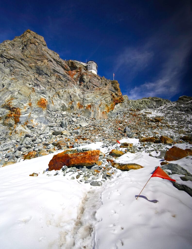
Hike to the Bertol Hut
The hike up to the Bertol Hut from Arolla is a beautiful trail rated T4-T5 in difficulty, passing through Plans-Bertol and then up a series of ladders to reach the hut on its rocky outcrop. If you’d like more information and photos about the route to the hut, I’ve written a detailed article on the subject:
From Bertol hut to the Aiguille Glacier
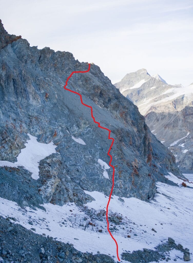
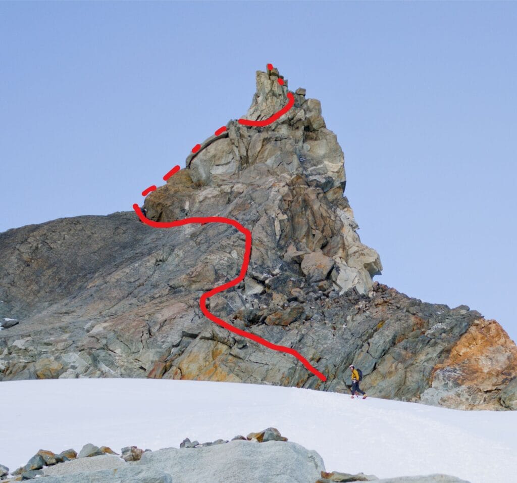
To be honest, from the beautiful balcony of the Bertol hut, you’re supposed to have a clear view of the path leading to the Aiguille Glacier. But honestly, since none of us had ever climbed that route before, we had a bit of trouble spotting the “path” that leads to the glacier.
Since it was still early afternoon when we arrived at the hut, we headed down to the Mont-Miné glacier to practice a couple of crevasse rescue techniques (just to refresh our skills). I also took the opportunity to go up and scout out the trail that runs behind Pointe de Bertol, which is equipped with a chain at the most difficult section. I didn’t really feel like trying to find the path at 4 a.m. with just a headlamp 🙂
To help you out, I’ve included a photo below taken from the hut, with the trail marked in red, as well as a few photos taken on the way down from the Aiguille de la Tsa. Depending on the time of year you visit, this area could be much snowier than this (we were there in September).
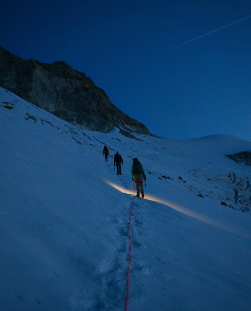
After a short night’s sleep and a delicious breakfast at the hut (with homemade braided bread, what a treat), we set off around 4:30 in the morning. Since we’d scouted the route the day before, we didn’t waste any time, and within an hour we were already on the Aiguille Glacier.
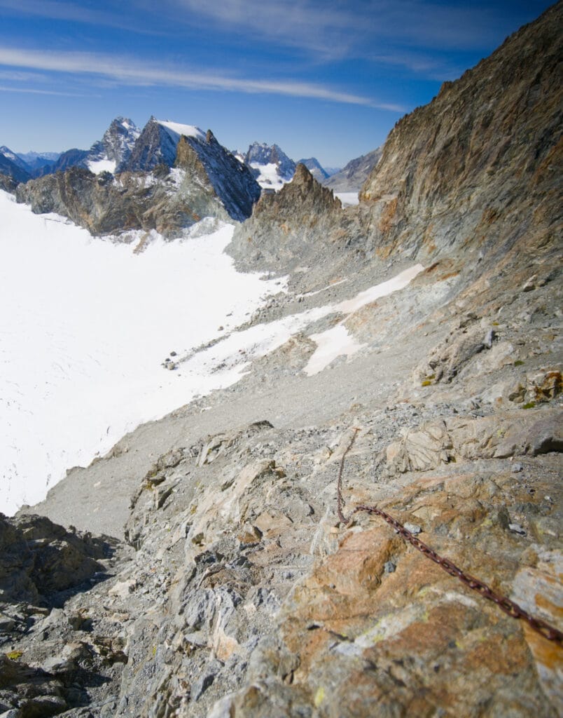
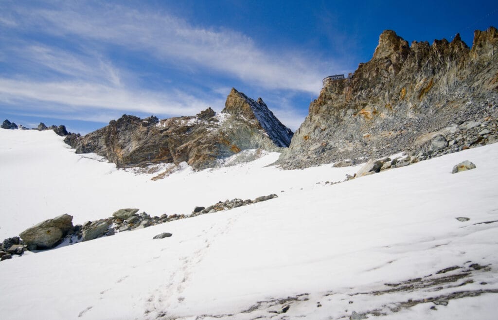
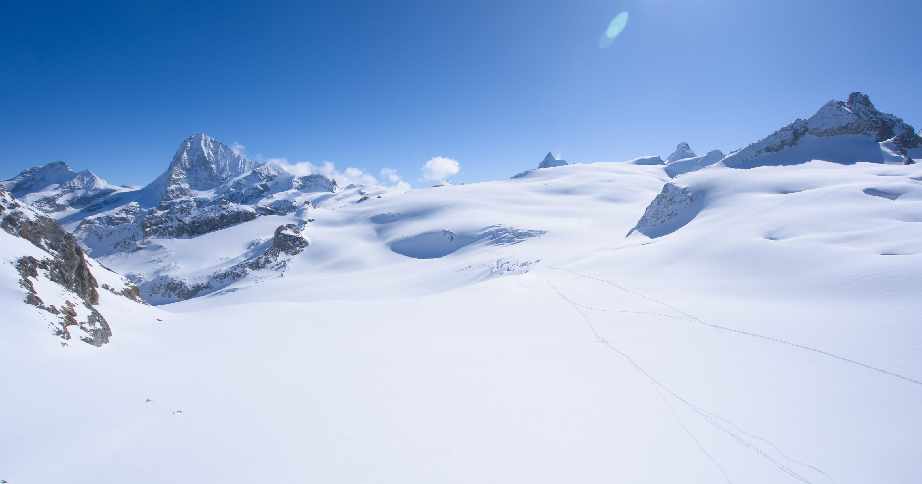
Crossing the Aiguille Glacier
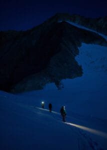
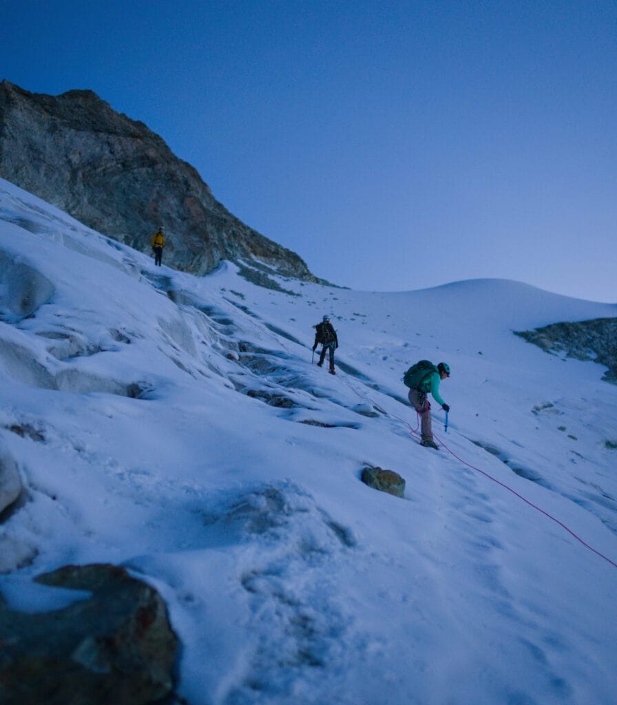
We put on our crampons and rope up before tackling a short descent (100 meters of elevation loss) toward the Col de la Tsa. In the distance, on the other side of the glacier, we can see the headlamps of the only two people who got up earlier than us to climb the Aiguille. It’s still quite dark, but the first light of day is beginning to show as we reach the pass below.
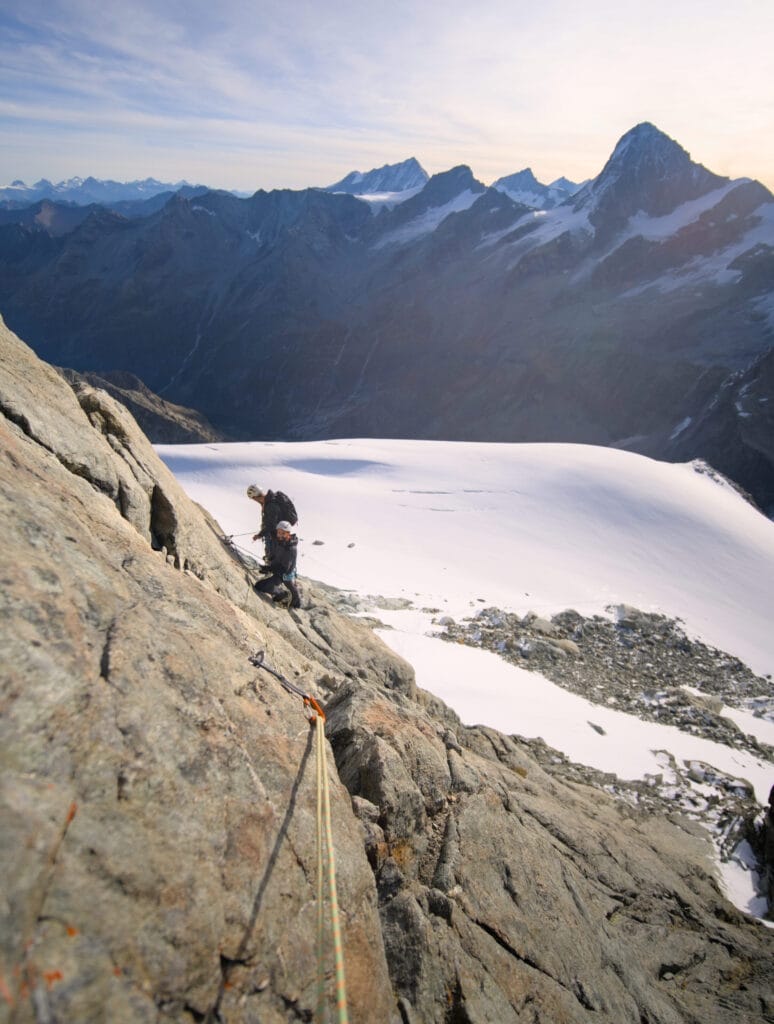
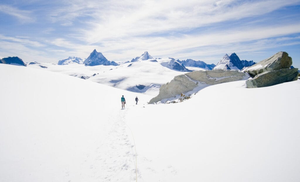
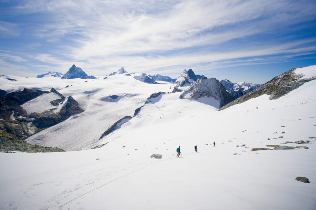
We start the climb up to the base of the Aiguille de la Tsa. The glacier is quite crevassed, so we had to be very careful. But overall, there was a good trail that we more or less just followed.
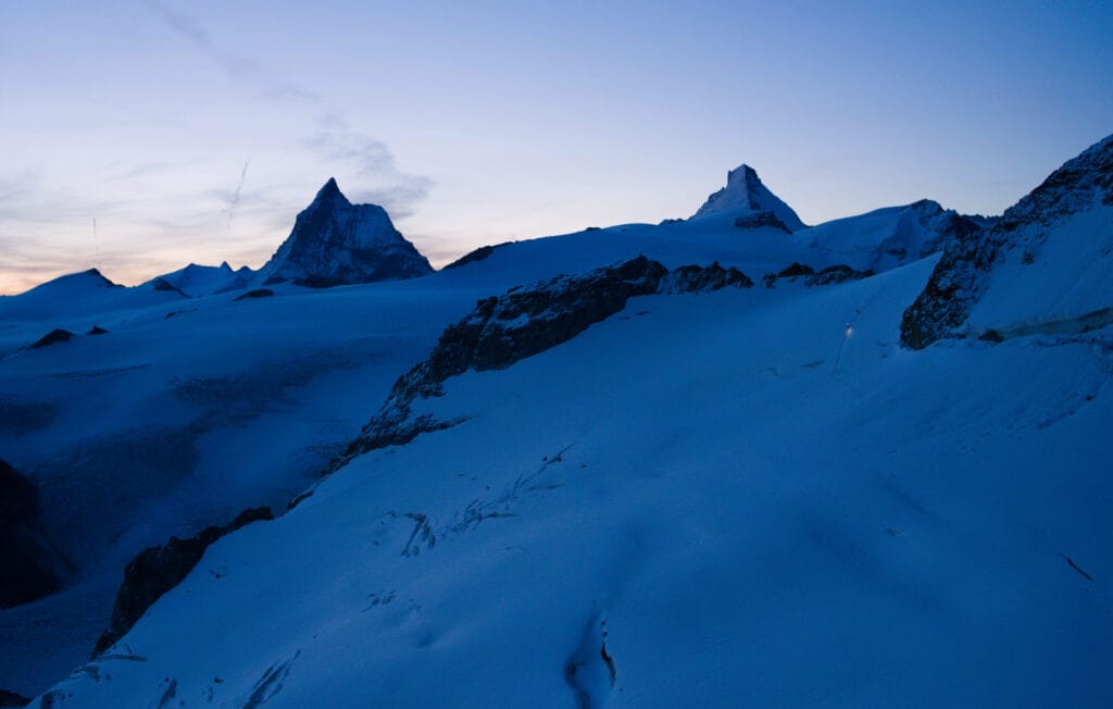
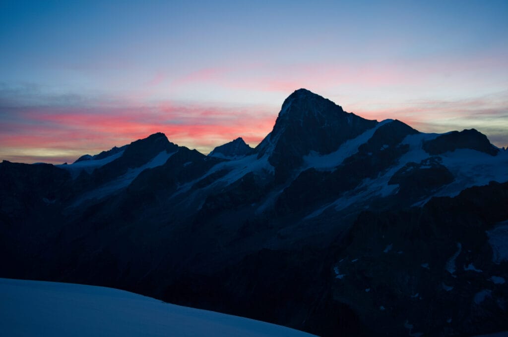
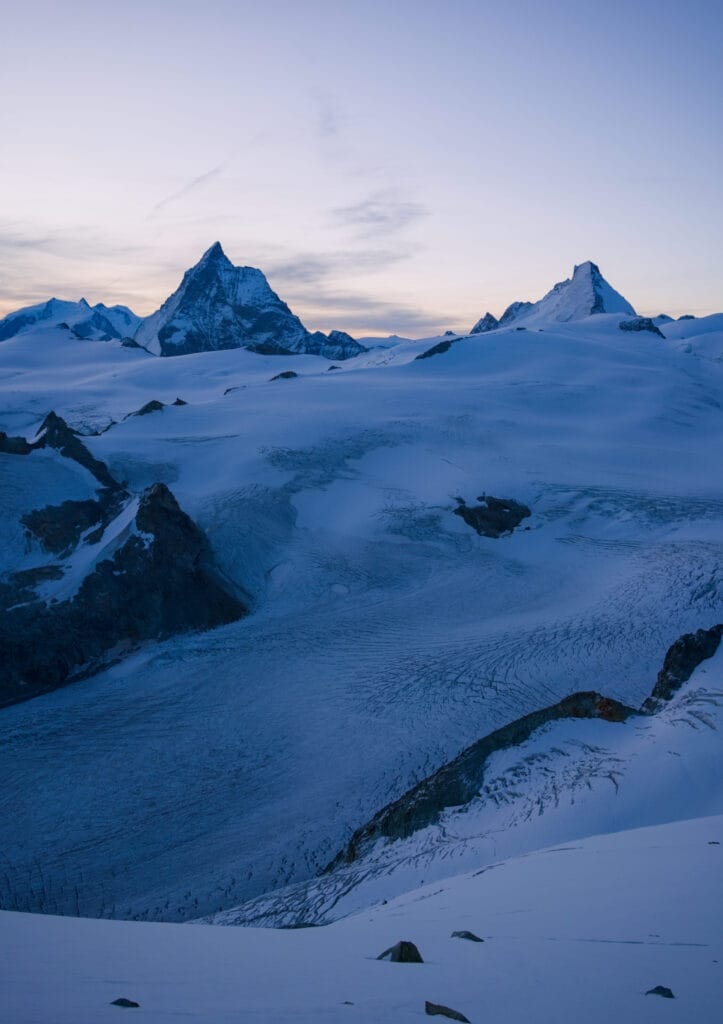
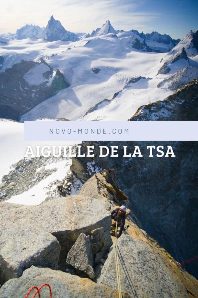
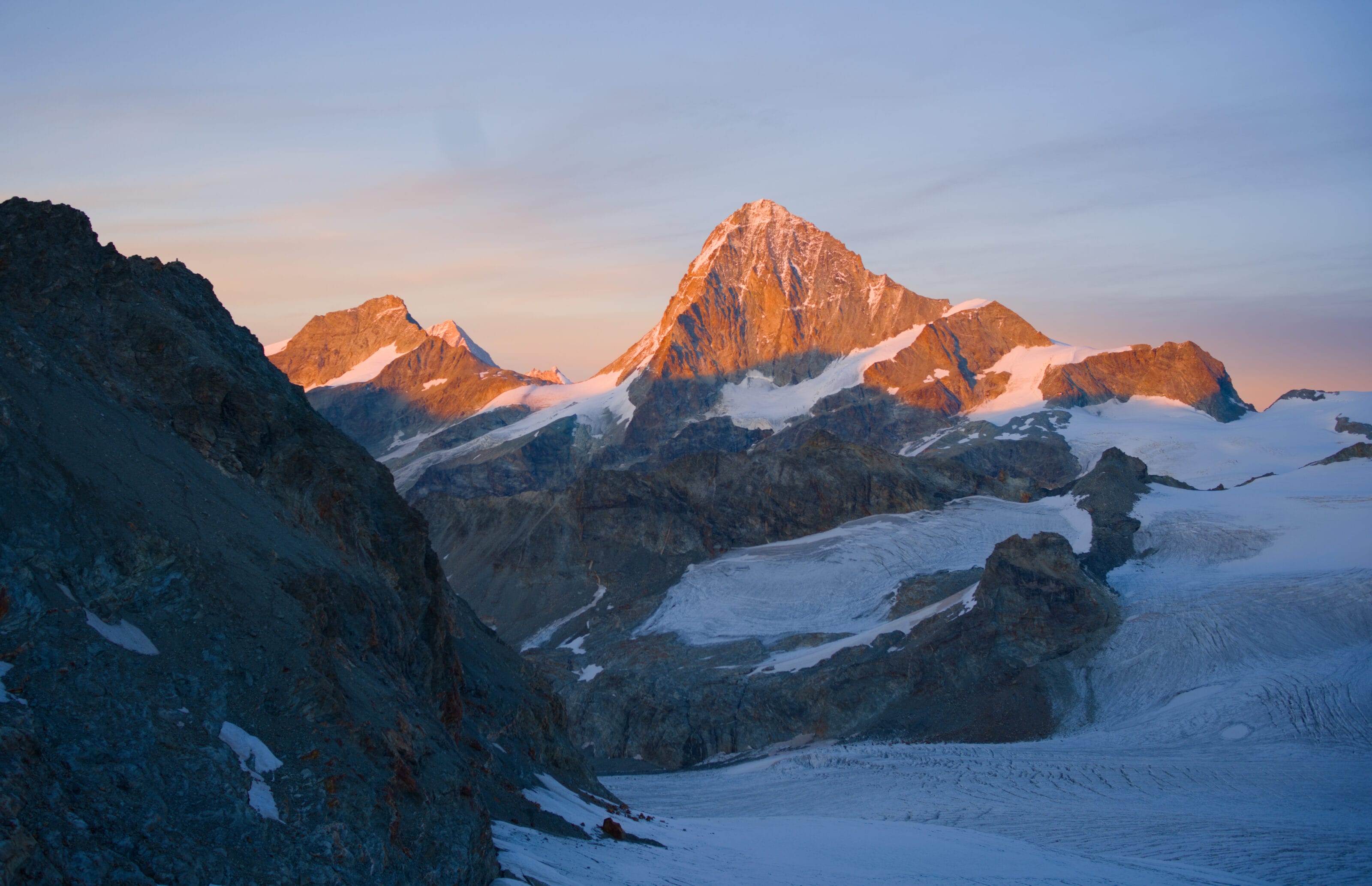
Daybreak brings a magnificent display of colors: from blue to purple, with pink clouds behind the Dent-Blanche. And what can we say about the scenery!!! Behind us lies a breathtaking view of the Ferpècle, Mont-Miné, and Aiguille glaciers, as well as the iconic peaks of the Valais: the Dent-Blanche, the Matterhorn, and the Dent d’Hérens. Here are a few photos for your viewing pleasure 😉
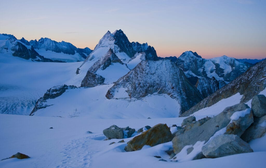
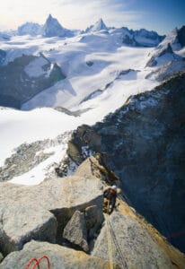
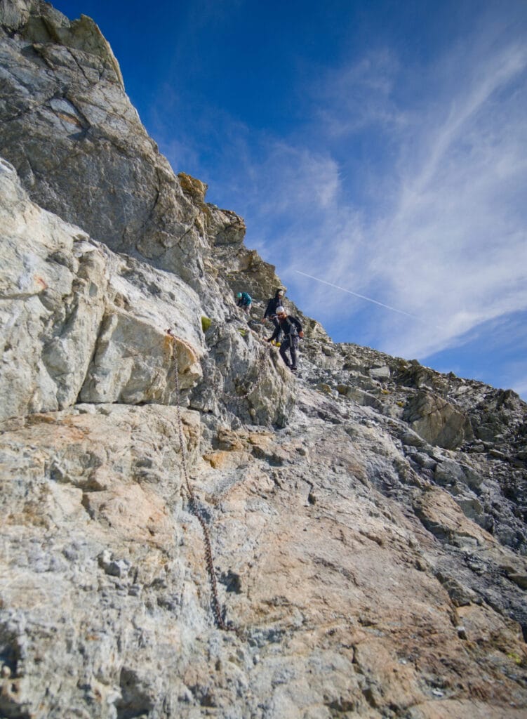
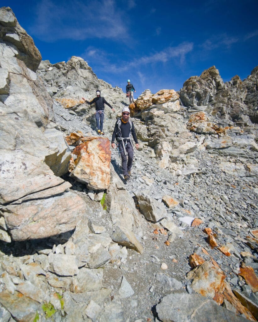
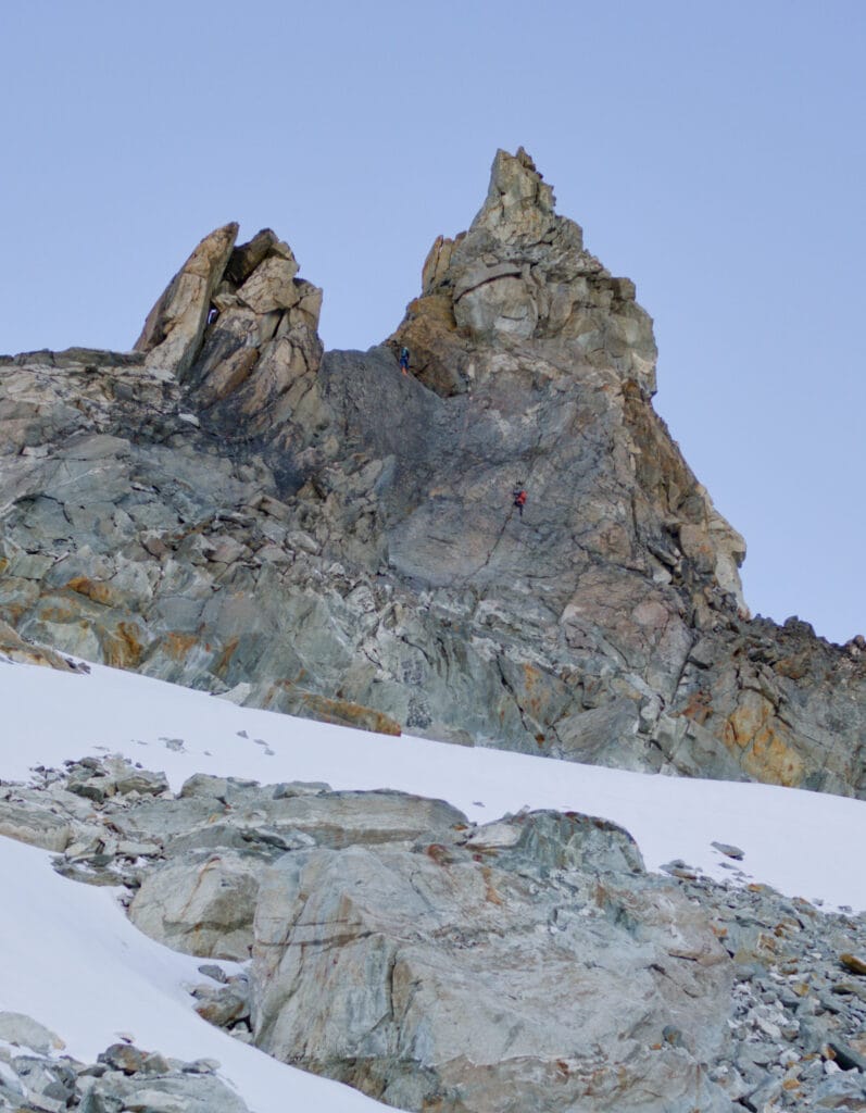
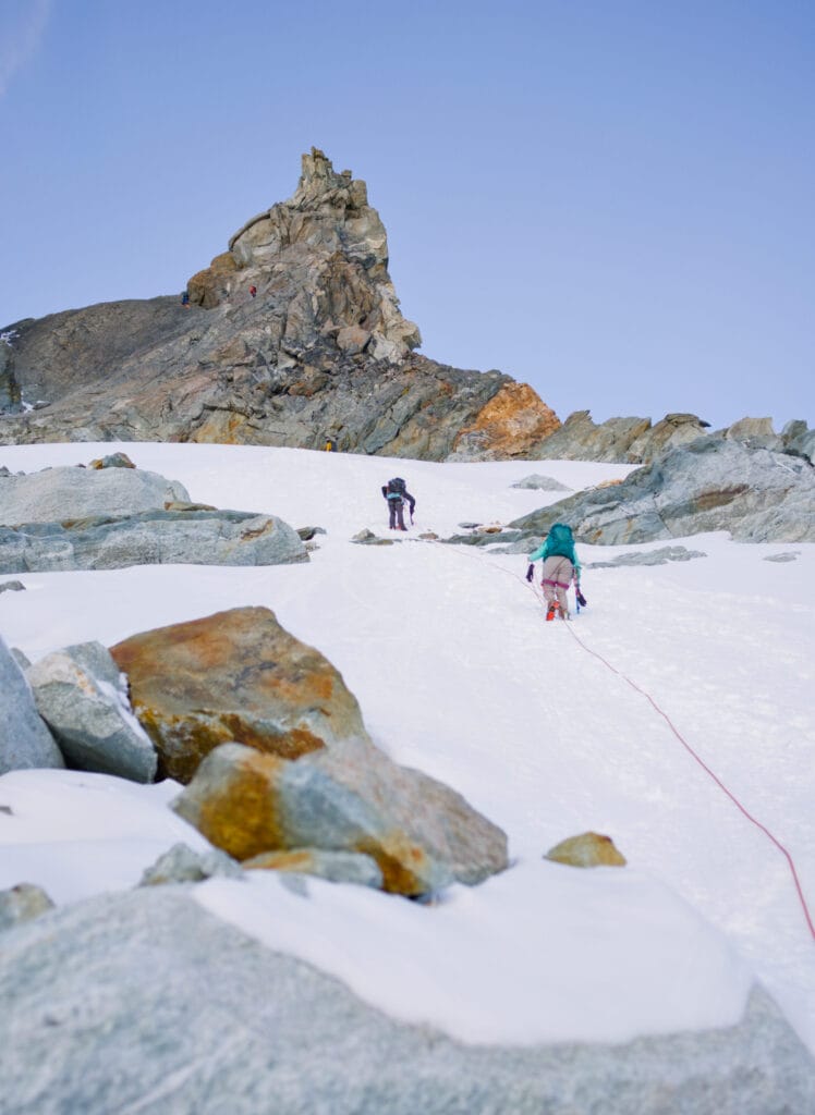
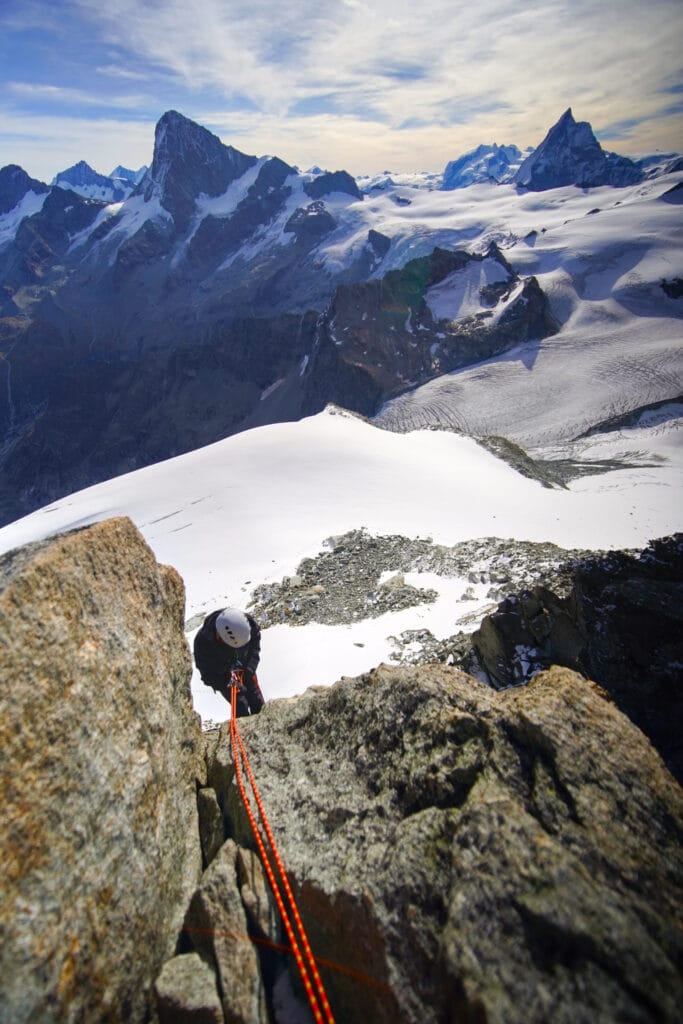
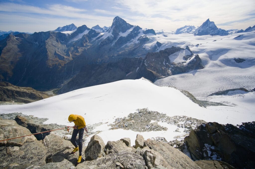
After a little over an hour of walking on the glacier, we arrive at the base of the Aiguille de la Tsa, which is indeed much less impressive from this side 🙂 . From where we stand, we can see the two people ahead of us climbing the Aiguille, which gives us a good idea of the route up. We climb a final, slightly steeper section, and here we are at the base of the Aiguille de la Tsa, ready to climb to the summit.
Climb of the Aiguille de la Tsa
Climbing the Aiguille de la Tsa isn’t very difficult. There are three short pitches with belays equipped with chains and a few bolts in between. In terms of difficulty, there are probably 1–2 moves rated 4, but nothing too nasty. Here’s a photo where I tried to sketch out the ascent route more or less (based on my memory, so it might not be perfectly accurate)
For rock climbing, you will need:
- a 50-meter rope (the descent involves three rappels of 20–25 meters)
- 3–4 quickdraws
- 2–3 friends and slings
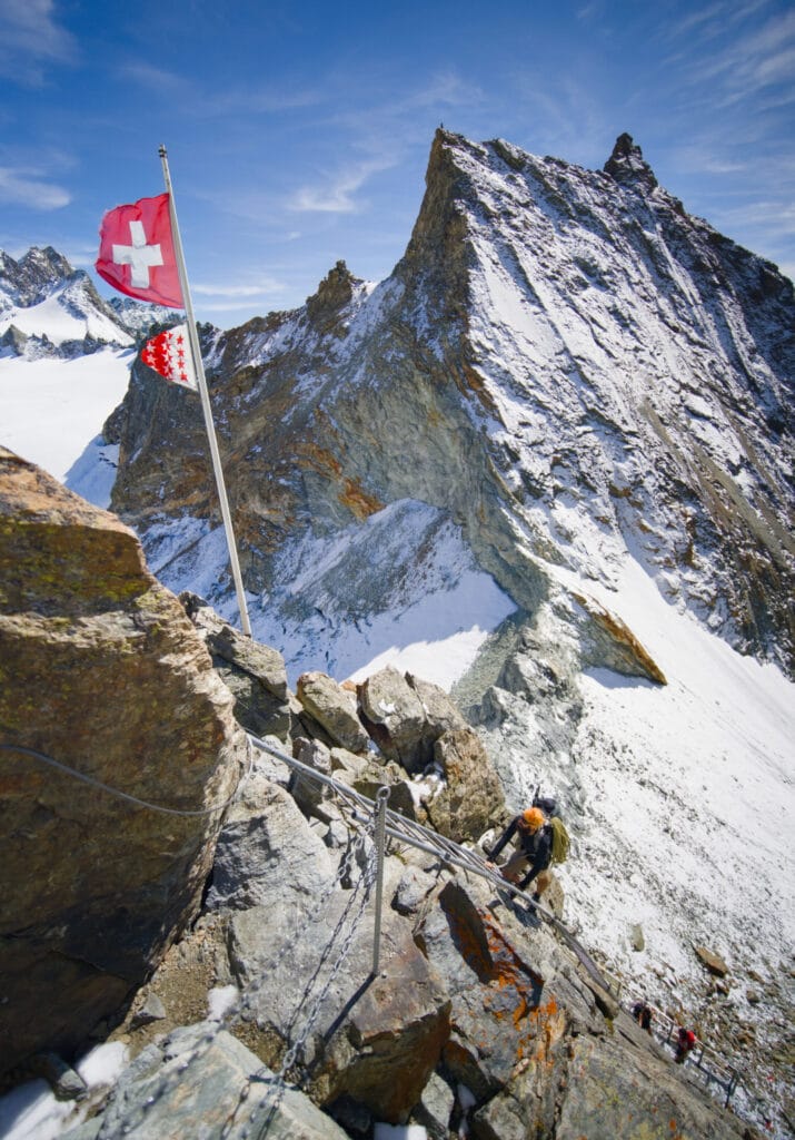
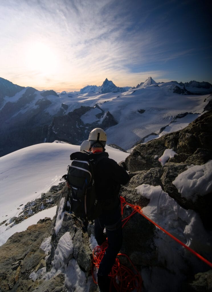
After the short traverse to the left, you reach the ridge, where the ambiance is great and there’s a stunning view on the other side (and the view of the Matterhorn and the Dent d’Hérens behind it is wowww). After the ridge, you then traverse to the right to reach the summit via a small chimney. Here are a few photos to give you a better idea:

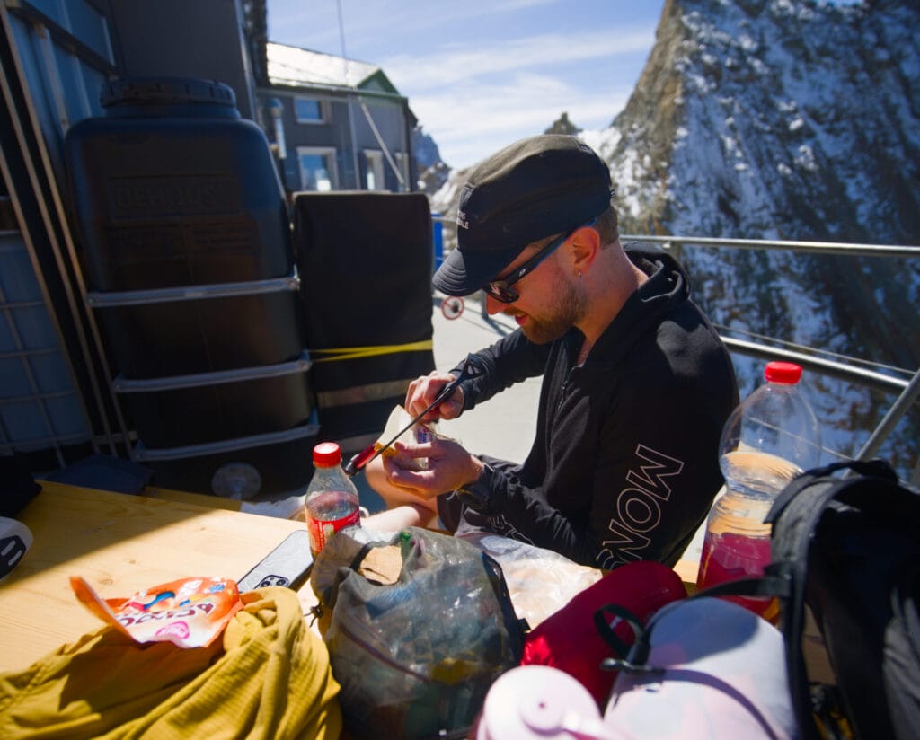
After three short rappels, we’re back on solid ground. All that’s left is to cross the glacier again, head down to Bertol to pick up some of our gear (and take a lunch break), and then finally make our way down to Arolla.
To give you an idea of our pace, here are our approximate completion times. Keep in mind that we weren’t very experienced and probably lost quite a bit of time on the climbing sections.
- 4:30 a.m.: Departure from the Bertol Hut
- 5:30 a.m.: We rope up to cross the Aiguille Glacier
- 7:00 a.m.: We’re all geared up and ready to tackle the climbing section of the Aiguille
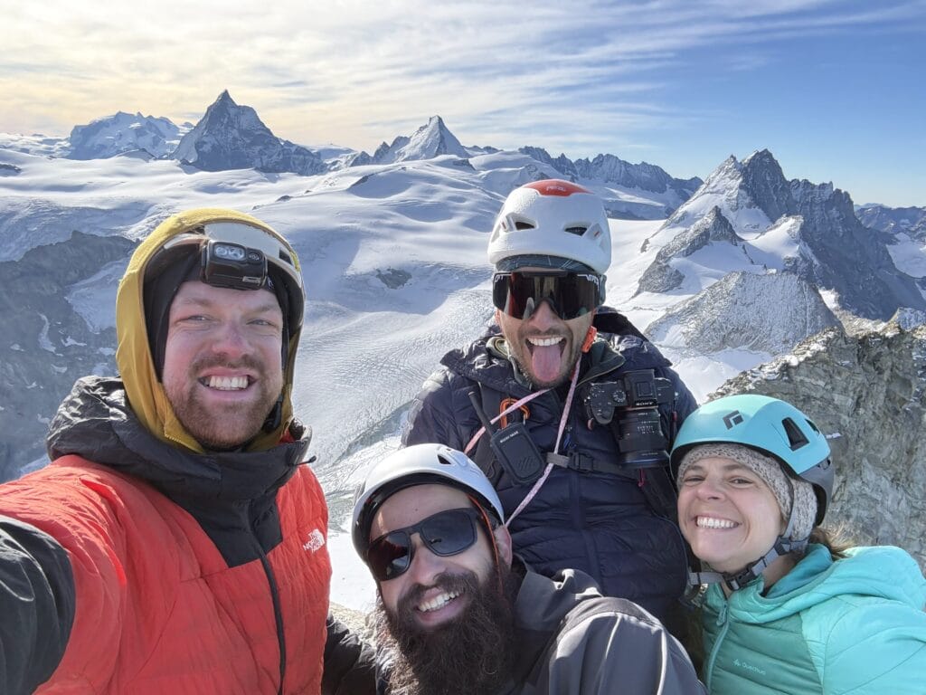
- 8:15 a.m.: We’re at the summit of the Aiguille de la Tsa
- 9:15: We’re all down the needle
- 11:00 a.m.: We’re back in Bertol
Route options for the descent
Please note that if you haven’t left anything at Bertol’s hut, you can also descend to Arolla via other routes:
- Via the Tsa Pass: This may allow you to avoid the detour to the hut. Apparently, it is possible to rappel from the center of the pass to cross the bergschrund. From there, you descend the Bertol Glacier to rejoin the route leading up to the hut.
- To the Tsa Hut via the Dent and the Pointe de Tsalion: From the base of the Aiguille de la Tsa, first climb to the Dent de Tsalion, then follow the north ridge to the Pointe de Tsalion. From there, an exposed trail marked with red blazes leads down from the summit to the Tsa Hut
Aiguille de la Tsa via the west ridge of the Dent de Tsalion
If you don’t feel like hiking for hours just for three pitches of climbing, this is the route you should choose. It’s at the top of my wish list because all the reviews I’ve read or heard about it have been very positive.
So, from Arolla, you need to hike up to the Tsa Hut, then head to the western ridge and climb it to the summit of the Dent de Tsalion. From there, you can clearly see the Aiguille de la Tsa, which is all you need to reach.
For now, I invite you to check out the route description on c2c for more details and feedback on this route.
Via the various climbing routes to Pointe de Tsalion
From the Tsa Hut, it’s also possible to climb up to the summit of Tsalion (and then, if you’d like, tackle the Aiguille de la Tsa) via several routes: the hut route, the red pillar route, and the red gendarme route. Here too, I invite you to check c2c for more information until we set out on one of these routes.
Pin it on Pinterest
Join the discussion