
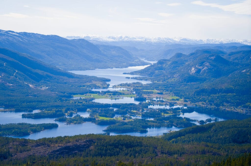
We’re still in the Telemark region of Norway, and today we’re taking you on a hike to the summit of Mount Venelifjell, near the village of Vrådal. With its rather rounded shape, this mountain certainly isn’t as impressive as some of Norway’s better-known peaks. But it offers spectacular views of the surrounding lakes and access to exceptional natural scenery.
This is an easy walk suitable for everyone that we did right after the Lårdalstigen hike, which we shared with you in our last post (we did the Lårdalstigen in the morning and the Venelifjell in the evening 🙂 ). It’s worth noting that when traveling in Norway during May and June, the days are very long, and you can easily go hiking even in the late afternoon (sunset was around 10:00 PM 😉 ).
Apparently, Venelifjell means “the beautiful mountain” in Norwegian, and you’ll see that it truly lives up to its name.
Practical information about the hike and logistics
- Distance: 4.2 km round trip between the parking lot and the summit, or 7.3 km on the loop trail that also passes through the summit.
- Elevation gain: approximately 250 meters for going back and forth and 330 meters for the loop
- Duration: 2–3 hours for the round trip and 3–4 hours for the loop
- Difficulty: The trail going straight up to the top is very easy up to the lake and moderate from there on up to the summit (but it’s really accessible to everyone). For the loop, the section that goes around the mountain is very easy, but the section that climbs to the summit from the back of Venelifjell is moderate.
- Parking: There is a fairly large parking lot at the start of the hiking trails (it’s also a great spot to camp that isn’t listed on p4n). However, the access road to the parking lot is private, and you have to pay 70 NOK to use it (more details below)
Map of the hike (+ GPX)
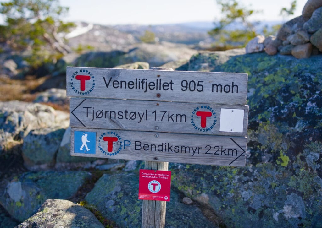
The different options for Venelifjell
You’ll see that it’s explained pretty clearly on the info sign at the beginning of the hike, but basically, you have two options for getting up to Venelifjell:
- Take the most direct trail for the round trip if you don’t feel like going on a longer hike. Aside from the fact that it’s a round trip, this route offers stunning views and also passes by a beautiful lake with a cabin about halfway up (apparently people swim in this lake… the water is way too cold for our taste, haha).
- There is a slightly wider trail that circles all the way around Venelifjell. Whether you start on the right or the left (see map), you can go around the mountain and climb to the summit from the back via a very nice trail, then descend via the standard route with the beautiful view right in front of you.
We decided to make the round trip in the late afternoon, and then the next morning I got up early to do Option 2 while trail running.
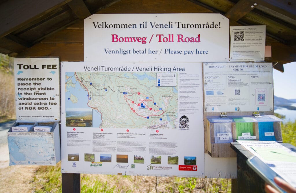
Private access road and toll
As is sometimes the case in Norway, the access road leading to the Venelifjell parking lot is a private road, so you must pay 70 NOK to use it (otherwise you risk a 600 NOK fine). After the first bend, there’s an information sign with slips of paper for your arrival date and license plate number. Then you’ll need to pay either in cash, via Vipps (the Norwegian equivalent of Lydia or Twint), or by card using the Stripe link provided. Easy peasy!
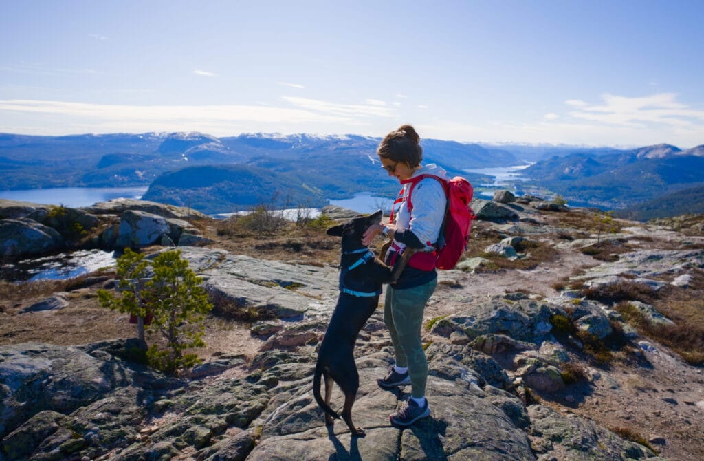
Our experience on the Venelifjell hike
We park in the late afternoon at the lot located at the start of the hiking trails. As usual in Norway, everything is well-maintained, with picnic tables (though there are no restrooms at this spot), which makes us want to stay there with the van for the night.
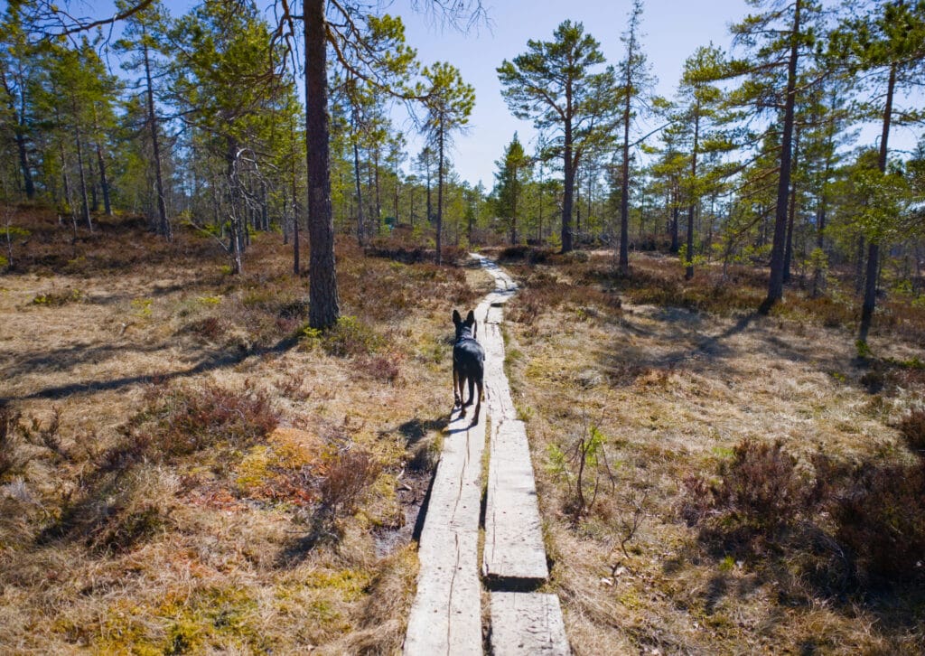
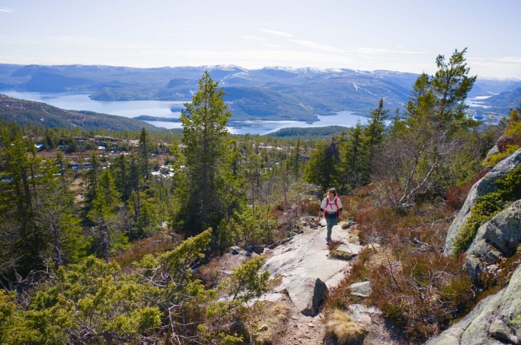
We start the hike by walking through very wet terrain (a common thing in Norway as well 😉 ), but the trail is equipped with wooden beams to keep our feet from getting soaked. We’d already encountered plenty of these boards on the Kungsleden in Swedish Lapland.
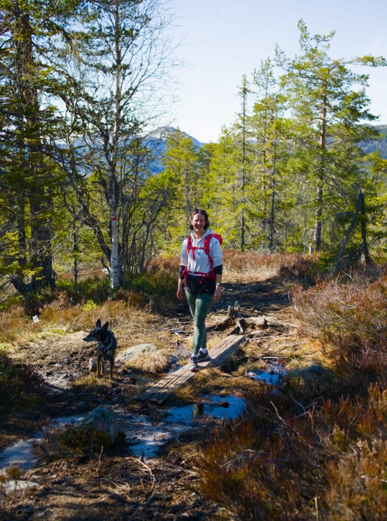
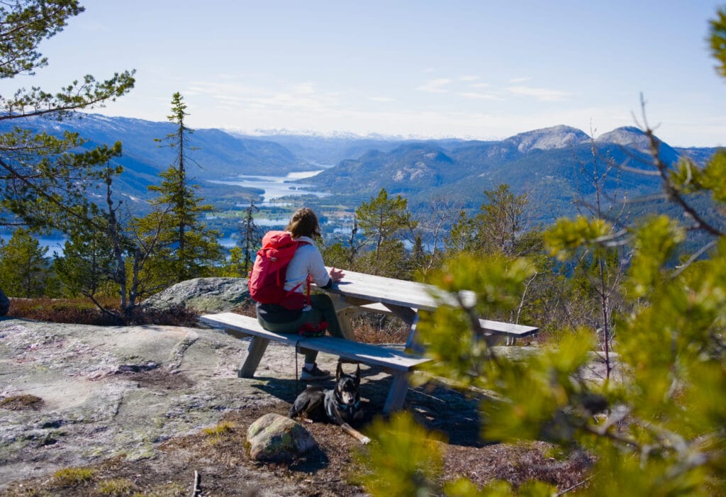
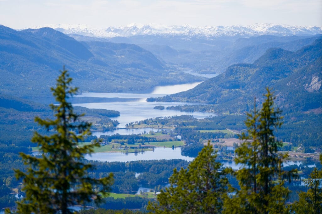
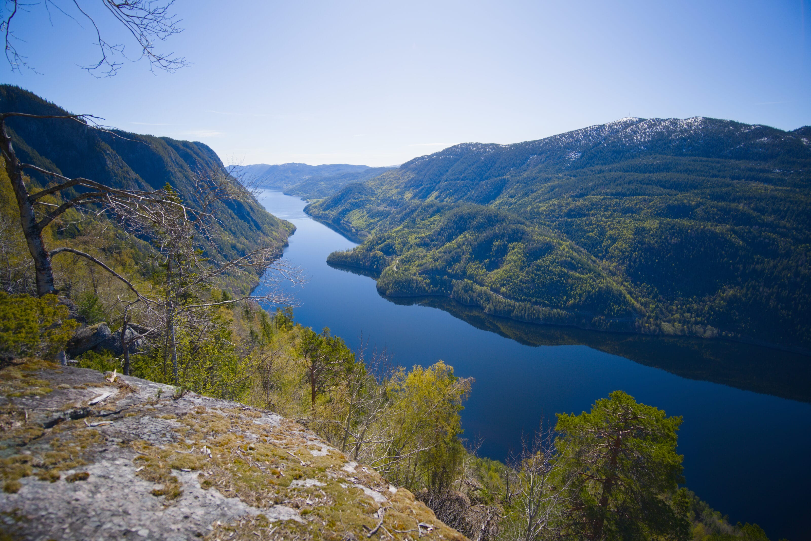
Then the path begins to climb gently. It’s nothing too steep, but behind us the landscape starts to open up, revealing a breathtaking view of the lakes below. Of course, since we’re in Norway, we found a nice table with benches where we could take a comfortable little break while enjoying the view.
I honestly think that by the end of this trip, we’re going to have to rank the most beautiful benches in Norway. We’ve already came across so many on our little hikes 🙂
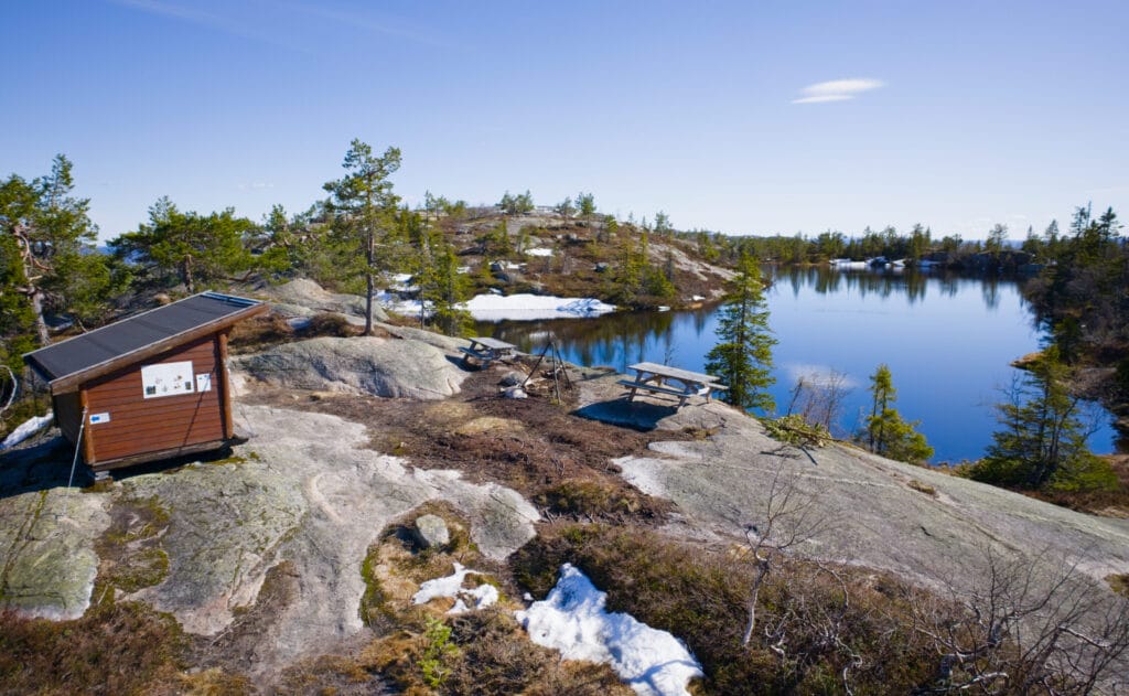
After this nice little break, we keep hiking up to Lake Venelitjørni. There’s a small cabin there with space to take shelter in case of bad weather, picnic tables, and a barbecue for grilling. Apparently, it’s also a great spot for fishing and swimming, but let’s be honest, in May there is no way we would take a dip (Fabienne and I aren’t really into cold dips, hahaha).
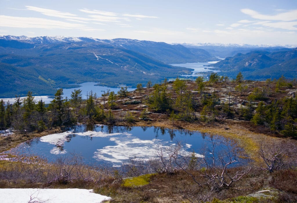
From there, it’s just another hundred meters of elevation gain to reach the summit of Venelifjell. It’s nothing too strenuous, but this hike is marketed online as a family-friendly hike. There are, however, one or two slightly more challenging sections where you might need to use your hands. It’s just that if you’re hiking up there with your 5-year-old, you might have to help them in a few spots. Nothing more 🙂
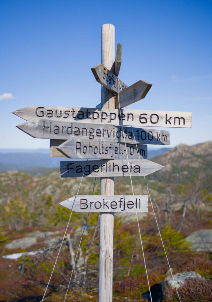
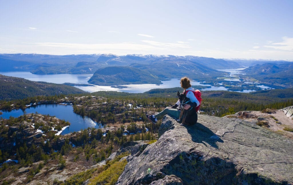
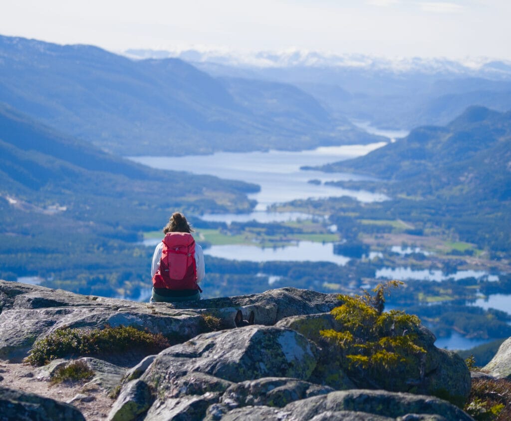
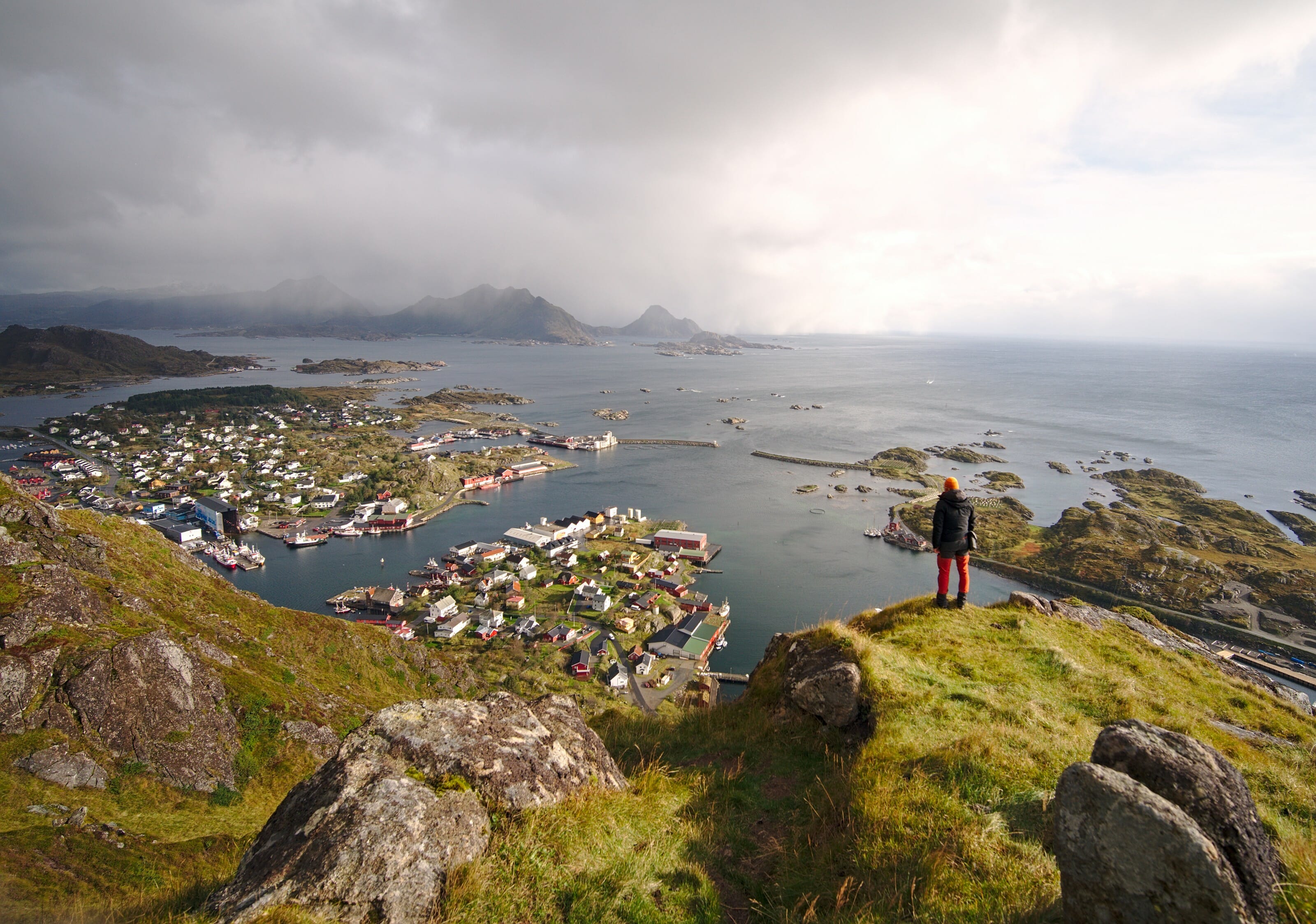
We pass by a second small lake and then reach the summit, marked by a cairn and a sign indicating the directions and distances to other iconic mountains in the region (such as Gaustatoppen, for example).
Since the summit is fairly flat, we recommend moving a little closer to the edge to get the best view of the surrounding area. We’ll let you decide for yourself whether Mount Venelifjell truly lives up to its name 😉
Finally, regarding the loop that goes around Venelifjell to climb to the summit from the back. Unfortunately, I don’t have many photos to show you since I ran the whole way. But I think it’s a great option for people who’d like to do a slightly longer loop hike. The section that goes around the mountain is really nice, and the trail that climbs up the back isn’t any harder than the normal ascent.
If you’re interested, you can find this run on my Strava here.
Pin it on Pinterest

Join the discussion