
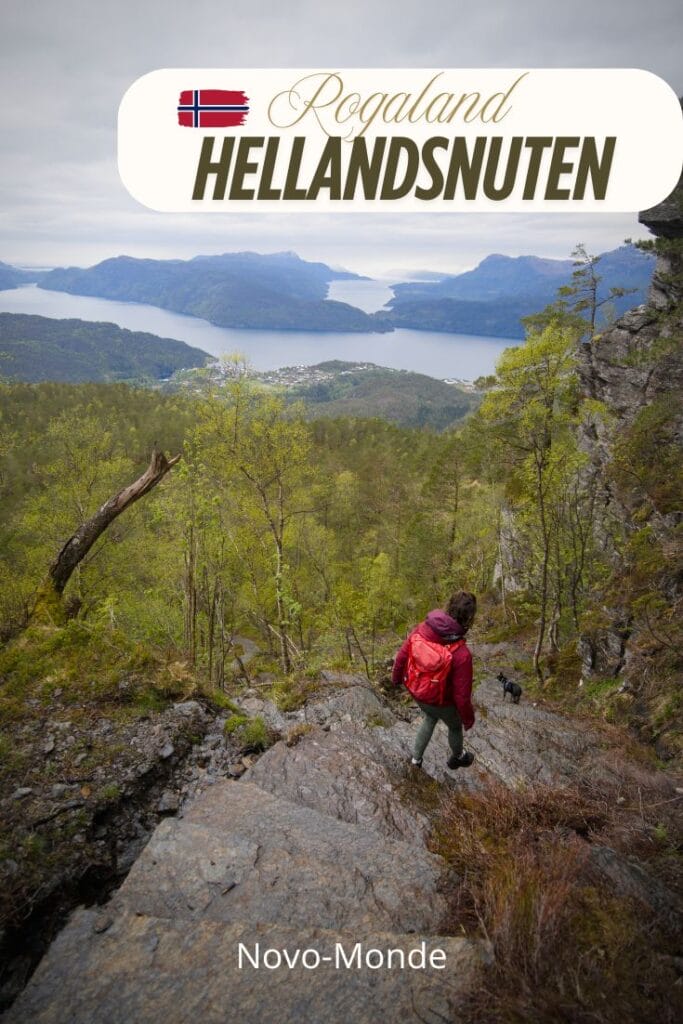
We’re continuing our explorations in Norway, and this time we’re taking you on a magnificent hike in the Suldal region, about 2.5 hours north of Stavanger: Hellandsnuten. This peak is a fairly well-known hike among Norwegians but isn’t necessarily on the itinerary of many travelers. And yet… the spot is known for offering a 360° view of no fewer than five different fjords!
Unfortunately, the weather wasn’t the best that day, but we still left completely charmed by the place, and we highly recommend this route if you’re visiting the area! Let’s go!
Hellandsnuten: a scenic hike in Rogaland
Located in the Rogaland region, not far from the main routes between Stavanger and Bergen and the fjords, this peak is an excellent choice for a day hike. : The trail is well-marked (it was completely renovated in 2024, but we’ll tell you more about that later) and leads to a panoramic view of the typical landscapes of Southern Norway.
What makes Hellandsnuten so great is the contrast between the relatively moderate effort required (don’t get me wrong, I was sweating buckets on the climb!) and the stunning views. In just a few hours of hiking, you go from the forest and its damp trails to a clear summit offering an incredible view of the mountains, valleys, and fjords below.
Now, don’t get me wrong, I’m not saying that the iconic hikes aren’t worth it, but to put things in perspective, you have to realize that every year around 300,000 to 400,000 people visit Preikestolen, and about 100,000 people go to Trolltunga (the hike is quite a bit more demanding, which limits the number of visitors a bit more). If, like me, you have a thing for stats, that still amounts to something like 5,000 to 10,000 people per day at Preikestolen during peak season. Right now (mid-May), we’re looking at more like 2,000 to 3,000, but that’s already absolutely HUGE! There are no statistics for Hellandsnuten, but I wouldn’t be surprised if fewer than 3,000 people a year make the climb up there. 😉 During our hike, we passed exactly four people over the four hours it took us (a trail runner and a dad with his two daughters!)
Where is Hellandsnuten, and how do you get there?
Hellandnuten is located in the Suldal region. The region is situated in the northeast of Rogaland County, and it is one of the wildest and least urbanized areas in this part of southwestern Norway. In fact, it’s right halfway between Stavanger and Bergen—and iconic hiking trails like Preikestolen and Trolltunga—but actually far away from the crowds!
To reach the trailhead, you must first head to Sand, a small town located on the shores of Sandsfjorden, a fjord that cuts deep into the Rogaland region. From Sand, continue toward the small hamlet of Eide, where a small parking lot is available right next to a daycare center (GPS coordinates for the parking lot).
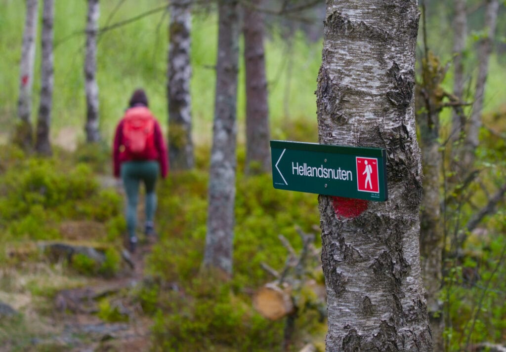
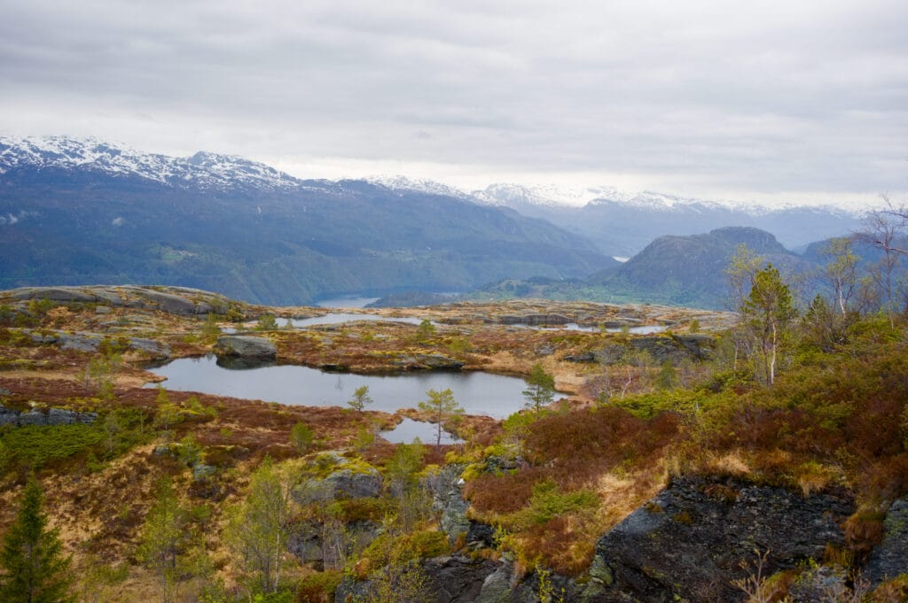
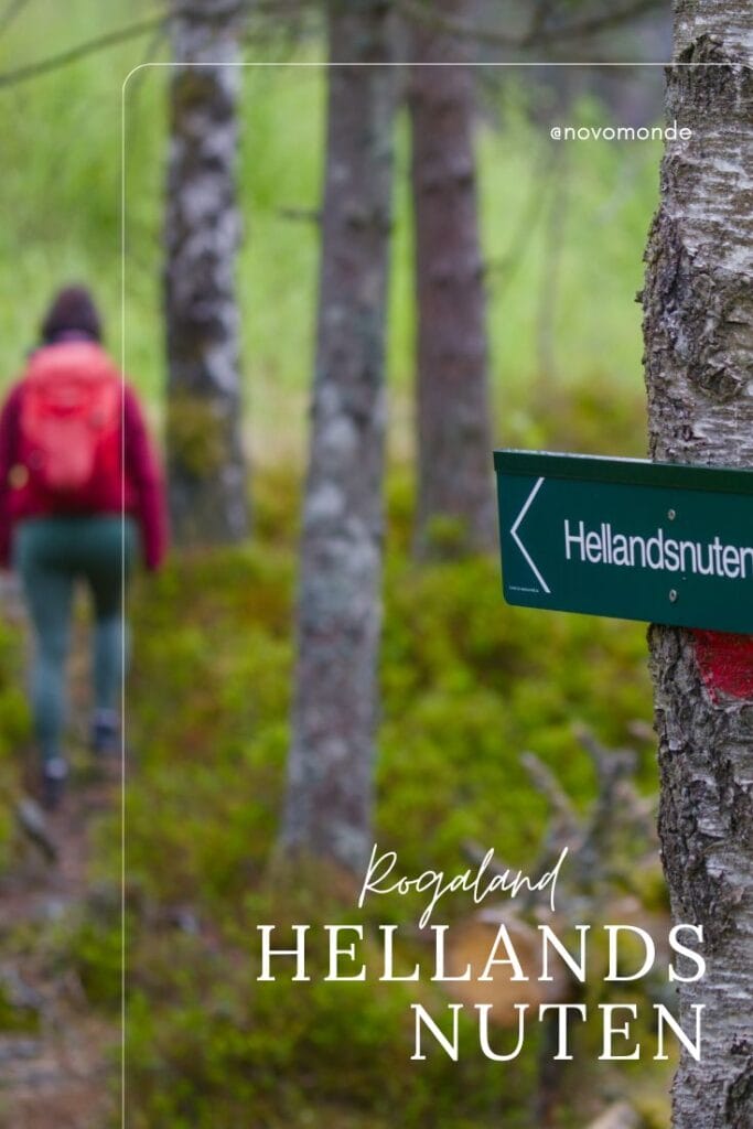
The trail leading to the base of Hellandsnuten
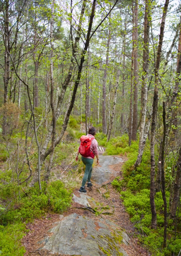
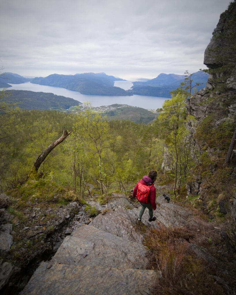
Starting from the parking lot, the hike begins by following a lovely trail through the forest. At first, it isn’t too steep, and best of all, there are small footbridges and planks laid down in the muddy spots. Naively, I’m already thinking to myself that this hike might actually be easier than I expected… Well, yes, online, the tourist office’s website describes it as a challenging hike that has to be earned. 😉 Who knows, but when it comes to hiking, it’s always tricky to get a sense of what to expect. Just on AllTrails (the app we use the most), I’ve found myself struggling way more than I should on hikes labeled “moderate” and literally strolling through others marked as “difficult.” In short, that’s why I think a blog is so useful… Of course, this is still just our personal experience, but we always try to be as transparent as possible.
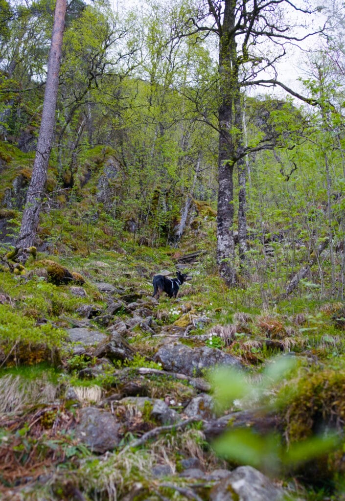
After just a kilometer or so, I quickly realize that I’m going to have to balance more than I expected. The weather is turning bad, and the light rain is making the rocks and roots very slippery. To top it off, it was on this hike that I discovered my Gore-Tex boots had developed holes in the toes (probably from all that hiking on rugged Norwegian rocks). I might as well tell you that Gore-Tex with holes in it loses some of its appeal… After not even 20 minutes of hiking, my right foot is literally swimming in my shoe, because yes, the trail is really very wet.
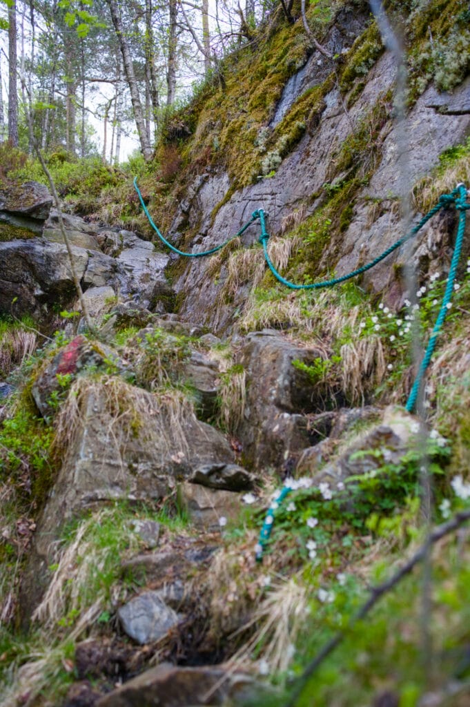
Technically speaking, there are a few sections where you need to use your hands a bit, and the uneven terrain (and the slope) make it a bit of a cardio challenge, but the trail itself isn’t really difficult. I honestly think that in dry conditions, the experience is quite different. And the more “tricky” sections are well-equipped with ropes, which helps keep you safe (especially useful on the descent, in my humble opinion).
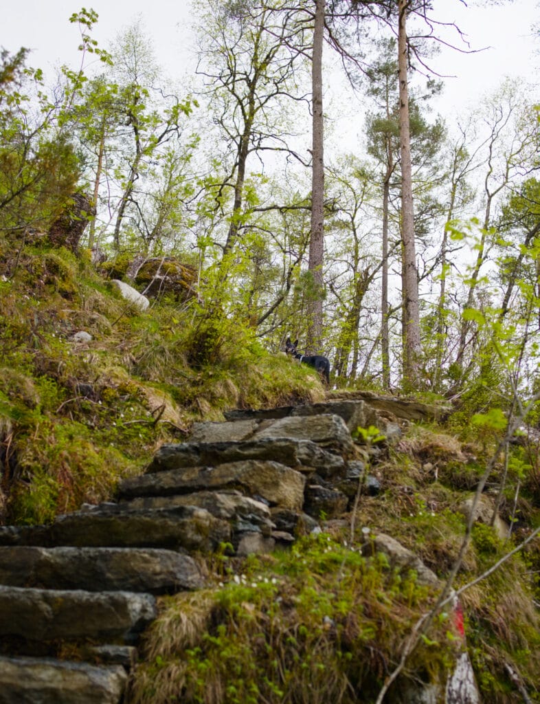
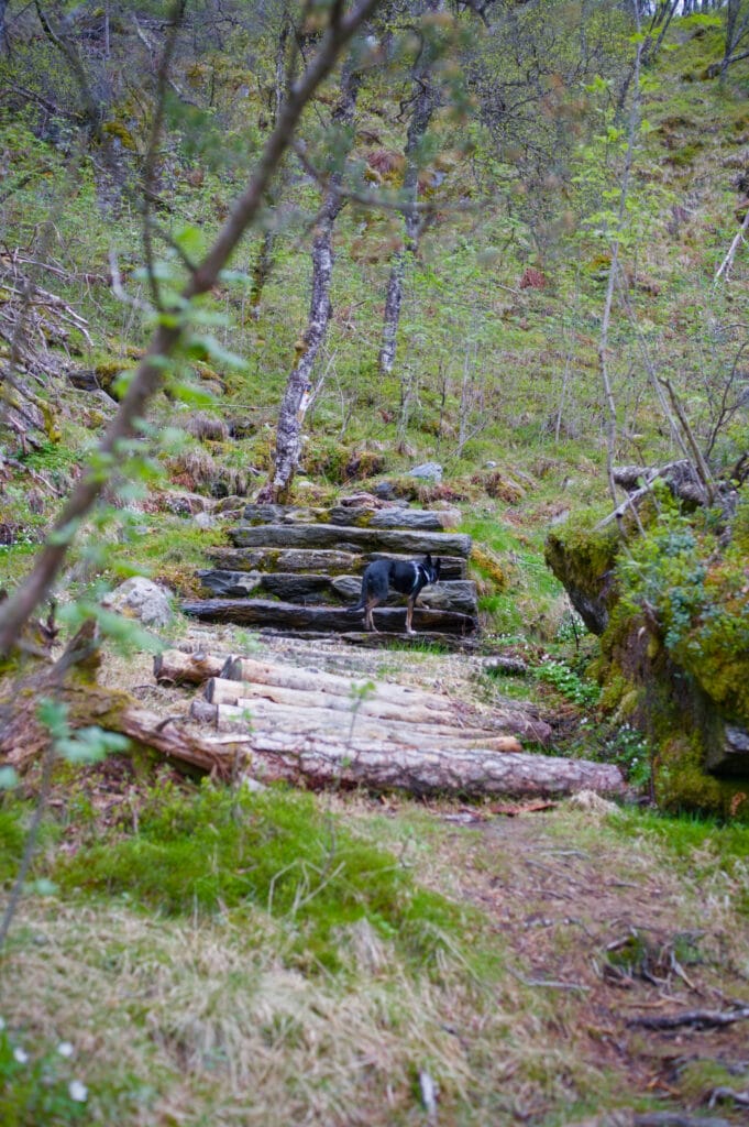
The stairs at Hellandsnuten
But what I really enjoyed about the hike was when we started reaching the sections with the large stone steps! Apparently, the trail had been created several years ago, and back then, a few stones had been placed to form steps in the steepest spots, but there really weren’t that many. A Norwegian hiker we met told us he’d already done this route a few years ago and that back then it was quite different.
We did some research and found that the municipality actually hired four Nepalese sherpas in 2024 to rebuild this trail and equip it with large steps all the way to the summit. So the trail is by no means a staircase the entire way (I’d say it’s about 20% to 30% of the route), but believe me, it makes the climb much easier! The steps are more even, and above all, it’s much more stable underfoot!
The final stretch to the summit (starting from the small lakes) is probably the steepest and the one where you’ll most often need to use your hands for support.
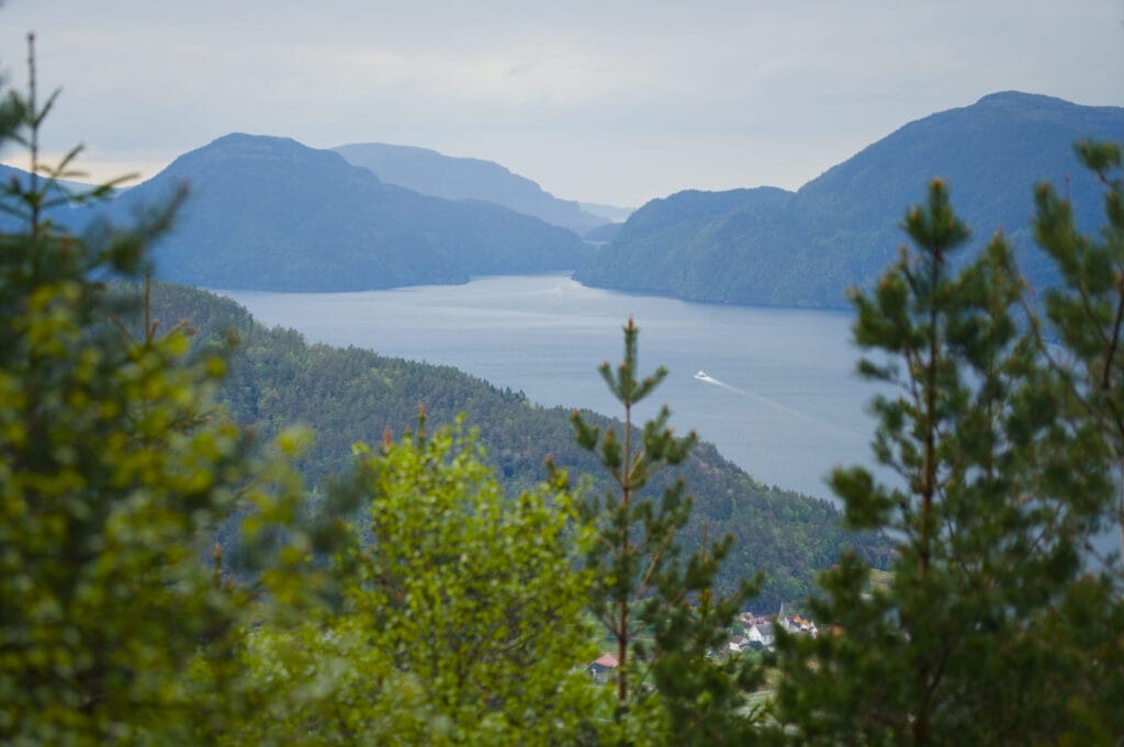
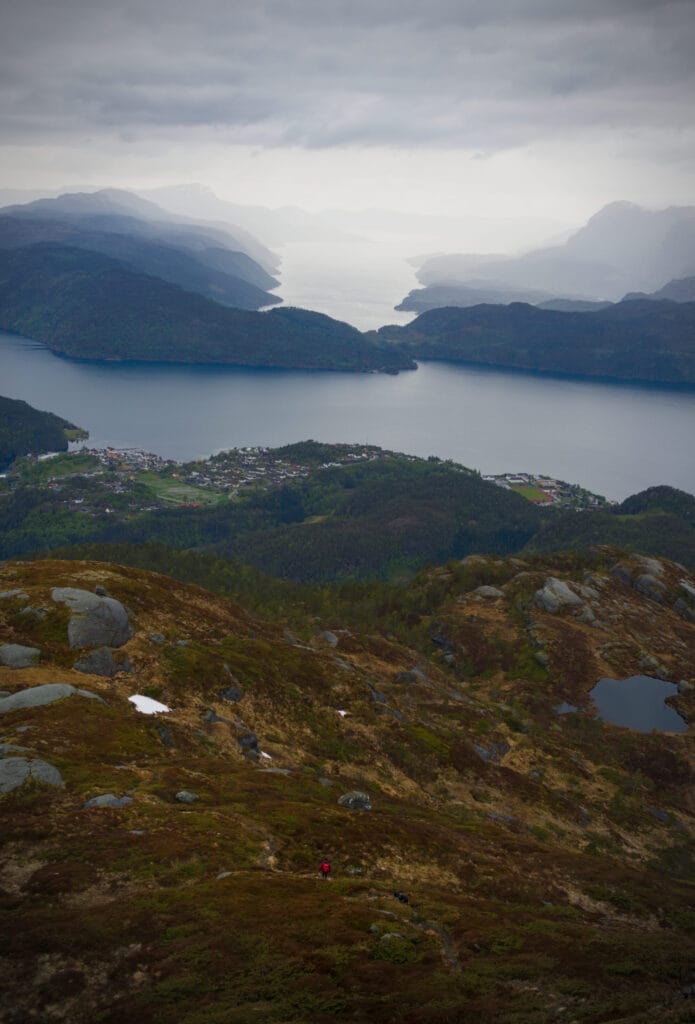
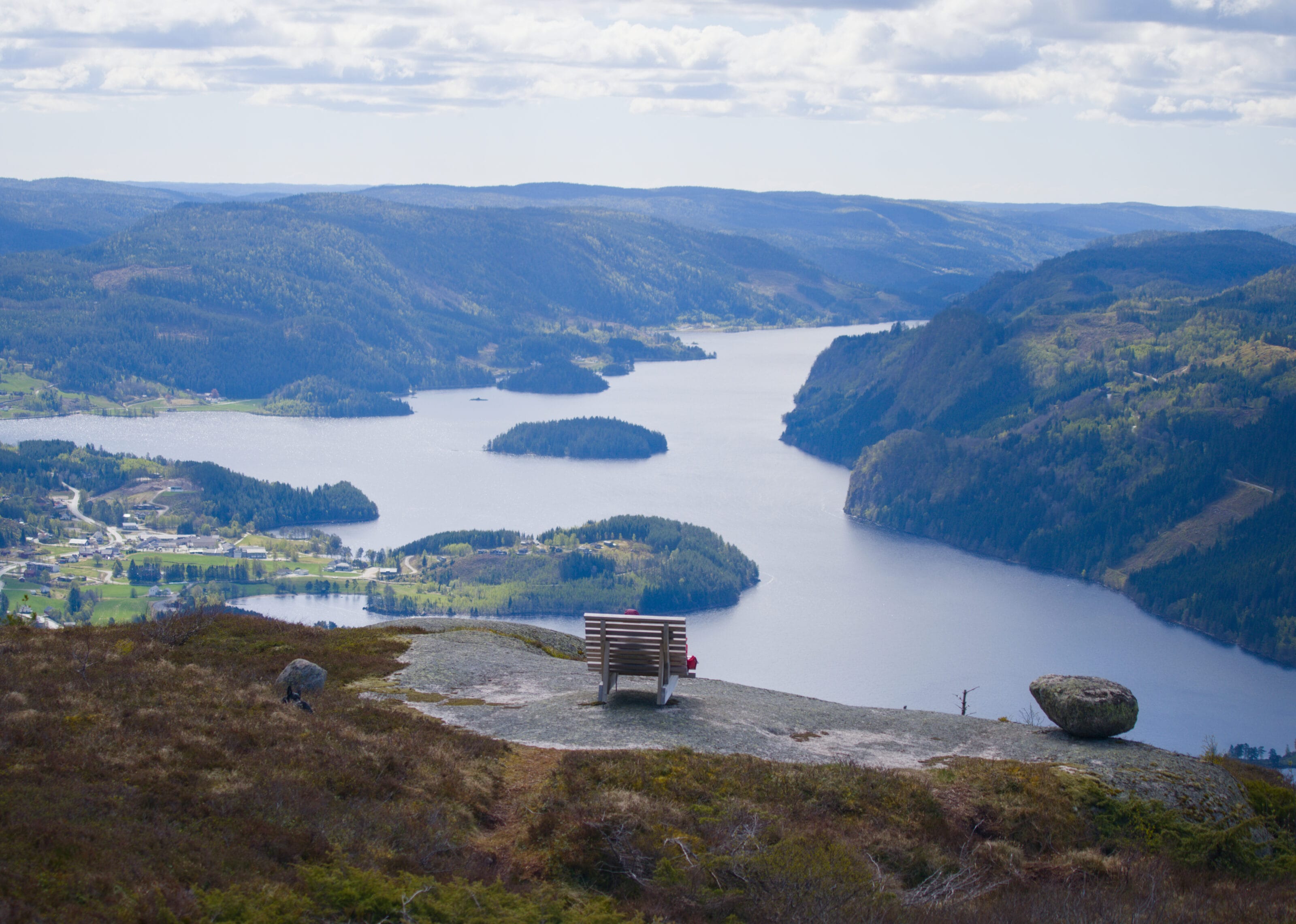
P.S.: Obviously, the climb will get your heart pumping, but don’t forget to look back every now and then. Even before you reach the summit, there are some truly magnificent views!
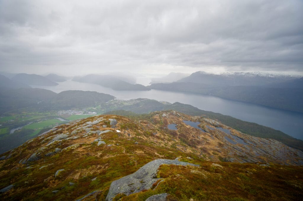
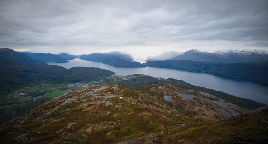
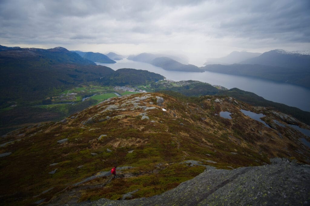
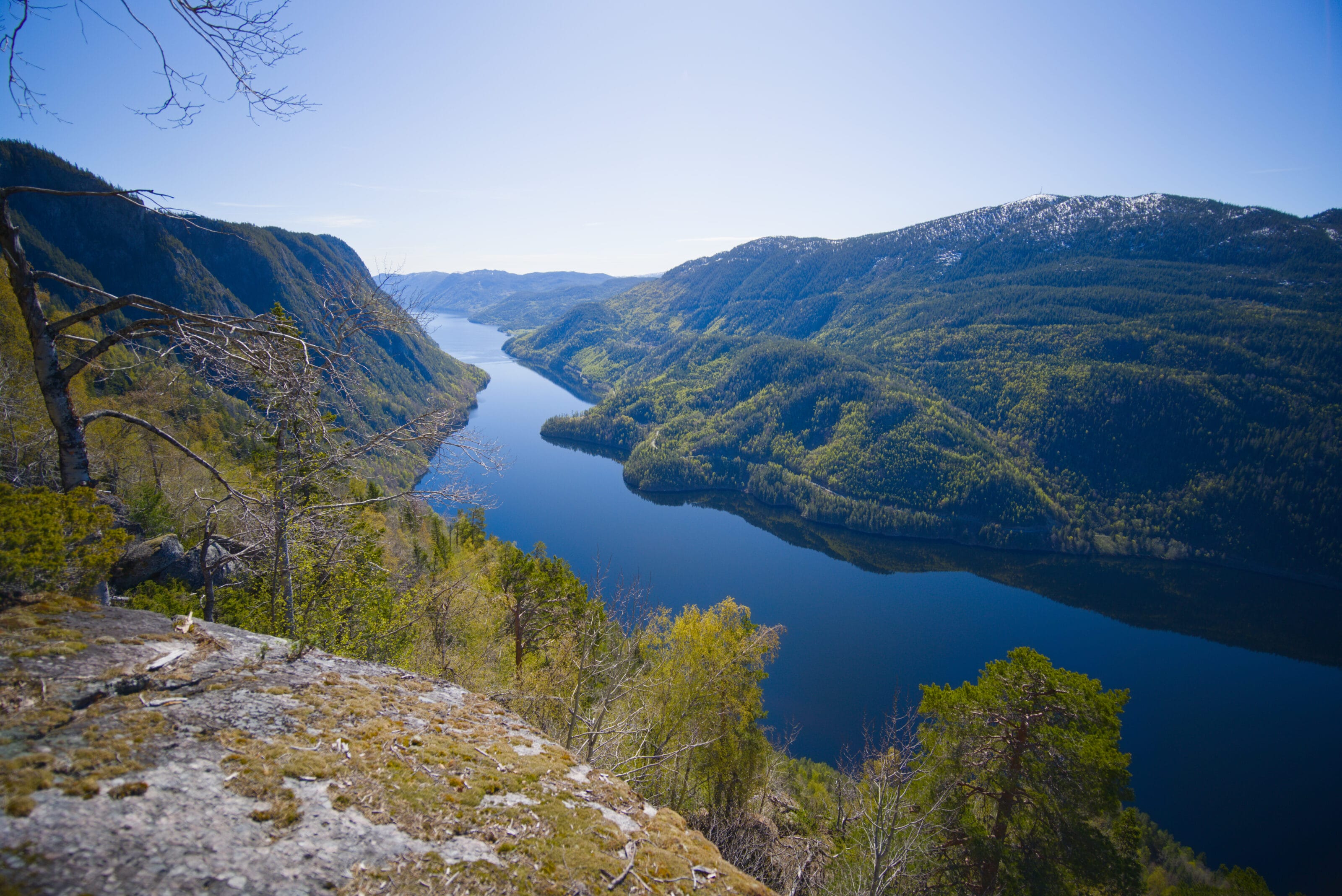
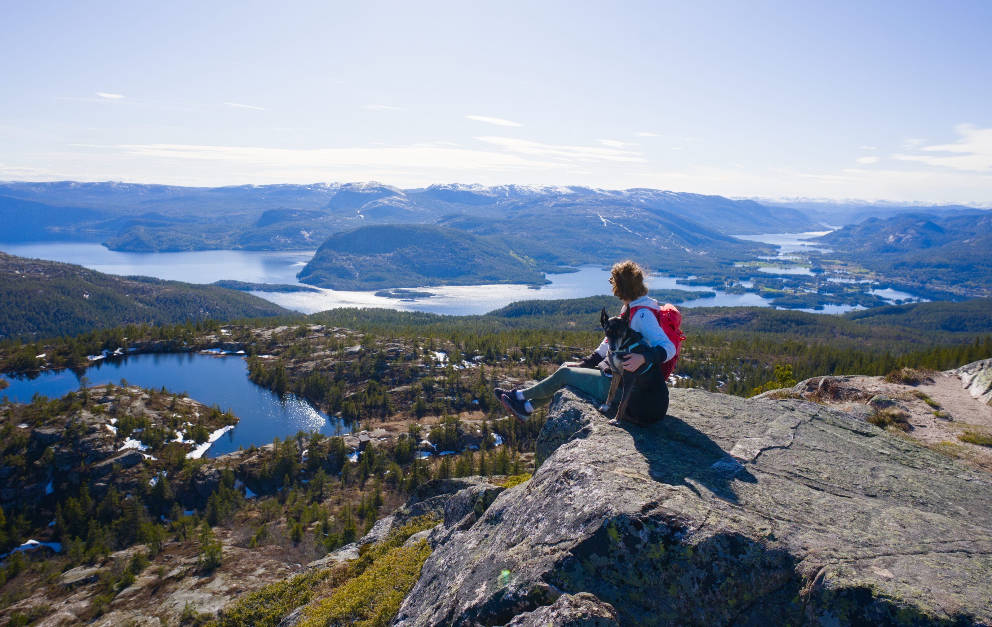
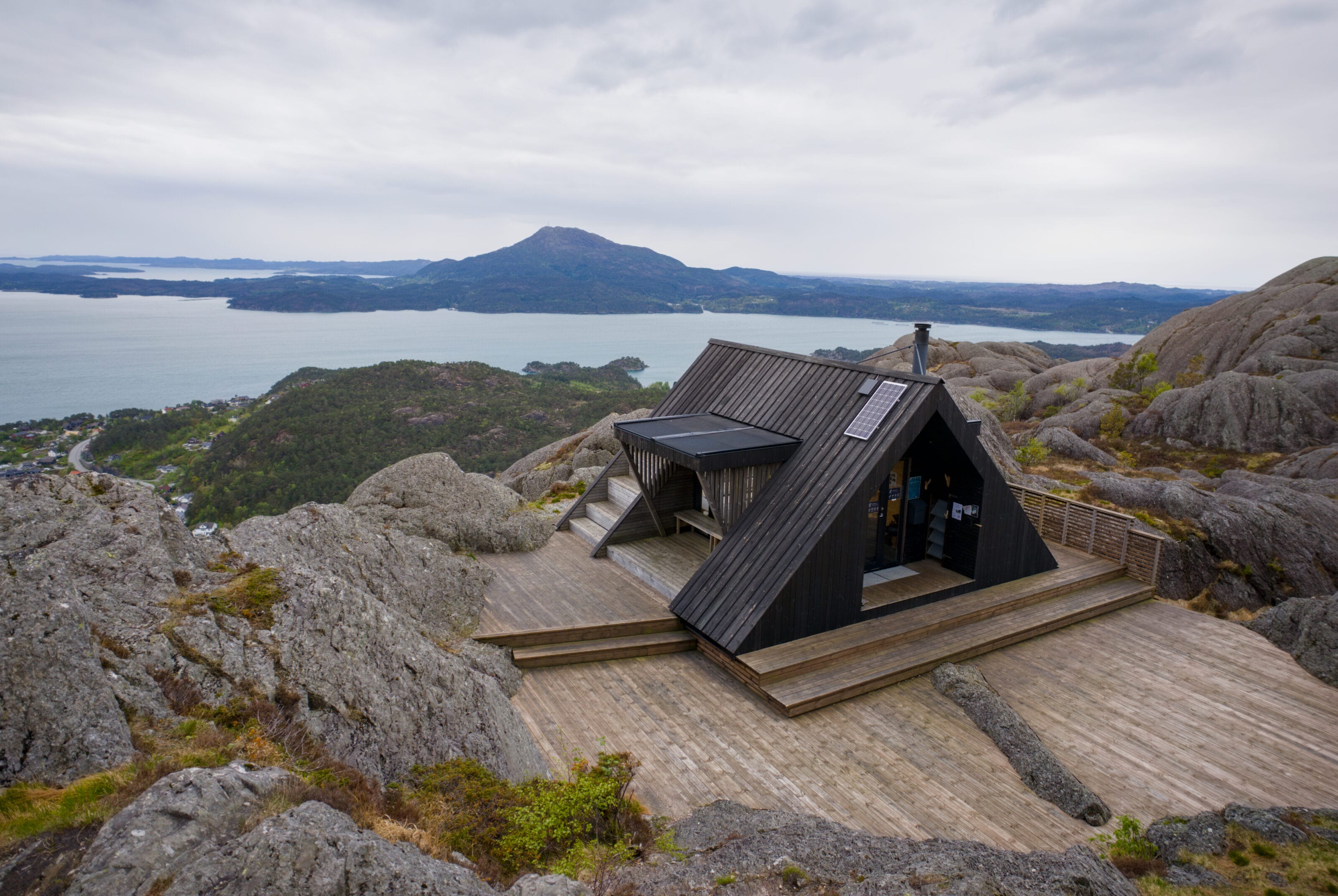
The summit of Hellandsnuten – 360° view
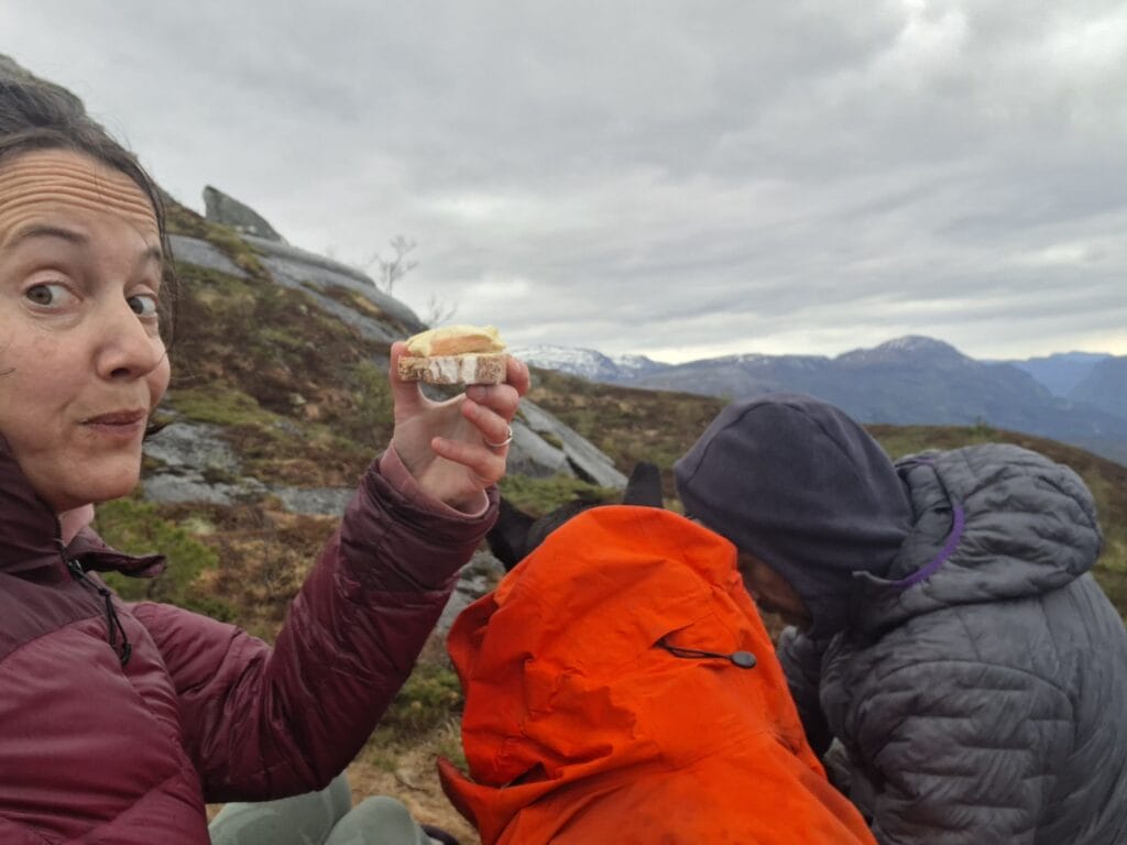
The summit of Hellandsnuten is marked by a large cairn offering a 360-degree view. So I’ll be honest, I enjoyed the summit for exactly three minutes… The rain had picked up, and an icy wind was blowing. In short, I barely had time to put on my layers before I was already heading back down a few dozen meters to take shelter behind a rock with the dog while Benoit took some photos. 😉
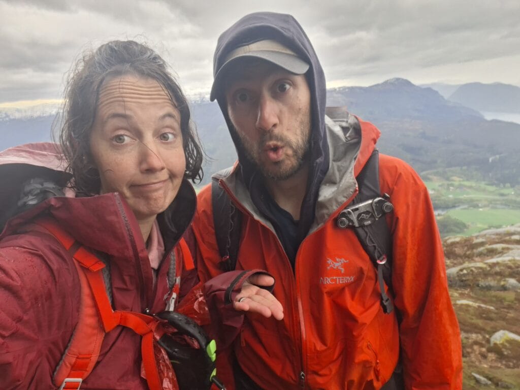
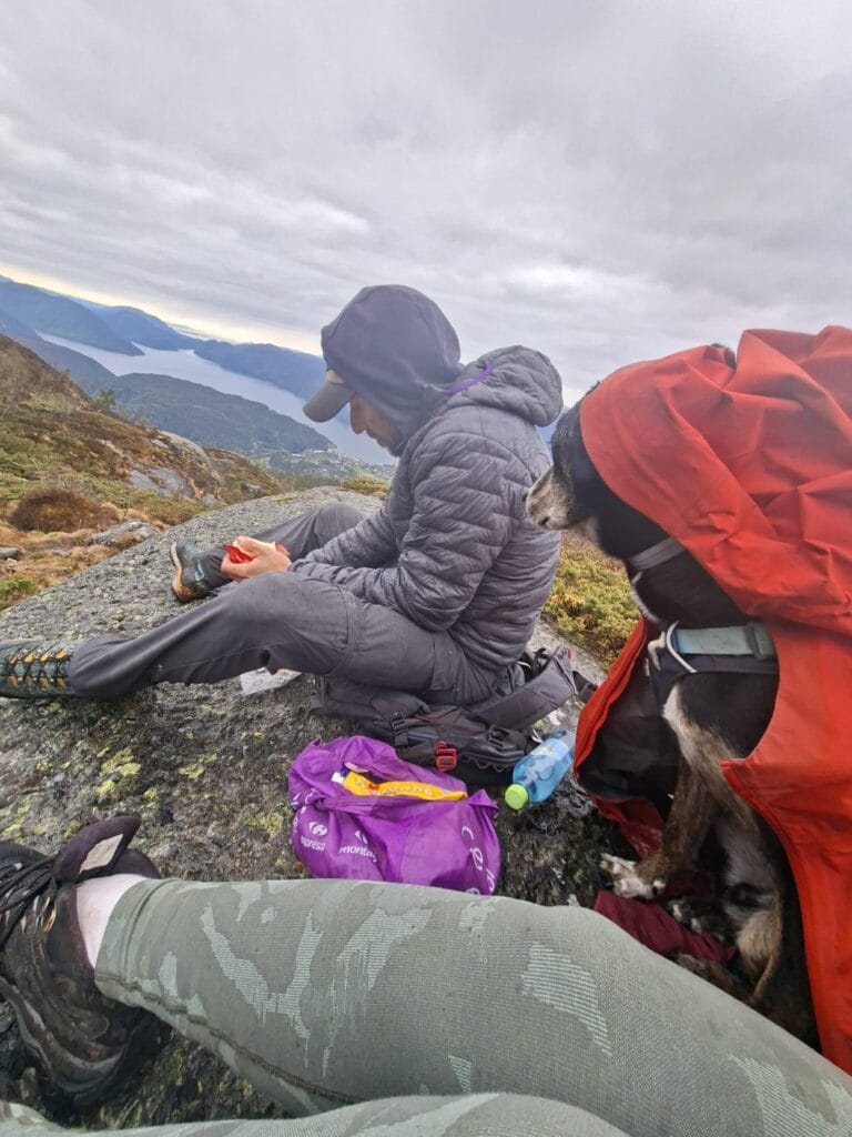
It wasn’t exactly a super idyllic scene at the summit, but the problem was that we’d packed a picnic in our bags and were starting to get REALLY hungry. Anyway, we hurried down a bit, and by the time we reached the little lakes, we took advantage of a brief lull (or rather, a decrease in the intensity of the rain) to devour two sandwiches in record time. PS: Yes, the rain jackets were used to sit on and protect the dog, who was freezing from the wind… we were already soaked, so it didn’t really matter anymore, if you ask me…
Hiking Route and Practical Information
As you’ll see below, there’s basically only one way to climb up to Hellandsnuten. However, there is an alternative route down the other side, allowing you to complete a loop (the light blue route on the map below). I’ll be honest, we had planned to do the loop, but the heavy rain that started pouring down on us at the summit convinced us to take the most direct route back down. In short, it’s hard to tell you what the other trail is like, but judging by the elevation lines, it looks a bit less steep. And given the quality of the trail markings in the area, we’d guess it’s probably well-maintained too. Feel free to let us know in the comments if you take this trail on the way down.
Well, let’s get back to the point. The round-trip hike to Hellandsnuten (as we did it) is about 7 km with 700 meters of elevation gain. It’s really odd because on the VisitNorway website, the route is listed as 14 km, but I think they just made a mistake. I promise, the round trip is really “only” 7 km, and it takes about 4 to 4.5 hours to complete the round trip. Yes, it’s long if you consider “normal” walking times, but I promise the terrain makes it hard to go any faster. I checked my watch, and it took us 4 hours and 15 minutes total (3 hours and 30 minutes of actual walking). But given the weather, we didn’t dawdle. 😉
That’s all for today! We’ll be back very soon with more hiking posts from the Rogaland region and southern Norway in general! We’ve been here for three weeks now, and the least we can say is that we’re having a blast!
See you soon!
Pin to Pinterest
Join the discussion