
It turns out that in our beautiful Val d’Hérens, we don’t have a peak over 4,000 meters that we can easily ski tour. We do have the Pigne d’Arolla, which we do as a day trip (or sometimes just a morning 😉 ) several times a season… But despite the magnificent panorama from its summit, it only tops out at 3,787 meters, lol. He is just missing about two to three hundred meters of height, you know 🙂
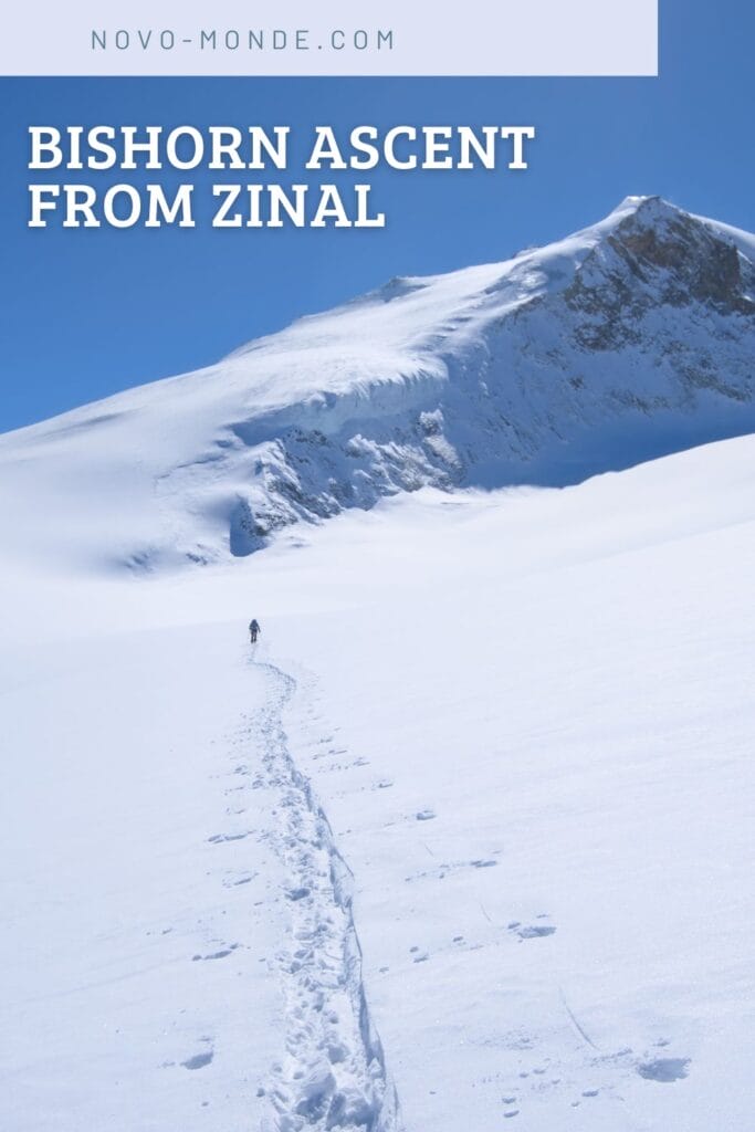
That’s what brings us to the Bishorn, which is located in the neighboring valley: the Val d’Annivier. It was more my neighbor David’s idea (with whom I do a lot of ski touring) who had long been planning to ski tour up the Bishorn in a single day from Zinal. He had this outing in the back of his mind for years but simply hadn’t yet had the right opportunity to do it. Of course, since I’m generally not that hard to convince (especially since it was my first 4,000m peak ski ascent in the alps), we just waited for the right conditions to embark on the adventure 🙂 .
Thus, at the end of April 2025, a week after the enormous snowfalls that caused heavy damage in our region, we wake up super early to begin our day from Zinal at 6 a.m., heading towards the Tracuit Hut.
Note: It is also possible to climb the Bishorn from the Turtmann hut, but that is not the topic of this article.
- Elevation change: 2600m+ for 13 kms of ascent
- Ski touring grade: Same grade for the Tracuit hut from Zinal and The Bishorn from the hut: PD / 2.2 / E1. If you don’t know exactly what these grades represent, we’ve written a full post on the matter here.
- Duration: Please note that this outing usually takes two days, with an overnight stay at the Tracuit hut. You need to be very fit to consider doing this tour in a single day. It generally takes 5-7 hours from Zinal to the Tracuit hut, then 3-5 hours to the summit of the Bishorn. It took us 4 hours to reach the Tracuit hut and about 2.5 hours more to reach the summit of Bishorn.
- Useful links: Tracuit hut camptocamp, Bishorn camptocamp, Tracuit hut website, Tracuit hut CAS, Bishorn CAS
Beyond the beautiful pictures of mountains and powdery snow, ski touring is a dangerous sport in itself, because of the alpine terrain, the danger of avalanches, the weather… So before you set off to tackle the Pigne d’Arolla, make sure you have the knowledge, skiing ability, endurance and gear required for this kind of adventure.
If you have any doubts, first read this article in which I share my experience since I started ski touring. I discuss the skills required, safety, essential equipment and many other aspects of the sport.
Finally, I’m by no means an expert in ski touring, and I’m simply trying to share my experience hoping that you’ll find it useful. But please don’t take everything I say as a given, and make your own experience.
Why the Bishorn rather than another 4,000-meter peak in the Valais Alps?
In my opinion, the interest of climbing Bishorn rather than choosing one of the 4,000-meter peaks accessible by skiing around Zermatt and Saas-Fee (such as the Allalinhorn, the Alphubel, the Strahlhorn, the Breithorn, or the summits of the Monte Rosa range) is that there are no ski lifts in the area.
Admittedly, it’s quite a climb to reach the summit, with a fair amount of elevation gain, but that also keeps the crowds a bit thinner up there (it’s a classic, so in peak season there can still be quite some people around 😉 ). And then, as you’ll see in the pictures below, this valley is magnificent and well-preserved… very different from what you can see around Zermatt and Saas-Fee imo.
From Zinal to the Tracuit hut
According to my research, there are two routes that ski tourers take to reach the Tracuit Hut from Zinal:
- Via the summer trail that climbs directly to Roc de la Vache: This is not the recommended route as it passes through very exposed areas. However, at the end of the season when there is little snow up to Roc de la Vache, it is a much more direct route on foot carrying your skis.
- By going around Roc de la Vache via the bottom of the Lé valley: This is the recommended route in winter and the one we chose given the amount of snow we had at the end of this season (we toured up with skis from the car). However, it is much longer in terms of distance!
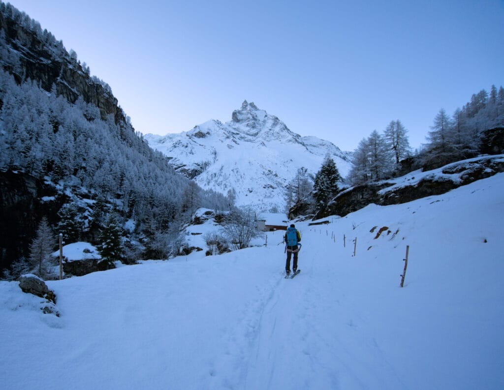
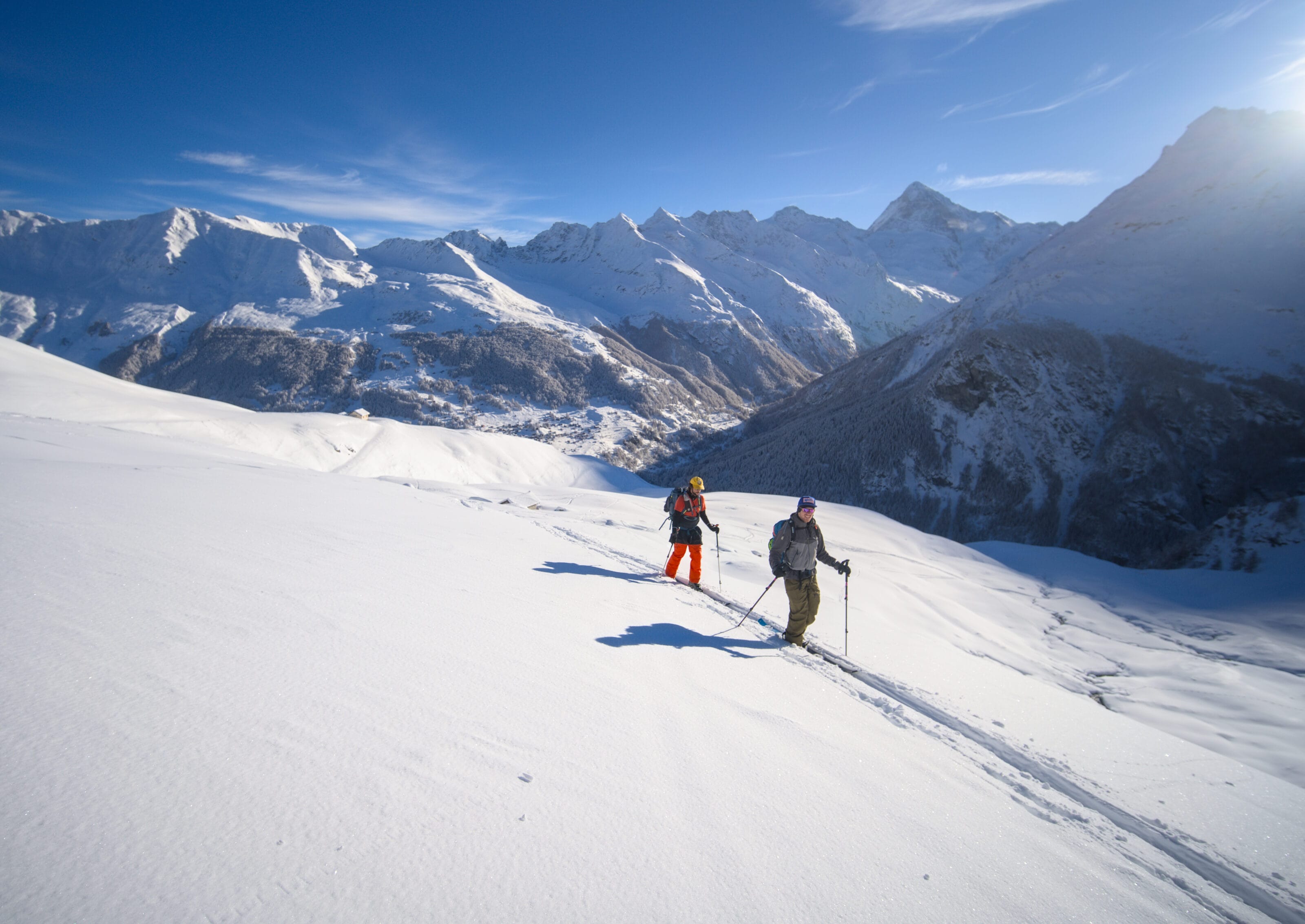
So, as I said, we started early (6 a.m.) along the Navisence River. We’re are super happy to see that we can start on the skis from the car into the valley. On the other hand, it’s quite a detour, and over the first five kilometers, we gain barely 300–400 meters of elevation.
The good (and at the same time bad) surprise of the day is that starting at Vichiesso there’s about 10 centimeters of fresh snow, and we’re obviously the first one to pass. Since it’s our first time touring up to the Tracuit Hut, that doesn’t help us find the easiest way, and we also have to make the track… (usually I don’t mind it, but when it comes to do the track from Zinal to the Bishorn summit, that’s another story). Fortunately David was in great shape that day because he blazed the trail practically all the way to the top!
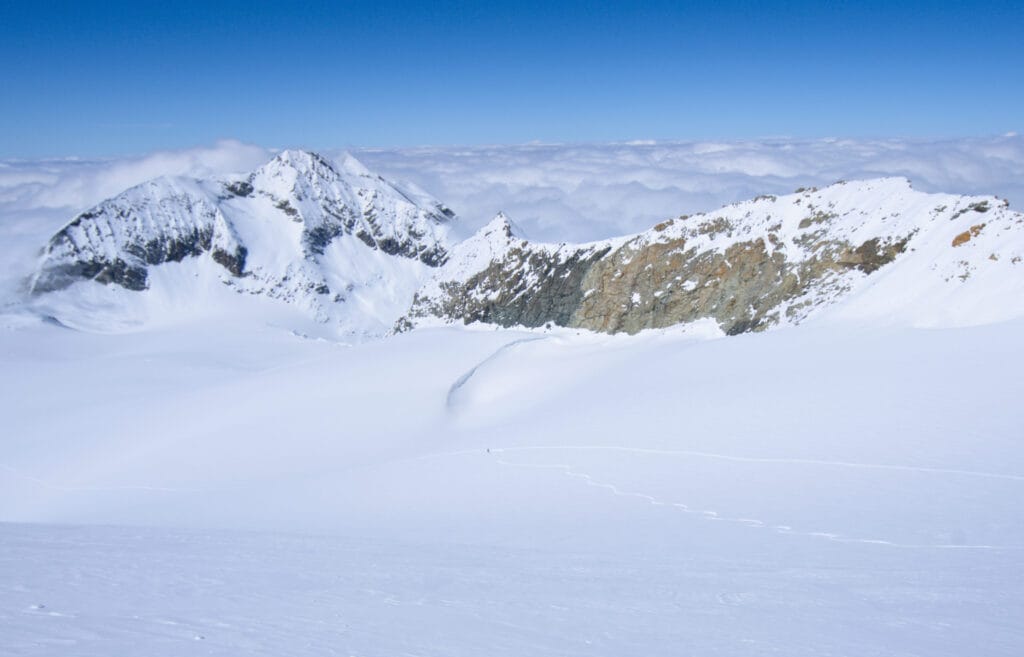
At the junction with the Arpitettaz valley, we cross the bridge to turn back and head toward the Tsijère de la Vatse alpine pasture. In front of us, the sun finally rises over Dent-Blanche and Grand-Cornier, which we are more used to seeing from our valley.
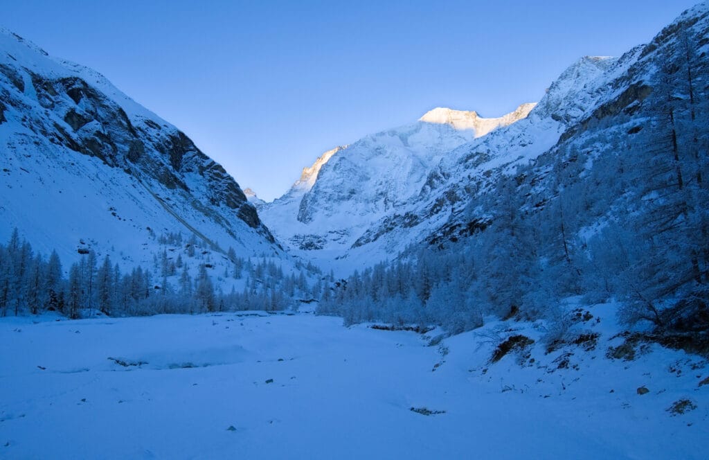
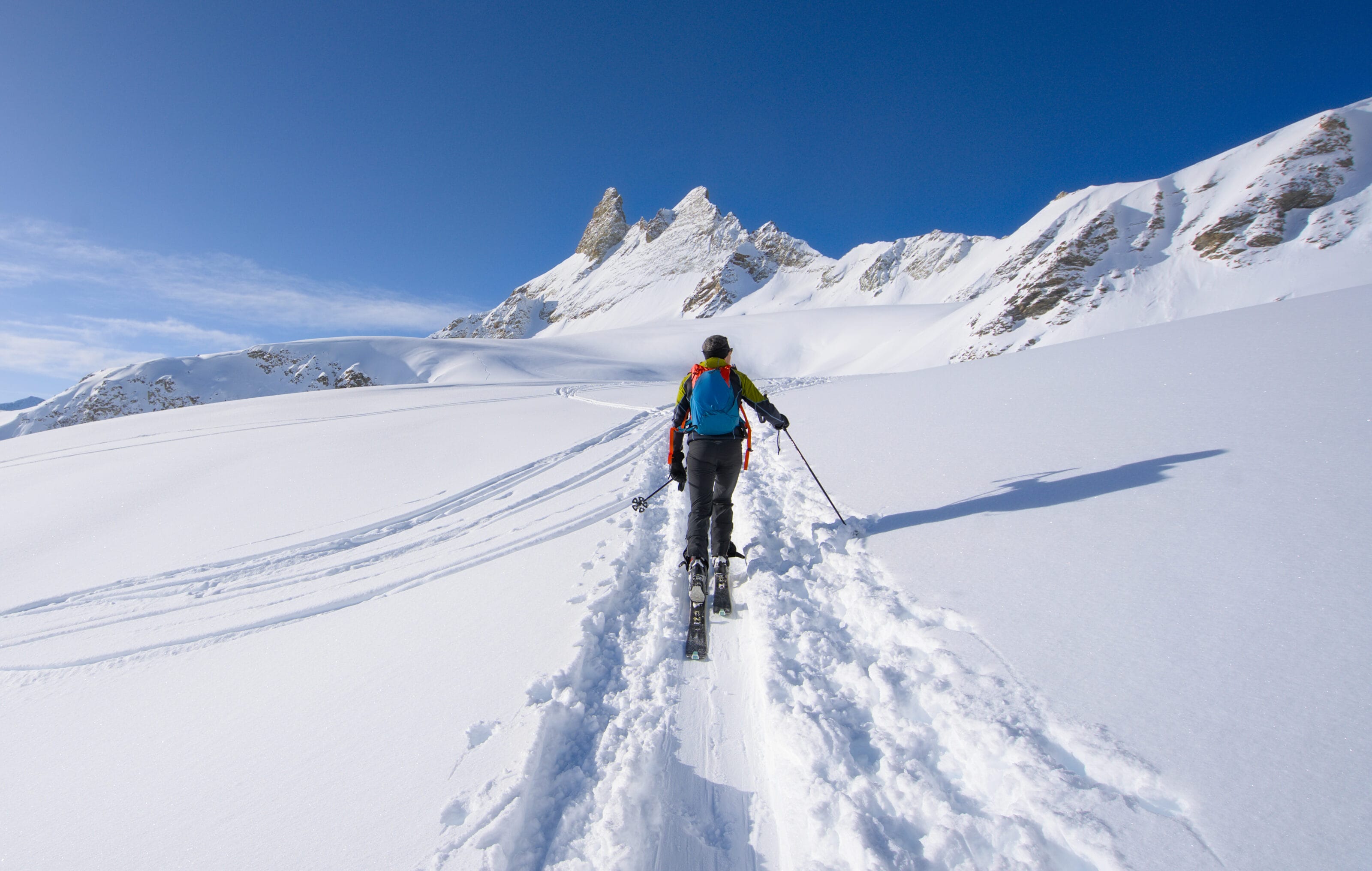
That’s where we really start climbing. We ascend diagonally, first through the Arpitettaz alpine pasture, then through the Tsijère de la Vatse alpine pasture, to reach a small pass southeast of the Roc de la Vache.
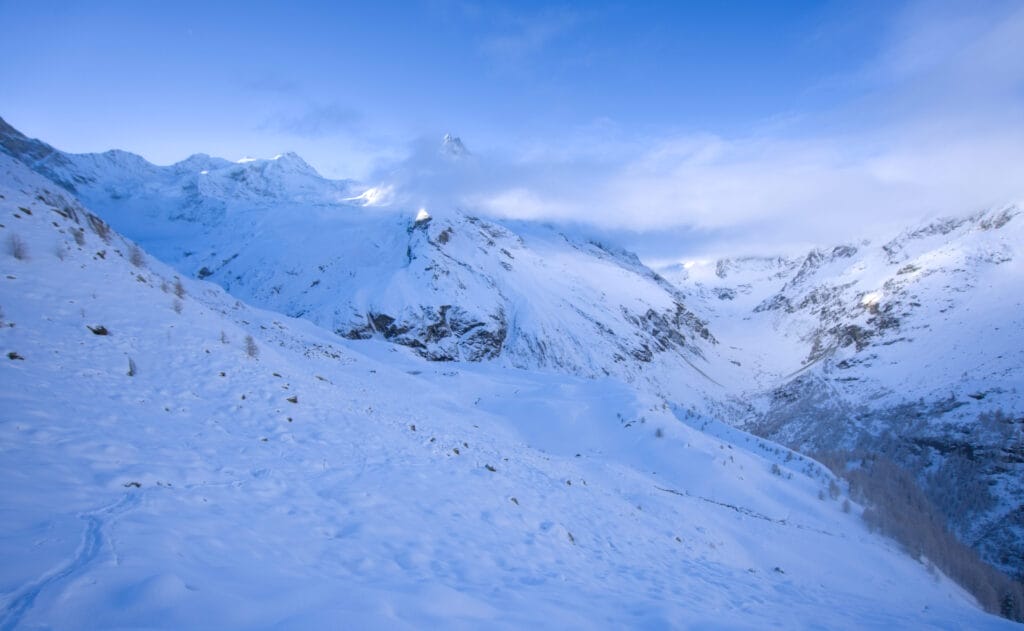
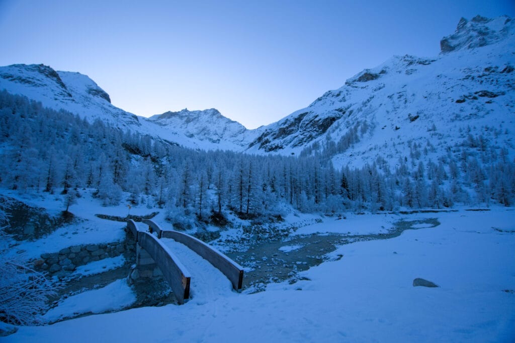
Once at the pass, we see for the first time the Tracuit hut, which still seems quite far away… and we also realize that we’ll have to ski down a little (about 50 meters of elevation) to cross the Barmé torrent (it’s not really worth taking off the skins, in my opinion).
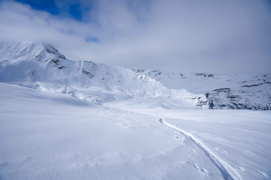
From there, there’s still about 700 meters of elevation gain to the hut. The first part of the climb is fairly easy, but the closer you get to the Tracuit Hut, the steeper it gets. And we also start to feel the altitude and we inevitably slow the pace 😉
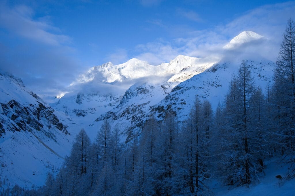
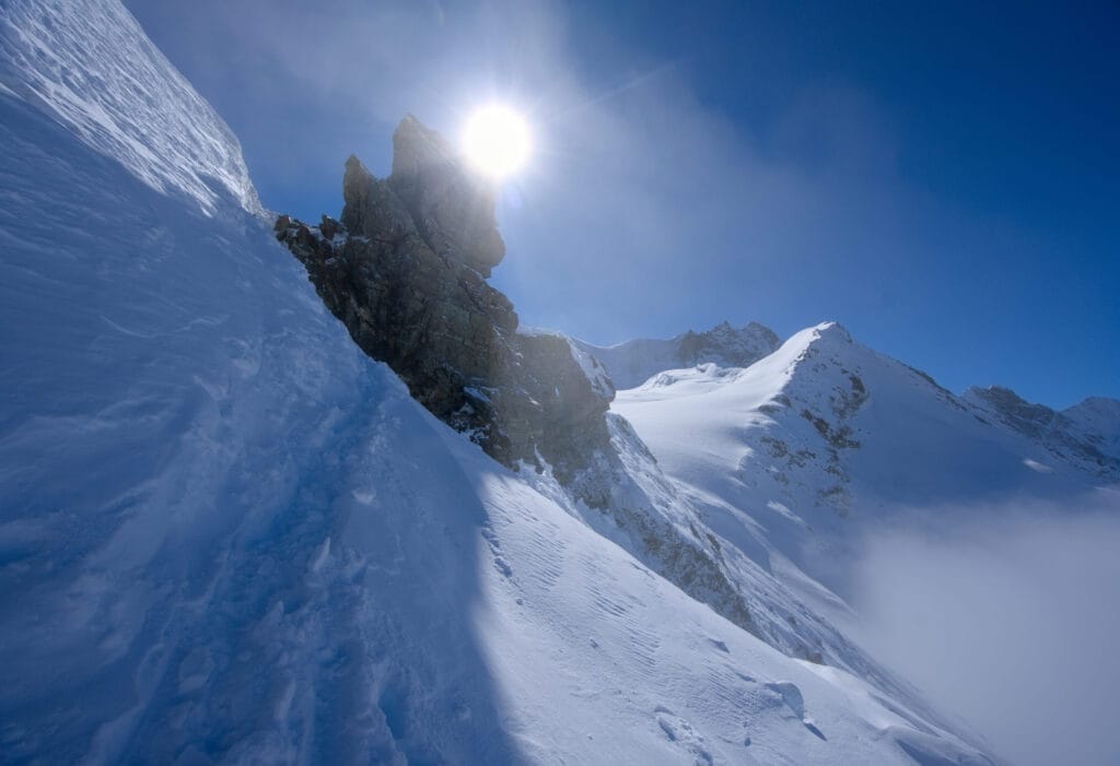
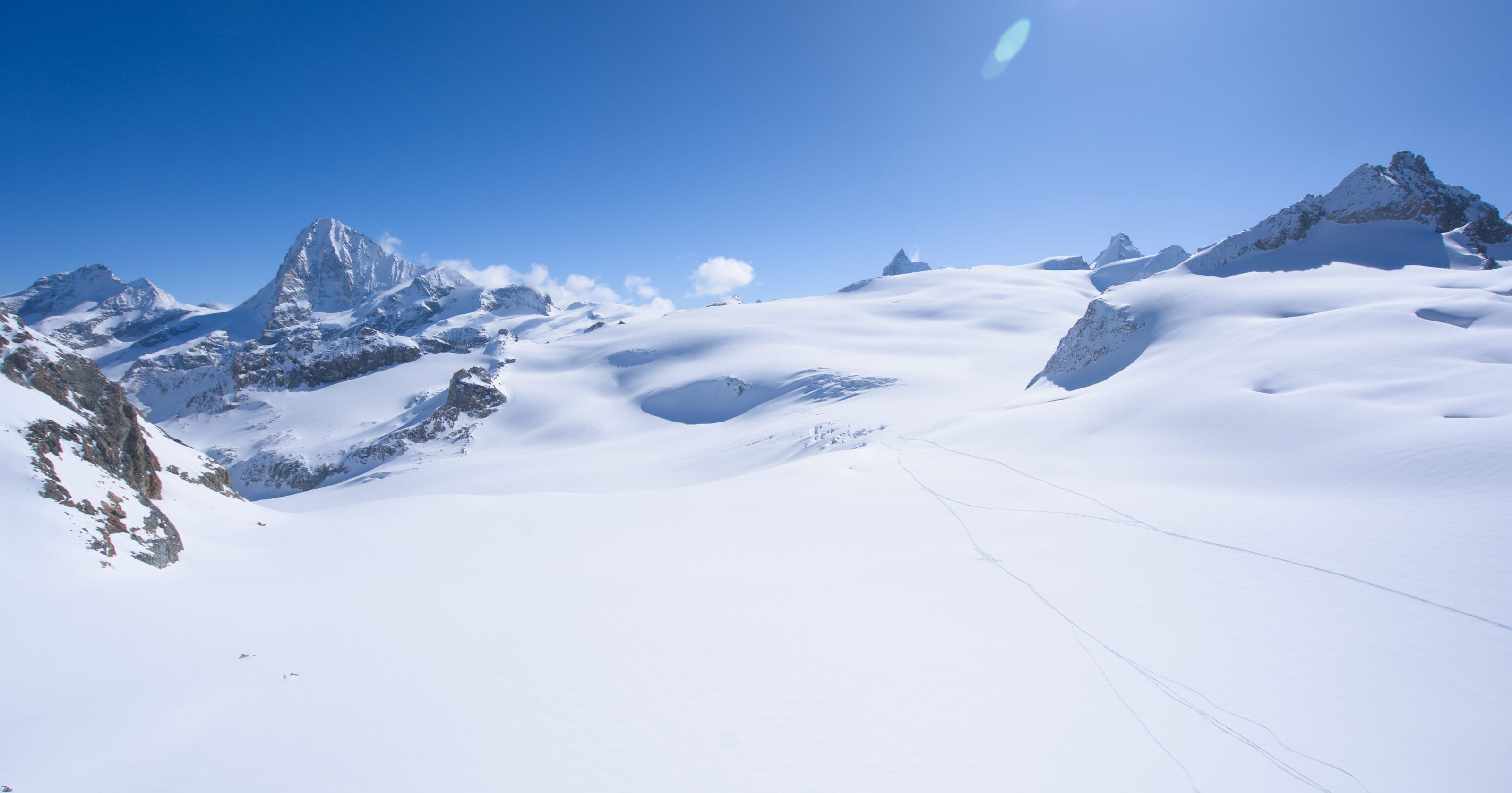
But anyway, we drift slowly above the cloud line and the landscapes are really incredible. Just before the Tracuit Pass, there’s a short stretch that’s a bit steep and narrow, equipped with chains where you may need to take off your skis to reach the ridge. But it’s nothing to worry about, and the hut is right behind it for a well-deserved little break.
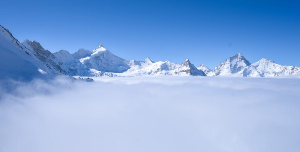
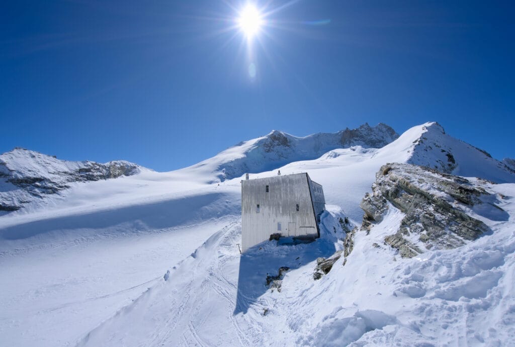
From the Tracuit hut (3256m) to the top of Bishorn (4151m)
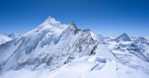
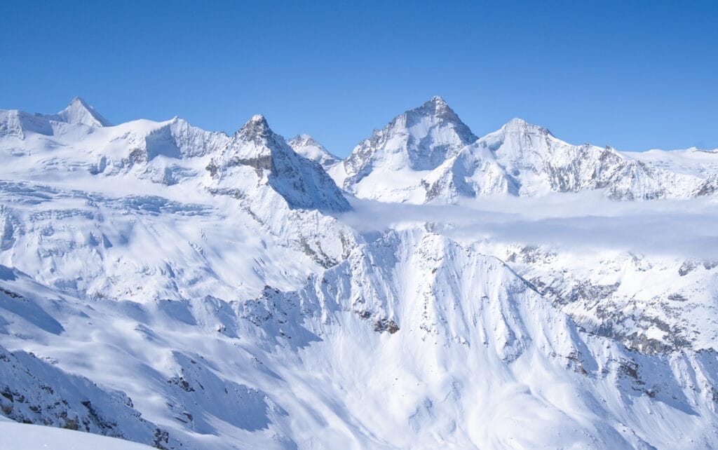
We arrive at the hut a little after 10 a.m. and we take the time to have a good break before tackling the 900 meters of ascent that still separate us from the top of Bishorn. From the terrace, our objective is in sight and we can see exactly where we’ll need to pass to reach the summit.
Well, I say “exactly” but there are, in fact, two routes to reach the summit of Bishorn:
- The NW slope (PD / 2.2 / E1): This is the normal route from the Tracuit hut and is not difficult (except for the altitude, of course).
- The W couloir (TD / 5.2 / E3): This couloir is also clearly visible from the hut and rises between the rocky face and the glacier. However, it is much more difficult and very exposed 😉 . More information about this route can be found on Camptocamp.
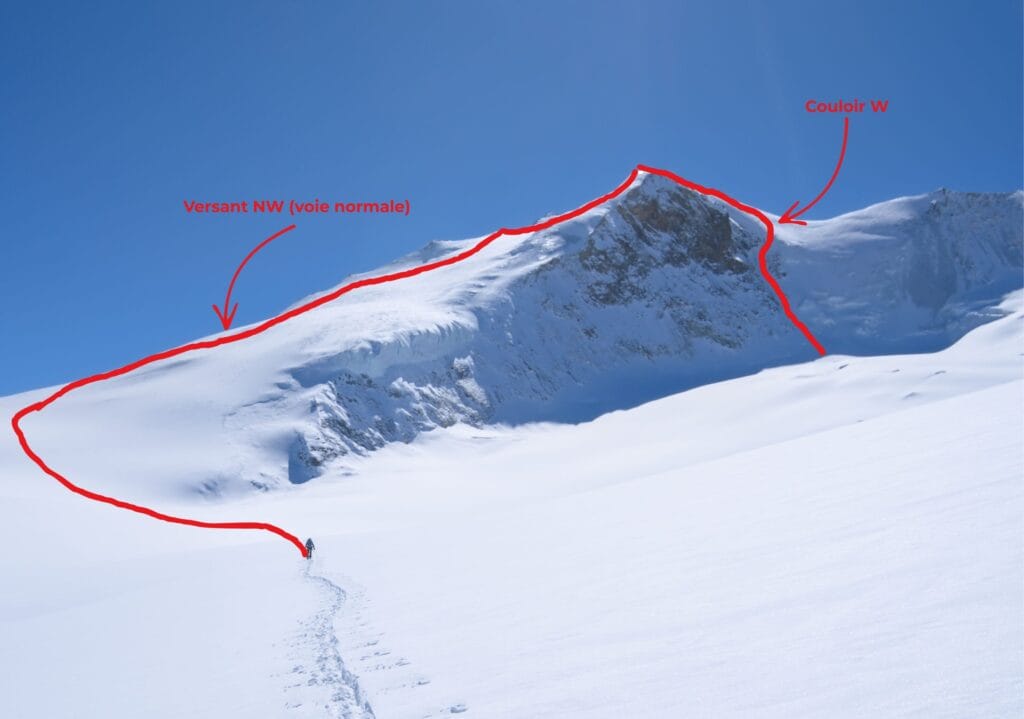
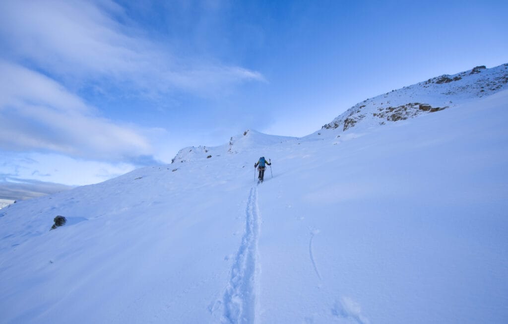
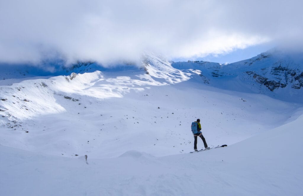
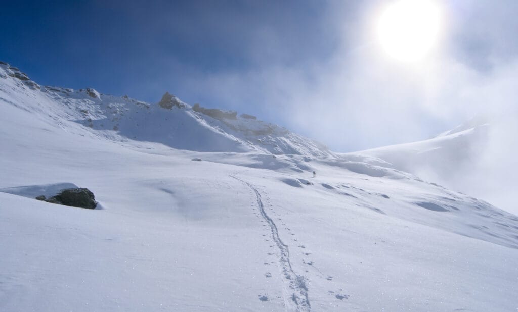
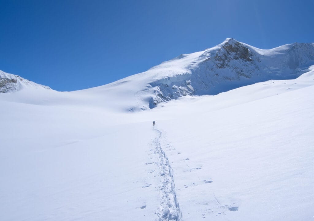
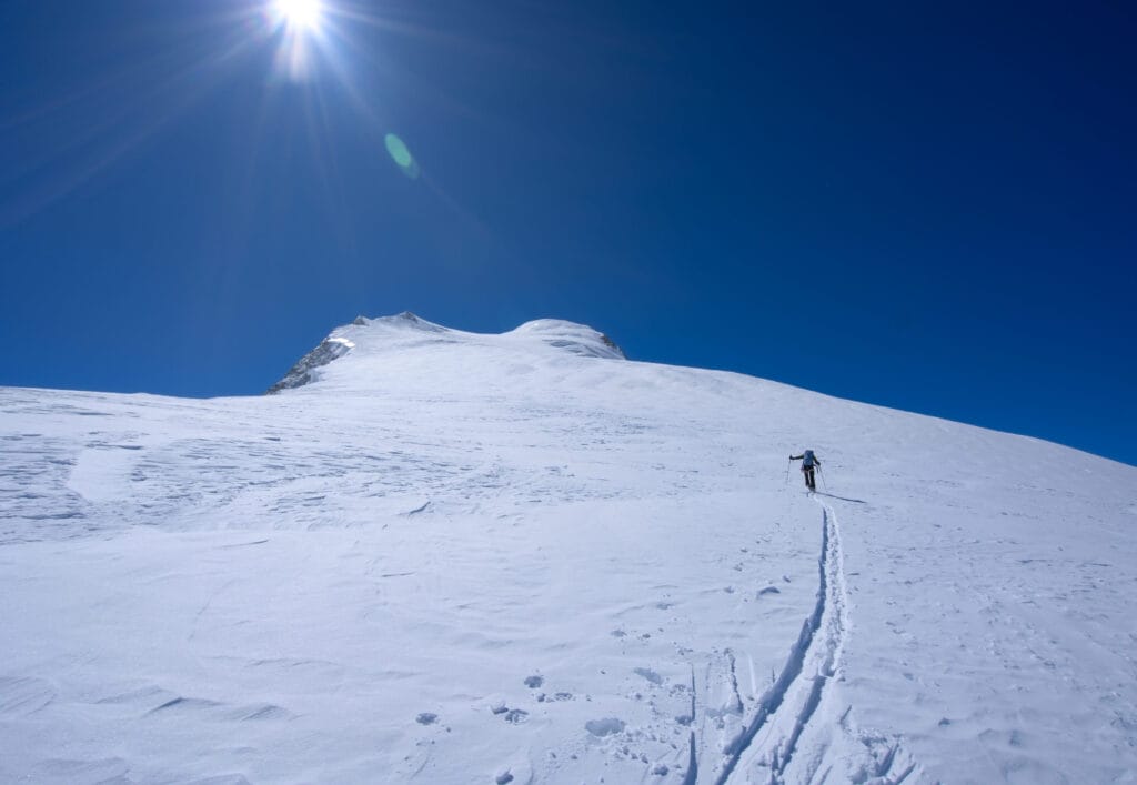
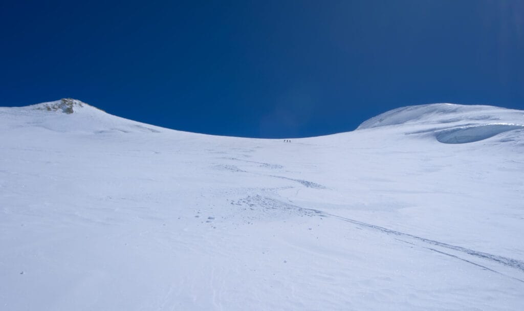
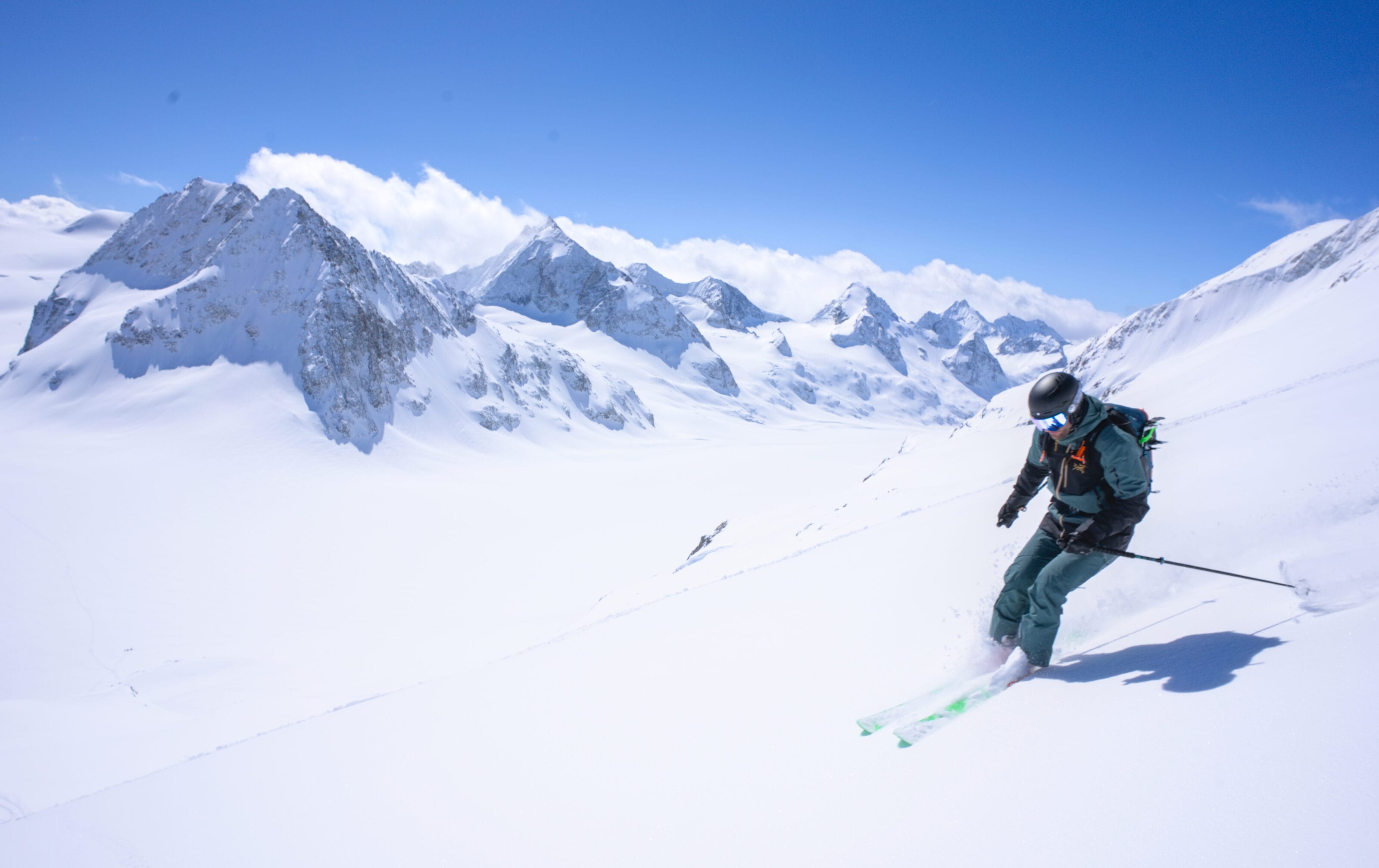
As you may have guessed, since this is our first time climbing Bishorn, we’ve chosen the normal route. We already start by crossing the Turtmann Glacier, still making the first track. We basically go straight ahead almost to the small pass south of point 3543 before tackling the ascent of the NW slope.
On my end, I really start to feel the altitude and fatigue! I let David go ahead of me and I’m trying to find a pace (quite slow) to reach the summit. Above 3,500 m it was really hard! I was very slow and I had to regularly stop to reach the summit with my guts… Honestly I wasn’t showing off as I wasn’t sure I’d make it to the top. On the last 650 meters of elevation gain, David must have pulled ahead of me by roughly 30–45 minutes 😉 #machine
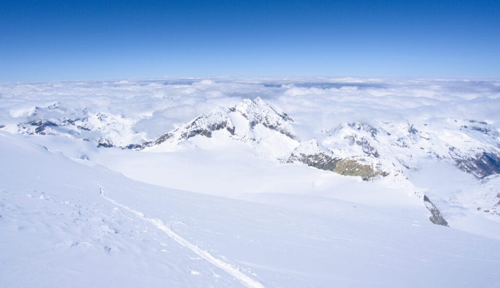

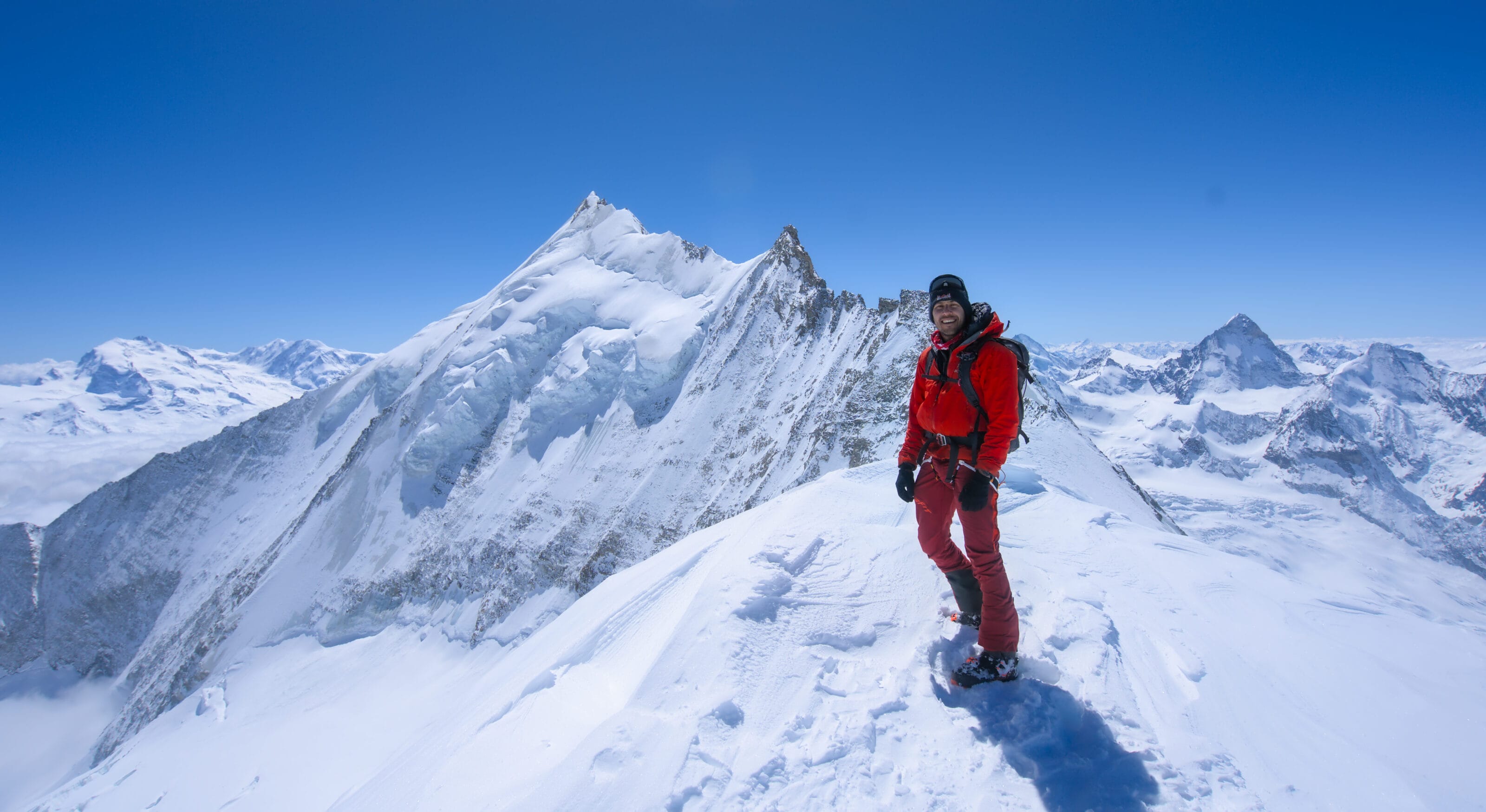
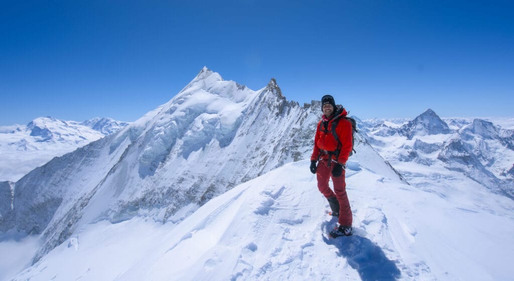
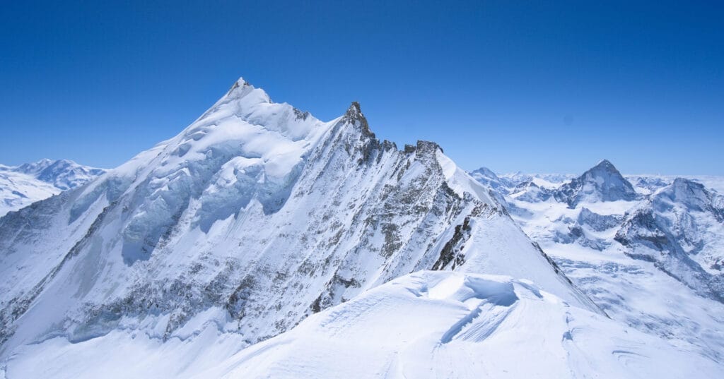
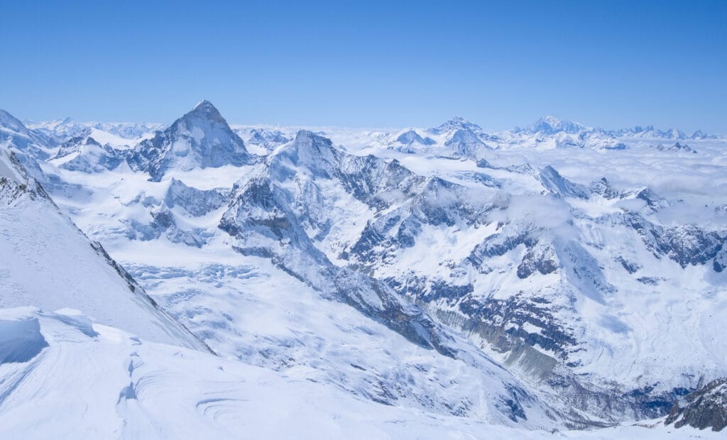
I take off my skis right at the base of the summit to tackle the last steeper meters on foot (no need to put the crampons though). And there before me unfolds the most beautiful panorama I’ve ever had the chance to see in the Alps: the splendid northern ridge of Weisshorn!
What a stunning sight. It’s absolutely beautiful. What a reward after that long, long climb! I can’t help but think that you’d still need a heck of a lot of stamina to tackle the entire ridge up to the Weisshorn’s summit. But hey, it’s not on the agenda for this outing, lol 😉 . Since the weather’s gorgeous and the temperature is fairly mild, we’ll stay up there for a good while to enjoy these unique landscapes.
If you don’t feel like skitouring the Bishorn on your own, don’t hesitate to hire a professional guide for this ascent. To do so, we recommend the Explore-share platform, which has been connecting adventure enthusiasts with certified local guides for many years (without going through agencies).
Options for skiing down Bishorn till Zinal
For our part, we skied down via the ascent route, but I’ll still include the other options with links to the associated Camptocamp pages.
By the uphill path
Ski grading: 2.2 / E1
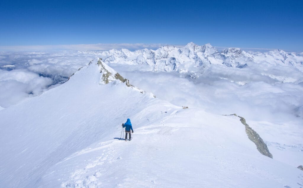
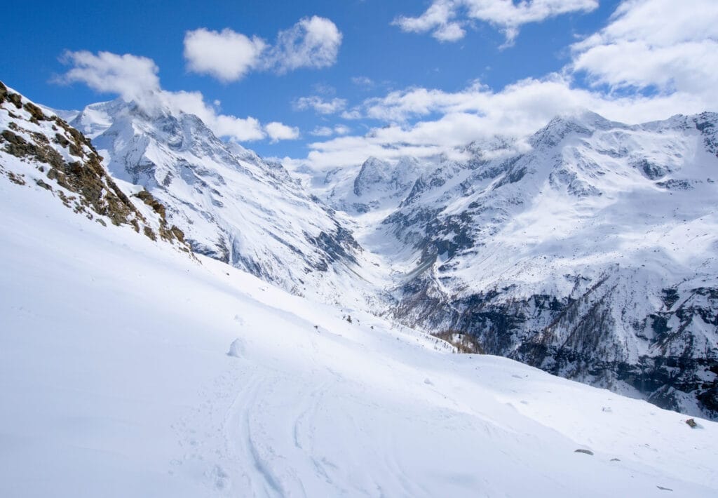
No doubt about it on our end, we’re going to ski down via the uphill route (the easiest) since we’re already pretty worn out. The second reward after the summit view: the NW face of Bishorn is in beautiful snow conditions with not a single track! It’s so good, but my legs are already destroyed by the time we reach the Tracuit Hut. A quick cake break at the hut will help 😉
However, below the hut, it’s SW-facing, and we quickly find ourselves in heavy, wet snow (nothing unusual for the end of April though 😉 ). We skied down the slope just south of the hut (not via the Tracuit pass) to find the ascent route just above the Barmé torrent.
We had to skin up twice for the rest of the descent (to climb back up to the little pass, then the whole Lé Valley) … But I won’t lie, I suffered in the slush and at the end I couldn’t manage more than four turns in a row while trying to avoid rocks, lol.
Through the W couloir
Ski grading: 5.2 / E3
That’s not the same vibe at all. Much more committing and exposed, this route is not in the same league. Personally I wouldn’t ski this one unless I also bootpack through the couloir to check the conditions.
Through the Milon pass and the Arpitettaz hut
Ski grading: 3.1 / E1
Finally we wrap up with a variant below the Tracuit hut. After the first slope below the hut, you’ll need to head south toward the Milon ridge and its East pass. If you choose this option you’ll have to put your skins back for about 300m up again. That said, we had already done enough elevation gain for the day and didn’t really consider this option.
After the pass, you will reach the Arpitettaz hut, from which you will descend to the bottom of the Vallon de la Lé. For more details about this route, see Camptocamp.
There you go— that’s it for this backcountry ski guide, the first one outside the Val d’Hérens 😉 If you have any additions to make or comments to share, don’t hesitate to leave me a comment below 🙂.
Pin it on Pinterest
Join the discussion