

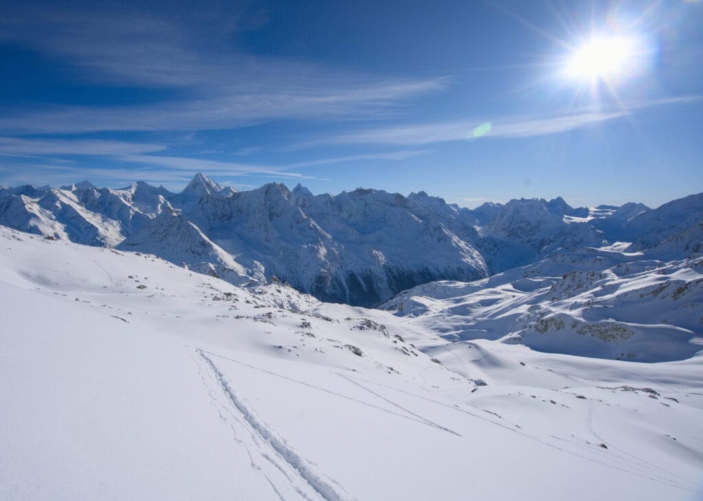
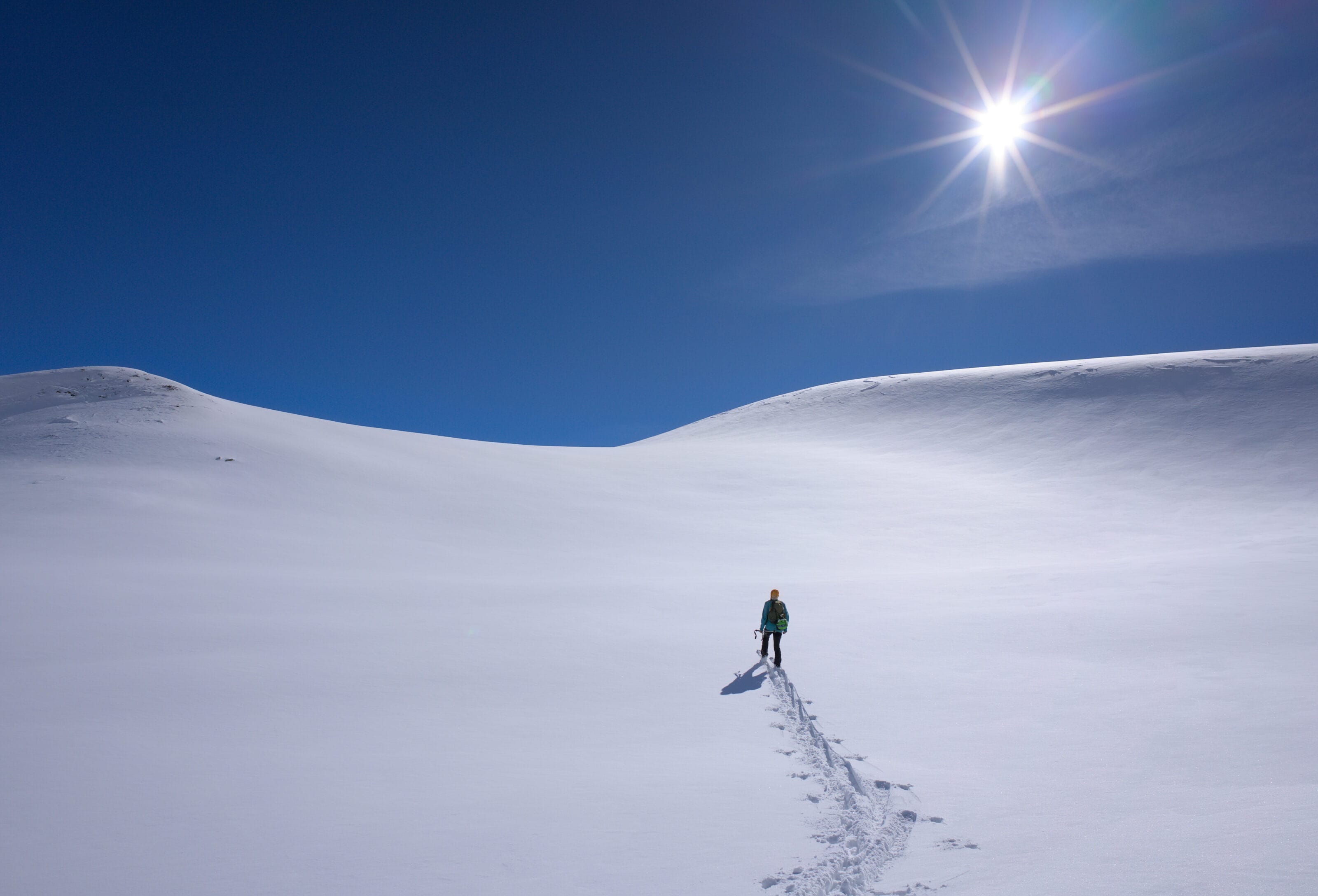
The Pointe de Vouasson (3490m) is a ski touring classic in Valais, and on winter weekends there are usually quite a few people heading up from La Gouille. It’s not surprising, either! It’s a summit that offers a spectacular panorama over the 4000m of the Alps, a nice little elevation gain (around 1650m d+), and no great technical difficulty. So there’s quite a wide range of ski tourers tackling it, from the average skier to athletes training for the Patrouille des Glaciers (‘running’ to the summit in just 2 hours).
Since we live in the small village of Les Haudères, we’re literally at the foot of Mont de l’Etoile and Pointe de Vouasson. So I’ve already had the chance to climb there several times (on both summits). What I really like about the area is that, if you have a bit of imagination, there are lots of possible variations both up and down. For example, there’s a superb route that allows you to make a loonnggggg descent almost all the way to Evolène via the Vouasson glacier when the snow conditions are good!
So even though I’m a long way from having explored all the corners of this sector, I thought I’d share with you the different itineraries I’ve already tried… and the ones I’m eyeing for future outings 😉
- Elevation change: Aiguilles rouges hut (1000m +-), Mont de l’Etoile (1530m +-), Pointe de Vouasson (1650m +-)
- Ski touring grade: Aiguilles rouges hut (PD / 2.1 / E1), Mont de l’Etoile (PD / 2.3 / E1), Pointe de Vouasson (PD+ / 2.2 / E1). If you don’t know exactly what these grades represent, we’ve written a full post on the matter here.
- Duration: Aiguilles rouges hut (1h30 – 2h30), Mont de l’Etoile (2h30 – 4h), Pointe de Vouasson (2h45 – 4h30)
- useful links: Aiguilles rouges hut camptocamp, Mont de l’Etoile camptocamp, Pointe de Vouasson camptocamp, swisstopo map
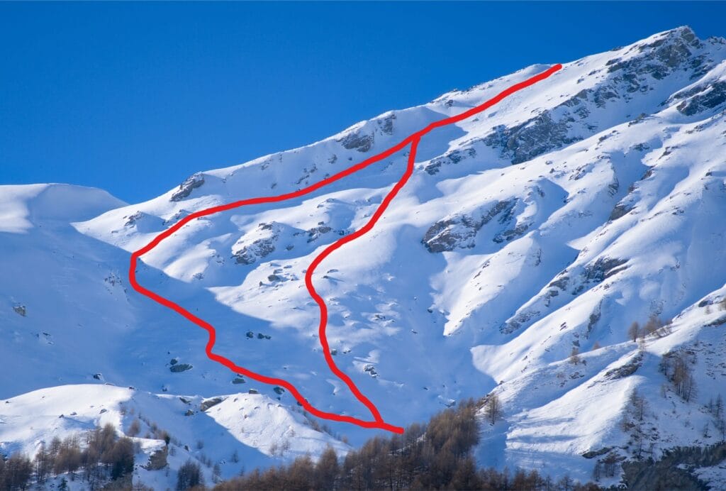
On the map below I’ve tried to give you a few gpx tracks to give you an idea of the different possibilities without overloading the map.
I’d rather say it again, but beyond the beautiful powder pictures and videos… ski touring is a sport that involves risks (alpine terrain, avalanches, weather, falls). Make sure you have the knowledge, the endurance, the skiing ability and the gear you need before embarking on any challenging tours.
If you have any doubts, first read this article in which I share my experience since taking up ski touring. In particular, I talk about the skills you need, safety, essential gear and many other aspects of the sport.
Finally, I’m certainly no expert on ski touring and I simply want to share my experience with you to inspire you and give you ideas for ski outings. But that doesn’t mean you shouldn’t make your own experiences, question what I say in these posts and turn back if you don’t feel like it.
- La Gouille – Aiguilles Rouges hut
- Aiguilles Rouges hut – Pointe de Vouasson
- Aiguilles Rouges hut – Mont de l’Etoile
- Alternative routes up from the Aiguilles Rouges hut
- Alternative route to Mont des Ritses (2915m)
- Alternatives for skiing down Pointe de Vouasson
- Different routes for skiing down Mont de l’Etoile
- Different routes for skiing down Mont des Ritses
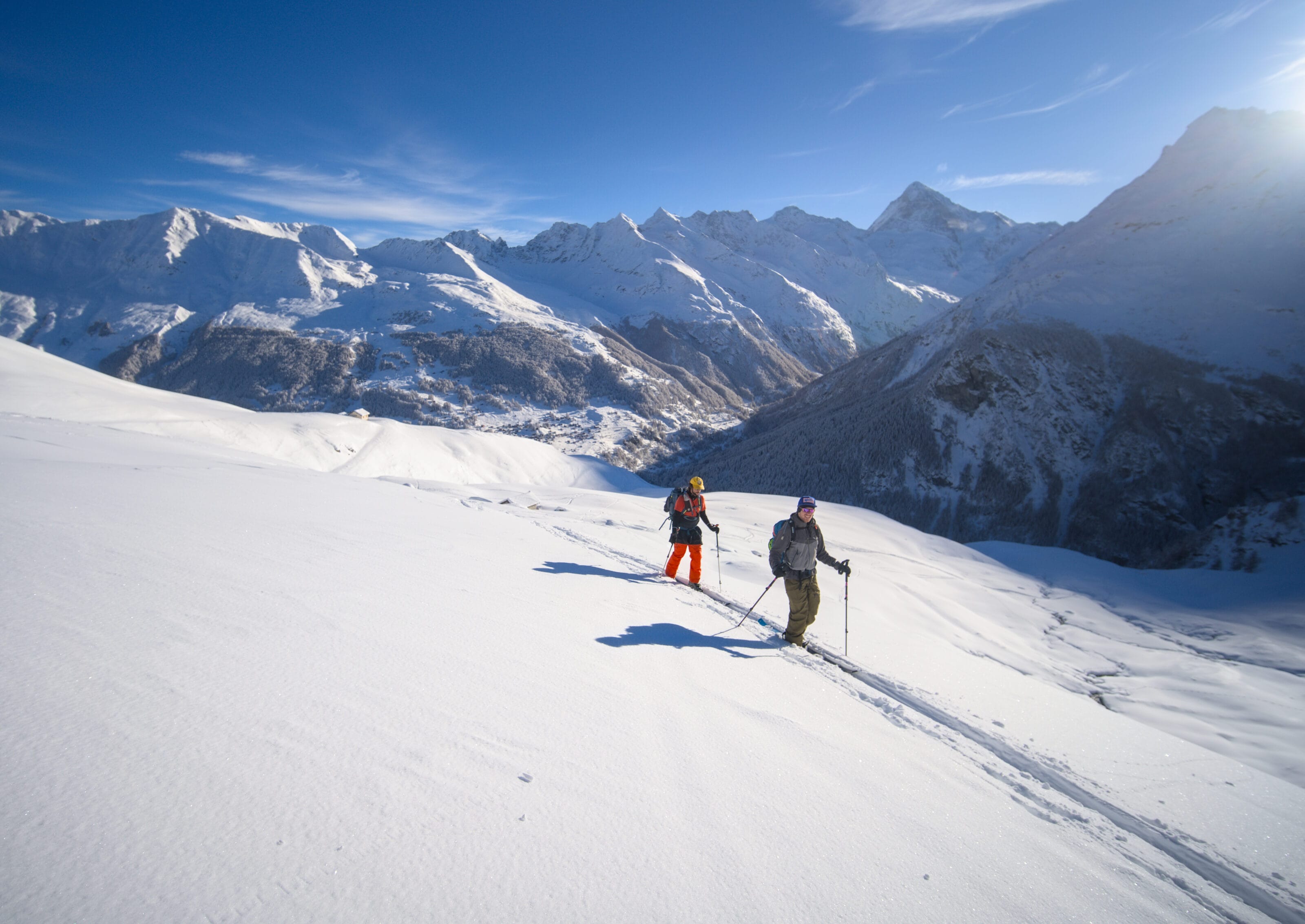
La Gouille – Aiguilles Rouges hut
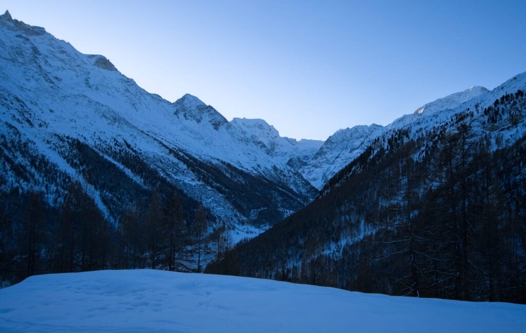
The classic route up to Pointe de Vouasson or Mont de l’Étoile starts at the La Gouille car park, after the tunnel on the road leading up to Arolla from Les Haudères. There are plenty of spaces in the car park, but on weekends (or during the holidays) it can fill up quite quickly with snowshoers – skitourers heading up to Lac Bleu. In the worst case, you can continue a few hundred metres to Satarma where there is a larger car park beside the cross-country ski run.
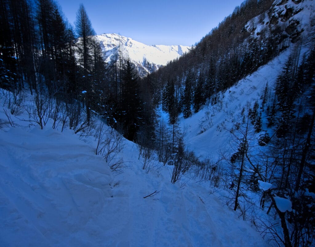
The ascent to Lac Bleu follows exactly the same route as the summer trail. When the snow conditions are good, it’s perfectly fine, but on several occasions I had to either take off my skis or take out my ski crampons because of the ice (or lack of snow) in the steeper sections.
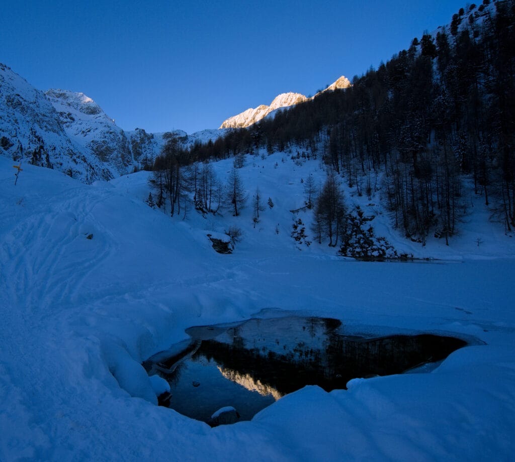
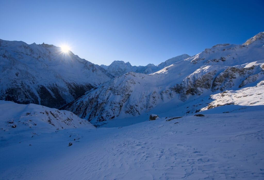
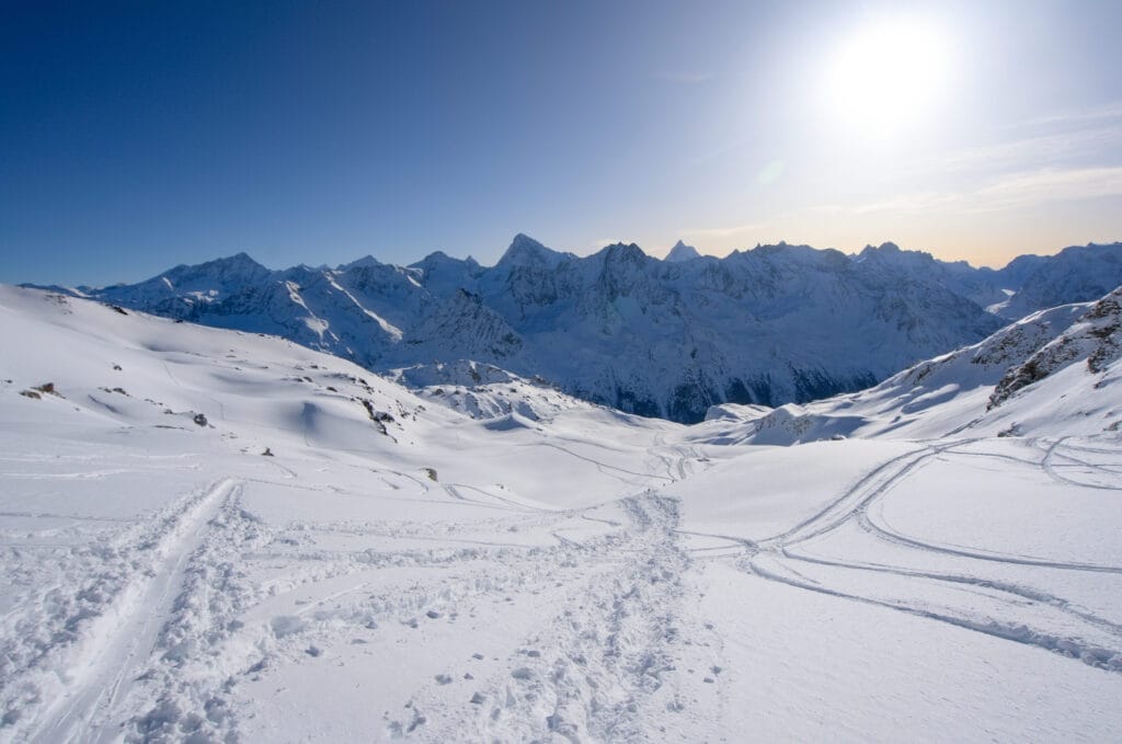
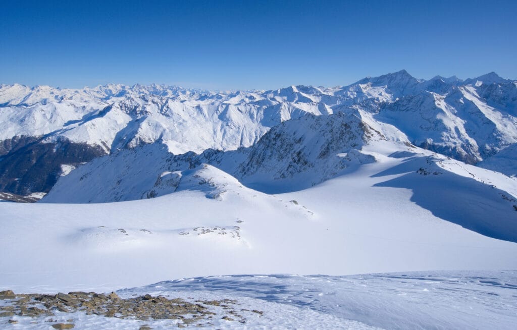
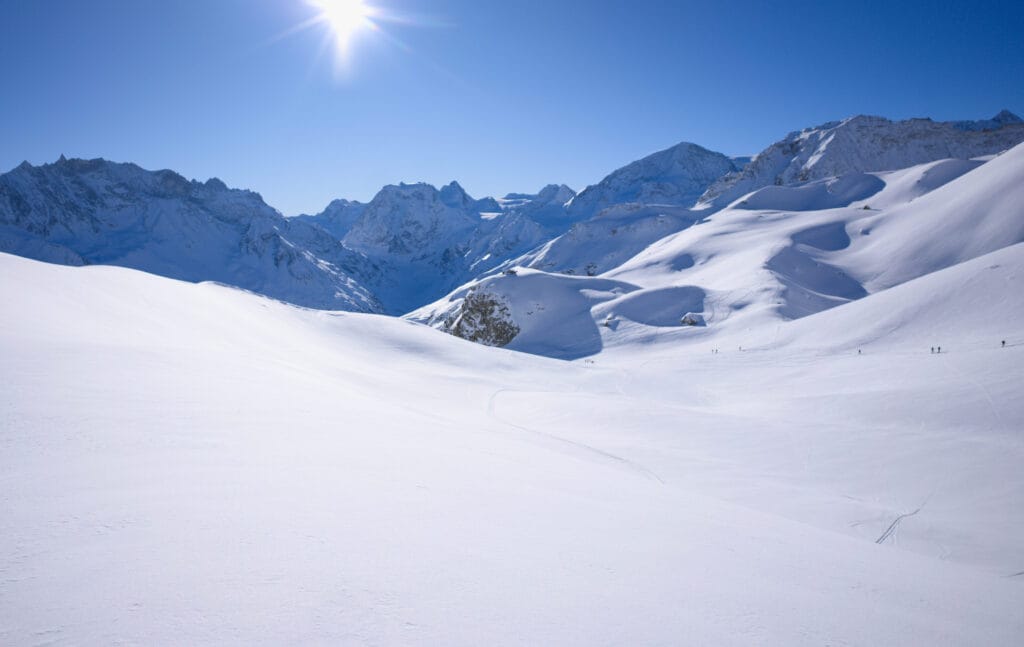
We soon emerged from the forest, which gave us a lovely view of the Arolla valley, Mont Collon, the Aiguille de la Tsa and the Pigne d’Arolla. Above us, we reach the alpine hamlet of le Louché with its beautiful stone roofs, and in the distance the sun rises over the Aiguilles Rouges. We are already reaching the blue lake, which is usually completely frozen at this time of year (but it is more beautiful in autumn or spring, when the ice has melted and the lake has regained its beautiful turquoise colours).
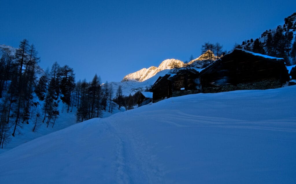
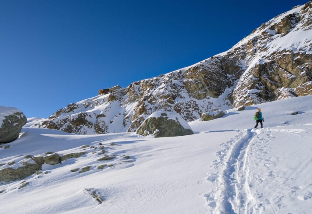
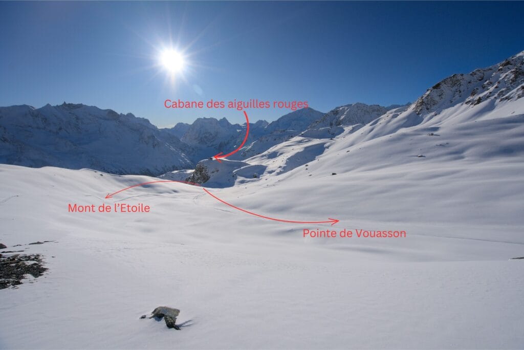
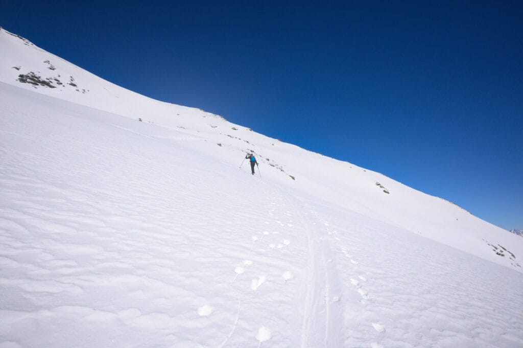
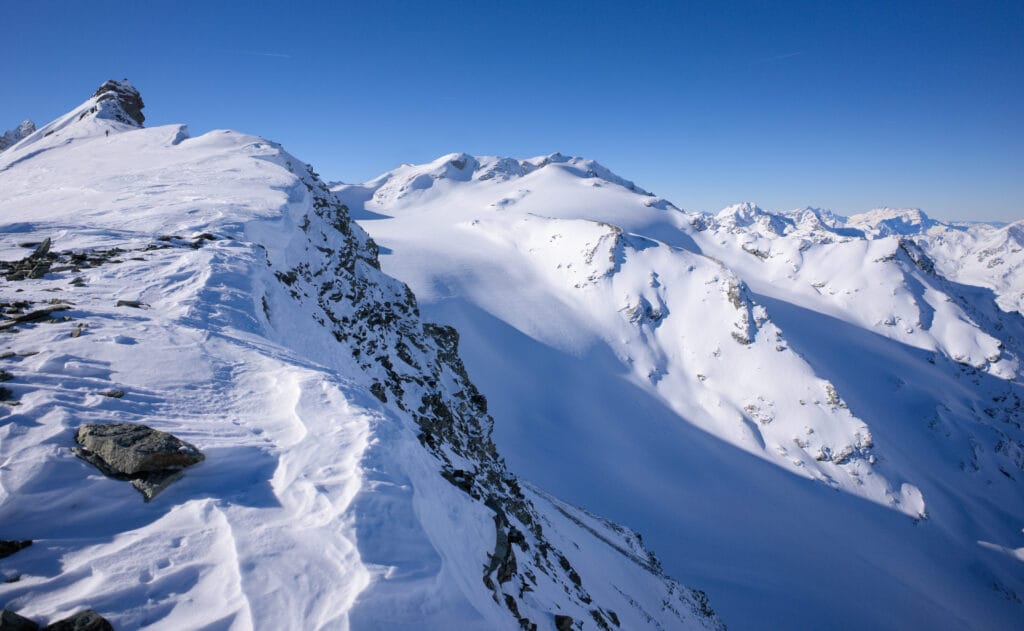
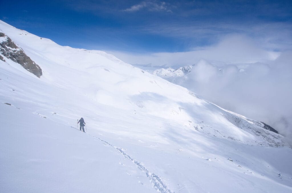
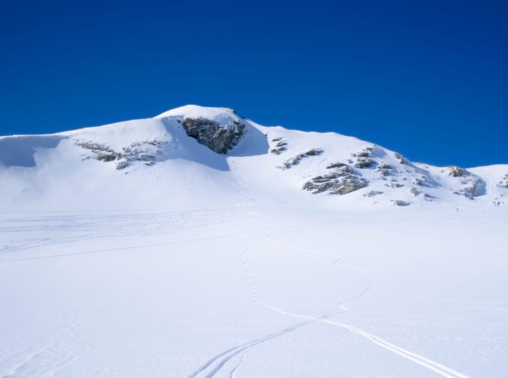
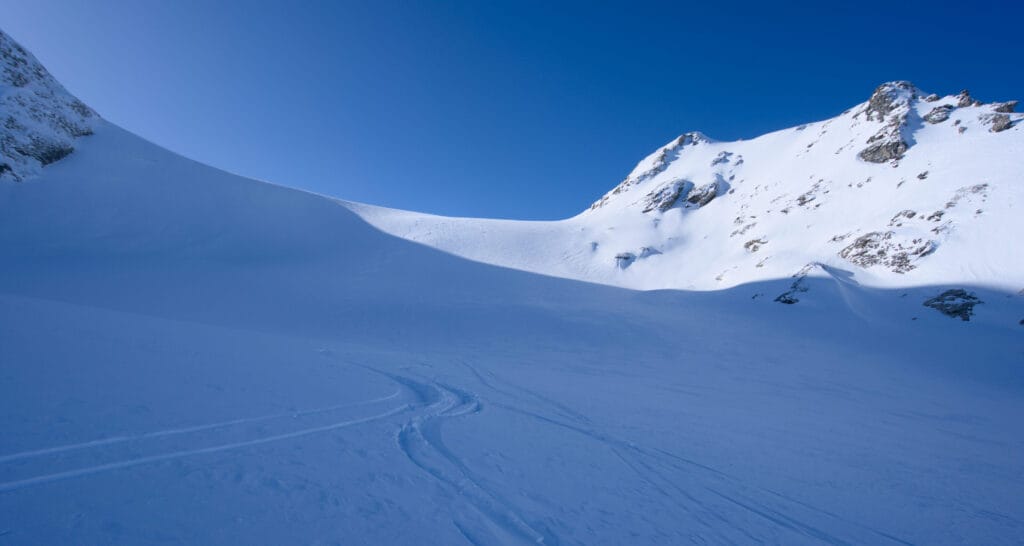
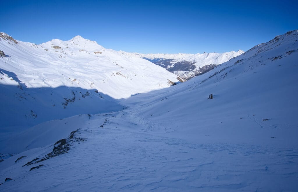
From Lac Bleu, there’s still 700m to climb to the Aiguilles rouges hut (signposted as a 2-hour walk). The track goes up through the last larch trees, more or less following the summer path… that’s the advantage of doing a classic route (if there is one), it’s that there’s very little chance that you’ll be the first to do the track 😉 . After a gentle slope, you reach a distinctive flat spot with a cross, ideal for a short break, from which you can finally see the Aiguilles rouges hut on its rocky ridge (as well as all the surrounding peaks).
From this point, there is still a long valley to climb to reach the flat area to the north of the hut. But as the climb progresses, peaks like the Weisshorn (and it’s neighbor the Bishorn that we also skitoured) and Dent Blanche start to appear behind us. What a backdrop! We arrive at the small pass where the routes to the Aiguilles Rouges hut, Pointe de Vouasson and Mont de l’Etoile split.
Aiguilles Rouges hut – Pointe de Vouasson
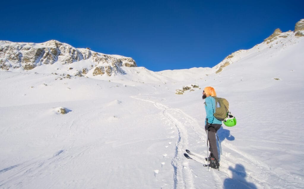
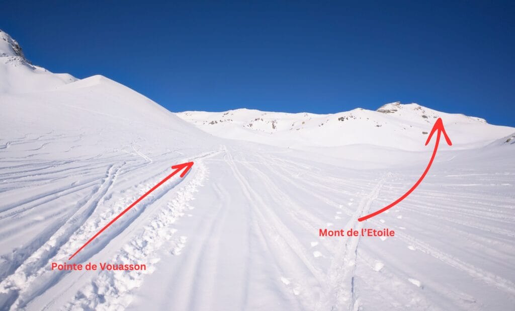
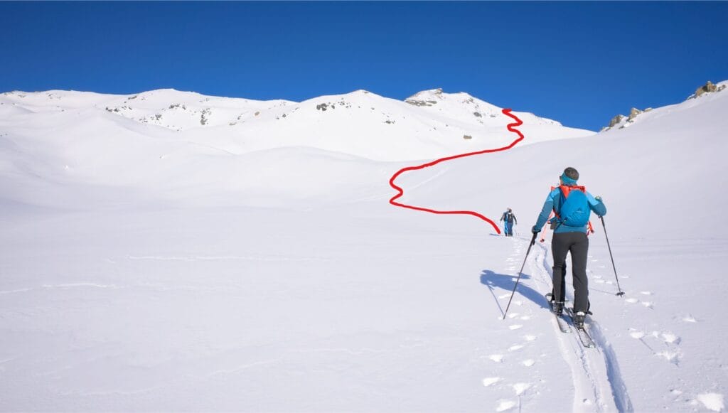
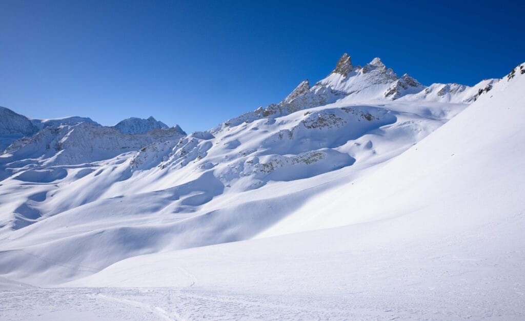
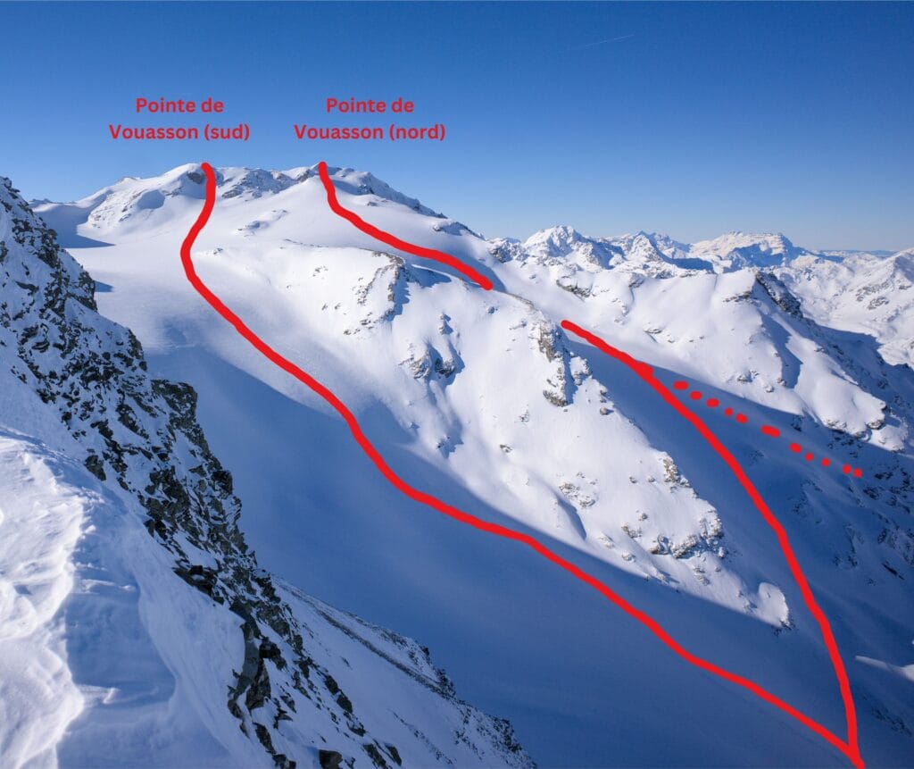
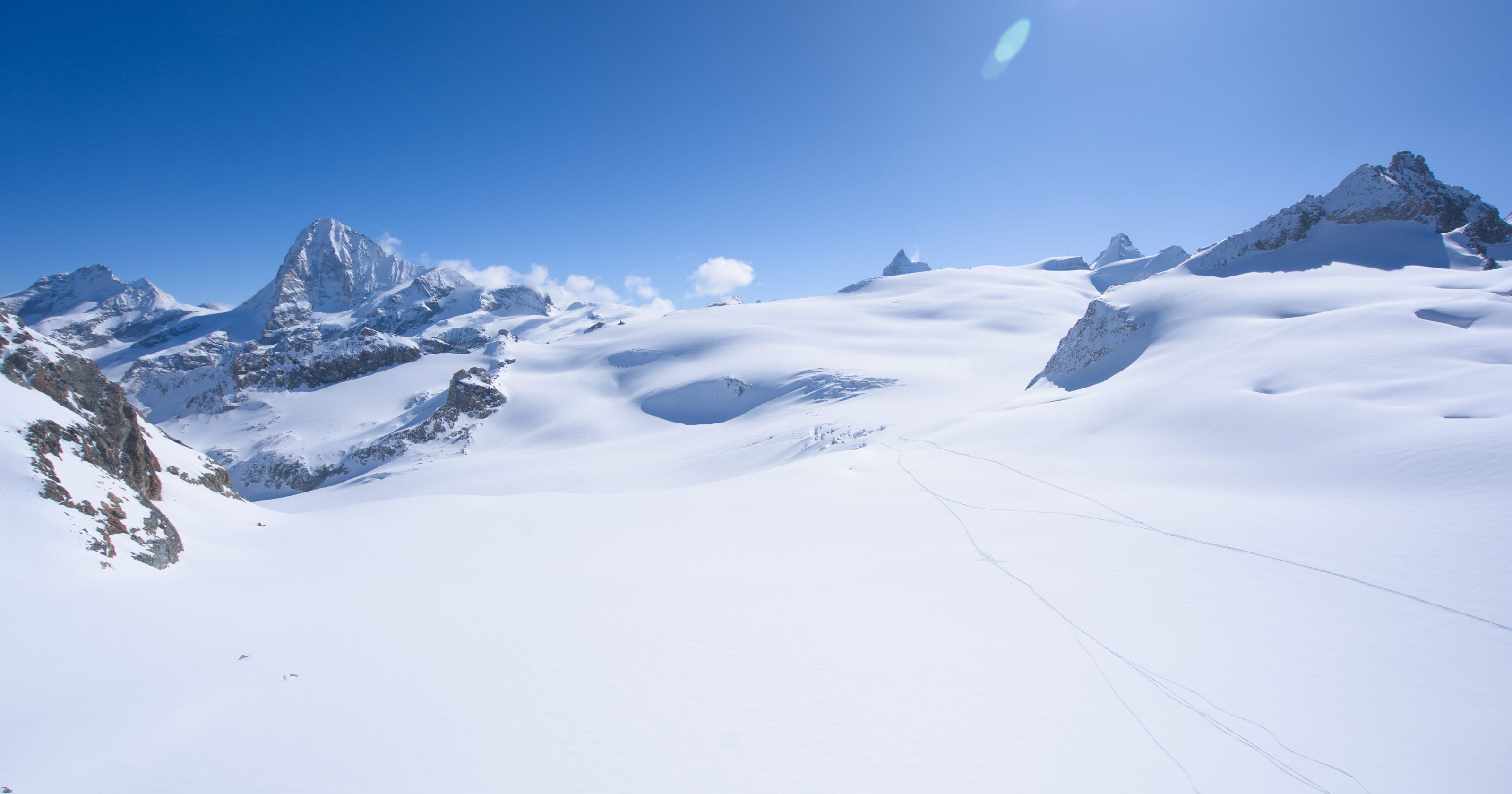
From there, to get to the Pointe de Vouasson, you first have to climb up the moraine left by the Aiguilles Rouges glacier up to the Col de Darbonneire, where you reach the actual Vouasson glacier (the track for Mont de l’Etoile goes off to the right as you climb).
Unfortunately there’s not much left of the Aiguilles rouges glacier… and I’ve included a photo taken in summer from Mont de l’Etoile to give you a better idea of what it looks like under the snow 😉
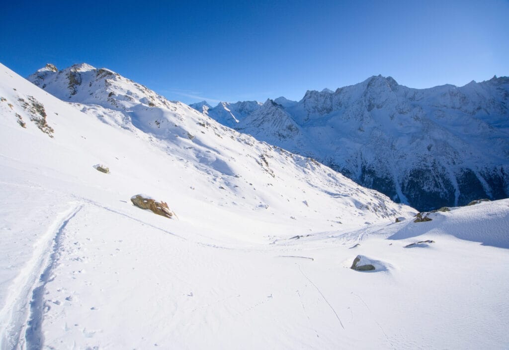
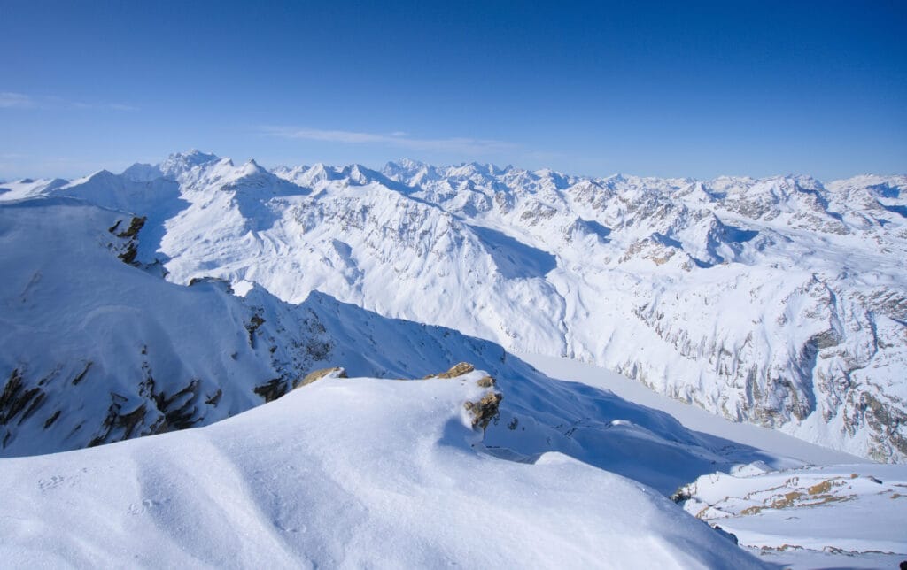
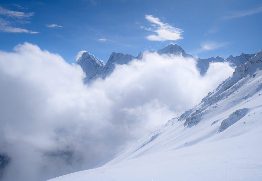
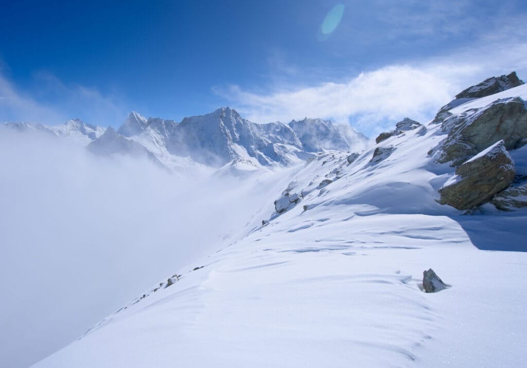
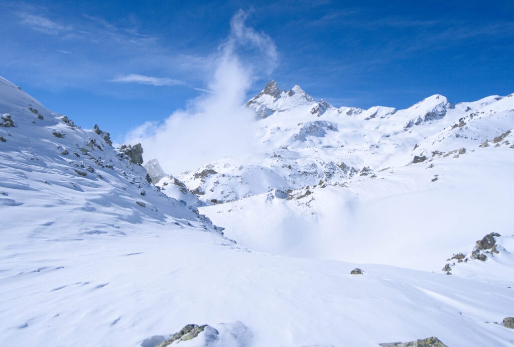
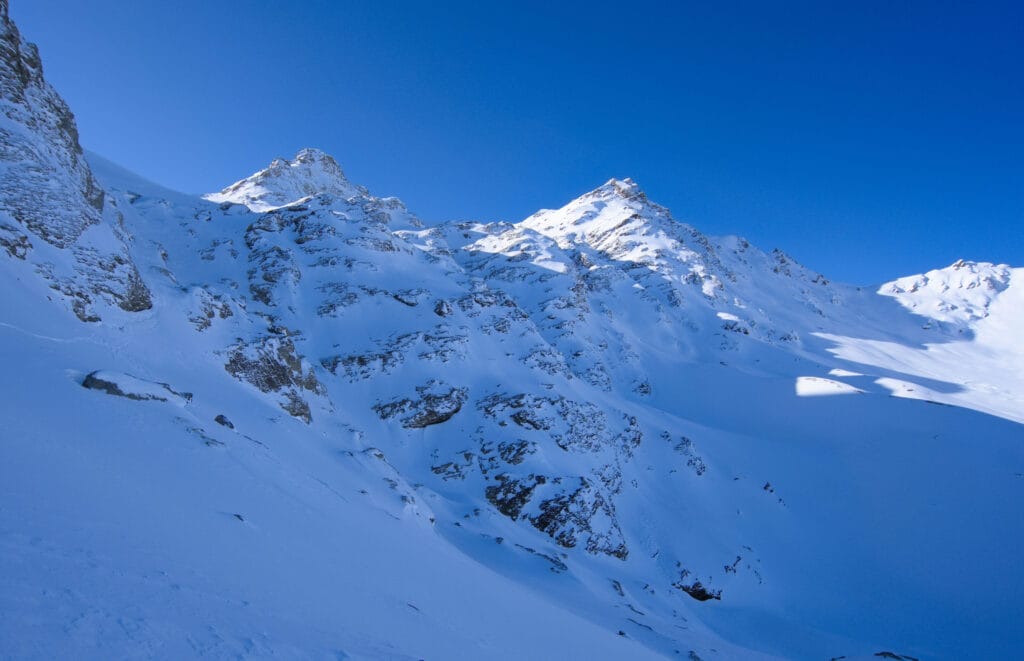
Once again, it’s a long valley with no major difficulties until we reach the Col de Darbonneire (or Darbonire). Fortunately, the panorama all around us is breathtaking, with the Aiguilles Rouges to our left and the Dent-Blanche, Matterhorn and Weisshorn behind us.
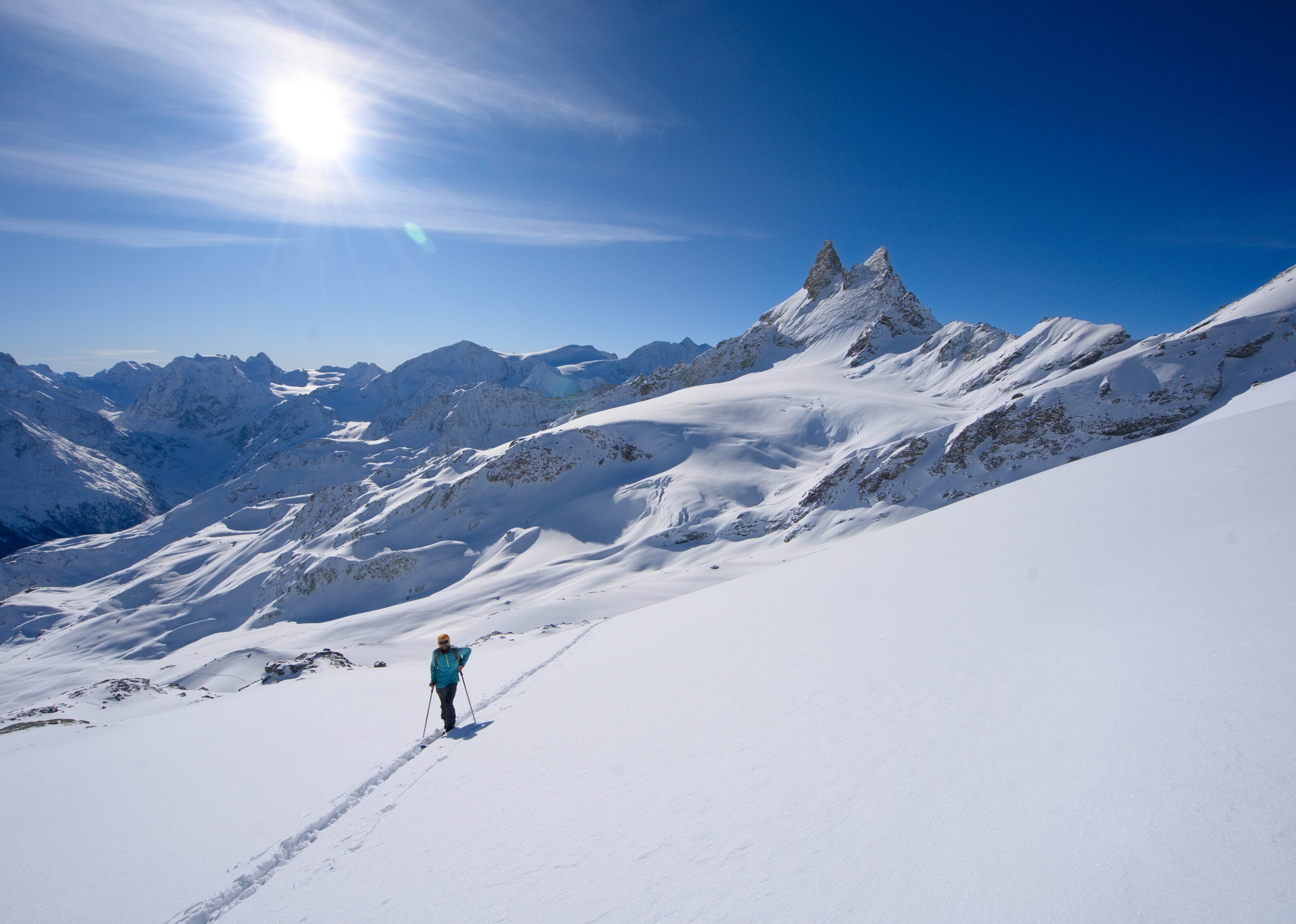
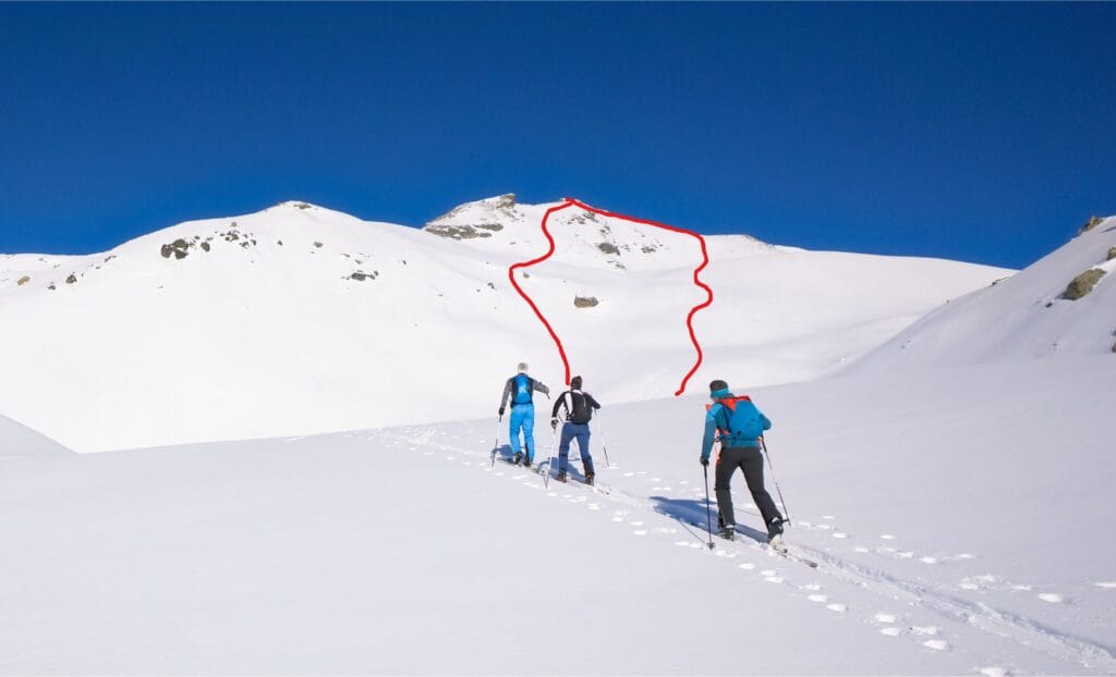
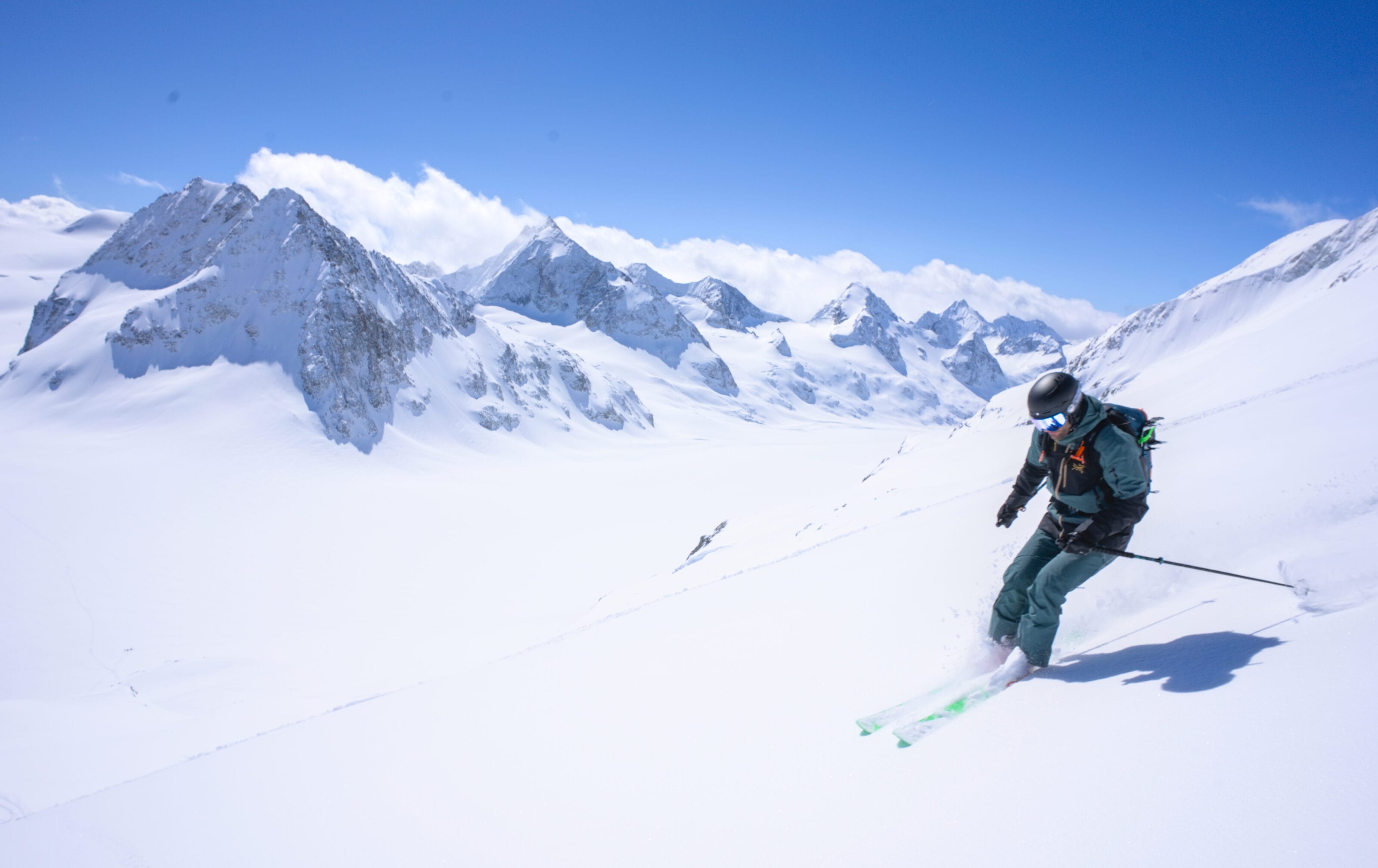
Once we reach the col, we can finally see our objective, the Pointe de Vouasson, just on the other side of the glacier in front of us. The classic route is to cross the glacier and climb to the northern summit of Pointe de Vouasson (3490m). The end of the climb just before the summit cross is quite steep and most of the time you have to carry your skis for 20-30m to reach the top (but nothing too tricky).
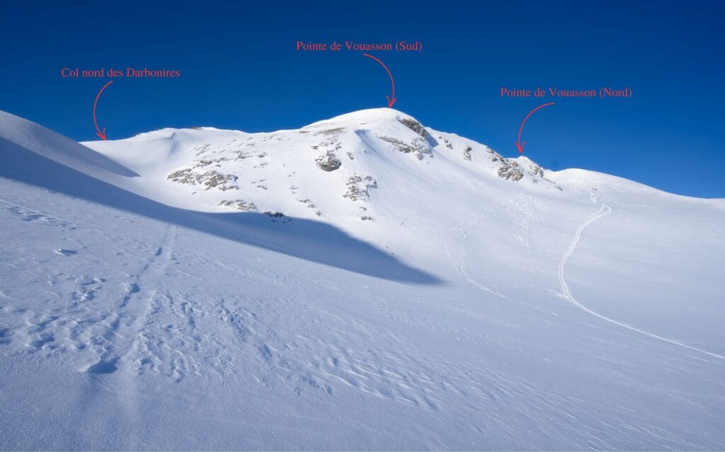
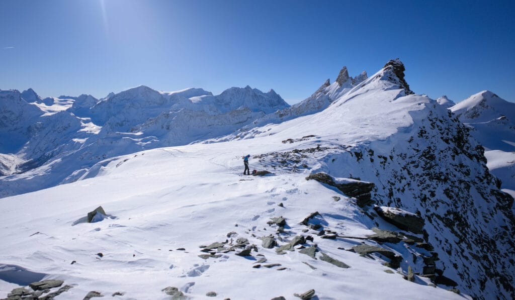
But the last time we climbed up there, we turned further left towards the Col Nord des Darbonires and climbed instead to the southern peak of the Pointe de Vouasson, as shown in red on the interactive map (it’s also possible to climb to the Pointe des Darbonires). From the south summit, there’s a nice little gully that’s rarely used and which leads right down to the glacier for some nice powdery lines (more details below in the descent section).
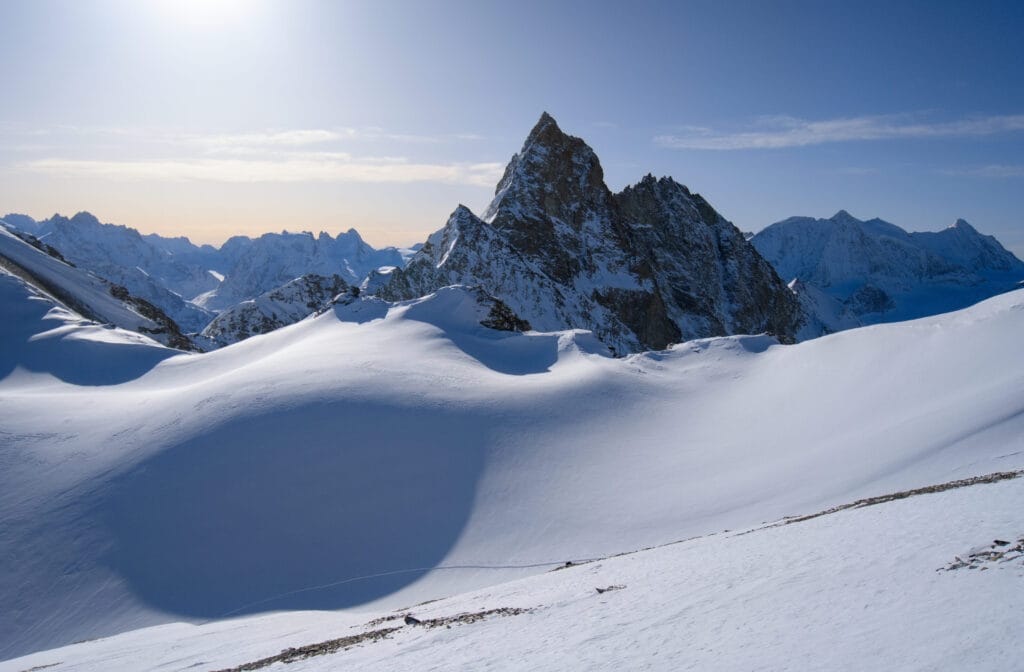
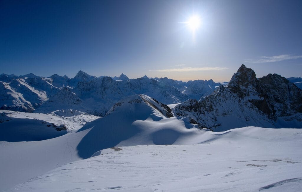
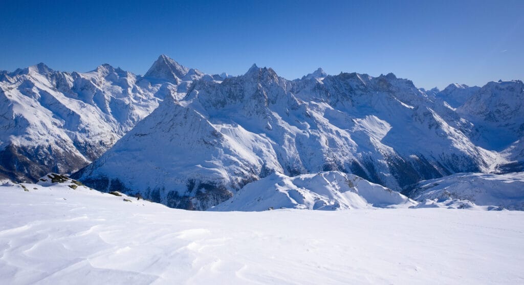
Needless to say, the view from the Pointe de Vouasson is pretty nice, with Lac des Dix, Grand-Combin and the Mont-Blanc range on one side and all the peaks I’ve already mentioned and the Bernese Alps in the distance on the other.
Aiguilles Rouges hut – Mont de l’Etoile
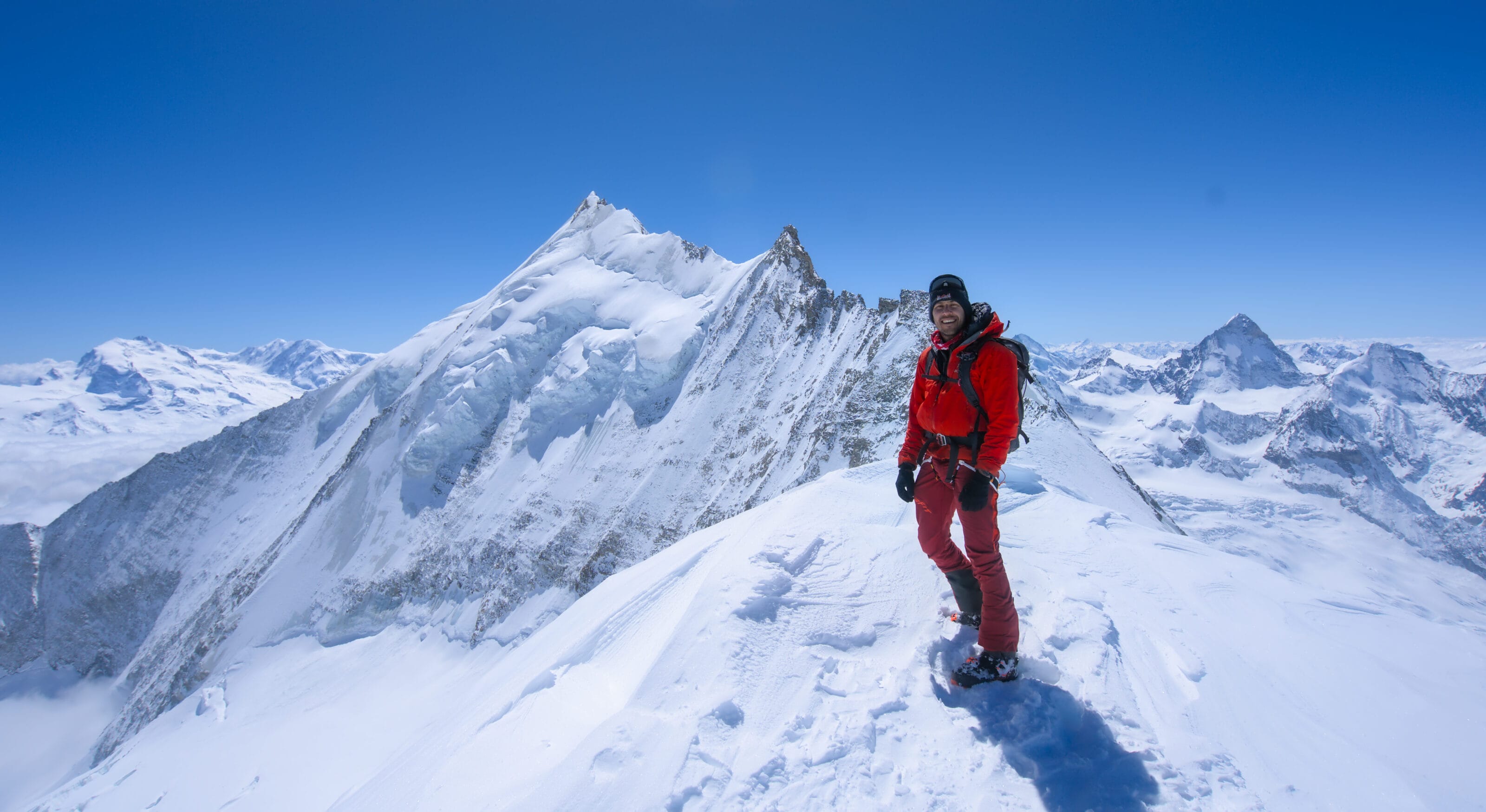
If you prefer to climb Mont de l’Etoile, next to the Aiguilles Rouges hut, you should take the right-hand track (if there is one… the Mont de l’Etoile route is a little less popular than the Vouasson route).
The easiest route, in my opinion, is to cross the moraine and climb straight north to a small flat area to the north-east of the summit just below it (summit 3329). If you really want to climb to the summit from here, you’ll just have to take off your skis for a few metres to climb the ridge to the top.
But it is also possible to climb from the south-west, either from the Vouasson glacier, or by turning right a little further up the normal route to the Pointe de Vouasson… or from the east side coming from La Coutaz.
The view from the top isn’t too bad either, with a great view of the Dent-Blanche, the Matterhorn, the Dent d’Hérens, the Aiguille de la Tsa… and on the other side you can see the Pointe de Vouasson and the whole descent on the Vouasson glacier towards Evolène.
Alternative routes up from the Aiguilles Rouges hut
Finally, just to give you 1-2 more ideas for ascents in this area, it’s also possible to go to the summit between Mont de l’Etoile and Col de Darbonneire (in blue on the interactive map and pictured below) to ski some nice, little-traced south-facing slopes. Alternatively, you could go up to the upper glacier of the Aiguilles Rouges, as there are always some nice tracks to be made above the Aiguilles Rouges hut.
Alternative route to Mont des Ritses (2915m)
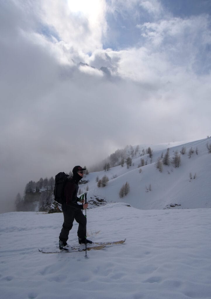
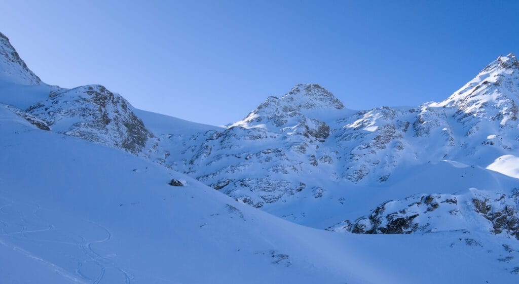
Recently I also climbed Mont des Ritses, a small, interesting and uncrowded summit just next to Mont de l’Etoile (south-east). There are 2 ways to get there:
- From La Gouille, climb to ‘Les Crosâyes’ just below the Cabane des Aiguilles Rouges and then turn right at around 2660m. This option is preferable if you have parked at La Gouille and plan to ski back down the S-E slopes.
- From La Coutaz, either start as you would on the climb to Palanche de la Cretta and turn left towards Mont de l’Etoile, or climb directly north of the Maresse river to reach the Remoints de la Coutaz (a slightly more difficult option). Once you reach the shoulder below Mont de l’Etoile, simply turn left towards the Mont des Ritses. This is the best option if you want to ski the beautiful N-E face, which is often in very good condition. Below are a few photos of the ascent from La Coutaz.
Alternatives for skiing down Pointe de Vouasson
There are quite a few variations on the way down from the pointe de Vouasson. Here are a few of them:
By the uphill path
Ski grading: 2.2 / E1
It’s the most popular route (and therefore the one that’s quickly traced) but it’s not the one where you’ll find the best slopes or the best snow, in my opinion. From the Pointe de Vouasson to the Aiguilles Rouges hut, the snow is generally not bad but it’s a bit flat for my taste (but it’s also very safe).
Then below the hut the problem is that the snow changes quickly… so it’s often crusty or heavy. Below the hut there is also a way to cross to the right towards the bottom of the Ignes valley. But here too it’s a bit of a shame as you arrive at the bottom of the valley and have to go back flat towards the Lac Bleu, which isn’t very interesting.
From the Lac Bleu, the best thing to do is to cross the hamlet of Louché (not by the uphill path) and descend into the forest just below. You then rejoin the uphill path, which you follow as far as the gully ( be careful, as there are always 2-3 stones sticking out). Then, if you have time, you might as well stop for a drink on the pretty terrace of the Pension du Lac Bleu 😉
Via the pretty southern slopes between Mont de l’Etoile and Col de Darbonneire
Ski grading: 2.3 / E1
From the pointe de Vouasson, cross the glacier to reach the saddle just south of Mont de l’Etoile. From here you can either reach the Aiguilles Rouges hut via the slopes of the Mont de l’Etoile itinerary.
You could also put your skins back on from the Vouasson glacier to climb a small section of the summit between the col and the Mont de l’Etoile that I mentioned earlier (blue trace on the interactive map). From there, when the conditions are good, there are some nice lines to do (not too many tracks in general).
And instead of heading for the intersection with the Aiguilles Rouges hut, you can stay a little further to the left on the moraine to take advantage of a nice slope before getting back on the classic route along the uphill path.
Through the Ignes valley
Ski grading: 2.3 / E1
There is certainly a way down from the Pointe de Darbonneire onto the upper Aiguilles Rouges glacier (which I haven’t tried yet, but maybe I will). But if not, choose the route that suits you best to the Aiguilles Rouges hut. Then you have to skin up again for about 100m of ascent to the south-west of the hut and reach the 2924m point.
From here you can enjoy the lovely slopes that lead to the top of the Ignes valley. You can then ski the entire valley below the Ignes waterfall and either reach Lac Bleu or descend to Satarma, staying to the right of the river and then into the forest.
Through the Vouasson glacier towards Lanna
- Ski grading: 3.2 / E1
- Useful link: camptocamp
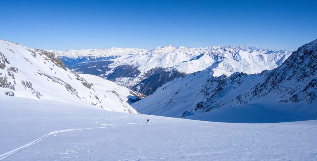
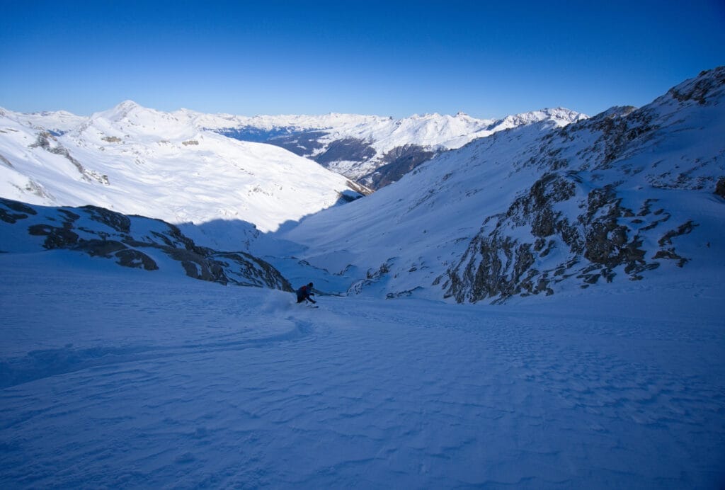
When conditions are good, this 2000m descent is incredible and takes you all the way down to the village of Lanna (at the bottom of the Evolène slopes)! From the Pointe de Vouasson, you can clearly see 2 parts of the glacier separated by a large rocky promontory. If you have any doubts about the quality of the snow cover, stay to the right on the slopes below Mont de l’Etoile, which are less exposed. This will help you avoid the glacier tongue couloirs, which are fairly steep.
But when the conditions are right (enough snow and stable), it’s clear that there are several routes at the bottom of the glacier (I’ve seen tracks on the left and right several times). So to give you an idea, I’ve put 2 photos below (1 taken from the Mont de l’Etoile and the other from the bottom of the glacier so that you can get an idea of the possible lines).
Once past the glacier tongue, the slopes become gentler and you follow the bottom of the valley below the western slopes of Palanche de la Cretta and Mel de la Niva. There are 2 options from here:
- If there is little snow: It’s best to put your skins back on to go up to the Arpilles lift on the Evolène ski area. If the lift doesn’t work, keep going north to reach the Chemeuille slopes, which will take you down to Lanna.
- When there’s a lot of snow: You can remain at the bottom of the valley by following the river first on the right side and then on the left side through the forest. The passage through the forest is not necessarily obvious and is easier if there is already a first track. Stay on the left bank until you reach a small bridge that crosses the river, then follow a path that leads directly to Lac d’Arbey. From here, turn right under the houses with a beautiful view of the Dent-Blanche to reach the Arbey road, which takes you back to Lanna.
Here are a few images of option 2, which I’ve already had the chance to ride on 2 occasions.
North face of the Pointe de Vouasson (Merdéré glacier)
- Ski grading: 4.3 / E2
- Useful link: Camptocamp
The north face of the Pointe de Vouasson is clearly visible from the Grande Dixence dam at the bottom of the Val des Dix (it’s also a great spot for ski touring, which I’ll tell you more about soon). When you look at it, you can see 2 strips of ice from the Merdéré glacier right in the middle of the couloir. This means that there has to be enough snow to pass to the right or left of the ice through narrow passages that have to be wide enough.
I haven’t had a chance to do this descent yet, but it’s on the top of my list, going straight up the couloir (which will allow me to see the couloir conditions and to have the car in the Val des Dix :). ). In the meantime, you can find out more by clicking on the link above… But I’ll update this article as soon as it’s done 🙂 .
Different routes for skiing down Mont de l’Etoile
vie the uphill path (south face)
Ski grading: 2.3 / E1
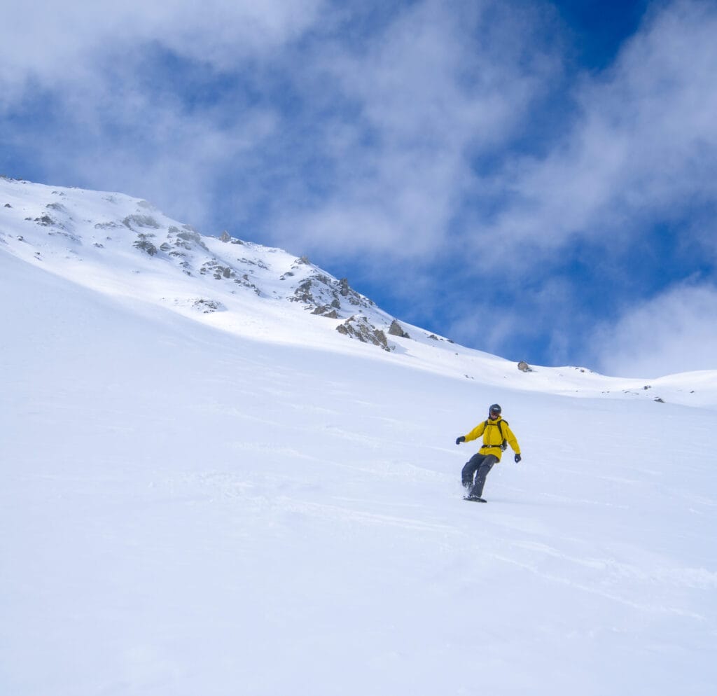
It’s a fun downhill run from the summit of Mont de l’Etoile or summit 3329, which I mentioned earlier. The nice thing is that it’s quite wide and there are lots of different lines to pick out. The problem, however, is that it is south-facing and the snow transforms quickly.
Then you’ll find all the options I described above from the Aiguilles Rouges hut.
Skiing down the east face from the summit 3329
- Ski grading: 4.1 / E2
- Useful link: Camptocamp
From our dining room in the coliving, we have a direct view of the east face of Mont de l’Etoile… so I really wanted to do it! It’s a really beautiful descent to make when there’s enough snow (because there are a lot of rocks there so it’s better to wait for a good base layer) and when the conditions are right. You can really start at the very top, directly on the east-facing slope from summit 3329 and descend to the Remointse de la Coutaz 900m below (there are quite a few possible routes, as you’ll see in the photo below).
Then there are 2 different routes (that I know of):
- You can either take the Palanche de la Cretta route, which joins the main road at La Couta.
- Or stay to the north of the Maresse river and descend to the main road. This is a less common option than joining the Palanche de la Cretta route.
Different routes for skiing down Mont des Ritses
South-East slopes towards La Gouille
- Ski Difficulty: 2.1 / E1
- Useful link: Camptocamp
If you have parked at La Gouille, you can descend the south-east-facing slopes and then head full south to arrive directly at Lac Bleu. Obviously, given the south-facing exposure, the snow transforms quickly, so choose a cold powdery day or wait for the sun to soften the crust a little.
North or North-East couloirs
- Ski difficulty: 3.2 / E2
- Useful link: Camptocamp
A very nice run with several options, including 2 couloirs to the north or the slightly wider north-east face. It is possible to reach the Arolla road by taking the route north of the Maresse river, but you will have to stay high enough to cross to the Remointse de La Coutaz. If you’re feeling a bit more adventurous, I recommend descending via Pra Liapec and then turning left into the forest towards the point 2087. This will allow you to join the road via the orange slope in a not too dense forest between 2 cliffs. If you choose this option, you’ll reach the Arolla road after the tunnel just south of the bridge over the river.
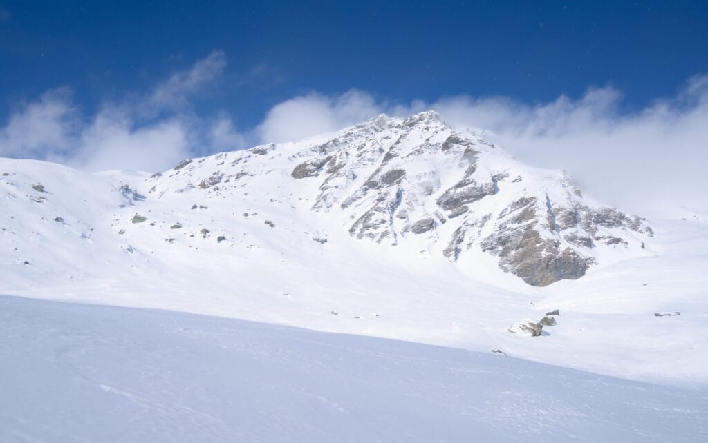
Here’s a photo of the north face of Mont des Ritses to whet your appetite:
That’s it for this ski touring guide to the Vouasson / Mont de l’Etoile sector! If you have anything to add or ask, don’t hesitate to leave me a comment below 🙂 .
Pin it on Pinterest
Join the discussion