
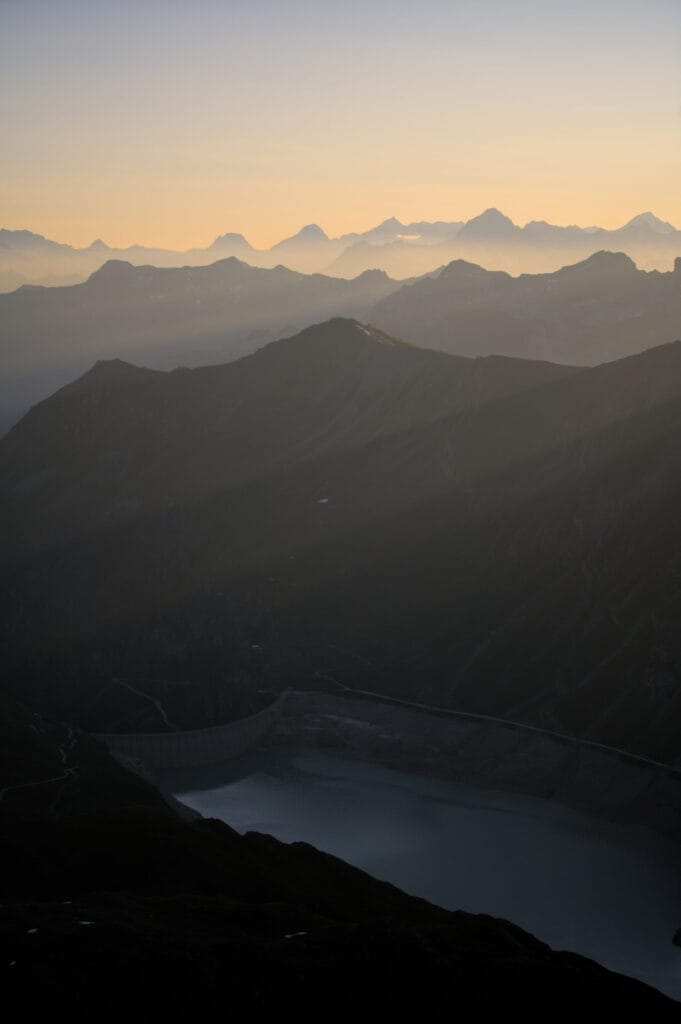
Today I’m going to tell you about what is perhaps my favorite hiking or trail running route in Val d’Hérens (even though technically the ridge is on the border between Val d’Hérens and Val d’Annivier). This magnificent ridge connects two beautiful peaks of our valley, Sasseneire and Pointe du Tsaté, via Pointe du Prélet… and offers wild landscapes, breathtaking views of the most iconic peaks in the Alps (except for the Matterhorn, which is hidden behind the Dent-Blanche during this hike), and Lake Moiry…
However, whether you choose to start from Val d’Hérens or the Moiry dam, this is a demanding and long hike (18-20 km, over 1,500 m of elevation gain) with some exposed sections (difficulty T4-T5). But you will find all the photos and information you need below to get a better idea of what to expect. And believe me, the reward is well worth the effort you are about to put in 😉
Different routes for the Prélet ridge/peak
Map + GPX track of the hike
Here is a map of the two most logical routes for climbing Sasseneire and then following the Prélet ridge to the summit of Tsaté:
You can see on the map above that you can start from the Moiry dam in the val d’Annivier or from the village of Villa in the Hérens Valley:
Itinerary from the village of Villa in Val d’Hérens
If you set off from Villa, just after the village of La Sage on the Val d’Hérens side, you will have a little more elevation gain but slightly fewer kilometers. The information below also includes the ascent of Sasseneire (it would be a shame not to climb it if you are already at the Col du Torrent 😉 ).
- Distance: 18.3 km
- Elevation gain: 1,700 m
- Difficulty: The main difficulty remains the Prélet ridge, which is rated T4 on the CAS scale (more details in the article). The climb to the Torrent pass or the descent from the Tsaté peak does not present any particular technical difficulties.
- Duration: 8-10 hours hiking, 4-5 hours trail running (depending on your level)
- Useful information: You should be able to park easily in the village of Villa. From the center of the village, follow the hiking signs indicating the Col du Torrent.
Directions from the Moiry Dam parking lot
The route from the Moiry dam has slightly less elevation gain (1,000 m to Sasseneire from the lake), but you will have to climb back up a little to the Tsaté pass after the Prélet ridge, which is a little longer in terms of kilometers.
- Distance: 20.3 km
- Elevation gain: 1,500 m
- Difficulty: Same as from the other side, the main difficulty remains the Prélet ridge.
- Duration: 8-10 hours of hiking, 4-5 hours of trail running
- Useful information: You can drive up to the Moiry dam, where there is a large parking lot just outside the tunnel.
From Villa to the summit of Sasseneire
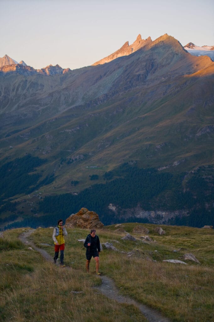
Since we now live in the village of Les Haudères at the end of Val d’Hérens, I usually set off on my trail runs directly from home, heading towards the Col de Torrent. But if you’re coming by car or public transport, I recommend going up to Villa to save yourself a few hundred meters of elevation gain 😉 (the hike is already long enough as it is lol).
Note: I won’t go into detail about the trail that climbs up to Sasseneire, as this article focuses more on the Prélet ridge (perhaps I’ll write a separate article to this hike another time 😉 ).
From the center of Villa, simply follow the signs for “Col de Torrent” and take the path that climbs steeply above the village. The hiking trail climbs directly between the hairpin bends of the Cotter road (which I believe is only accessible to residents) to the Cotter mountain pastures.
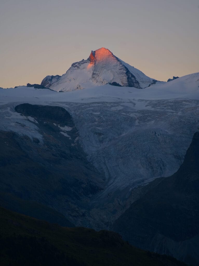
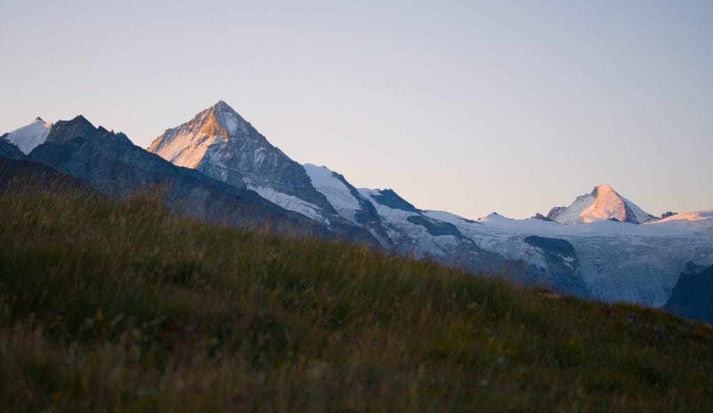
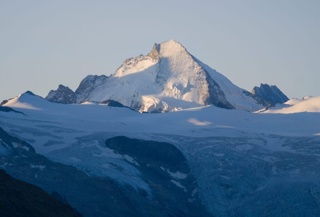
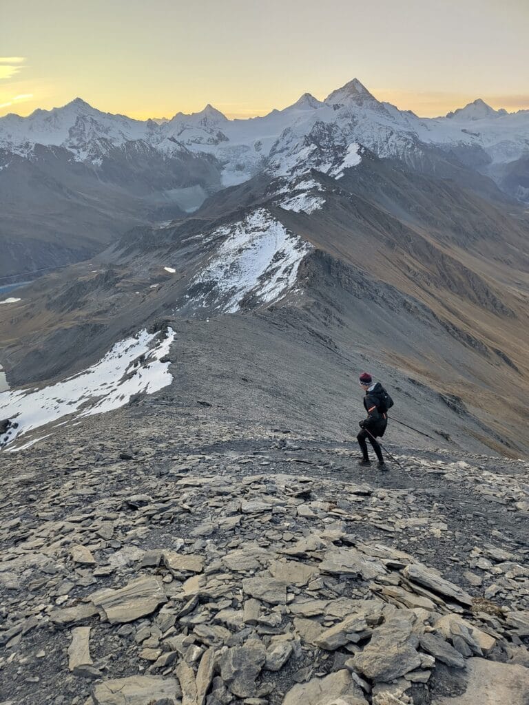
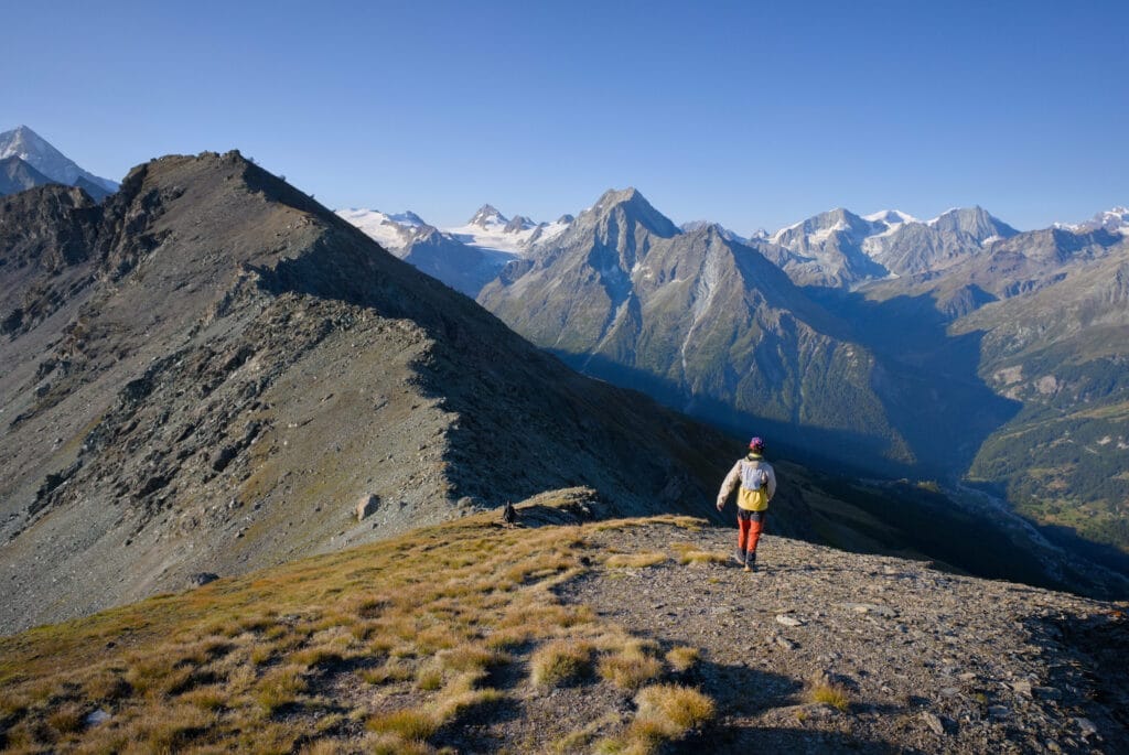
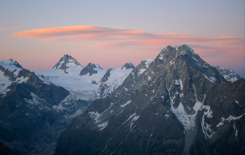
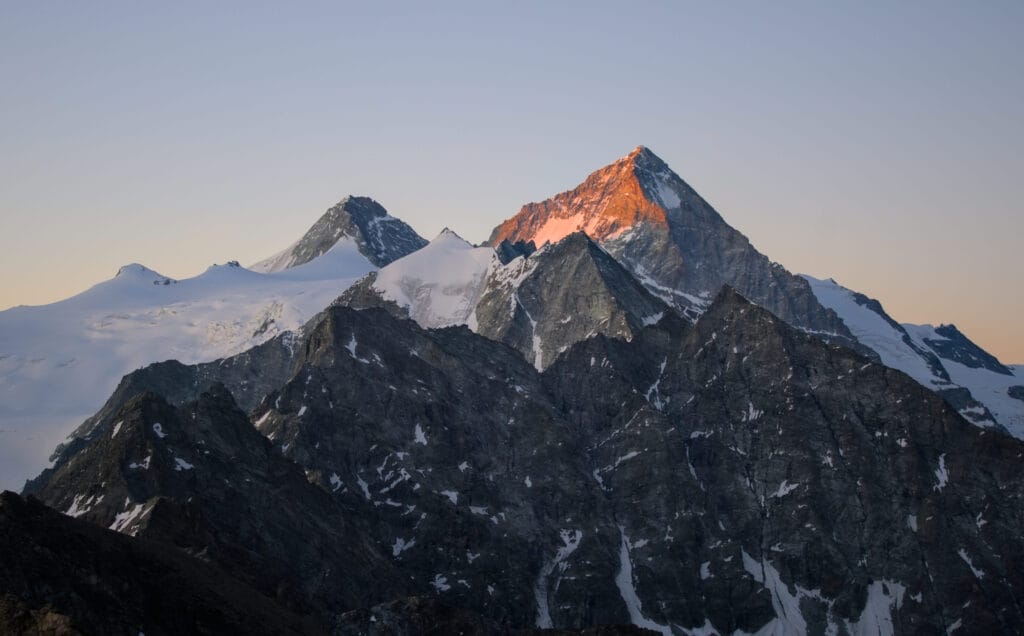
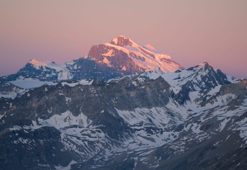
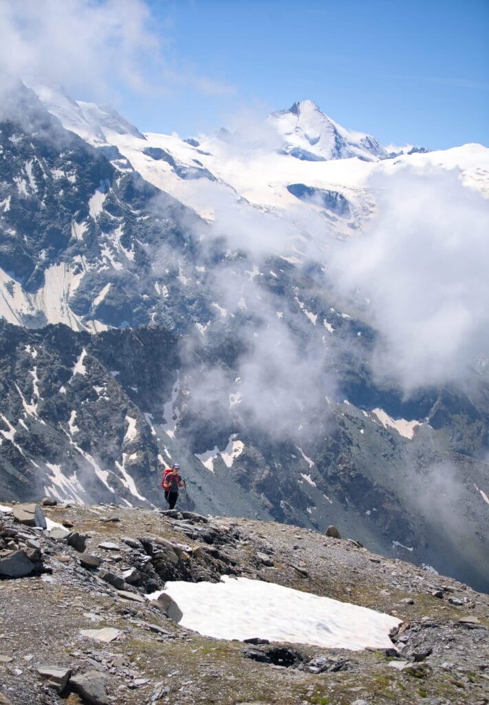
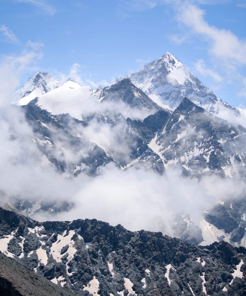
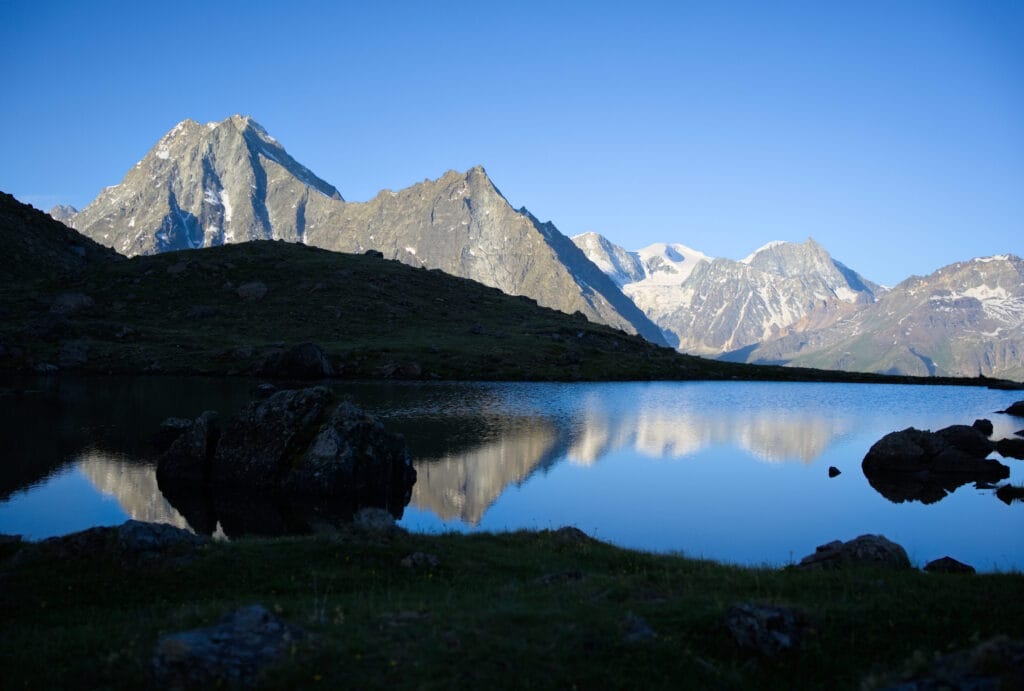
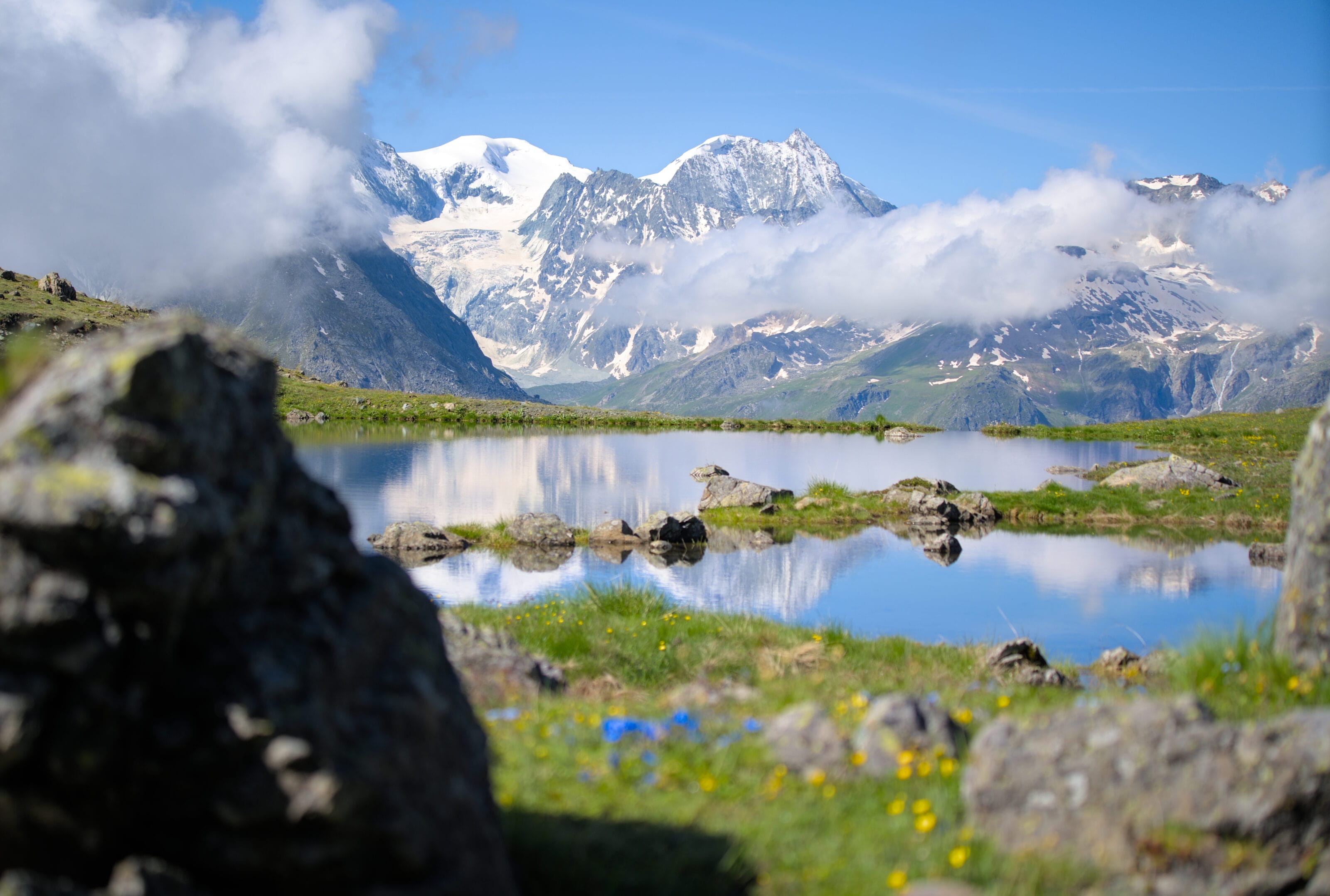
As you climb, the iconic peaks of the Val d’Hérens come into view: the Dents de Veisivi, the Dent d’Hérens, the Dent-blanche and, behind you, the Aiguilles Rouges d’Arolla. These landscapes are even more beautiful if you set off early in the morning and watch the sun rise over the peaks… See for yourself in these photos 🙂
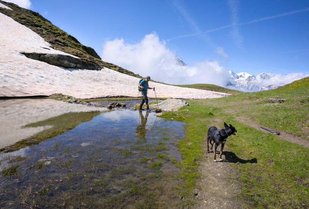
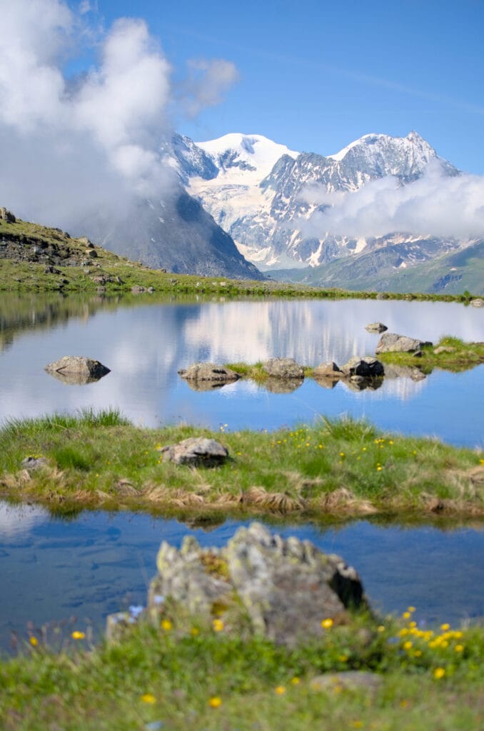
Above the mountain pastures, the trail climbs through the alpine meadows to the Béplan pond (which I have seen empty more often than full). The Torrent Pass is not far away, and you can clearly see the last part of the trail zigzagging up to the pass.
If you want to climb to the summit of Sasseneire (an additional 300m of elevation gain), take the trail that branches off to the left before the pass, which leads up some slightly crumbly schist slopes. You will then reach the ridge, which you will follow more or less to the summit (just at the end, the trail bypasses the ridge on the left). If you don’t feel comfortable climbing to the summit of Sasseneire (difficulty T3), it may be better to skip the entire Prélet ridge, which is more difficult in places.
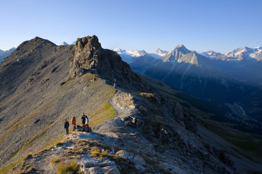
From the Torrent Pass to Pointe du Tsaté via the Prélet ridge
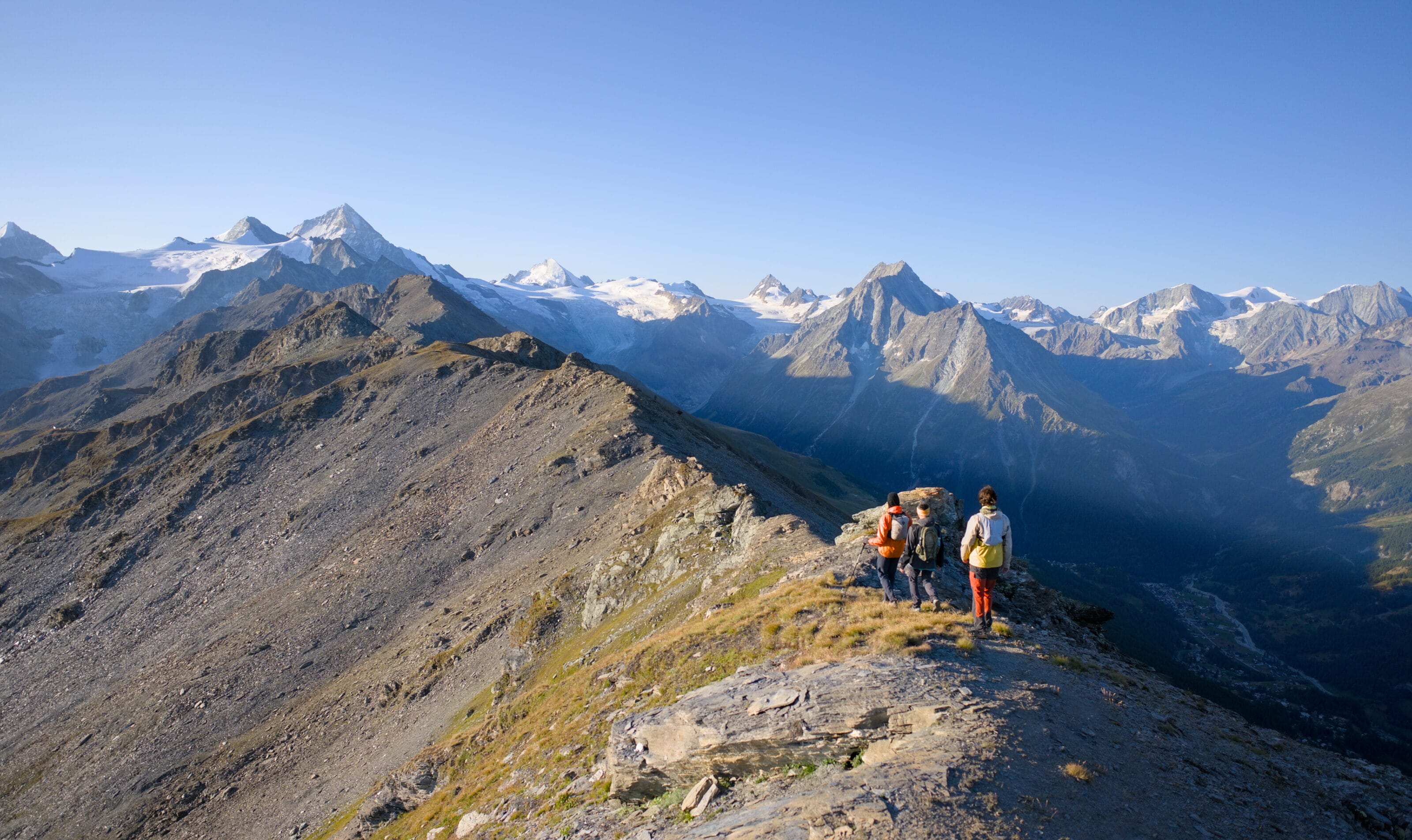
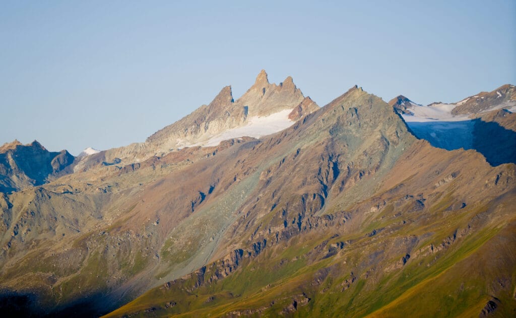
From the Torrent Pass, you have to go around the small rock outcrop on the left (Moiry side, see the photo above) to rejoin the ridge just after it. The trail is already less marked and you can tell that you are leaving the clearly marked paths. On the Val d’Annivier side, there is a magnificent view of Lake Autannes just below (you will pass by the lake if you climb up from Moiry).
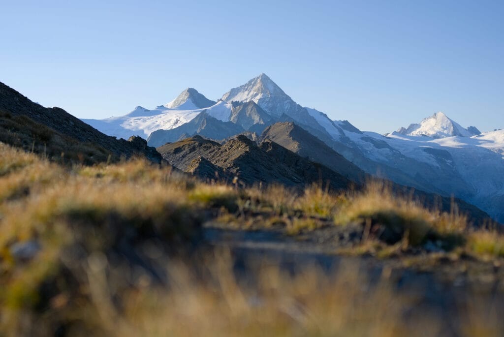
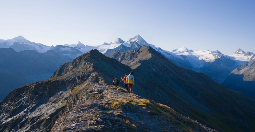
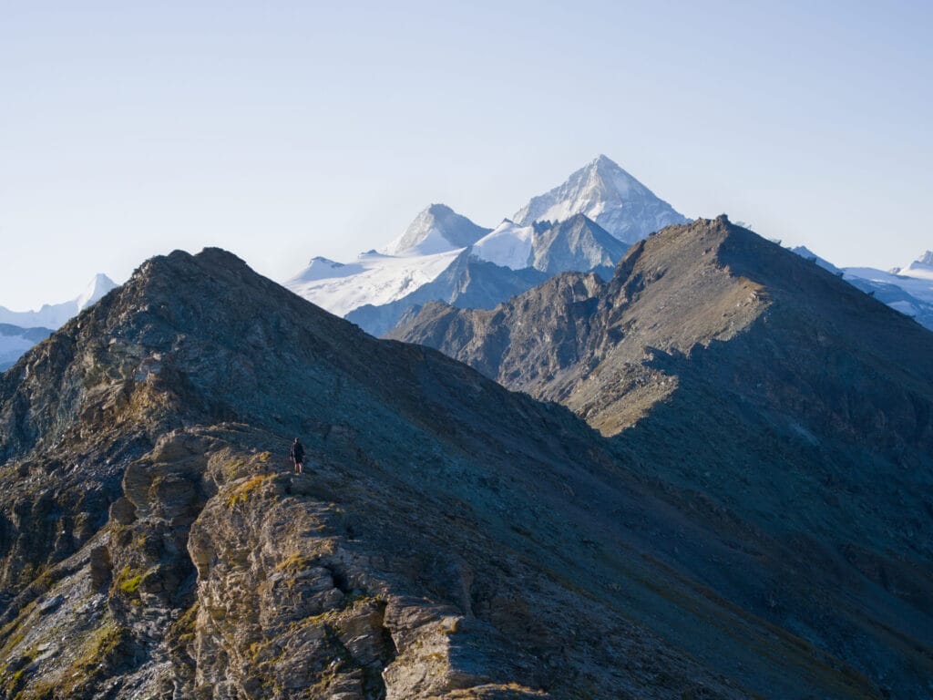
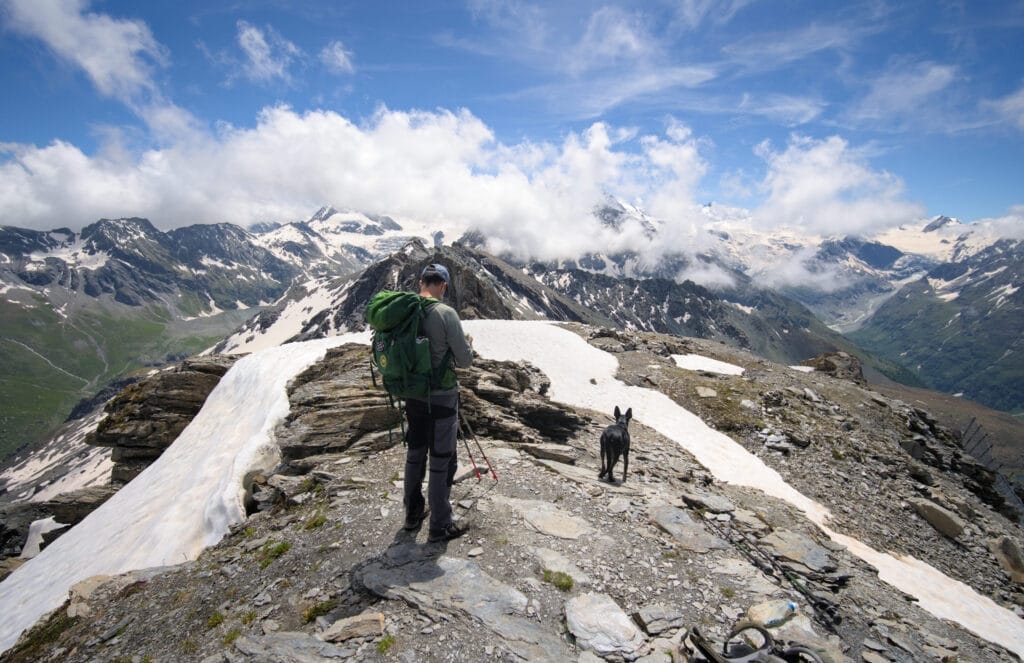
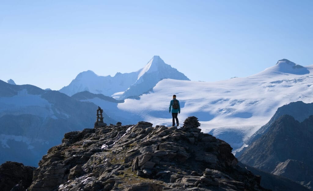
Continue on well-marked trail along the ridge to reach the first small summit (point 2987). The great thing about doing the loop in this direction is that you get a splendid view of the entire ridge with the Grand Cornier and Dent-Blanche in the background. Simply magnificent! Up to this point, the trail is a little exposed but nothing too serious.

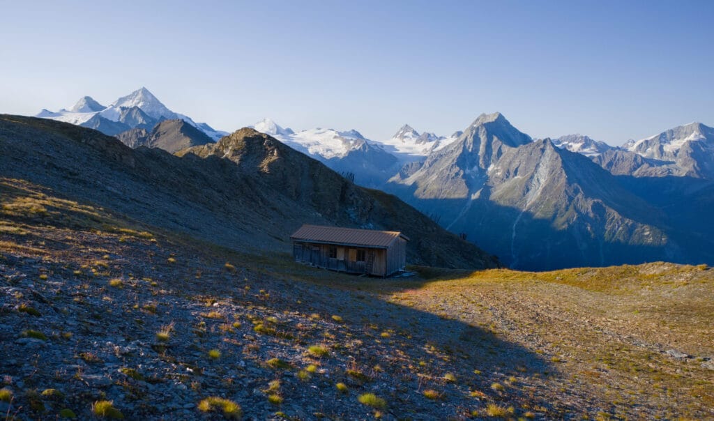
We continue down the ridge to see a hut that must have been built there to house the workers who worked on the avalanche barriers. If you want more information and photos about the Prélet ridge shelter, I found some on this website 😉 .
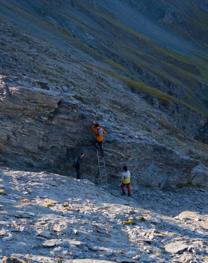
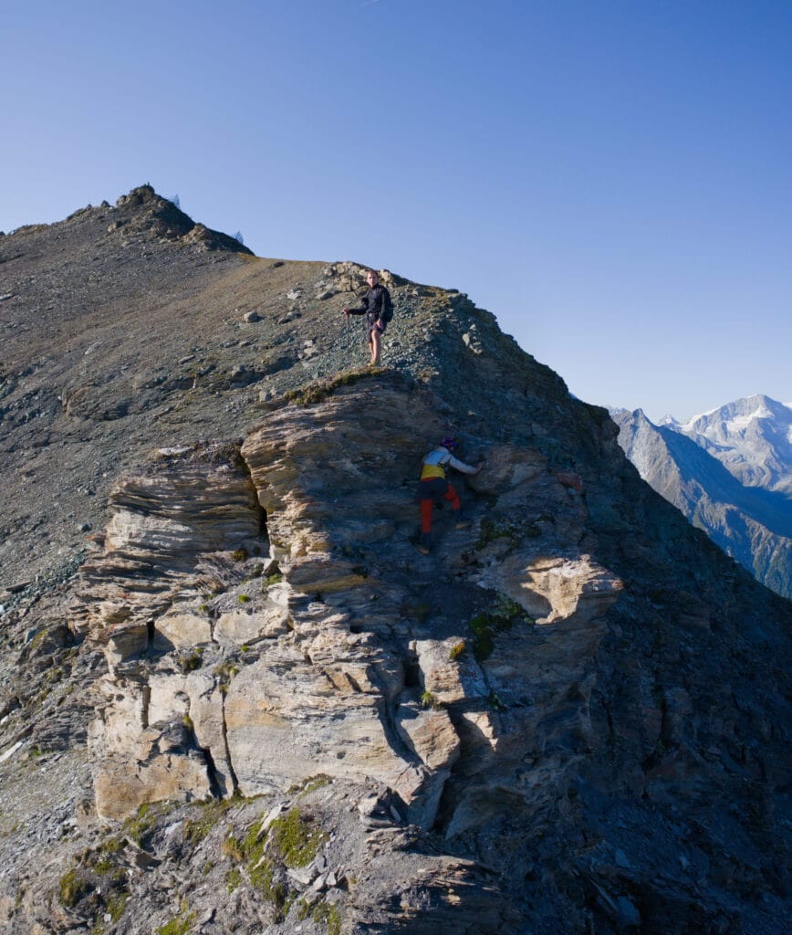
If you’re not particularly curious about this hut, I recommend staying on the ridge to reach a small ladder that allows you to easily cross a small rocky outcrop and then continue towards the Pointe du Prélet.
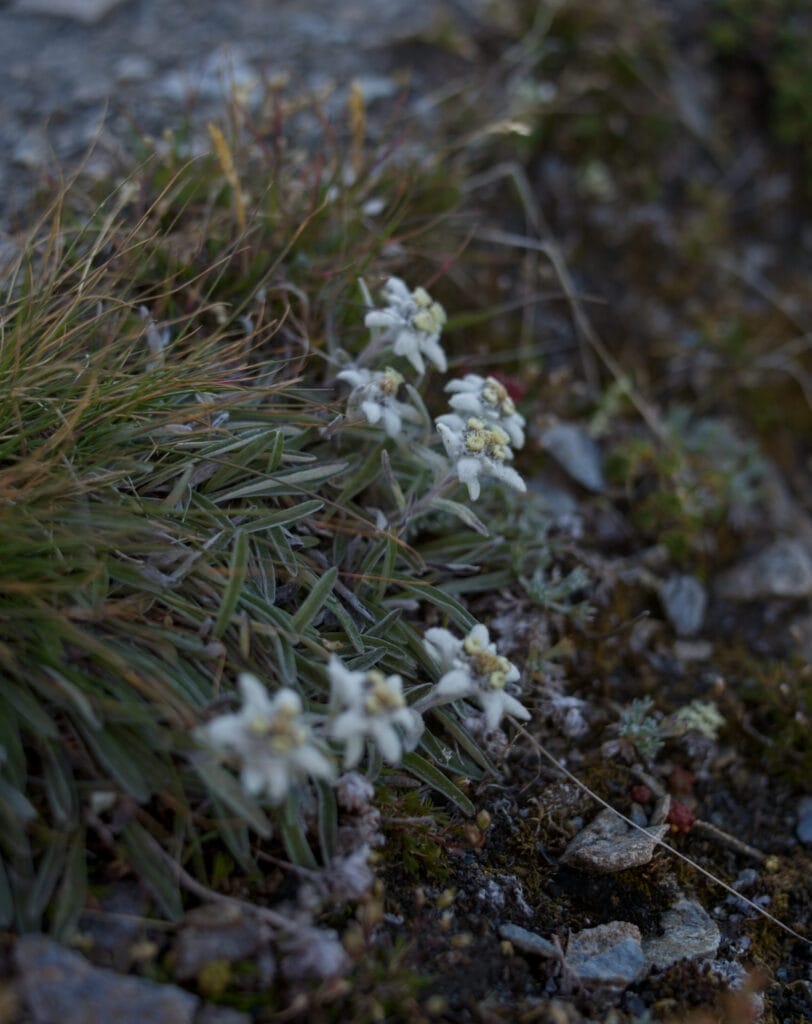
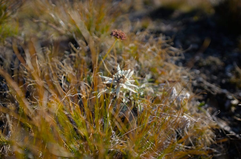
As far as the Prélet peak, I don’t recall any particular difficulties. Just beautiful scenery, a few edelweiss flowers along the trail, and the avalanche barriers at Pointe du Tsaté getting closer.

We descend a little towards Pointe du Tsaté, staying as close as possible to the ridge to reach what is, in my opinion, the most difficult part of this traverse. You find yourself in front of a kind of gendarme that you have to climb (you can also go around it, but in my opinion, that’s not any easier) with two or three really easy climbing steps (grade 2, I imagine). But you still need to use your hands and be comfortable in this kind of terrain. For me, this is perhaps the only section of the Prélet ridge that is T5 rather than T4.
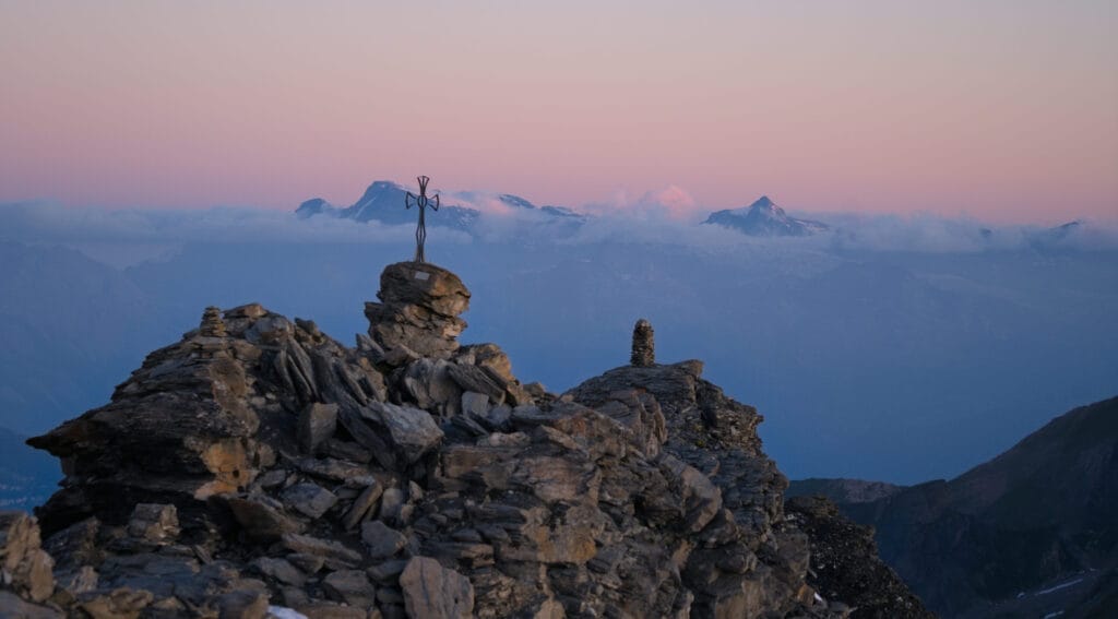
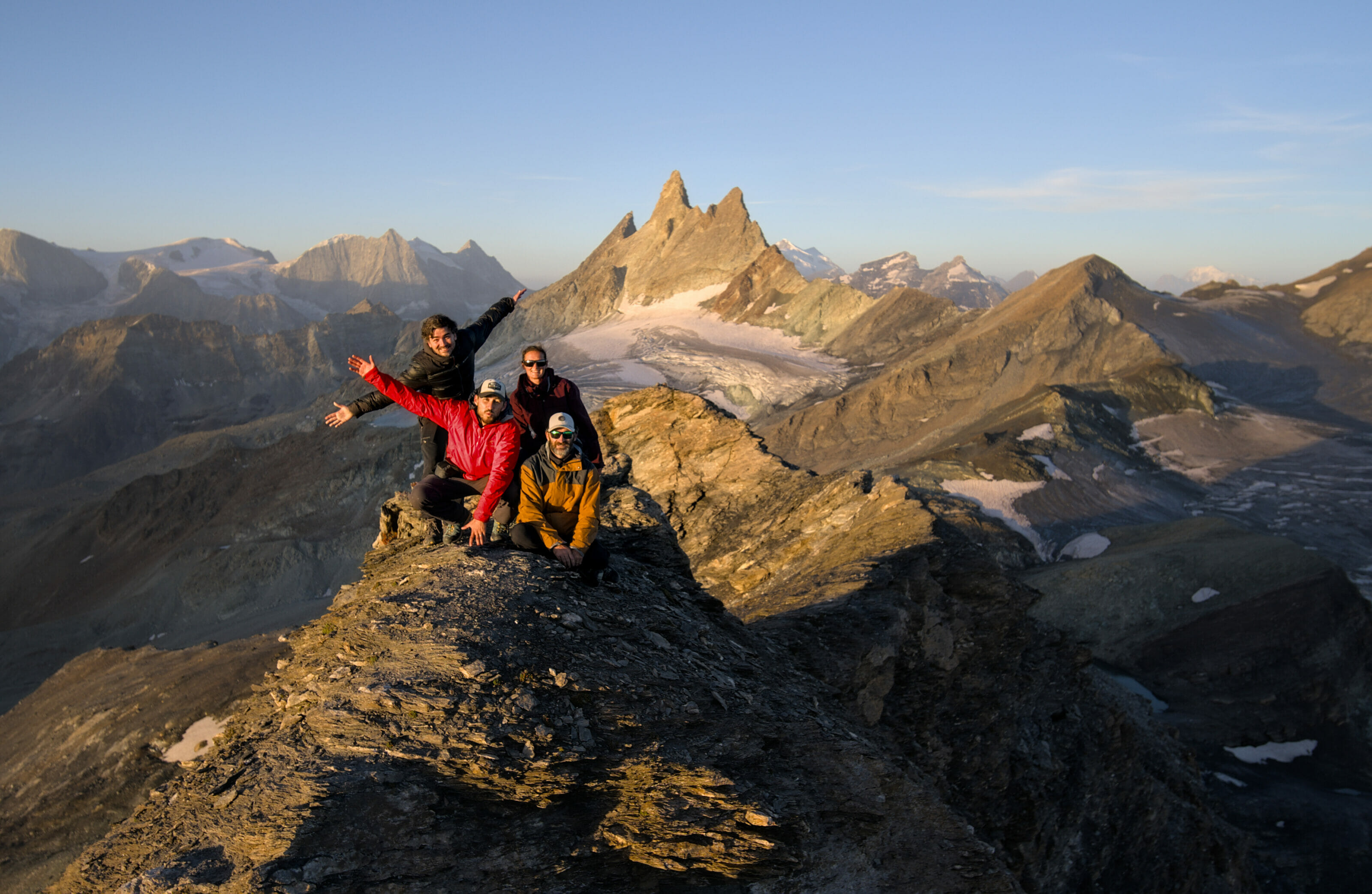
Finally, once you have negotiated this short, tricky section, all that remains is to climb up to Pointe du Tsaté. The trail bypasses the obstacles on the Moiry side and allows you to reach the metal cross at the summit fairly easily.
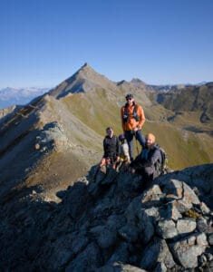
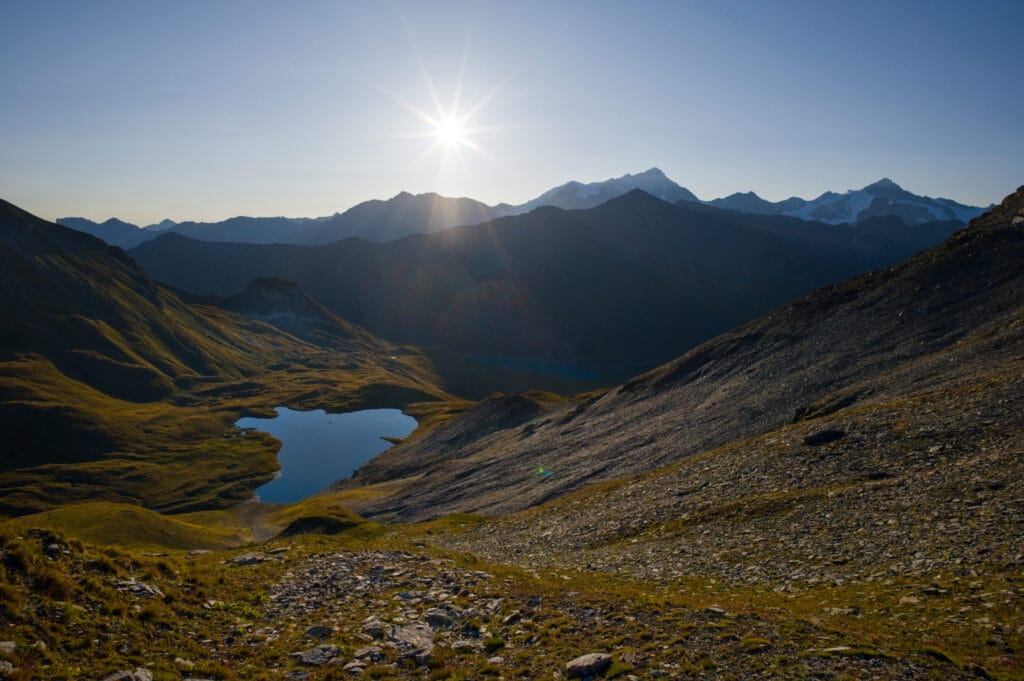
I’ve climbed to the summit of Pointe du Tsaté many times, sometimes during the day, sometimes at sunrise, hiking, trail running, ski touring… Below are some beautiful pictures I took from the summit during these different outings to whet your appetite 😉
Finally, for the descent of Pointe du Tsaté:
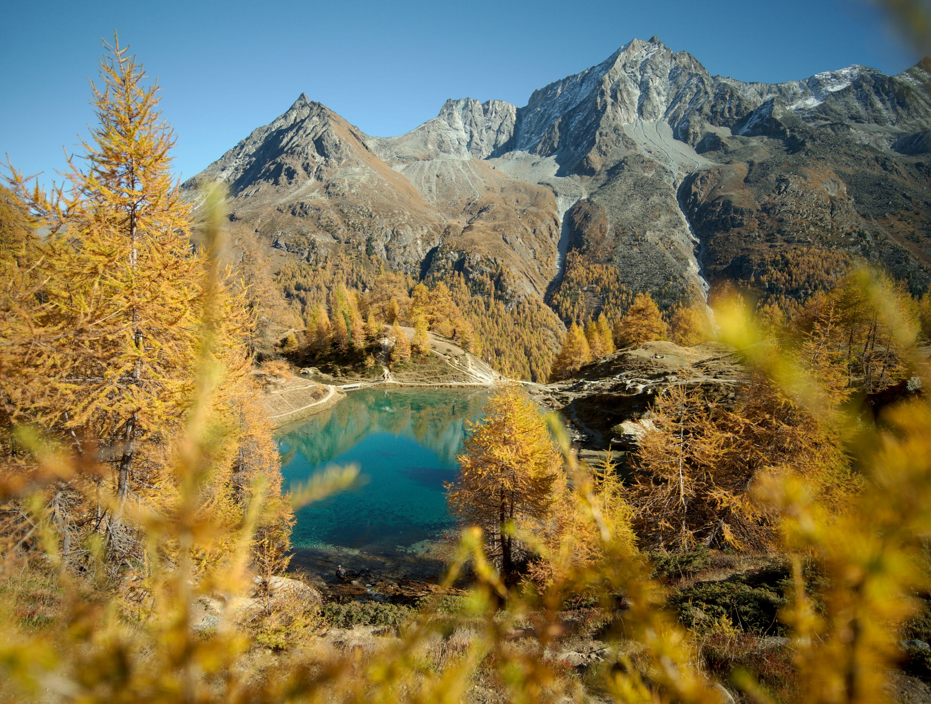
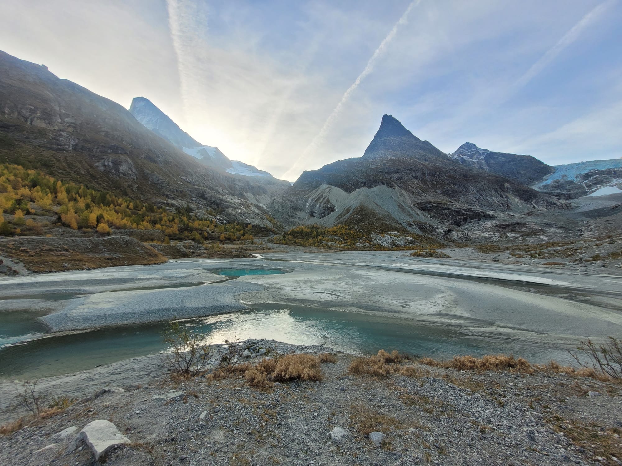
- Either you started on the Moiry Lake side. You will then have to descend to the first Tsaté Lake, climb back up to the Tsaté Pass, and finally descend on the Moiry Lake side.
- Either you started on the Val d’Hérens side and will have to descend to Villa or possibly to La Forclaz if you started there.
In both cases, you will pass by the beautiful Tsaté lakes, but I won’t go into any more detail as I have already written an article about the Pointe du Tsaté hike 😉

Arête du Prélet: difficult hike or not?
As I have mentioned several times, the ridge between Sasseneire and Pointe du Tsaté is rated T4-T5 on the CAS scale. This means that you sometimes need to know how to navigate to find the best route, and at times you will need to use your hands to help you cross exposed and steep passages… In short, if you add to that 18-20 km and 1,500-1,700 m of elevation gain, it makes for a rather difficult hike. After all, it depends on your fitness level and whether you have sure footing, but you have been warned.
That’s it for this beautiful outing at the border between the Val d’Hérens and the Val d’Annivier. It’s definitely one of my favorite summer outings in the region, and I hope this little article has made you curious about this place 😉 .

Join the discussion