

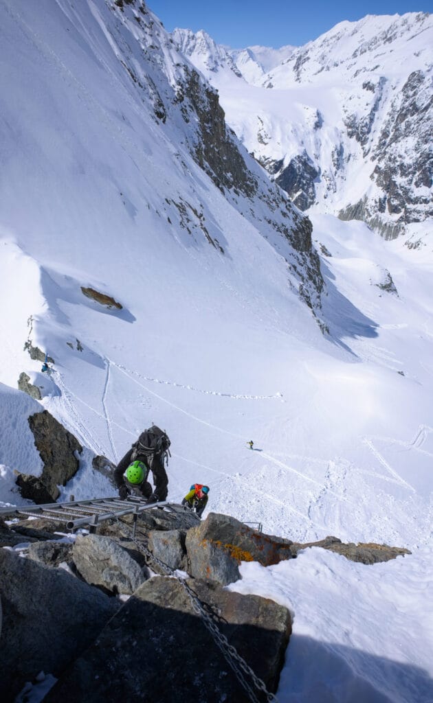
The Bertol hut is certainly the most emblematic high-mountain refuge in the Val d’Hérens! It is located on the itineraries of the Chamonix-Zermatt Haute Route and the famous Patrouille des Glaciers (the world’s most renowned ski mountaineering race), which connects Zermatt with Verbier. The hut is also rather impressive as it was built on a rocky spur just below the Pointe de Bertol and can only be reached via impressive ladders (on both the east and west sides).
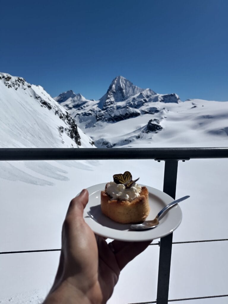
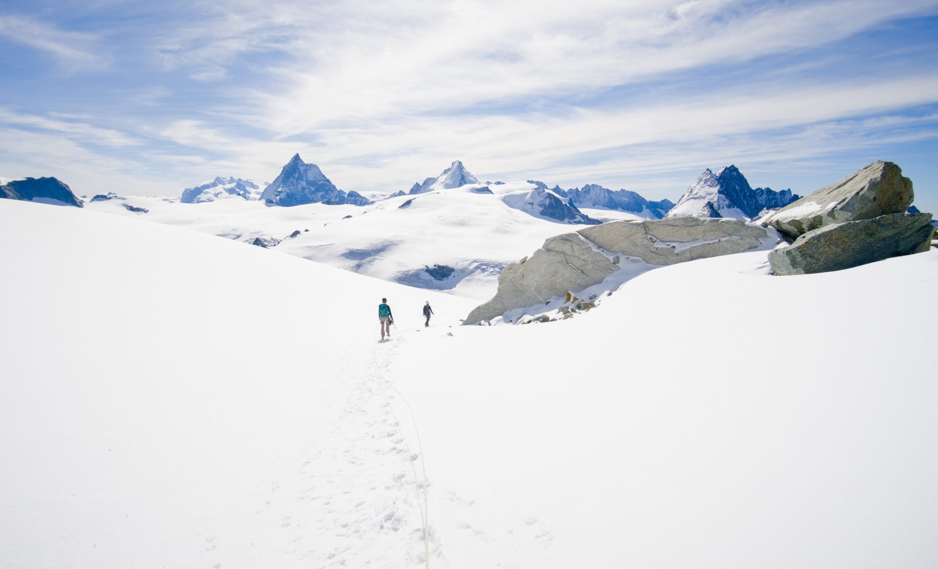
I went up to Bertol for the 1st time at the end of my 1st ski touring season (it was a 9th of May ahah) and it has become my favourite coffee spot 😉 . The view from the hut is just incredible! The terrace overlooks the gigantic Mont Miné and Ferpècle glaciers and you’re right in front of the Dent Blanche (4357m), the Matterhorn (4478m) and the Dent d’Hérens (4173m). It’s just heaven!

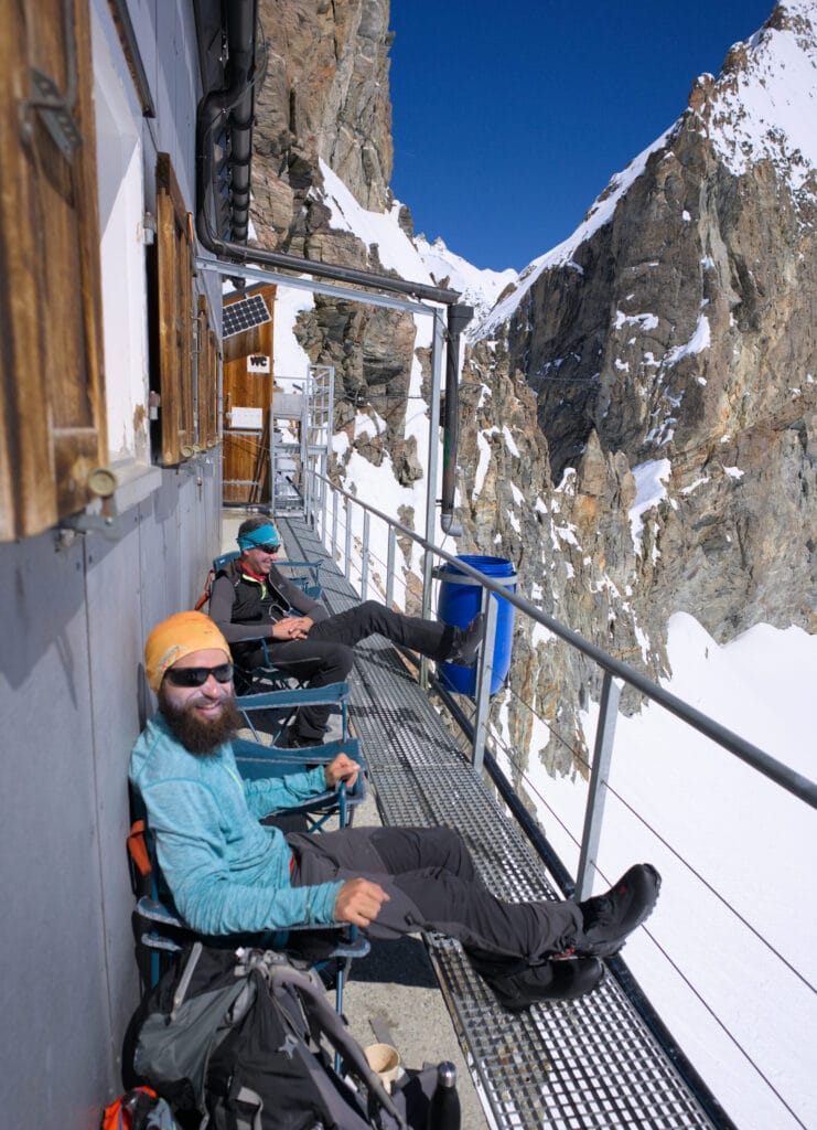
I’ll always have wonderful memories of that 1st trip up with David and Louis, when we were welcomed like kings by the friendly hut keepers (Florence & Stéphane). They set up camping chairs for us on the terrace, and made us a nice french press coffee with a delicious homemade cake. A real treat! Since that day, I’ve been back there several times and I can confirm without a doubt that it’s the terrace with the best view for a coffee in the Val d’Hérens.
In this blog post, I’m going to share with you my experience of climbing up to the Bertol hut and the various options I’ve tried or that I’m still contemplating from up there.
- Elevation change: 1340m+
- Ski touring grade: PD / 2.2 / E1 . If you don’t know exactly what these grades represent, we’ve written a full post on the matter here.
- Duration: 3-5h
- Useful links: Camptocamp, swisstopo map, Bertol hut website
Here is the map with the GPX track you can download:
I’d rather say it again, but beyond the beautiful powder pictures and videos… ski touring is a sport that involves risks (alpine terrain, avalanches, weather, falls). Make sure you have the knowledge, the endurance, the skiing ability and the gear you need before embarking on any challenging tours.
If you have any doubts, first read this article in which I share my experience since taking up ski touring. In particular, I talk about the skills you need, safety, essential gear and many other aspects of the sport.
Finally, I’m certainly no expert on ski touring and I simply want to share my experience with you to inspire you and give you ideas for ski outings. But that doesn’t mean you shouldn’t make your own experiences, question what I say in these posts and turn back if you don’t feel like it.
From Arolla to Plan Bertol
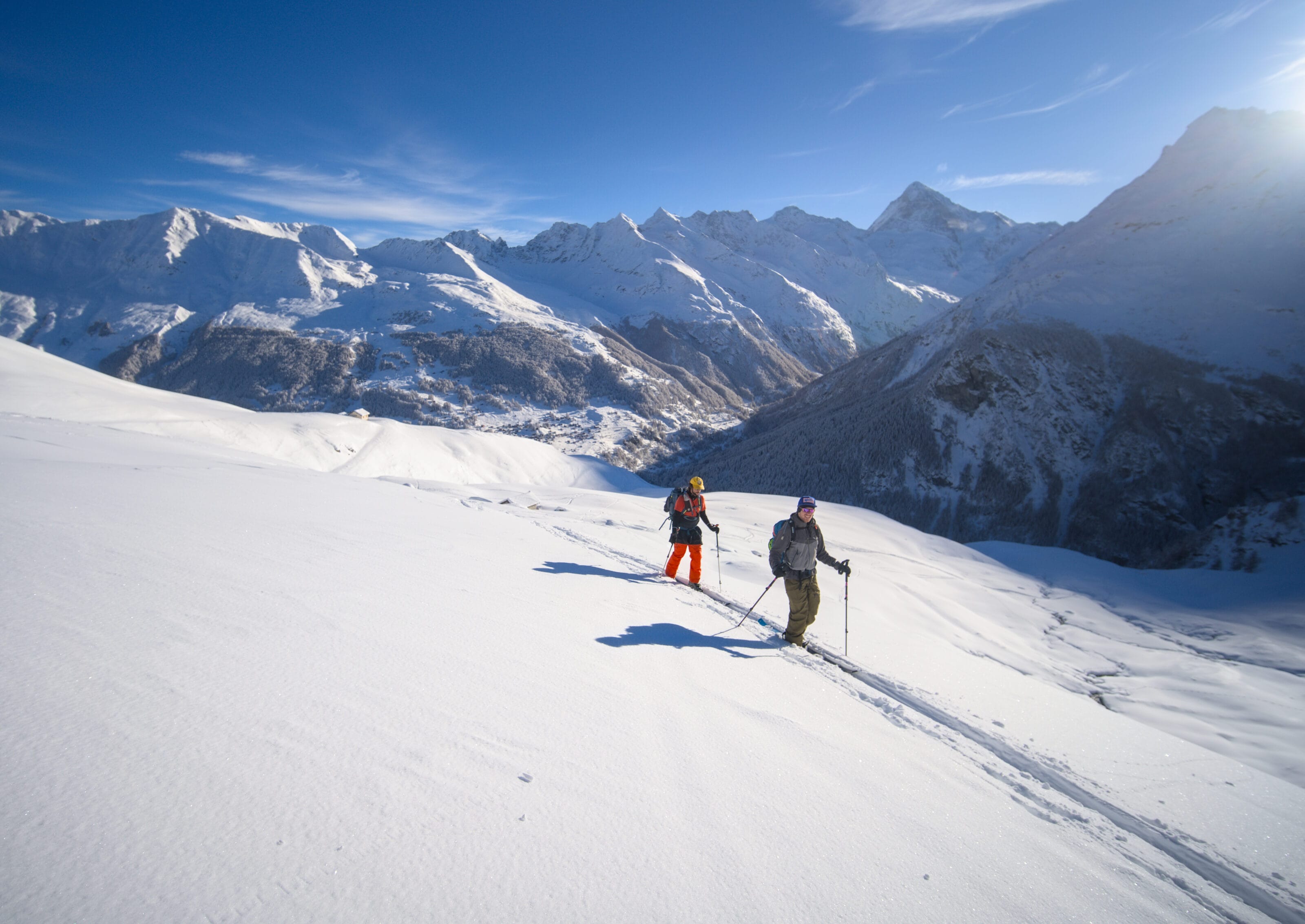
The route up to the Bertol hut starts from the Arolla ski lift car park (you can park at the far end of the car park to save a few meters 😉 ). On Camptocamp, the route starts directly from the electricity plant, but it is officially forbidden to drive towards the plant and to park there if you don’t work in it.
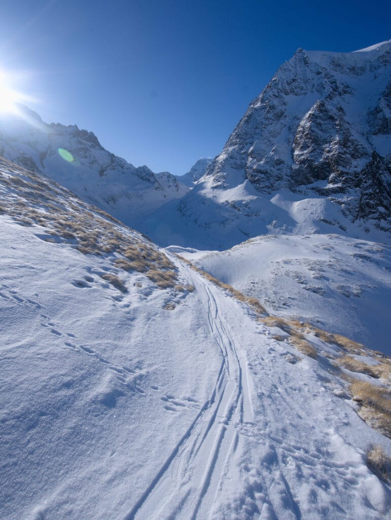
The start of the route is fairly straightforward! Just aim for Mont Collon for the first 3 kilometres, which are almost flat. But that doesn’t mean it’s monotonous. The scenery is already very alpine, with Mont Collon and its glacier in the background. On your right you can also see the N-E Serre de Vuibé couloir (easily recognisable because it ends in an icefall) and the Vignettes couloir, which will give you ideas for your next outing 😉
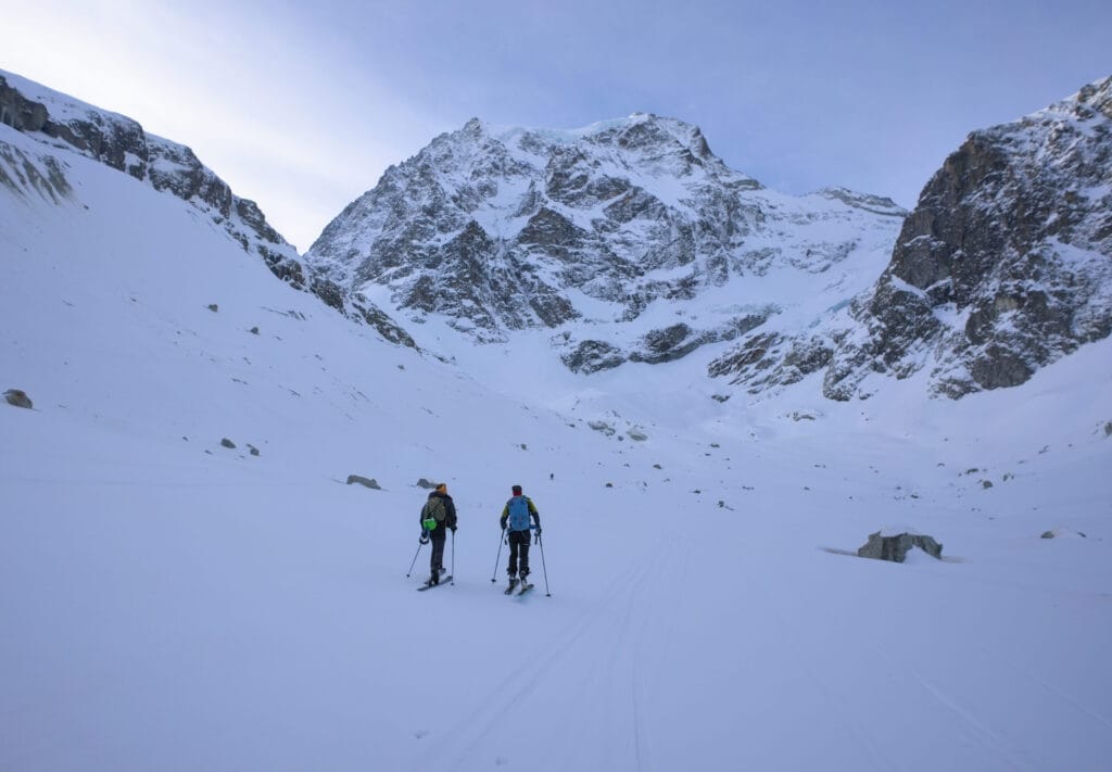
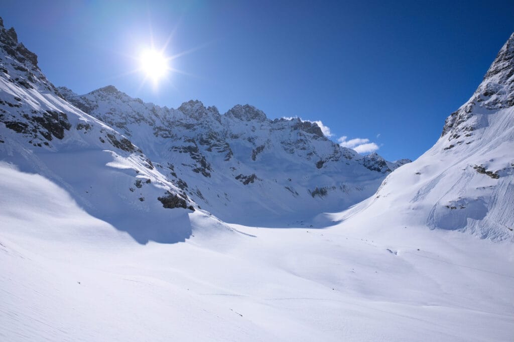
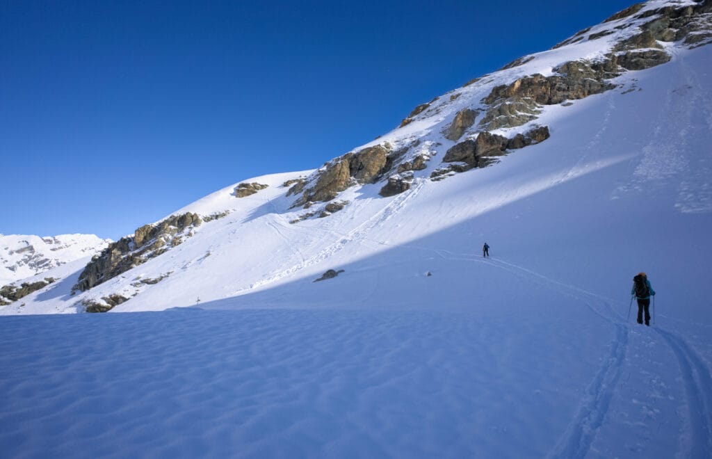
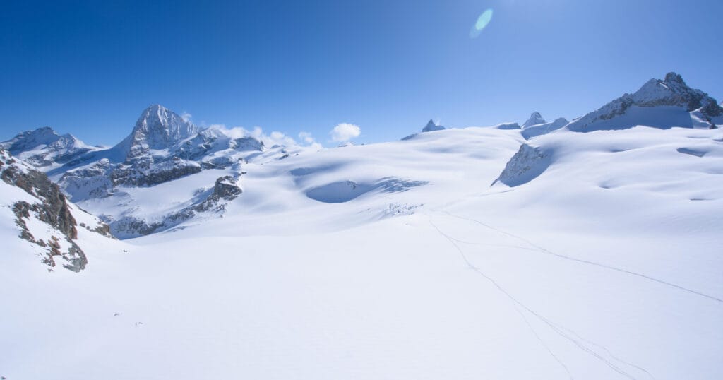
At the bottom of the Arolla valley, it finally starts to steepen a little on the left towards the high Arolla glacier. On the right, there’s a beautiful view of the Mont Collon glacier, which can also be skied from Les Vignettes. The ascent is short and you reach a new plateau where you can either turn right towards the upper Arolla glacier or left towards Plan Bertol. In front of us, you can admire the Bouquetins (means Ibex in french) and the Dents de Bertol.
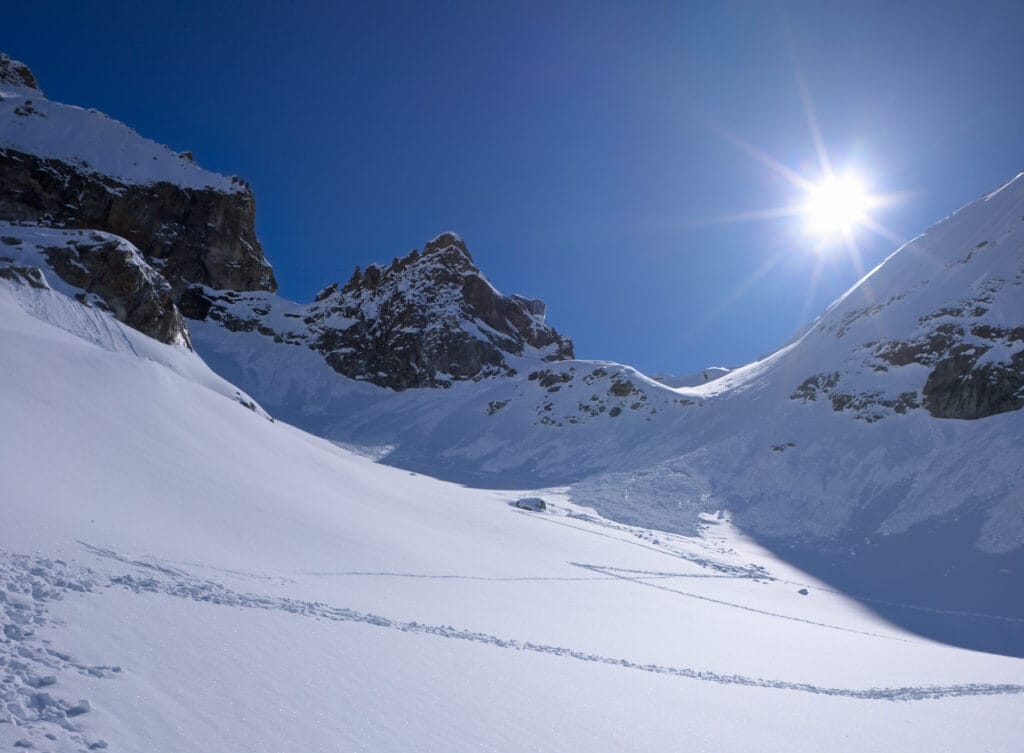
The following section is, in my opinion, the only one that can cause problems depending on the conditions (this section is indicated by a point on the alltrails map). First of all, you have a magnificent view of the high Arolla glacier 😉 but the part just before Plan Bertol is more than 30 degrees steep. In my experience, this is especially annoying when there isn’t much snow and the track is frozen (I’ve already had to take out the ski crampons at this point) but theoretically when there’s a lot of snow it can also be a bit dangerous.
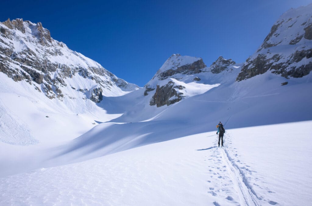
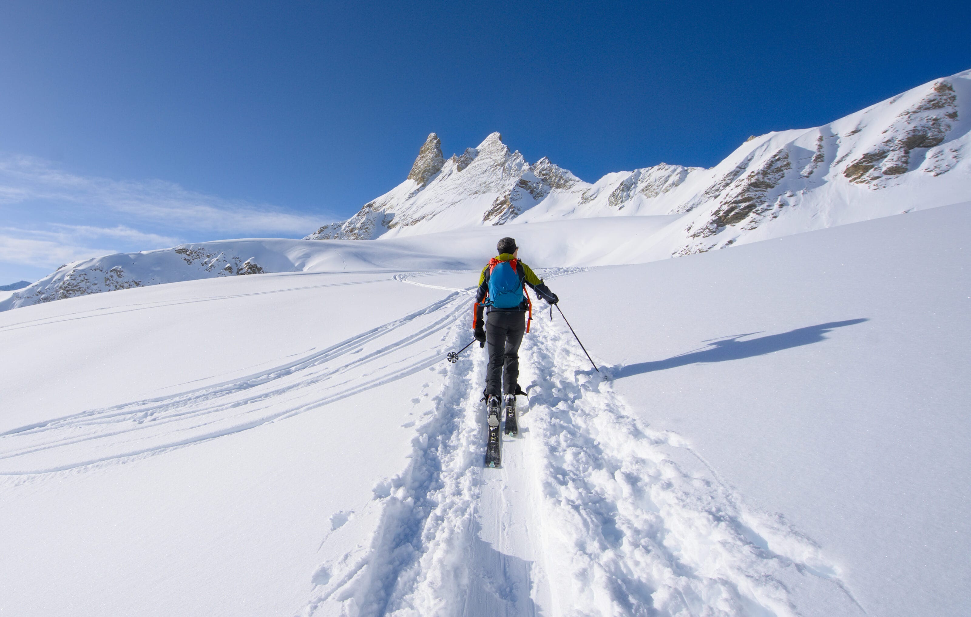
After this short section, we reach Plan Bertol and have the hut in our sights at the bottom of the valley with just over 600m to climb.
From Plan Bertol to the Bertol hut
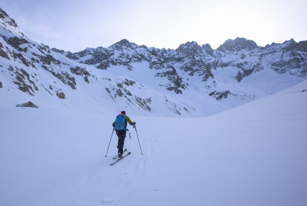
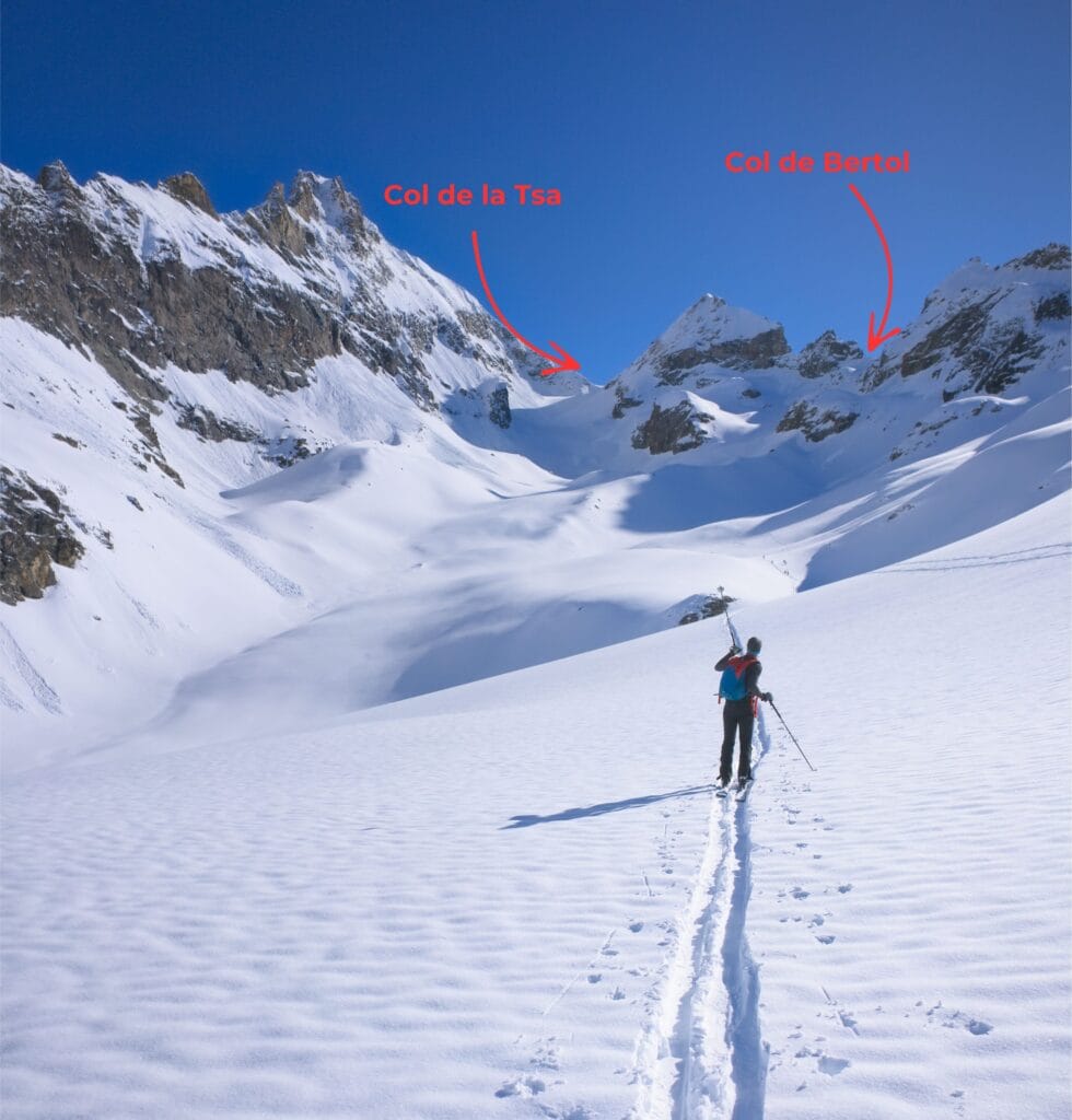
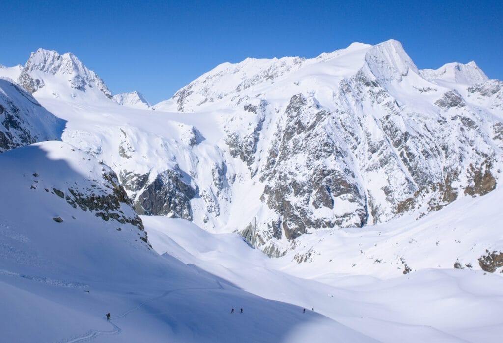
In front of us is the Pointe de Bertol at the bottom of the valley, with the Col de la Tsa on the left (itinerary to the Aiguille de la Tsa and its famous couloirs, which I haven’t had the opportunity to do yet… but I’m sure I will soon) and the Col de Bertol plus the hut of the same name on the right. The chain that delimits the valley on the left is called the Douves Blanches.
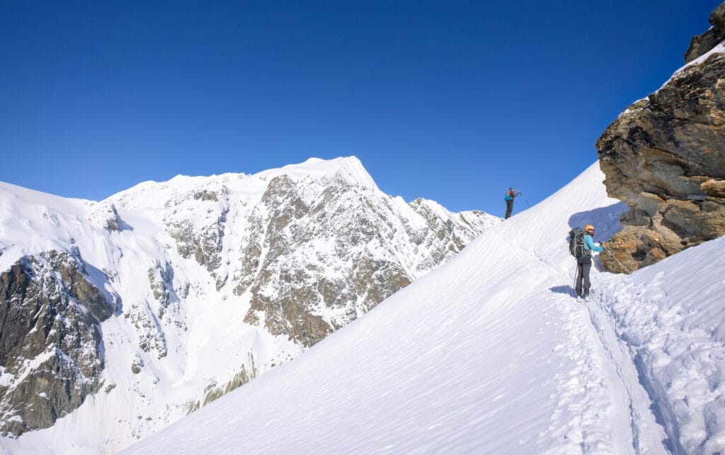
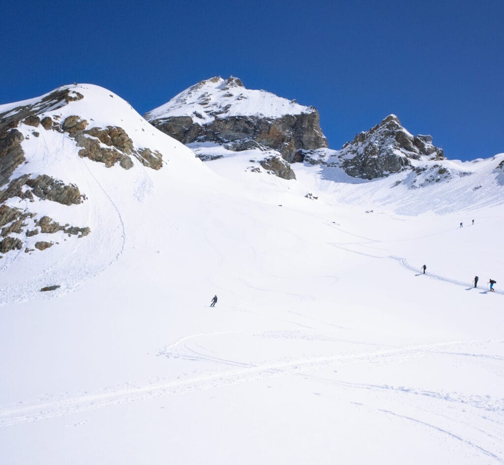
There is no particular difficulty in reaching the Bertol hut. In the 1st part of the valley, the slope is not very steep, then it gets a bit steeper as you fork to the right towards the Col de Bertol. Also, when the slope becomes steeper, you’re already at an altitude of 3000m, so I wouldn’t go so far as to say it’s easy 😉
Don’t forget to look back from time to time to admire the Pigne d’Arolla, the little Mont Collon and the pretty couloirs below the Vignettes hut.
Once at the top, all you have to do is lay your skis at the foot of the ladders leading up to the hut. It’s not technically difficult, but if you’re afraid of heights, it’s not necessarily the easiest access! To give you a better idea, I’ve included a few photos below. It’s up to you to decide whether you feel you can climb (and descend) the Bertol ladders. But if you’re not afraid of heights, it shouldn’t be a problem 🙂
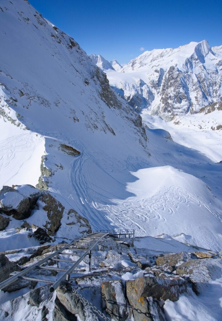
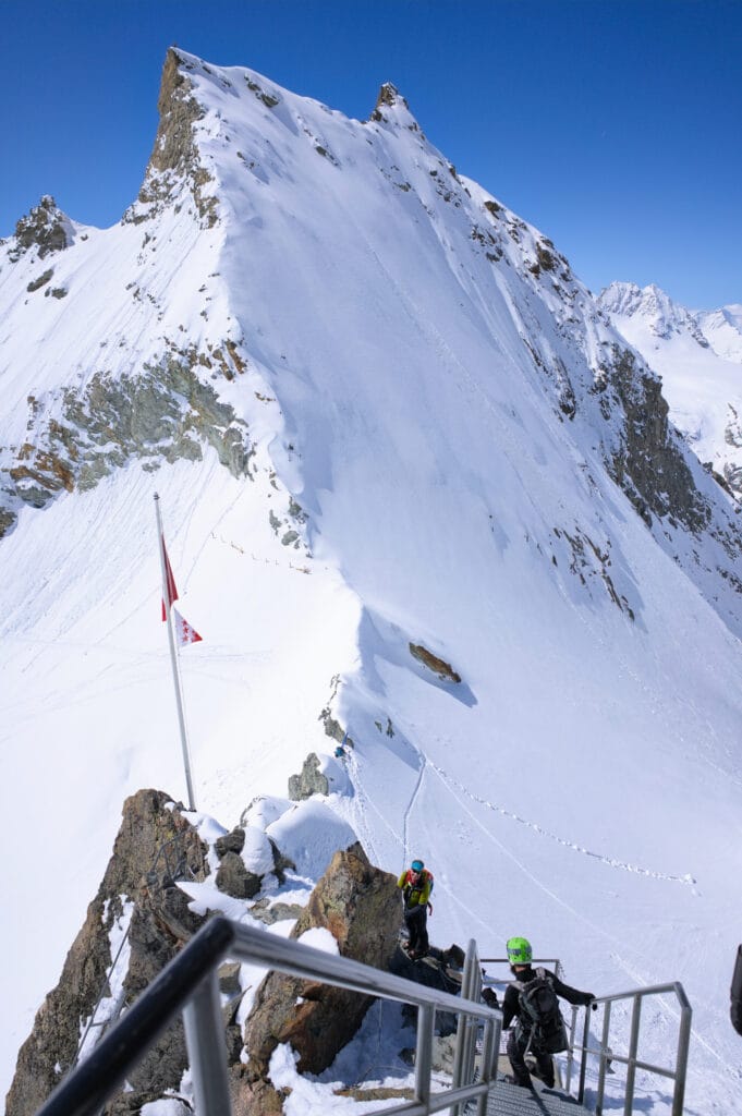
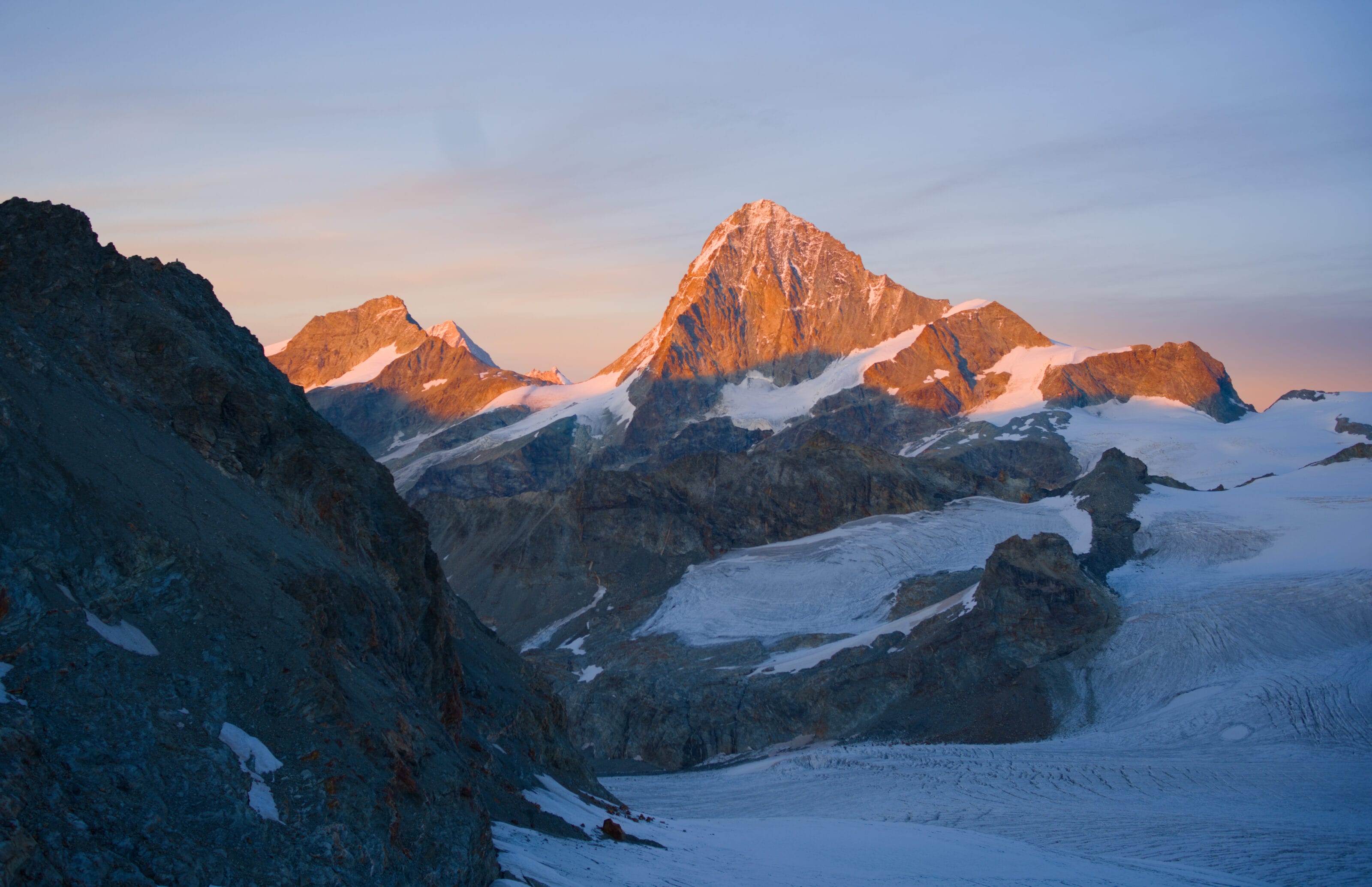
But if it helps motivate you, the reward is well worth the effort you put in to get to the top 🙂 . Firstly, you’ll be warmly welcomed by the hut keepers, and secondly, the view from the front of the Bertol hut is simply magical! You’ll overlook the imposing Ferpècle and Mont Miné glaciers… and the backdrop of the Dent-Blanche, the Matterhorn and the Dent d’Hérens completes the picture! It’s a dream!
Add to that the fact that they make great french press coffee and have delicious homemade cakes… and you’ll understand why it’s my favourite terrace in the valley 😉
Loop via the Dents de Bertol (or the Charlie couloir)
- ski touring grade: AD / 3.2 / E1 (Charlie couloir D+ / 5.1 / E2)
- useful links: Camptocamp (Charlie couloir loop c2c)
I haven’t done this route yet (but I hope I can do it soon) but the Dents de Bertol are just south-east of the hut. From the Col de Bertol, follow the route towards Tête Blanche, then turn right after going around the Dent de Bertol North. You then have to climb up a glacial slope to the Col des Dents de Bertol and then to the summit of the Dent de Bertol South. From the feedback I’ve had and read, it seems that there’s often a cornice that can be a bit tricky to get over at the col (point 3409 on the map, there are photos on camptocamp but apparently it’s fine on the south side of the cornice).
The nice thing about this variant is that you can make a nice loop with a nice descent below the Dents de Bertol instead of going back down via the uphill route.
For the Charlie couloir, the idea is to climb a little further south of the cornice mentioned above to reach the gap at point 3457 and join the entrance to the couloir. On c2c, it’s apparently ski-able but I guess it depends a bit on the conditions.
Options for skiing down
For now I’ve only done the descent via the ascent route. So for the other itineraries, I’ll refer you directly to Camptocamp and I’ll be adding more information when I’ll do more.
By tu uphill itinerary
Ski difficulty: 2.2 / E1
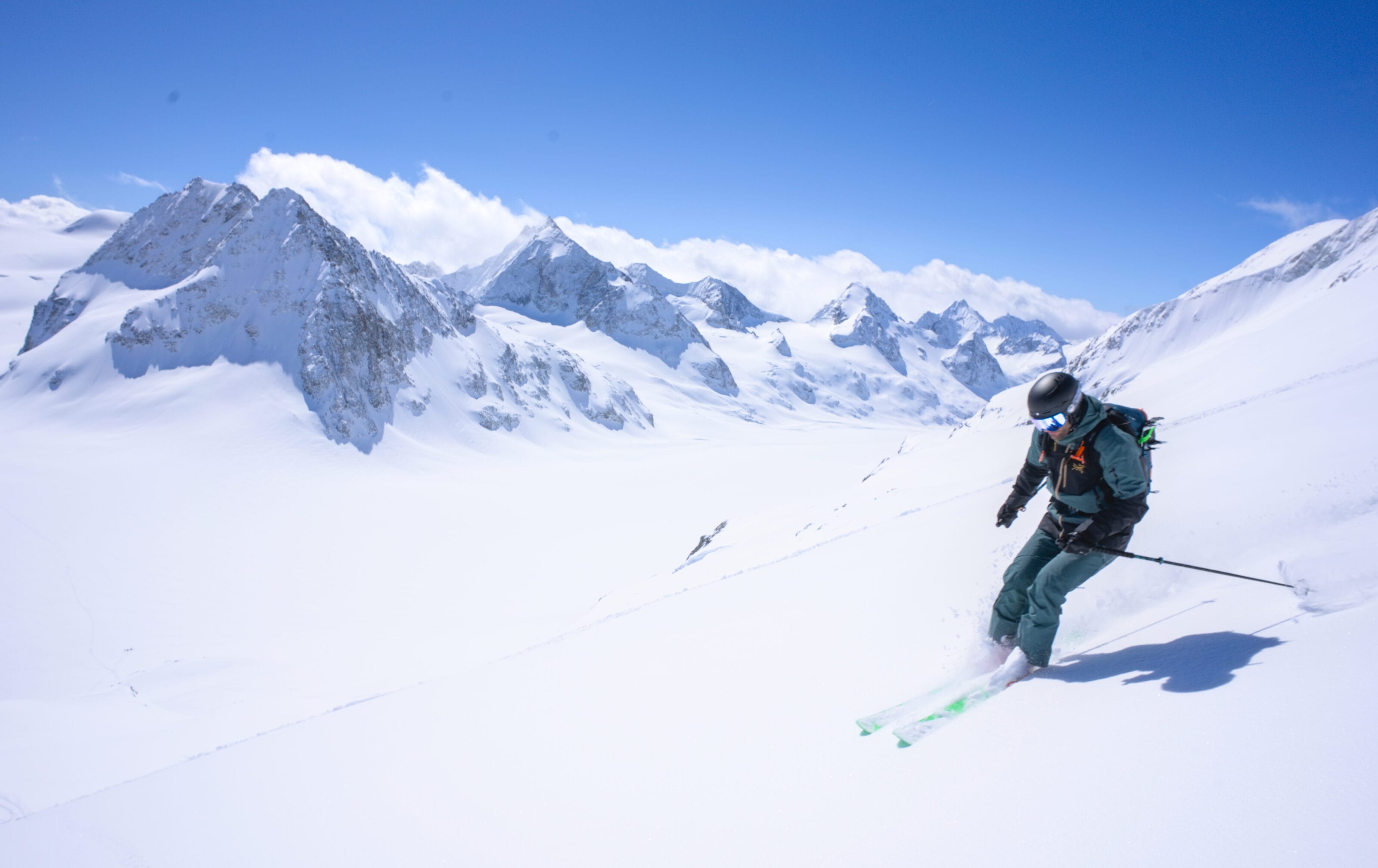
The descent via the uphill route is not particularly difficult. When conditions allow, I tend to stay to the kier’s left to enjoy the slightly steeper slopes, which are great fun to ski. You can even stay to the south of point 3027 (after a short traverse to the left) to ski a lovely slope just above Plan Bertol.
Via the glacier below the Dents de Bertol
Ski difficulty: 3.2 / E1
As indicated on Camptocamp, you need to stay on the right side of the glacier to avoid the serac waterfall, then aim between points 2818 and 2838 to reach the high Arolla glacier. Then simply follow the uphill route to join the cross-country ski track to the car park.
Loop via the Charlie couloir
- Ski Difficulty: 5.1 / E2
- Useful link: camptocamp
Clearly not the option for everyone… But this couloir is obvious when you climb the high Arolla glacier towards the Bouquetins refuge. What isn’t necessarily obvious is that there is an access ramp at point 3457 which allows you to access the couloir without necessarily bootpacking up in it. All the information is on c2c.
Via the Mont Miné glacier to Ferpècle (even Les Haudères)
According to the Camptocamp report, you should stay on the left bank of the Mont Miné glacier and descend the moraine at around 2400m. It is clearly indicated that the glacier has crevasses and that it is useful to rope up (even if in most of the c2c reports, people did not rope up).
- Ski difficulty: 3.3 / E2
- Useful link: camptocamp
Via the Ferpècle glacier to Ferpècle (even les Haudères)
To descend the Ferpècle glacier, first climb to Tête Blanche (3710m) and then descend either the west or east side of Mota Rota. According to the c2c entries, it’s safer on the east side but prettier down the centre of the Ferpècle glacier. Here too, the Ferpècle glacier has lots of crevasses, so depending on the conditions, it may be useful to rope up.
- Ski difficulty: 2.3 / E1
- Useful link: camptocamp
That’s it for this ski touring guide to the Bertol hut area! If you have anything to add or comments to make, don’t hesitate to leave me a comment below 🙂 .
Pin it on Pinterest
Join the discussion