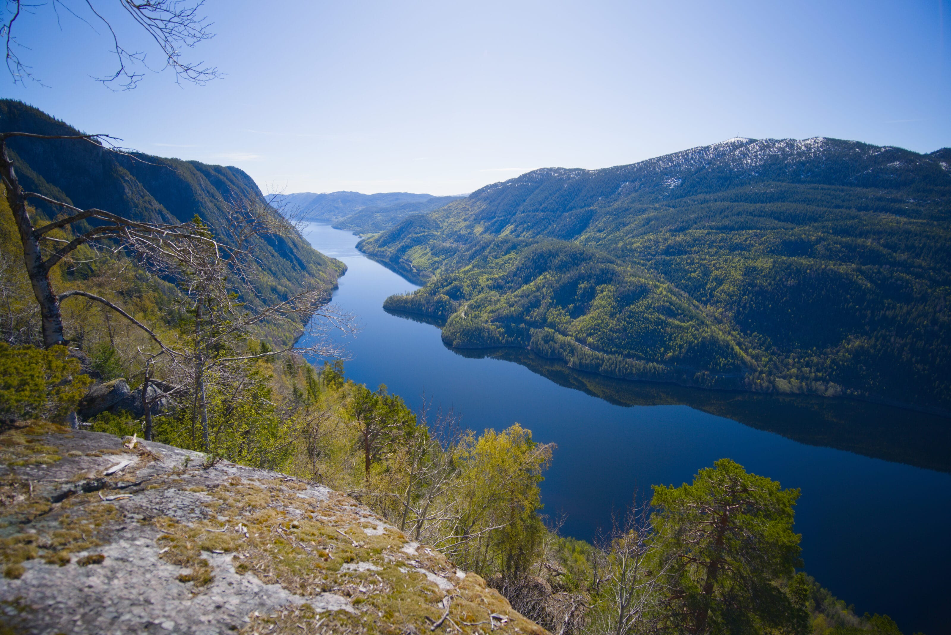
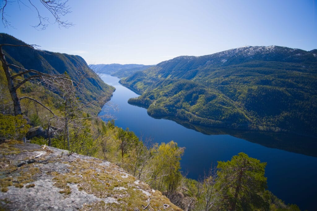
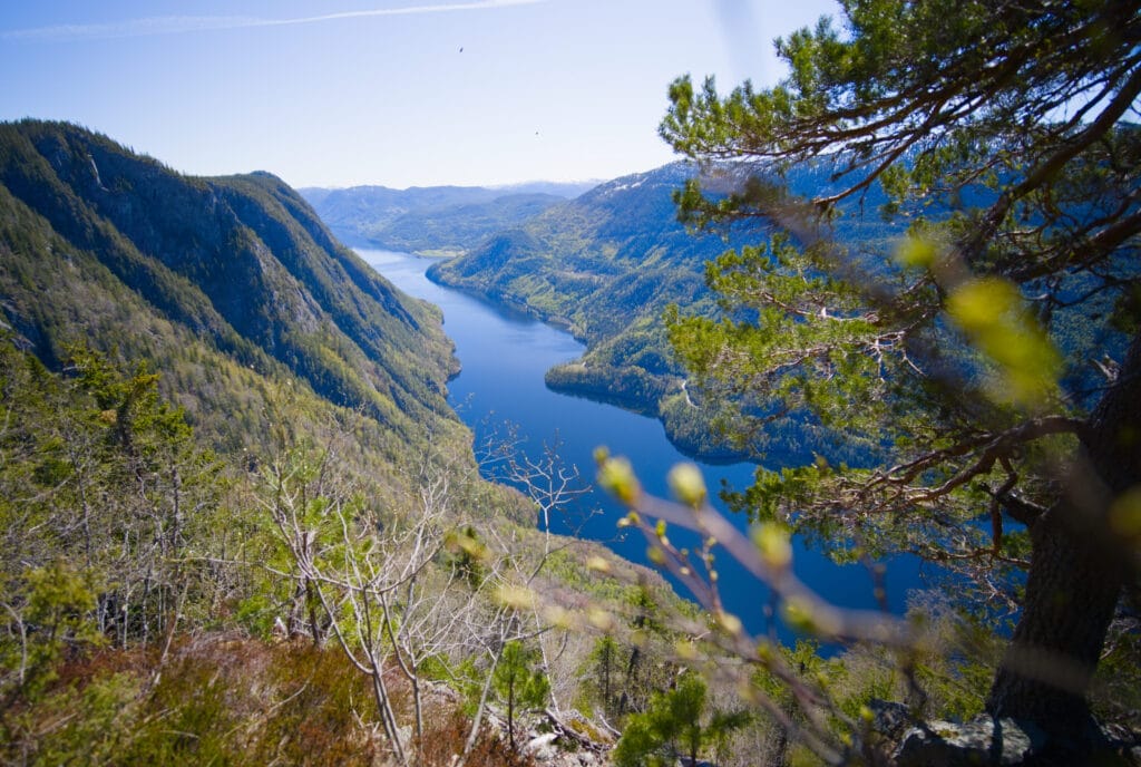
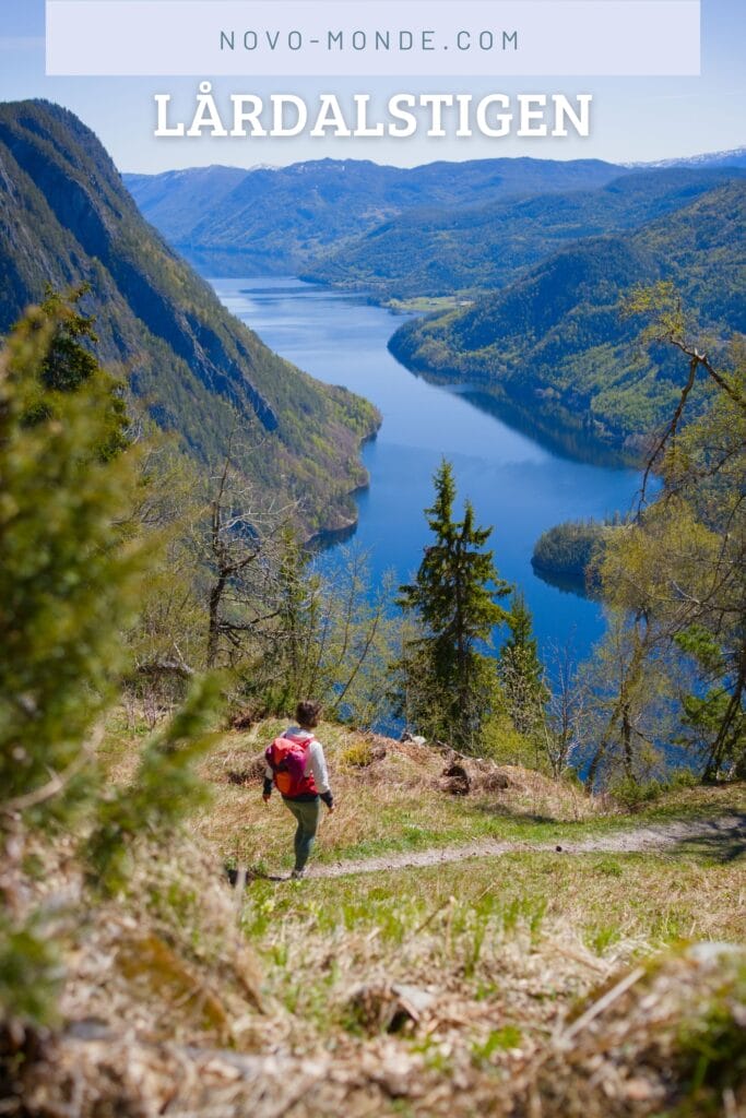
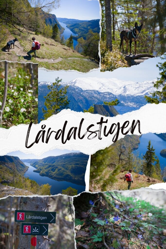
The Lårdalstigen is a spectacular ridge hike connecting the villages of Dalen and Lårdal in the lesser known region of Telemark in Norway. The route follows the impressive ridge that rises 700–800 meters above the Telemark Canal (or the lake Bandak here) for about 14 kilometers. It’s not an easy hike, but if you venture out there, you’ll be rewarded along the trail with incredible views of the lake below.
Since this is a point to point hike (i.e., from Dalen to Lårdal or vice versa), it requires a bit of planning if you want to do the whole thing. But as always, we’ll walk you through all your options, and then you can just pick the one you like best 🙂
As for us, we only did part of the full hike from the parking lot. Since we were in the area in early May, the boats between Lårdal and Dalen weren’t running yet (the season starts in mid-May). If we’d wanted to do the whole hike, the only option would have been to hitchhike or take a taxi back to the parking lot from Lårdal. But that’s not a big deal because just by doing the first 6–7 kms of the hike, we’d already reached some magnificent viewpoints.
Alright, let’s go for the Lårdalstigen!
Lårdalstigen: Practical Information and Logistics
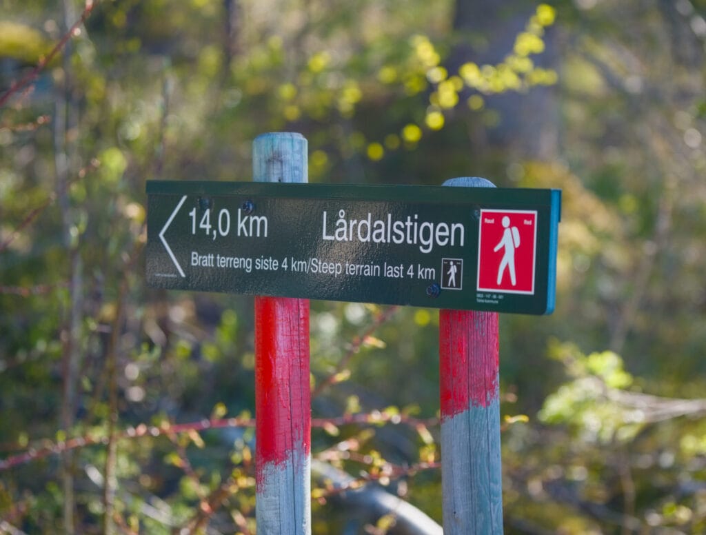
- Distance: 14.2 km (between the parking lot above Dalen and Lårdal)
- Elevation gain: approximately 800m up and 1,200m down from Dalen to Lårdal
- Duration: 5–8 hours (depending on your pace)
- Difficulty: fairly difficult, as the trail is a bit rough (roots and rocks everywhere), and it’s still a fairly long hike with a significant elevation gain
- Parking: Parking for 10–20 vehicles at the top of the winding road above Dalen (see map below). If you have a van, I’d say this is probably a good spot to sleep as well.
Map of the hike (+ GPX)
The different options available to you
- Hiking from Dalen to Lårdal: The plan is to park at the port in Dalen, take a taxi (or hitchhike) to the trailhead, hike the Lårdalstigen trail, and return by boat. You could also walk up to the trailhead, but that would make the hike even longer. It’s already quite a long hike and unfortunately, you’d have to follow the road.
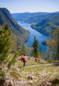
- Doing just part of the hike and returning to the parking lot: Logistically, this is the simplest and cheapest option (no need to pay for a taxi or boat). It’s not as cool as returning by boat, but if you make it to the highest point of the hike (Gløstøylnuten at 848m after about a 7-kilometer walk), you’ll have reached the most beautiful viewpoints on the trail.
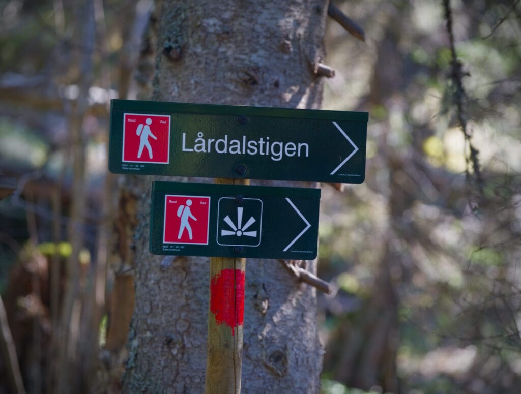
- Doing the loop hike (more for trail runners): To be honest, it’s not the smoothest trail ever, so it’s pretty tough to run the whole way. But if you’re used to this kind of effort, it’s doable as a day trip. If you choose this option, don’t head down to Lårdal; instead, take the trail that lets you complete a loop before the big descent (see map).
- Approaching from behind and reaching the ridge: We didn’t try these options, and to be honest, the idea only occurred to us after we did the hike, but it’s also possible to reach the ridge at various points by parking behind it (access via a trail or a road). We didn’t try these options, but I’ve marked them on the map in case you want to give them a try.
Boats between Lårdal and Dalen
Honestly, if we hadn’t arrived too early in the season, we might well have taken the boat, because sailing on the Telemark Canal in Norway is still a pretty unique experience (even if it’s a bit pricey).
There are only two historic boats that sail on the Telemark Canal (the MS Victoria and the MS Henrik Ibsen). So on Mondays, Wednesdays, Fridays, and Sundays, they depart from Skien bound for Dalen, and on other days they travel in the opposite direction. To return from Lårdal, there are only two boats in the late afternoon, and they run every other day. You can find the schedule here, and the price for an adult is 385 NOK (buy your tickets here) for a 40-minute trip.
Note: If you have a dog like we do, they are allowed on board, and you will need to purchase a ticket for your dog directly on the boat (online payment is not available).
Take a taxi
To take a taxi from Dalen to the trailhead, or to return from Lårdal if you’re visiting outside the boat season, you can contact Tokke Taxi (+47 909 71 909). In a comment on Alltrails, people mentioned a fare of 250 NOK to get to the parking lot at the trailhead.
The Telemark Canal
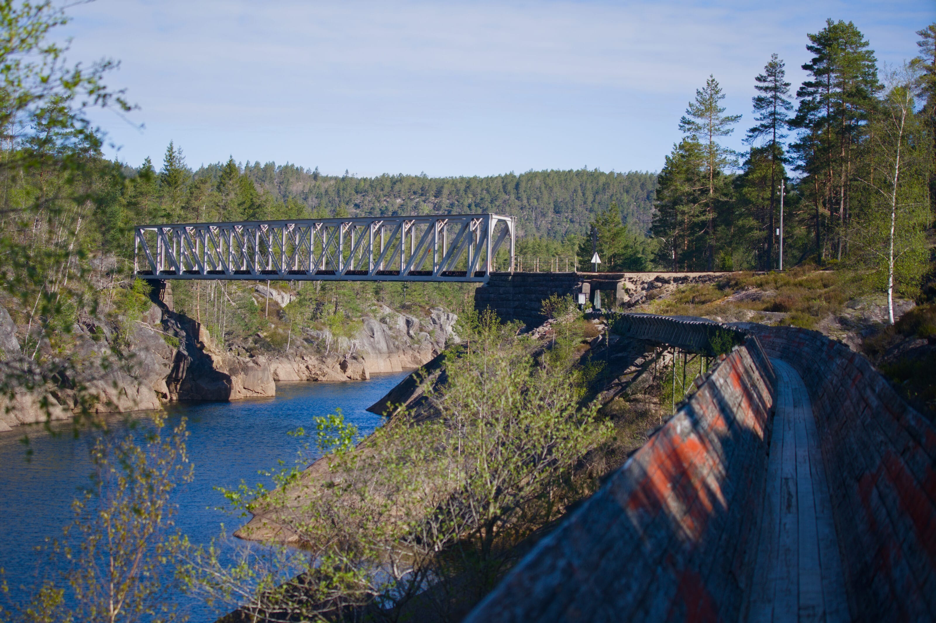
Before we tell you about our hiking experience, we thought it might be interesting to say a few words about what the Telemark Canal is. The Telemark Canal is actually a system of 18 locks connecting the various lakes between Dalen and Skien (over 105 km), allowing navigation from Dalen all the way to the North Sea. Back in the day, it was mainly used to transport goods and passengers.
The MS Victoria began operating on the canal in 1882 and is still in service today. It takes a full day to travel from Skien to Dalen.
Our experience on the Lårdalstigen
So we drove our van to the parking lot at the trailhead (which, in our opinion, is actually a great spot to spend the night). We found a very helpful information board there with details about the route, useful phone numbers, and so on. As usual in Norway, everything is very well organized, and in that respect, it feels just like being in Switzerland.
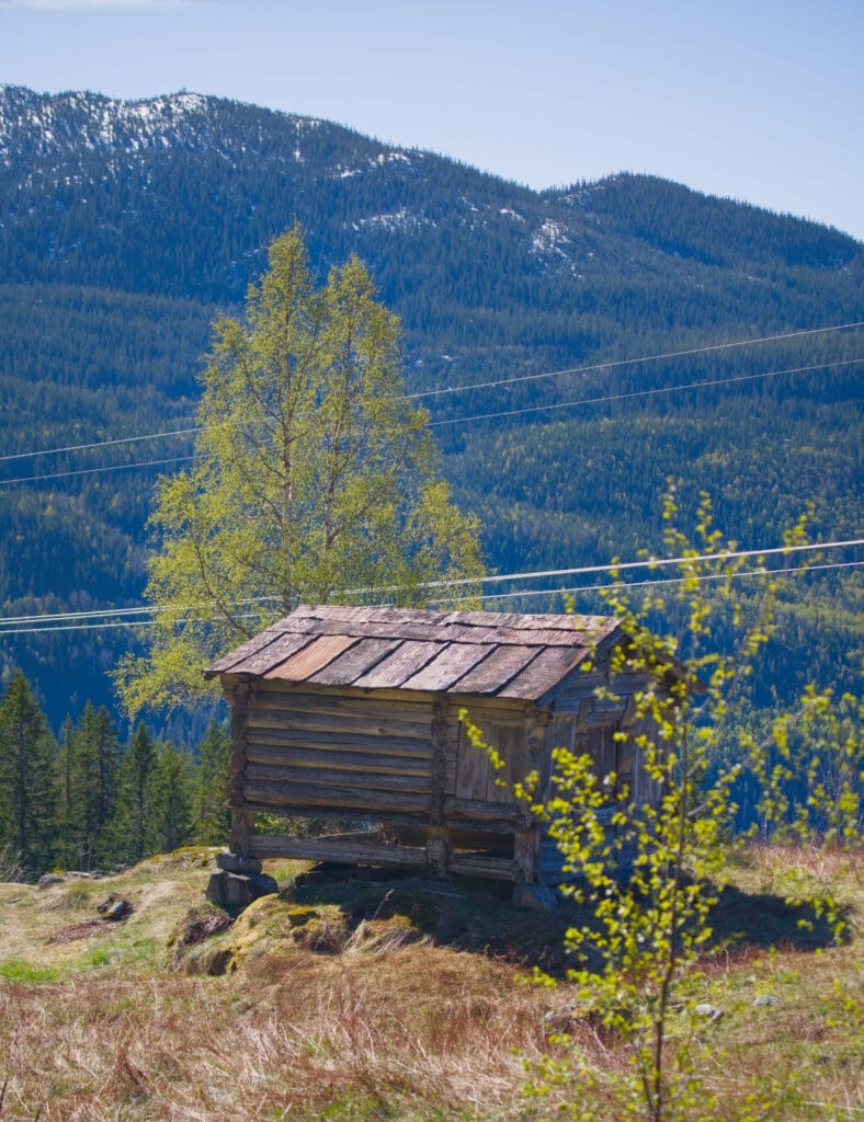
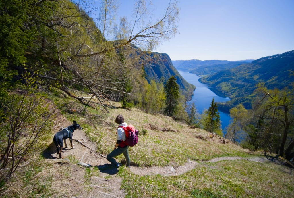
The hike begins gently on a lovely trail. A sign points the way and notes that the last 4 km of the hike are quite steep to hike down to Lårdal. After a few minutes’ walk, we arrive at a place called “Sud Rui,” where another sign explains that several generations of women lived there. Since the area faces south, they found fertile plots of land there that weren’t too steep for farming.
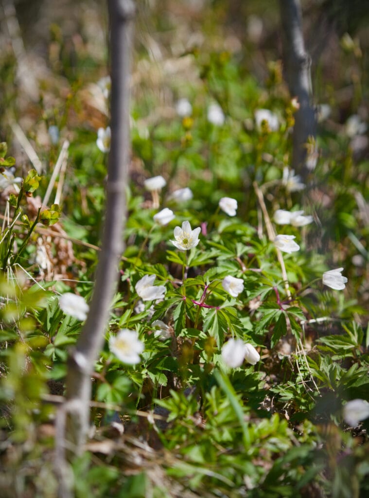
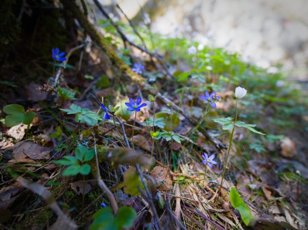
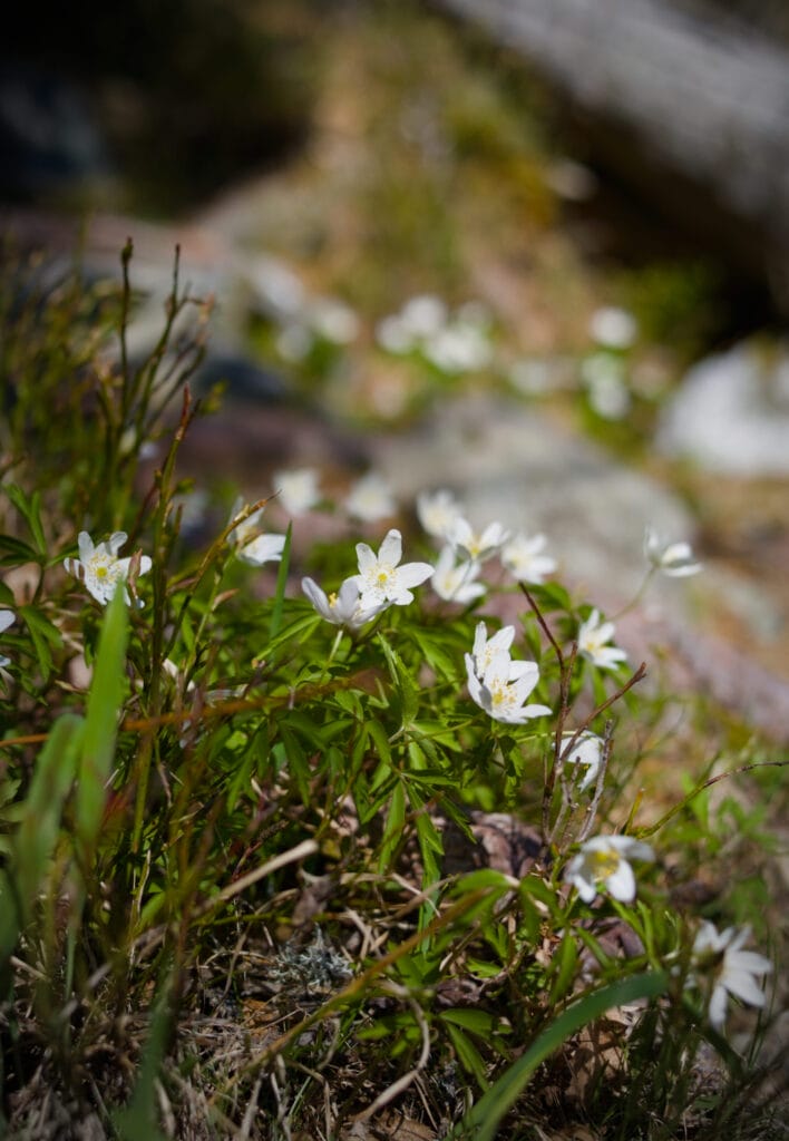
Then the trail starts to get a lot steeper 🙂 . There are lots of roots and rocks, so you need to watch your step a bit (but it’s not technically difficult, you just need to pay attention where you put your feet). Spring is in full swing, and the ground is covered with beautiful white and purple flowers.
Except for right at the start of the hike, where we crossed a river, we didn’t see many other places along the way to refill our water bottles. So be sure to bring enough to drink with you if you plan to hike the entire ridge.
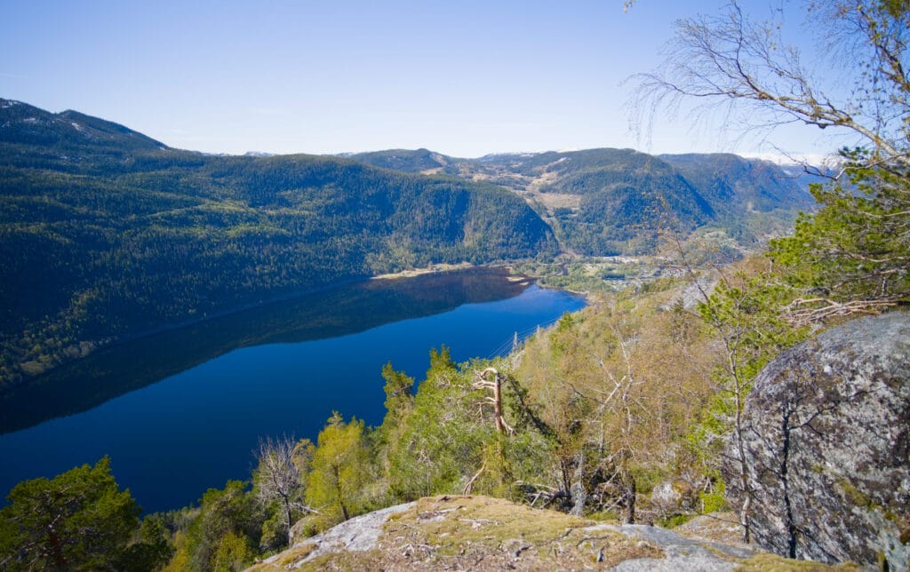
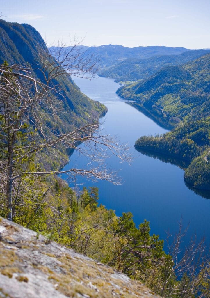
We then pass through a place called “Urdalen” where another sign explains that, driven by the region’s growing population, as many as 13 people once lived and farmed these sloping fields. It is also from here that the view occasionally clears, offering splendid panoramas of Lake Bandak below.
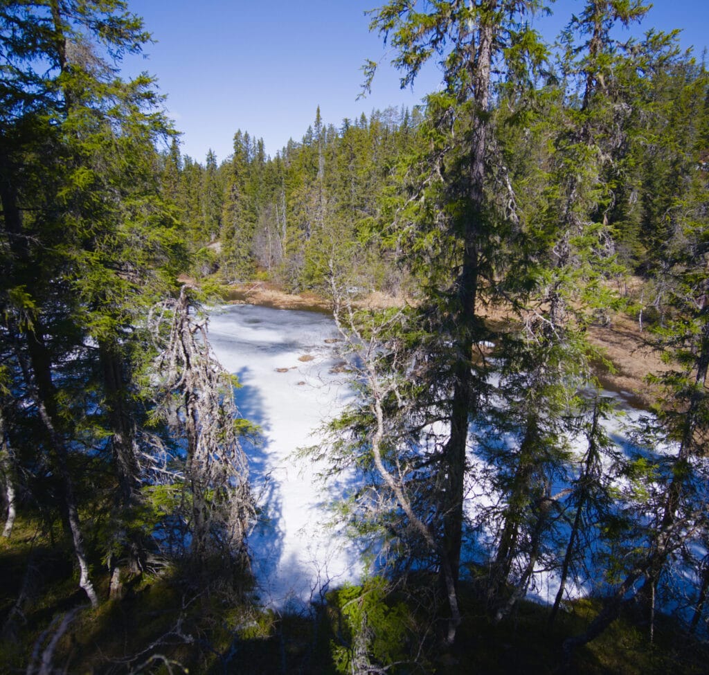
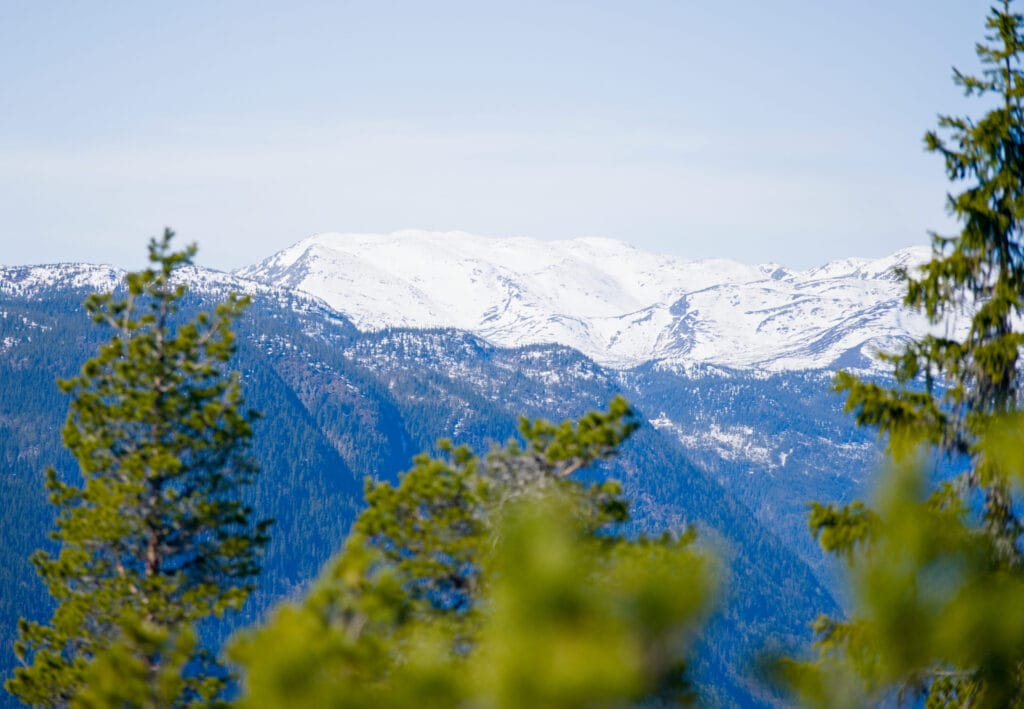
We continue climbing through the forest, passing by a pond that’s still frozen (at an elevation of less than 700 meters). There are even a couple of patches of snow here and there to remind us that it’s really only early spring. In the distance, we can see higher peaks that are still well covered in snow… I’m not sure we’ll be able to do all the hikes we’ve planned a little further north, even if we’re traveling for two months 🙂
On the trail, we keep coming across piles of little droppings that, upon closer inspection, turn out to be moose droppings. On the one hand, I was really hoping to spot one so I could capture the moment, but you have to remember that the animal can be more than 2 meters tall and weigh over 700 kg… I don’t know if I’d be so courageous if one of those guys were standing right in the middle of the path, lol.

The trail then passes by a crevice that you can climb down into (it’s noted that you need to be an expert to do this, but it’s not really that hard) to rejoin the path on the other side. We then continue the hike until we reach another spectacular viewpoint, where we decide to have a scenic picnic. Here are some photos for you to enjoy:
In the end, we decided to turn back at that point, after hiking about 4 km. We could have continued a bit further to the highest peak on the ridge (Gløstøylnuten at 848 m), but we preferred to head back after enjoying the view from there (also because we had another hike planned for the same day, which I’ll tell you about soon).

But if you want to read about someone’s experience hiking the entire ridge, you can check this blog post that’s very well written and illustrated.
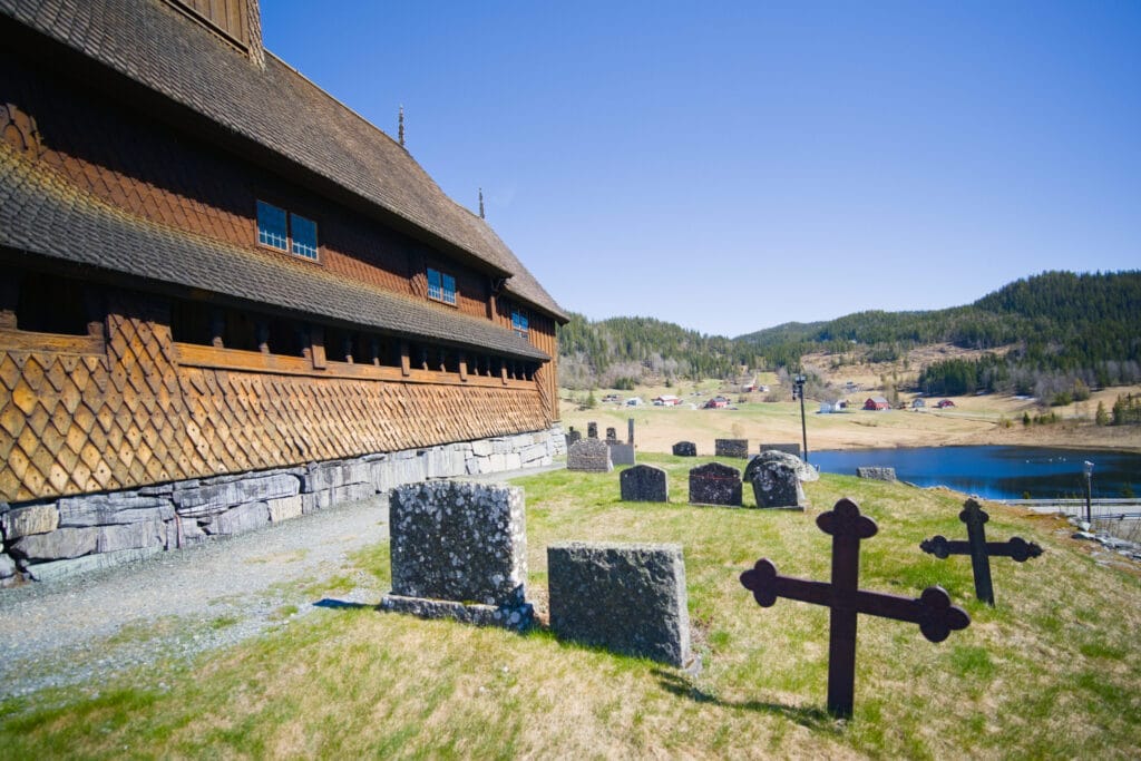
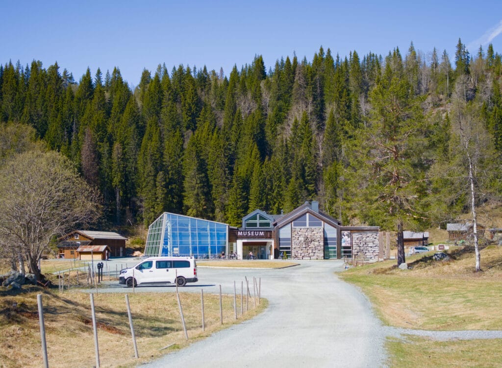
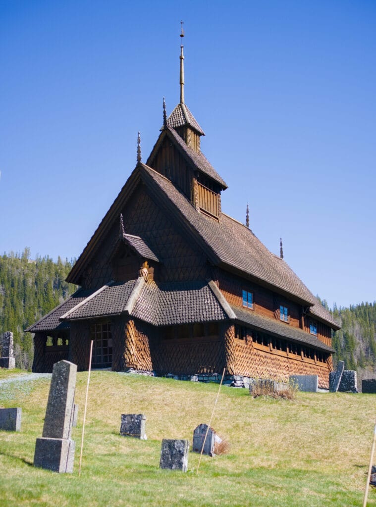
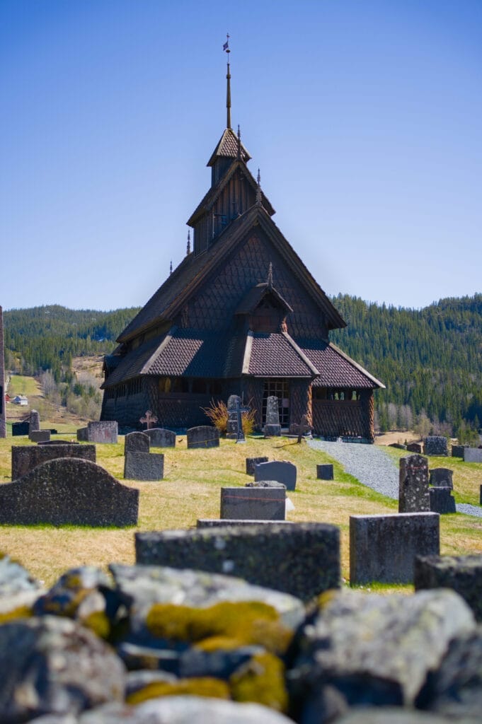
The Eidsborg Stave Church and the West Telemark Museum
Just a 5-minute drive from the hiking trail parking lot is the Eidsborg Stave Church (dating back to the 12th century) and the West Telemark Museum, located just next to it. For our part, we didn’t feel like spending a beautiful day inside a museum, even though it looked very interesting. We simply admired the church and explored some of the world’s oldest wooden buildings, which are located right next to the museum.
Pin it ont Pinterest

Join the discussion