In the last article we left you in the beautiful region of Riaño (where we also hiked up to Pico Gilbo) and today we continue our road trip in Castilla y León and more particularly in the northwest of the region. At the very beginning of our road trip we had gone down along the Catalan coast and had passed by the Ebro delta… And so, nice coincidence, 5 months later, we are here, so to speak, at the source of the Ebro. Here is a small overview of what to see and do in the north east of Castilla y León!
This article contains affiliate links to partner sites. By using our links you do not pay anything extra, but we will get a small commission. The affiliate links help us to offer you free, independent and ad-free content.
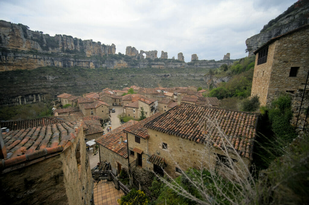
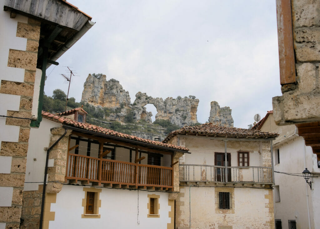
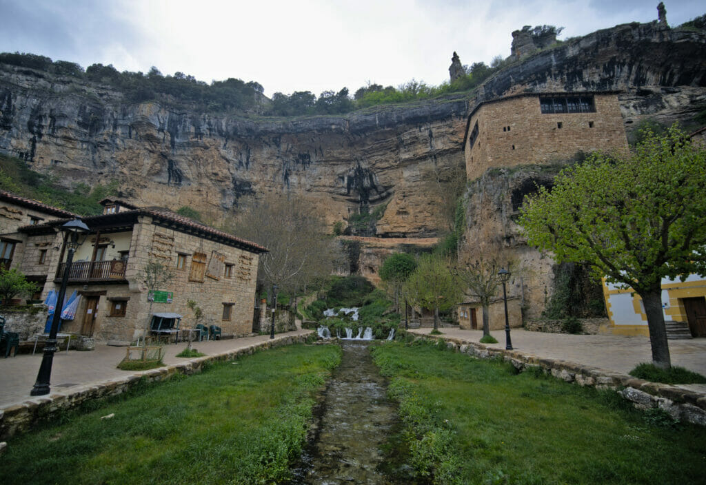
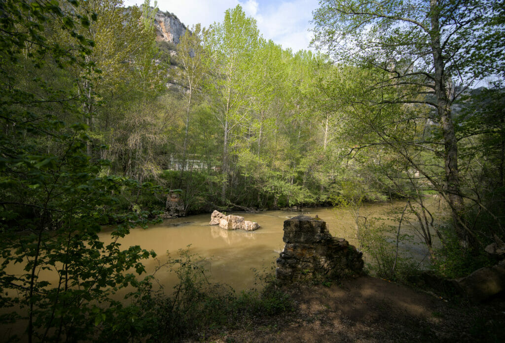
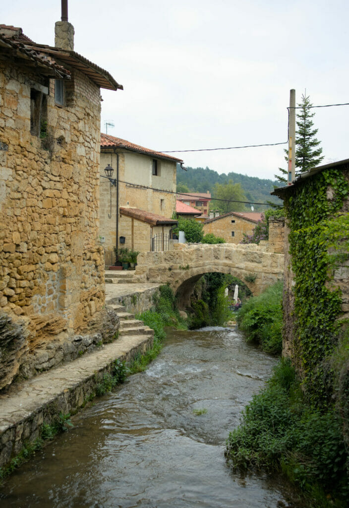
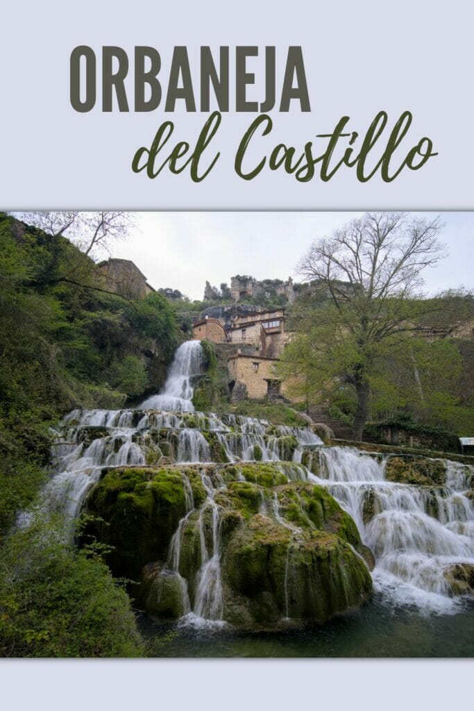
The village of Orbaneja del Castillo
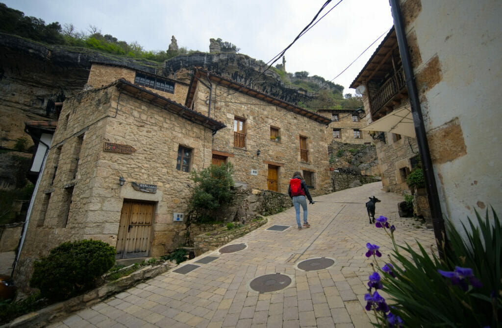
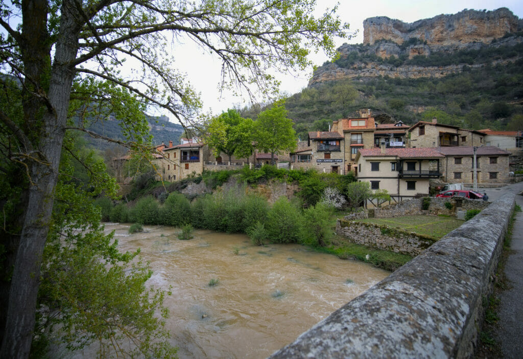
On our way from Riaño to Valdelateja we decided to stop at the village of Orbaneja del Castillo on the banks of the Ebro. This small village of only 47 inhabitants is often cited as the most beautiful in the province of Burgos.
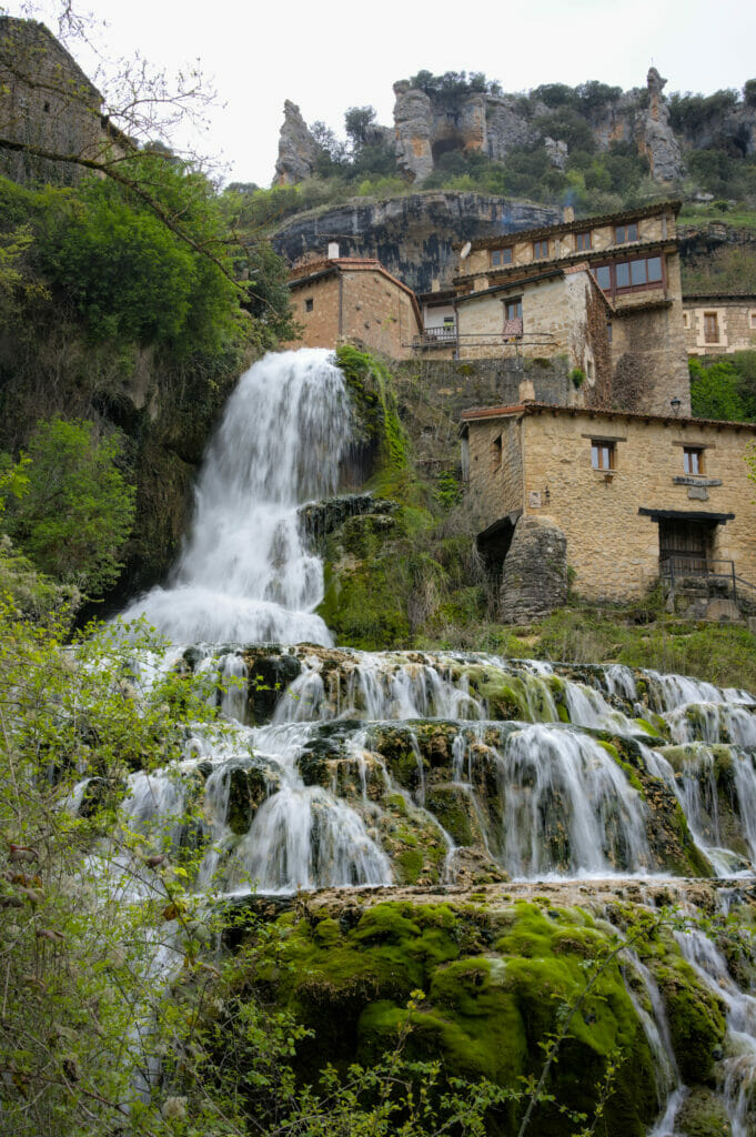
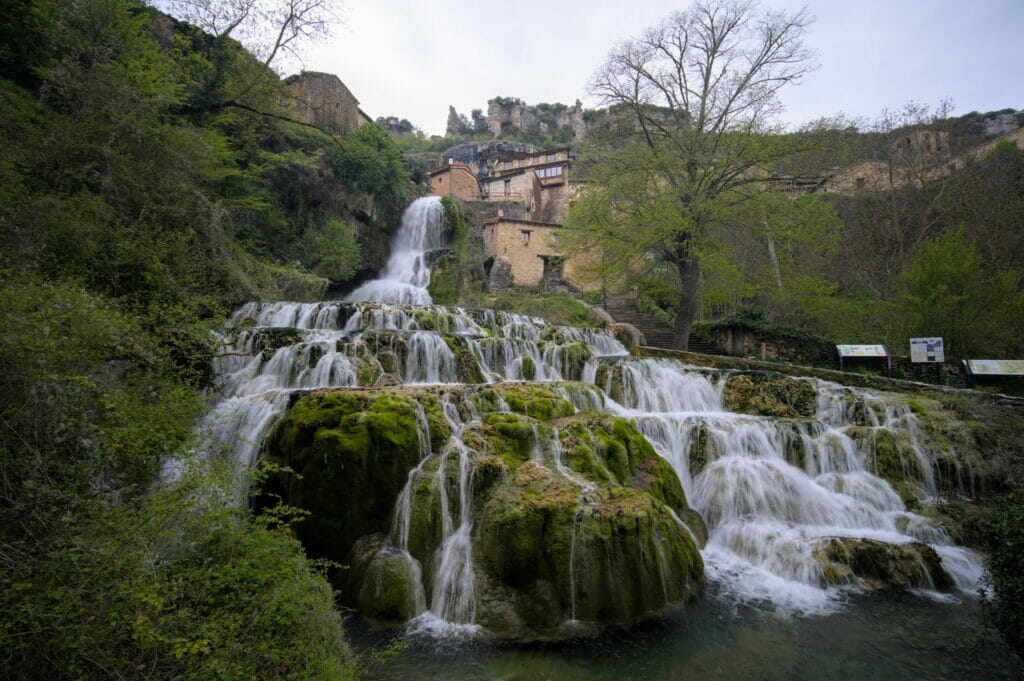
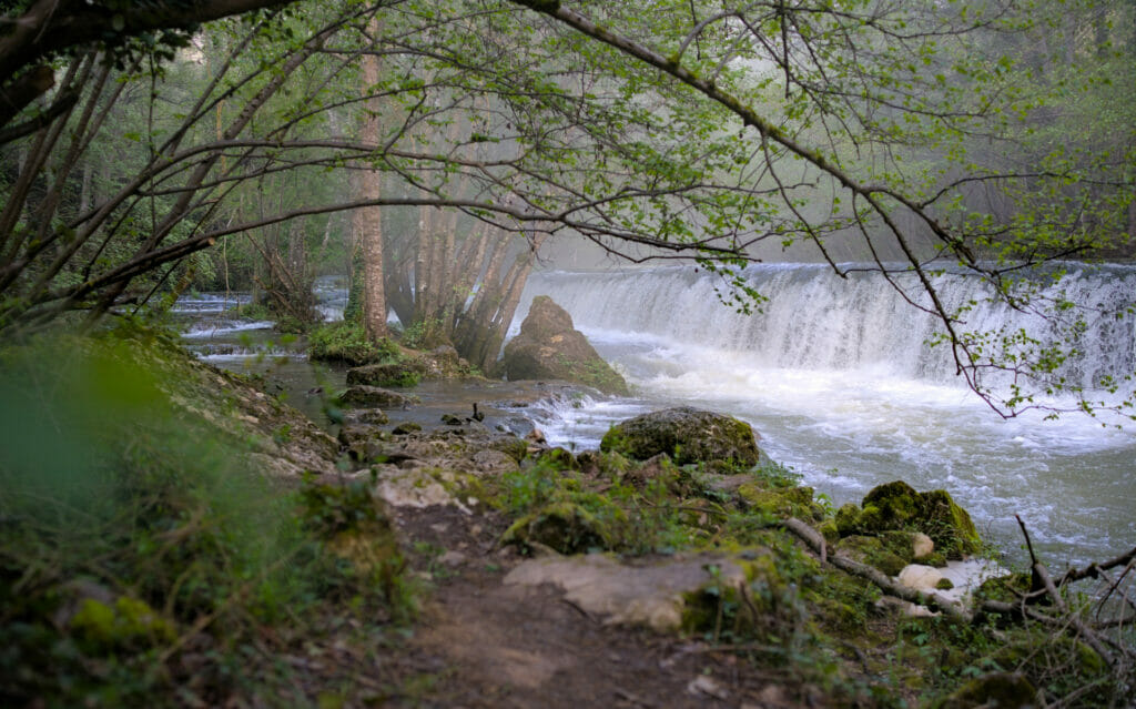
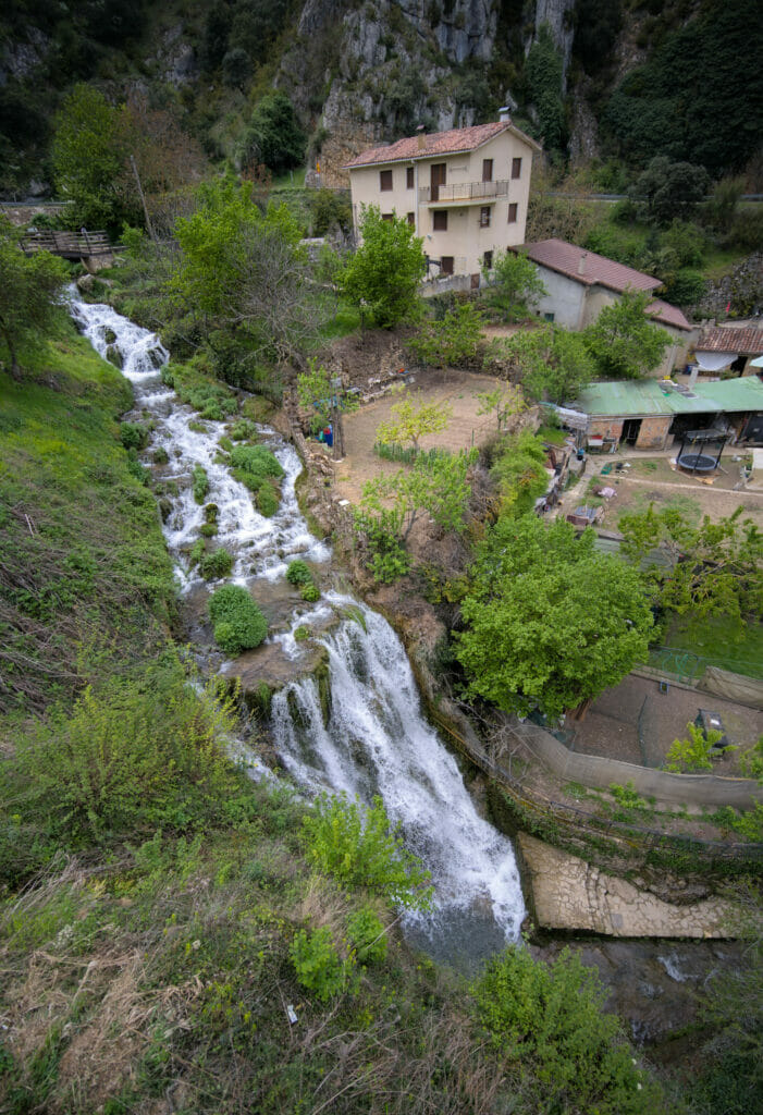
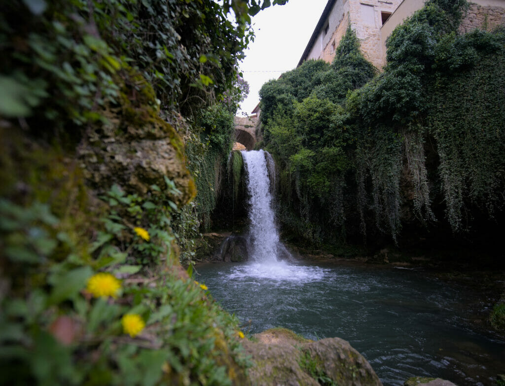
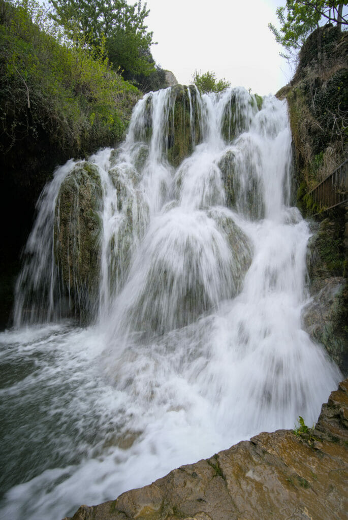
A waterfall in the middle of the village
Not being far away, we obviously couldn’t resist going there to have a look! To get there, we followed the BU-643 that connects Ruerrero to Escalada. As soon as we arrived in the village, we quickly understood that the place seemed to be quite popular. Many parking places are available along the main road and you can easily guess that given the number of parking spaces it’s not only meant for the 50 or so inhabitants 😉 Without even having arrived until the village we parked on the first available spot and we decided to continue on foot.
And phew… the least we can say is that the view on the village from the main road is already worth it! It is absolutely crazy! A huge waterfall seems to come out from under the houses.
We were there in spring (period of the year with, a priori, the strongest water flow) and we will admit to have been completely blown away by this view. It is not every day that we are in front of such a wonder.
Of course, we were not going to just stay on the main road and observe the village from below 😉 So we went for a walk in the lovely streets of the village. Water is omnipresent and there are small canals and streams at almost every corner.
Visit Orbaneja del Castillo
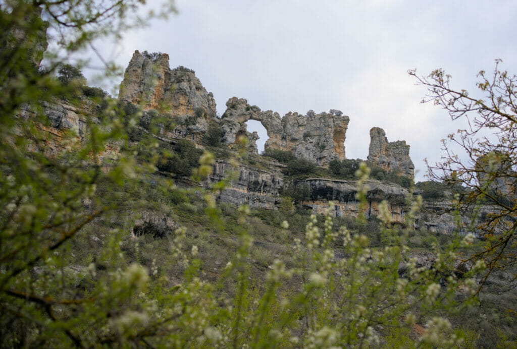
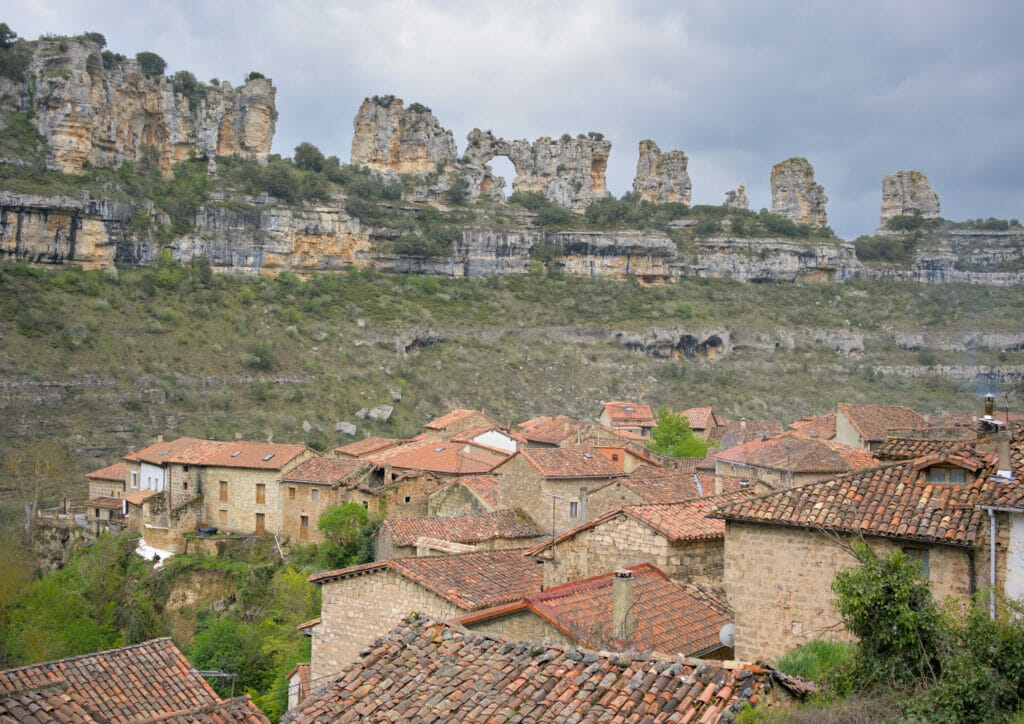
If we can give you one piece of advice, then it would be to go up to the top of the village to enjoy the view of the rooftops with the backdrop of the kharstic mountains that are on the other side of the valley. These rocks are called “Risco los camellos”.
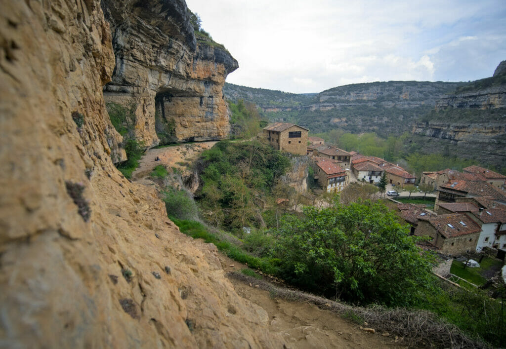
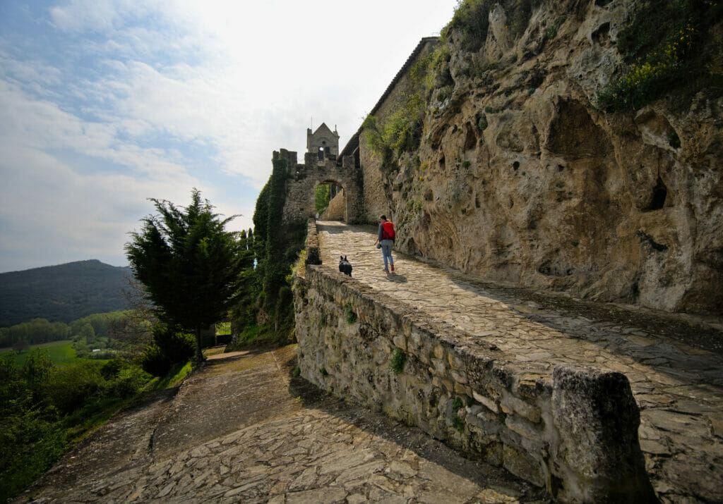
Note that it is also possible to go for a walk on the cliff which directly overhangs the village (the path is quite wide and easily accessible, you just have to be careful not to get too close to the edge because the path is not secured).
You will see it, the village is relatively small and the tour is rather intuitive. We give you anyway a small map of the tour that we did on foot.
Frankly, if you come in the area we highly recommend you to visit this village! However, try to avoid the weekends and prefer the mornings in order not to have too many people on the spot.
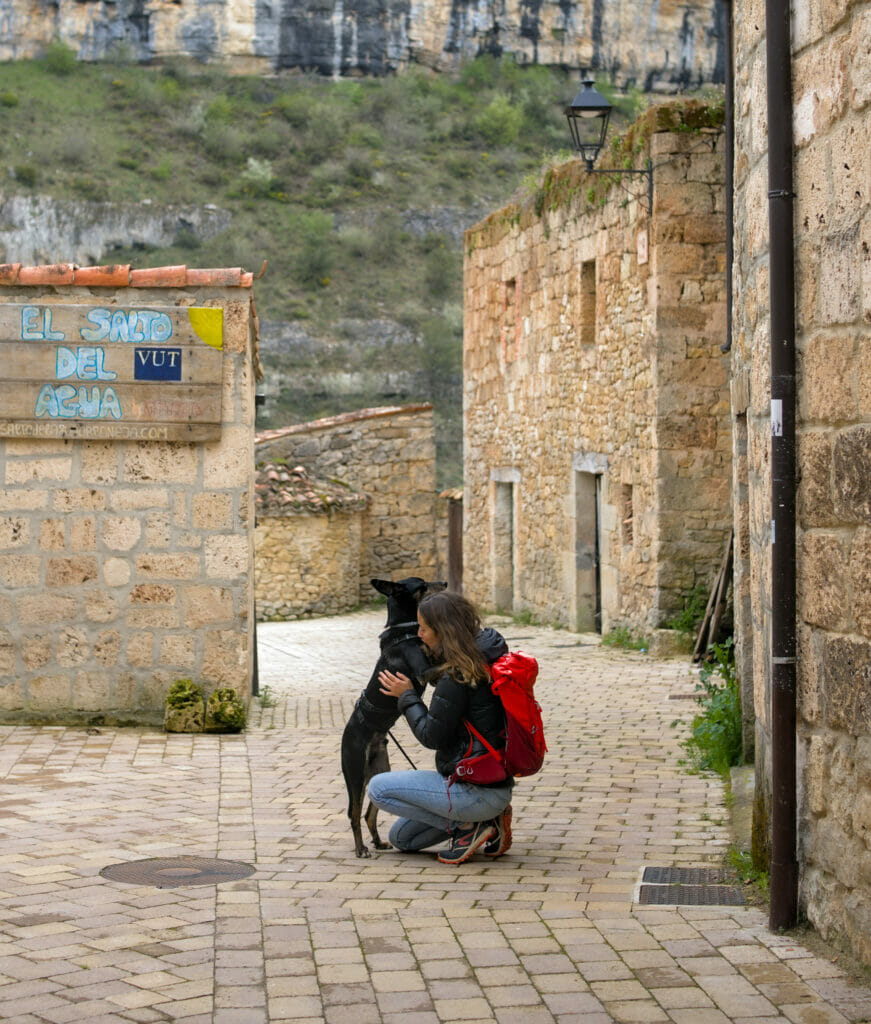
At the time of our visit there were not many people, but at a moment the center of the village filled up suddenly… Winchy not being a fan of crowd movements we quickly decided to move away a bit (you will notice on the picture below that he needs cuddles when he feels a little stressed out) 😉
Oh, and if you’re in a more athletic mood, there’s a 16km route that looks pretty cool! Here is the Wikiloc track that we had saved. We briefly hesitated to take the plunge, but we had already walked quite a bit that day and then wanted to continue our journey towards Valdelateja to spend the night. Next time as we say! But if you do the hike, feel free to tell us how it was in comments!
The village is very charming and is probably a very nice place to base yourself to explore the surroundings. There are not many accommodations on site (there are 3 of them) 😉 But if you are interested, you can see the available accommodations on Booking.
Valdelateja: small hamlet on the banks of the Ebro
Only 20 minutes away from Orbaneja del Castillo is another small village that is worth a visit: Valdelateja. Well… I say village, but I think it should be called a hamlet. The population? 17 inhabitants according to the last census. After that, the village itself must count something like 40 houses, but as it is unfortunately often the case in Spain, the vast majority of the buildings are unoccupied.
The peculiarity of Valdelateja, in addition to its beautiful stone houses, is that it is here that the river Rudron joins the Ebro and offers a gateway to the canyon for hiking enthusiasts.
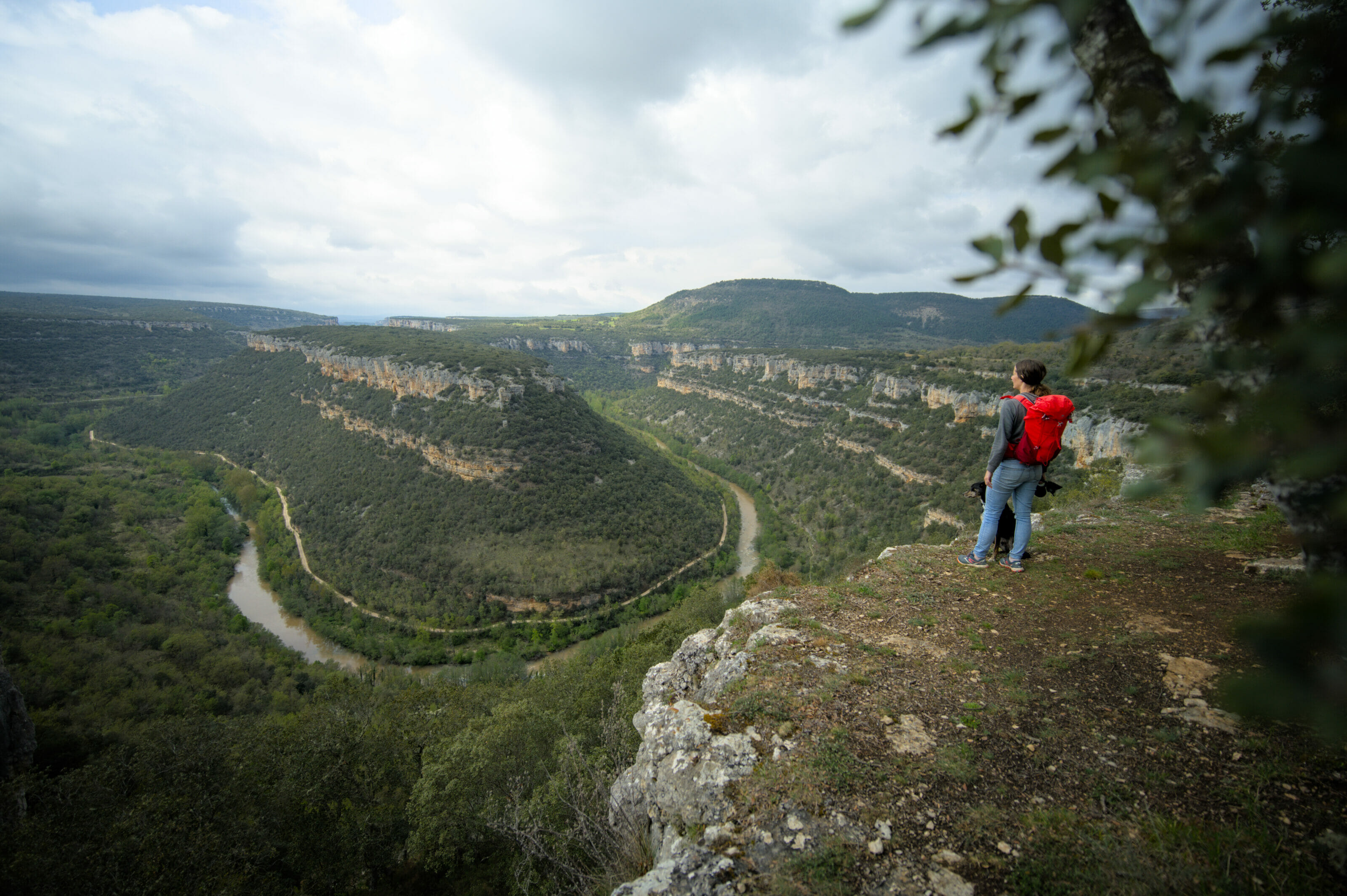
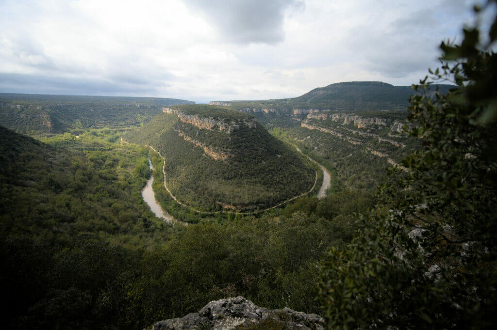
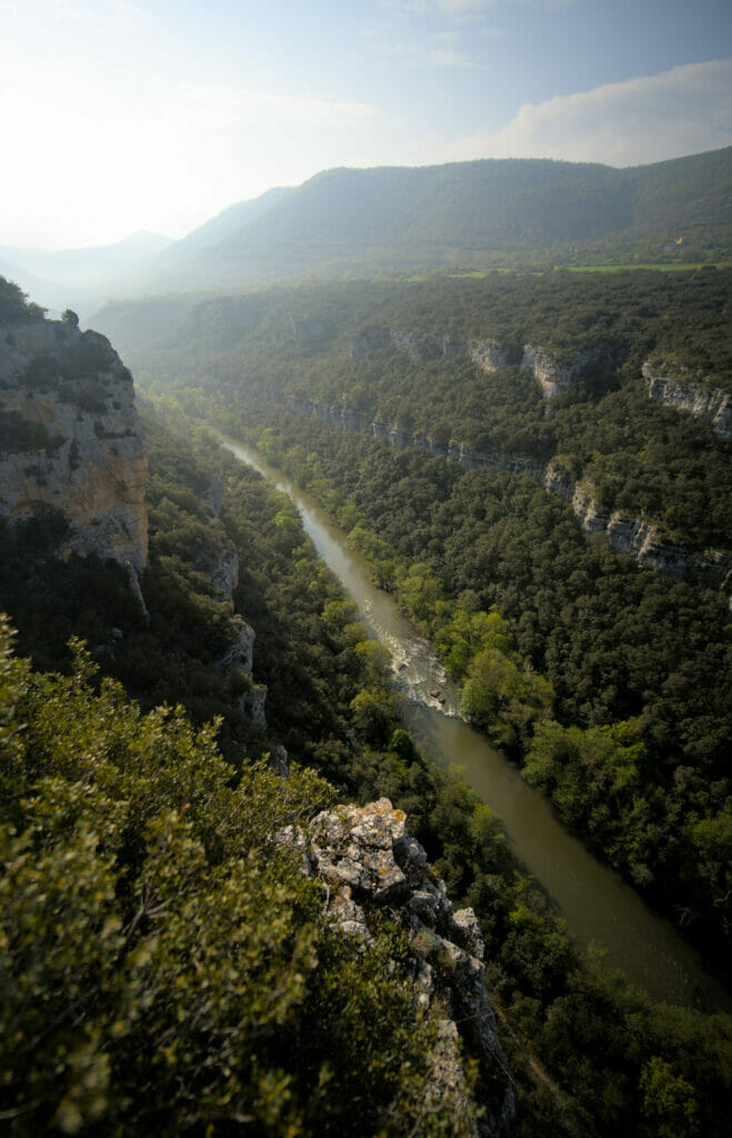
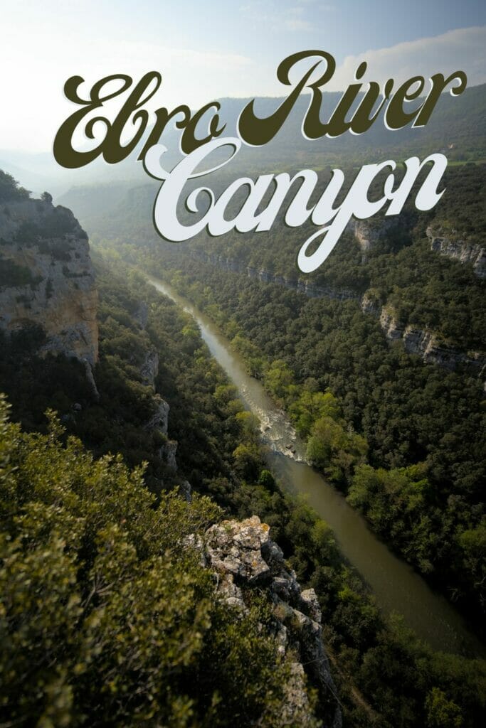
Our hike in the Ebro canyon
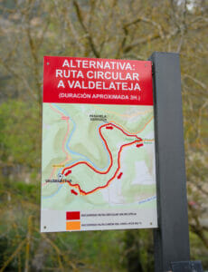
Well, that’s nice, but about going for a hike? Before coming to Valdelateja we had found two itineraries on Wikiloc, one of 10 km and the other of 18. Benoit was clearly in favor of the long version… while I… I had nothing against the shorter version! Anyway, we told ourselves that we would decide on the spot! In the end, an information panel made it easier for us: a bridge having collapsed, the long route was no longer accessible. They suggested an alternative route which was precisely the track we had found. BINGO, I was happy not to have to negotiate more haha.
Leaving the village, we decided to follow the itinerary in the counter-clockwise direction, that is to say to attack directly the serious things and to climb on the top of the canyon by following the path which goes up in yaw through the forest.
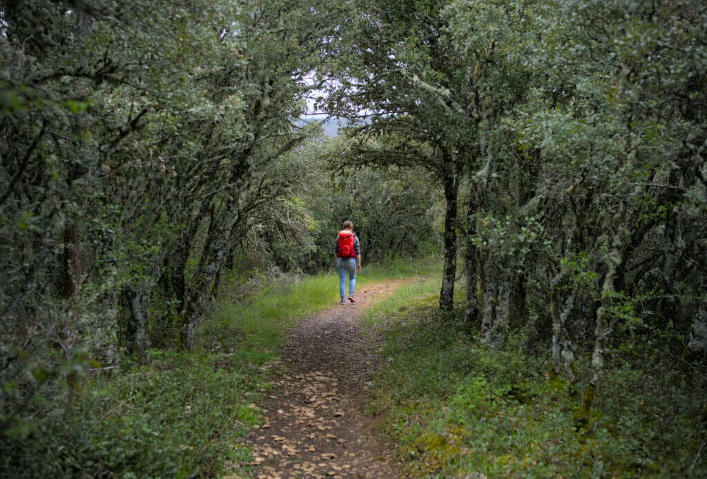
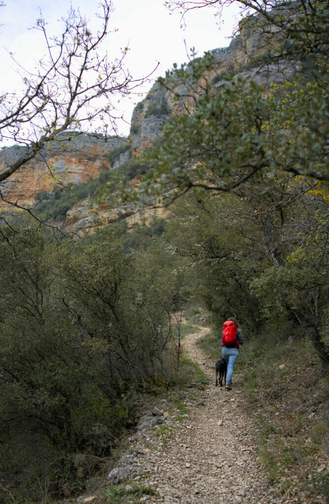
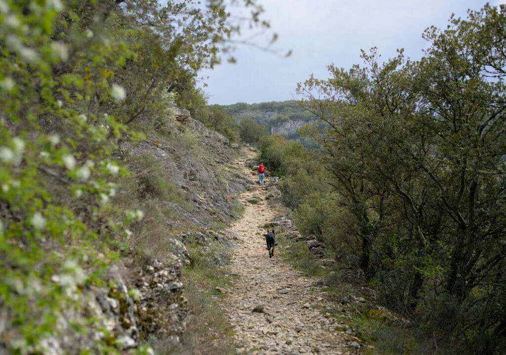
Once at the top, the path continues relatively flat following first a trail and then a track. At the beginning of the flat we don’t have any view yet but after a few hundred meters we arrive at a place where we can follow the edge of the canyon. Several viewpoints are indicated on the maps and of course we advise you to go there. But after that, the best thing is to trust your instinct, there are plenty of nice little spots that offer a magnificent view of the Ebro without necessarily being indicated as “mirador”.
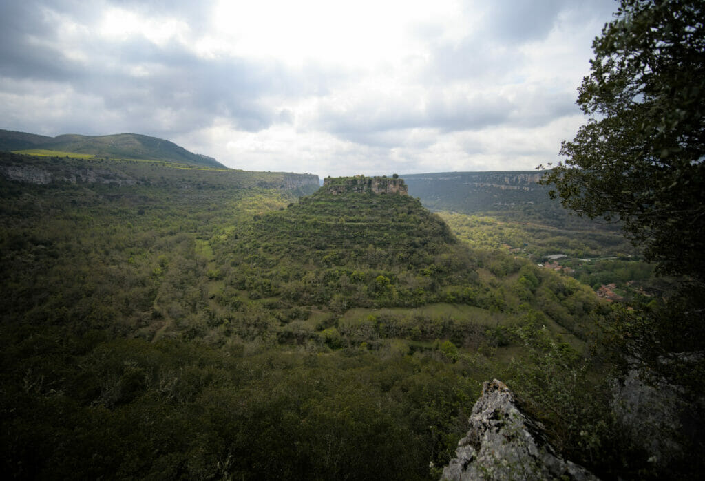

After about 2.5 km along this high plateau, the path turns left across the fields and then plunges towards the Ebro. The descent is very well marked, but still impressive. Relatively steep in some places, we thought that the hike would be easier the other way around (well… it depends if you want to go up or down steeply… Personally, I prefer to go up steeply and save my knees on winding paths on the way down).
We join the edges of the Ebro shortly before the collapsed bridge (I let you see the photo above). Seeing the bridge, we wonder what could have happened here… the whole structure seemed to be torn off! A flood? The simple obsolescence? We’ll probably never know, what is certain is that the bridge is well and truly impassable at the moment.
The last 5 kilometers the path goes along the Ebro, passing, for the most part, through the forest. We return to Valdelateja at the small church.
To finish the walk, we recommend you to go and take a look at the small waterfall that is located a few meters upstream of the Rio Rudron. To get there, go to the stone bridge in the village and follow the signs.
Map and information about the Valdelateja – Ebro Canyon hike
As mentioned above, we could not do the “full” hike because of a bridge collapse. It did not seem to us that there was any work going on, so we decided to put the two routes below. This way you can choose.
Note that if you have any doubts about the existence (or not) of the bridge, we recommend that you hike clockwise (so start by going along the Ebro), this way you will quickly arrive at the bridge and can decide on the route accordingly.
The red route (the one we followed)
- Distance: 9,3 km
- Elevation change: 327 m (+ and -)
- Difficulty: Medium (no particular difficulty but the path up and down the canyon is quite steep in places)
- Duration: Officially, 3 hours. It took us about 3h30 to do the loop (gentle pace with lots of pictures)
The yellow route (the official route)
- Please note that this route is not accessible until the bridge is rehabilitated. We don’t know when the work will be done. If you are in the area, please leave us a comment to give us news on the progress of the work.
- Distance: 18,1 km
- Elevation change: 470m (+ and -)
- Difficulty: High (not so much on the course, but the distance is quite substantial)
- Duration: Officially, 5 hours (it looks like a bit more if you want to enjoy the landscapes)
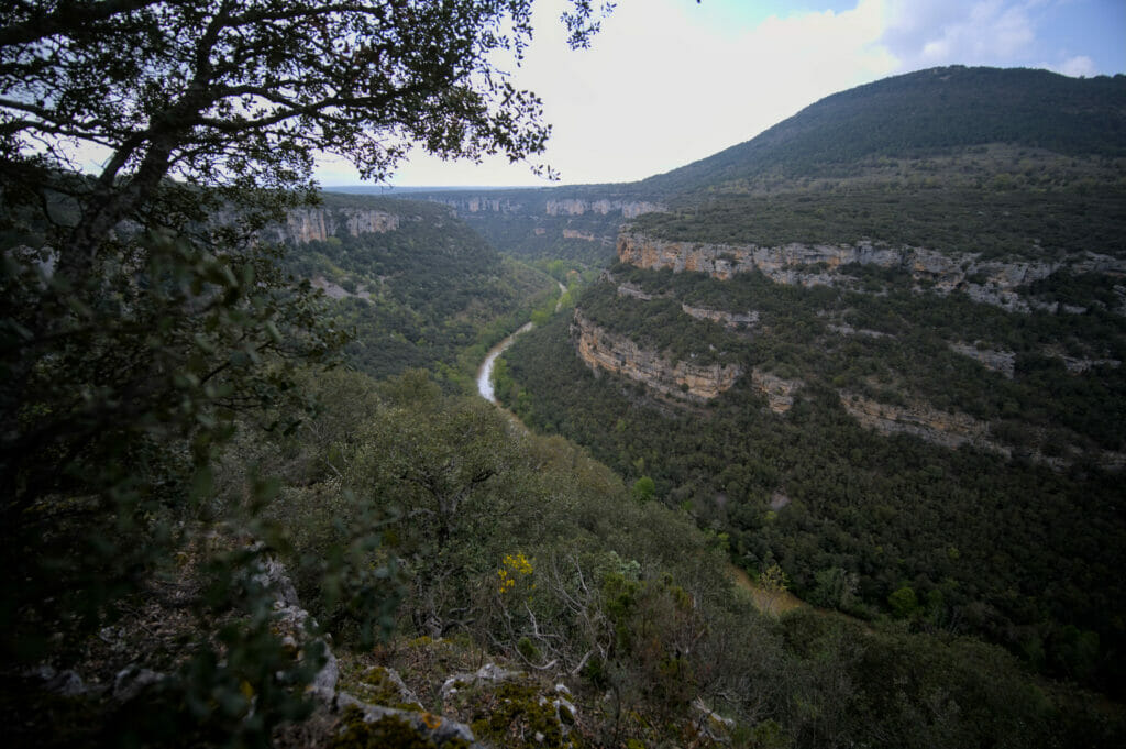
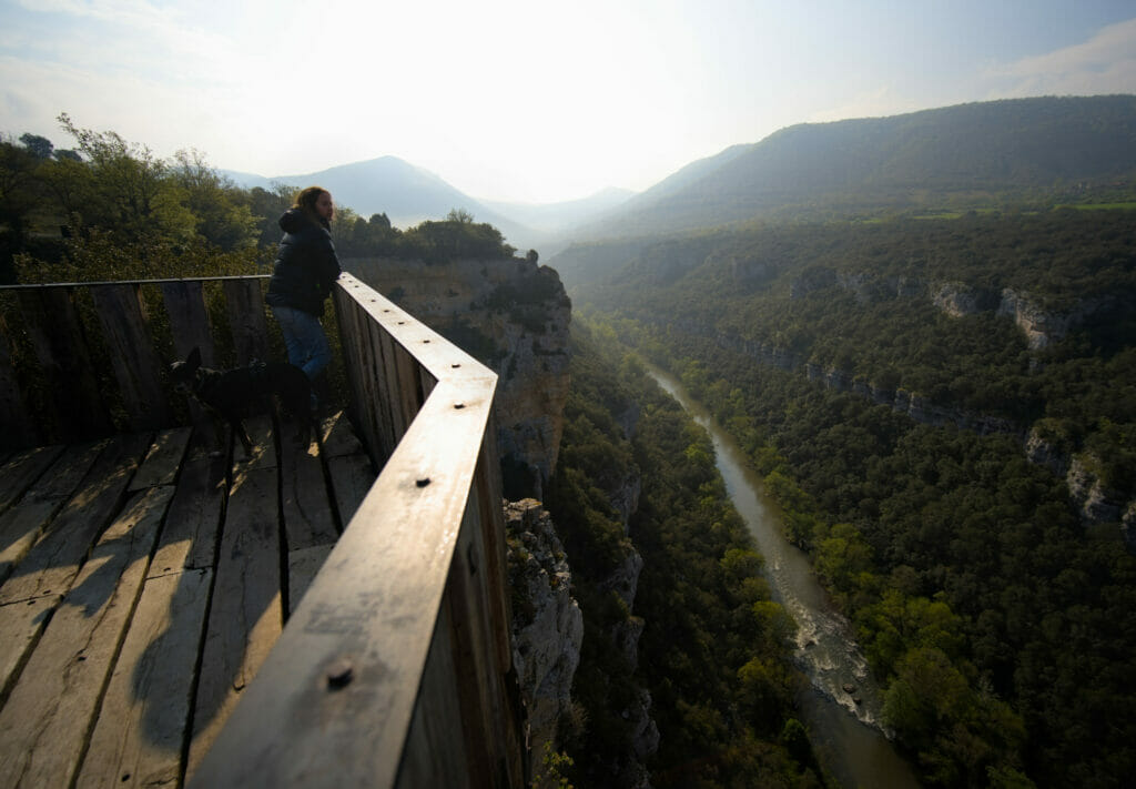
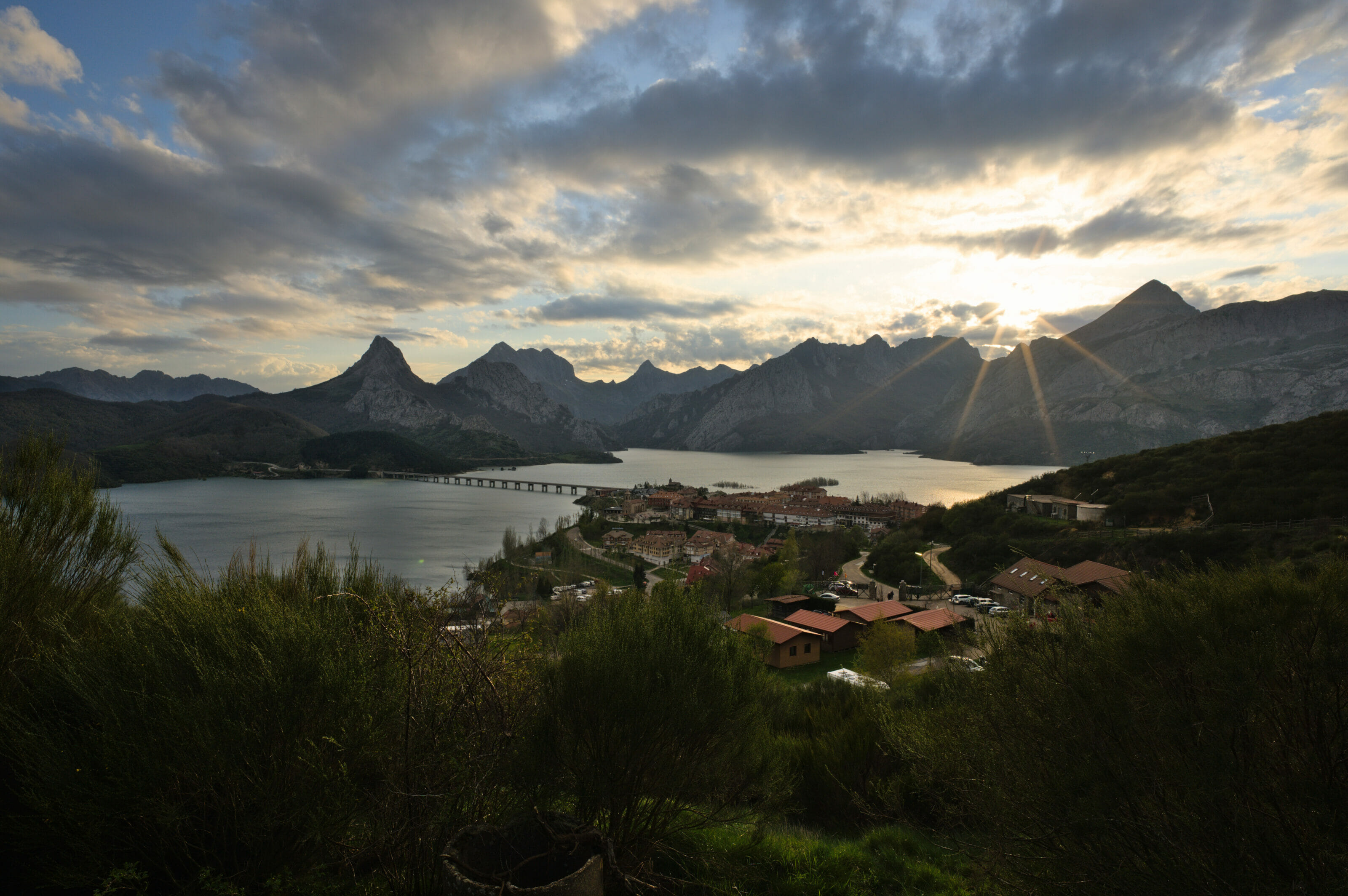
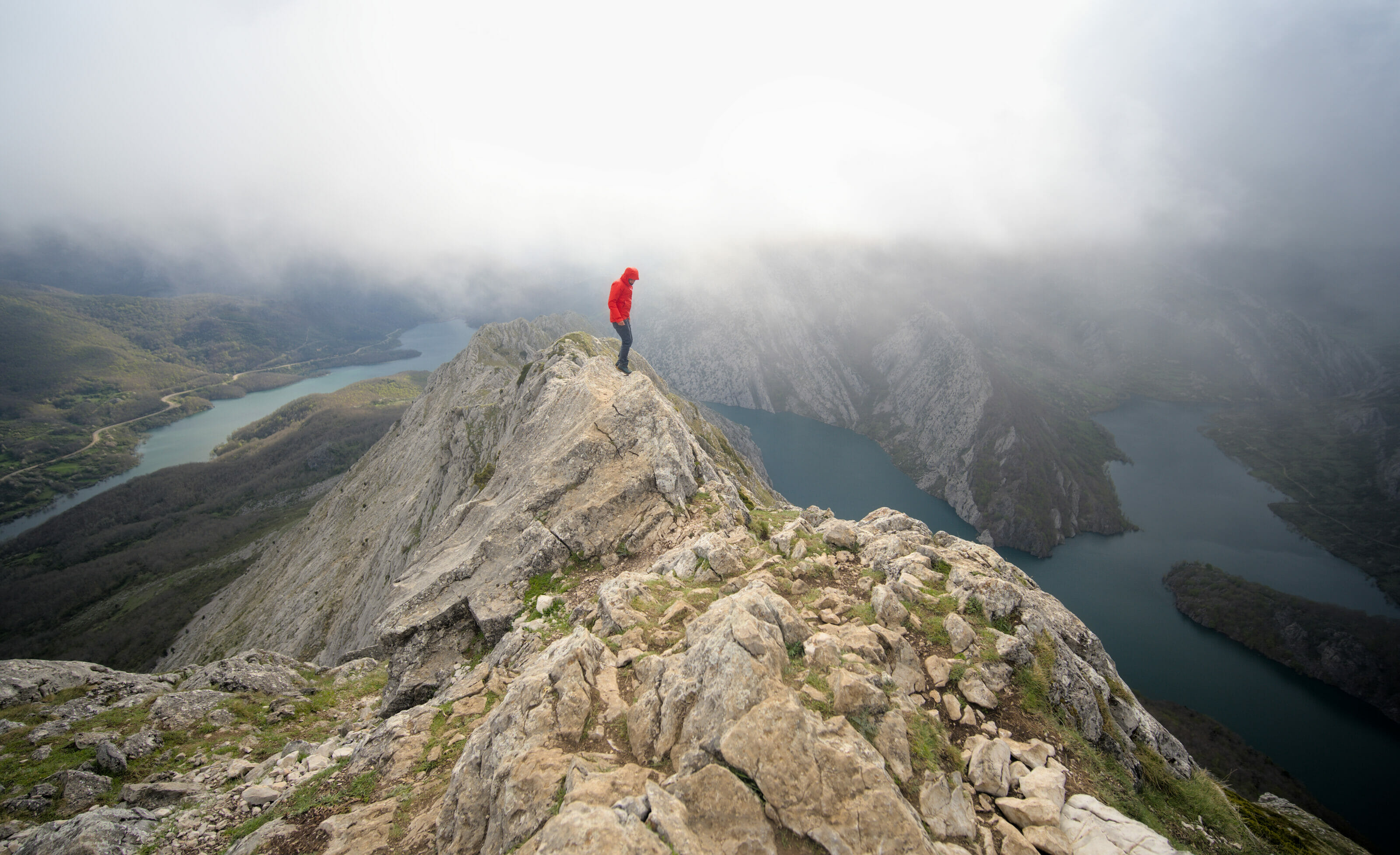
The Belvedere of the Ebro Canyon
After spending the night in the parking lot at the entrance to Valdelateja, we set off again in the direction of the small village of Frias. When choosing our route, we decided not to take the most direct route but to make a small detour to the Ebro Canyon viewpoint. The road BU-V-5143 (the name of the road) is actually more direct in terms of kilometers, but it adds 30 minutes of extra travel time. The reason for this? Well, simply the fact that the road along the canyon is not very wide and especially winding 😉
By taking this road, one enjoys almost continuously a breathtaking view of the Ebro. Afterwards, as mentioned above, the road is quite narrow and it is not easy to stop to take pictures. Anyway, for the pictures, we stopped at the official lookout (GPS coordinates: 42.792971, -3.731732). A small parking lot has been built above the road and from there you can follow a mini itinerary marked out towards different platforms.
At the time of our visit, we had the impression that the site had just been developed (the paths seemed all new and many trees seemed freshly planted). Coming in the middle of the week, the place was completely deserted and we were the only ones on the spot during nearly one hour of visit (in truth the site is not very big, a stop of 15 minutes is amply sufficient to make the tour, but let us say that we took our time for the photos) 😉
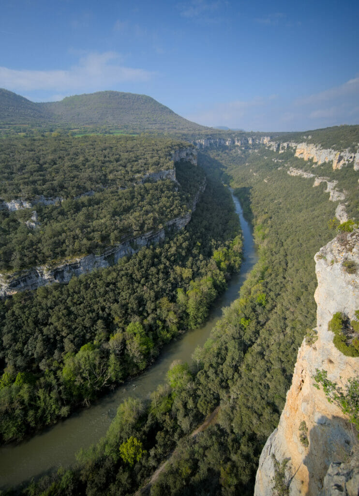
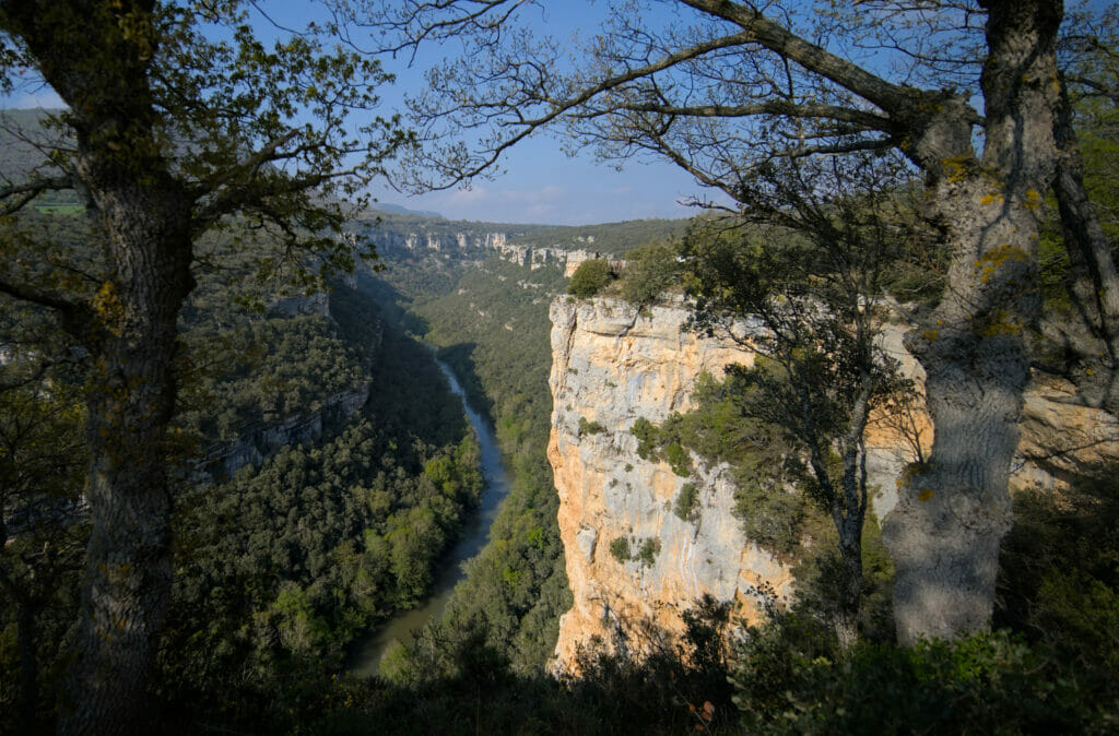
From a “viewpoint perspective” there is nothing to say, it is splendid (we let you judge). After, we will admit that we had nevertheless prefered the viewpoint of the day before (in front of the meander) but well, this mirador has the merit to be more easily accessible by car, therefore that would be a pity not to stop there.
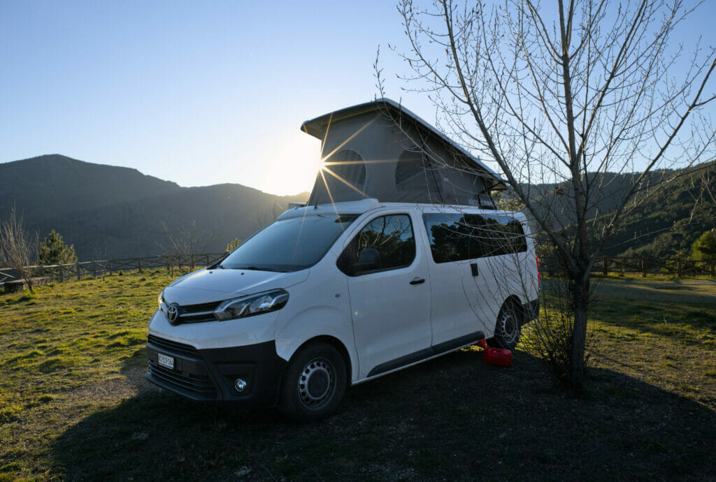
On this trip we were with our van “Dahu” and honestly, the van is just the perfect way to explore the region! If you want to rent a vehicle but you don’t know where to start, we suggest you to read our article dedicated to the van/cc rental.
If you already know what type of vehicle to go for and are wondering where to rent, we advise you, as usual, to take a look at Yescapa (for rental from private individual to private individual) or on BlackSheep Van (for rental by professionals)
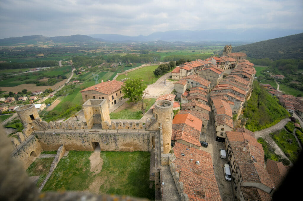
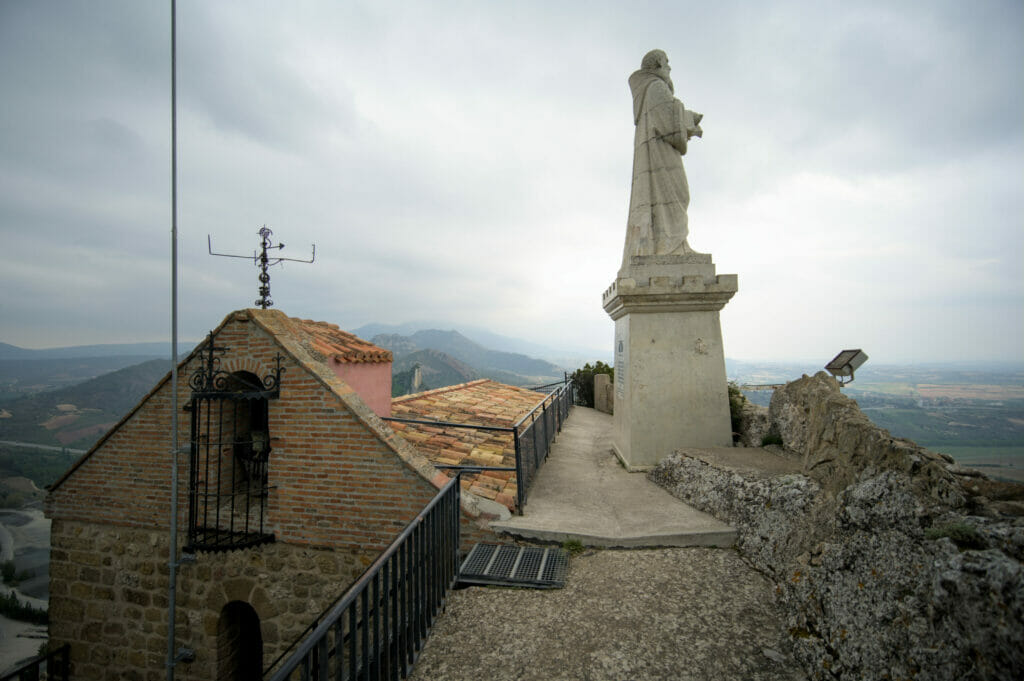
The village of Frias and its castle
We remain on the banks of the Ebro and this time we take you to the town of Frias. And note that I say town… The agoraphobes can rest assured that there are only 300 inhabitants in Frias, but the village was given the title of “town” during the 15th century by King Juan II of Castile (the truth behind this title is not particularly glorious because he gave this name in order to be able to exchange the little town for another with a count of the region).
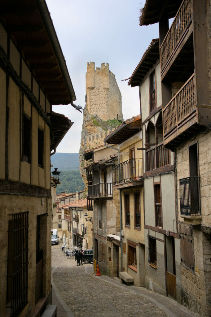
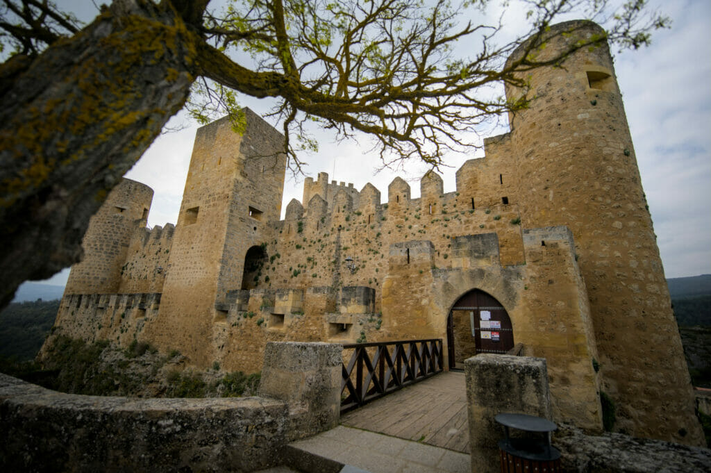
The castle of Frias
The town was founded on the top of a hill in the 10th century and has kept its old charm. When you arrive at the foot of the village, you will quickly notice the typical “casas colgadas”, meaning the houses hanging from the cliffs, and also the tower of the castle with its particular shape, which is perched above the houses.
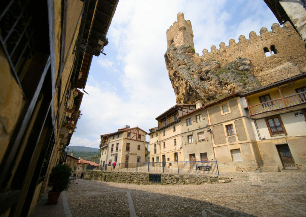
We strongly recommend you to visit the castle. More than the explanations, it is especially the view from the highest tower that is really worth it. The entrance costs 2€ and the ticket can be bought at the tourist office which is just next to the entrance (open every day from 10:30 am to 2 pm and from 4 pm to 8 pm).
Roman bridge of Frias – the medieval past on the Ebro river
Historically speaking, the village of Frias was founded here for purely strategic reasons. Already in Roman times, this place was used to cross the Ebro. A Roman road crossed the village and allowed merchants to bring goods from the Cantabrian coast to the Mestra (the high plateau in the center of the Iberian Peninsula).
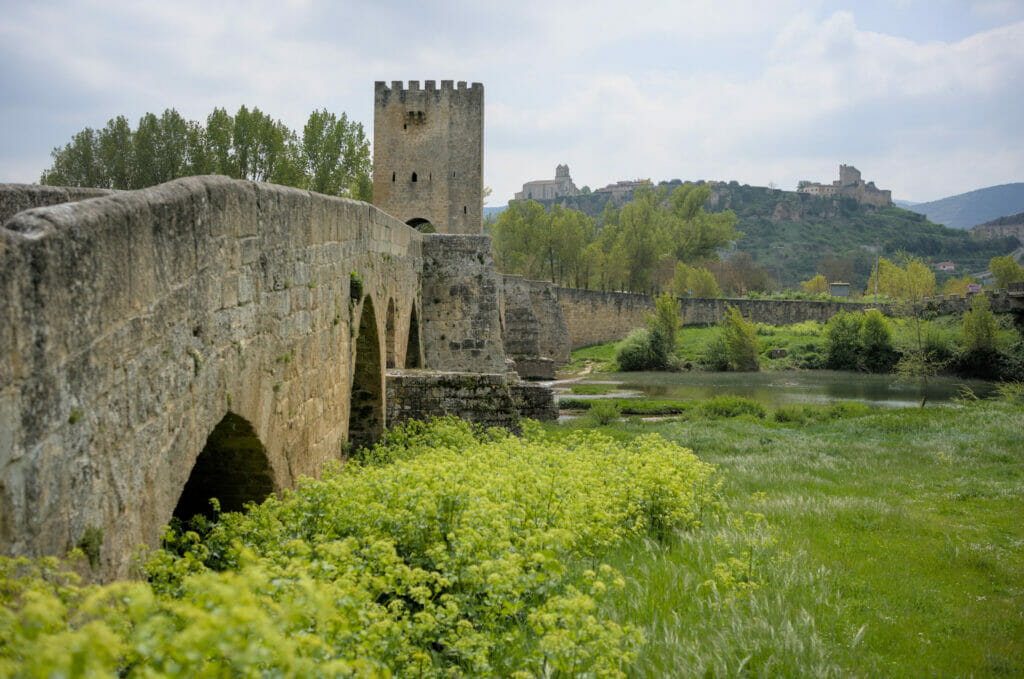
From that time there is still a bridge that you can admire (and cross on foot). Built in Roman times, it was however renovated several times during the Middle Ages. Located a good kilometer from the historic center, it is an opportunity to go for a little walk and observe the city “from below” and enjoy a little stroll along the Ebro River.
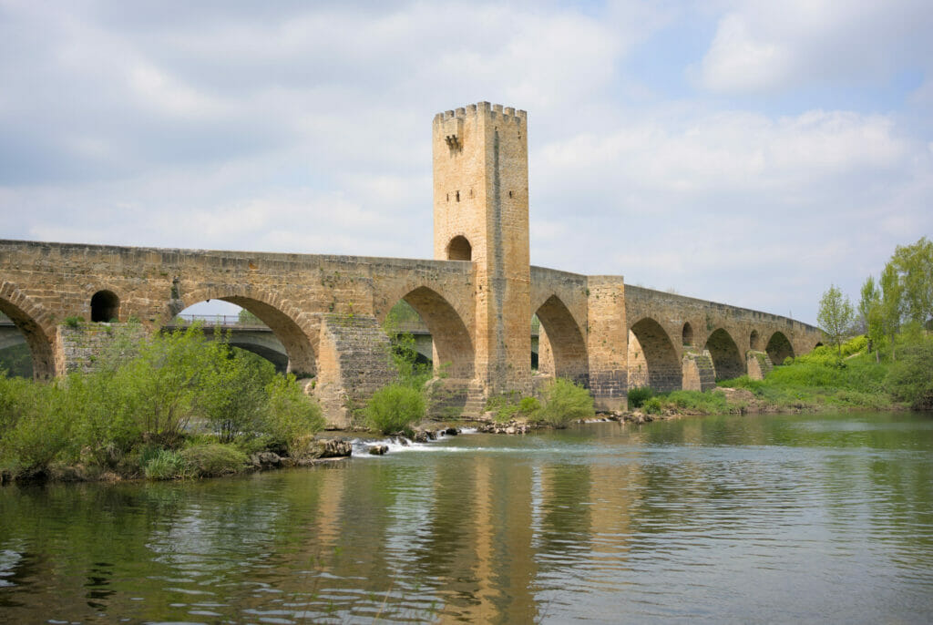
We notice that in the middle of the bridge there is a large fortified tower. The history of the tower is not 100% confirmed, but it seems that it was added in the Middle Ages to collect the “Pontazgo“. The Pontazgo was a fee charged to anyone wishing to cross the bridge. The fee depended on the number of people, the place of residence but also on the goods transported. These amounts were used for the maintenance and repair of the bridge. A form of ancient toll if you will 😉
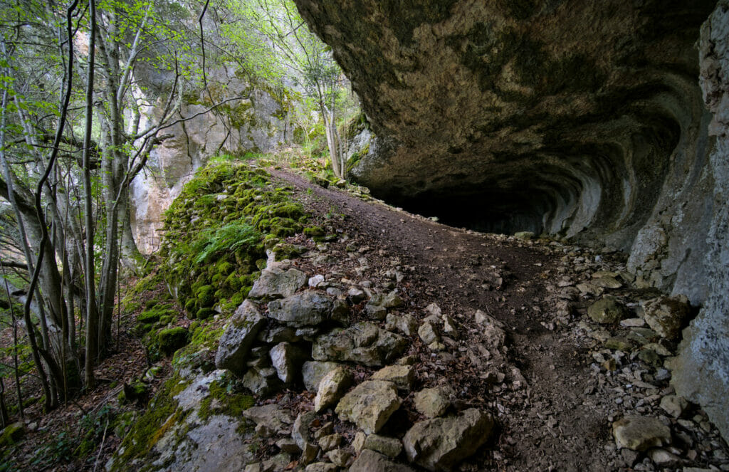
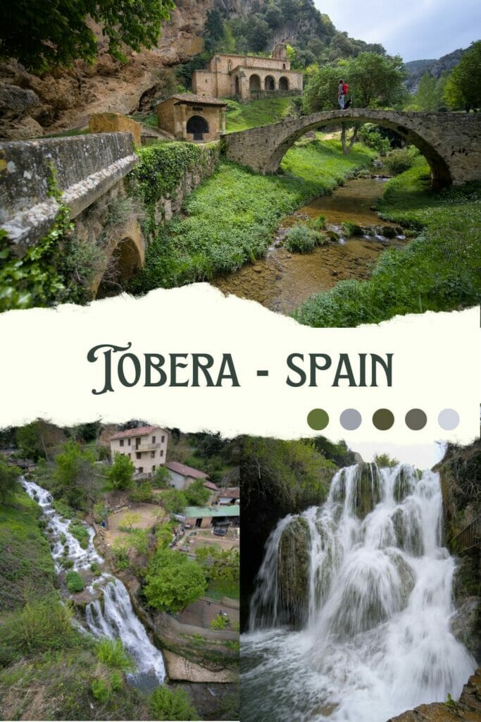
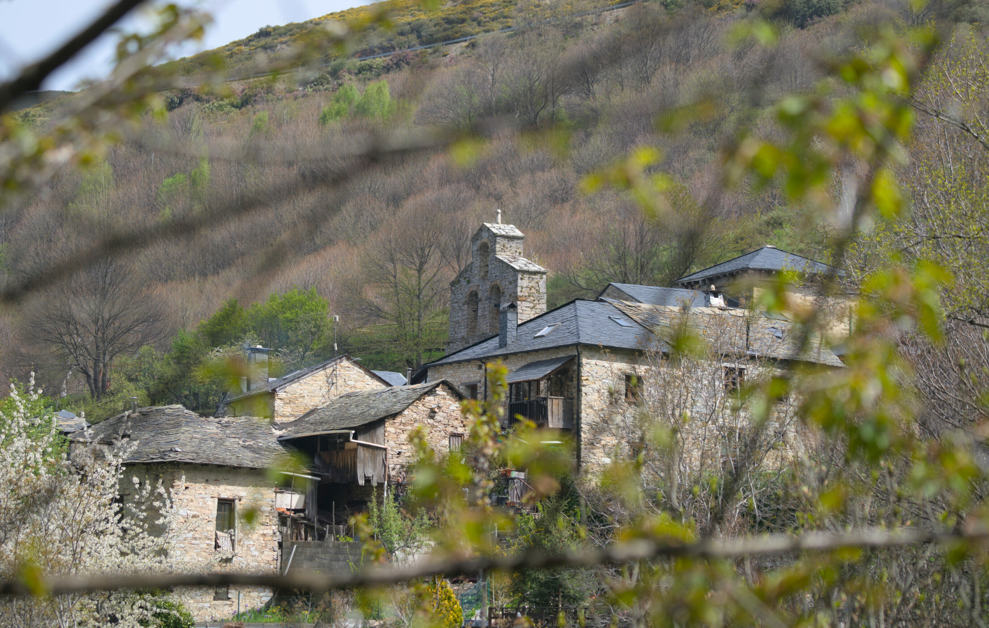
The village of Tobera
Since we are talking about beautiful villages and waterfalls, we were not going to miss Tobera. Since 1489, Tobera has been part of the municipality of Frias, although geographically slightly apart. But since the village has only 23 inhabitants, it is easy to understand that they want to group together for administrative and logistic reasons 😉
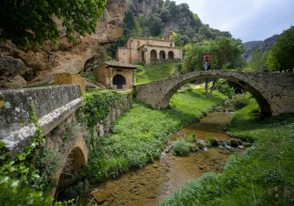
Located in the heart of a holm oak forest, this village is literally rocked by the water. To visit it, we suggest you park in the small parking lot on the upper part of the village (next to the old Roman bridge) and then take the beautiful walk along the Rio Molinar.
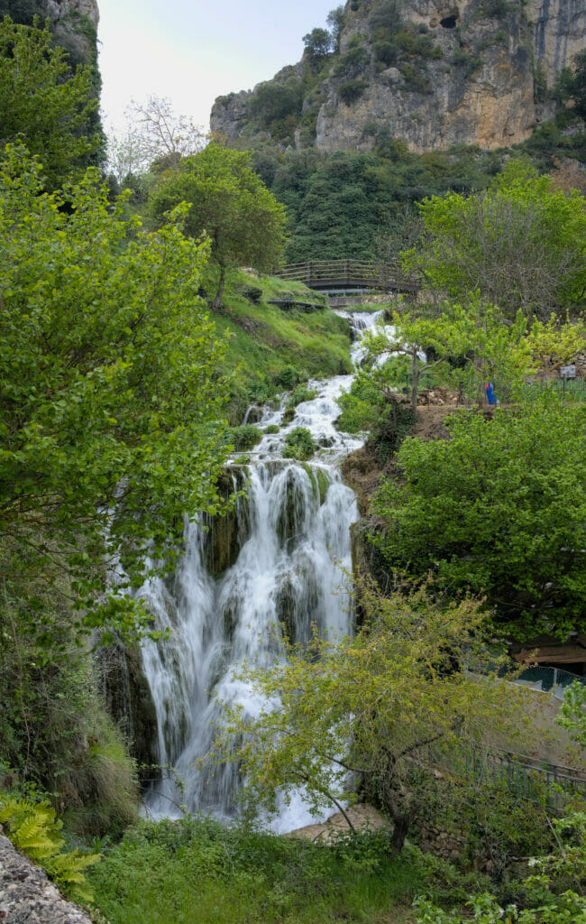
The walk is relatively short (our little loop was less than 2 km) but it is really beautiful! The village is crossed by several waterfalls and seems like out of time! If you feel like having a little coffee, we can only recommend you the terrace of the only bar of the village “Entre Pozos”, it’s by far from there that we have the most beautiful view on the main waterfall!
Ermita San Felices – a little getaway in the Rioja
To finish this article on Leon, we thought we would slip you a little extra in the neighboring region. The Ermita San Felices is located in the Rioja region (but less than 2km from Leon so… technically not too far) 😉
While looking for a place to walk the dog, we came across some pictures taken on top of a mountain that seemed to offer a great view. After some research we saw that there was the hermitage of San Felices and the ruins of the Bilibio castle perched up there.
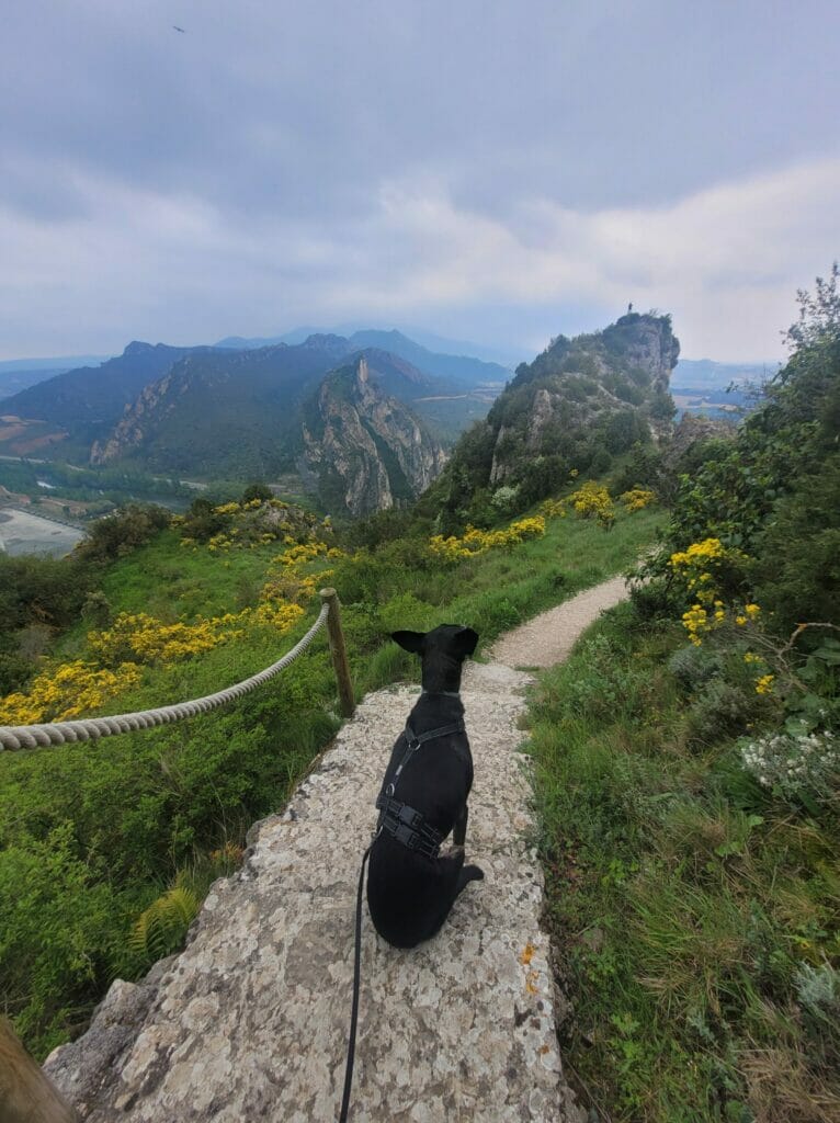
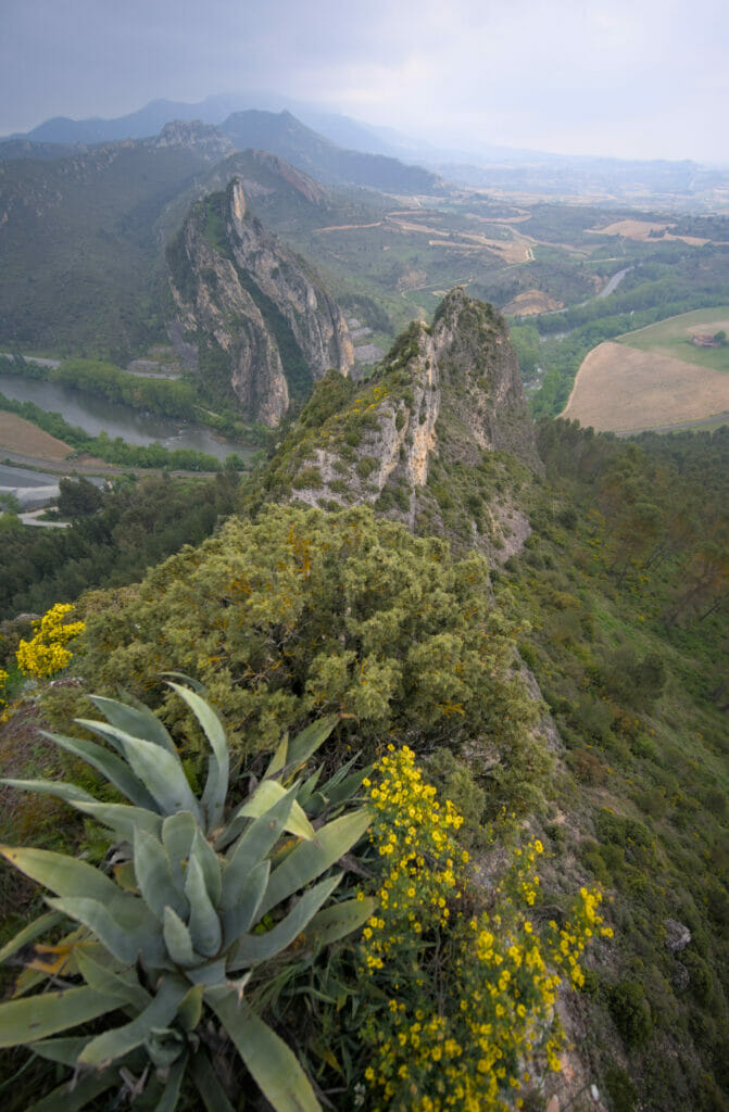
So I warn you right away, we are far from a real hike. A small parking lot is at the end of a small access road (GPS coordinates: 42.615572, -2.853583). From there, it’s a mini walk of about 600 m which allows to go around. The view is best on the right side of the hermitage; from here you have a view of the Ebro river below and the surrounding peaks. Afterwards, you have to realize that there is also a big quarry on the edge of the Ebro, which makes the view a little less glamorous.
I wouldn’t go so far as to say it’s an “unmissable” but if, like us, you’re looking for a little stop between Leon and La Rioja, then the view is worth it.
Map of things to see in the north east of Castilla y León
Well, I think that’s all for today! This article marks the end of our road trip from Galicia to Switzerland… Because yes, after almost 2 weeks of visiting the Leon region, it was time for us to head to Switzerland. After the hermitage of San Felices we simply made a last stop in Rioja to buy some wine, then we went straight back to Switzerland.
We’ll see you soon for our 100% Swiss and 100% hiking articles of the summer!
Pin it
Join the discussion