
If you’ve been following us for the past few months, you may know that we’ve just moved to the small village of Les Haudères, at the very end of the Val d’Hérens, to create our own coliving space.
Even if we are quite busy lately (between moving, cleaning, sorting, renovating etc…), we still keep some time to explore our new playground. And for the hiking / nature lovers that we are, we could hardly have dreamt of a better place than the Val d’Hérens for hiking.
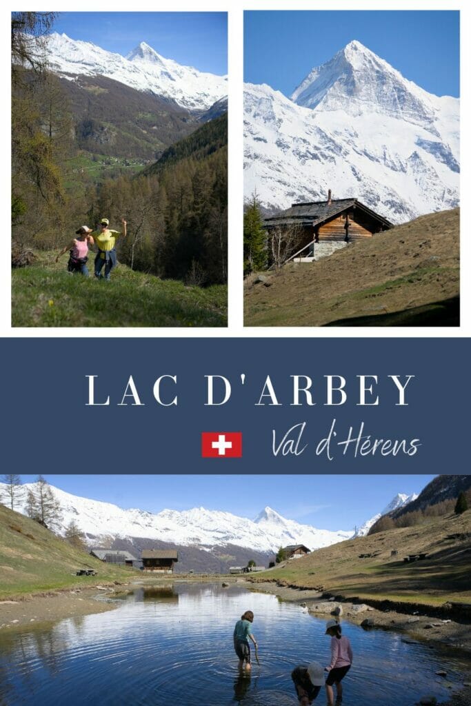
In this region, the hiking possibilities are almost infinite and I think that in the next few months you will have a lot of adventures from this region on the blog 😉 . And we start right away with a classical hike of the area: the ascent to the lac d’Arbey (Arbey lake) from the village of Evolène or its slightly longer version from Les Haudères.
Hiking to the Lac d’Arbey (Arbey lake) from Evolène
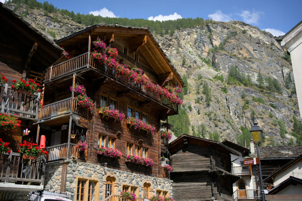
Evolène village
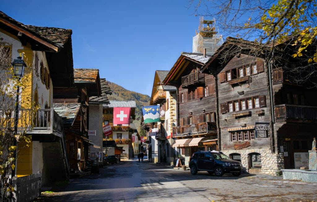
The short version of this walk starts in the lovely village of Evolène (which is one of the most beautiful villages in Switzerland), on the large parking lot in front of the tourist office at the entrance of the village. Evolène is also the name of the municipality that includes all the villages at the bottom of the Val d’Hérens, such as Les Haudères, La Tour, La Sage or Arolla.
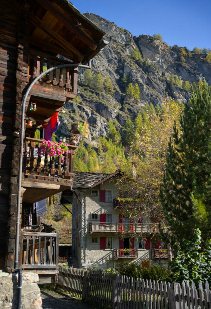
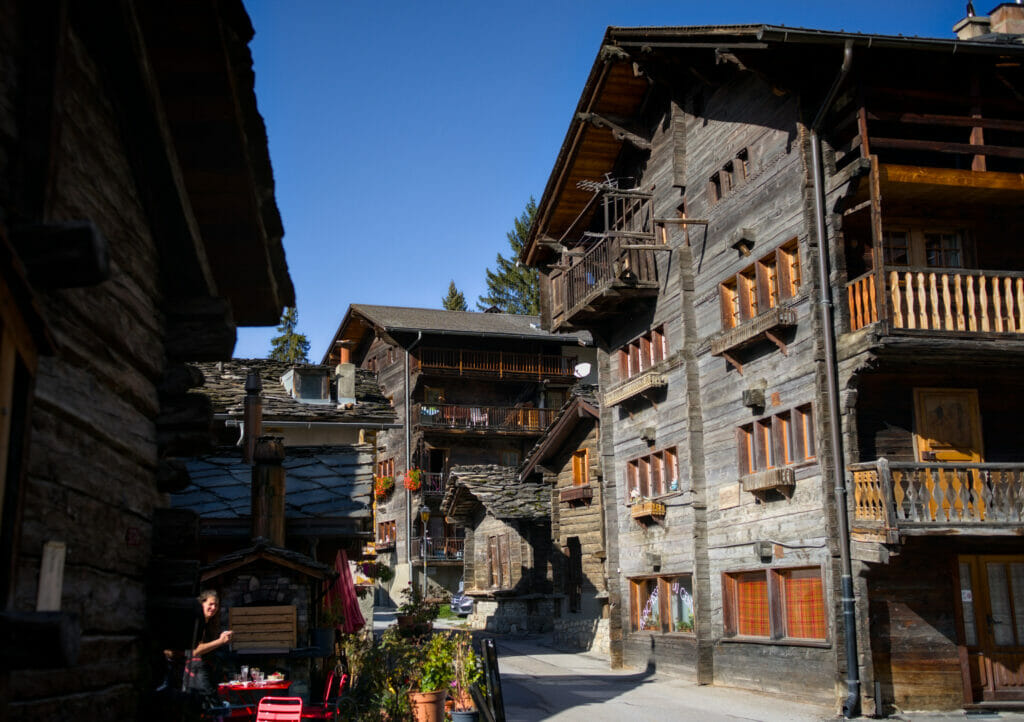
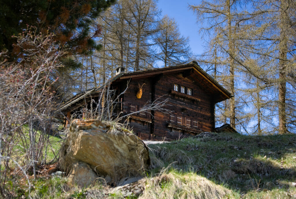
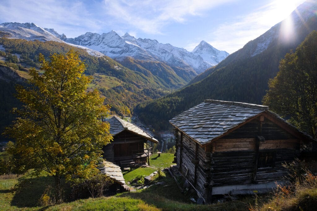
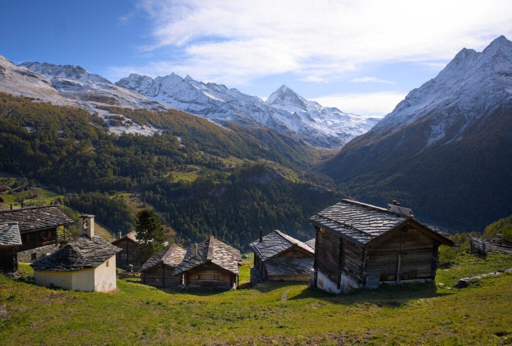
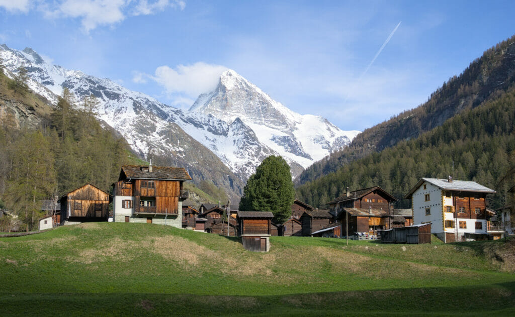
One of the particularities of the municipality of Evolène is the richness and the good preservation of its built heritage. When you walk through the narrow streets of the villages of the municipality, you get the impression that time has stopped. The traditional houses with their slate roofs, the barns, the “raccards”… just the beginning of the walk through the heart of Evolène village will transport you to another time.
The topic of the built heritage in the Val d’Hérens would deserve an article by itself. But if you are interested, you should know that there is a built heritage trail through the streets of Evolène with different explanatory signs along the way. More information here.
Description of the hike
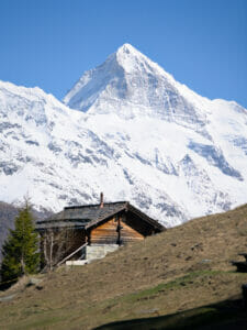
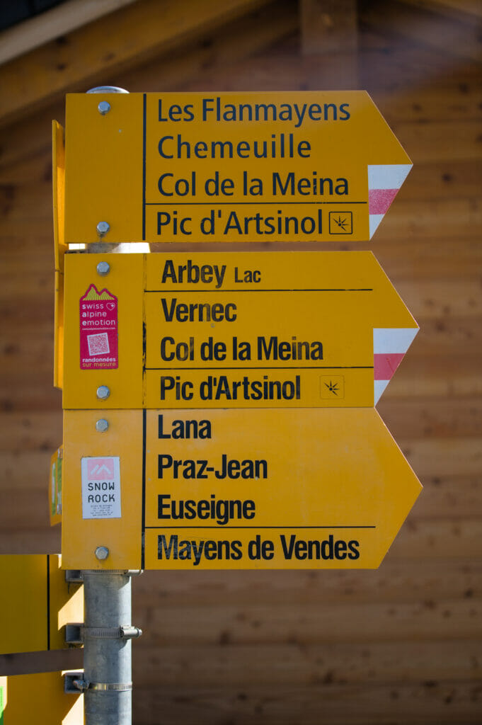
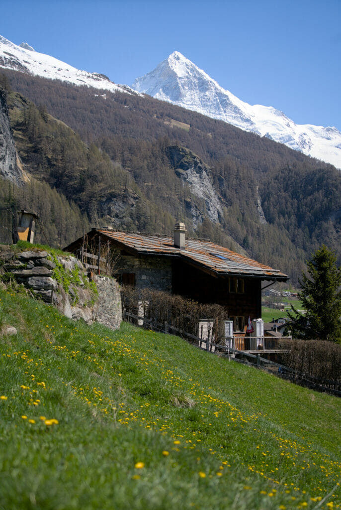
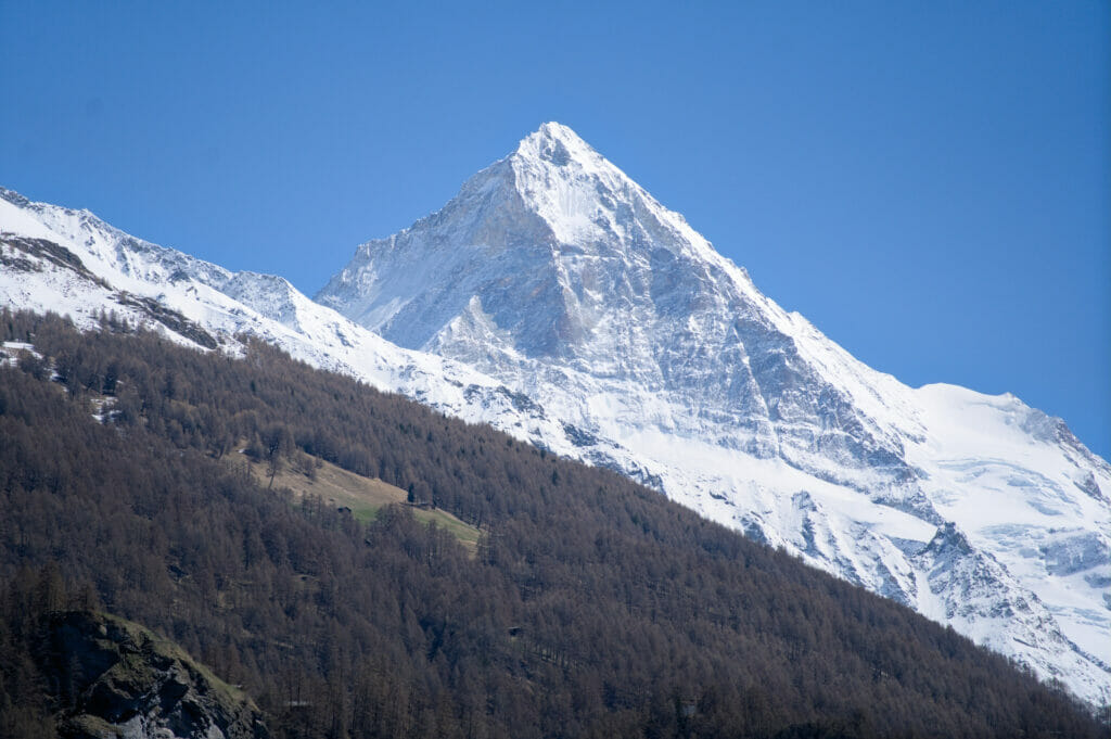
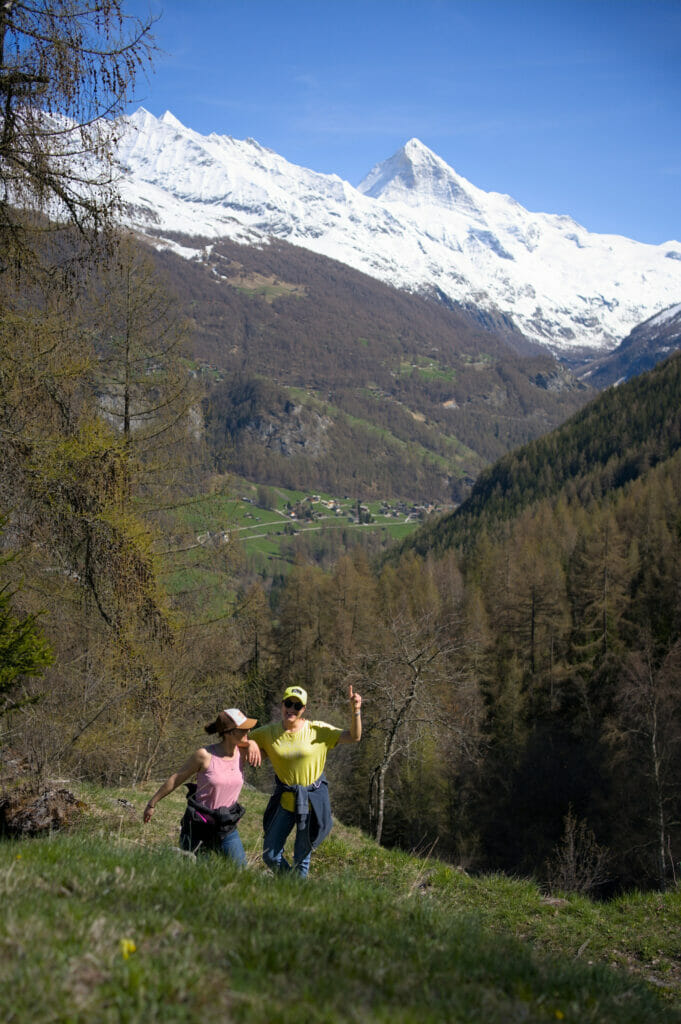
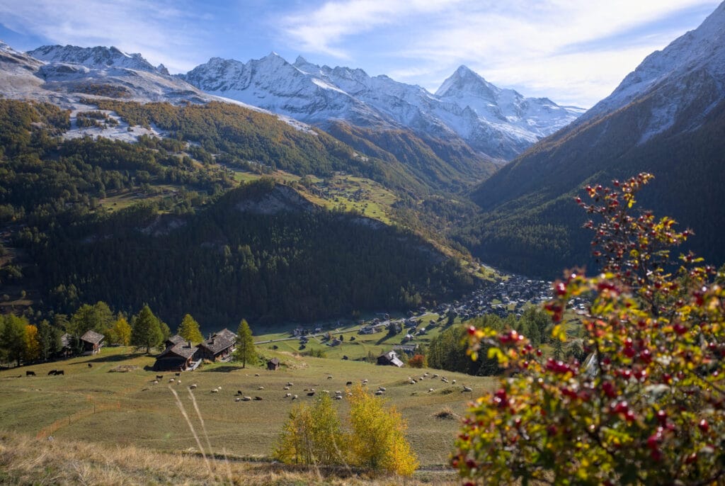
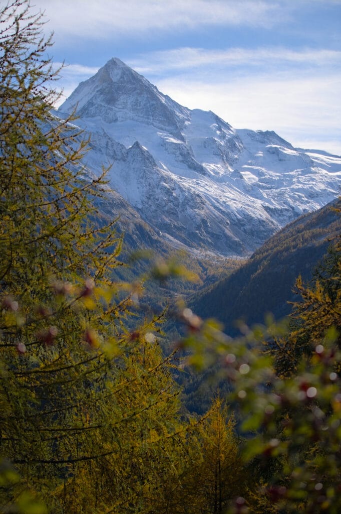
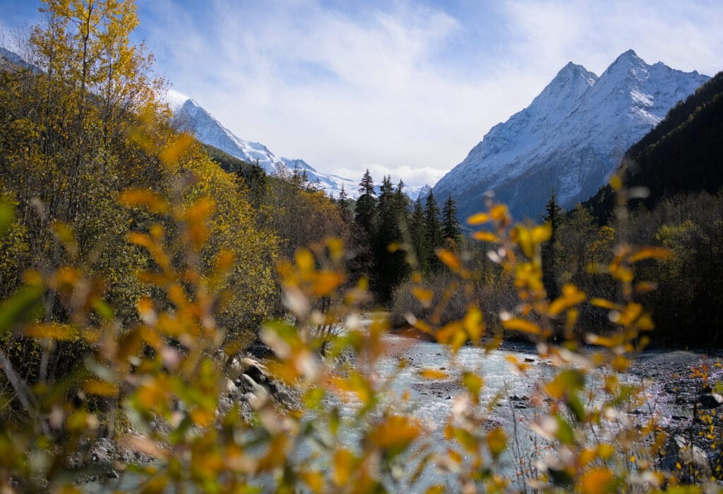
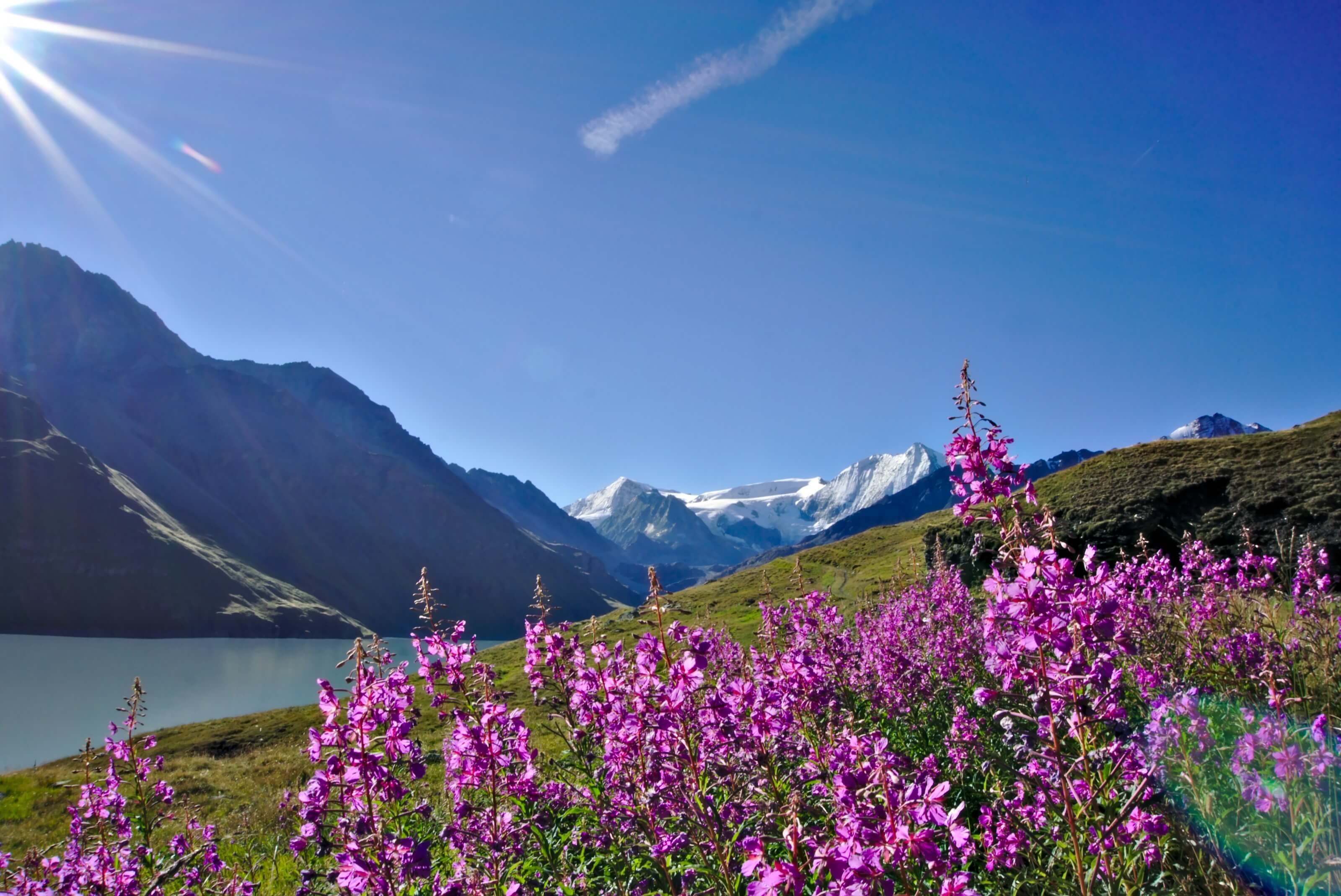
At the level of the village church, turn left to go down towards the river (the Borgne). The path is easy to follow since it is marked all along and you just have to look for the indication “Arbey lac”. We take a small paved road to then cross the river on a broad bridge. On our left, there is already a very nice view on the majestic Dent-Blanche which dominates the valley.
From this point, the climb to the Arbey lake begins… Let me reassure you right away, there is hardly more than 400m of elevation change to the lake so nothing too serious.
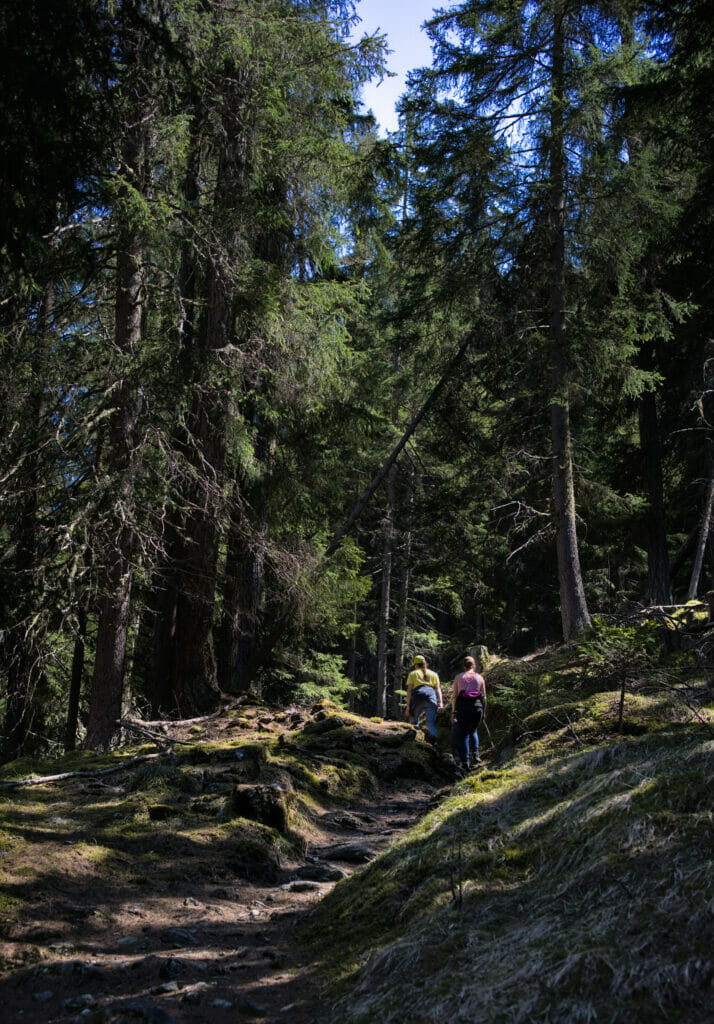
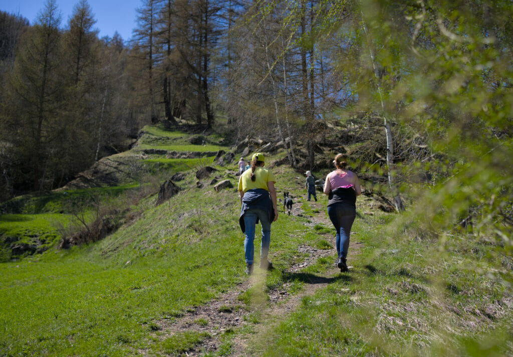
Immediately after the bridge, you can cut the road on a path that goes up on the right and then take the trail that goes up in the forest on the left towards the Arbey lake. We soon arrive at a crossroads where it is possible to go either left or right. On our side we chose to go up on the left to go down later on the right but that does not have much importance.
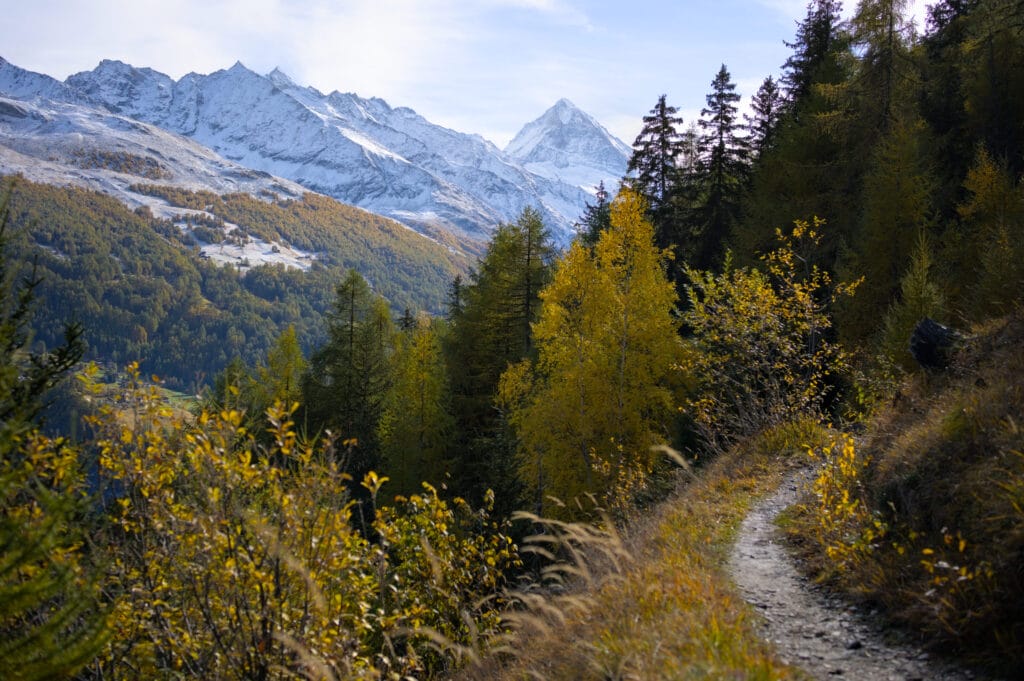
The trail goes up steeply in the forest but remains really accessible to everyone. This day we were with a friend and her 3 children and we had no problem to reach the lake. And even if it’s a bit steep, we are well under the shade of the trees and sometimes we also have some nice openings offering nice panorama on the valley and the Dent-Blanche.
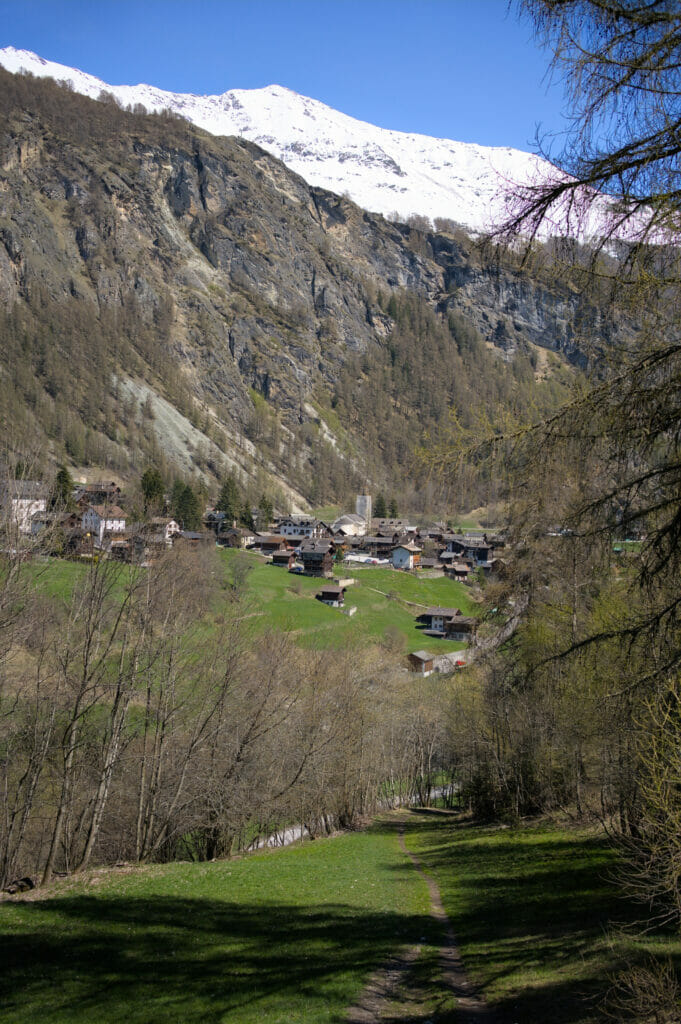
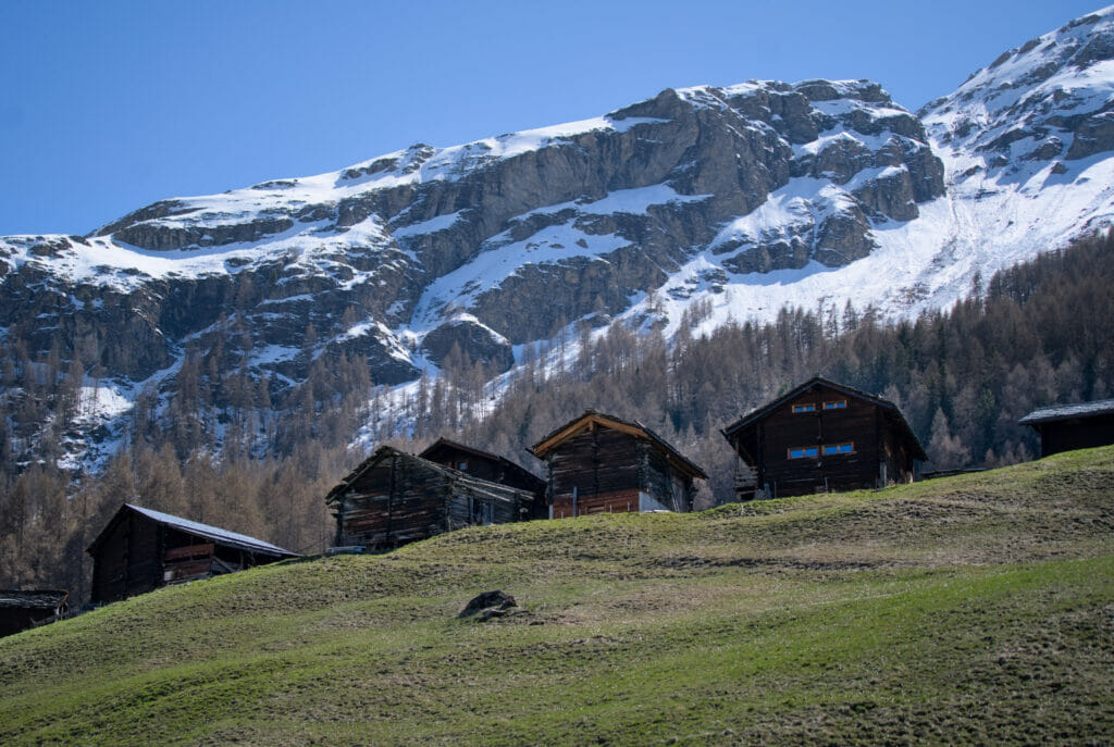
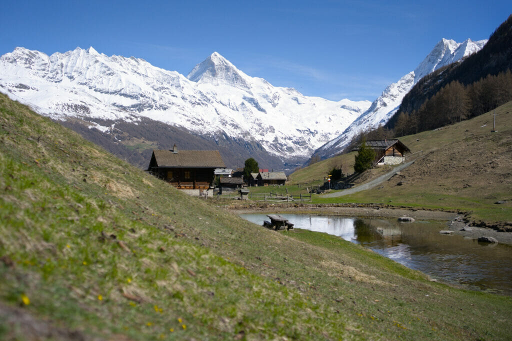
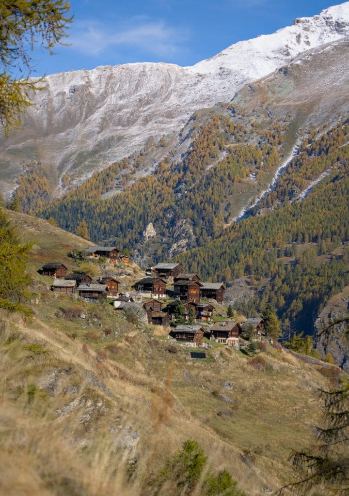
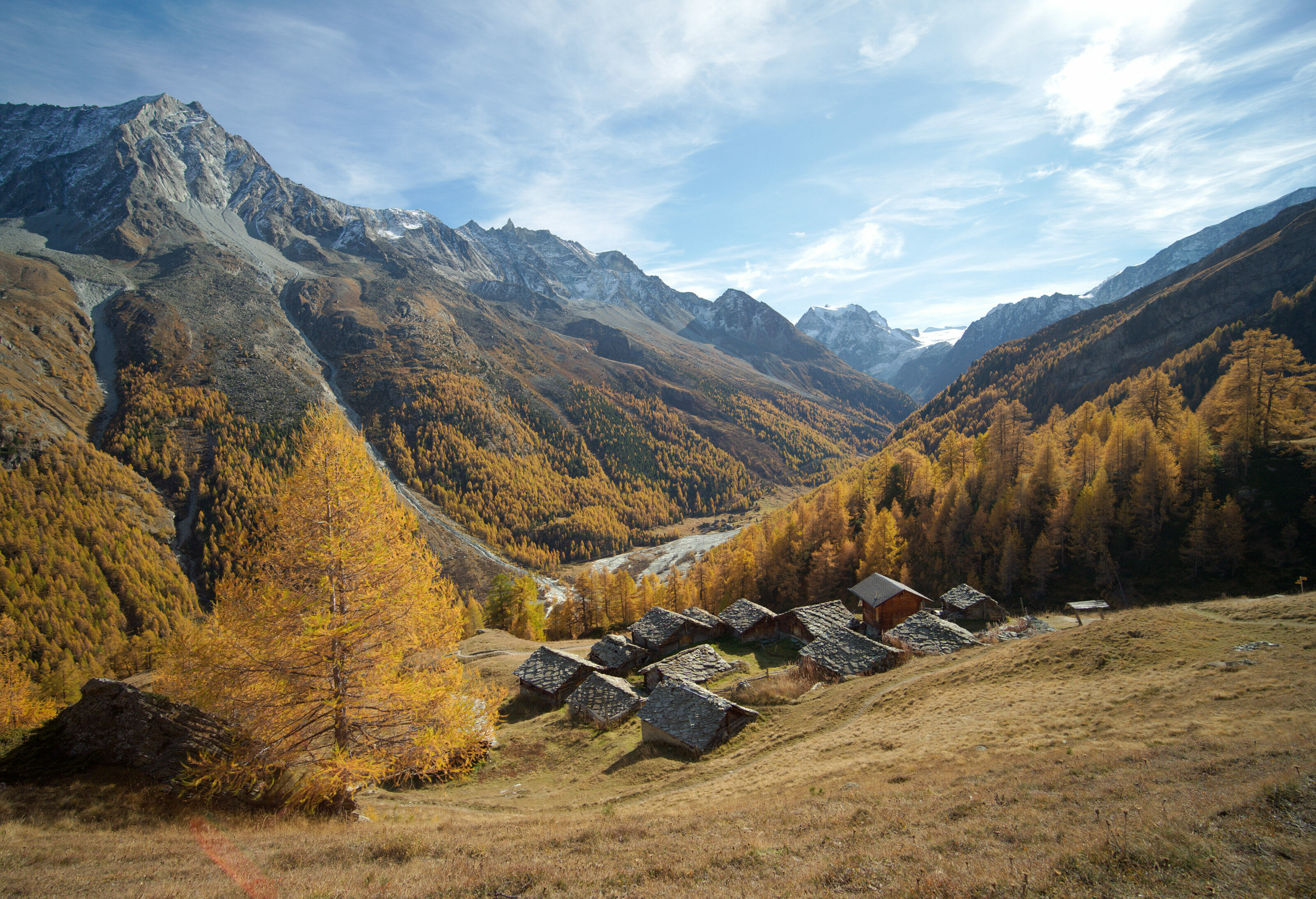
Then little by little the forest becomes less dense and we begin to see over us the chalets of the Arbey hamlet. We cross some pastures before reaching the first houses. As we are only at the beginning of May, the snack bar of the Arbey lake is not open yet. But if you come during the summer season, you will be able to stop for a drink or to eat a cheese crust 😉 .
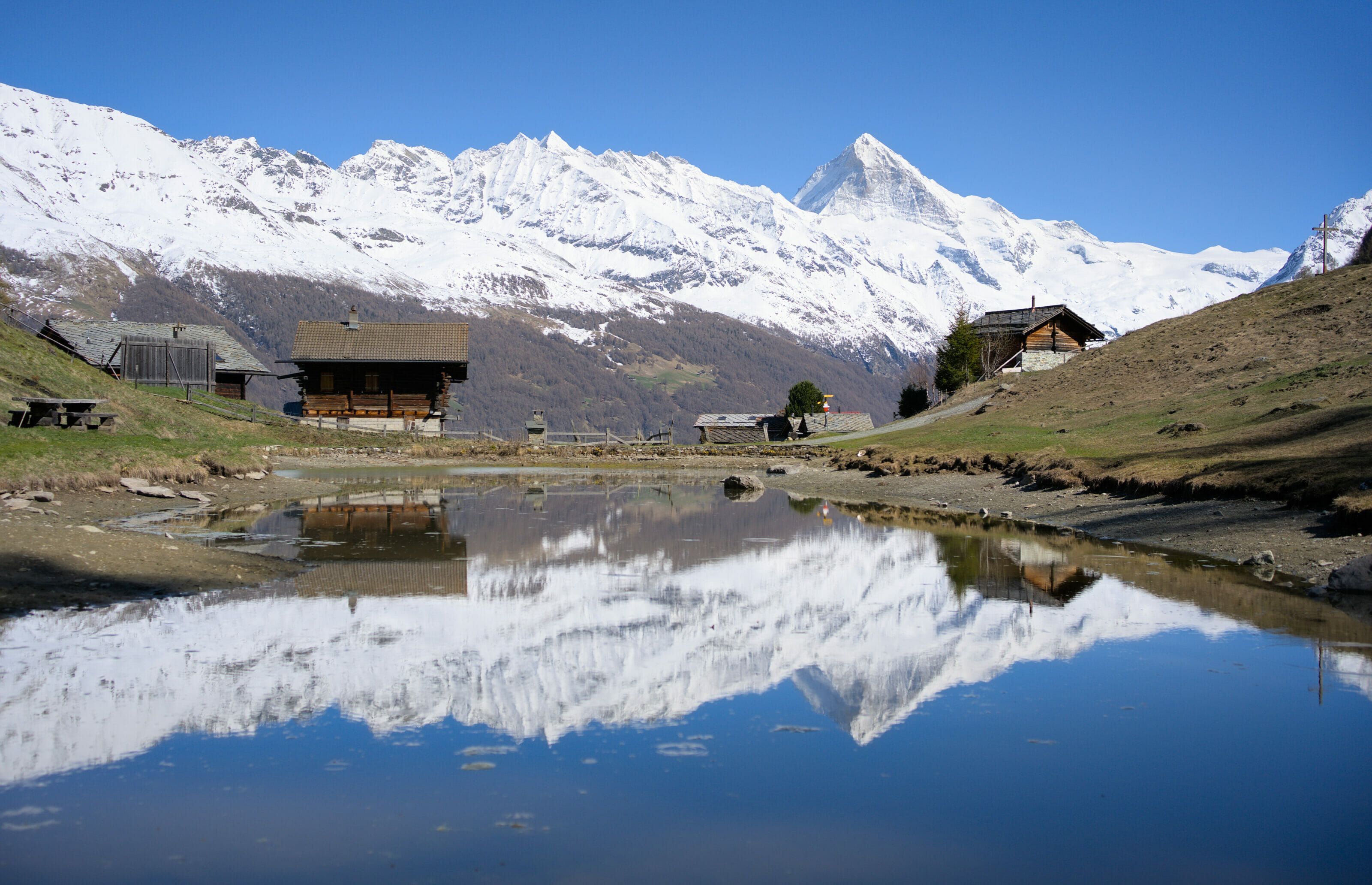
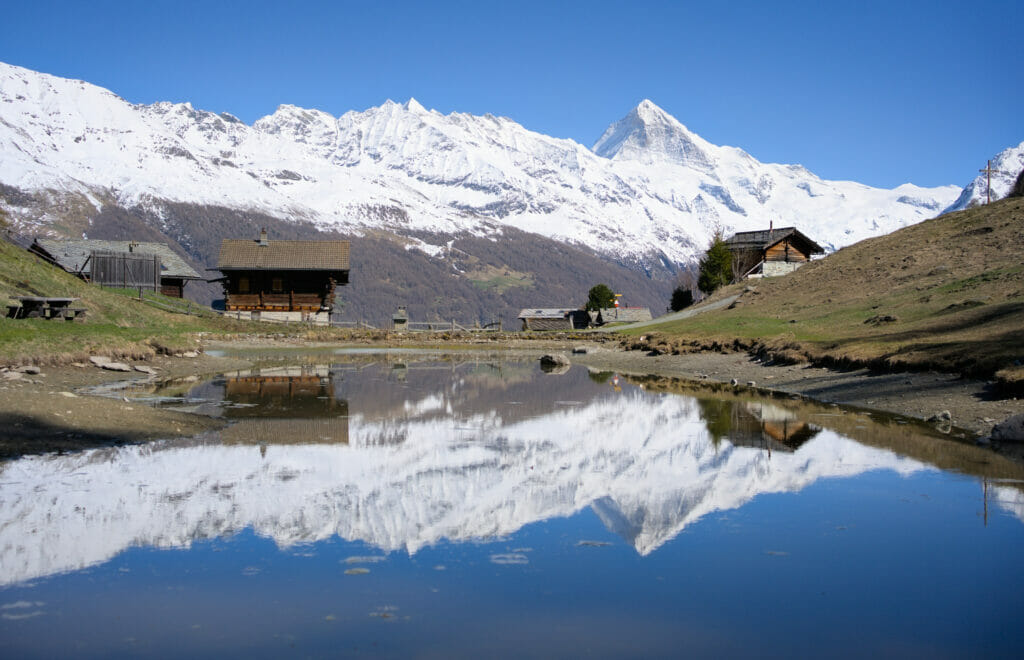
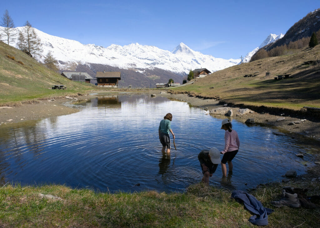
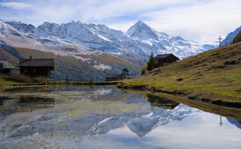
Finally, for the children’s pleasure ( they started to get tired of going up), we reach the edge of the small Arbey lake (lac d’Arbey). Who knows why, there was not so much water in the lake the day of our visit. But that did not stop the children to go dip their feet and to hunt the tadpoles 🙂 .
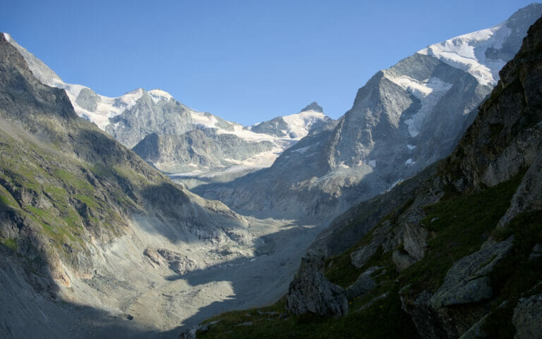
And frankly the panorama is just gorgeous with the Dent-Blanche and the chalets of the hamlet reflecting in the water. I think that we stayed at least one hour on the benches at the lakeside to enjoy these landscapes 😉 .

After this nice contemplative break, we went back on the trail by simply taking the path that goes down in the forest behind the lake. Nothing special to note on this part… after half an hour of descent, we find the crossing of the outward journey and we return to the Evolène village by the same route.
If you still have the energy, we would still recommend you to walk through the streets of the Evolène village to discover its magnificent built heritage. You could also enjoy a stop on one of the beautiful flowered terraces on the main street of the village.
- Distance: 5,9kms (red trail on the map below)
- Elevation change: +- around 450m
- Difficulty: Easy
- Duration: 2-3 hours
- Infos: There is a big parking in front of the tourist office in Evolène. The parking is not free (1chf per hour, 8chf per day) and it is also possible to pay by twint.
Map of the hike to Lac d’Arbey + GPX
The small loop to the lac d’Arbey is the red route on the map below. The blue itinerary is the big loop from the village of Les Haudères.
If you’re planning a trip to Switzerland or if you live here and wish to discover some new spots, don’t miss our new ebook. Released in May 2025, this 75-page guide will help you prepare for your upcoming stay in Switzerland. We’ve compiled all our best tips and tricks for visiting our beloved little country without breaking the bank. You’ll find advice on transportation, accommodations, where to shop, as well as a list of free activities and events throughout the seasons, along with our personal recommendations for hikes and must-see spots, and a selection of off-the-beaten-path itineraries (with estimated budgets). This ultra-complete guide also includes a fantastic interactive map featuring over 500 addresses and deals.

To learn more about the ebook and the interactive map, the introductory article is available here.
Hiking to the lac d’Arbey from Les Haudères
The alternative
If you want to make a longer hike, it is also possible to hike up to the lac d’Arbey from the village of Les Haudères (so from our place 😉 ). It’s a 13kms loop that goes up first to the hamlets of Farquèses and Giette and then along the hillside to the Arbey lake. The itinerary then goes down to the village of Evolène to come back to Les Haudères on a nice path along the Borgne river.
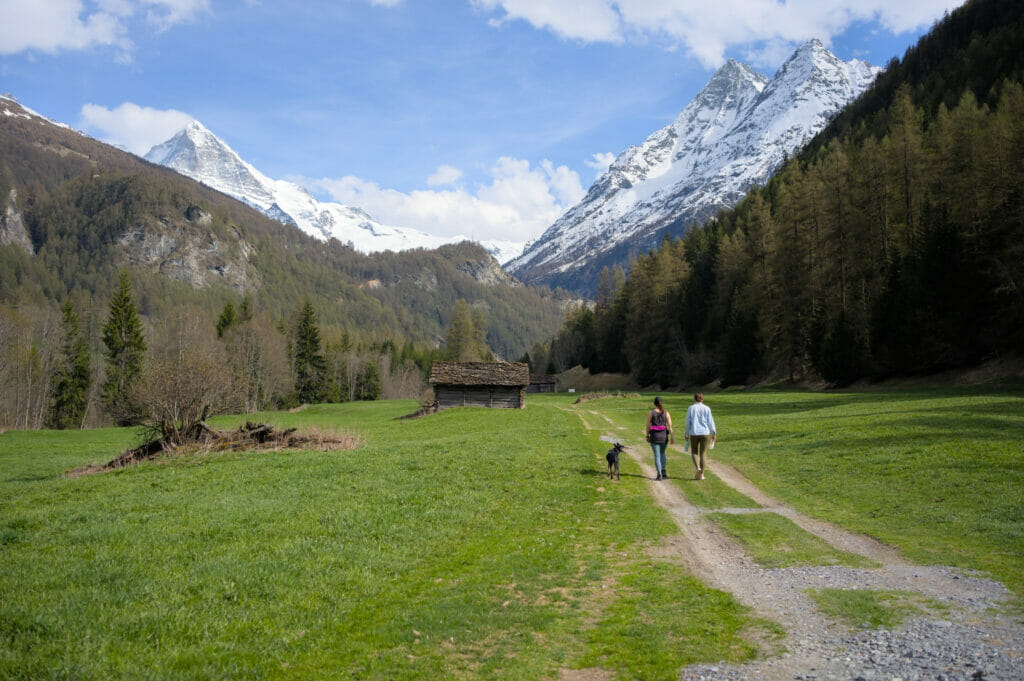
From the village square of Les Haudères, where the postal bus stops just in front of our coliving (you can also park next to the tennis courts on the other side of the bridge), we cross the bridge and head down to the point where the Borgne de Ferpècle and the Borgne d’Arolla meet (the rivers). At the next bridge, we take the path that goes up behind a farm towards the hamlets of Farquèses and La Giette.
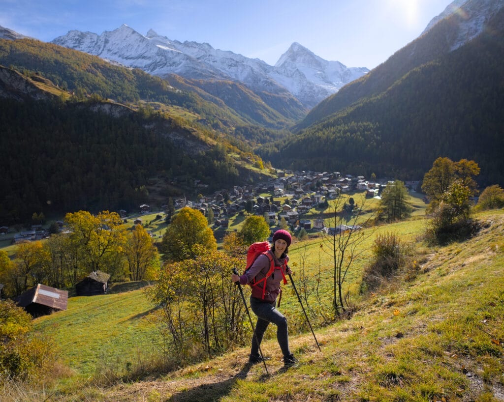
We’ve done this hike several times already, and the views over our village of Les Haudères, with the majestic Dent-Blanche in the background, are just splendid! However, if you have a dog like us, you may have to cross some pastures with cows… So if you don’t like it, or your dog might react badly, it’s best that you know about it 😉 .
After 200m of climbing and crossing the asphalt road twice, we reach the Farquèses bus stop, where we take the small road towards La Giette. This track is a magnificent balcony overlooking the Val d’Hérens, with views of all the peaks from the Sasseneire to the bottom of the Arolla valley, including the Dent-Blanche and the Veisivis. What’s more, you’ll pass through a number of hamlets, all of which are magnificent examples of the valley’s built heritage.
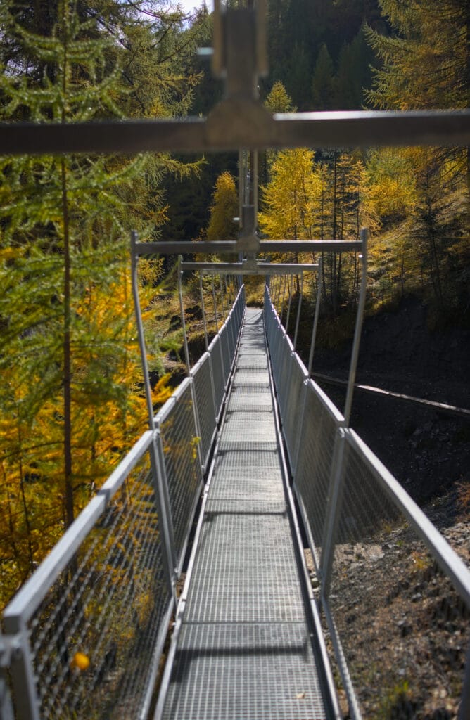
After a while, the road becomes a hiking trail through a beautiful larch forest heading towards Lac d’Arbey. The panorama is as beautiful as ever, and the village of Evolène comes into view in the distance. Shortly before reaching Lac d’Arbey, we cross a brand-new footbridge that allows us to avoid the old, somewhat tricky path across a torrent. After a 6 km walk, we arrive at the lakeside for a well-deserved contemplative break.
All that’s left is to head back down to the village of Evolène, following the path described in Part 1 of this article (it doesn’t matter if it’s the one on the left or the one on the right). Once we’ve reached the river’s edge, all that’s left to do is walk 4 km along a pleasant riverbank path back to the village of Les Haudères.
We recommend getting lost in the village’s narrow streets to appreciate the magnificent traditional houses. And if you’re feeling a little thirsty after your hike, don’t hesitate to stop off at the terrace of Les Veisivis or the “Petit Café”.
- Distance: 13kms (blue track on the map below)
- Elevation change: +- 560m
- Difficulty: Easy
- Duration: 4-5 hours
- Infos: There is a large free parking lot just after the bridge in the village of Les Haudères, next to the tennis courts.
Map of the hike from Les Haudères + GPX
The long loop to Arbey Lake is the blue itinerary on the map below.
We hope you enjoyed this nice hike to the Lac d’Arbey and we’ll see you soon for more hikes in the Val d’Hérens (in the meantime you’ll also find below other hikes we already did in the area in the past 😉 )
Pin it on Pinterest

Join the discussion