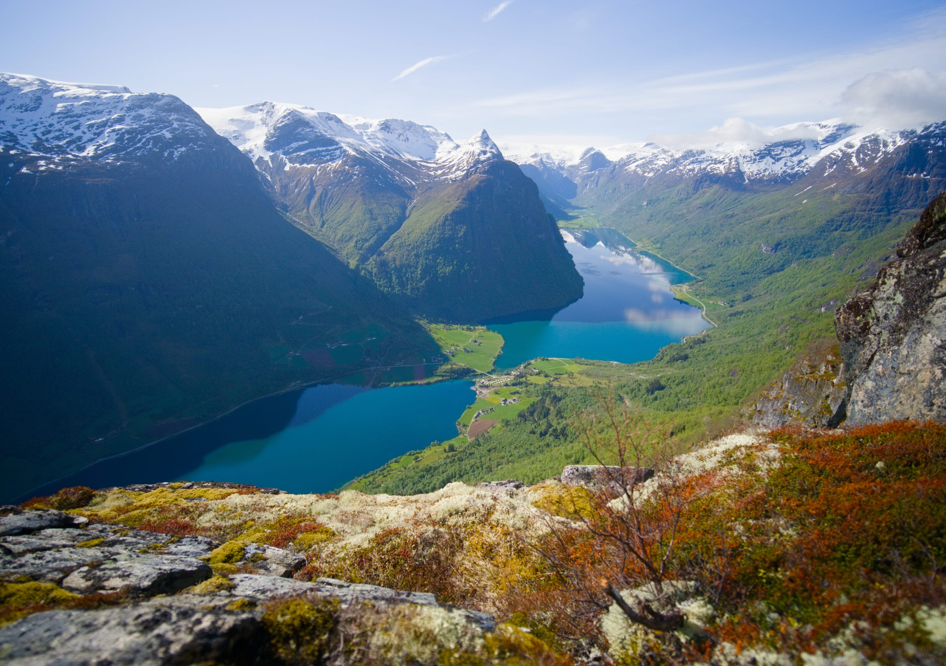
We’re taking you to Vestland, on Norway’s west coast, to discover one of the country’s most beautiful valleys: Oldedalen (well, that’s just our opinion based on the ones we’ve visited 😉 ). Tucked away at the end of Nordfjord, this glacier valley stretches about twenty kilometers to the ice tongues of the Jostedalsbreen (Jostedal Glacier in Norwegian), which is, the largest ice cap in continental Europe.
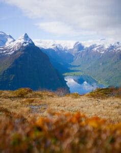
Between the turquoise waters of Lake Oldevatnet, the sheer cliffs, the waterfalls, and the glaciers clinging to the mountain peaks (well, what’s left of them, anyway), we guarantee you’ll be blown away. And to really make the most out of these landscapes, guess what: we’ve got a few great hikes to recommend (lol, seriously).
All right, let’s go!
Arrival in Olden and cruise ships
After hiking the Hamnanova trail, we arrived in Olden after a quick stop at a nice bakery (and local products shop) and driving along Route FV60, which offers some beautiful views of the Nordfjord.
The first thing that struck us when we arrived in Olden was the two enormous cruise ships moored at the village harbor. After a quick search online, we realized that these two ships were disembarking between 6,000 and 8,000 tourists a day in a village of 500 residents.
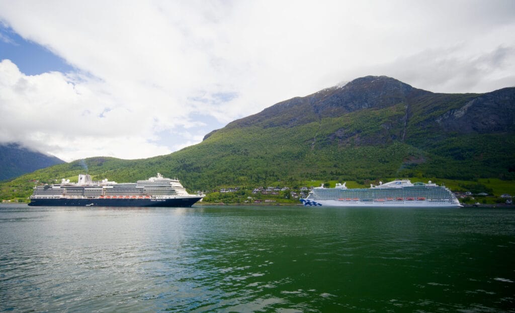
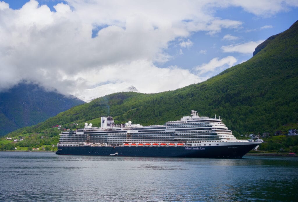
This is a somewhat sensitive topic in Norway (along with the issue of vans and RVs as well 😉 , but we’ll come back to that in another article), because visitor numbers to the Norwegian fjords have more than doubled since the early 2000s. A small village like Olden saw more than 360,000 cruise ship passengers arrive in 2023, which obviously creates strain in various areas, such as:
- pollution, since ships leave their engines running in ports
- the infrastructure of small villages that welcome thousands of day-trippers, all of whom go to the same places.
- the local economy, which is restructuring itself around the cruise industry (with stores that are only open when there are ships, which gives a feel of a ghost town the rest of the time)
- the dissatisfaction of local residents, who feel that the economic benefits do not make up for the nuisances caused by cruise ships
When cruise ships like these stop somewhere, the same routine always plays out. Many of the passengers go out for a stroll, and some of them go on day trips (often by bus). In Olden, by far the most popular excursion is to go deep into the Oldedalen valley to hike to the base of the Briksdal Glacier. Since we’d also planned to go there, what we mainly thought when we saw the ships was that we’d head to the glacier early in the morning or in the evening instead 🙂
The Oldedalen Valley and Lake Oldevatnet
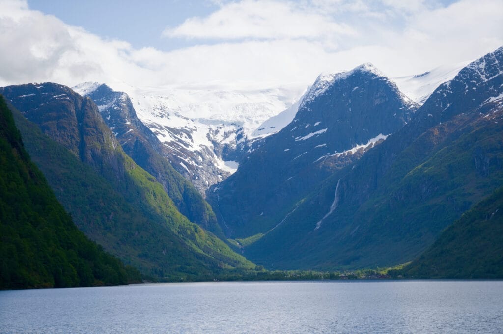
The Oldedalen Valley is located at the end of the Nordfjord and stretches from the village of Olden to Jostedalsbreen National Park and its famous glacier tongues, which, unfortunately, are retreating further and further up the valley. In the heart of the valley lies the magnificent Oldevatnet Lake with its emerald-green water. In fact, it almost looks like two lakes, but they’re connected by a narrow stretch of water, on the shore of which lies the first campground where we stayed during our trip: Oldevatn Campground.
Campgrounds vs. Wild Camping in the Oldedalen Valley
The Oldedalen Valley is quite touristy and has a very steep, rugged terrain. So it’s not very surprising if we tell you that we find it difficult to wild camp there. As in all of Norway’s more touristy regions, the tracks leading away from the main road are often blocked by a gate, and any potential bivy spots all have “No Camping” signs.
We’ll discuss this further in a separate article, but it’s certainly the result of certain areas being overcrowded by RV travelers and vanlifers. And frankly, it’s understandable that the locals have reached this point.
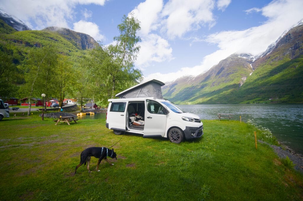
But in this case, in Oldedalen, we stayed at two of the most beautiful campgrounds of our entire road trip in Norway: Oldevatn Campground and Melkevoll Bretun Campground. So we really recommend you to check them out.
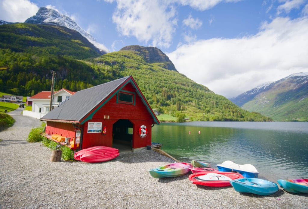
Oldevatn Campground is located on the shore of Lake Oldevatnet, at its narrowest point, and is the ideal base camp for the Klovane hike, which I’ll tell you about below. Admittedly, it’s not the cheapest campground we’ve stayed at in Norway, but the price includes showers, use of pedal boats and canoes on the lake (which alone justifies the price), a magnificent picnic/BBQ area, several common rooms… it’s really good!
The Klovane Hike from the Oldevatn Campground
It’s certainly not the valley’s main attraction, since everyone comes to see what’s left of the Briksdalbreen glacier tongue, but personally, it was one of the hikes I was most looking forward to doing in Norway. I’d heard about it on the excellent website Horizon Rando (a site that lists quite a few off-the-beaten-path hikes in Norway and whose philosophy really resonates with me), which rated it 5/5, hence my excitement, haha.
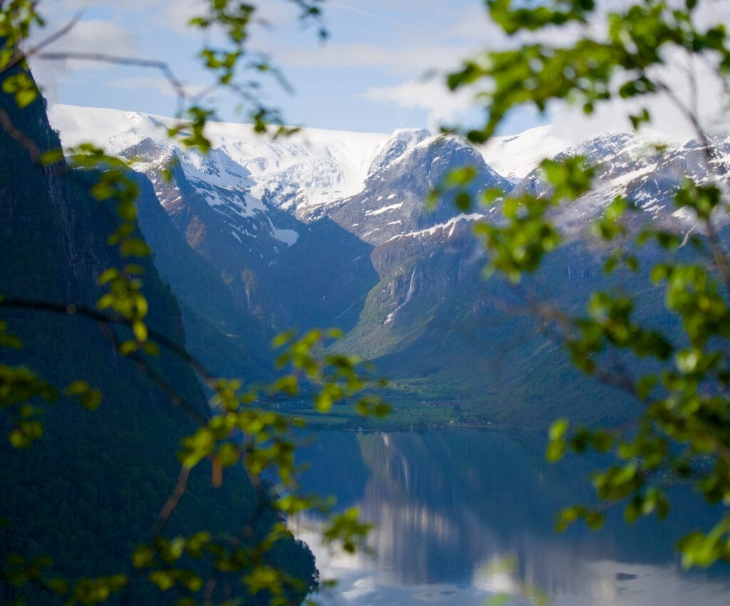
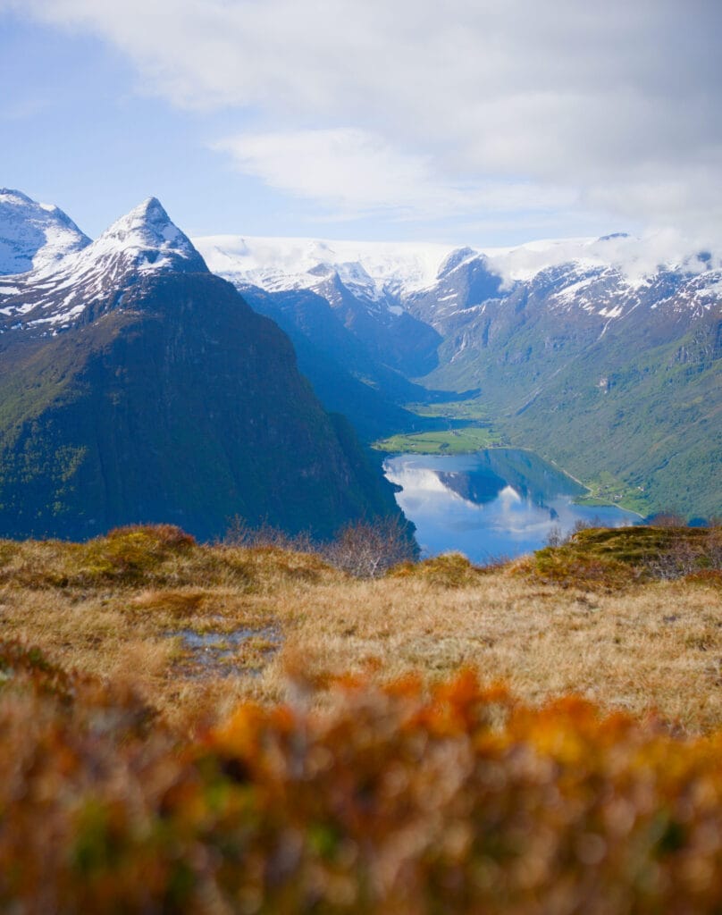
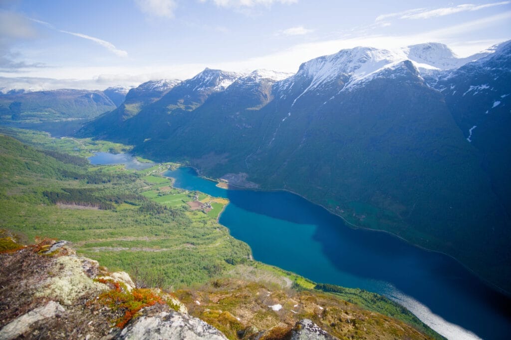
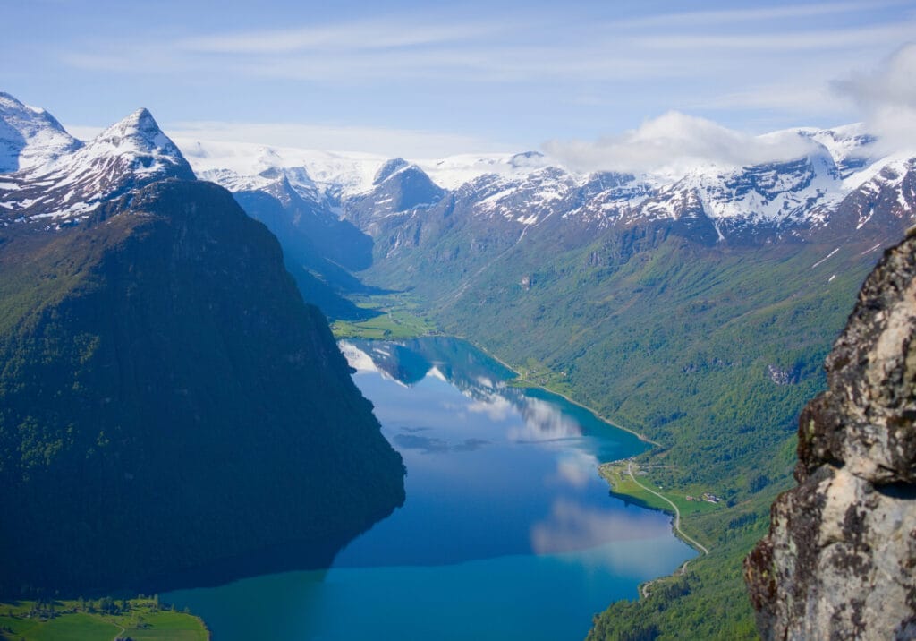
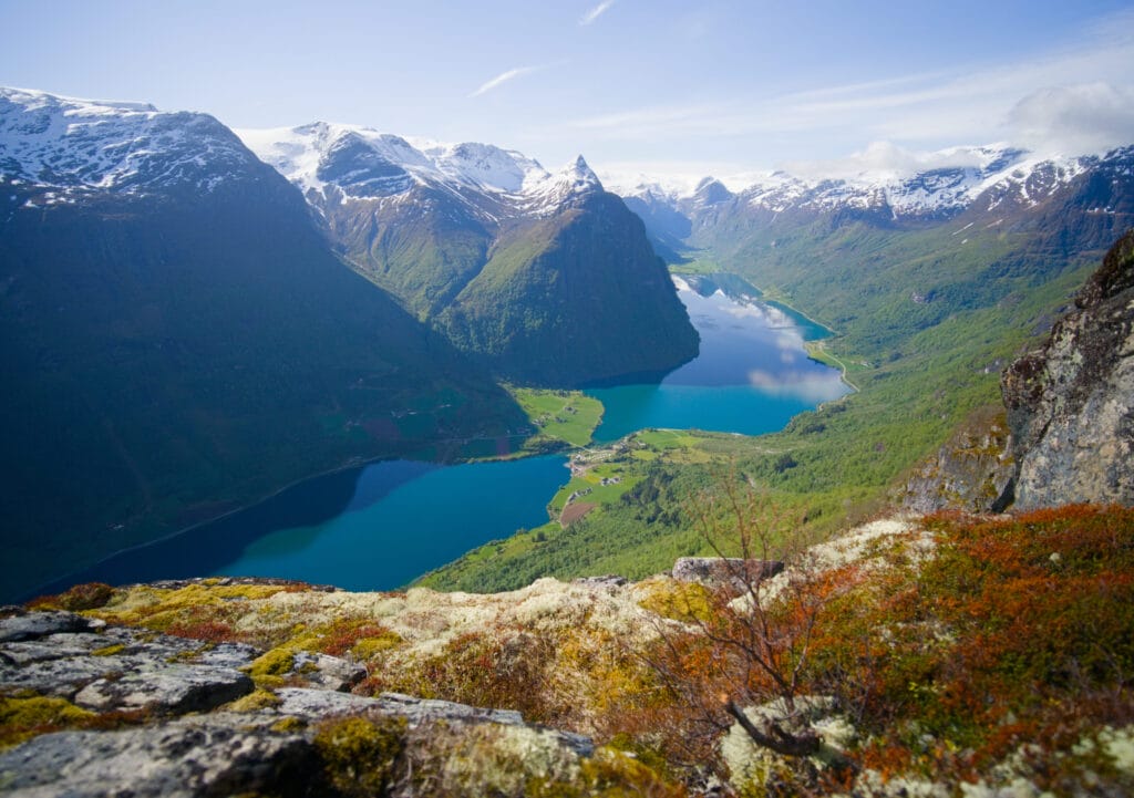
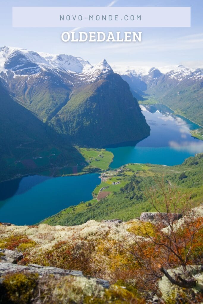
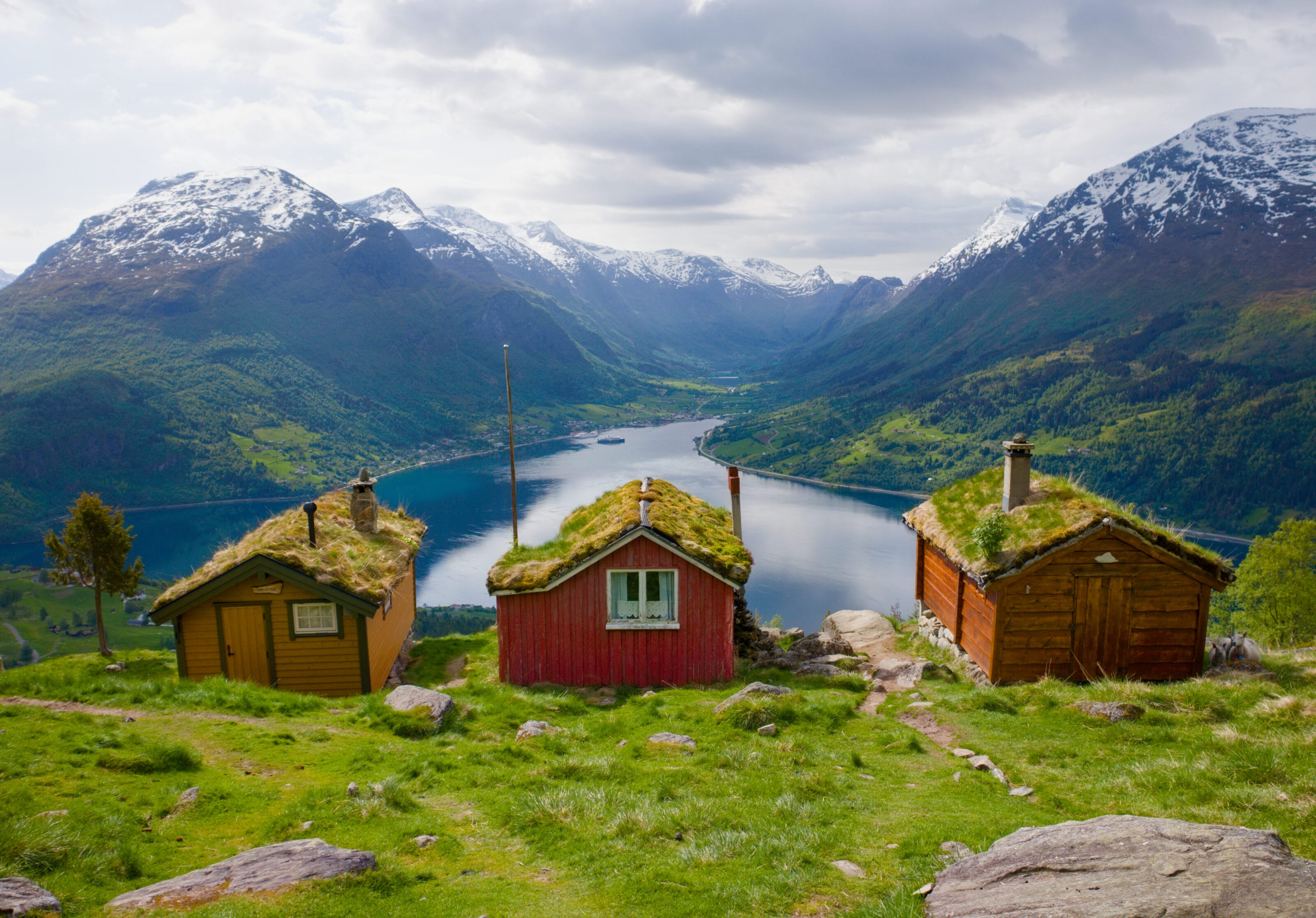
From the summit, you’ll have a spectacular view of the entire valley and its emerald-green lake, with waterfalls and glaciers in the background. You won’t regret the effort it took to get there. Oh, and another plus is that I didn’t run into a single person on this trail. Not exactly the same vibe as at Briksdalbreen at the bottom of the valley 😉
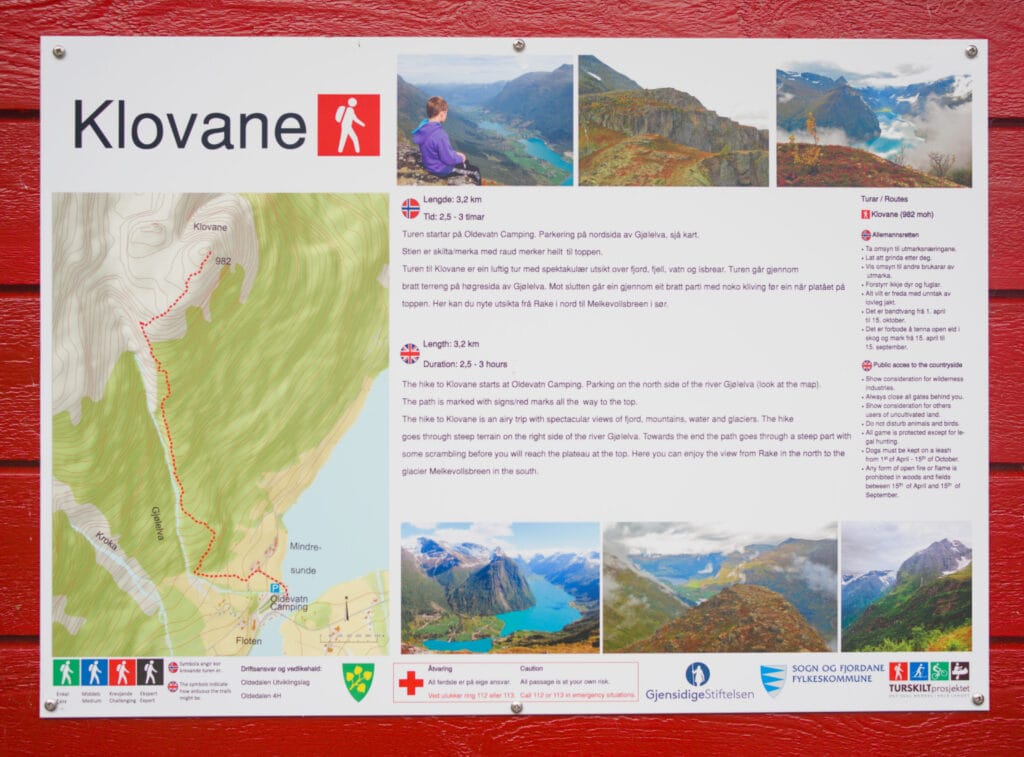
- Distance: 6.8 km round trip
- Elevation gain: 970 m
- Duration: 4–6 hours, depending on your endurance level
- Difficulty: I’d say that even though it’s fairly short, it’s a pretty challenging hike because after 1.5 km, the trail starts to climb quite steeply
- Note: I’ve included the GPX track I recorded with my watch because the trail on the map is drawn incorrectly. If you have the Pro version of AllTrails, you can see it pretty easily using the heatmap.
So the Klovane hike starts at the Oldevatn campground, which is really convenient. This time I’m tackling it on my own because we’ve done quite a few hikes since the start of the trip, and Fabienne didn’t mind sleeping in a bit longer… plus, the idea of climbing “that wall” didn’t feel super appealing to her 🙂
Because, yeah, there’s not much suspense on this hike: it goes almost straight up to the top. Then again, if you come to Norway too, you’ll see that Norwegians don’t usually take many detours on their way to the tops of their mountains, lol.
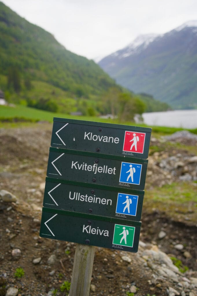
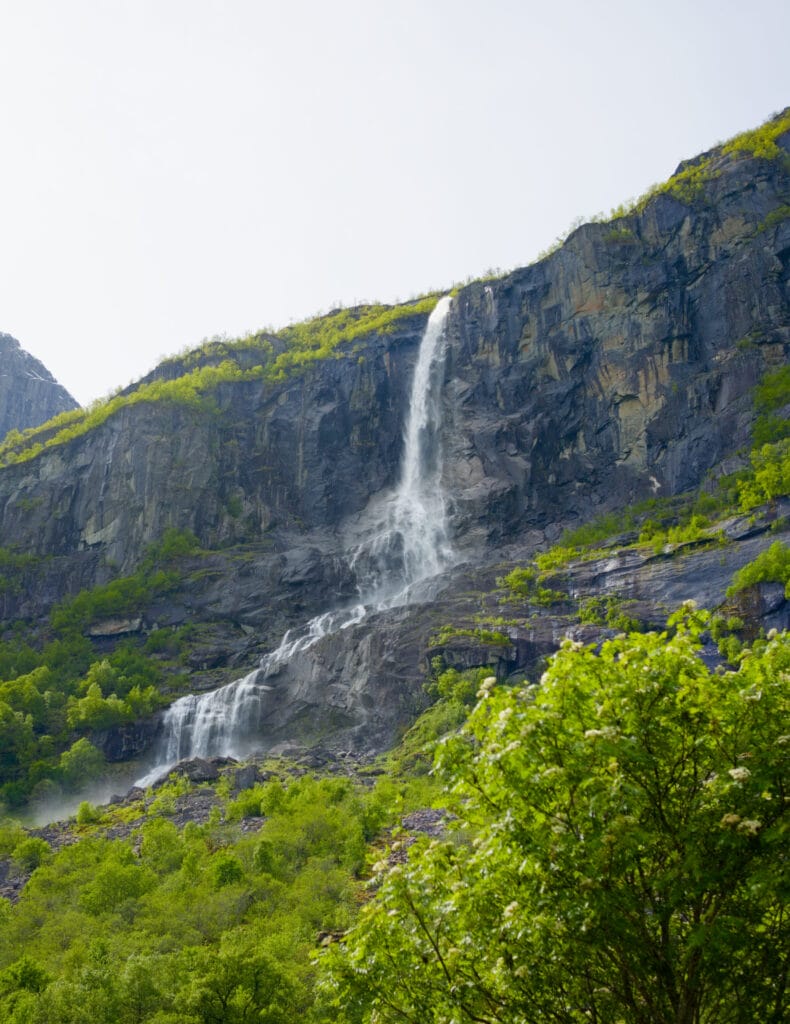
Right behind the campground, you’ll find a hiking sign that marks the Klovane trail in red, as well as 2–3 other routes that aren’t listed on Alltrails (unless you look at the heatmap). Behind the farm, you immediately reach the hiking trail that climbs to the right of the river. I found that the first kilometer and a half wasn’t too difficult yet. It does go uphill, but the trail is in good condition and you never need to use your hands for support. Plus, the weather was gorgeous that day, and I took advantage of the beautiful morning light to enjoy the view of the lake and the Vollefossen waterfall, which gradually came into view behind me.
After that, though, things get a little trickier. It’s nothing super technical, but it climbs pretty steeply on a wet, rocky trail. Several times I had to use my hands to help pull myself up. If you’re used to this kind of terrain, it’s nothing you can’t handle, but let’s just say this section is enough to really get your heart rate up.
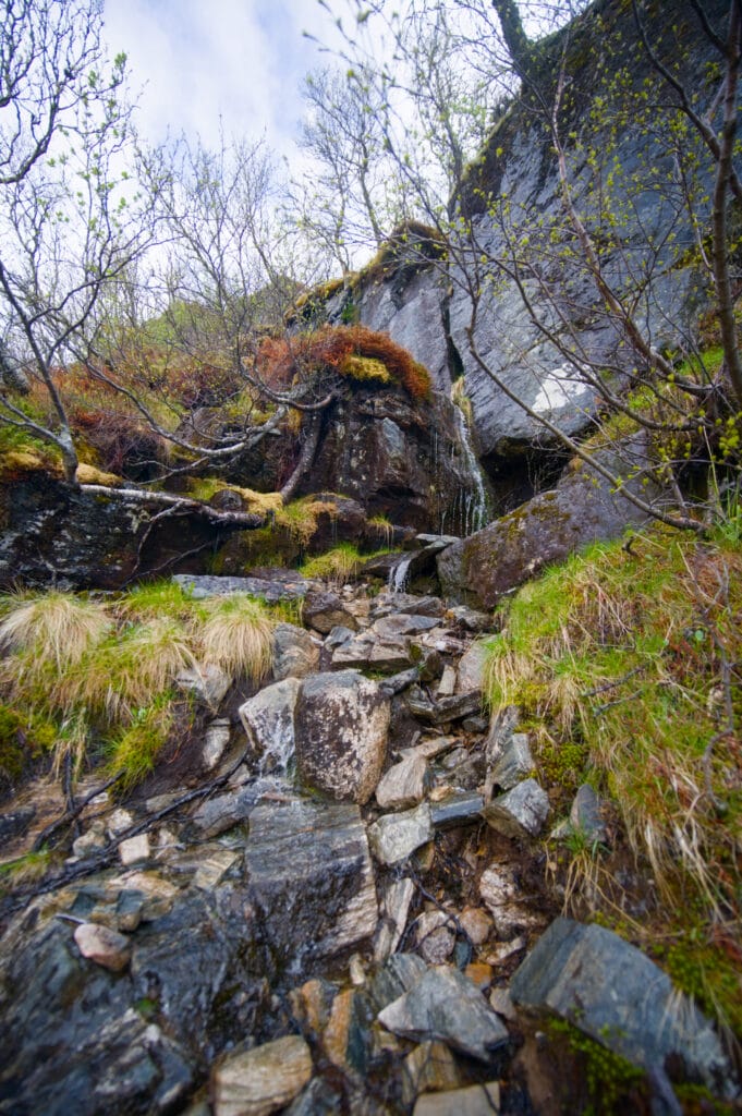
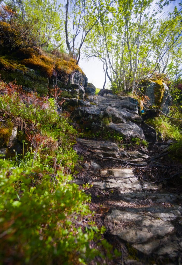
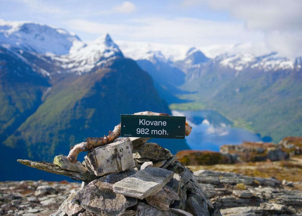
After this more challenging stretch, which is about 1 km long, you reach the high plateau, where the slope levels off considerably. Personally, I climbed straight up to the summit of Klovane, marked by a large cairn. But the two most beautiful viewpoints are located either just before the summit (overlooking the valley floor and the glacier) on the right, or just past the summit (looking toward Olden). I’ve marked these two viewpoints directly on the AllTrails map to help you.
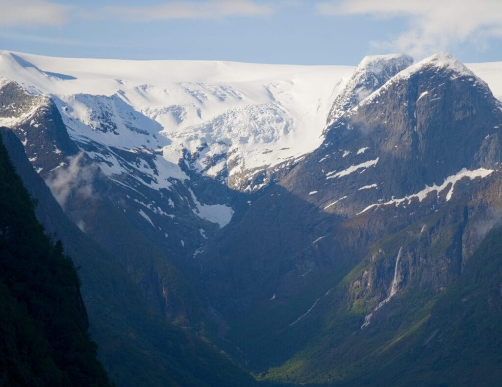
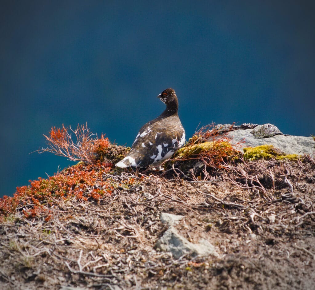
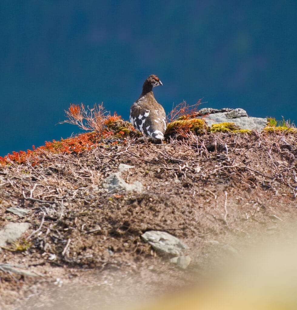
From up there, the view is simply spectacular. The color of Oldevatnet Lake below really stands out, and you can admire the hanging glaciers at the tops of the surrounding mountains. Without a doubt, one of my favorite viewpoints in Norway. Plus, I was lucky enough to come across a cute ptarmigan that wasn’t very shy, so it let me snap a couple of photos of it 😉
The Briksdal Glacier (Briksdalbreen) in Jostedalsbreen National Park
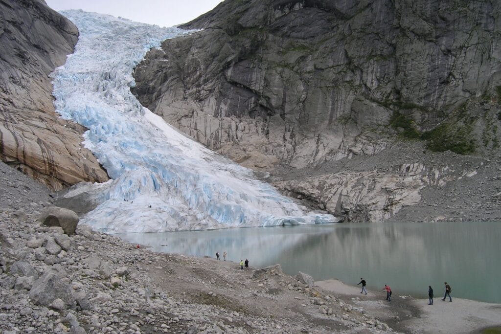
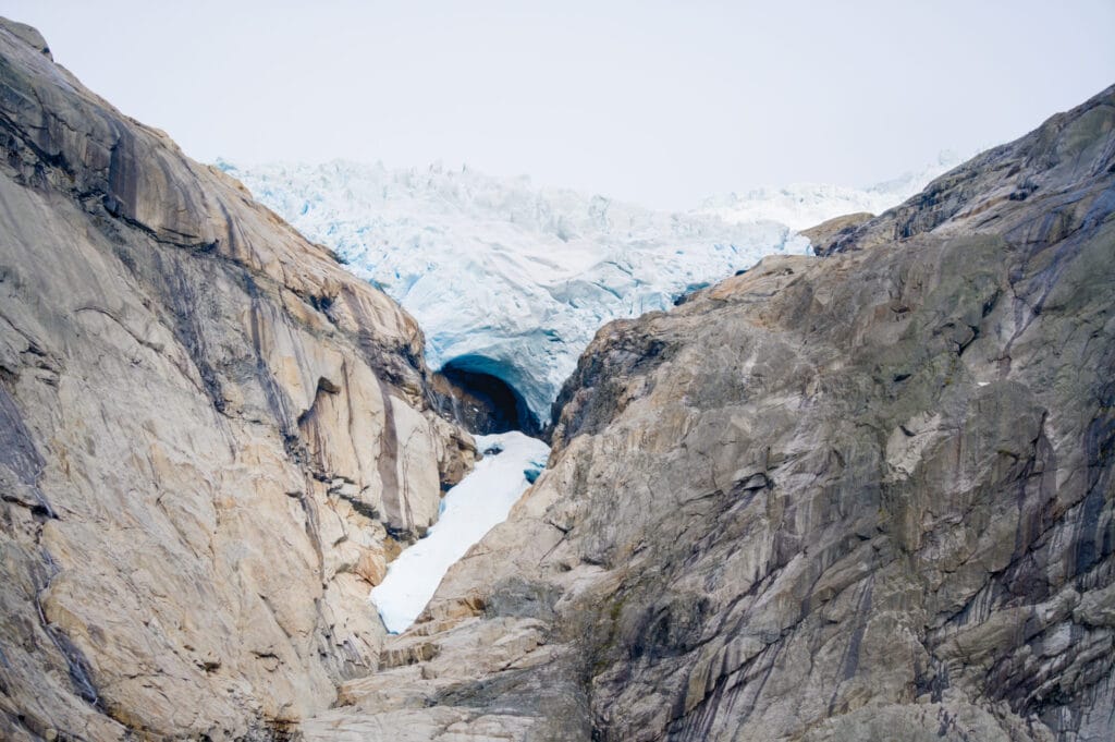
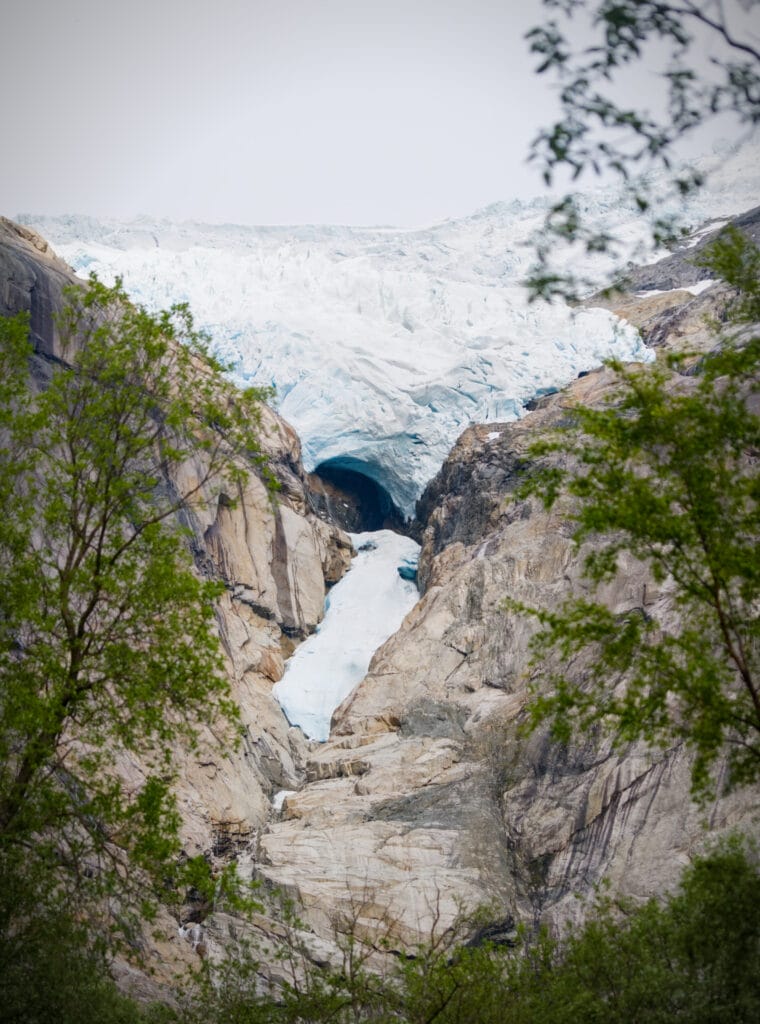
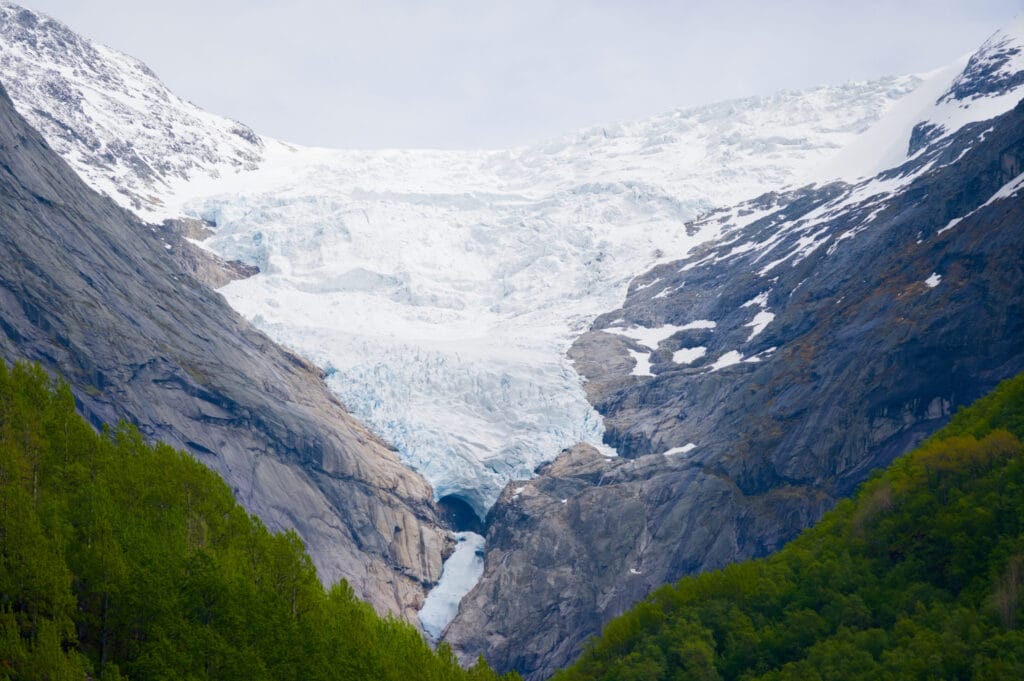
The Briksdal Glacier is still the main attraction of the Oldedalen Valley. However, I have to say that it doesn’t look very impressive in 2026, and that this place is now more interesting for seeing the effects of climate change than for admiring the glacier itself (though then again, maybe we’re a little jaded since we live at the foot of a glacier in Switzerland 😉 ).
Briksdalbreen’s popularity is nothing new; as early as the 1900s, more than 1,000 people were already visiting it every day, thanks to a trail that had been built back then by local farmers. Today, between 1,500 and 2,000 people a day come to see the glacier, which isn’t such an incredible increase in visitor numbers over the course of more than a century.
The Briksdal Glacier is also known for a rather unusual event that occurred in the 1990s (known as the Briksdalbre event): Between 1993 and 1996, the glacier tongue grew by nearly 300 meters in just a few years, covering almost the entire lake that we see today. This was obviously not an isolated case in southern Norway, but it was the Briksdal Glacier that was most affected (meaning it grew the most). This event has been attributed to a sharp increase in snowfall during those years.
Unfortunately, it took just 7 years, starting in 2001, for the glacier to lose more than 400 meters due to rising temperatures. These days, measurements have even been halted since the glacier tongue hardly extends into the valley anymore (and is therefore inaccessible on foot). For more information, including several before-and-after photos of the Briksdal Glacier, I recommend checking out this page, it’s very informative.
The Briksdalbreen Hike
The Melkevoll Bretun Campground
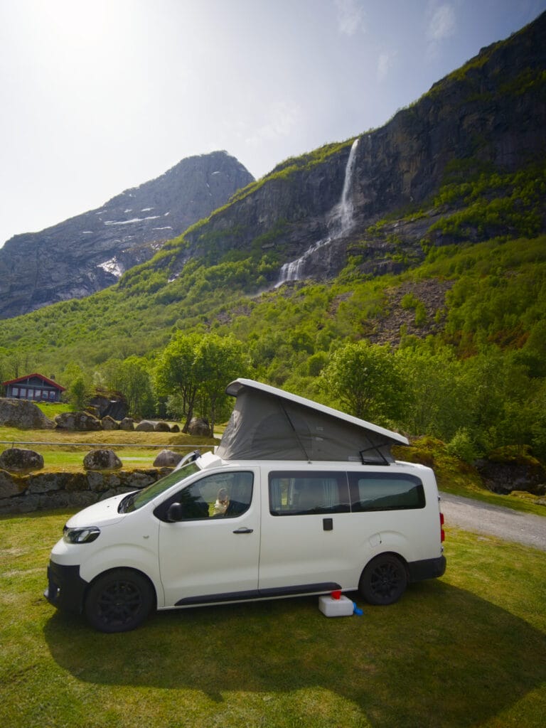
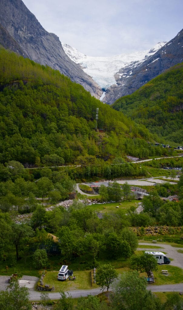
Before I tell you about the glacier hike, let’s start with the incredible Melkevoll Bretun campground, which is the perfect base for exploring the bottom of the Oldedalen valley. This campground (just like the Oldevatn campground) should be held up as a model! The campsites are spacious, nestled in nature among the trees and rocks. There’s a beautiful wooden common room with BBQs available, a sauna with access to the river for a quick dip in the cold water, and a yoga room built right up against a massive granite boulder that’s an integral part of the building (of course, cleanliness is top-notch, but that’s practically standard in Norway).
The icing on the cake is that the campground is located at the starting point of plenty of hikes and right below the enormous Vollefossen waterfall, which we could already see from the middle of the valley. The scenery, with glaciers, rivers, and waterfalls, is just incredible! If we could do it all over again, the only thing we’d change is that we’d stay 2–3 nights instead of just one. That would have given us time to do the last two hikes I’ll mention at the end of this post, which we didn’t have time to do.
Note: For climbers, there are also plenty of boulders to climb in and around the campground. The guidebook is available at the front desk.
Hike from the campground to the Briksdal Glacier
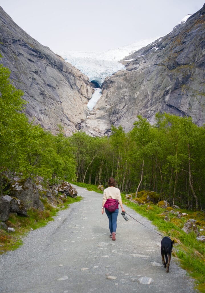
This hike is one of the most popular in Norway and was truly designed to be accessible to everyone. The trail leading up to the lake at the foot of the glacier is extremely well-maintained (it’s actually more like a path) and presents no difficulty. There are even small cars (called “troll cars”) that can take you up to the glacier for 300 NOK, but of course, we recommend walking if you can.
- Distance: 5.5 km round trip
- Elevation gain: 250 m
- Duration: 2–3 hours
- Difficulty: easy
- Note: We recommend checking the Olden Harbor website to see if any cruise ships will be there on the day you plan to go hiking. If so, head up to the glacier early in the morning or late in the afternoon, when the buses have already left with the cruise passengers.
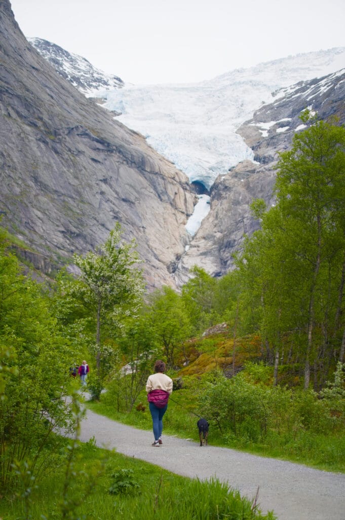
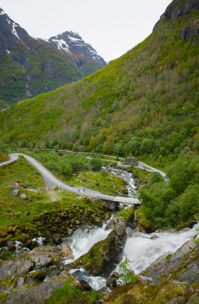
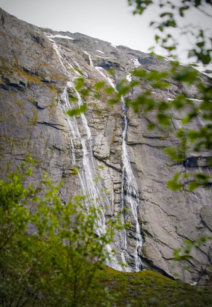
The hiking trail winds up the valley along the river (since there’s also a wider path for golf carts), passing by some beautiful waterfalls. Kleivafossen, the first waterfall, has a powerful flow and is sure to splash you.
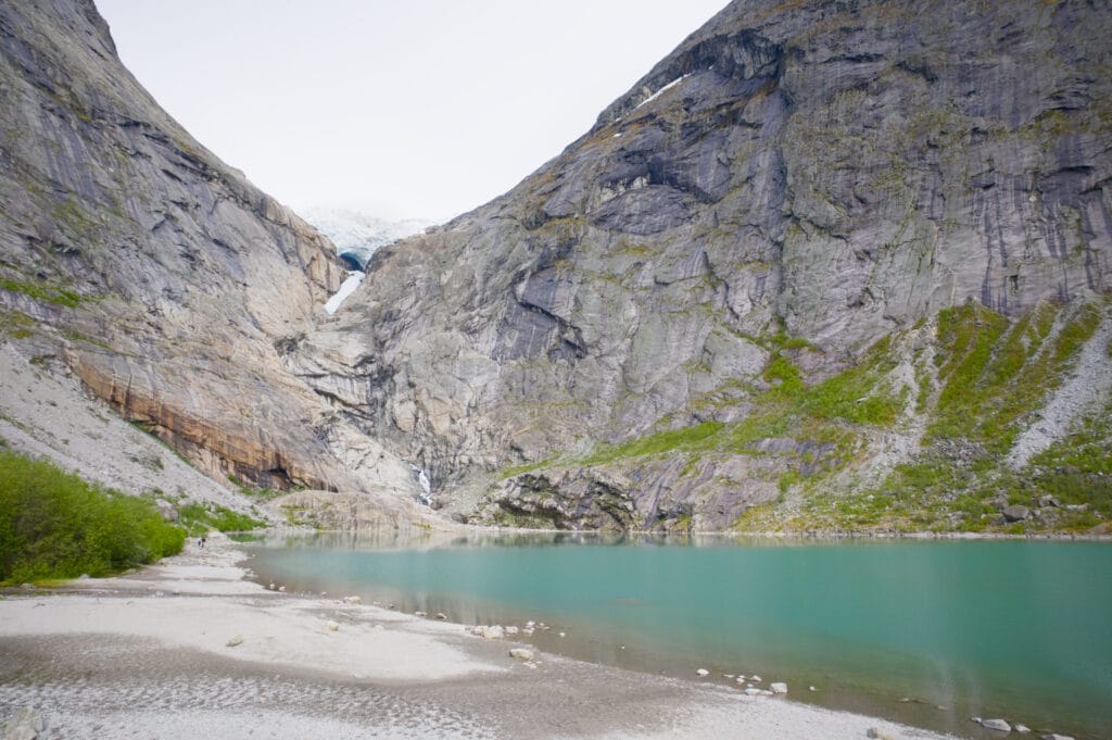
All along the trail, there are also informational signs that tell the story of the area and the glacier’s evolution over time. Then you finally arrive at the lake, which is surrounded by impressive cliffs carved by the glacier. The glacier tongue is now much higher than the lake… to think that less than 20 years ago, you could still touch the ice at the end of the trail!
Other Hikes in the Oldedalen Valley
As is often the case, it’s when you spend a few days in one place that you discover other trails or routes you wish you’d taken. We could have stayed longer in Oldedalen, but well, southern Norway is a big place, and even with a 6-7 week trip (which is already pretty good, you’ll agree 😉 ), we had to make some choices 🙂 .
In any case, I’m still going to share two other hikes with you that I think I would have really enjoyed starting from the Melkevoll Bretun campground. Just in case you’d like to extend your stay deep in this beautiful valley 😉
The Kattanakken Hike
It was while hiking up to the Briksdal Glacier that I saw, just before the lake, a trail branching off to the right with a sign pointing to Kattanakken (the cat’s eye). After doing a bit of research, it seems this is a magnificent but challenging ridge hike that climbs to a viewpoint offering a breathtaking panorama of the surrounding glaciers and peaks.
On the trail sign, the hike is marked in black, which means “for experts only” on the Norwegian scale. So expect a nice little adventure. But if you read the reviews of this hike on AllTrails, it seems that only the last section is a bit more exposed.
- Distance: about 14 km round trip
- Elevation gain: 1,250 m
- Duration: 6–8 hours
- Difficulty: difficult
The Oldeskaret Hike
Another hike that looked great starting from the Melkevoll Bretun campground is the Oldeskaret trail. The trail climbs behind the Vollefossen waterfall to a plateau with beautiful high-altitude lakes and numerous viewpoints overlooking the glaciers. The trail has also been re-routed by Nepalese sherpas, making it more accessible than before.
Actually, Oldeskaret is a mountain pass, and if you continue to the summit, you can descend into the Stardalen valley (but it’s easier to do it as a round trip; otherwise, you’ll need transportation to the other side). For the more adventurous among you, you could also hike up to Blåfjellet from the pass.
- Distance: about 9 km round trip
- Elevation gain: 1,050 m
- Duration: 5–6 hours
- Difficulty: fairly difficult
Well, I think that covers all our little discoveries in the Oldedalen Valley. I hope you enjoyed it and that you’ll find some inspiration here to help you plan your trip to Norway. If you have any questions or comments, feel free to use the comments section below 🙂
Pin it on Pinterest


Join the discussion