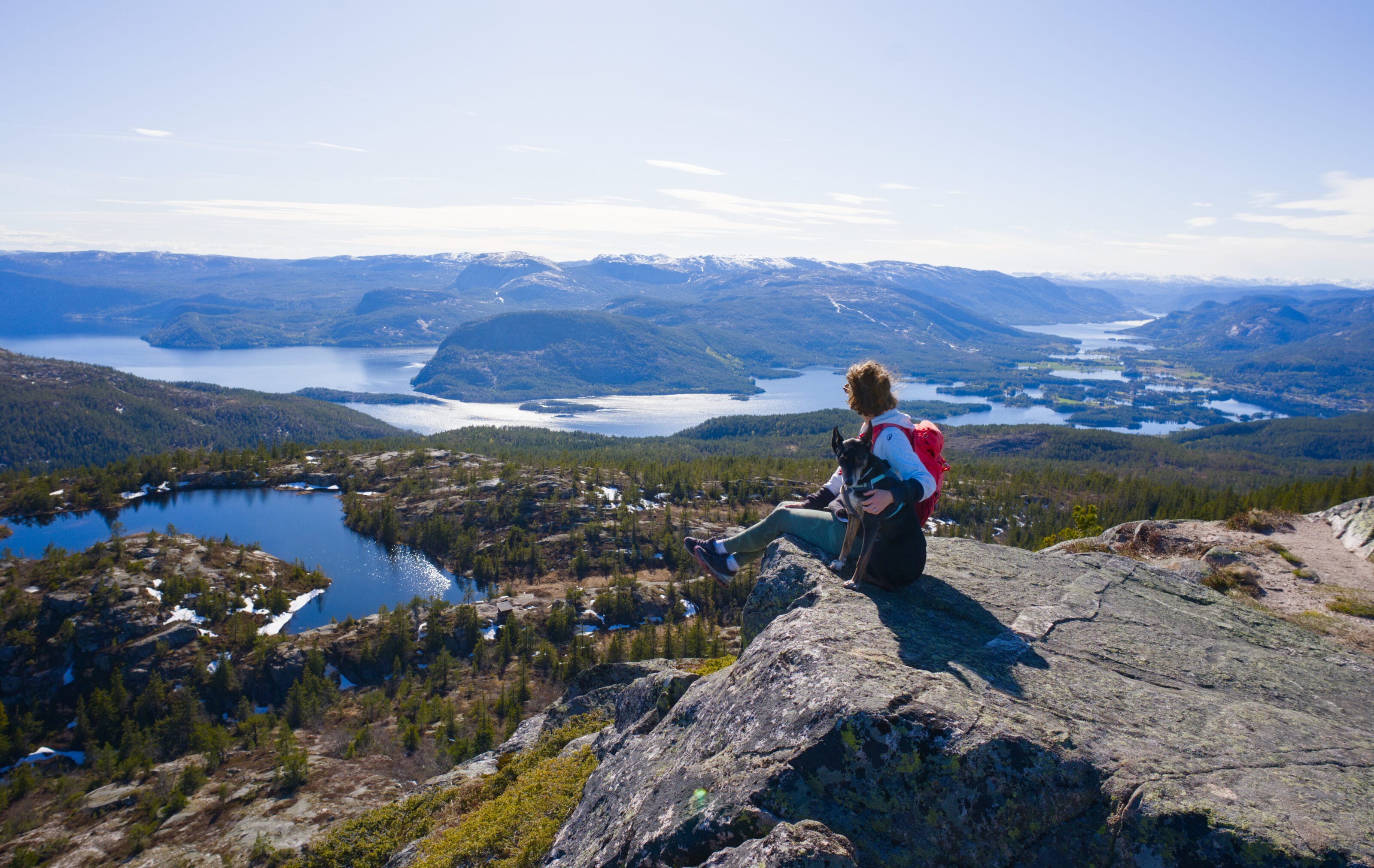
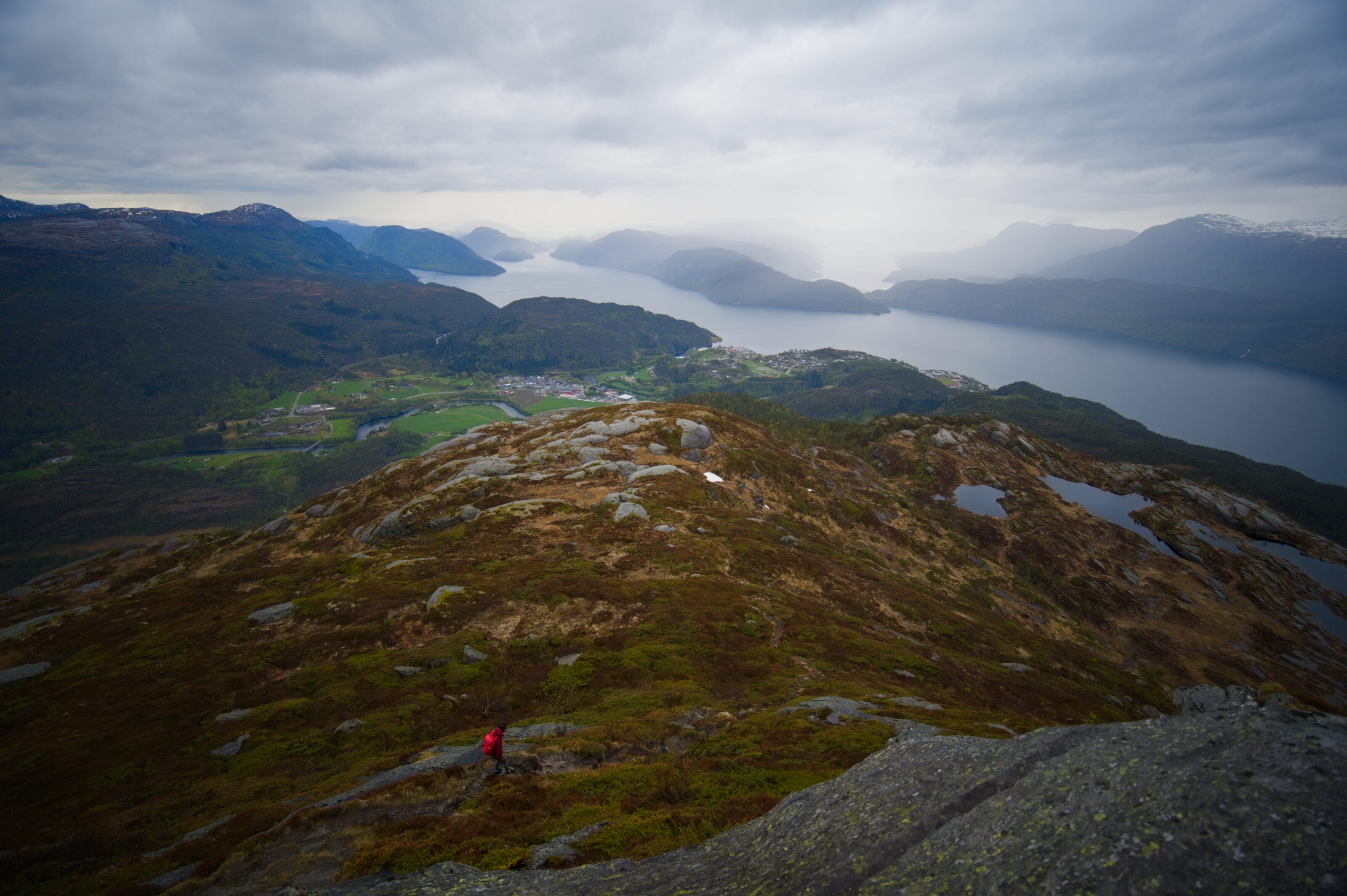
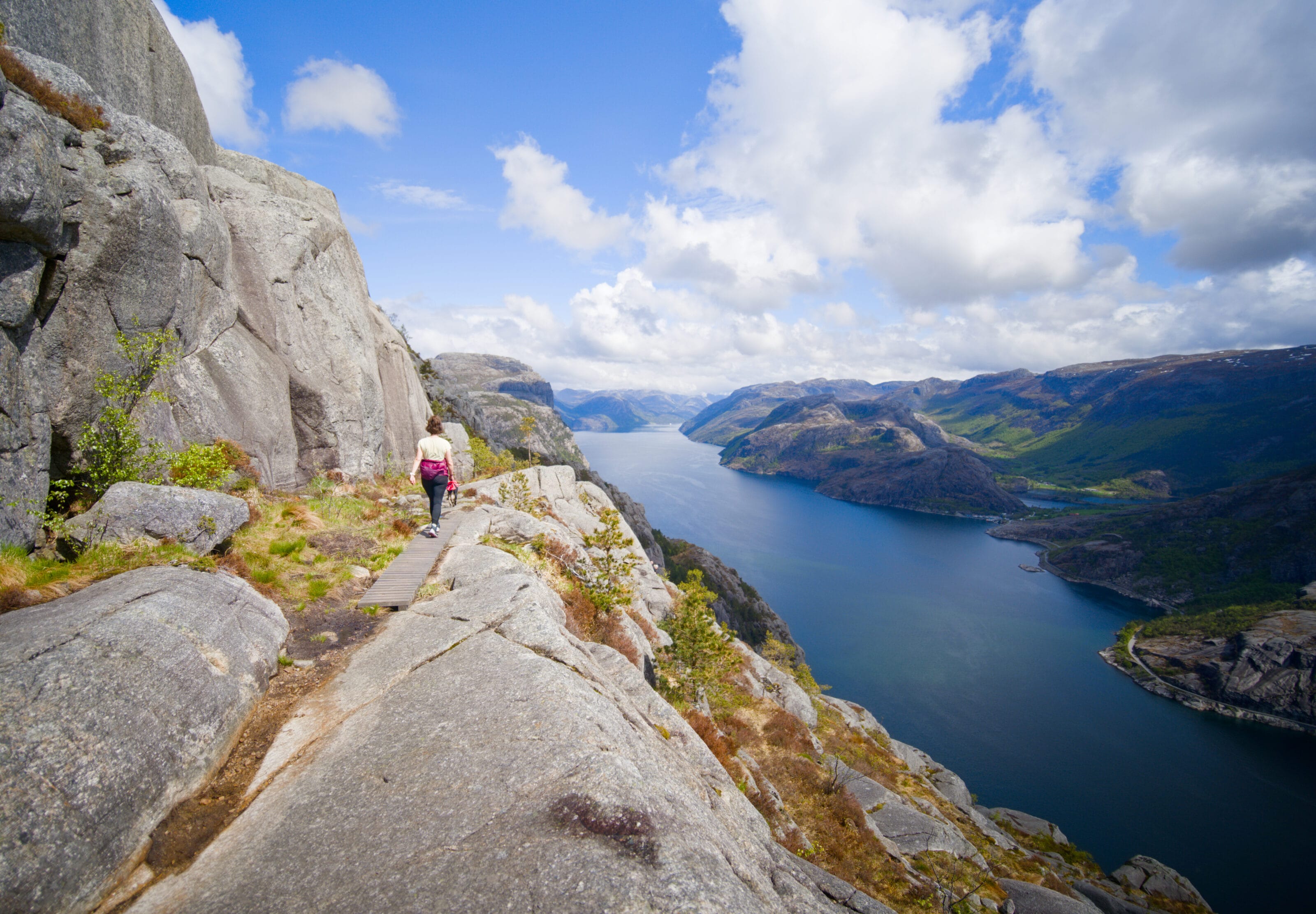
We’re continuing our series of articles on hikes in southern Norway. Today, we’re suggesting a very short route that’s actually quite well-known: Rakssetra. We’ll be honest—we were hesitant to go… the spot is known for being very “Instagrammable” and easily accessible. Those two factors combined usually mean the place will be crowded. In the end, clear skies as we passed by Loen convinced us to make the detour, and honestly, we don’t regret it at all! Come on, let’s take you there.
Where is Rakssetra located in Norway?
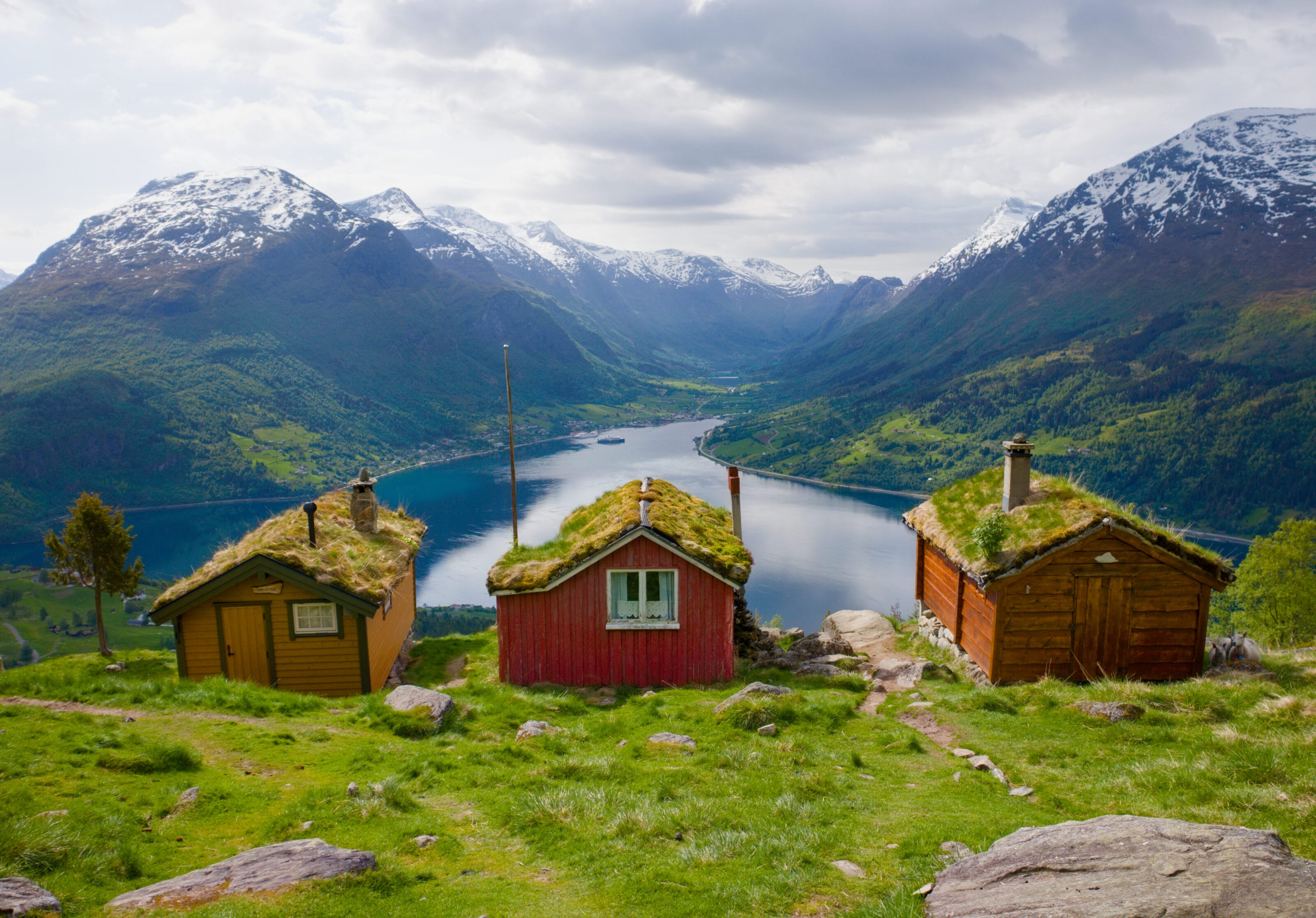
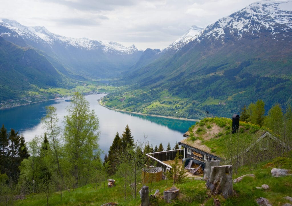
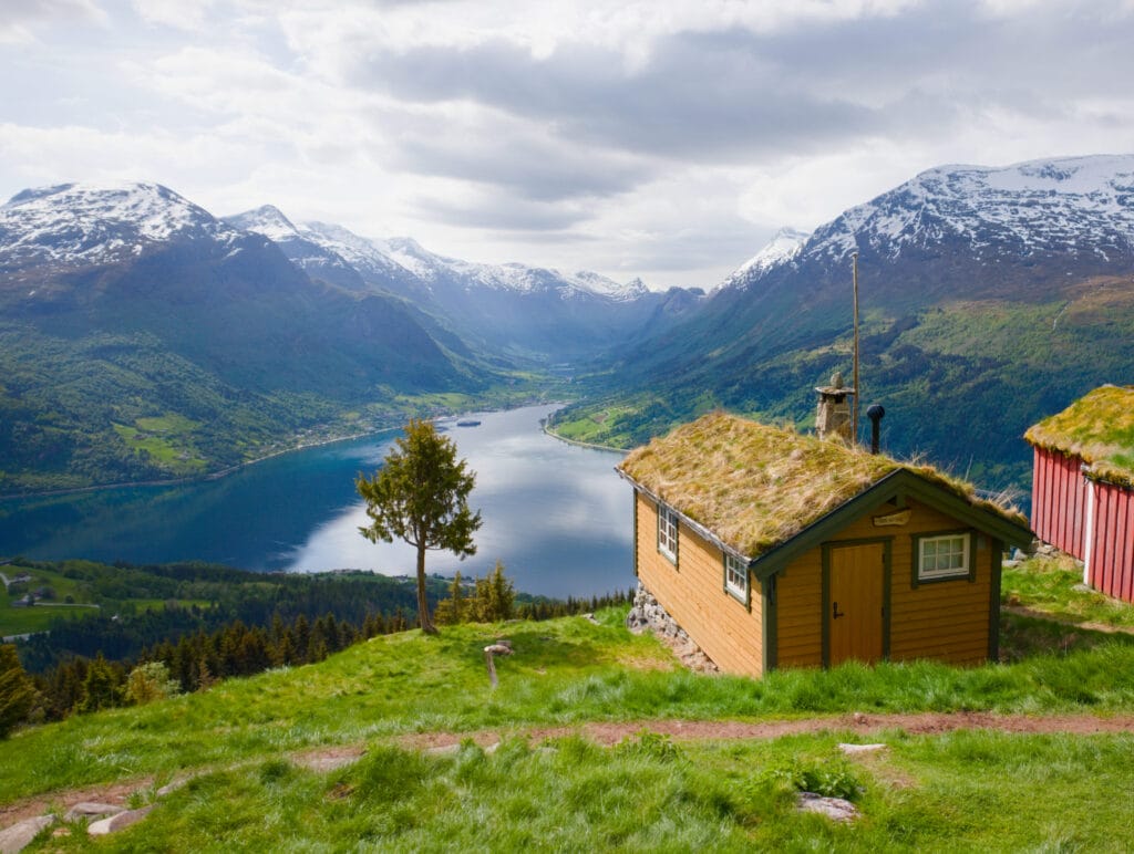
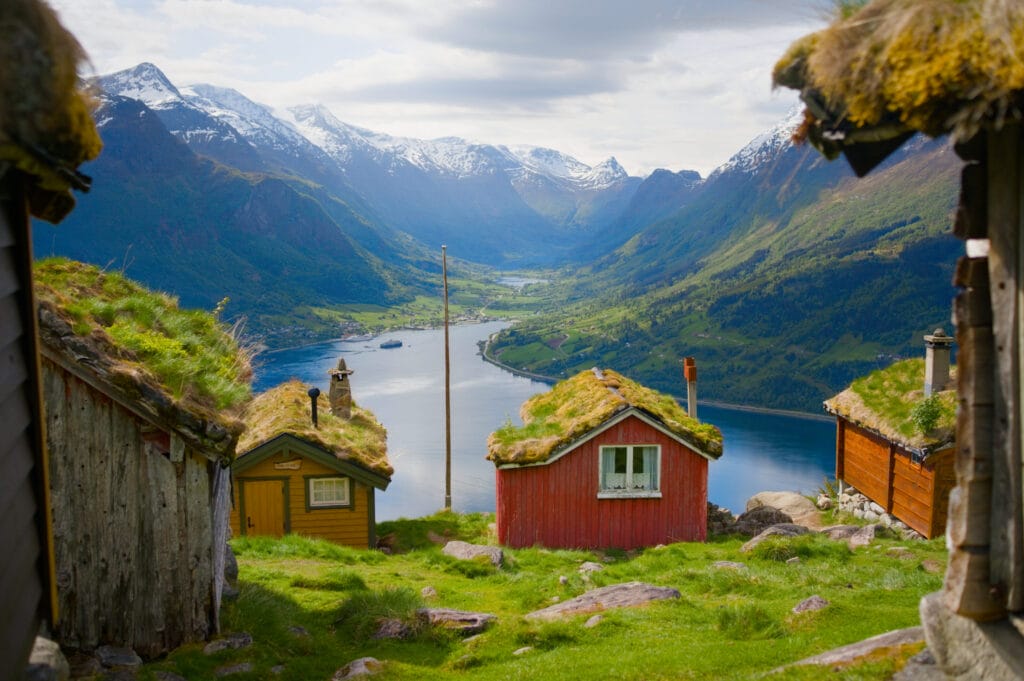
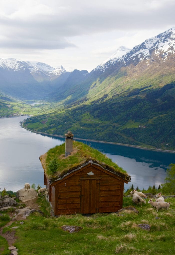
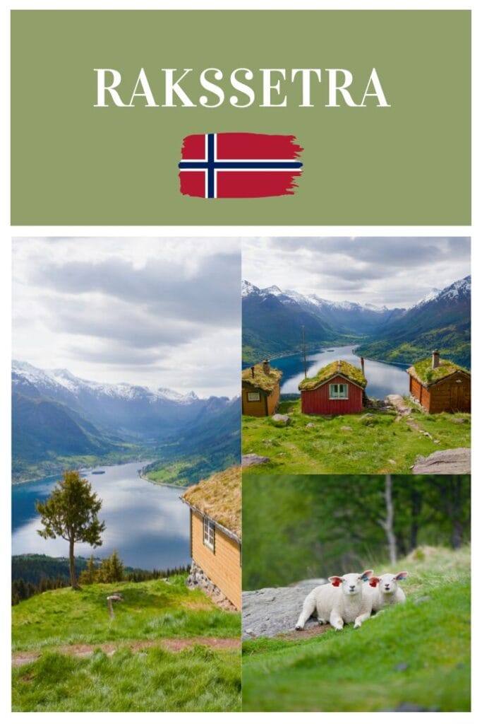
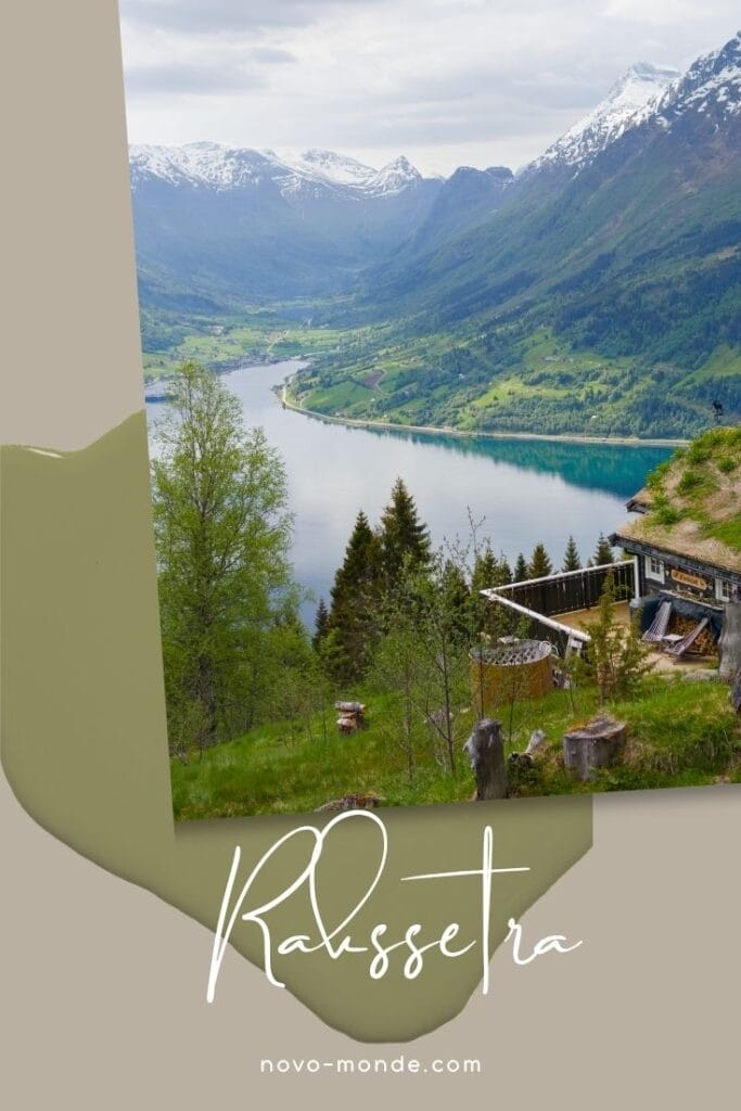
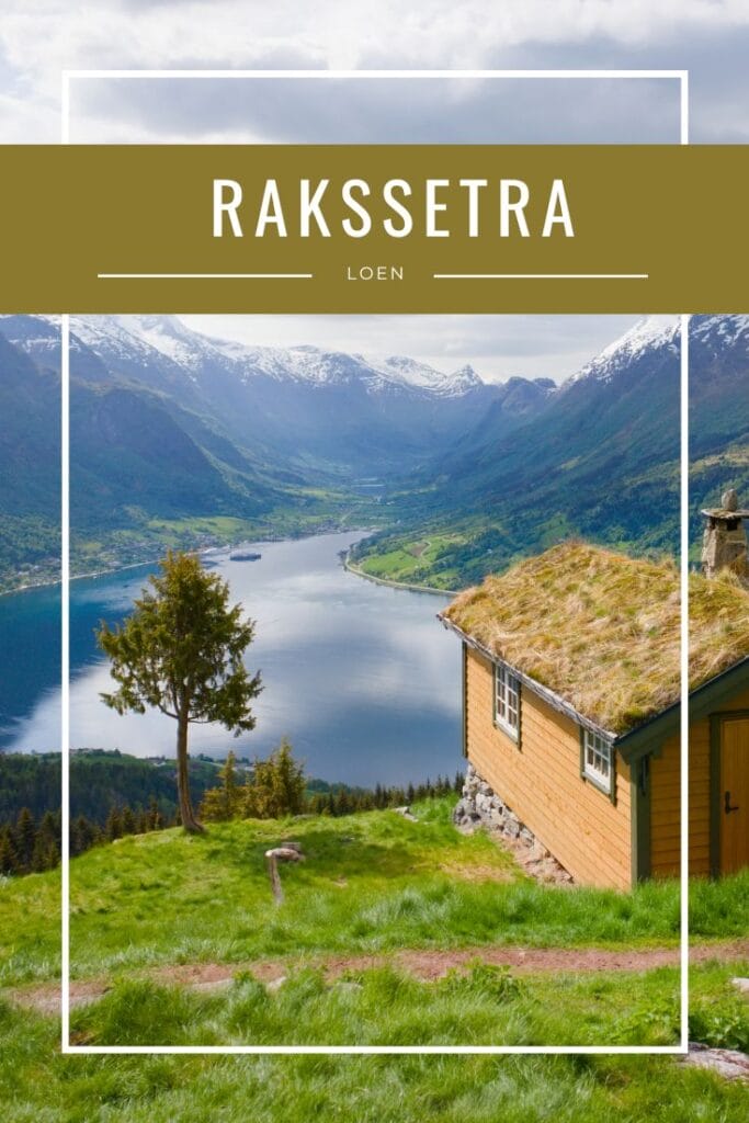
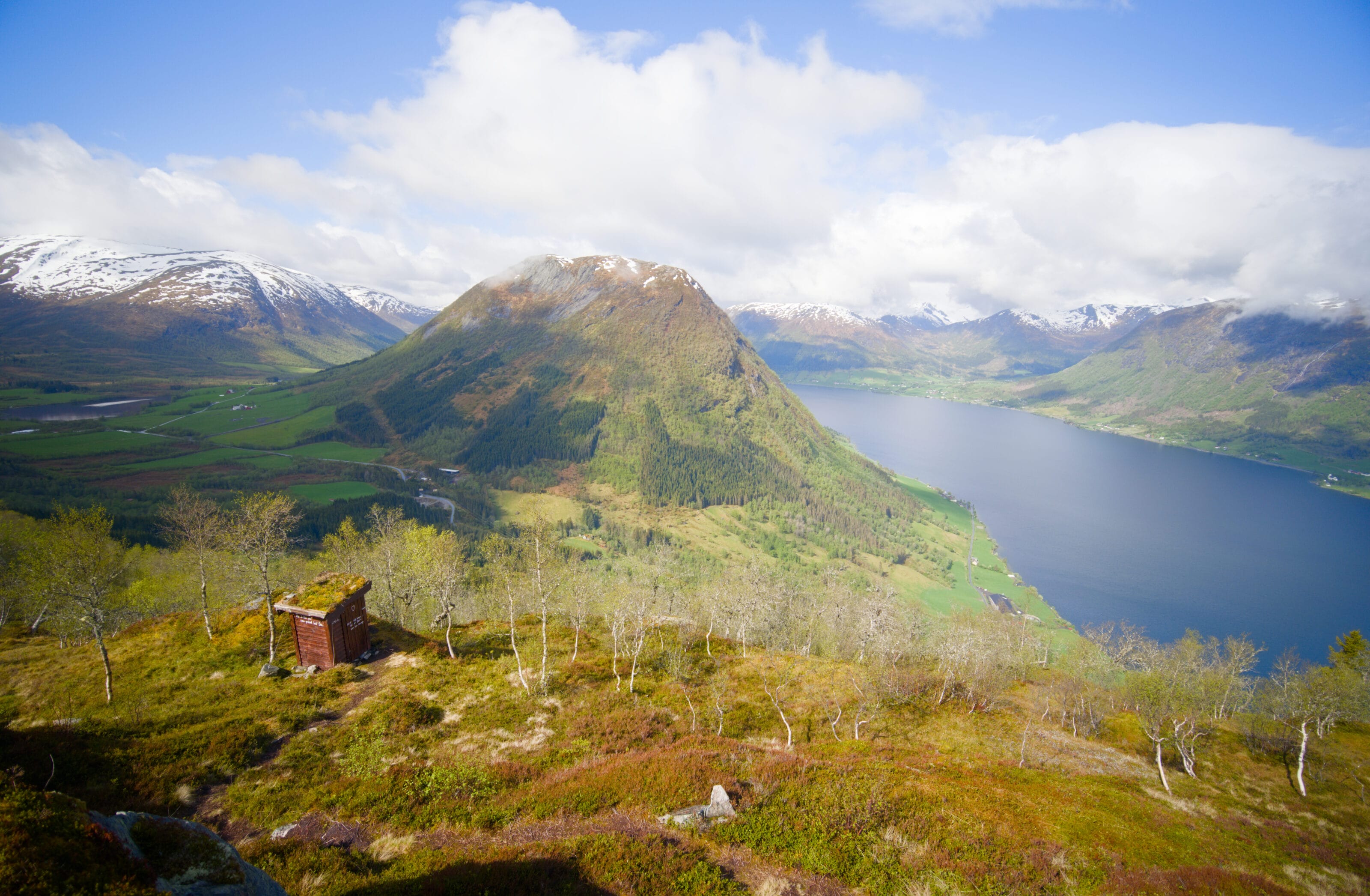
Rakssetra isn’t the name of a village or town, but rather a “hamlet” or small cluster of houses located above the village of Oppenheim. It is a former mountain pasture (called a “seter” in Norwegian). What makes this tiny hamlet between Loen and Stryn special is that it offers a magnificent view of the Nordfjord, with charming little traditional houses and their green roofs in the foreground.
The small mountain pasture is located at an elevation of 540 meters, which is about 250 meters above the parking lot at the top of Oppenheim.
Start above Oppenheim
We arrived quite early in the morning and were one of the first cars in the large (paid) parking lot located at the start of the hike. Not knowing just how popular the place was, we decided to arrive relatively early (we got there around 8:30 a.m.). The road leading there is relatively narrow, but you can tell it’s well-traveled… The official parking lot is at the end of the road, but a few hundred meters before that, there are several other private parking lots (also paid) that have been set up.
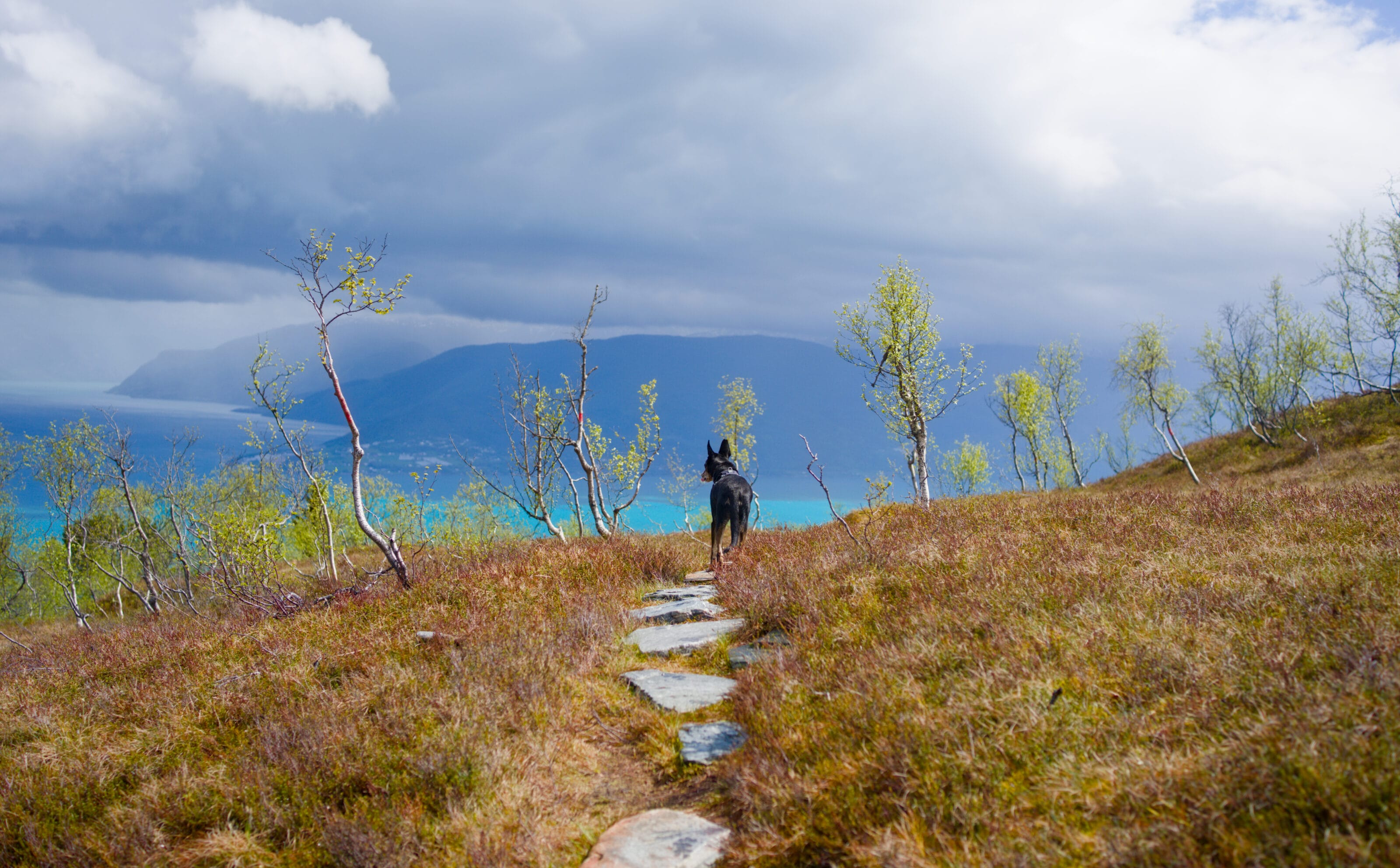
Starting from the parking lot, there’s no need to hesitate—the trail is clearly marked and well-signposted. In fact, it seems the trail was completely rebuilt in 2025, and instead of a dirt path with roots and rocks as it used to be, we now find ourselves on a wide gravel path that climbs toward Rakssetra.
The Ascent to Rakssetra
Starting from the parking lot, we begin by climbing up this gravel path and cutting across the paved road’s switchbacks three times which winds up to the summit of Hoven. Then we reach a section in the forest where, I must admit, Benoit and I had a little laugh when we realized that, once again, the Norwegians clearly don’t like detours at all. In Switzerland, France, or more generally in the Alps, a hiking trail would typically wind in “hairpin turns” to provide a steady and relatively gentle ascent. In Norway? Oh well, if you’re going to climb, you might as well go straight up, right? The path climbs straight up and at times reaches a 35% grade. You don’t need to be a geometry whiz to know that’s really steep. 🙂 And sorry, but the photos don’t really do the terrain justice, so you’ll just have to take my word for it.
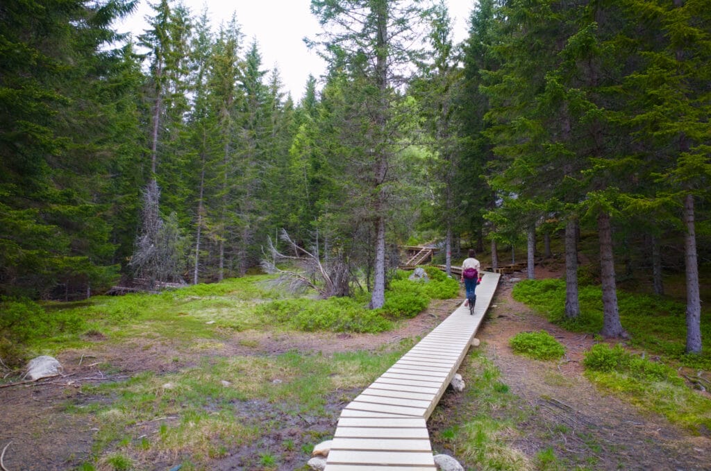
But don’t worry—it’s steep, but it’s also really short! About 800 m after leaving the parking lot, you’ll already reach a section of the trail that’s equipped with wooden walkways. The area seems more marshy, so this solution was chosen to ensure hikers keep their feet dry. Let’s be honest—after our previous experiences on Norwegian trails, I’m actually pretty happy to see this infrastructure. 😉
At the end of the footbridges, you reach the final section of the trail (about 300 m long), where the gravel path and footbridge give way to a more “conventional” trail. By that, I mean you’re walking on dirt with rocks and roots, but thanks to the well-trodden path left by hikers, the ground is well-packed and the stones have been cut to make it easier to walk.
Just 1 km past the parking lot, you arrive at Rakssetra, and that’s where the real reward awaits.

The Little Houses of Rakssetra
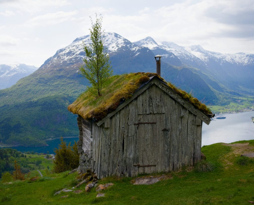
The now-famous little houses in Rakssetra weren’t built here for the enjoyment of visitors; they date back to the time when local farmers would come here during the summer months to graze their cows. We’re very familiar with the concept of mountain pastures because where we live, this practice is still widely used. In Norway, things are a bit different. Of course, a few mountain pastures still remain, but the vast majority have been abandoned in favor of more modern, low-altitude farming. Because, yes, hiking up on foot and spending two to three months a year in the mountains with your cows isn’t necessarily the most “profitable” practice—it’s more of an ancestral tradition.
These simple dwellings, without running water or electricity, served at the time as summer homes for mountain farmers. Today, these houses are still privately owned, but they are used as vacation homes.
I’d be hard-pressed to say whether the owners actually still go up there. But personally, I think that if my little haven of peace nestled in the mountains had become an Instagram hotspot, I’m pretty sure my desire to go there to recharge would probably have dried up. 😉
Although cows are no longer found in the hamlet, sheep are still very much present. Their insatiable appetite for fresh grass helps preserve the landscape and maintain biodiversity.
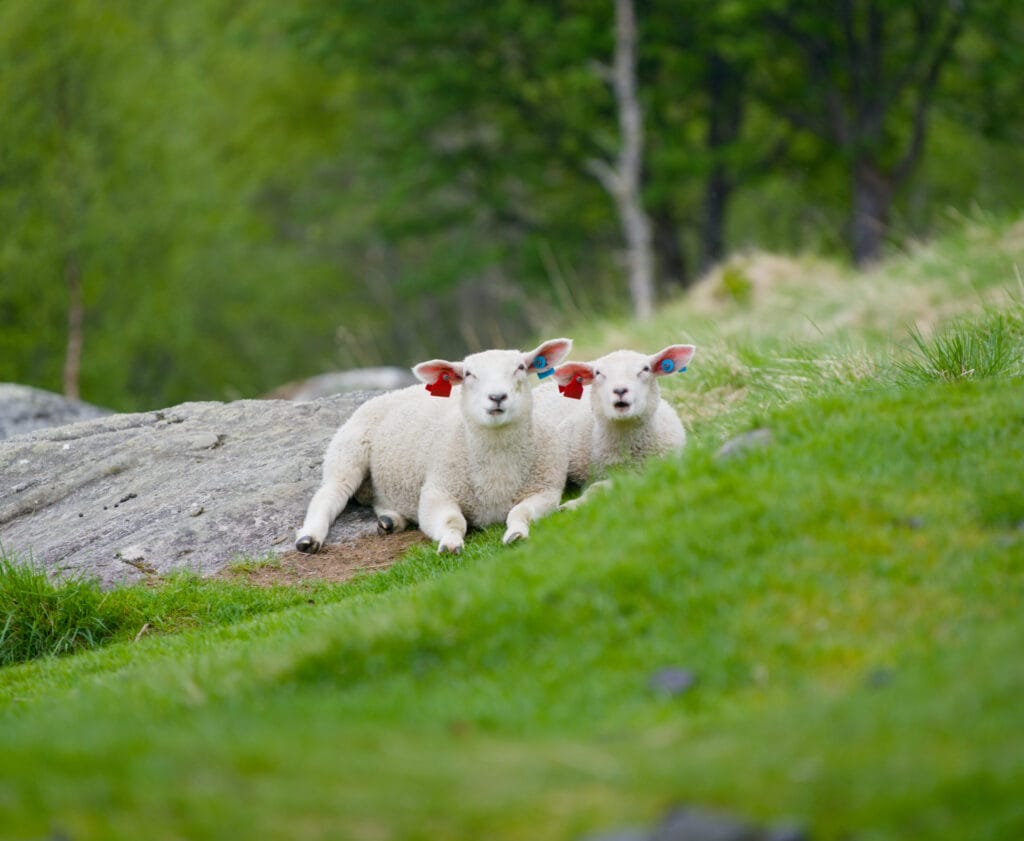
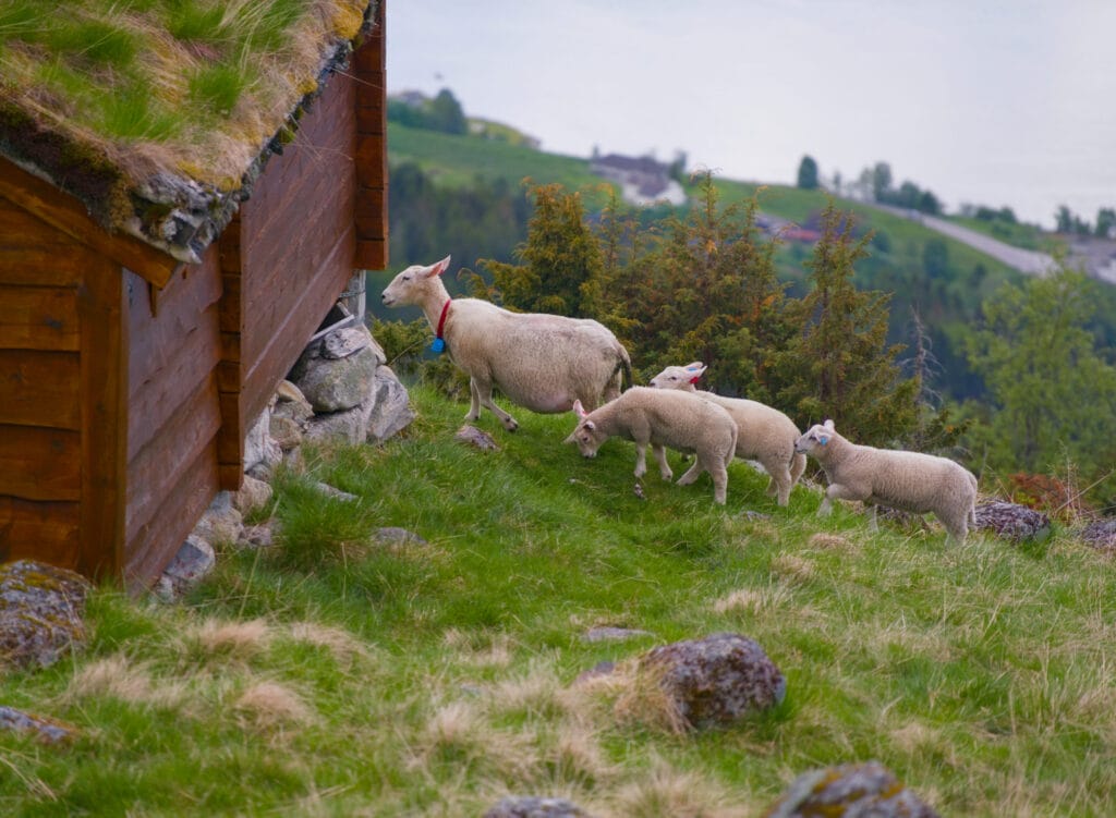
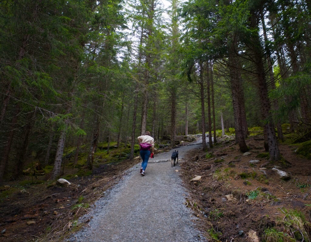
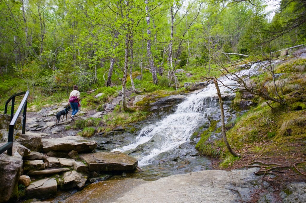
Clearly, these sheep are more than used to being disturbed while they’re eating, and the presence of people doesn’t seem to bother them much. That said, if—like us—you’re hiking with a dog, it’s really important to keep it on a leash to ensure the sheep aren’t disturbed. Our dog, Winchy, seems to be absolutely terrified of sheep, so we weren’t particularly worried about the sheep’s safety (to be honest, we were more concerned that a sheep might charge at the dog). 😉 Of course, he was on a leash the entire time.
Back to the Oppenheim parking lot: your options

As you’ll see on the map below, there are plenty of options for getting back to the parking lot, as well as for extending your walk a bit.
- Retrace your steps. That was the quickest option—and the one we chose. We still had other plans for the day, so we decided to go back to the car and continue on our way.
- Follow the paved road. I’m suggesting this option, especially if you have “bad knees.” On the way down, we passed several people heading up, and we remarked to each other that for some of them, the descent would probably be more challenging than the climb. The gravel trail is really well-maintained, but let’s be honest—it’s VERY steep in places. To go down, it’s best to be comfortable with the idea of “letting go” and taking small steps while keeping your weight firmly on the front of your feet. From the little houses, you can reach the paved road and follow it all the way down. Of course, this option is quite a bit longer (3.3 km instead of 1.1 km), but it’s also much gentler.
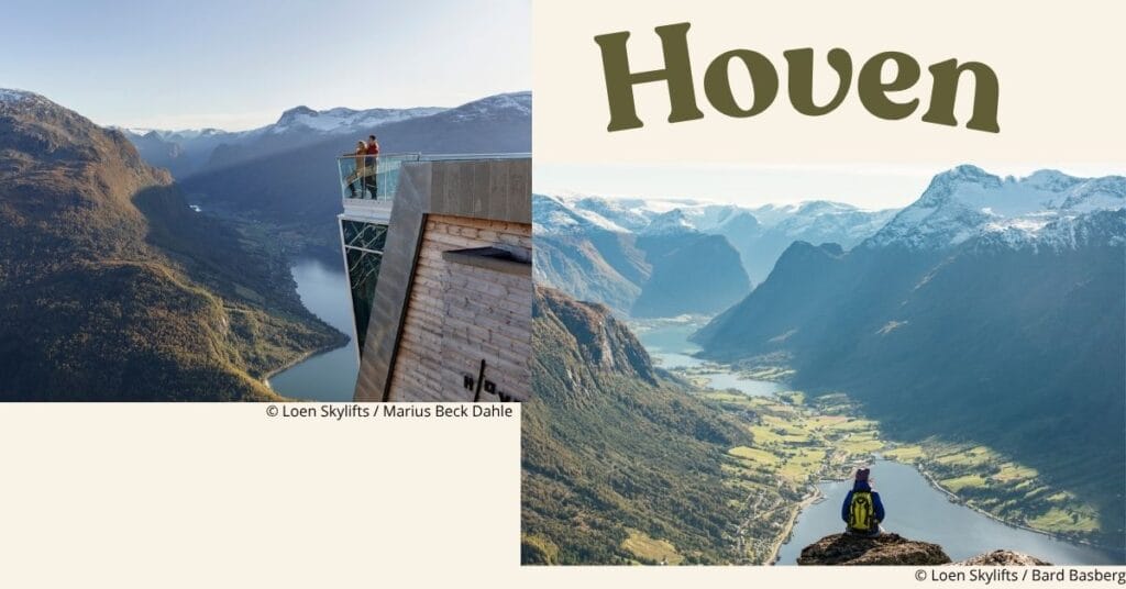
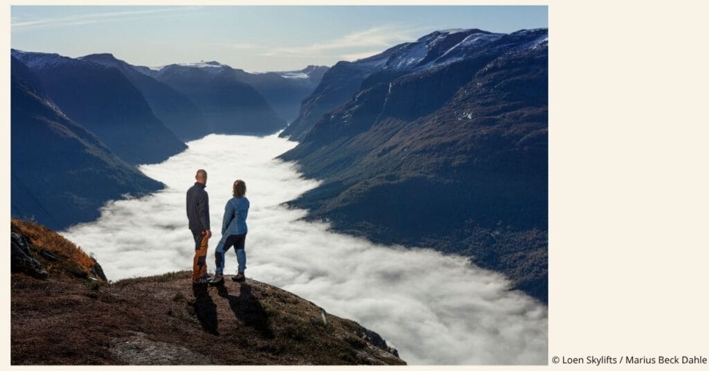
- Hiking up to Hoven via the Skredfjellet viewpoint. We definitely considered this option, but in the end we decided to go on another hike further along our route (Urkegga, which we’ll tell you more about very soon!). This popular route looks absolutely stunning. It adds about 9 km to the hike and 600 m of elevation gain if you do it as a round trip. It’s also important to note that the summit of Hoven is the terminus of the Loen Skylift, a large cable car that departs from Loen. For those of us who like to hike at a “leisurely” pace, we generally tend to prefer routes where the goal of the hike isn’t to reach a cable car station… 😉 But then again, the place really looks beautiful, and it’s a safe bet that the trail leading there would be relatively easy.
In short, you’ll find all these routes on the map right below.
Practical Information for the Walk
The parking lot
There is a large parking lot available above the village of Oppenheim. There is no height limit, although it’s worth noting that the access road isn’t very wide. That said, it’s still perfectly doable with a van or a minivan. As for RVs, I think it depends on the size of the vehicle… but unless you’re driving a 10-meter behemoth, you should be fine.
The parking fee was 90 NOK for the day in late May 2026. I’d like to specify the time period because this parking lot seems to be experiencing significant price increases… According to online sources, it cost 50 NOK in 2022, 70 NOK in 2024, 85 NOK in 2025, and now 90 NOK.
Paid parking in Norway
A brief aside in this article to explain a little about how paid parking works and the “logic” behind it. Of course, this isn’t official information, but rather a subjective opinion based on our two months of travel.
In Norway, paid parking lots are commonplace in tourist areas, so it made “sense” that this one would be too. I’ll admit, at first it annoyed us a little to always feel like we were paying “for nothing,” but in reality, that’s not exactly the case… In fact, as we went on our hikes, we quickly realized that in less touristy areas, parking is indeed free, but the trails are also “left as is.” Personally, we prefer this option, but in Norway it’s still important to note that the nature of the terrain makes these hikes less accessible. “Unpaved” trails generally mean very rugged terrain, lots of rocks and roots, but above all, a huge number of (very) muddy sections. Obviously, we’ve gotten used to it, but we’ll also readily admit that every now and then, walking on a well-maintained trail while keeping your feet dry can be worth the few euros charged for parking and maintenance.
Distance, Elevation Gain, and Difficulty
The hike is really short and not at all difficult. In total, the round trip to Rakssetra is 2.2 km with 250 m of elevation gain. I sincerely believe this is one of the easiest and most accessible hikes we’ve done in Norway. When you read reviews online, you quickly realize that the walking time varies greatly depending on each person’s hiking habits. Estimates range from a 20-minute climb to nearly 1 hour and 30 minutes. I admit this variation seems huge to me for such a short distance, but I think it simply shows that this trail is used by both people who are used to hiking in the mountains and those for whom it’s not a regular activity. If you take your time, it’s really accessible!
To give you an idea, it took us about 35 minutes to hike up and 25 minutes to hike back down (and we spent about an hour at the top taking pictures and enjoying the view)
As for crowds—a topic that had us a little worried—it’s hard for us to say what the situation is like in July and August (the peak tourist season). We visited in late May and set out around 8:30 a.m. (returning to the car around 10:30 a.m.), and we were alone the entire time during the climb as well as during the hour we spent at the summit. On the way down, we passed about fifteen people who were on their way up. So yes, it’s best to arrive early, even during the off-season. But I think this advice is even more important during peak tourist seasons.
Map of the hike in Rakssetra
Here is the map of the hike. I decided to include several routes on the map so you can choose a route based on your preferences and energy level.
- In light green: the “official” trail we followed. 2.3 km round trip and 250 m elevation gain.
- In light blue: the alternative route that follows the paved road. The elevation gain remains the same, but the distance increases to 3.3 km one way (6.6 km round trip). While a bit less “interesting” since you’ll be walking on asphalt, this alternative is a good choice if you want to avoid a slope that’s too steep.
- In purple: a scenic loop that takes you past the summit of Hoven. This route is about 11 km long with an elevation gain of about 900 m. A great option if you’re looking for a day hike.
What is there to see around Rakssetra and Stryn/Loen?
Stryn and Loen are often cited online as must-see destinations in Norway, and I might not make any friends by saying this, but we did wonder a bit where this reputation came from… Well, actually no—the region is stunning, and for that reason I understand why people would want to use these small towns as a base for exploring. But if you’re planning a trip, I don’t think it’s worth setting aside “dedicated” time to visit the villages. This is obviously where you’ll find the most hotels, and “geographically” speaking, they’re excellent bases for exploring this part of Nordfjord. But as for the charm of the villages—we’ll pass.
I’d like to give a quick shout-out to the excellent bakery “Minibakeriet Stryn,” located along the main road. We bought some delicious pastries there—and probably the best rye bread of our entire trip. FYI: Here’s the bakery’s location.
Well, that’s all for today. We hope you enjoyed the article. As we mentioned at the beginning, this short hike is far from being a “secret” route or one off the beaten path. Depending on the season, it might get a little crowded… Still, we think the place is definitely worth a visit if the weather is clear! And if you’re looking for lesser-known routes, we invite you to check out our page dedicated to Norway. During our trip, we went on more than 40 hikes in the southern part of the country, and aside from 2 or 3 classic routes, most of the trails are definitely far from the crowds. 😉
Pin this article

Join the discussion