If you’re looking for a hike that offers some of the most beautiful views of the Sognefjord, Raudmelen is definitely worth adding to your itinerary. Located above the village of Balestrand, this 972-meter peak overlooks Norway’s longest and deepest fjord, which cuts more than 200 kilometers into the Norwegian mainland!
Why hike the Raudmelen trail?
The Sognefjord and the Esefjorden are absolutely stunning, and it would be a shame to visit Balestrand and not take in this view from above. Especially since the trail is quite popular with Norwegians and is therefore perfectly maintained and well-marked.
And here’s a little bonus: unlike other peaks overlooking fjords in Norway, Raudmelen also has the advantage of a fairly even trail and a “relatively” gentle slope. Well, we are still in Norway after all… But this isn’t one of those climbs where the average gradient is 30% or more (can you tell from the tone of this sentence that I’ve struggled a bit on other routes? Yes, probably…).
As you’ll see below, you don’t have to hike all the way to the summit to enjoy a beautiful view; you can easily take a shorter loop and still take in an incredible panorama.
Detailed itinerary for the Raudmelen hike
Are you ready? Then put on your shoes (preferably waterproof ones), your best rain jacket, and let’s head out on a hike toward Raudmelen.
Departure from Balestrand
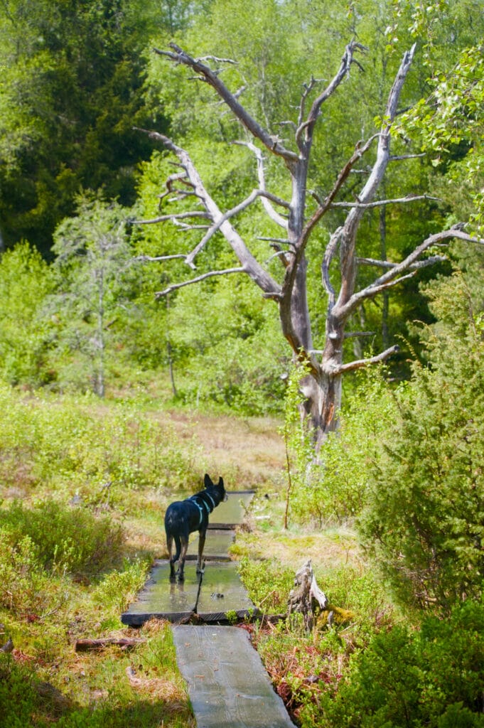
To start the hike, we parked at the top of Balestrand. The trail begins right behind a schoolyard, and from the very first few steps, we realized that this route is perfectly marked and, above all, quite well-traveled (both by visitors and locals, who seem to come here for trail running). The first part winds its way up through the forest, and it’s really very pleasant. When we set out on our hike, it was still raining a bit (though we were confident about the rest of the day), so walking under the trees kept us relatively dry. As for our feet, though, we’ll have to come back another time, because obviously, rain means a pretty muddy trail—but we’re starting to get used to that in Norway. 😉

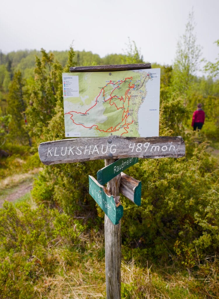
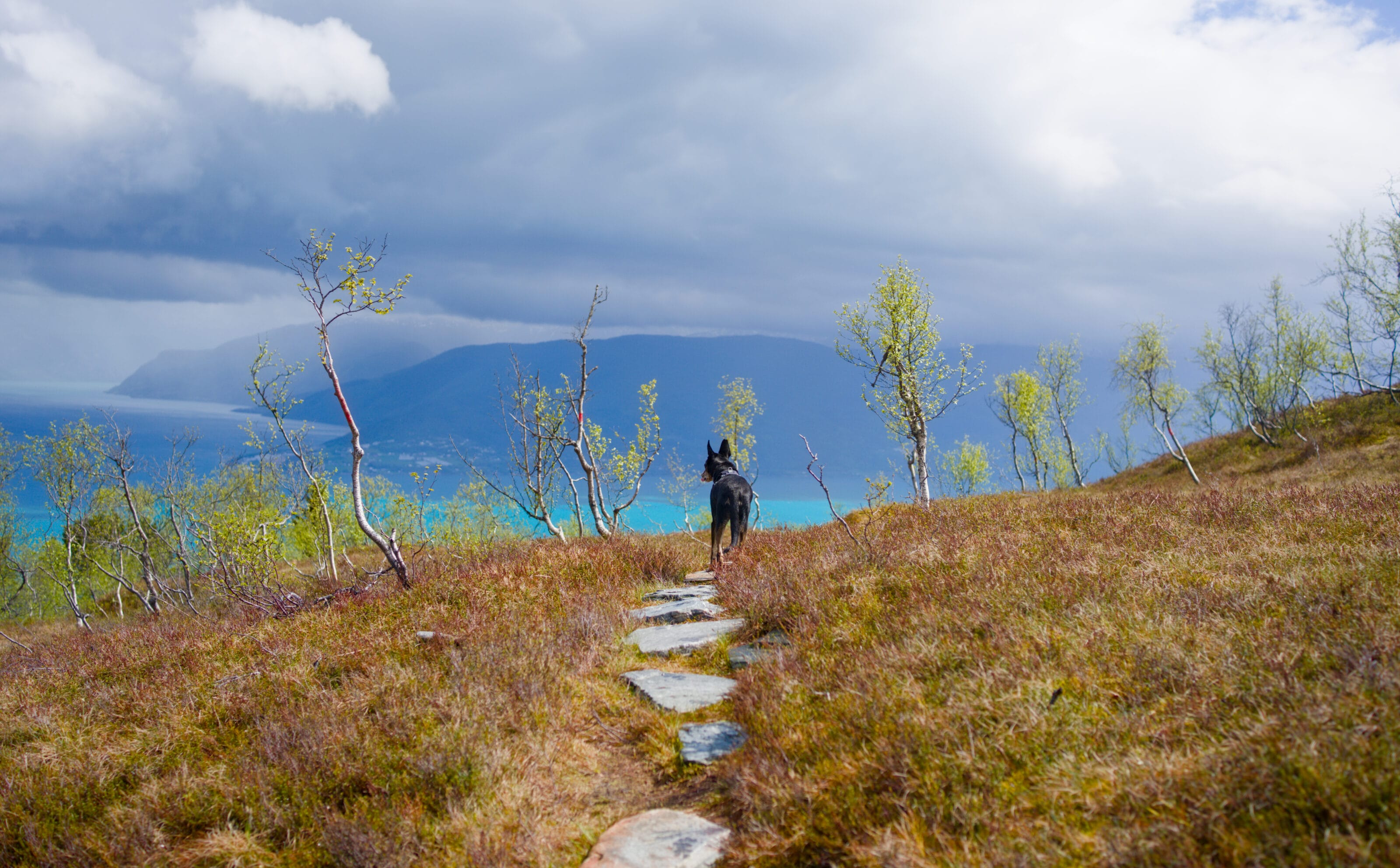
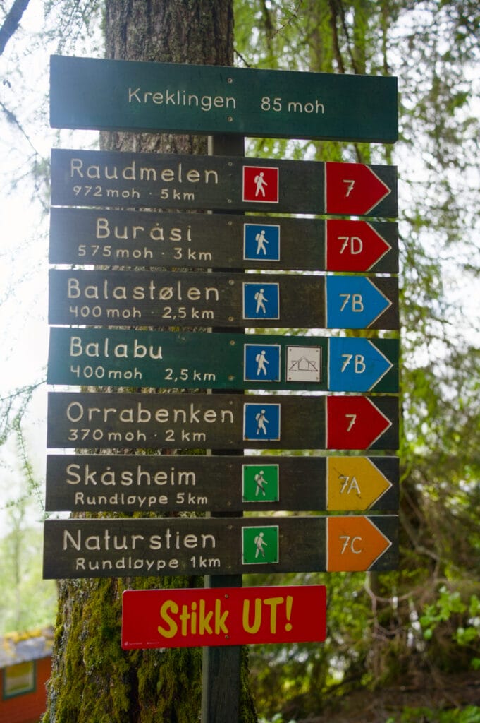
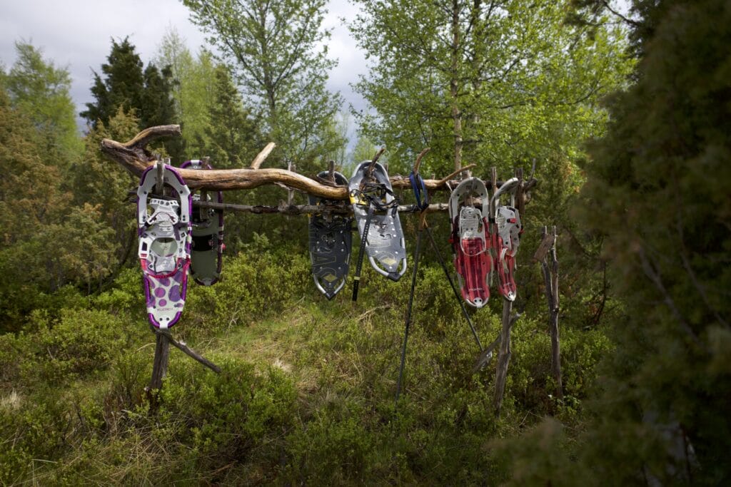
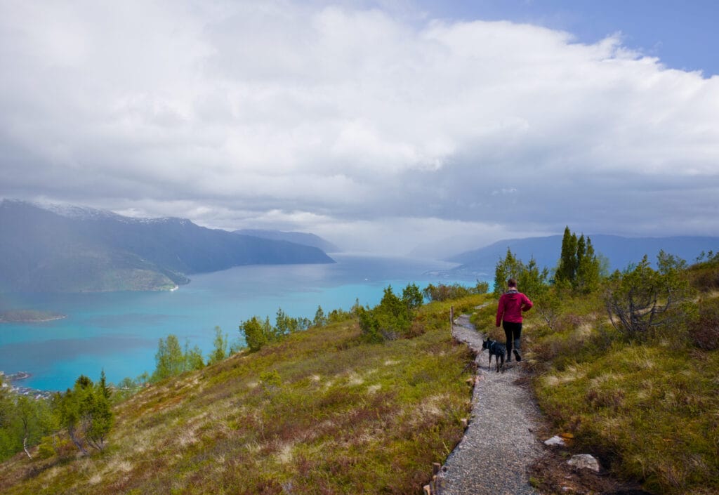
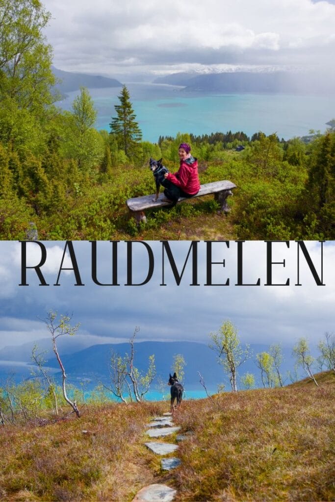
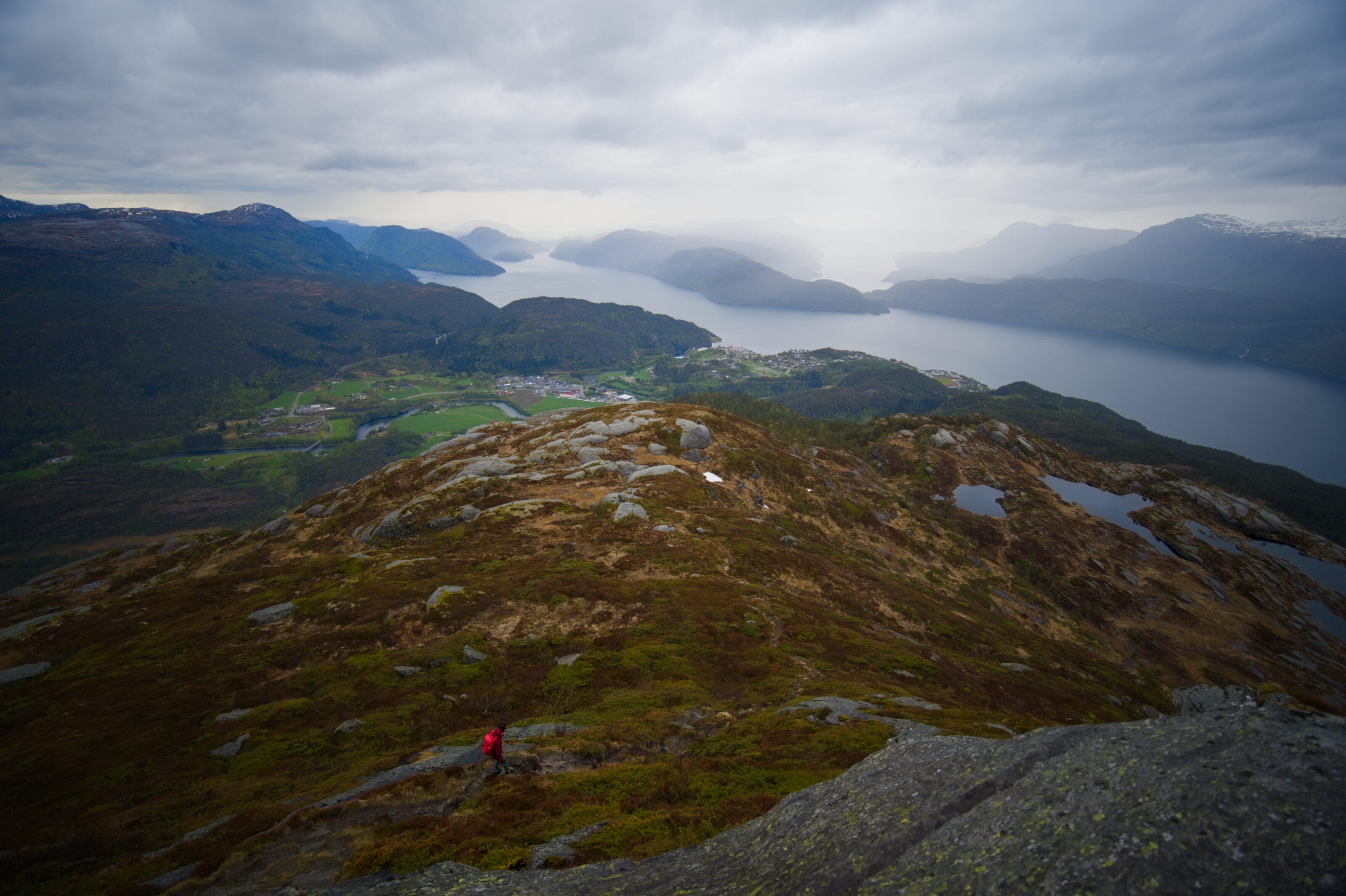
The first viewpoint at Orrabenken already offers a lovely first glimpse of the fjord, but I promise, there are even more beautiful surprises in store ahead. 😉 Shortly after this viewpoint, we reach a fork in the trail where we can either continue straight ahead toward Burasi and Raudmelen or turn left to reach the Balabu cabin. We decide to continue to the right and soon arrive at a small peak called Klukkshaug (489m). Here, we have a little laugh because some people seem to have “forgotten” their snowshoes (the ones for walking in the snow, that is). We’ll realize later that those were probably still in use not that long ago, haha
The view from Burasi of the Esefjorden
Once we left Klukkshaug, it started raining a bit harder, but we also had some sunshine. Some might say that was bad luck, but in the end, that mix of weather allowed us to see some beautiful rainbows from the trail.
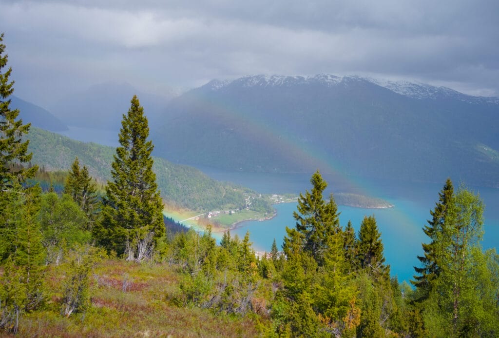
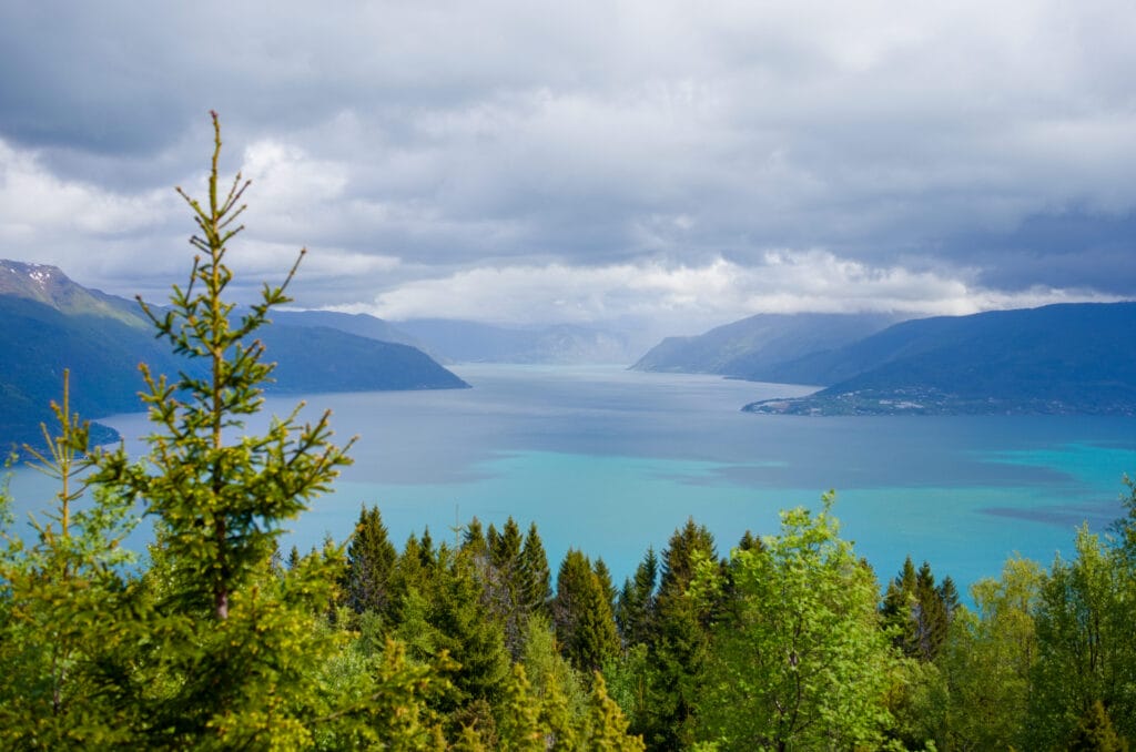
After about an hour of climbing, we arrive at the second-largest junction on this route: the Burasi viewpoint. Here, the view of the fjord opens up a bit more, but it’s not really a “balcony-style” vantage point. In fact, the viewpoint is slightly to the right (when looking in the direction of the climb), and rather than overlooking the Sognefjord, it offers a magnificent view of the Esefjorden. The Esefjorden is a tiny inlet of the Sognefjord but is known for its emerald green color.
At this point, the path splits into two:
- Continue straight ahead to climb to the summit of Raudmelen, which is directly above us in a perfect line of sight
- Turn left to head back down toward Balabu.
The summit of Raudmelen
We can’t really tell you about that part, because we ended up not going up there after all. 😉 It’s pretty rare for us to turn back, so it’s worth mentioning, but the conditions just weren’t right that day, and that’s totally fine.
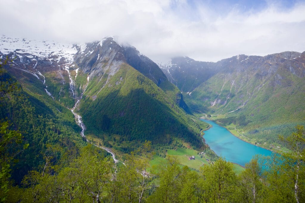
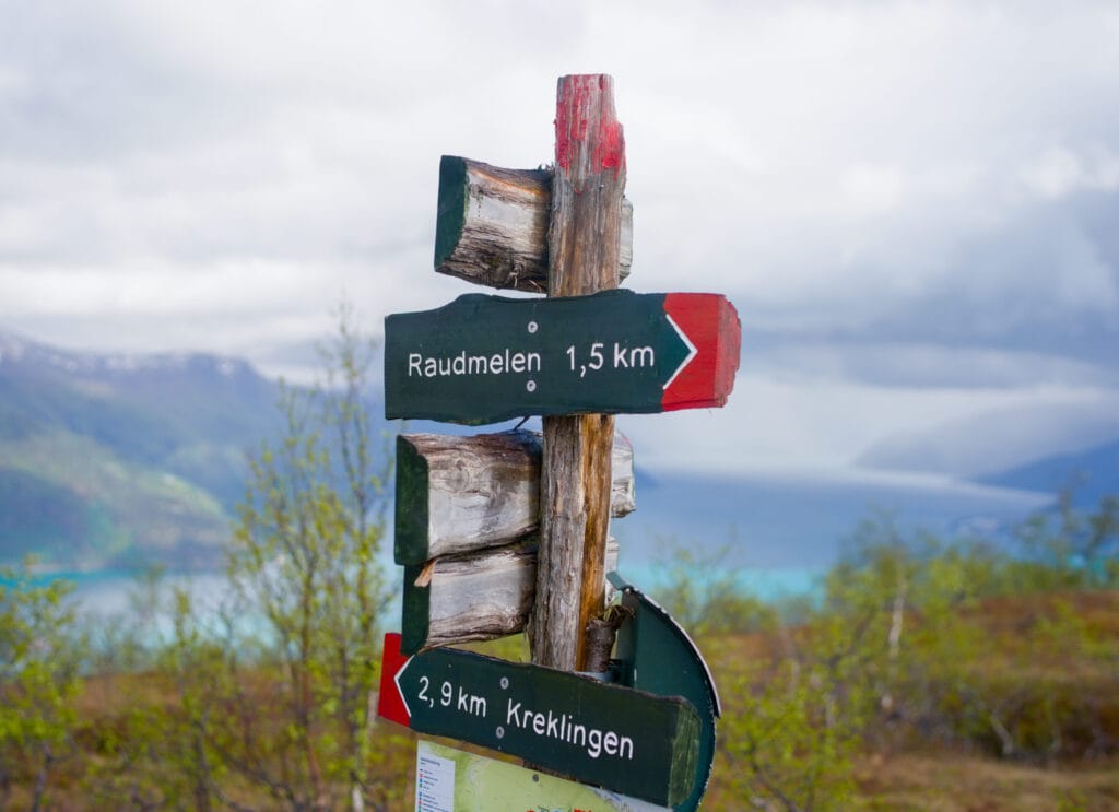
The weather was pretty iffy during our visit, and here’s a small (but important) detail: we were here in late May, and starting from Burasi, there was still snow on the trail. Would it have been impossible to hike up? No, absolutely not… I think that aside from 2-3 slips and a little extra effort on the climb while walking through the snow, it wouldn’t have been a big deal. But we’d also planned a hike for the next day and wanted to stay somewhere not too far away (which would have meant another 2-hour drive). In short, it was simply more reasonable to settle for the loop. But from the “Burasi” point, the summit is in sight. There’s about 1.7 km left (the sign says 1.5 km, but if you go by the map, that’s not quite right) 😉
The final stretch is the steepest, but it has been equipped by Sherpas with large steps that make it much easier to climb.
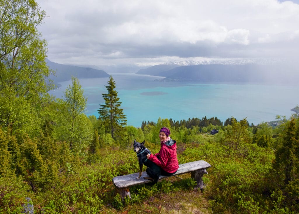
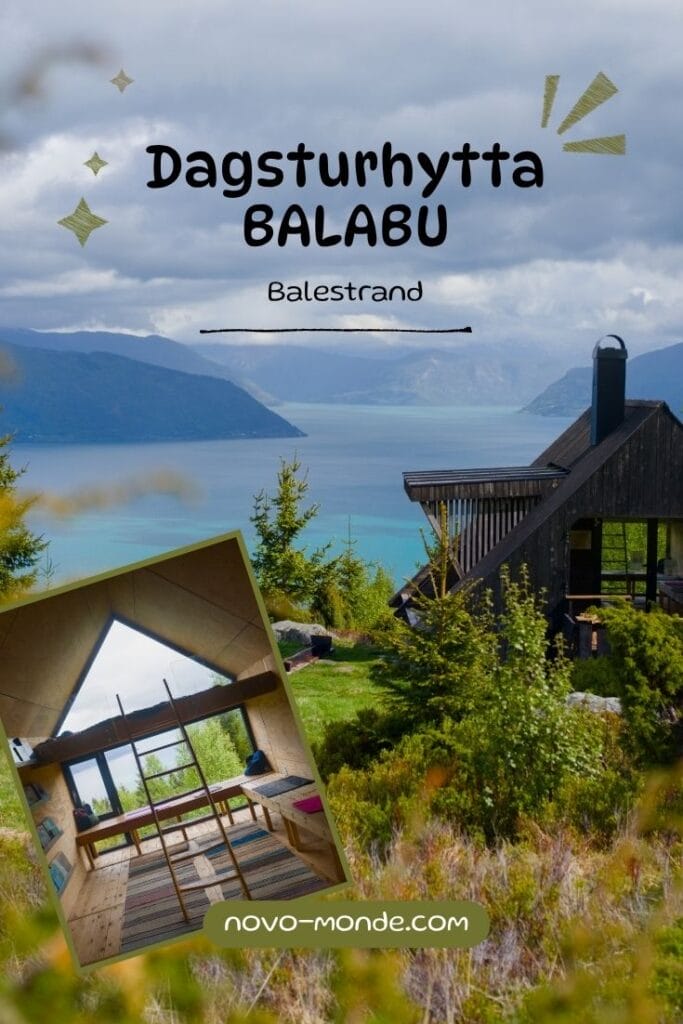
Return via the Balabu Day Hike Cabin
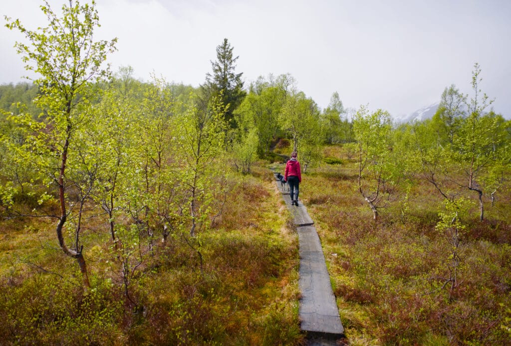
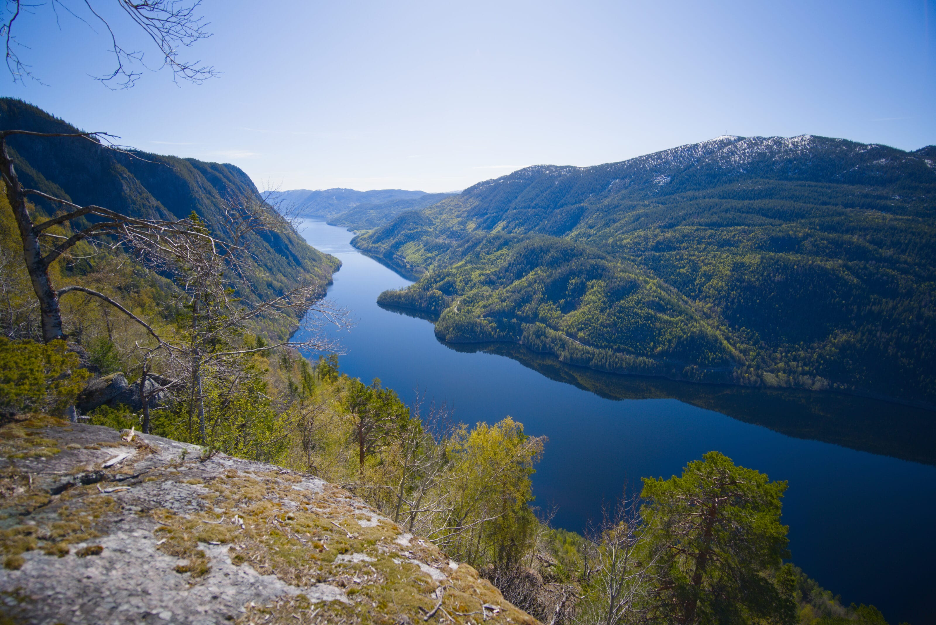
From Burasi, we decided to start our descent toward Balestrand. But rather than doing a round trip, we opted for a loop that goes through Balabu. This choice turned out to be a very wise one for three reasons:
– Not retracing your steps is almost always a better option. 😉
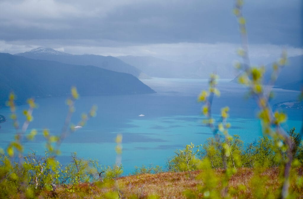
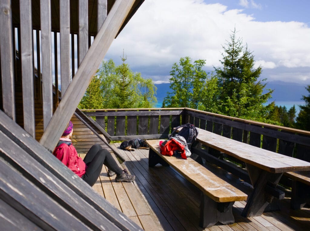
– You get to enjoy a breathtaking view of the fjord from the balcony trail (I think that was my favorite part of the hike)
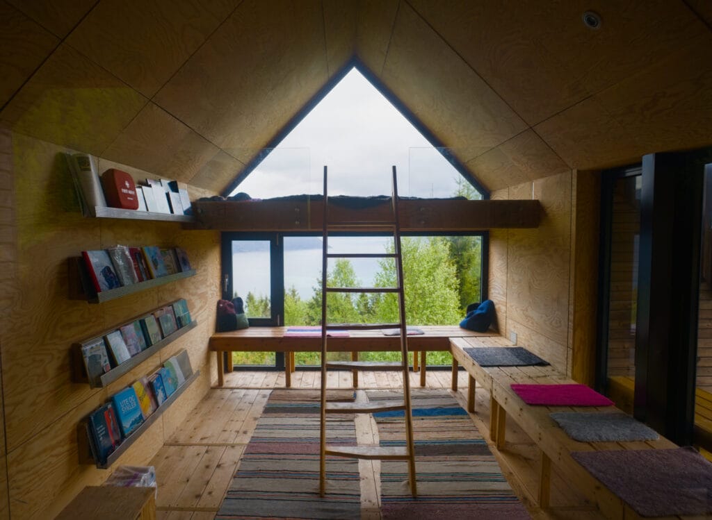
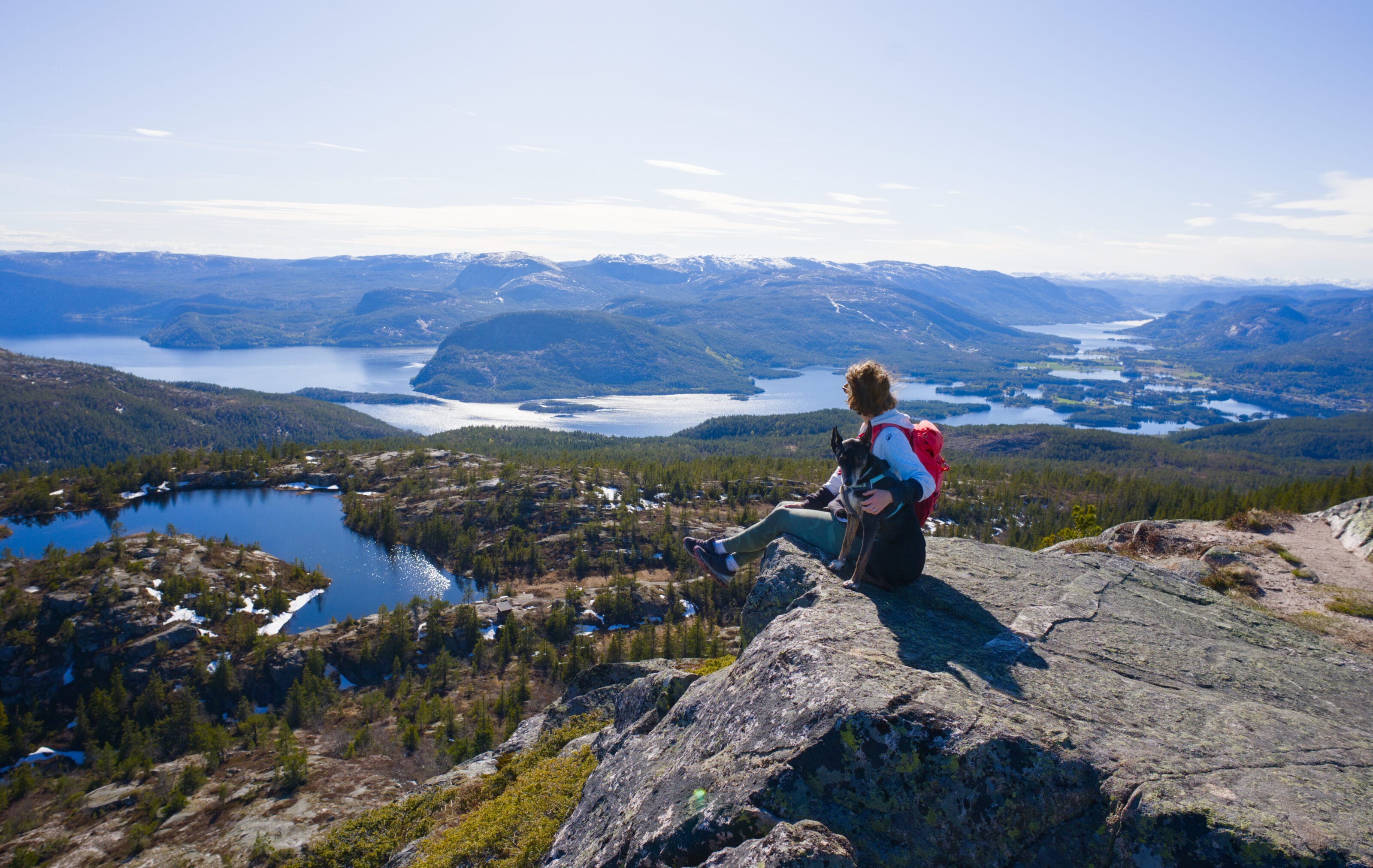
– And finally, we’ve discovered another Dagsturhytta. We’ve written an article about these cabins designed for day hikes, and we’re still big fans of the concept.
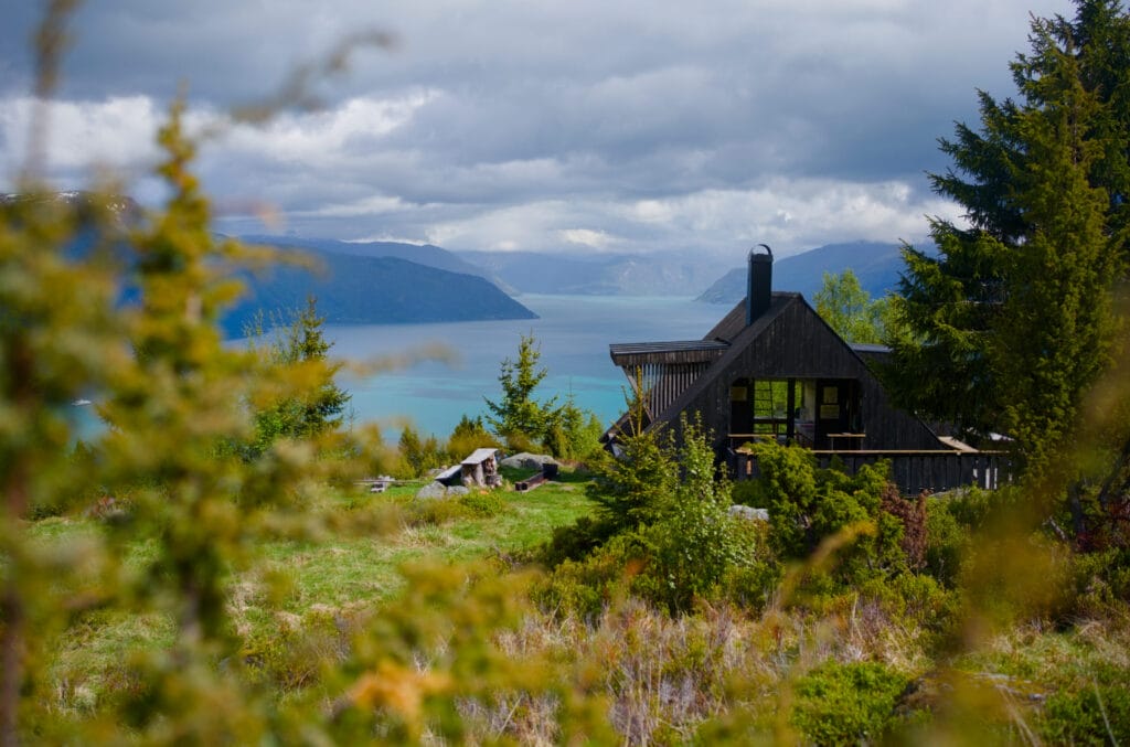
The descent on this side is gentle and presents absolutely no difficulty. After passing the cabin, we rejoin the forest trail we took on the way up, and after one last short push, we’ve come full circle.
P.S.: When we got back to the car, we were glad we hadn’t gone all the way to the top. No sooner had we started the engine than it started pouring! 🙂 That’s what you’d call perfect timing for once!
Practical information about the Raudmelen hike

The Raudmelen hike is 10.1 km long with approximately 930 m of total elevation gain and loss. The hike starts from the small parking lot located at the top of the village. Here are the GPS coordinates for the parking lot. As for walking time, it will obviously depend on your pace, but it’s reasonable to allow about 5 to 5.5 hours for the round trip.
If you want to take the shortest loop (the one we did), the route is 6.3 km long with an elevation gain of about 530 m. As for the walking time, it took us exactly 3 hours, including a few photo breaks along the way.
Map of the abridged version:
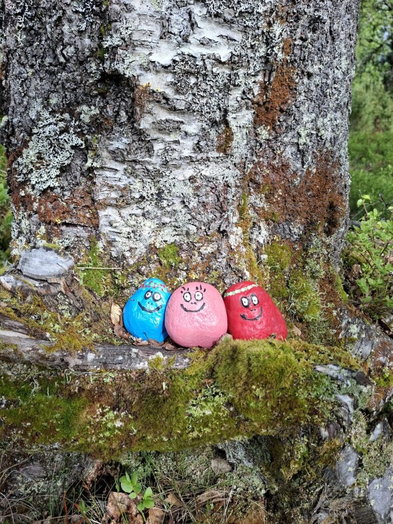
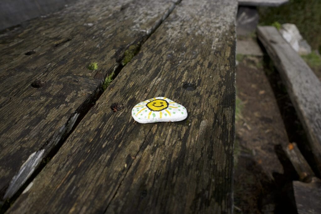
P.S.: During the hike, have fun spotting the little painted pebbles scattered all along the trail!

What’s there to see around Balestrand after the hike?
After the hike, if you have time, we recommend exploring Balestrand a bit. This small town of about 1,300 residents is often cited as a place where many artists have come to paint the Norwegian fjords. There aren’t 10,000 things to see in Balestrand (it’s very small), but the town center is pretty and there are a few buildings worth checking out:
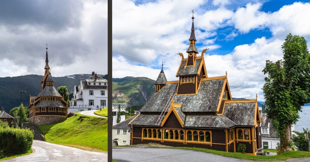
St. Olaf’s Church: Also known as the “English Church,” it is one of the most iconic landmarks in Balestrand, on the shores of the Sognefjord. Built in 1897, it mimics the style of a stave church without actually being one. 😉 Because, yes, to be classified as a stave church, a Norwegian church must have been built between the 12th and 13th centuries using a specific technique based on wooden support posts (“staver”) assembled in a particular way. Here’s a fun fact that would have delighted my goddaughter: it’s also known for having inspired the chapel seen during Elsa’s coronation in the animated film Frozen.
The Strandheim Villa: This is a historic villa built in the late 19th century in a style said to be inspired by Swiss architecture. So, as good Swiss people that we are, we’re not exactly sure we see the connection between this house and our little country, but then again, we’re no architecture experts. Swiss or not, the house is pretty and worth a look.
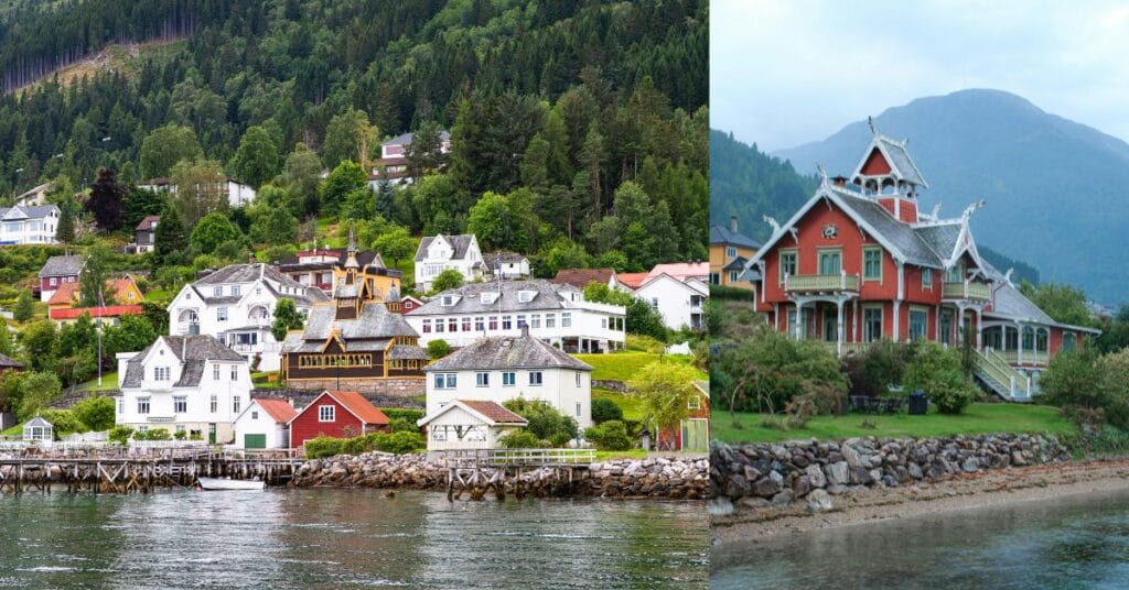
The Kviknes Hotel: This large white wooden hotel is also known for having been built in the style of Swiss chalets… Not sure if the architects of the early 20th century had actually seen Switzerland, haha. But let’s just say we like this Swiss-Viking fusion, and the hotel is famous for having hosted many artists.
Here’s a photo that better shows the architecture. Photo credit: Kviknes Hotel, Balestrand (2020), Bjørn Christian Tørrissen — Wikimedia Commons — CC BY-SA 4.0
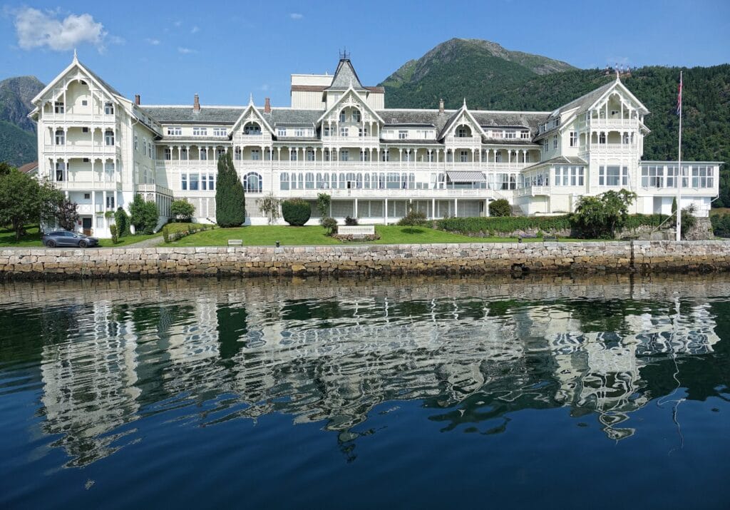
Just for fun, every year (in September) a trail run is held from the hotel’s grounds to the summit of Raudmelen. Calling all runners! 😉 The race is called the Balestrand Opp.
That’s it for today! We’ll see you soon for more articles on Southern Norway.
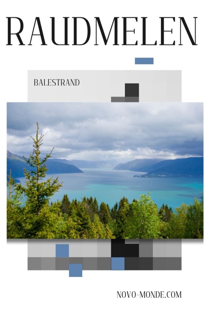
Pin this post

Join the discussion