
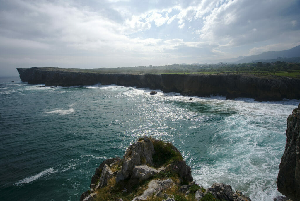
After our 5 months in Galicia it was time for us to come back to Switzerland. At the beginning of May, the restrictions were beginning to lift and we took the opportunity to take our time and decided to follow the northern coast of Spain. And if there is a region that we wanted to see for its landscapes and its hiking possibilities, it was Asturias! Neighboring region of Galicia, Asturias is known for its cider but also for the striking contrasts between the coast, its cliffs and the mountains of the Cantabrian massif. In this article we propose you a small best-of of our discoveries in Asturias made during this small road trip leading us from Galicia to Switzerland.
- Map of Asturias: our favorite spots
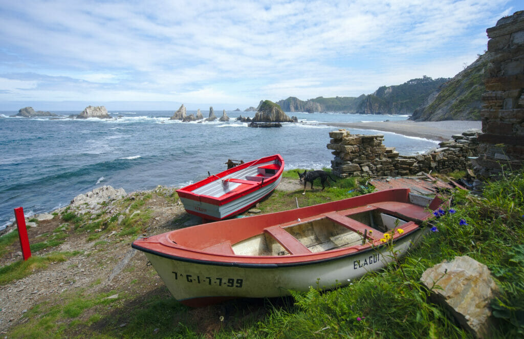
- The Frexulfe / Frejulfe beach
- Gueirua Beach
- Silencio / Gaviero Beach
- The Vidio Lighthouse
- The natural park of Somiedo – small pearl of Asturias
- The Ruta de las Foces del rio Pendon
- The Mirador el Fitu
- The Bufones de Pria
- The Picos de Europa Park in Asturias
- The Bufones de Arenillas
Map of Asturias: our favorite spots
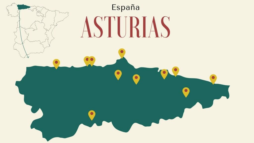
Note: for the order in this article we decided to classify the places to see from west to east (the direction of our trip)… This way we keep the Picos de Europa national park for the end 😉
Note 2: In 2022 we went back to Galicia again. To come back, this time we went through the north of the León Province, a road trip that we also enjoyed a lot.
The Frexulfe / Frejulfe beach
Our very first stop in Asturias was an “overnight spot” with the van. We had noticed on Park4Night that the parking of the beach of Frejulfe was authorized to the parking for the vans (attention, not camping, but parking! –> so no table outside and no roof up 😉
Well, what we can tell you is that this stop will have been an excellent surprise! The beach of more than 800m long is absolutely splendid and is really worth the stop. We didn’t swim (remember that we were there in May and the water was… 13°C 😉 ) but whether it’s for a walk or just to enjoy the nice lights at the end of the day, this place is great!
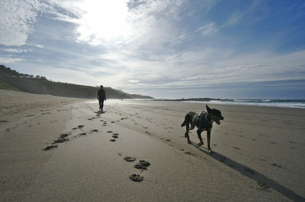
Being there early in the morning, we took the opportunity to go for a very nice walk along the coast towards Fajal beach located a little further west. If you are in a sporty mood, we strongly advise you to follow the coastal path!
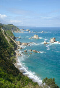
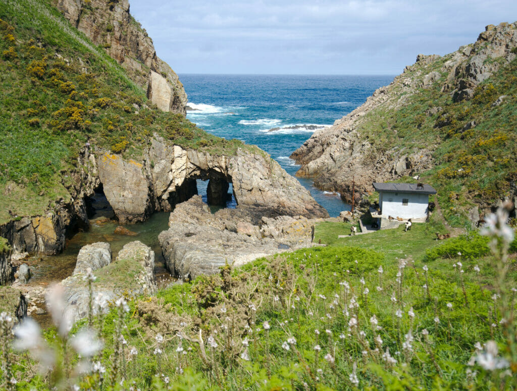
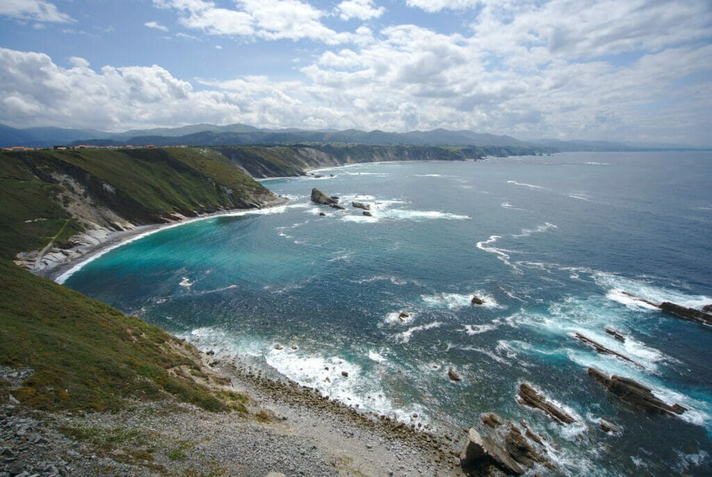
Gueirua Beach
More than a beach, our second recommendation along the coast is above all a small paradise for photo amateurs! We were not there at the best time for the lights (nor for the tides), but the little rocky cove is absolutely splendid. In fact, we went first to the beach of Silencio (next point in the article) and it is from there that we spotted that there was a beach which seemed accessible on this side and we wanted to go to see that more closely.
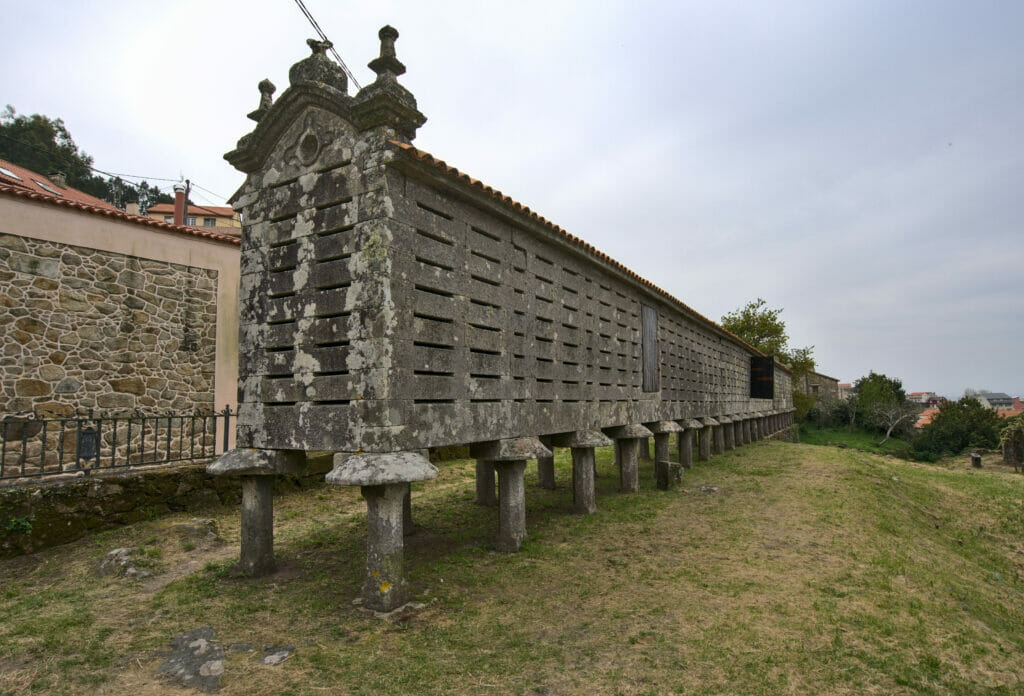
To reach this row of rocky islets there are not many options: you have to park in the small village of Santa Marina and go down the 100m of difference in altitude until the ocean. This stop in the village allowed us to see our first “asturian horreos“. If you have followed our articles on Galicia, you may remember that we had already talked about these typical constructions of the north of Spain. Originally built to store cereals, these buildings are now protected. In Galicia, a horreo typically has an elongated shape, with a number of feet ranging from 4 to more than 40 (we told you about the horreo of Lira and its 44 feet in this article). In Asturias we also find horreos, but unlike their Galician neighbors, it seems that the Asturians preferred to opt for a square architecture.
Leaving the village, the itinerary first follows a small path, then you plunge the last few meters by taking a steep staircase.
When we were there we were at relatively high tide, but from what we saw, it seems that it is even more impressive at low tide! In fact, on the pictures above, you can only see the tips of the rocky spurs, but when the water is at its lowest you can see much more of this ancient peninsula of quartz and slate. (You can find pictures of this beach at low tide on the Asturias website)
The map of the small stroll to the beach:
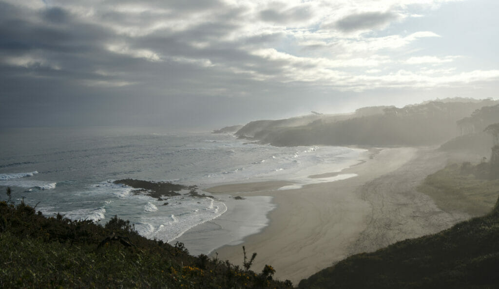
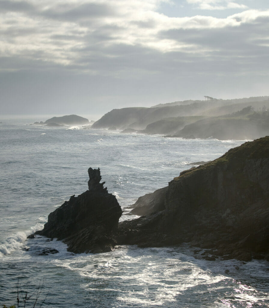
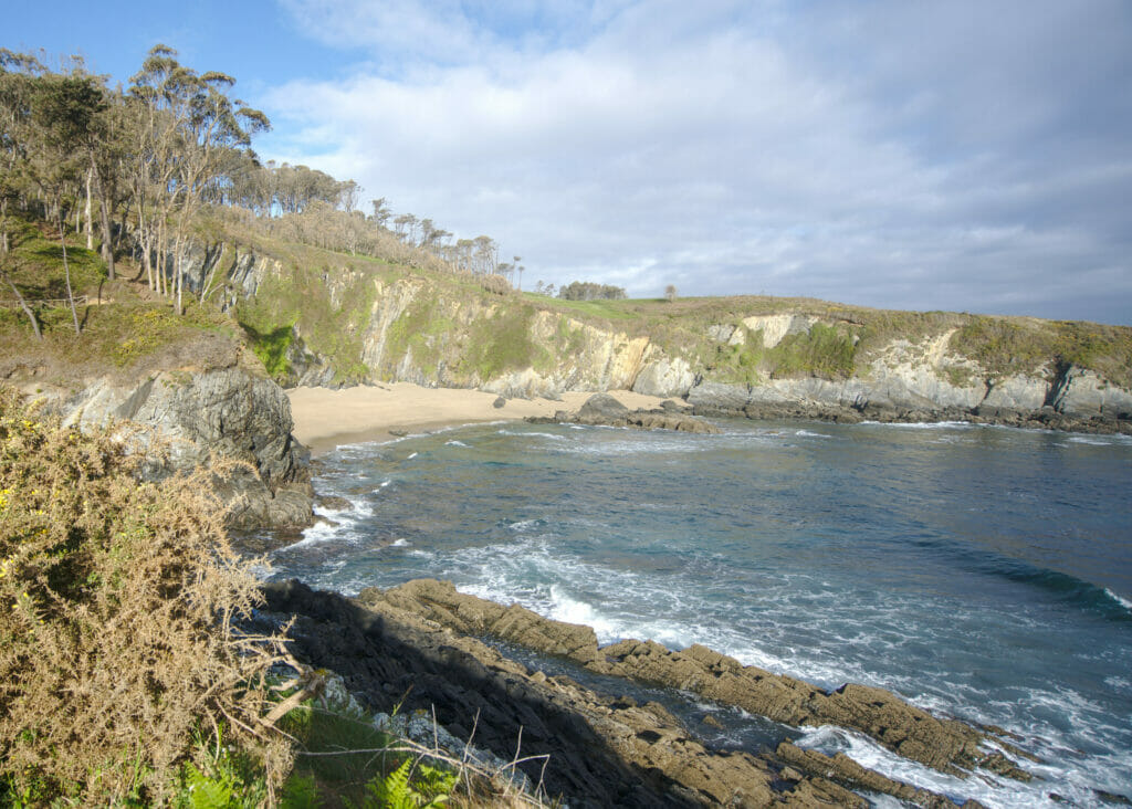
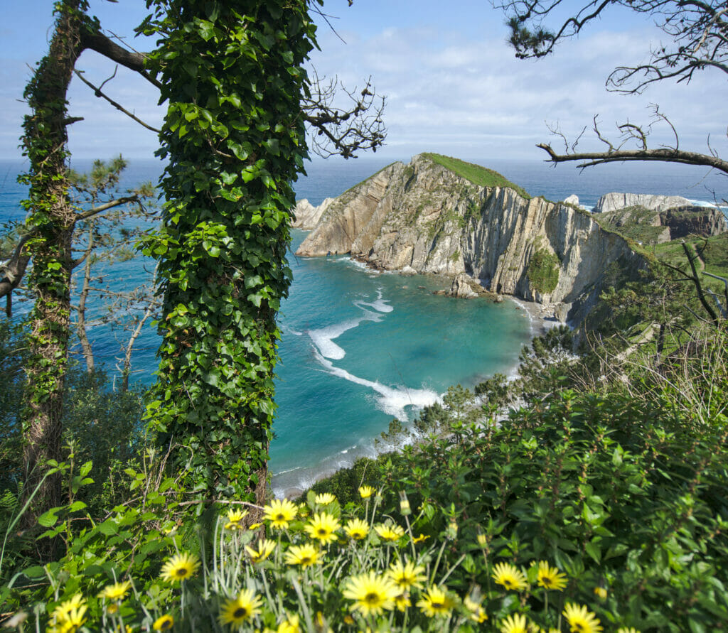
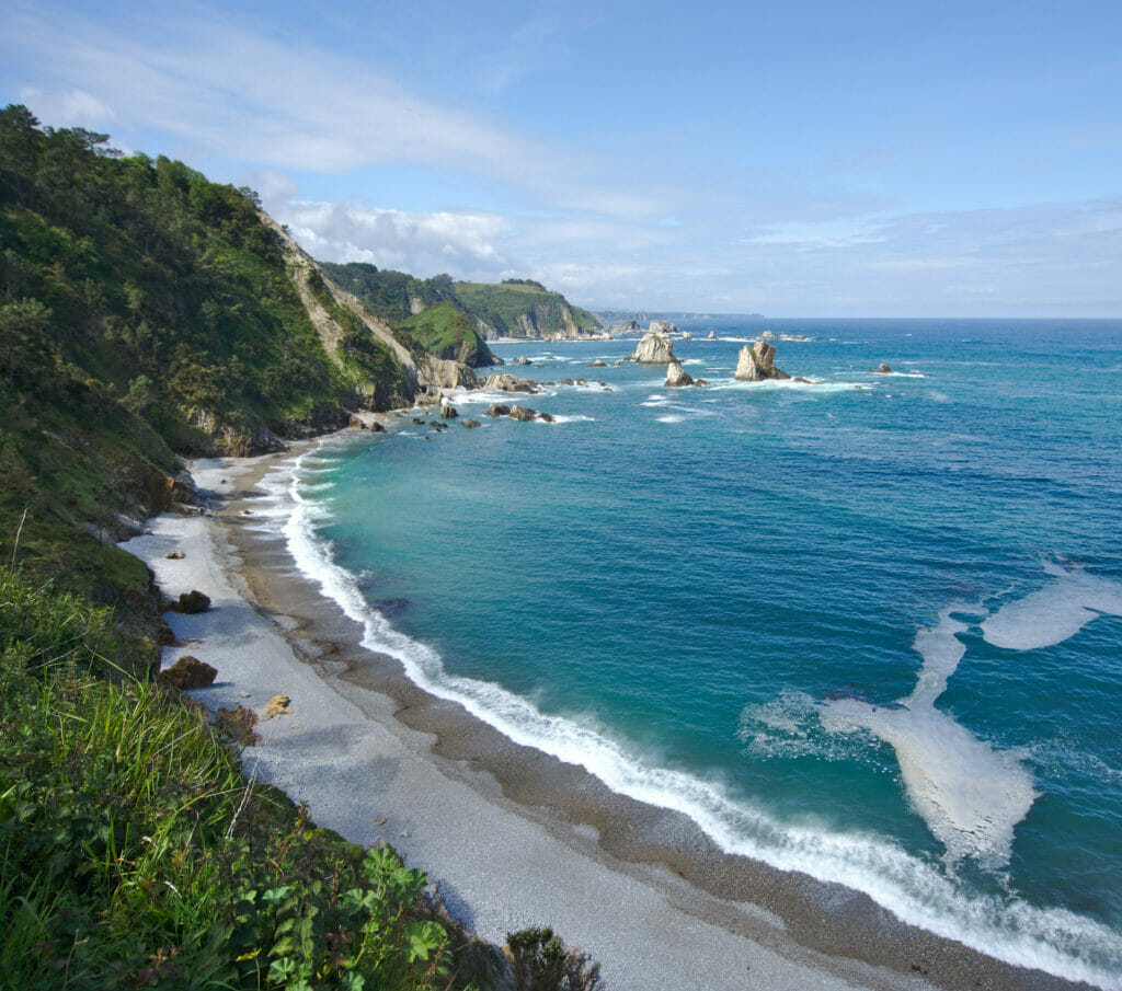
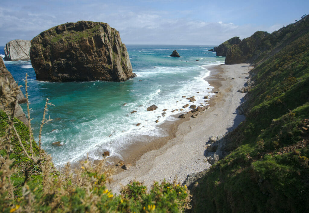
Silencio / Gaviero Beach
3rd and last beach of this article, we saved the best for the end! 🙂 We had seen pictures of this little piece of paradise while researching Asturias and the nice places to stop on the way. In fact, if the beach of Silencio is relatively well known, it is, as its name suggests, its absolute calm that characterizes it! It is not easy to get there (you have to take a one-way track for a little while and then walk down a steep path), but once at the beach you feel really alone in the world! There is not a single building or house visible from this small cove.
The beach is not very big (less than 500m long) but the view on the rocks coming out of the water and the cliffs is really incredible.
If, like us, you’re more into walking than relaxing on your towel, we recommend you to go and have a look at the beach of La Barquera which is 10 minutes away on foot to the east. The beach itself is not as big, but the landscapes are just as beautiful. On the way we came across an old little house where goats seemed to live their best life eating everything they could find and climbing on the roof 😉
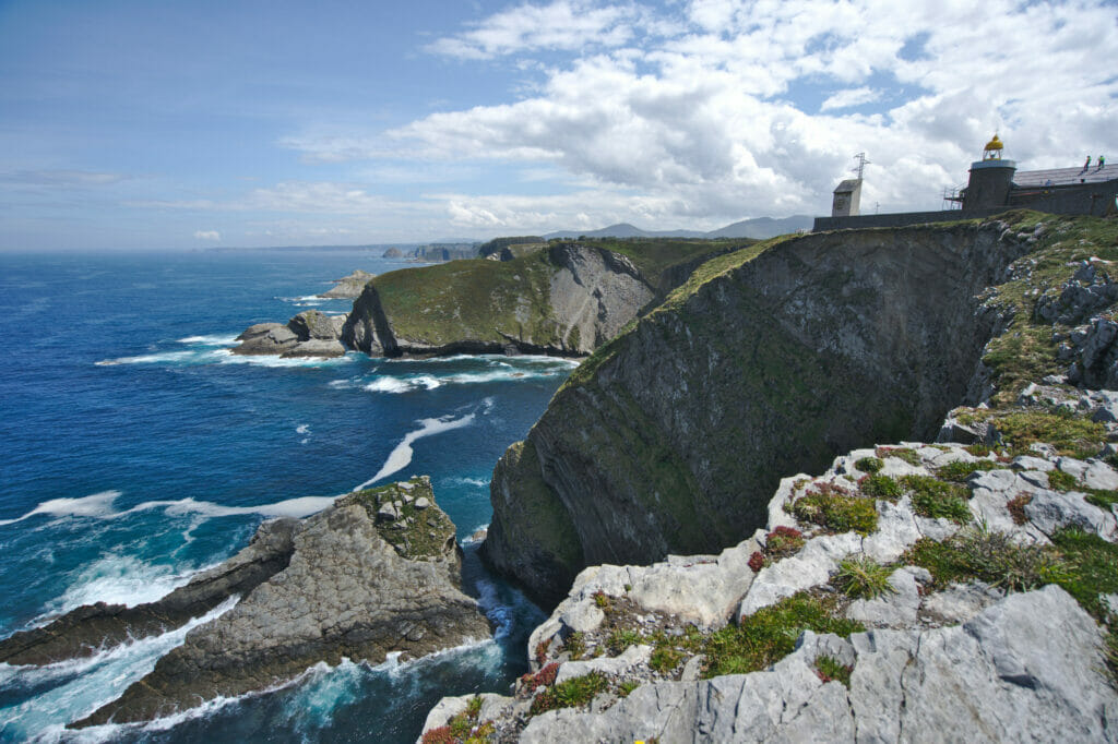
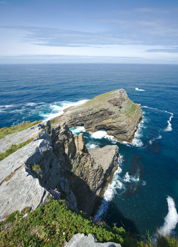
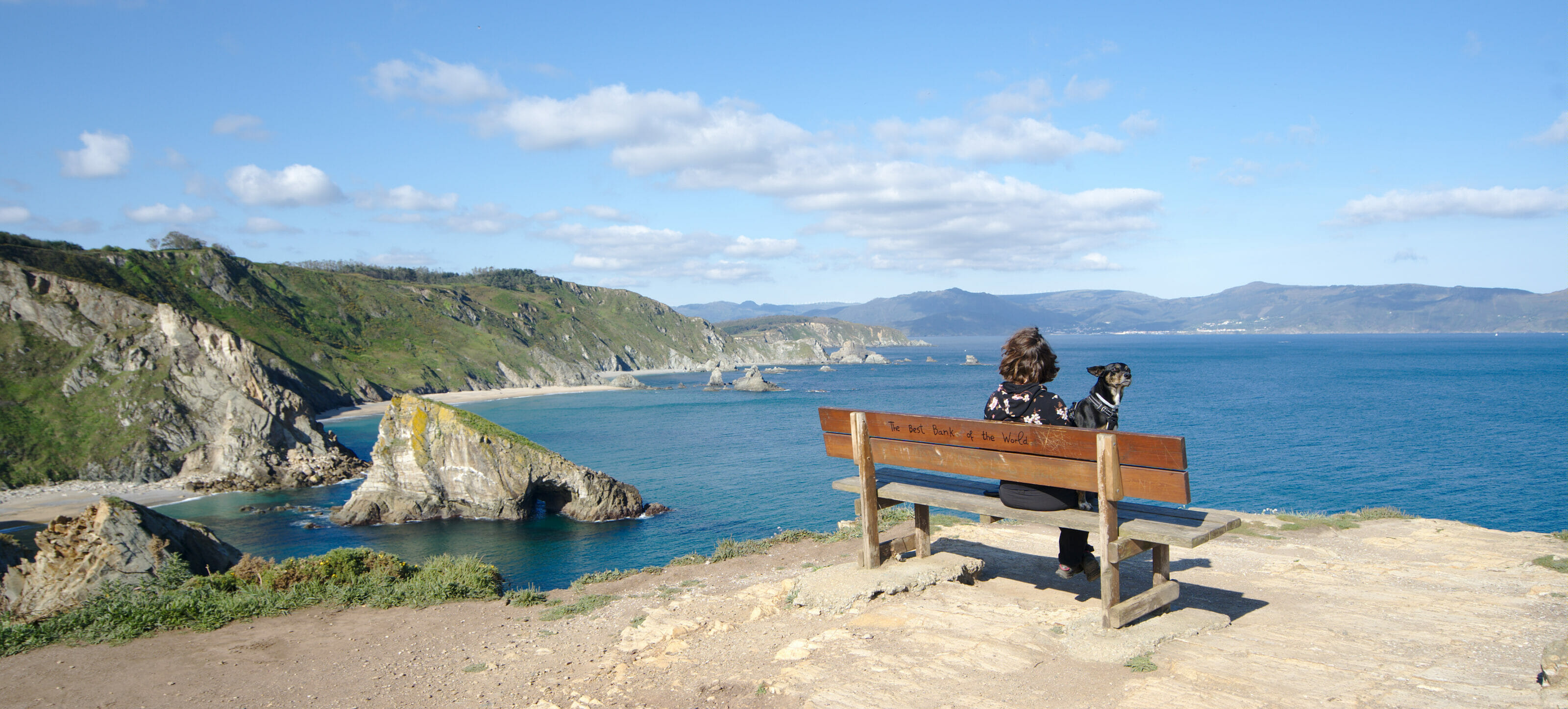
The Vidio Lighthouse
Before taking the road “inland”, we wanted to make a last stop along the coast. Since we arrived in Spain and more particularly in Galicia, we have learned one thing: lighthouses are often placed in very nice places 😉 Well, it’s normal, you’ll tell me, they have to be on an overhang of land to cover a maximum of “surface” with their light, but still.
When we look at the map of Asturias, we quickly notice that the most northern point is the one of the lighthouse of Vidio, needless to say that we did not need more to decide to stop there!
Unfortunately, at the time of our visit, the lighthouse was under construction and there was scaffolding all around (and workers at work). But even if the lighthouse itself was not “crazy”, the view is clearly worth the detour! I let you judge… 😉
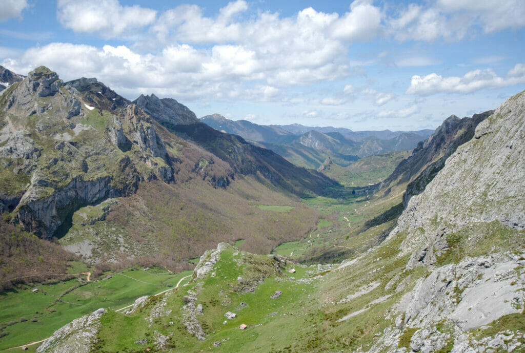
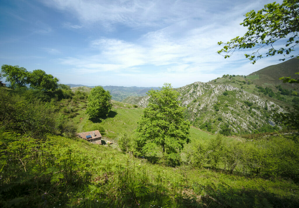
The natural park of Somiedo – small pearl of Asturias
After all these weeks of road trip along the coast and on the Galician “hills”, we were ready to see some mountains again. The Picos de Europa park was clearly on our list, but we also spotted the Somiedo park on the way which seemed to meet a lot of our criteria (it doesn’t go up very high, which means that at the beginning of May we didn’t have any problems with snow either).
To visit the park we stayed at the campsite of La Pola de Somiedo. A campsite that we recommend (not for the basic infrastructure) but because it was the only one in the region to be open 😉 There is a second campsite further up towards the lakes, but unfortunately it was closed at the time of our visit. After, to the relief of the Pola campsite, we arrived at their place the week after the deconfinement and clearly they had not yet launched their season nor done their “big spring cleaning” (or let’s say that this is what we assumed seeing the place) ;).
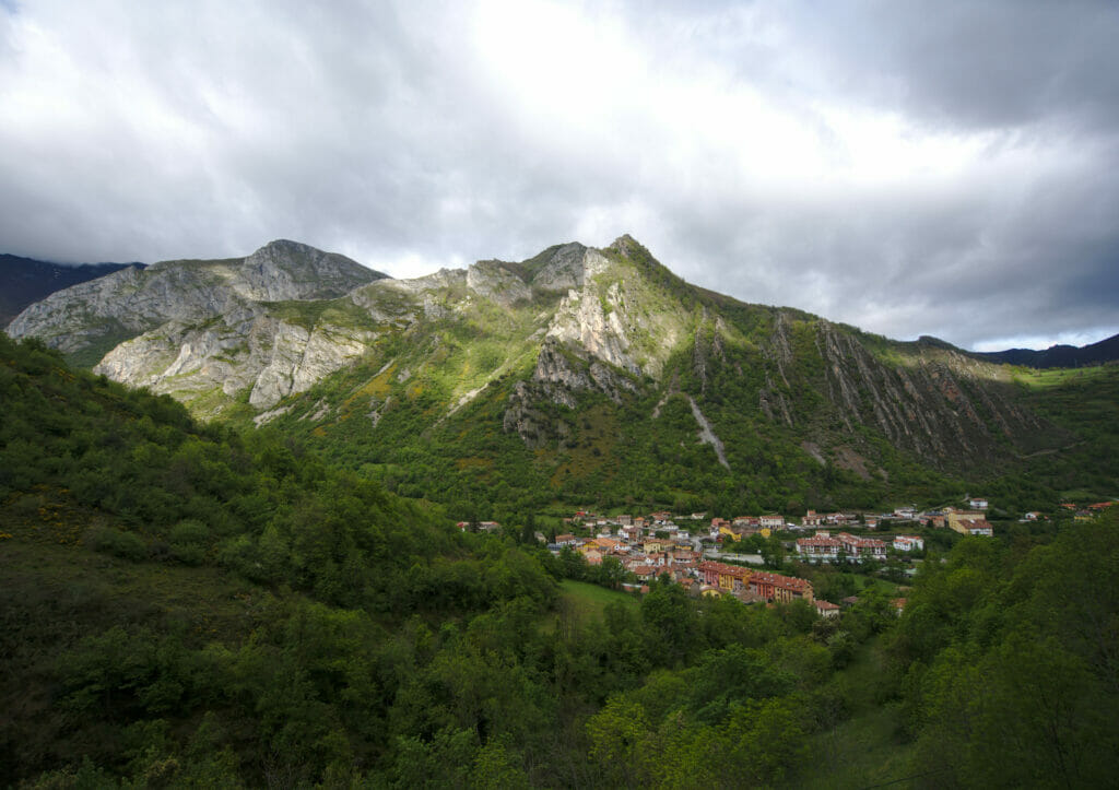
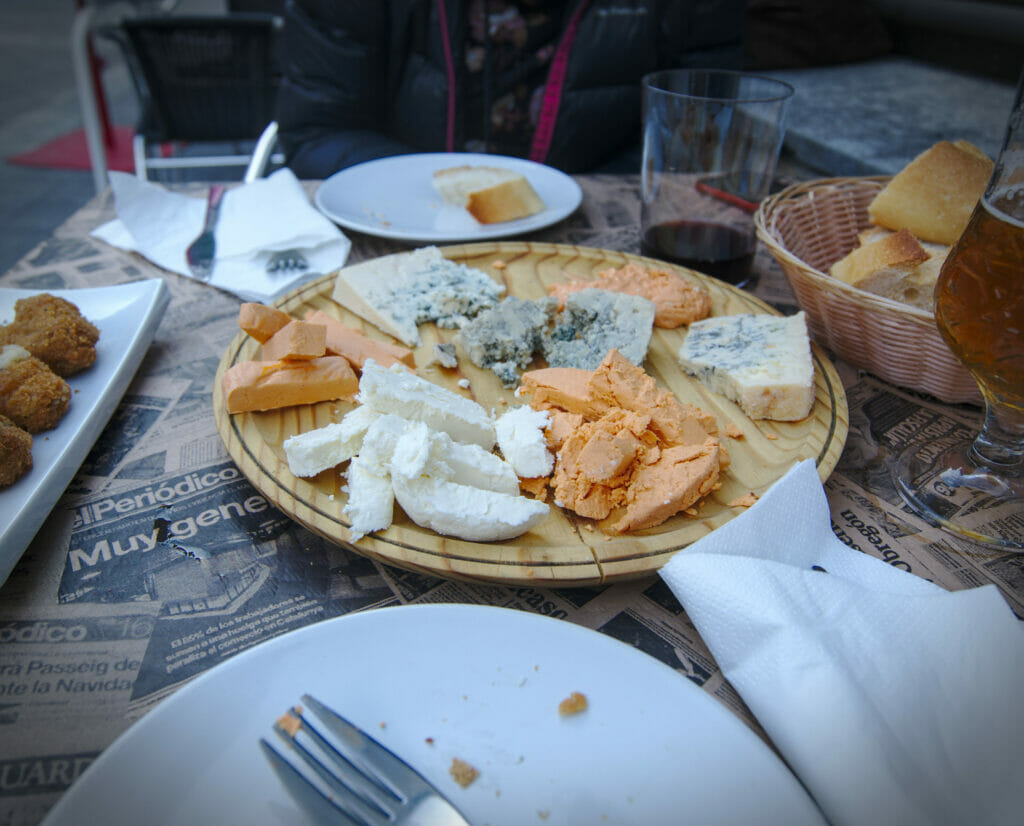
In short, the small village of Pola has everything you need: a bakery, restaurants and even a craft brewery under construction 😉 By the way, the speciality of Asturias is the cheese… But we warn you, they are quite strong! 🙂
If Somiedo is relatively well known in Spain, it’s usually for the lakes hike (which we did and which we’ll tell you about below) but also because this park is one of the places in Spain where you can most easily observe bears in the wild. Several agencies organize tours to see them. Personally, we decided to skip the tour. In our opinion, tourism involving animals is NEVER a good idea, despite all the little labels and certifications. Bears have been reintroduced in these mountains and we like the idea that they can evolve freely and not be disturbed by hikers looking for pictures.
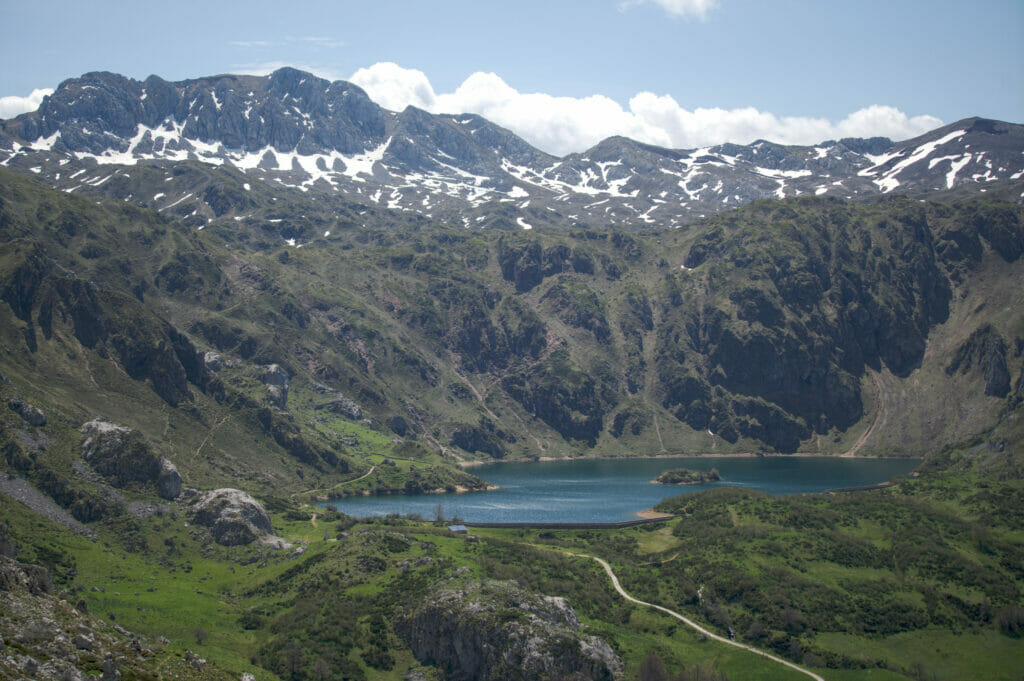
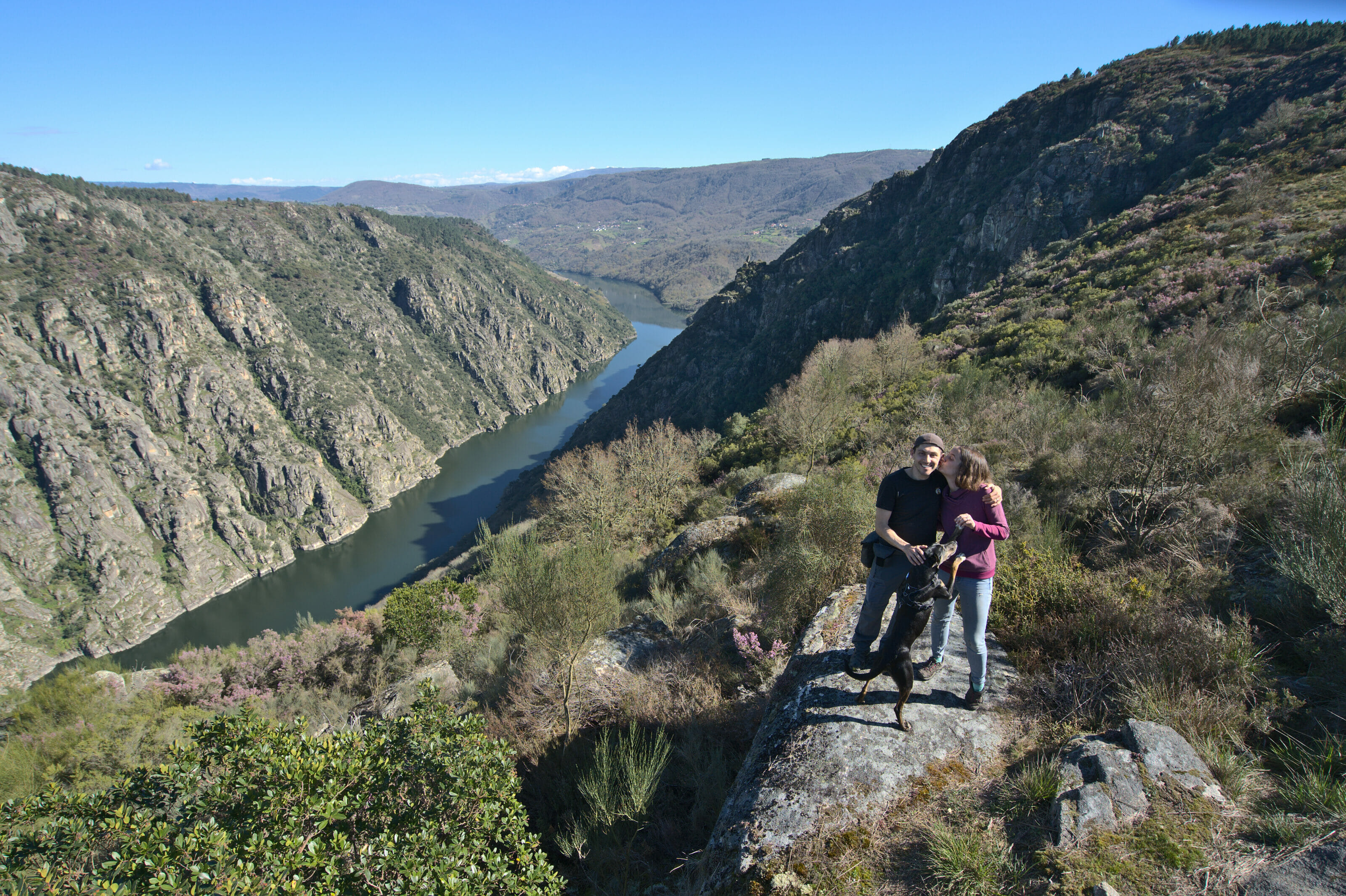
The hike to the Saliencia lakes – Somiedo
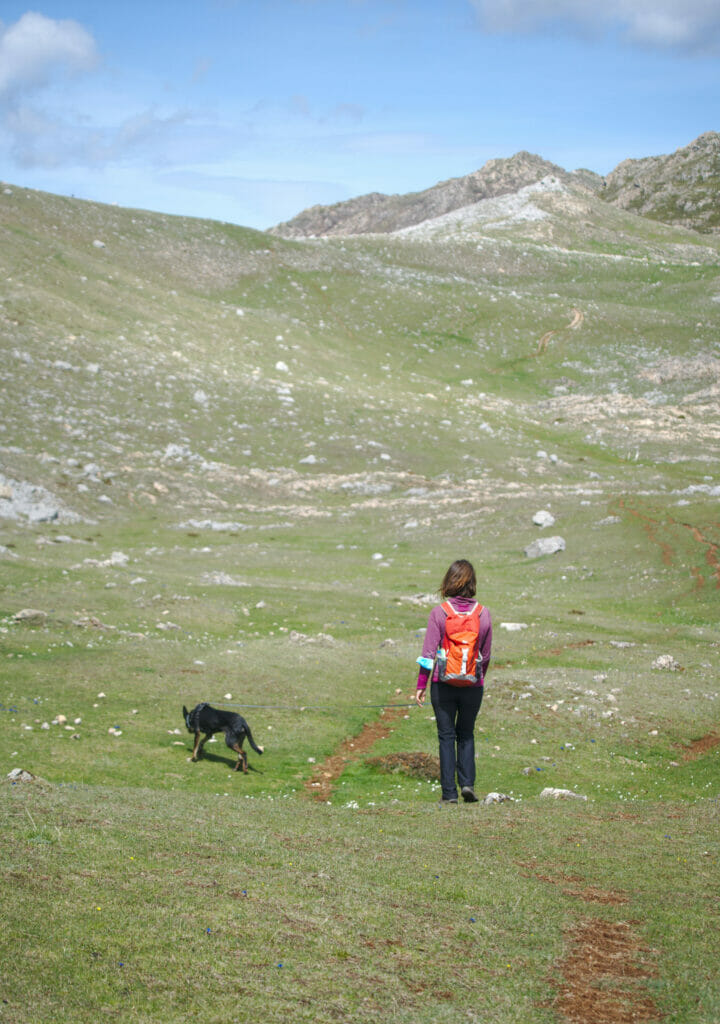
The objective of our stay in the Somiedo park not being the bears, we returned to our first love: hiking! For this new hike we started by taking the road again and went up with Dahu to the alto de la Farapona, a pass where the road stops and which is literally at the border with the region of Castilla y León.
From the pass, a wide track goes down towards the first lake of this itinerary: the lago de Cueva. The first lake is quite nice but we have to admit that we were a bit surprised by the width of the path, a real highway for hikers if you want our humble opinion.
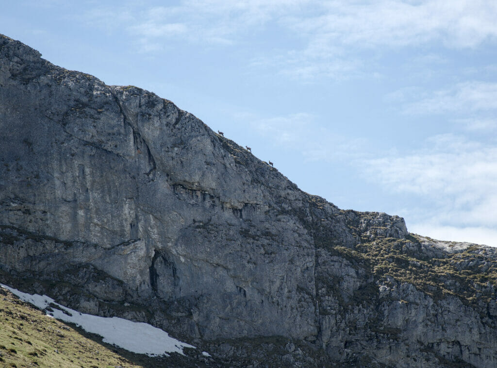
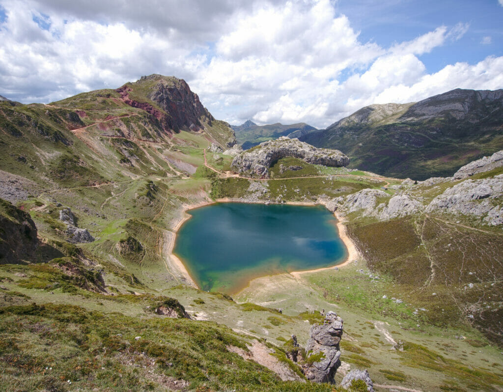
Anyway, feeling that the crowds were coming, we quickly decided to continue our route to reach the Lago Ceveriz (the place where many decide to turn back). From this point on, the wide track gives way to small paths still barely marked that evolve on huge green meadows. Perched above us, we had the nice surprise of being able to observe a group of chamois.
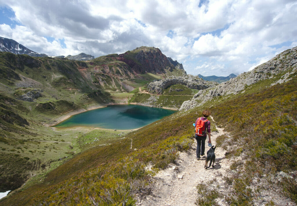
We didn’t really have a precise objective for this route, the only thing we knew was that we would have to retrace our steps for a good part of the way before we could do a variation around the lakes. Our basic idea was to go up to a pass, from where we thought we could see the Lago del Valle (the next lake). This calculation turned out to be wrong because from the pass we couldn’t see anything (well yes, a nice view on the valley but no lake on the horizon). Anyway, Benoit being stubborn he decided to continue alone until seeing this famous lake 😉
For the return trip, we took the same itinerary as on the way out until we reached Lago Ceveriz. Here, instead of following the wide trail, we opted for the path that goes around the lake. In some places the path was not easy to find, but in the end we loved this “detour”. The colors of the rock and the perspective “seen from above” on the Lago de la Cueva were among our favorite moments of the walk:
Map of the Saliencia / Somiedo lakes hike
You will see it, but around these lakes there are dozens of options to create your own route… If you are interested, here is the route we followed during this day:
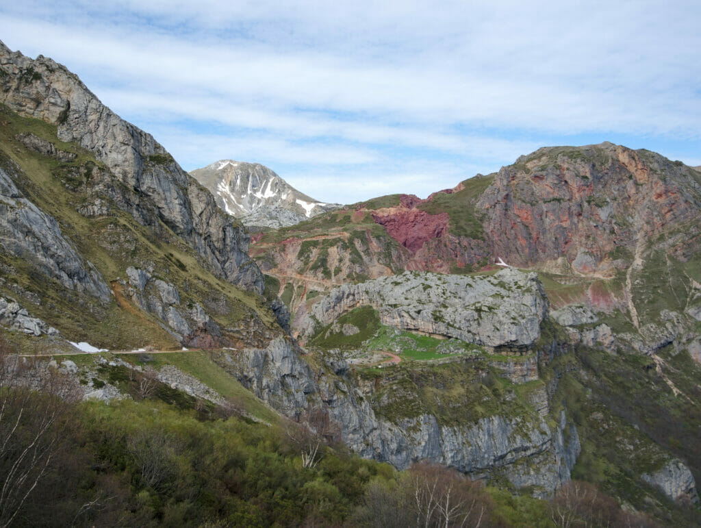
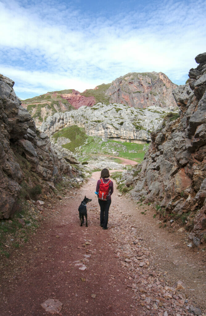
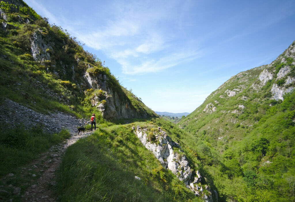
The Ruta de las Foces del rio Pendon
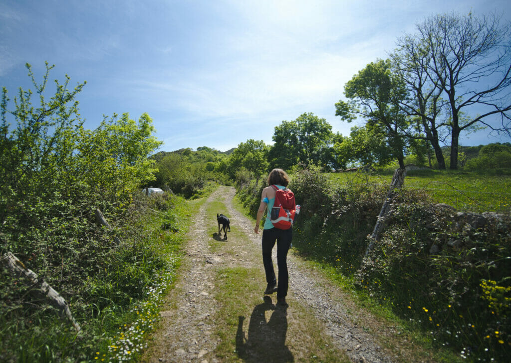
We continue on the theme of hiking and this time we leave for the center of Asturias. I’ll be honest, our decision to stop here was mainly motivated by the idea of giving the dog a good walk and we found this itinerary on Wikiloc while looking for something halfway between Somiedo park and Fitu mirador 😉 We wouldn’t have necessarily imagined that this route would end up in our recommendations of things to see… and yet!
In absolute terms, this hike starts at a factory (the point named Fuensanta on the map below). Arrived a little bit late, we unfortunately didn’t find a parking place for Dahu (he is big 😉 ) and we were forced to go up to the small hamlet of Oméu. An addition of almost 3km along a road which we would have been well without 😉
The first part of the hike consists in reaching the highest point. Here, either we go through the gorges, or we take the wide track which goes up in zig-zag. Wanting to keep “the best for the end” we opted for the ascent by the track but it is obviously quite possible to do it in the other direction.
Some pictures of our climb and the summit (last picture):
Once at the top, we had the most pleasant part of the walk left: a superb 4km descent in the forest with lots of small waterfalls. If you do the hike in the middle of summer, we recommend you to do the round trip there and back because it’s much cooler than on the trail (in May we already sweated a lot 😉 )
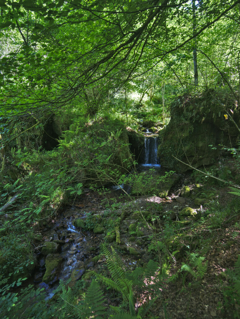
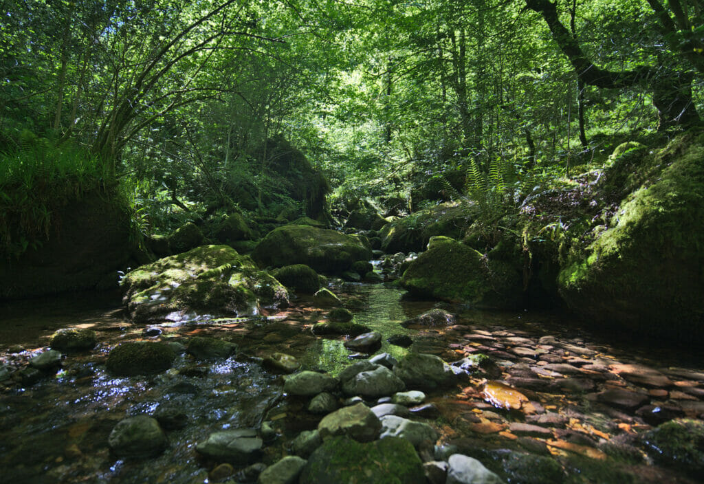
Once out of the forest, the hike ends with a nice flat stretch to get out of the gorge before a last little plunge back to the parking. A very nice loop that we recommend if you want to stretch your legs (or those of your dog 😉 )
- Start and Finish: Fuensanta
- Distance: about 8km (if you manage to park at the beginning)
- Elevation change: about 420m (from the official start)
- Duration: the hike took us 3-4 hours
Hiking map:
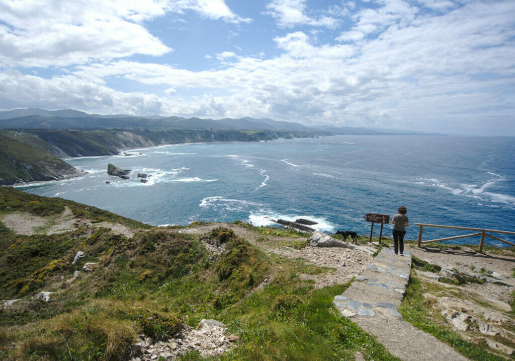
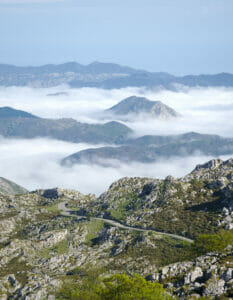
The Mirador el Fitu
If you’ve been reading us for a while, you’ve probably noticed that we have a particular affection for the viewpoints (and the sunset beer that goes with them lol)… At the time of preparing a road trip we always try to see if there is a way to take a “more scenic” road even if it is not the most direct way.
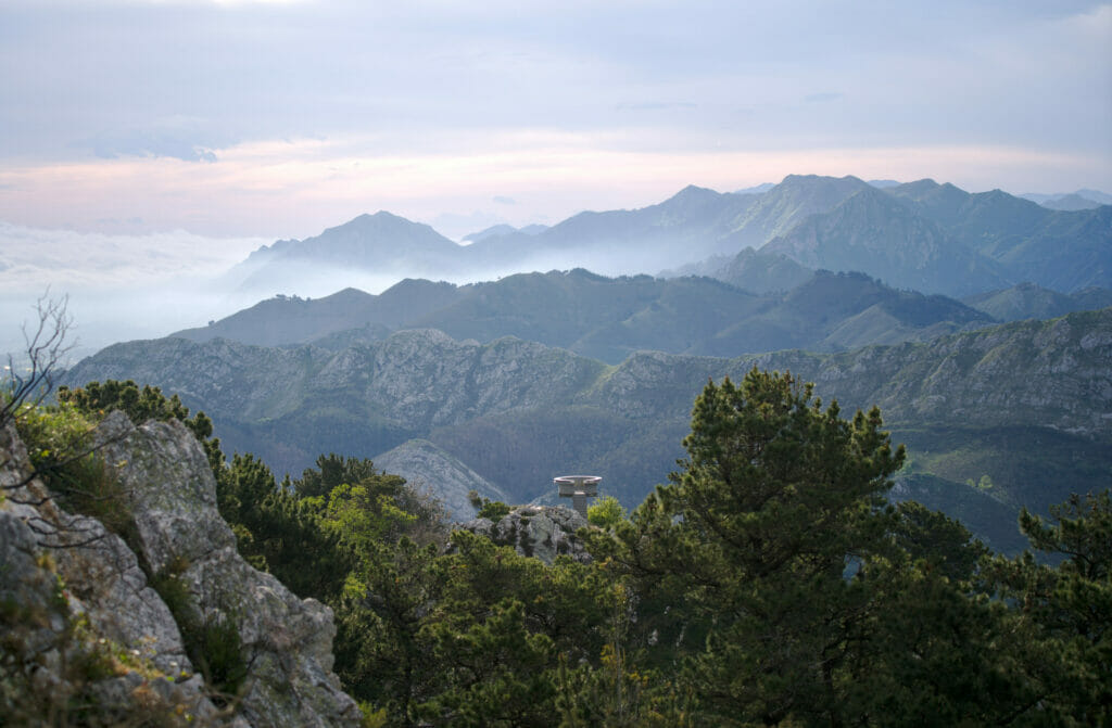
For the case, the mirador del Fitu will have been a small detour, but we do not regret it AT ALL! In fact we had planned to pass by there on our way down from the Picos de Europa park, but a nice clear weather made us reconsider our plans (it’s a place that it would clearly be a pity to visit when the weather is grey). Located at the top of a mountain road connecting Cangas de Onis to the coast, this viewpoint offers a 360°C panorama with, on the north side, the coast and on the other side the Picos de Europa range!
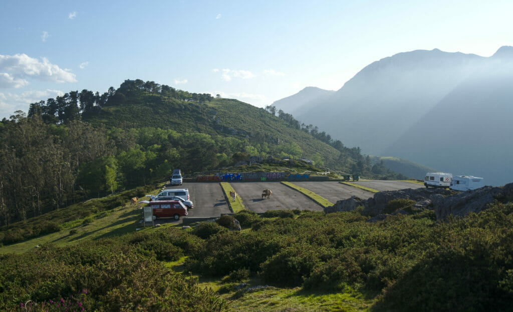
On Park4Night we saw that there was a recreational area just below the mirador and apparently no parking ban for vans and campers. So indeed, there is nothing secret about this spot… the evening we were there there must have been 5-6 vans when we arrived at the end of the day and we were probably about 20 at sunset. The guardia civil (local police) came several times to make rounds but according to the echoes that we had this is rather to make sure of the safety… In any case they didn’t say anything to anyone.
The sunset on the coast:
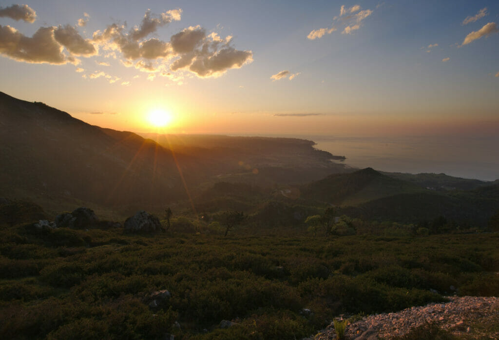
And the next day, the sunrise just behind the peaks of Europe:
Similar to Galicia, visiting Asturias without a vehicle is “possible” but it will be much more complicated, especially to access the different natural sites. As always, if you want to rent a vehicle for your stay, we recommend the rentalcars comparator which will allow you to find a cheap vehicle for your trip.
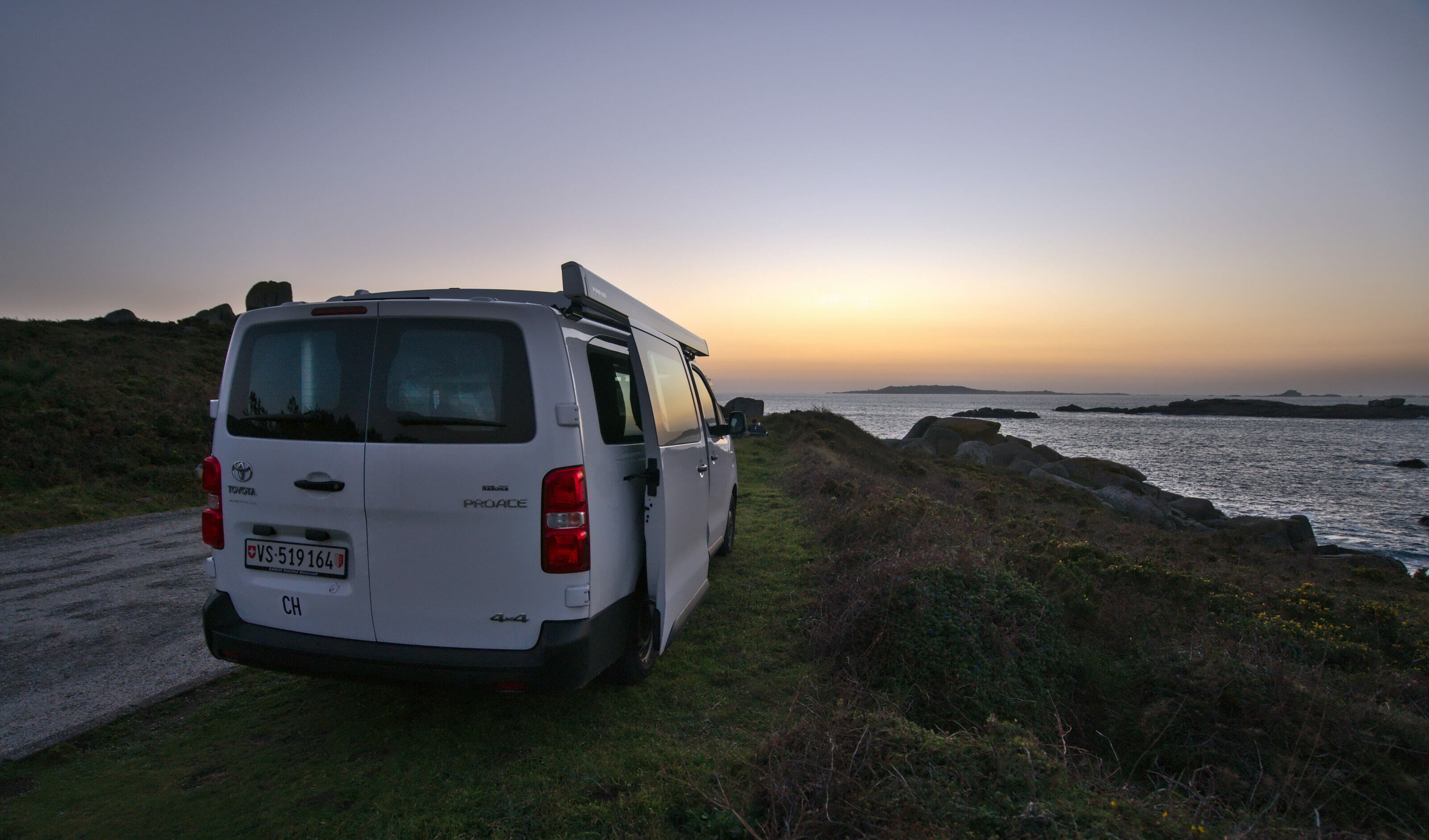
During our road trips we travel with Dahu, our van that we presented here. If you are interested in the Vanlife in Spain, you should know that it is easy to rent an RV for a given period. On Yescapa you can find for example RV rentals from private owners (with all the required insurances) from 60€ per day. Otherwise you can also rent a van or motorhome from a professional rental company like Campstar.
By the way, we have created a complete guide about how to rent a campervan or motorhome that you can find below
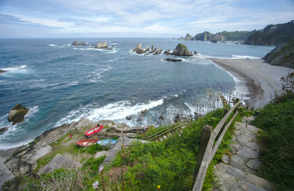
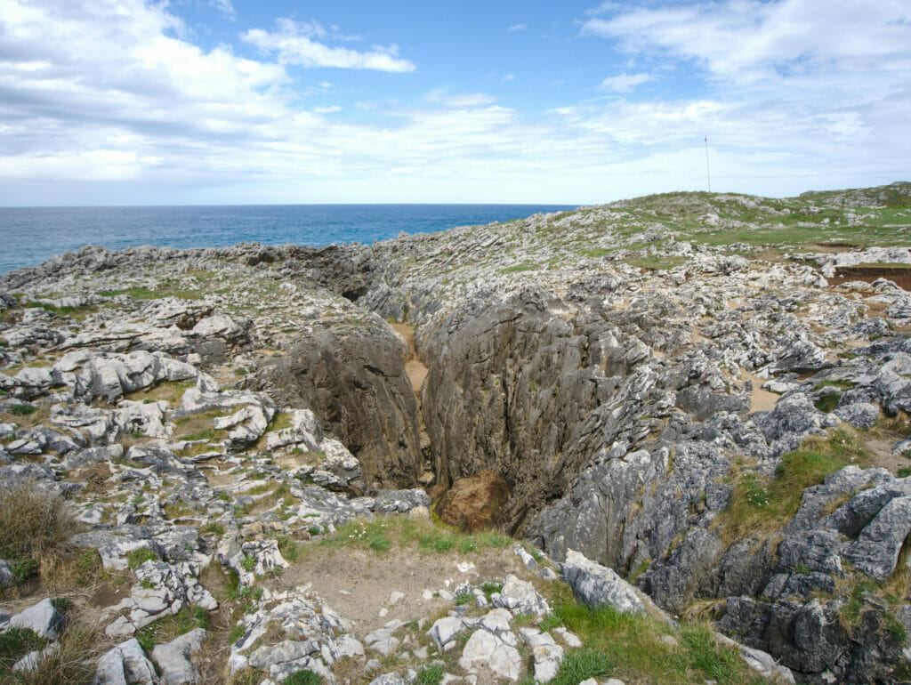
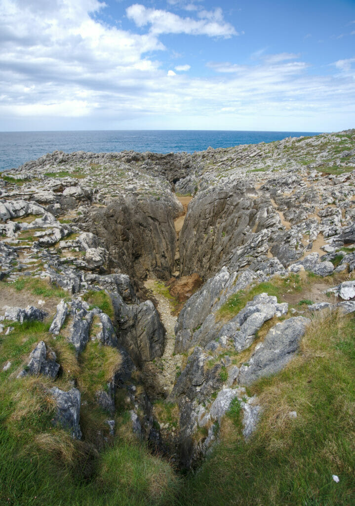
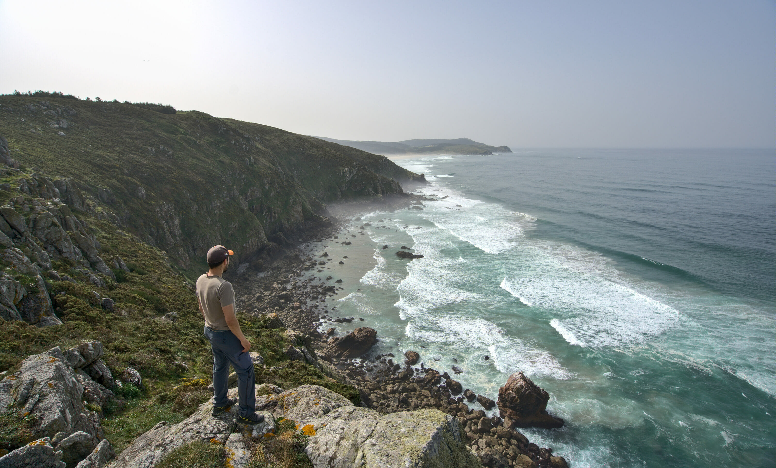
The Bufones de Pria
The Bufones are a natural phenomenon quite unique in its kind and it is possible to observe them in several places along the coast in Asturias. In fact, a “Bufon” is a kind of large chimney that connects the sea to the land in an almost vertical way. Created by erosion and rain, these formations normally allow you to see water gushing out of the ground when large waves come crashing against the cliffs (the pressure making the water rise in the chimneys).
In theory, it could look like this:
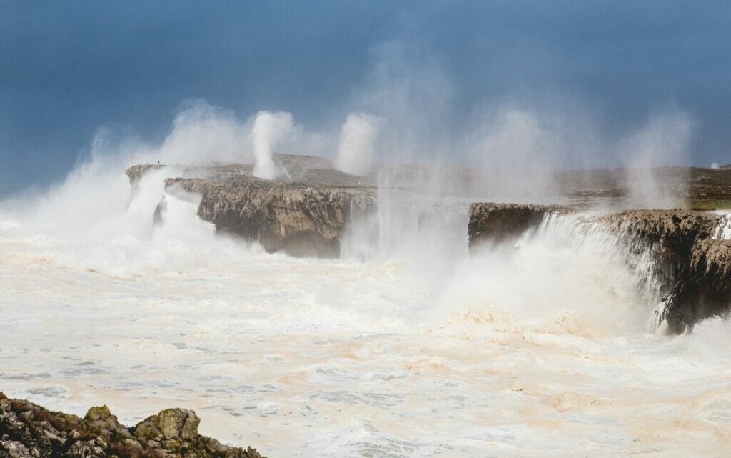
Motivated by this image, we timed our visit to the tide times (it is imperative to come at high tide) and went to park on the small overhang of land in front of the Bufones. The view we had? Ohhh it was beautiful, but no bufones exploding on the horizon 😉
Lesson learned that day? Coming at high tide is good… To come when there is a strong coefficient and or a storm is even better 😉
And there, we said to ourselves: “it doesn’t matter, we’ll go and see it up close, maybe if we don’t see it we’ll already be able to hear this apparently hyper characteristic sound”.
Yep… so fail number 2… because we naively thought that we could reach the other cliff by crossing the beach which is between the 2. Remember: high tide! haha we are really mountain people and not sailors. We laughed a lot that day! Of course we could have taken the van back, but in the end we decided that the Bufones had beaten us and we decided to leave it there.
Since we did almost everything wrong, the good news is that we can tell you how to do it right 😉 To see the Bufones up close, the best thing to do is to park near the village of Llames and continue on foot. To get the view from the cliff you have to go to the recreational area on the other side (a narrow but well-maintained track goes there).
And of course, aim for days with high tides and/or storms.
And if you still have doubts, here is the map of the area:
The Picos de Europa Park in Asturias
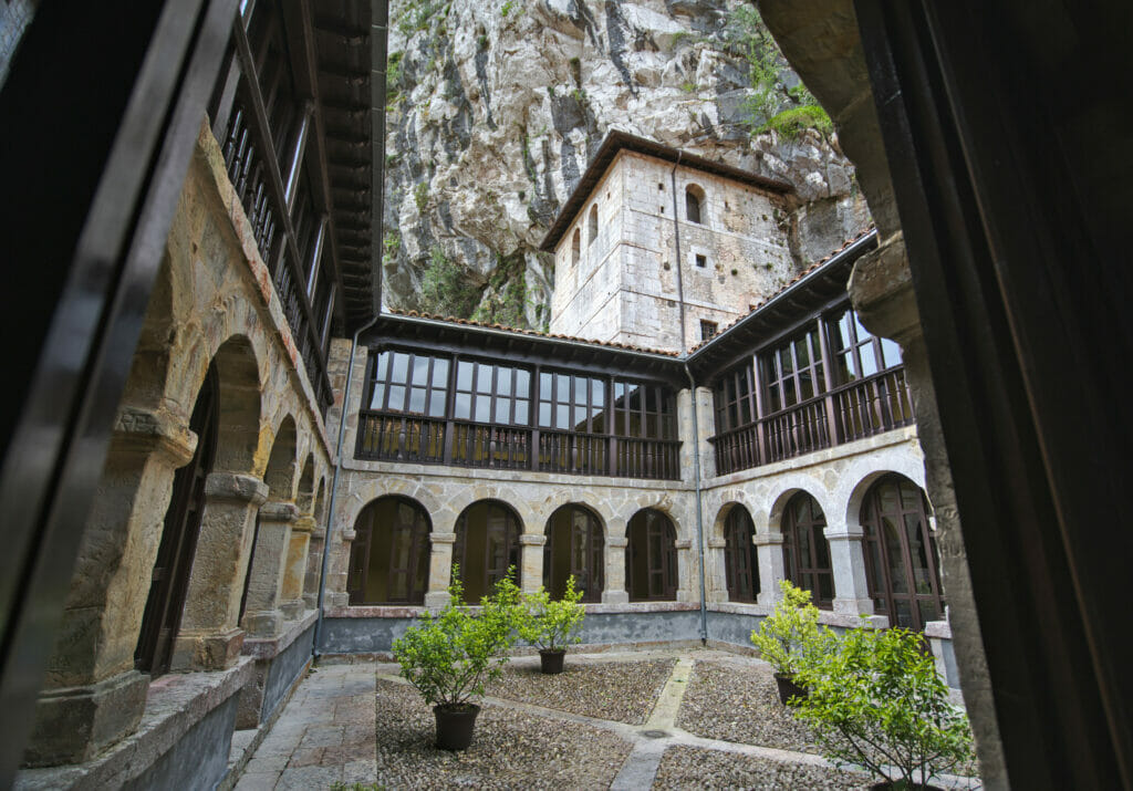
Visit Covadonga
Since we arrived at the end of the day, we decided to save the lakes for the next day. But not knowing yet exactly how long the hike would take us, we decided to visit the small village of Covadonga the day of our arrival (Update: it is quite possible to combine the 2 in the same day) 😉
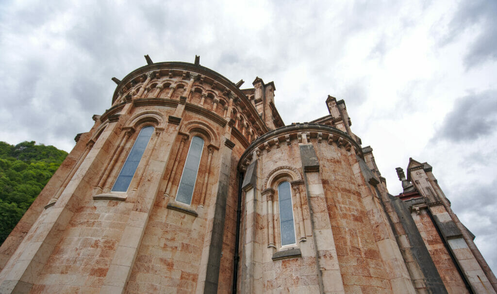
If the Picos de Europa Park is very well known among hiking enthusiasts, Covadonga is also very popular among Christians. The small village is home to a cave sanctuary with a statue of the Virgin and an imposing basilica. In 1989, Pope John Paul II came to pray in front of the statue of the Virgin during his trip to Spain, which further contributed to the popularity of this place. This small town is also known for the battle (of Covadonga) that took place here in 722. It was in this battle that the Christians managed to stop the Muslim advance into Spanish territory.
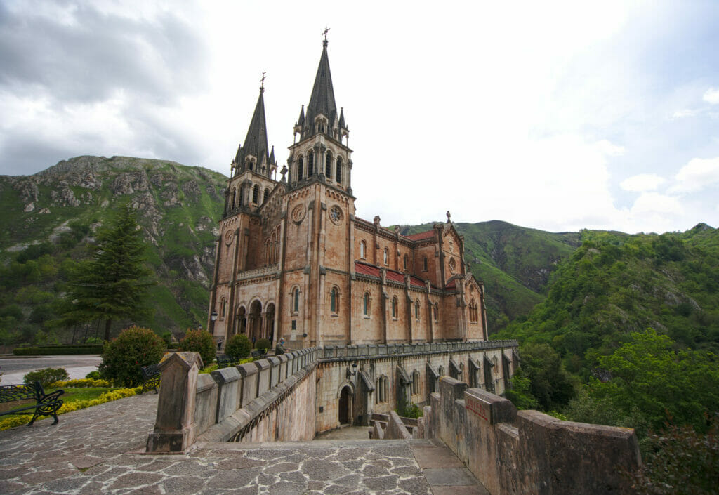
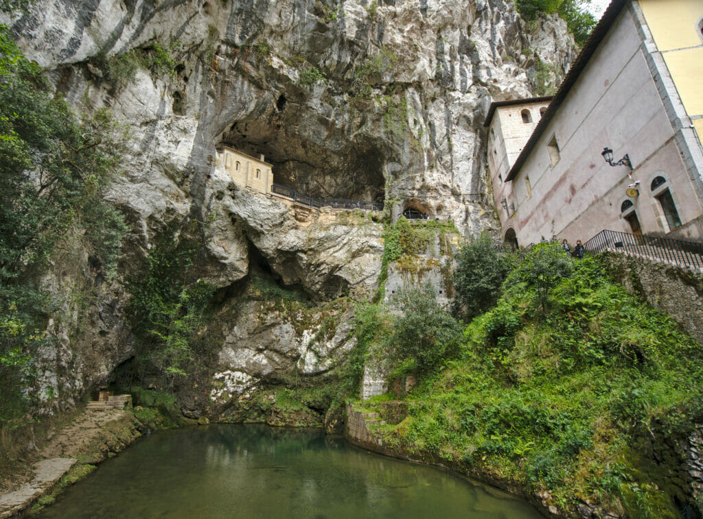
Not particularly fond of history nor particularly Christian, we found this place really beautiful! Afterwards, we can’t help but wonder what the place looks like outside of the health crisis and in high season. When we visited (at the end of the lockdown, during the week and outside of the vacations) we already found that it was very crowded… The number of stores, restaurants and parking lots suggest a rather massive influx if you ask us!
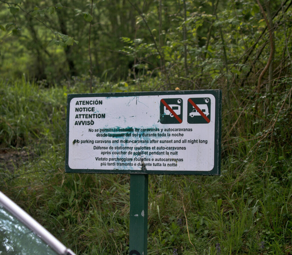
The national park is strictly forbidden to wild camping. The bivouacs with a tent are authorized above 1600m (well on the other hand we warn you, there are bears in the area 😉 ) but with a van or camper it is strictly forbidden to spend the night in the enclosure of the park (many signs are present to remind us). There are several campsites just outside the park, unfortunately all of them were closed at the time of our visit (we were a bit early in the season, most campsites open at the end of May or beginning of June). For our part we decided to park on a large parking just outside the park (before the village of Covadonga). During the off-season, overnight stays in the parking lots outside the park are tolerated, but during the season it is better to use the official campgrounds.
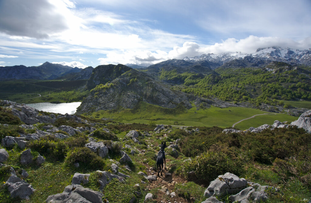
Hike to Covadonga Lakes
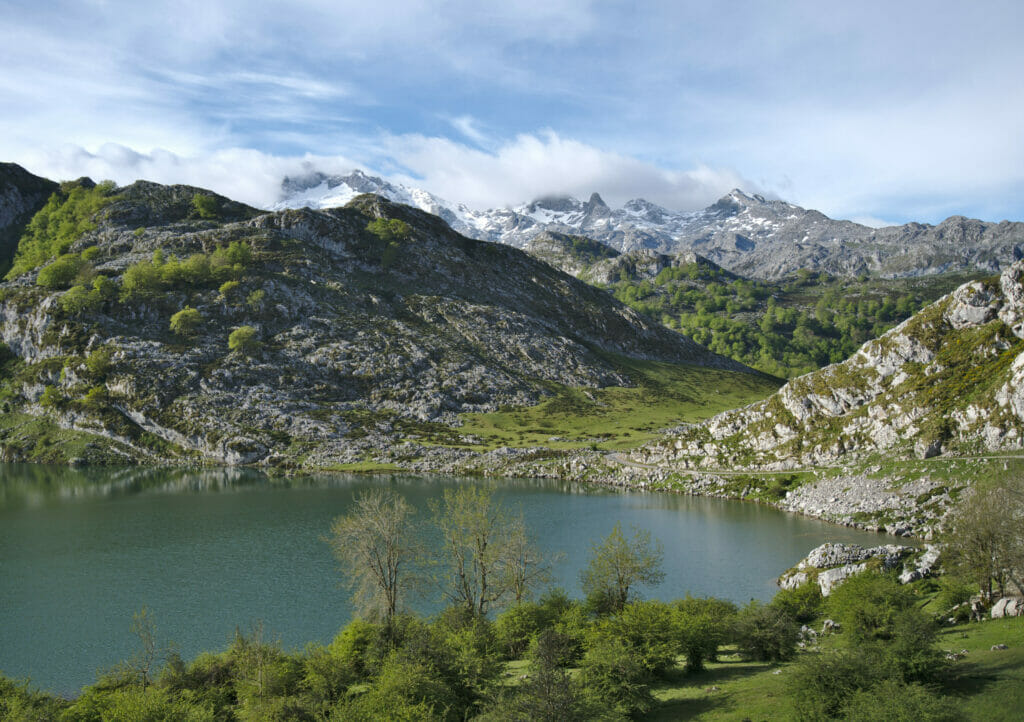
Well it’s nice to talk about the villages and basilicas of Covadonga, but generally if we come to the Picos de Europa park it’s to do some hiking too 😉 The late snow in the season limited us a bit, but we had nevertheless the chance to make a very nice hike around the lakes of Covadonga!
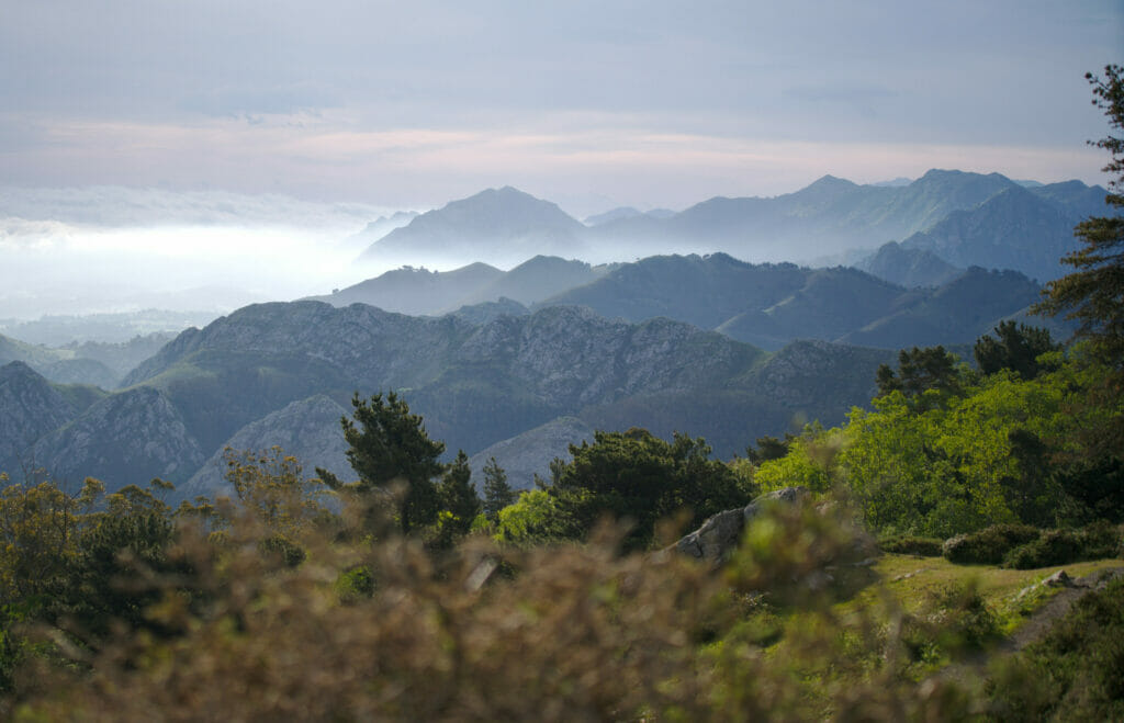
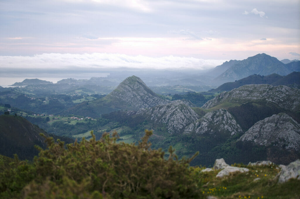
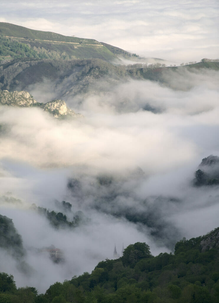
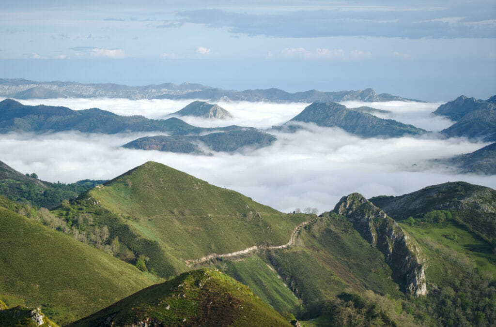
We left early and started by following the winding (and long) mountain road to Enol Lake. We started in the mist, but we quickly passed above the clouds and it was just MAGIC! We took several photo breaks on the way… 😉
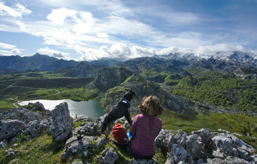
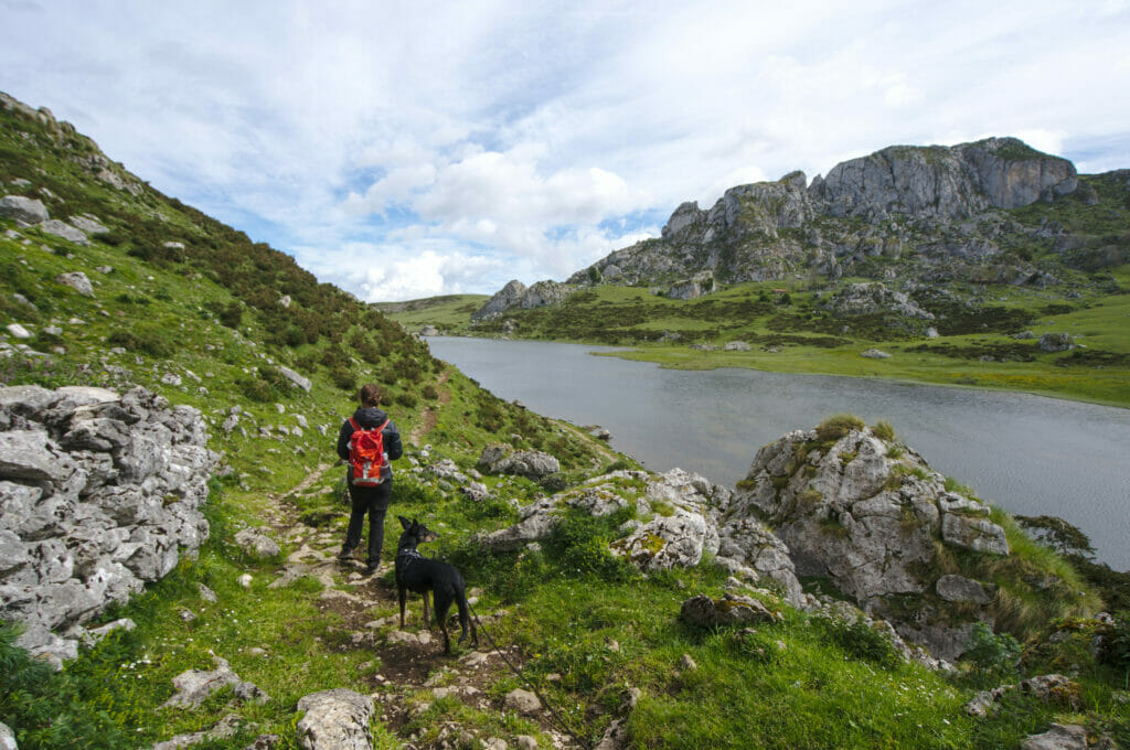
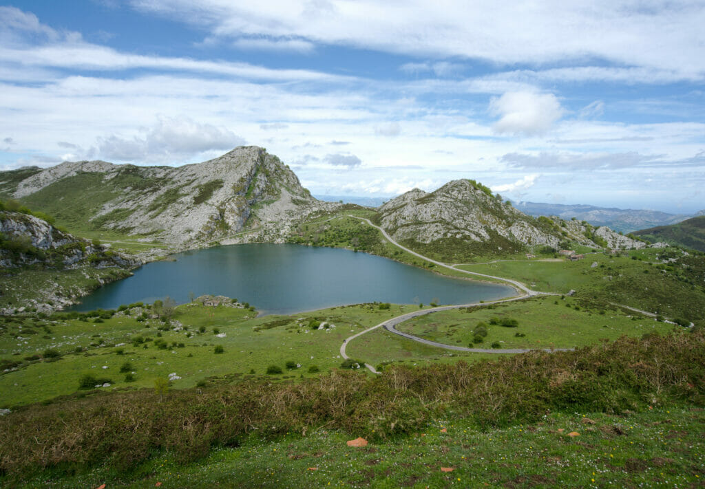
Arrived at the parking lot located near the lake of Enol we set off. Initially, our plan was to do the small loop passing by the 2 lakes (about 6km). But it was without counting on Benoit and his sharp eye for the viewpoints… As soon as we arrived at the edge of the lake, he had already found us a “mini detour for a nice view” as he said so well. 2km more, but also a good little climb of 250m of D+ in order to overhang the lake. I admit I was a bit grumpy at the time but I’ll admit it turned out to be a great idea. From the top we have a breathtaking view on the lake with, in the background, the whole chain of the European peaks.
Once we came down from our little peak, we started the loop of the lakes. On the 3rd photo above the itinerary is quite clear: we had to go around the right side of the small mountain in front of us and come back on the left side.
This itinerary does not really present any difficulty and is very well marked. If like us you hike with a dog you just have to be careful when crossing the herds (or rather to make sure to avoid them). During our passage 2-3 calves were, it seems, super intrigued by Winchy and approached a little too close to our taste pushing us to make some good detours to pass as far as possible from the small ones (and especially from their moms) 😉
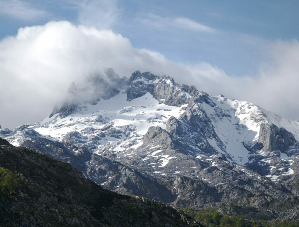
Once we reached the Ercina lake, we opted for a mini detour to the Picota viewpoint and the Principe viewpoint to enjoy the panorama one last time. For Swiss kids like us, the mountains of the peaks of Europe are not the “most impressive” but on the other hand, to have such peaks with the ocean in the background is really special!
Departure and arrival of the hike: Parking below the lake Enol.
Attention: the road leading from the village of Covadonga to the lakes is closed from 8:30 am to 9 pm from June to October, on weekends in April and May and during Holy Week. You will have to get in the car before 8:30 am (the descent can be done at any time) or take one of the official shuttles (9€, ticket valid all day). The shuttles leave from Canga de Onis and pass through all the parking lots (with a fee) along the road leading to the entrance of the park and through the village of Covadonga. In high season, it is recommended to buy shuttle tickets in advance (via the official website alsa.es), as those who have tickets in their pockets have priority over those who buy them on the spot.
Distance : about 8km
Elevation change: about 450m (positive and negative)
Duration: we took about 4 hours (with plenty of photo and picnic breaks)
Dogs: Dogs are allowed in the Picos de Europa national park but must be kept on a leash
Hiking map:
The Bufones de Arenillas
After our little fail of the Bufones de Pria, we decided to give a second chance to this natural phenomenon and added a little stop at the Bufones de Arenillas. This time we were luckier, because it is here that we could see for the first time these impressive “water eruptions”. On the other hand, we warn you, in photo it does not look like much… 😉 In fact, the water comes out rather as steam and more than the visual effect it is especially the sound which is absolutely seizing! In short, visually speaking we can’t show you much, you’ll have to stop to see (and especially hear) it with your own eyes (and ears).
To get to the Bufones de Arenillas we have only one advice: don’t do like us! 🙂 haha
No, seriously, we didn’t do much research and decided to blindly follow our friend Google Map. Following tiny roads and tracks we reached a small parking lot located at 1,5km from the bufones, but very sincerely the few cold sweats in the narrow passages were not worth the “getting closer”. To visit the Bufones we clearly recommend you to park in the small village of Puertas de Vidiago (along the national road) and to continue on foot. It is possible to make a loop (about 5km) or to do it in return by the most direct way in 3,5-4km. Here is the map to help you find your way:
Well, this time I think we told you everything about our little road trip in Asturias! We hope this article will give you some great ideas for your future trips and of course, if you have any questions or recommendations of additional spots to discover, don’t hesitate to leave us a little comment! We have already decided to come back to the north of Spain next year and we will most probably continue our discoveries of this beautiful region. 🙂
Note: This article contains affiliate links to car rental sites. By booking your car or van through our link you don’t pay anything extra but we will get a small commission which encourages us to create free and independent articles like this one.
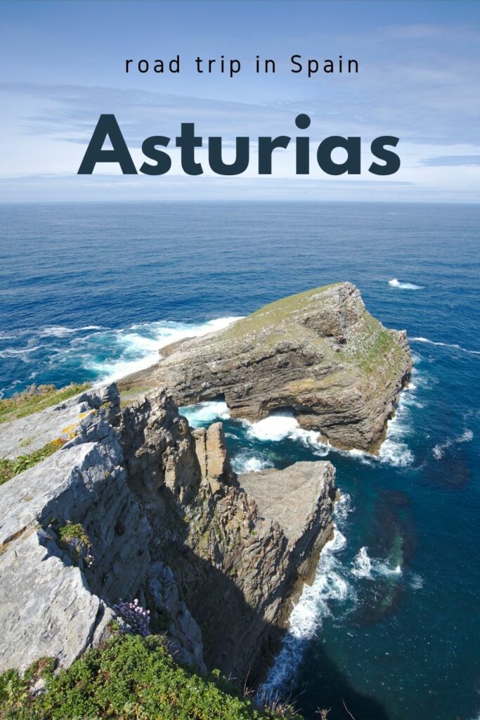
Pin it
Join the discussion