
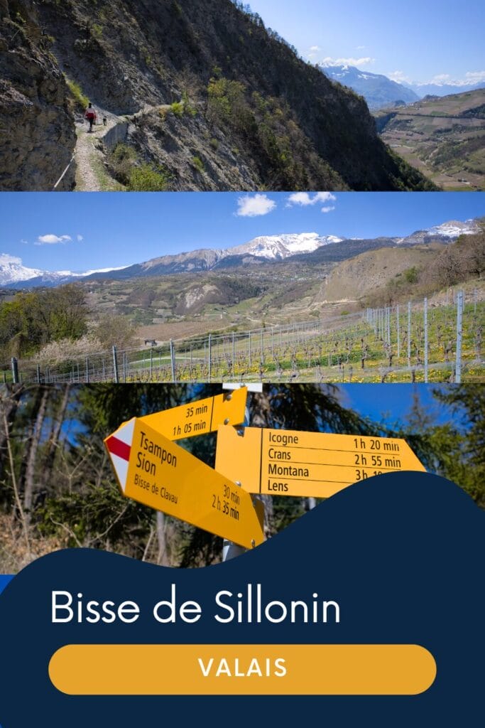
Today we wanted to tell you about our latest little hike: the bisse de Sillonin from Saint-Léonard in Valais. At the moment, the weather is more than clement (we’ve had temperatures of up to 15°C at 1500m…) and although the ski slopes next to us are still open, we’re slowly starting to get into spring mode and prefer hiking (even if Benoit still does a few ski touring outings 😉 ).
Last Saturday, we were in search of a short walk on the plain, preferably not too far from Sion. In short, we set our sights on the unfamiliar bisse du Sillonin.
This itinerary can be done as a continuation of the Bisse de Clavau itinerary (described here) or even as a continuation of the Bisse du Grand Lens itinerary (details here). But for this hike, we decided to opt for a loop starting from Saint-Léonard.
Bisse de Sillonin – hike difficulty
You’ll find the map and full details (distance, altitude difference) at the end of this article. But before going any further, I’d like to make a disclaimer about the fact that this itinerary is relatively aerial and therefore not necessarily suitable for walks with small children or if you’re very prone to vertigo.
It’s funny because on the Cran Montana website, this route is described as “easy” but I think this term is probably a bit exaggerated… some of the passages are still impressive! After that, it’s important to note that we did it at the very beginning of the season, and the path didn’t seem to have been cleared of a few small rockslides yet (more on this later in the article).
The path is still wide enough, and a rope is present on the cliff side for almost the entire route. But it’s important to note that unlike other bisses, this one doesn’t always have fences on the cliff side (no problem for our dog Winchy, although we did prefer to take him on leash in case his survival instinct decided to abandon him).
Departure from Saint-Léonard on the banks of the Lienne river
We began our hike in the center of Saint-Léonard. Located in the commune of Sierre, this small village is best known for its underground lake, the largest in Europe. We didn’t take the time to go and visit it this time, but if you’re in the area for the walk it can be very nice to combine the hike with the underground lake. You’ll find more info on times and prices on their website.
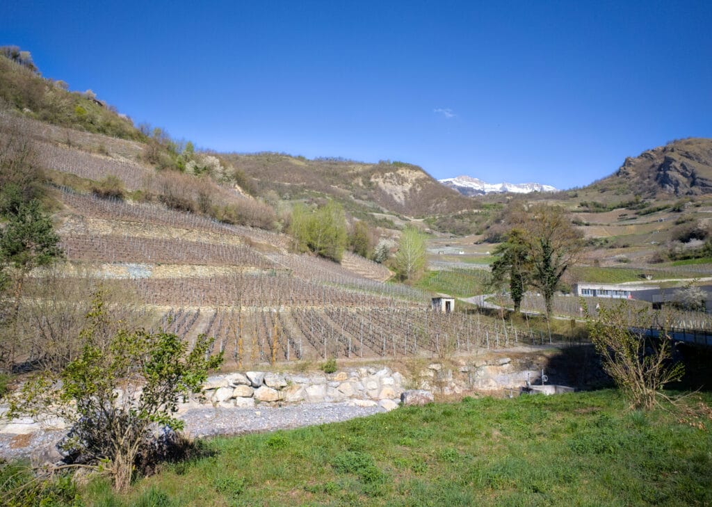
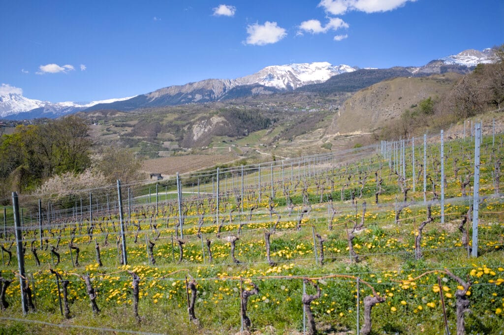
Anyway, back to the point! The hike begins by following the banks of the Lienne for just over 2km. I’m not going to lie to you, this isn’t the most exciting part of the hike. But as it’s almost perfectly flat, it’s done really quickly and well… we still get some nice views of the vineyards along the way 😉
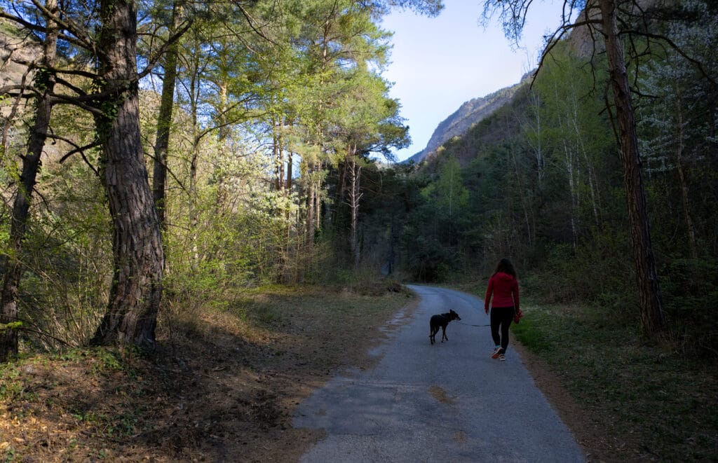
Parking in Saint-Léonard is relatively easy. There are plenty of white zone parking spaces in the village (limited to 3 hours from Monday to Saturday). As we began our walk, we noticed that there was also plenty of space along the Lienne (on rue du Stand) and near the boulodrome de la Liennoise. If you don’t want to enter the narrow village streets, this is the ideal place to start the walk.
Ascent to bisse de Clavau
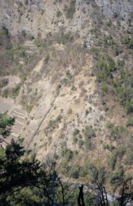
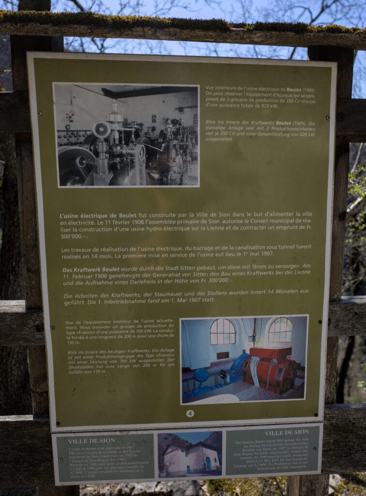
When you reach the old Le Beulet power station, this is where things get “serious”. No, I’m only joking, but it’s true that this is clearly the steepest part of the walk ahead… 130m of ascent over just under a kilometer 😉
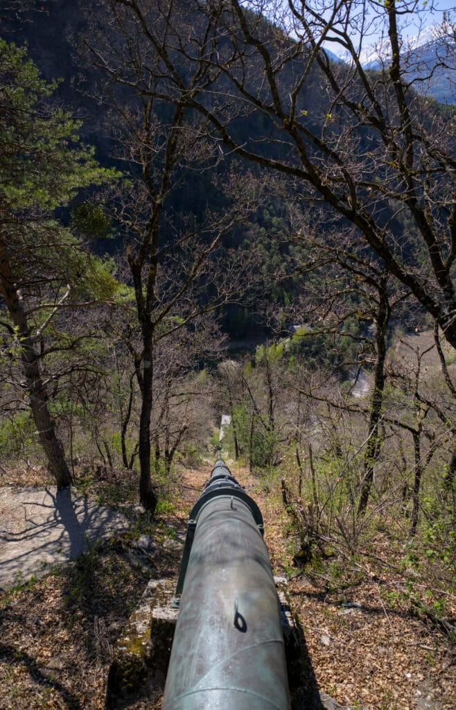
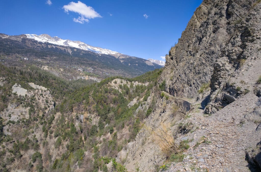
In fact, it was this spot that made us choose the direction of the hike – when we have the choice, we always prefer a steep climb to descending steep terrain. To give you a better idea of the route, here’s a photo of the climb. The photo was taken from the bisse de Sillonin just opposite 😉
I can assure you, it’s relatively short! It took us less than 15 minutes to reach the bisse de Clavau (by walking at a brisk pace), and the ascent is certainly a little hard on the cardio but not particularly difficult.
Crossing to the Sillonin bisse via the Clavau bisse
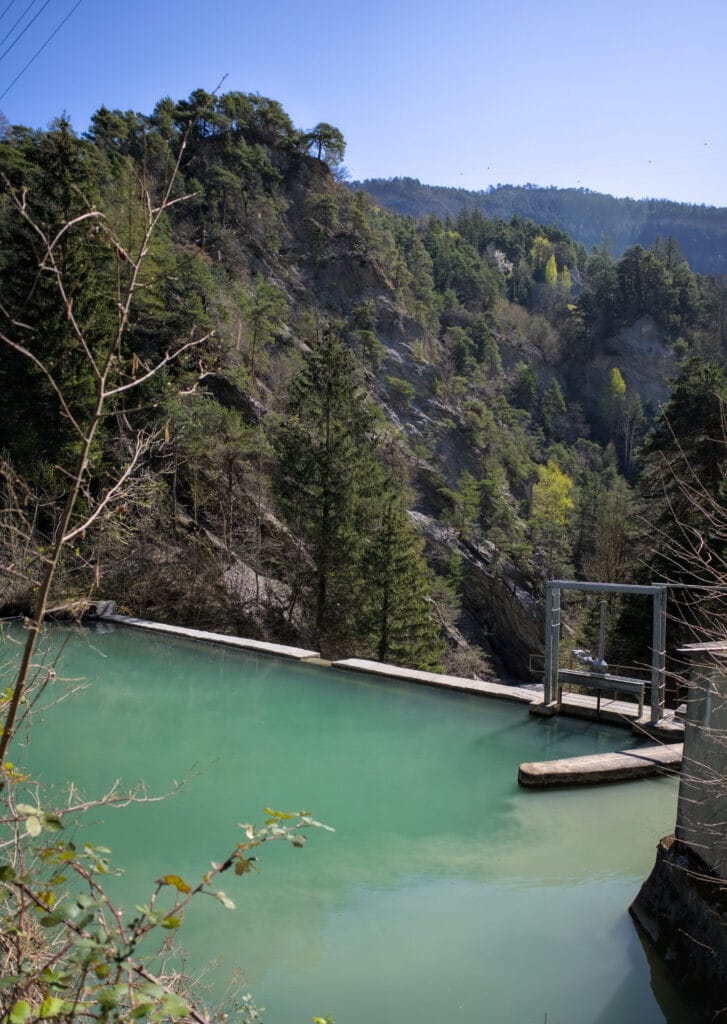
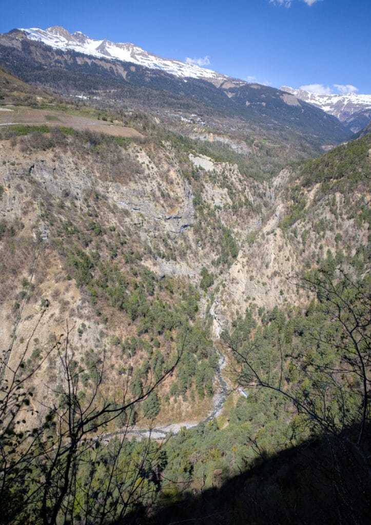
By the time you reach the top of the pipe leading down to the factory, you can officially say that you’ve finished the hardest part 😉 It’s actually quite impressive to stand at the top of the pipe and watch the dizzying fall towards the Lienne.
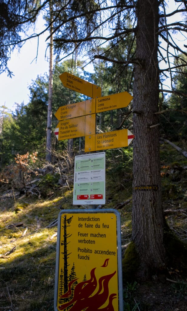
At this point, we also officially join the bisse de Clavau. This bisse has its water intake at a small dam on the Lienne, just a little further along the trail. At this junction, we turned right towards the bisse de Sillonin, but if you go left you can reach the town of Sion by following the bisse de Clavau.
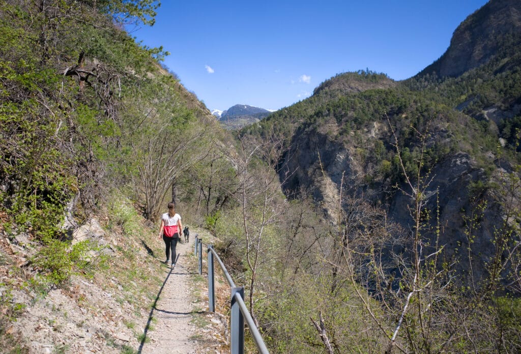
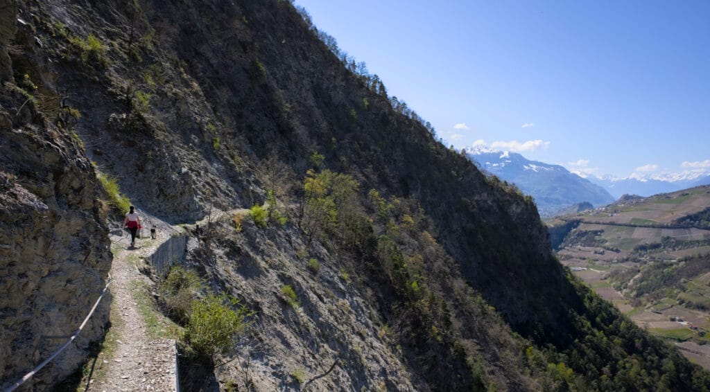
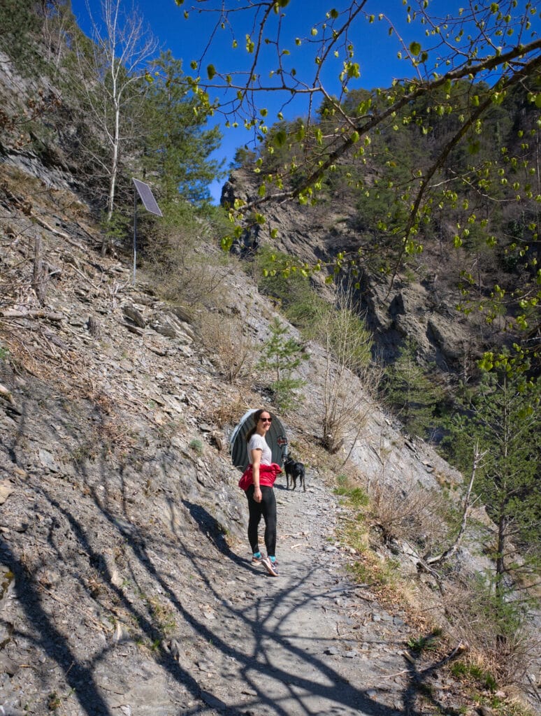
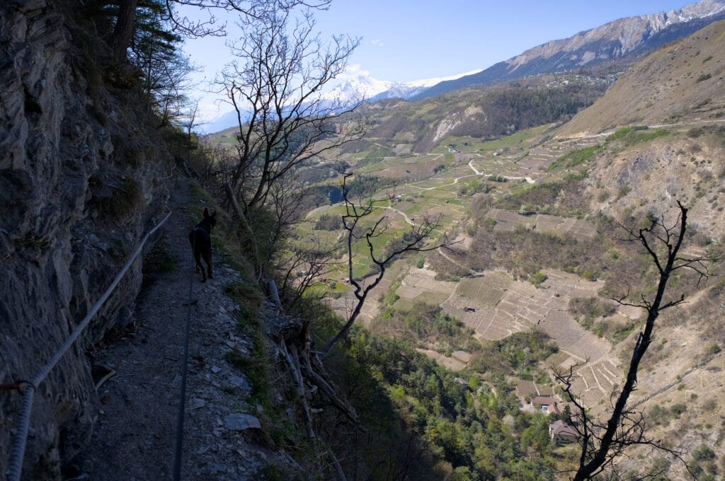
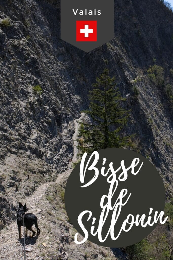
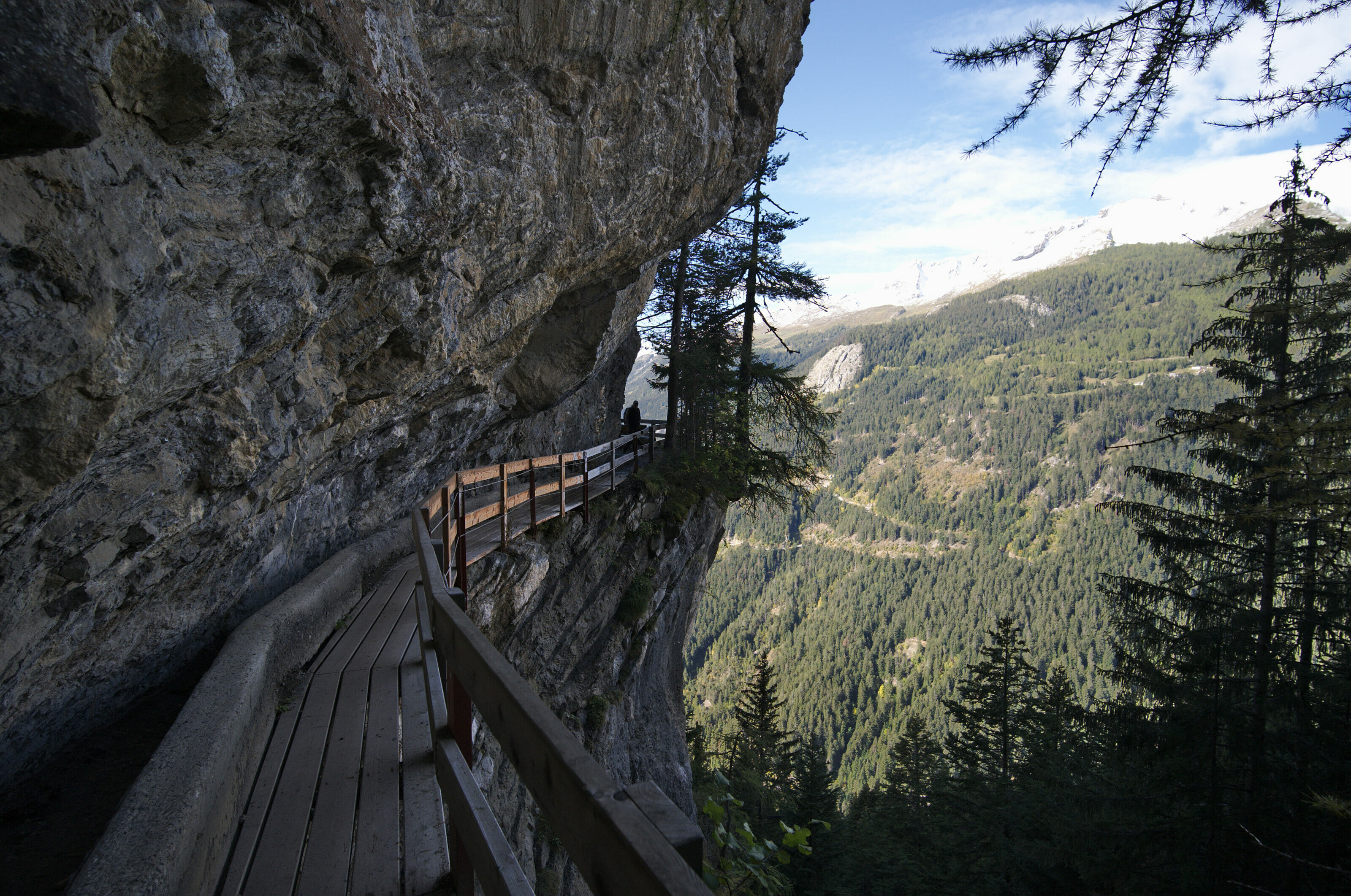
This balcony section is really very pleasant! The bisse is still present on some sections (buried on others). The path overhangs the gorges of the Lienne and you can enjoy a few plunging views of the gorges carved out by the river. This passage is a little “vertiginous”, but it is not exposed to the void, meaning that there is always a barrier on the side of the void.
If you feel uncomfortable with vertigo at this point, we advise you to go as far as the dam but then turn back (the Sillonin bisse is clearly more vertiginous).
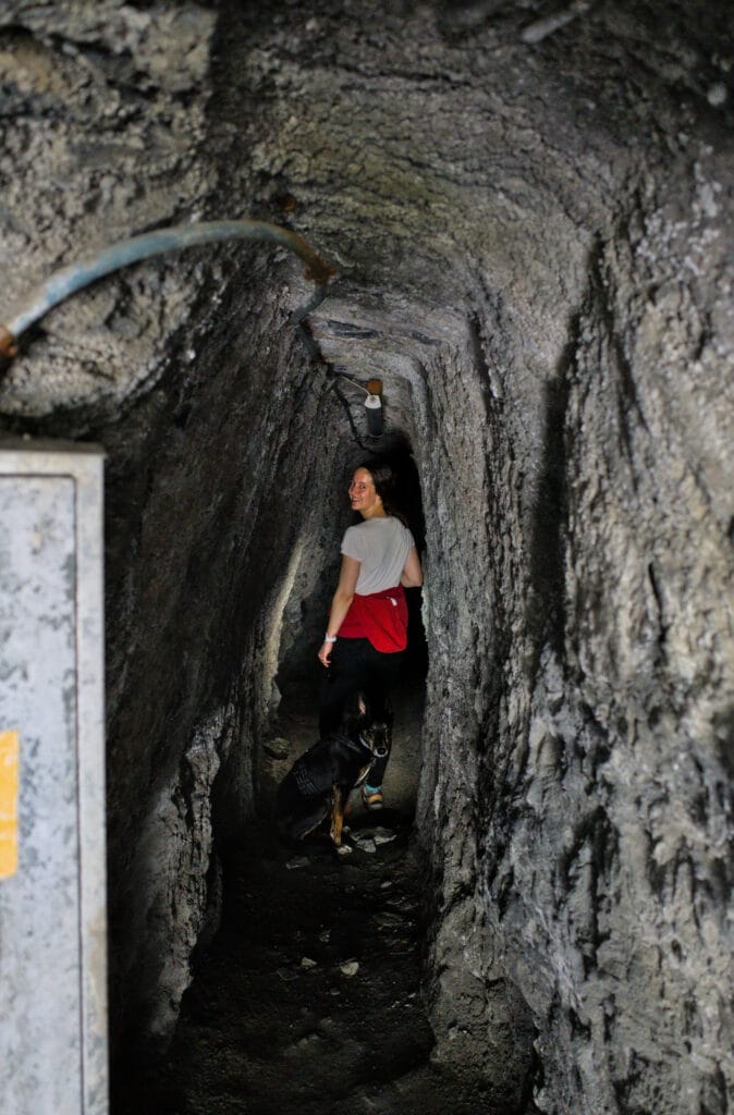
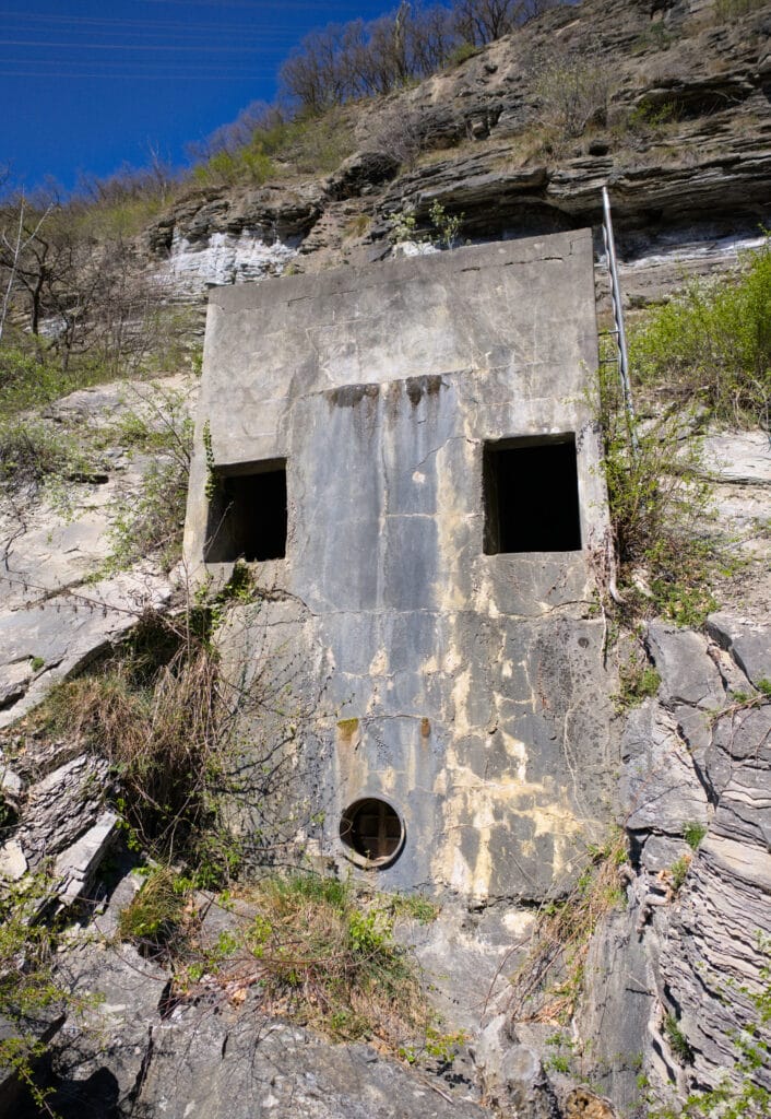
About halfway along, we pass through a tunnel cut into the rock. It’s about fifty meters long and relatively narrow. There are switches at each entrance and lights inside, but they weren’t working when we passed through. So it’s best to bring a (charged) telephone with a flashlight.
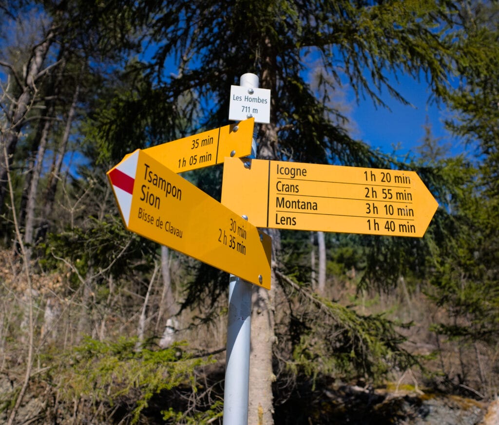
After about 1km, you reach the small dam from which the Clavau bisse rises, and shortly afterwards cross the Lienne. The path then continues along a wide track towards a crossroads. Here, you have the choice of turning left to reach Icogne or right to join the Sillonin bisse.
If you’re planning a trip to Switzerland or if you live here and wish to discover some new spots, don’t miss our new ebook. Released in May 2025, this 75-page guide will help you prepare for your upcoming stay in Switzerland. We’ve compiled all our best tips and tricks for visiting our beloved little country without breaking the bank. You’ll find advice on transportation, accommodations, where to shop, as well as a list of free activities and events throughout the seasons, along with our personal recommendations for hikes and must-see spots, and a selection of off-the-beaten-path itineraries (with estimated budgets). This ultra-complete guide also includes a fantastic interactive map featuring over 500 addresses and deals.

To learn more about the ebook and the interactive map, the introductory article is available here.
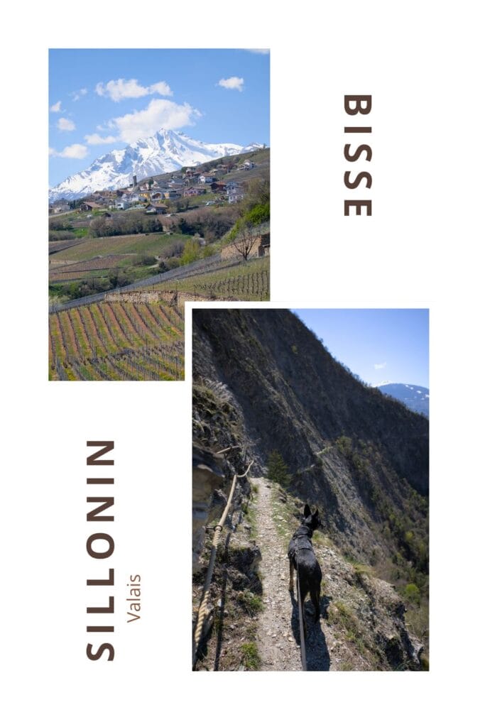
The bisse de Sillonin
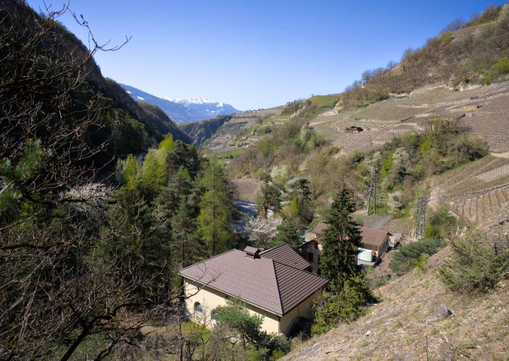
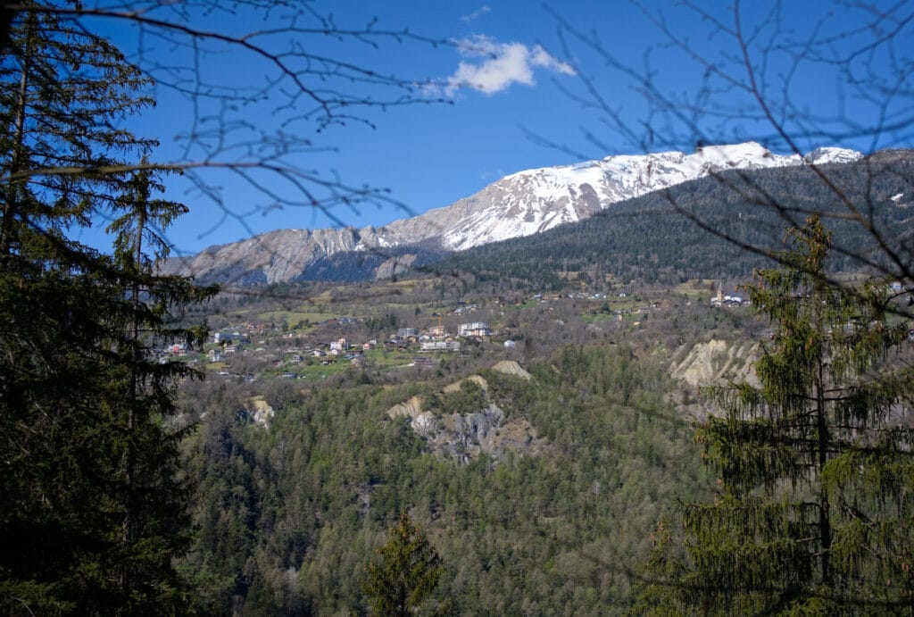
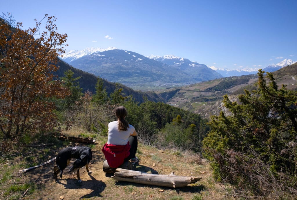
The path continues flat through the forest for a while, and just before reaching the cliff-side passage you come to a magnificent clearing from which you can enjoy a magnificent view over the Rhône plain. The ideal spot for a picnic break, if you ask us 😉
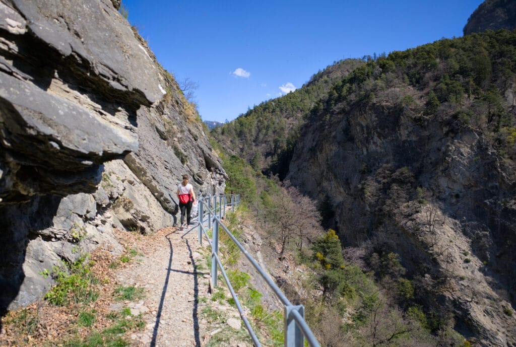
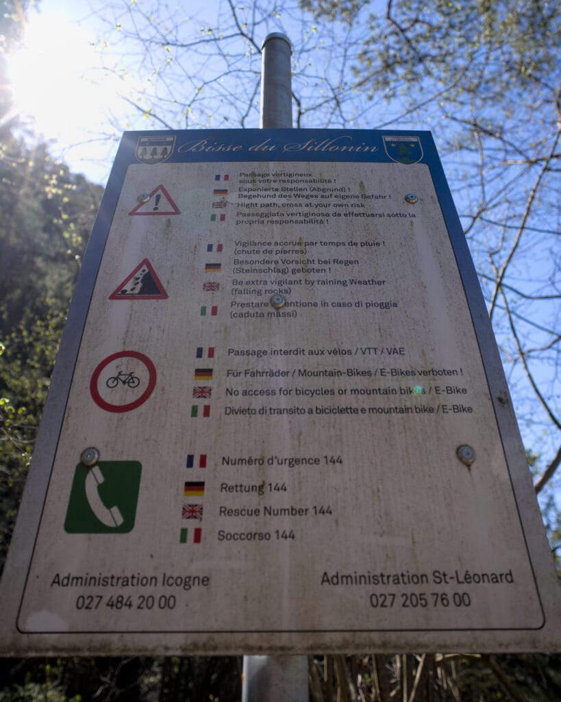
From here, you reach the most exposed part of the walk. A sign warns hikers of the risk of falling rocks (especially in wet weather).
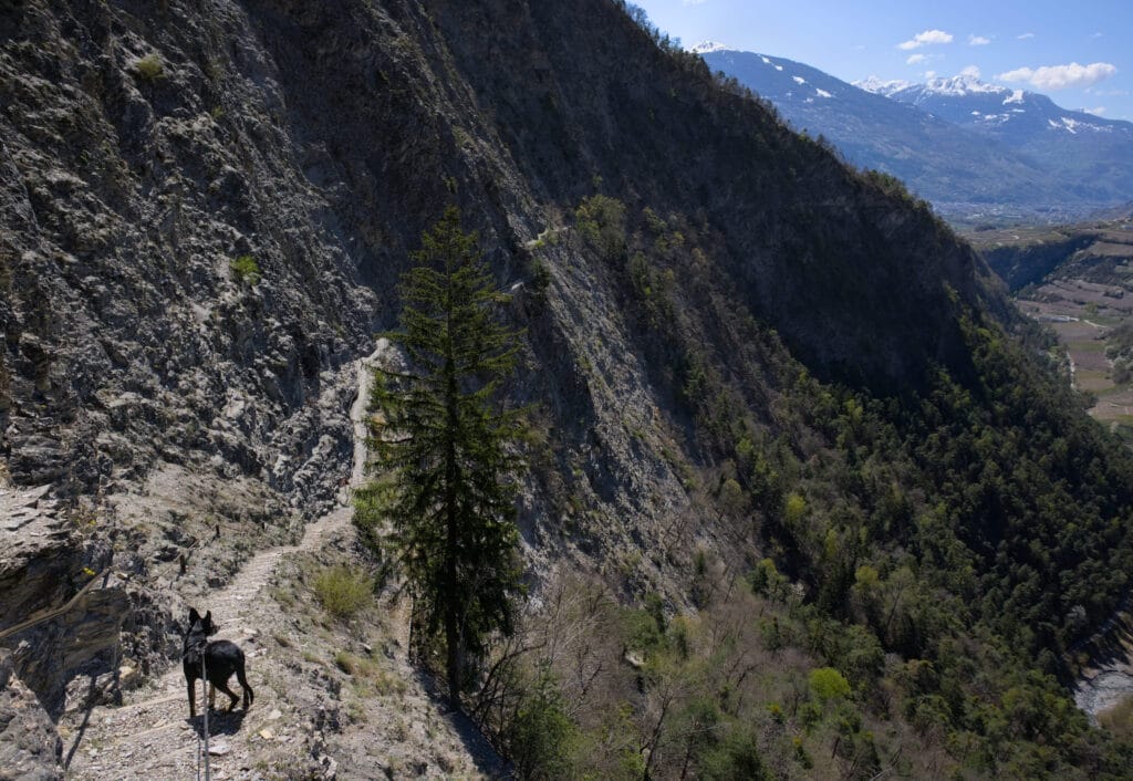
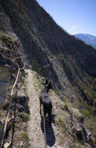
We start by descending a staircase set into the rock, then skirt the cliff on a relatively narrow but well-maintained path. A rope has been installed on the vast majority of the route, which makes you feel a little more confident (at least it did for me). It’s a psychological thing, but having something to hold on to (even lightly) makes progress much easier.
The only point we found a little tricky was the small passages where there were landslides. The path, which is normally quite flat, is covered by a heap of rock (it looked like very fine, crumbly slate). These passages aren’t particularly difficult, but it’s quite unsettling to walk on very loose ground that gives way slightly as you pass (and incidentally, the rope is buried, so there’s no way to hold on). In short, we didn’t linger too long in these places.
During our hike, I think there were 3 or 4 passages of this type:
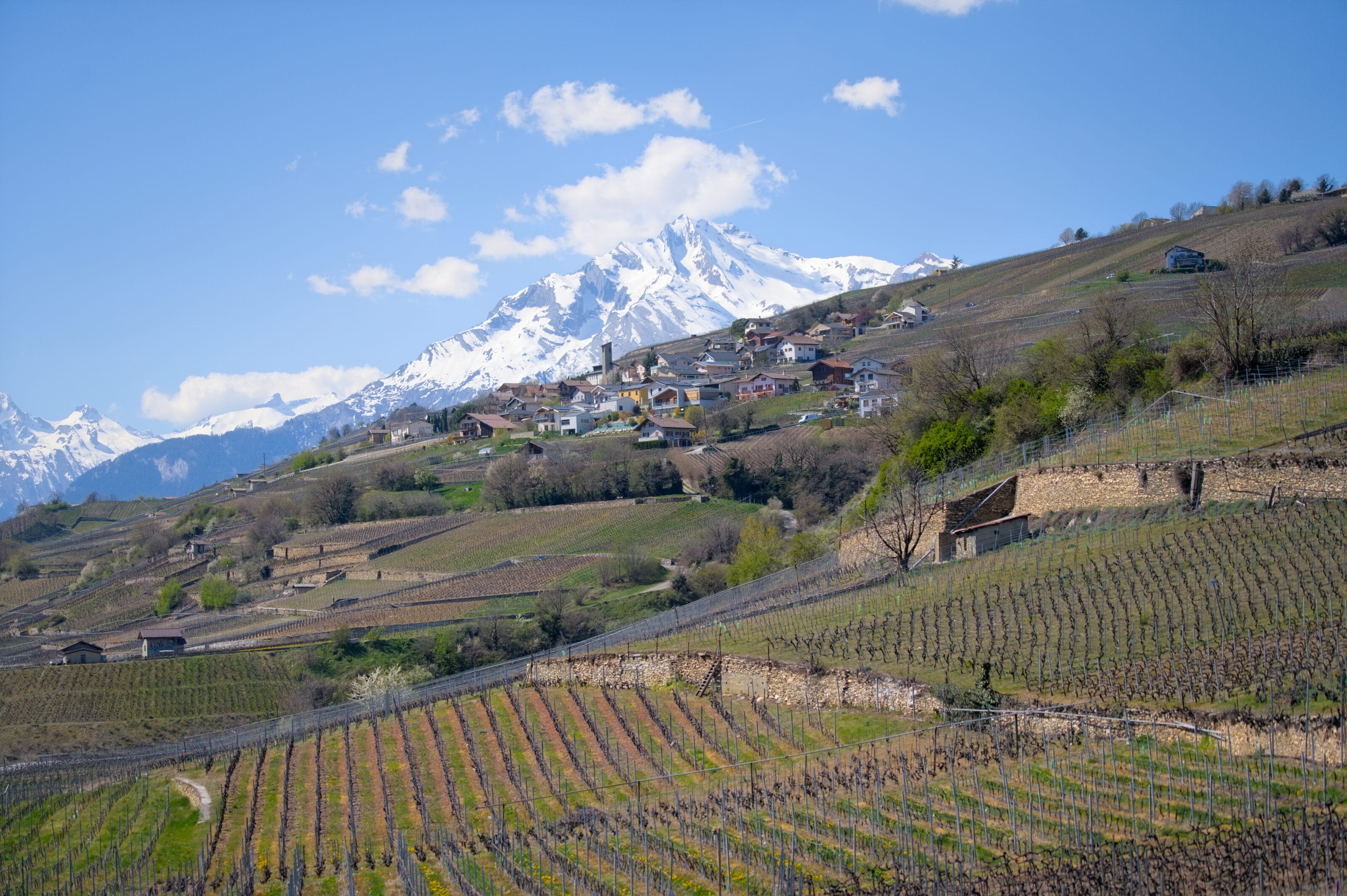
Descent through the vineyards to Saint-Léonard
Once at the end of the bisse, you quickly reach the vineyards overlooking Saint-Léonard, and the descent is very easy. There’s about 2km of descent left, during which you can simply enjoy the view (no need to worry about the emptiness haha).
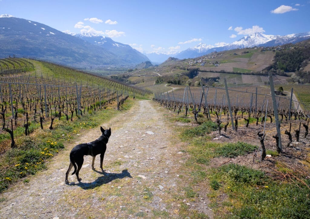
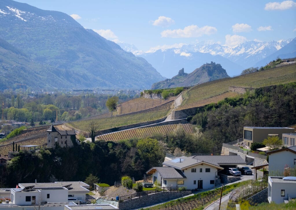
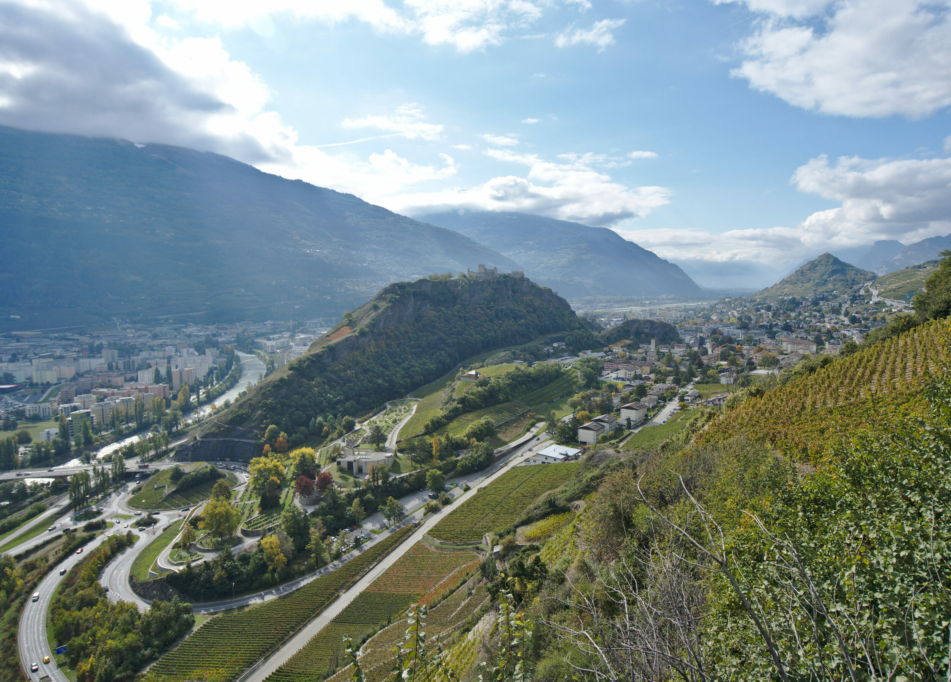
Along the way, we enjoy magnificent panoramic views of the villages of Arbaz and Grimisuat, with the snow-capped peaks in the background. In the distance, you can also see the two emblematic hills of the town of Sion: Valère and Tourbillon.

Practical information for the Sillonin bisse hike
We did this hike at the very beginning of April. The bisse is accessible most of the year, although we advise you to avoid rainy days, as the slippery terrain and the risk of falling rocks could make the adventure more perilous.
In all, the route is 9.2 km long, with an ascent of around 460m (both positive and negative). According to the AllTrails website, the itinerary takes around 3h15, but we think that’s a bit of an exaggeration… It took us 2h30, including a 30-minute picnic break in the middle 😉
We chose to follow the route in a clockwise direction (i.e. the opposite of what’s suggested on AllTrails) for the simple reason that, after a quick glance at the gradient lines, we preferred to go uphill for the steepest part (but then, it’s a matter of taste).
Hiking map
That’s all for today! We hope you enjoyed this little stroll close to home. We’ll be back soon with more articles on hikes and getaways in the Valais (and elsewhere).
This article contains affiliate links to AllTrails. What does this mean? It means that if you decide to use AllTrails, we’ll earn a small commission. Want to upgrade to AllTrails+? By using our link, you’ll receive a 30% discount on your annual subscription (if you decide to take AllTrails+, it’s still free otherwise) and you’ll be helping us to create free, independent and regularly updated content.
AllTrails is the application we’ve been using for all our hikes for over 8 years now. To find out more about the application, please read this article.
Thank you for your support.
Pin it

Join the discussion