
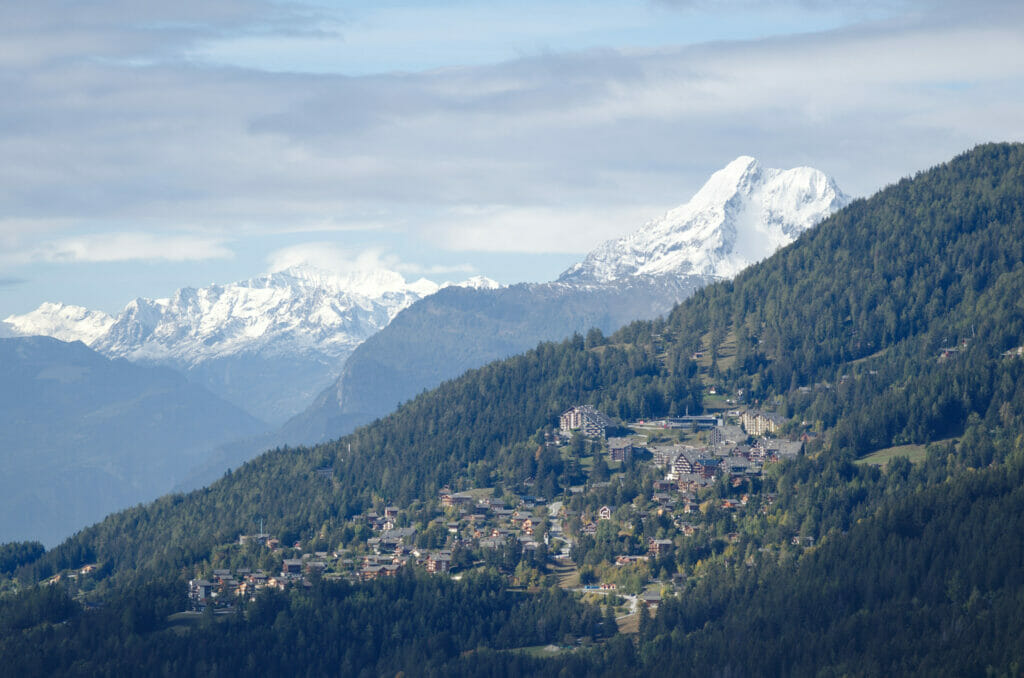
In this beginning of autumn we are starting to be in more and more seriously need of outdoor and adventure. The weather is rather rainy these days and we try to take advantage as much as possible of each clearing to go hiking a little around our home base in Valais. That’s how last week we left on a whim for the region of Crans Montana and made a nice loop along the Bisse du Ro, the Grand Bisse de Lens passing by lake Tseuzier.
This is really a wonderful hiking route in central Valais! It is a little over 18km long and we did it in one day. Thus, here is a small article about this beautiful hike with, at the end, all the practical information and the map of the hike.
Bisses in Valais, a small historical context
If you are not Swiss or should I even say Valaisan (or at least with a pronounced affinity for Valais) there is a good chance that you don’t know what we are talking about when we say the word bisse. 🙂 Am I wrong? Then go directly to the next point!
For all the others a small explanation on this word 100% AOP Valais is essential! The bisses are in fact small irrigation canals built by man in the 14th century. Their primary function was to bring water from the valley bottoms to the cultivated land and vineyards. If we look at the history of the bisses we discover that at one time there were more than 600 in Valais! At the present time there are only about 200 officially listed and only a small part of them is still maintained and accessible to the public.
Nowadays, bisses are still used for irrigation but are also more a historical heritage that associations have decided to preserve by opening them to tourism. From a personal point of view, I must admit that I really appreciate the walks along the bisses because very often it rhymes with a relatively flat hike… Well… usually! In our today’s hike that will not be completely the case because we decided to pass 2 bisses and that between the two there is indeed a little difference in altitude which will for sure warm up your thighs (but more about this below ;)).
If you’re planning a trip to Switzerland or if you live here and wish to discover some new spots, don’t miss our new ebook. Released in May 2025, this 75-page guide will help you prepare for your upcoming stay in Switzerland. We’ve compiled all our best tips and tricks for visiting our beloved little country without breaking the bank. You’ll find advice on transportation, accommodations, where to shop, as well as a list of free activities and events throughout the seasons, along with our personal recommendations for hikes and must-see spots, and a selection of off-the-beaten-path itineraries (with estimated budgets). This ultra-complete guide also includes a fantastic interactive map featuring over 500 addresses and deals.

To learn more about the ebook and the interactive map, the introductory article is available here.
The Bisse du Ro and walk to the lake of Tseuzier
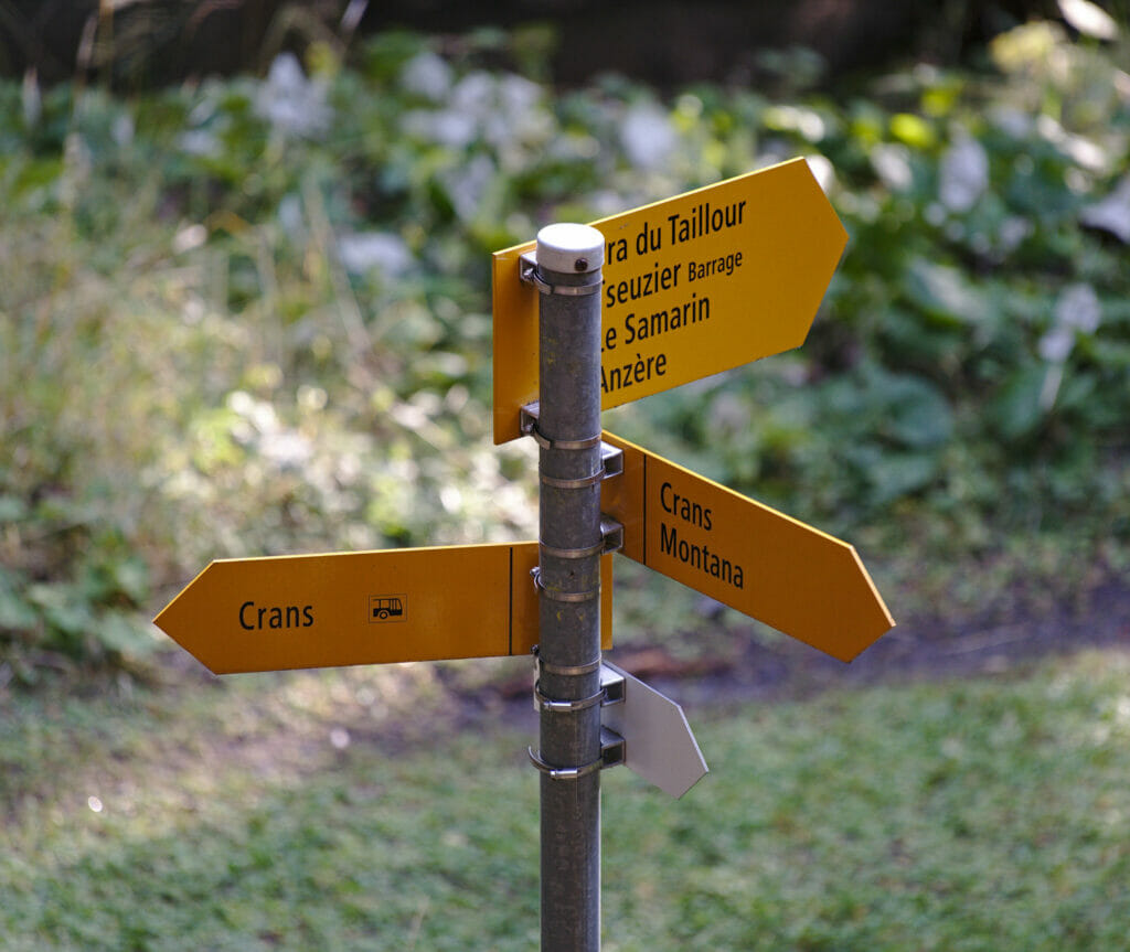
For this first Bisse we start the hike in Crans-sur-Sierre and more precisely at the parking lot next to the Clébard Palace (enter this in Google Maps to find the parking lot). In case you’re wondering, the Clébard palace is not a luxury hotel, but it’s a refreshment bar with an agility field and a boarding house for dogs. 😉
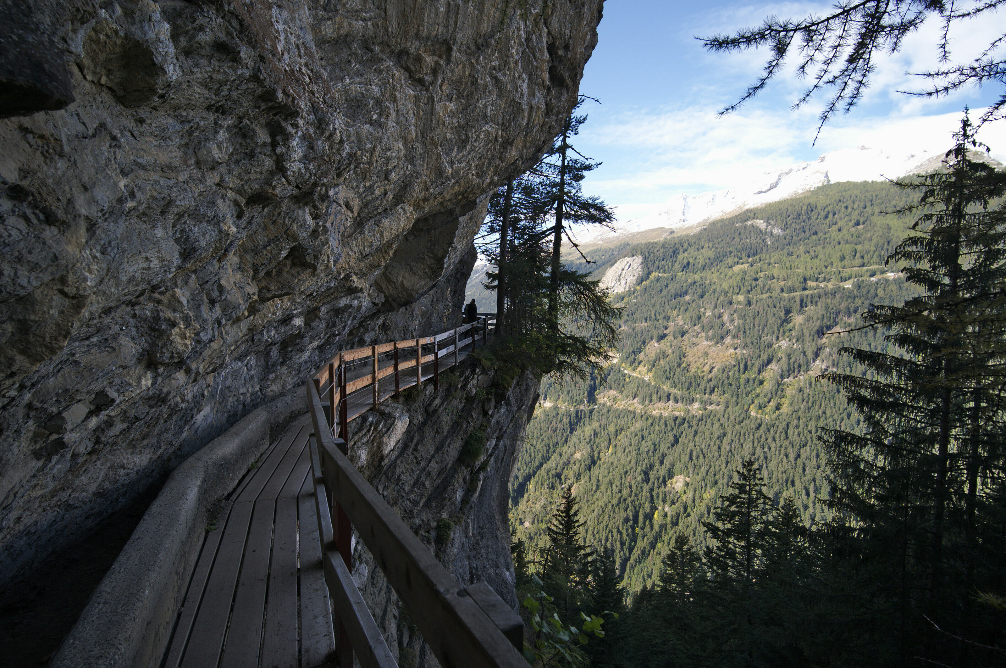
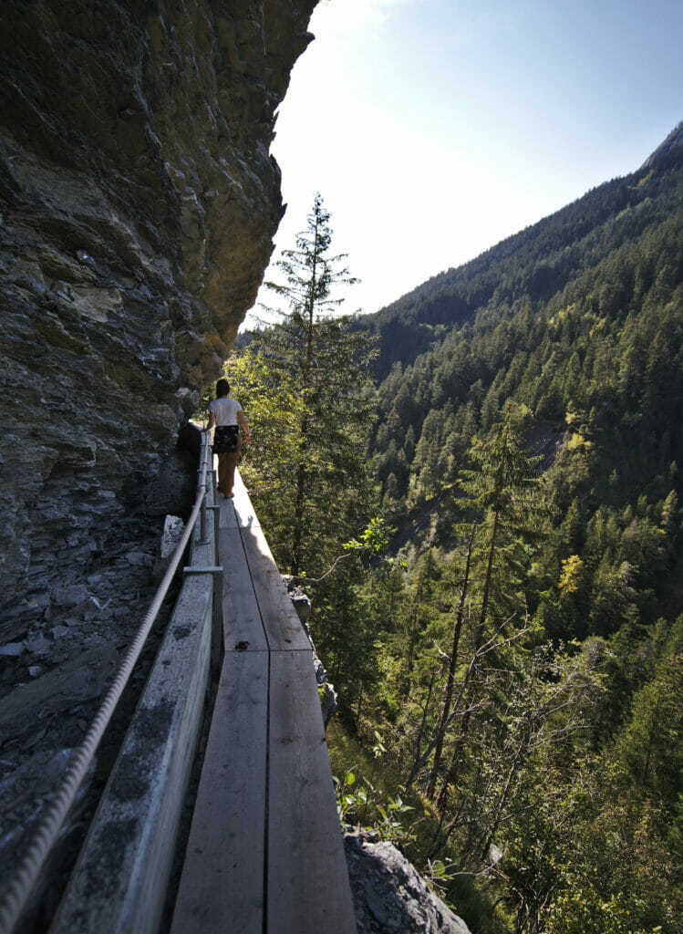
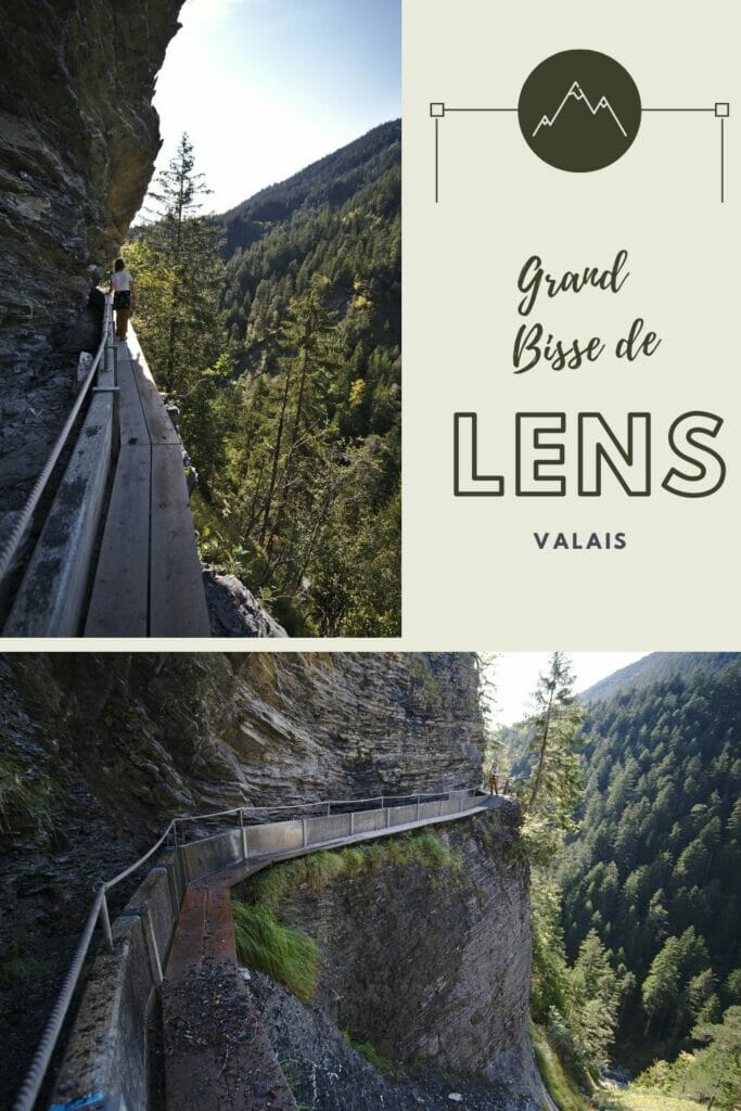
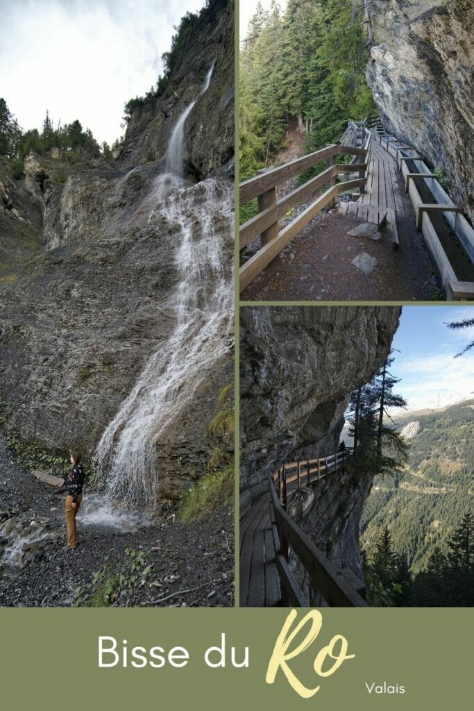
The bisse du Ro starts right next to the parking lot and from the first meters you arrive directly on these beautiful footbridges on the mountainside with the irrigation canal on the side. The bisse du Ro is a well known bisse in Valais because it offers on the one hand beautiful views of the valley and the Valaisan Alps but also because it is very well secured and maintained.
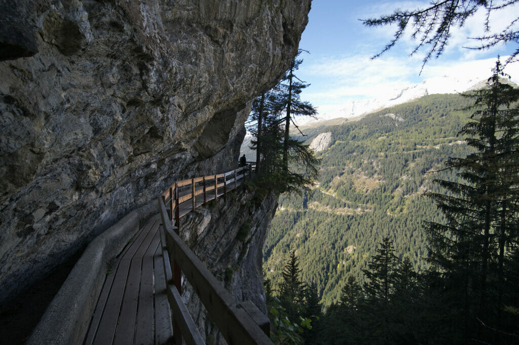
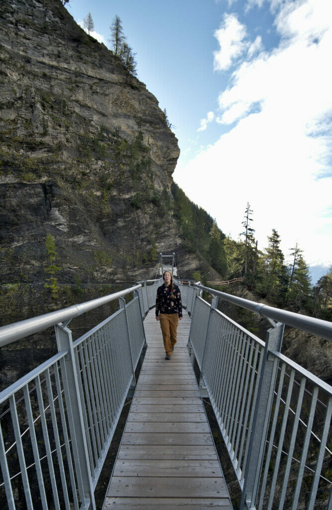
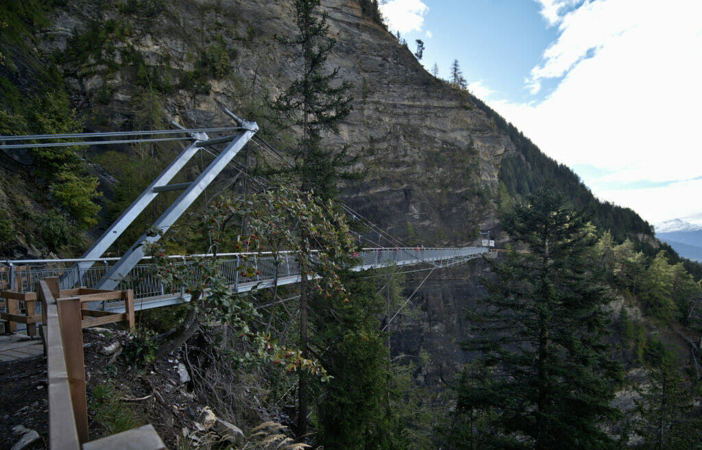
In fact, since 2020 there is now a brand new footbridge that has been inaugurated on the course! Before it was necessary to go along the cliff but since this spring we can cross the small valley on this 120 meters long metallic giant, all at 70 meters above the ground.
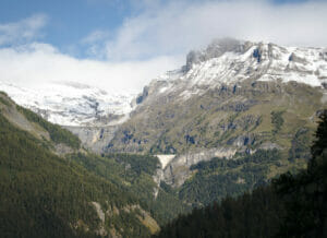
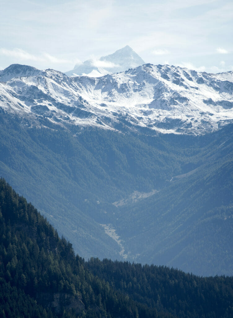
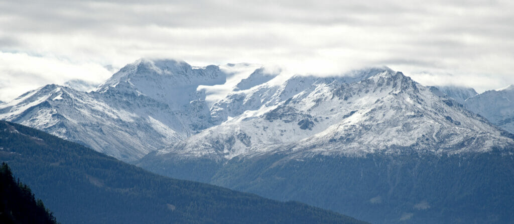
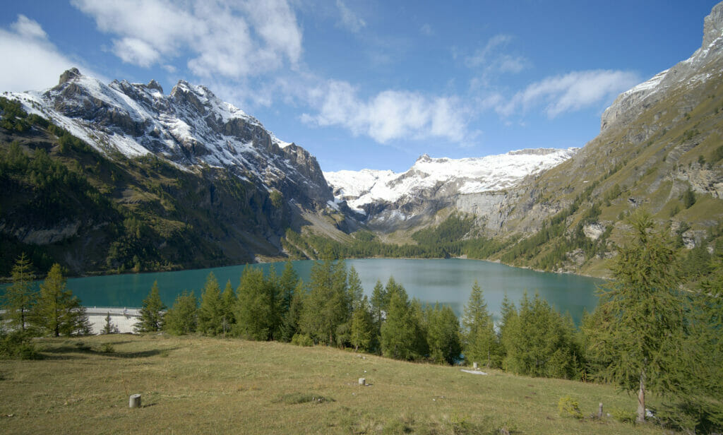
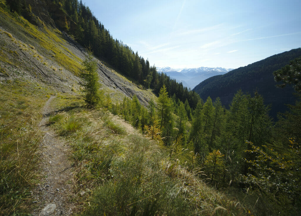
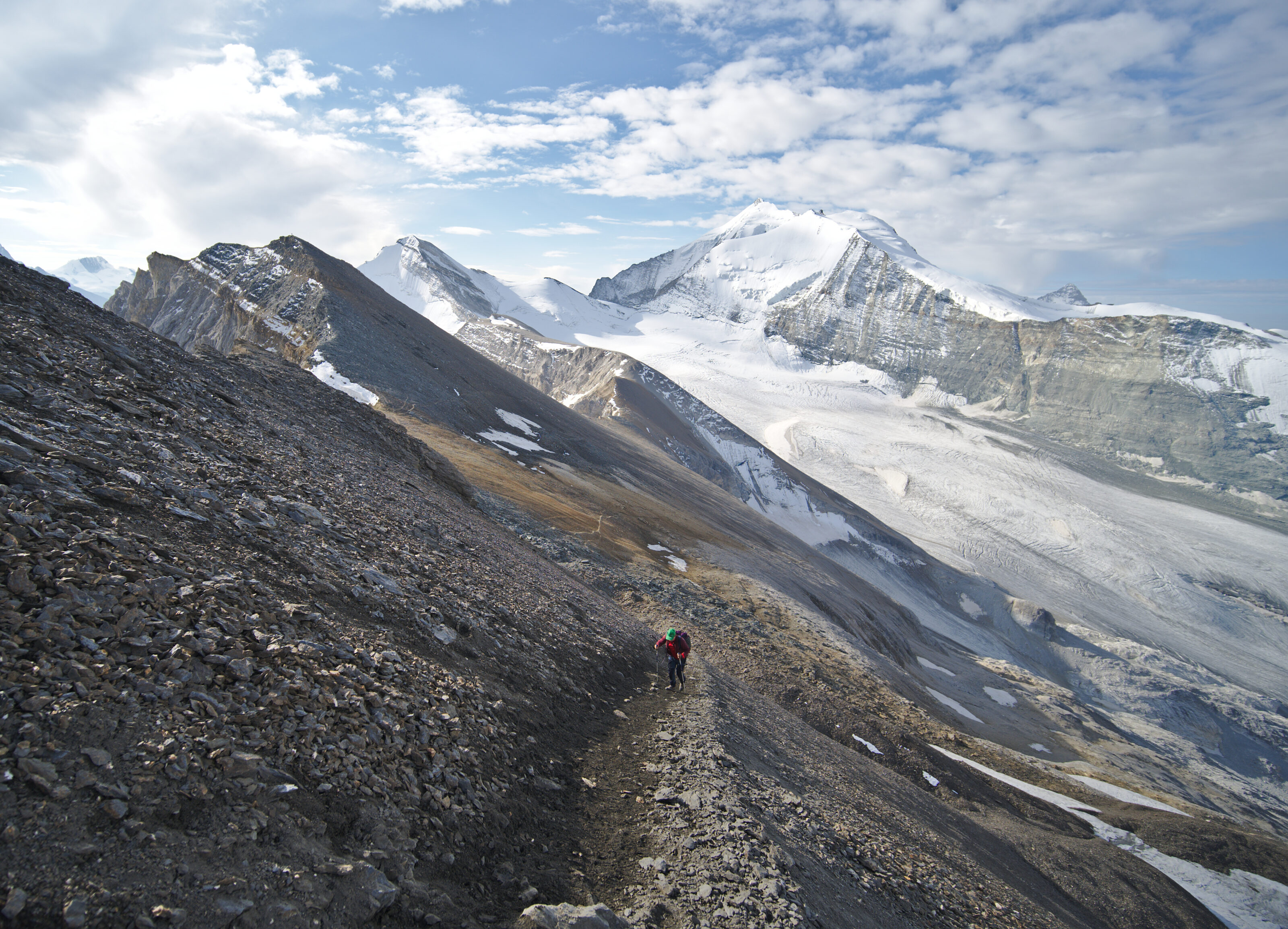
The actual bisse trail should be about 5km long and can be done in a good 2 hours. But if you want our opinion it is really worthwhile to continue the walk a little more and to continue to the lake of Tseuzier. From the “official” end of the bisse, the path continues along the valley for about 7km until you reach the impressive dam. This section is really magnificent and also offers some breathtaking views of the 4000m on the other side of the plain.
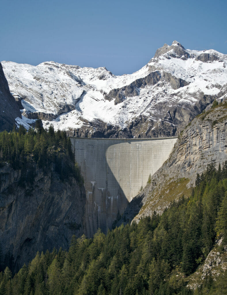
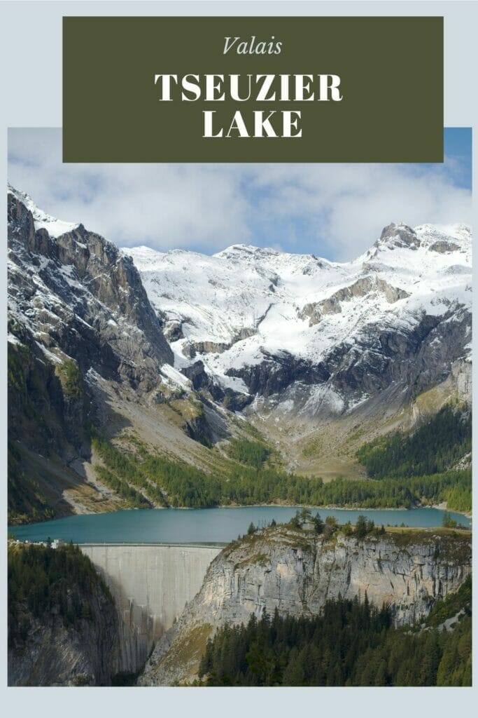
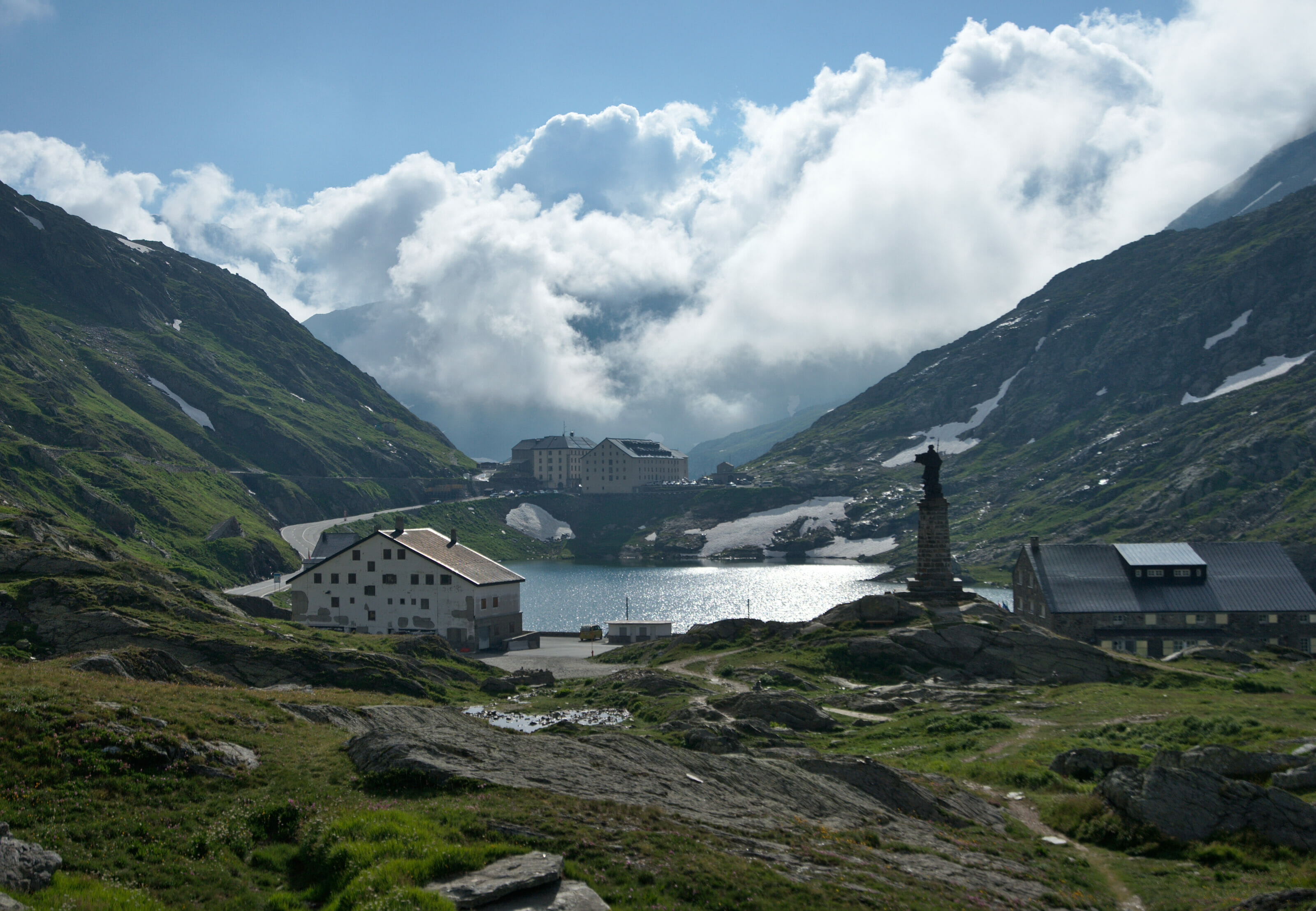
Getting to lake Tseuzier and its dam
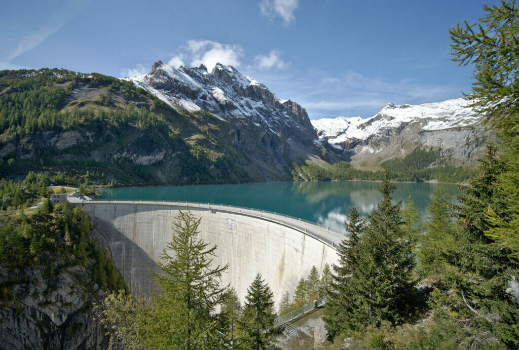
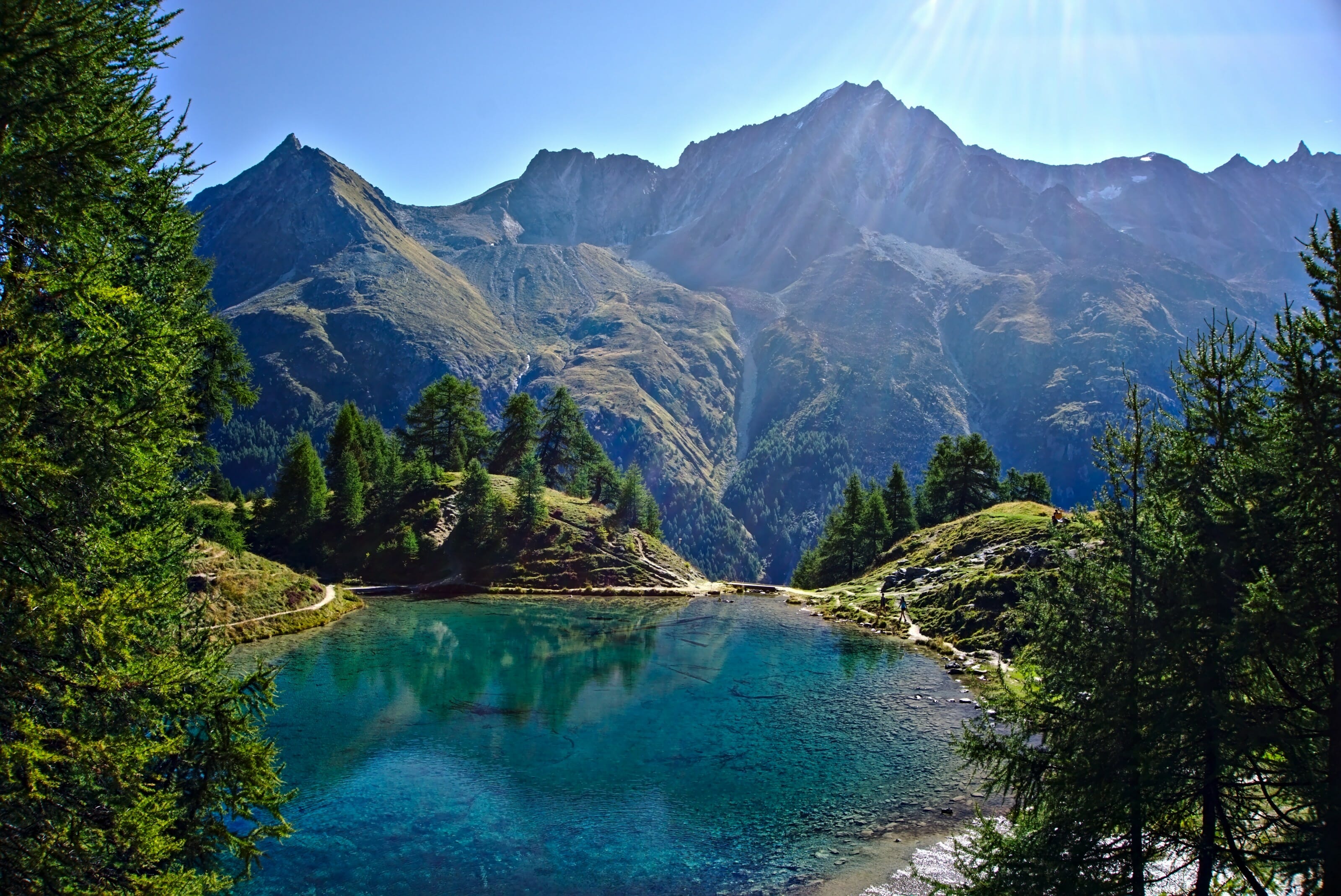
The Tseuzier dam is also known as the Rawil dam (the name of the pass just above it that makes the border between the Valais and the canton of Bern). Dams are a great classic of our mountain landscapes and whether you like or not these big concrete walls you’ll have to agree that the resulting artificial lake is really beautiful.
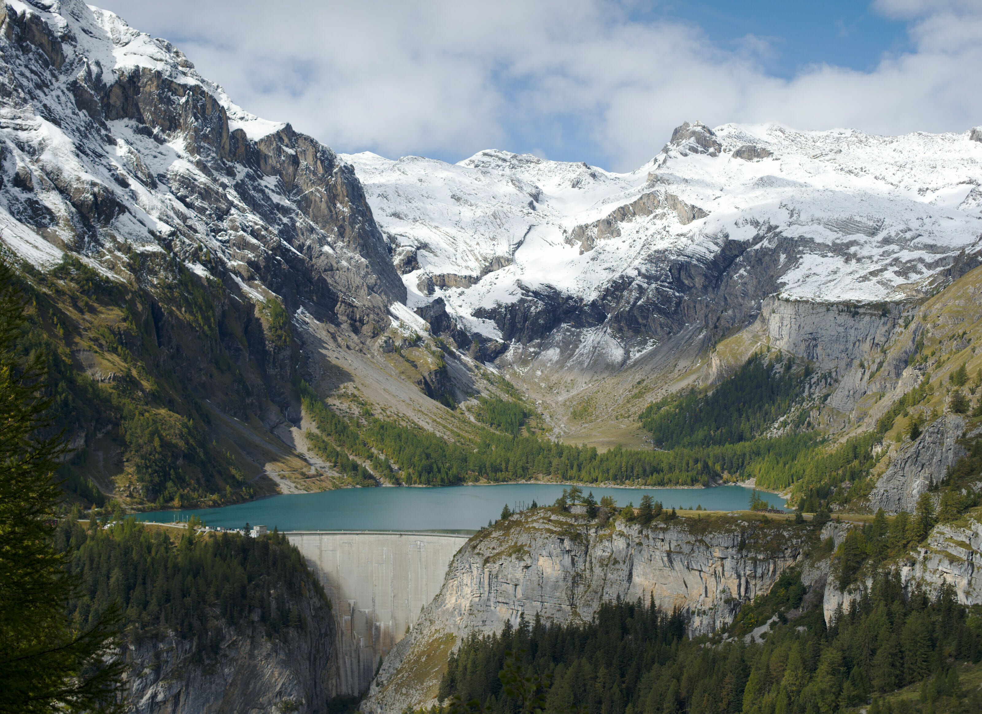
The lake of Tseuzier is also accessible by car or thanks to the local shuttle bus. This probably explains the fact that there were relatively many people at this place (even if on a weekday outside vacations it was still quite reasonable).
For our part we took advantage of this magnificent panorama for a good picnic break. But if you don’t have anything to eat, you should know that there is a restaurant at the dam (open 7/7 from June to October).
For those who are motivated (in case our 19km hike is not yet long enough), note that it is possible to do the complete tour of the lake in a little hour. 😉

Are you planning to visit Switzerland by train? We advise you to read our article which will allow you to compare the Swiss travel pass with the half-fare card. The article also includes 3 examples of train routes through Switzerland and the associated budget depending on the ticket you take.
If you prefer not to take a travel pass, but rather take advantage of the Supersaver tickets and day passes, then go to this post for all the details.
From the lake of Tseuzier to the Grand bisse of Lens
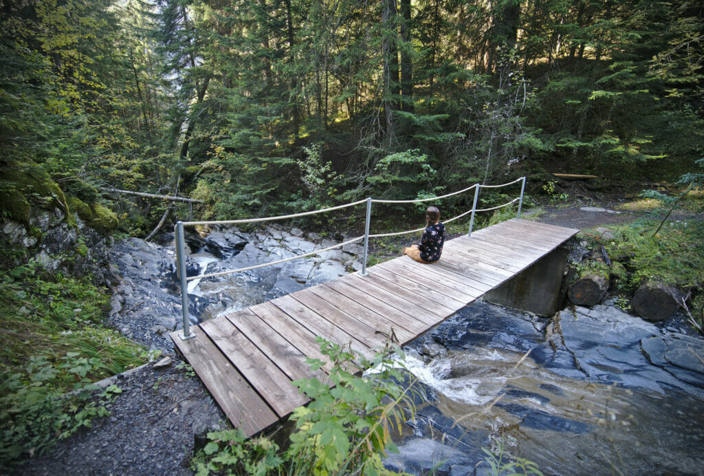
From the dam of Tseuzier we came back on our steps a few hundred meters then we took the path that goes down on the right towards Icogne and the Grand Bisse de Lens. The first part of the descent is really pleasant; the slope is very soft and the path is very wide. We arrive almost at the foot of the dam where it is possible to make a detour by taking the path that goes on the right. We knew that quite a few kilometers were still waiting for us so we did not make the detour (which would have been a round trip).
After a few kilometers we arrive at a crossroads that allows us to go up towards the Bisse du Rho, then, 500m further on, another crossroads where 2 options present themselves to us:
 On the left a path goes up “quietly” in direction of Crans sur Sierre.
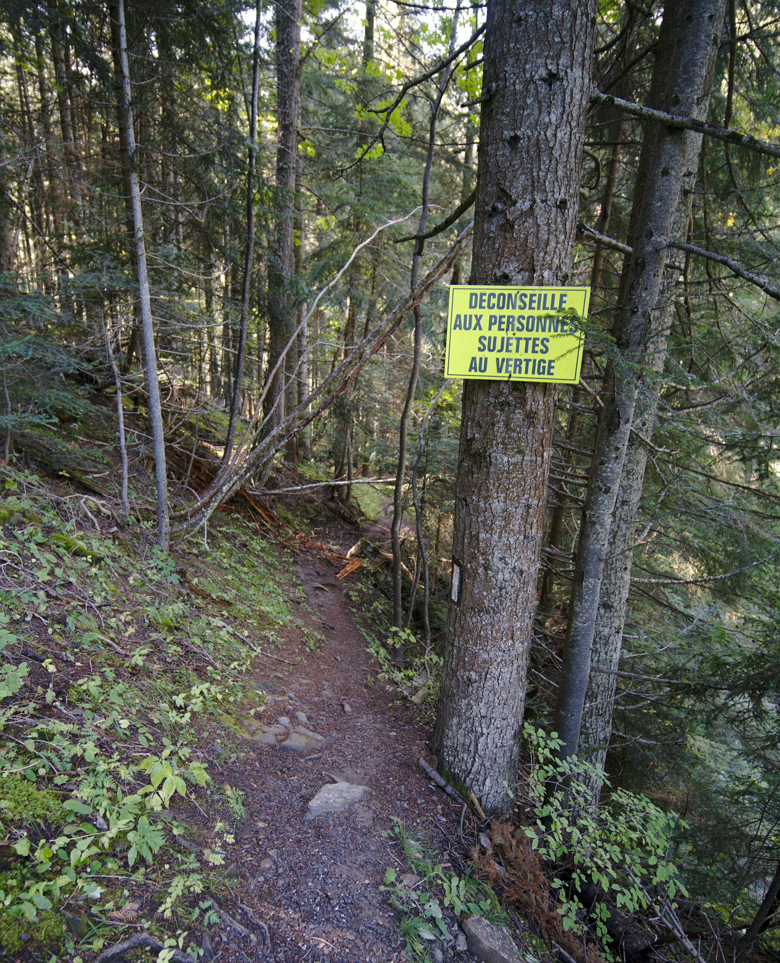
- On the right a path that drops towards the Grand Bisse de Lens. A sign indicates that the path becomes a little bit steeper from this point and that it should be avoided by people who are afraid of heights.
From this “famous” sign, the game changes a little. The path becomes narrower and much steeper! There is no particular difficulty but let’s just say that it can be impressive if you are not used to it and we wouldn’t necessarily recommend it for young children. For our part the descent went well even if we regretted a few times not to have taken our hiking poles. With the autumn humidity the path was a little slippery and it was sometimes a little acrobatic let’s say ;).
Note: For those who are very prone to vertigo and do not want to go back and forth along the whole route, we recommend taking a left at the second intersection to return to the Bisse du Ro or at the third intersection to return to the starting point avoiding the Grand Bisse de Lens (see the map to visualize the paths).
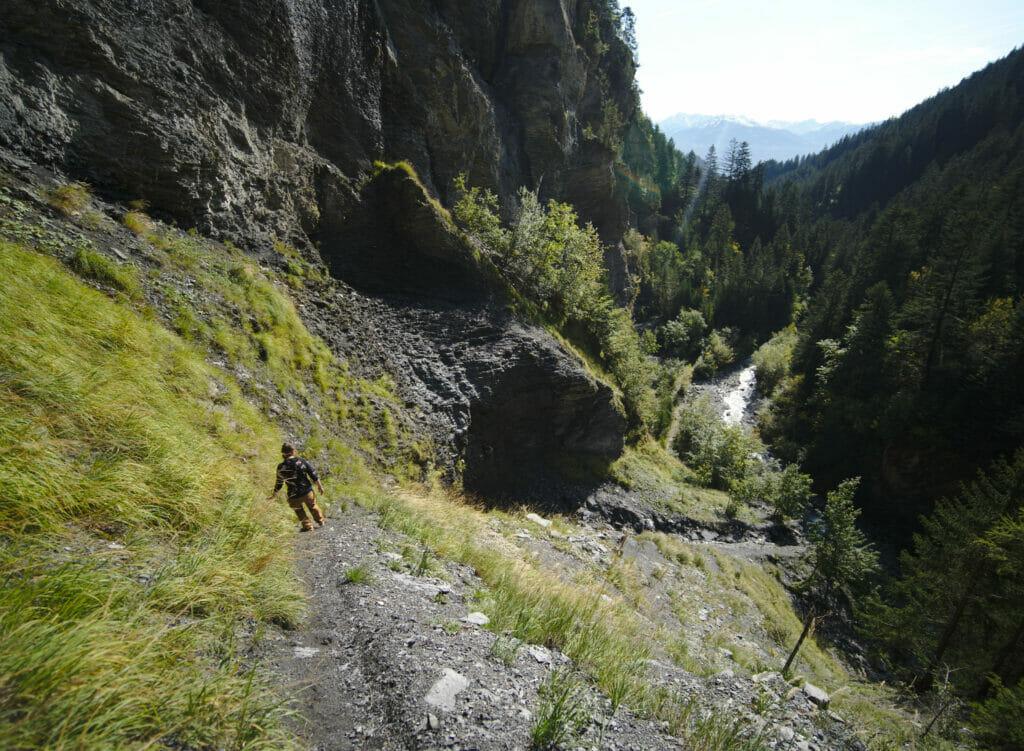
The Grand bisse de Lens (upper part)
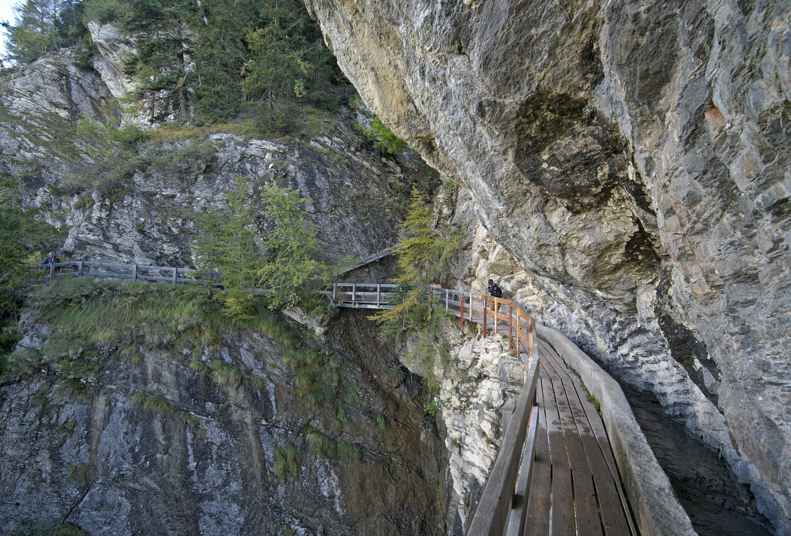
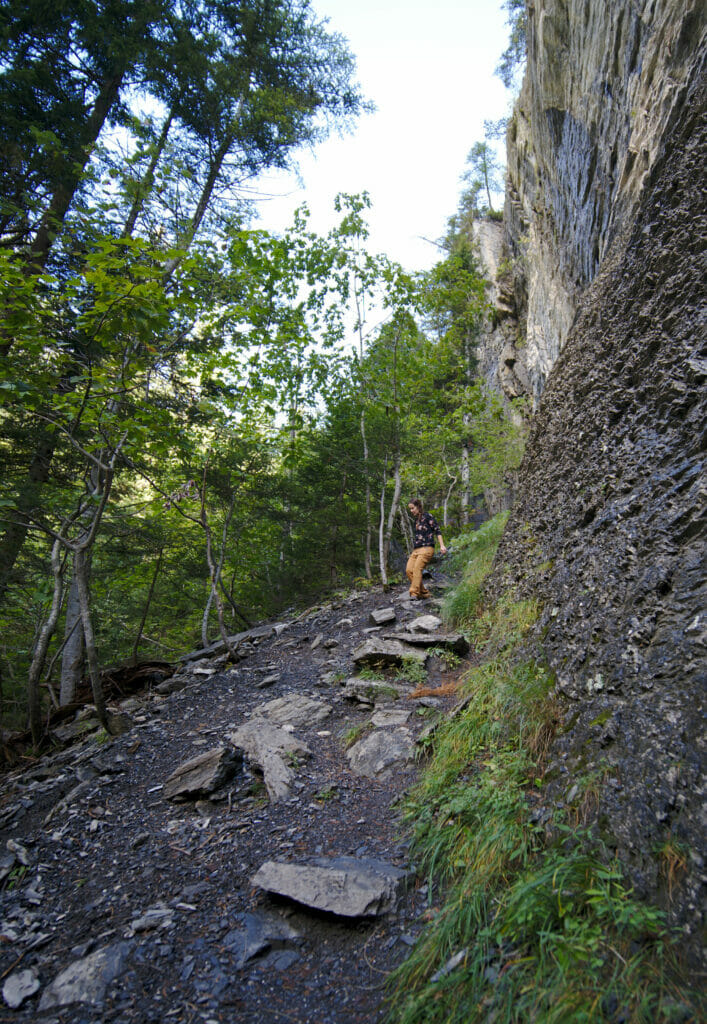
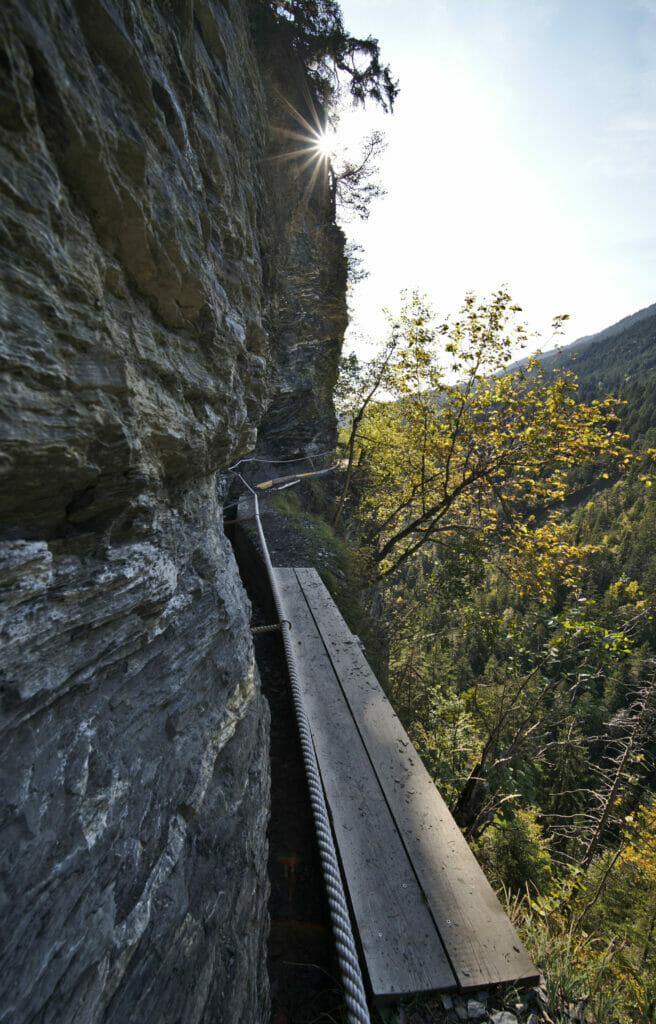
After this relatively long descent, we finally reach the level of the second channel of this itinerary: Le Grand Bisse de Lens. Contrary to the bisse de Ro, this last one is a little bit more aerial… Or let’s rather say that although it is well secured, it can make the adrenalin go up a little bit more for some people. (yes yes, I clearly fall into this category…)
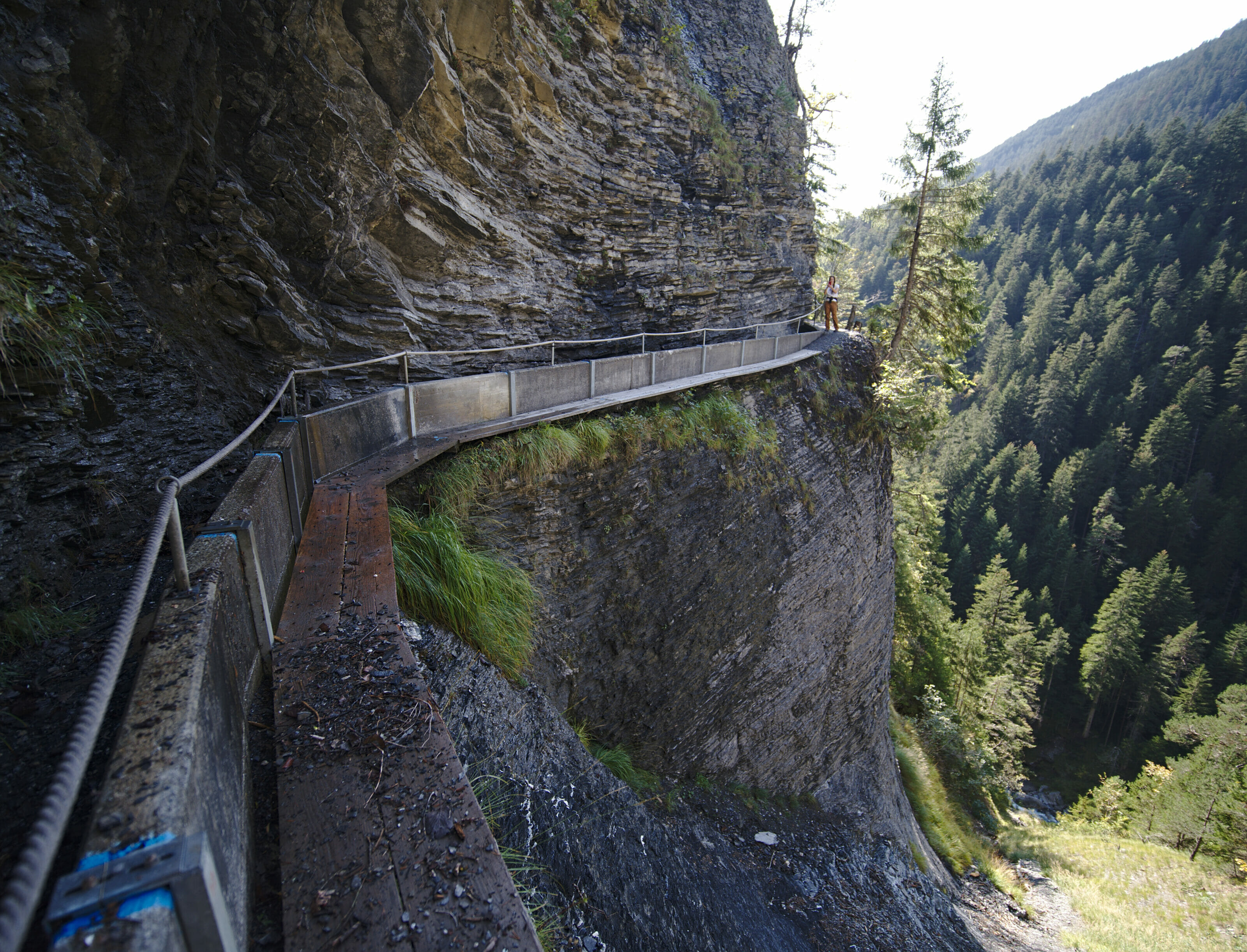
In fact it is not dangerous at all, but it is at the psychological level that it can become a bit tricky. Indeed, several passages on the cliff side are done on large wooden boards with a handrail on the rock side but absolutely nothing on the other side (you will surely notice that my body has a natural tendency to lean on the cliff side in this kind of situation haha).
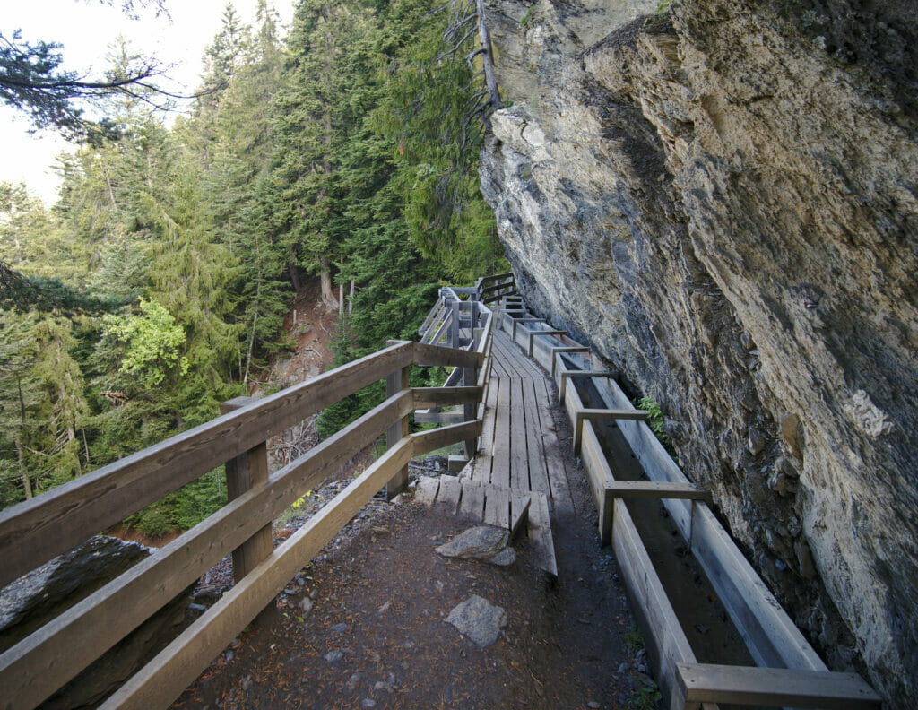
Note: The Grand Bisse de Lens is actually divided into 2 parts. The “lower” part is the most well known and most often taken by hikers. It joins Icogne to Chermignon-d’en-bas. You will find more details about this part here. The lower part is much less exposed to the void than the one we took.
Getting back to Crans sur Sierre
At the end of the Bisse we come back to our famous sign indicating that this passage is not recommended to people who are afraid of heights (they will not have lied on that one 😉 ). From this point comes the part of the hike that we will simply call “the killer”. From this intersection there is still something like 3km and 500m of difference in altitude in the forest. Phewwww… After 15km I promise you that this last climb will make sure that you will get a good tingling in your thighs.
At the level of the landscapes it is not the most “incredible” end given that we are in a forest most of the time but that being said the path is very pleasant and that is done in a small hour.
We are well wiped out when we arrive at the car and we will not even have the courage to go get a beer at the refreshment bar of the Clébard Palace… But well, we also still had something like 1h20 of driving to go back home, so we kept the beer for a next time 😉
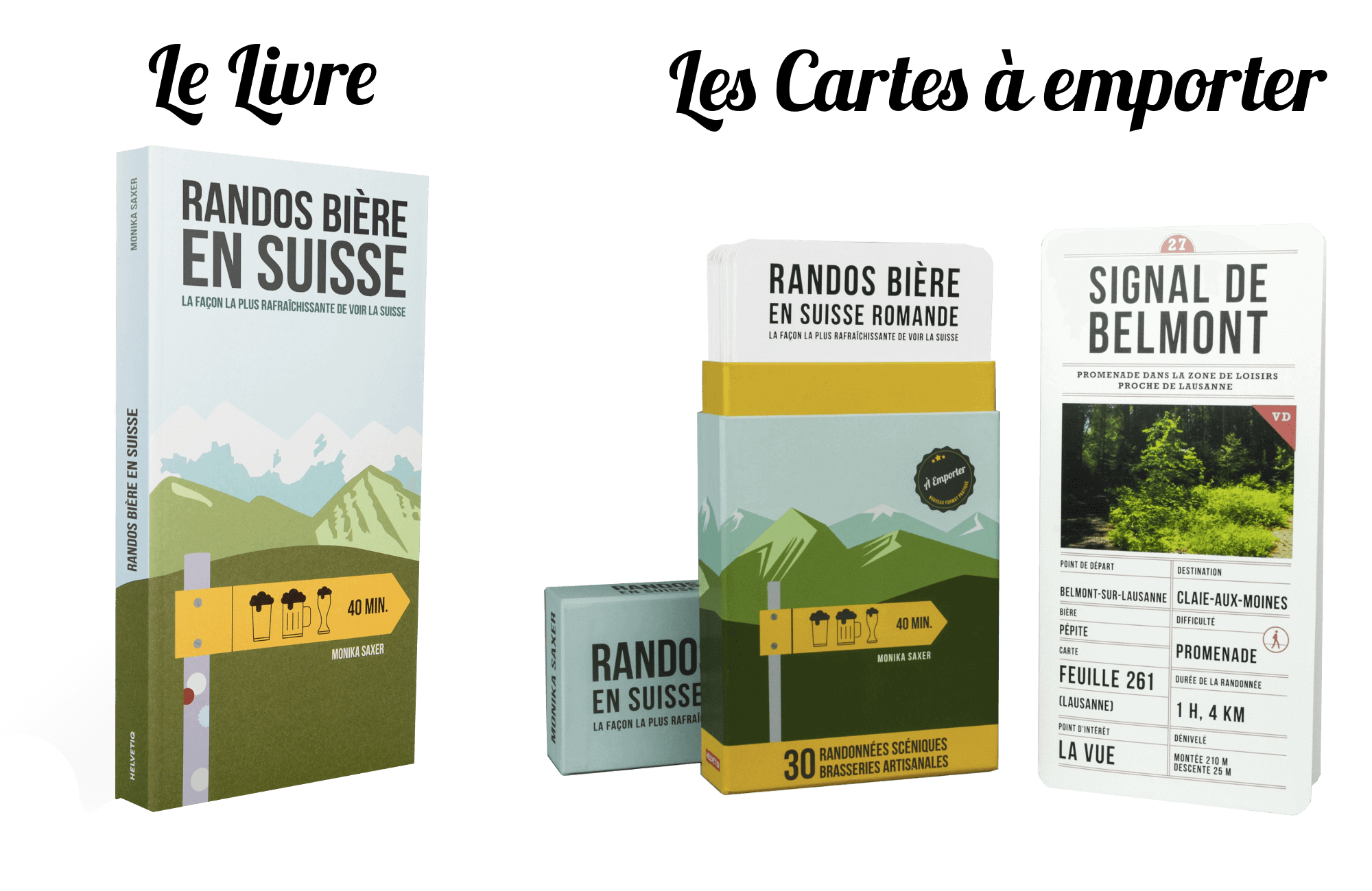
But in case you want to turn this walk into a beer hike (we know there are amateurs here) you should not be disapointed! In Crans Montana there is the artisanal brewery “La Marmotte” or on your way down to Sierre you can stop at “Hoppy People” (it’s one of the best Swiss breweries in our humble opinion). There is also an official Berr Hike that is the area (from the book). Note: The book is available in English as well 😉
See the Book
Practical information for the Bisses du Ro and Lens hikes
Want to do the same hike? Here is some practical information to know before you start.
- Hike distance: about 18,5km
- Elevation change: 1600m elevation gain and loss.
- Dificulty: Average – Hard. The day is quite long and the hike is not what one could call flat. 😉
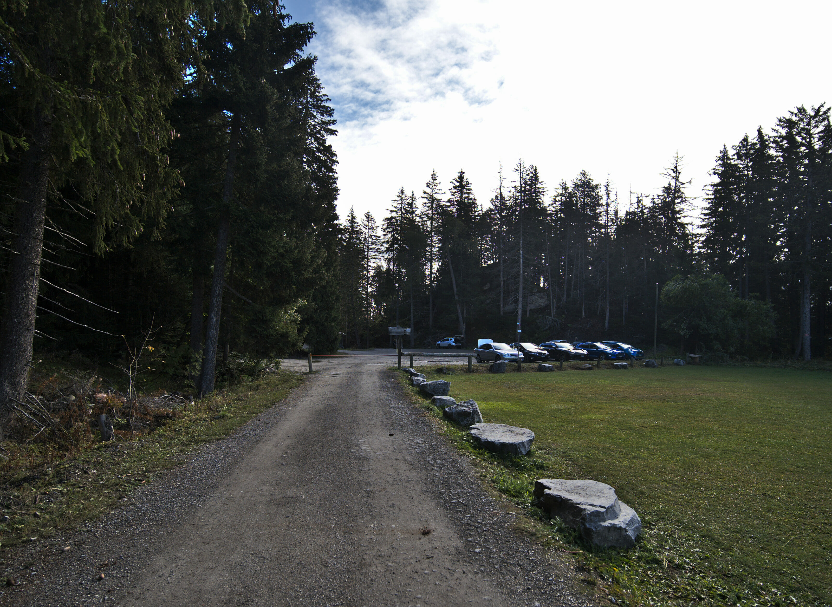
 Start and Finish: a parking lot is available at the level of the Clébard palace, a boarding house for dogs which also has a refreshment bar. If you are coming by public transport, you have to get off at the bus stop of the cable car of Crans sur Sierre (about 30 minutes more walking time each way).
- Vertigo: Bisses can be impressive. The Bisse du Ro is really ULTRA well maintained and secured so really no worries unless you suffer from really severe vertigo. The Grand bisse de Lens is a bit more freestyle… It’s secured and maintained but let’s say it’s more impressive because there is not always a safety rail on both sides.
- When to do this hike: It is a summer hike. The access period depends on the snow on the one hand but also on the opening of the bisses (if the wooden boards are in place everywhere). The ideal period is from June to September because the bisses are “in water” at that time. We did it in October and the paths were still open but there was no more water in some places.
To know the opening of the trails please refer to the Crans Montana resort bulletin available here.
Map of the hike “Bisse du Ro and Grand Bisse de Lens”:
Well, this time I think you know everything about this nice hike near Crans Montana. We hope you enjoyed this stunning hike and we’ll see you soon for new articles!
Note: This article contains an affiliate link to our publisher’s website. By buying books or games from Helvetiq via this link you pay nothing more (you even pay less, see below), but we do get a small commission… And since our two books are on their site, you can treat yourself. Bonus: the code “novomonde10” gives you a 10% discount on the whole site 😉
Pin it

I love this article. Thanks so much. I always try to describe the bisses, particularly bisse du Rho, but this nails it. I like to say I “grew up” in Crans-Montana (Bluche, actually) since we lived there from the mid-80s until 2008. I miss it so. I remember hiking the bisse du Rho in 1985 for the first time. It was more like the photos you have of the Grand Bisse de Lens…well, not that good. I’ve hiked it many times since, most recently in 2016 after all the modernization–and removal of the biggest thrills–was done. Thanks again for this delightful walk down memory lane. Love your blog!
Hi Suzanne,
Thanks for your comment and glad our blog has awakened some of your nice Swiss memories 😉 . I can imagine how bisse du Rho was before all the modernization and I’m glad that the grand bisse de Lens is still the way it was. I really enjoyed this part of the hike!
We are heading to this Bisse this July – Can’t wait!
Nice! Sure you’re gonna enjoy it 😉
Loved this hike! Thank you so much for the recommendation. We just had the best hike imaginable.
Glad you liked it David. This hike is really stunning!