
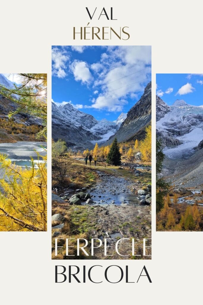
We’ve been living in the magnificent Val d’Hérens for nearly a year now, and we’ve got plans to make sure you get the most out of it! When it came to choosing a mountain valley to open our coliving space, the Val d’Hérens was an obvious choice. We’d been here many times before for hiking, and we knew the area would hold a few more surprises in store for us. Today, we’re going to tell you about the Ferpècle valley, the Mont Miné glacier and the Bricola hut, a place we particularly like to come to in the summer months.
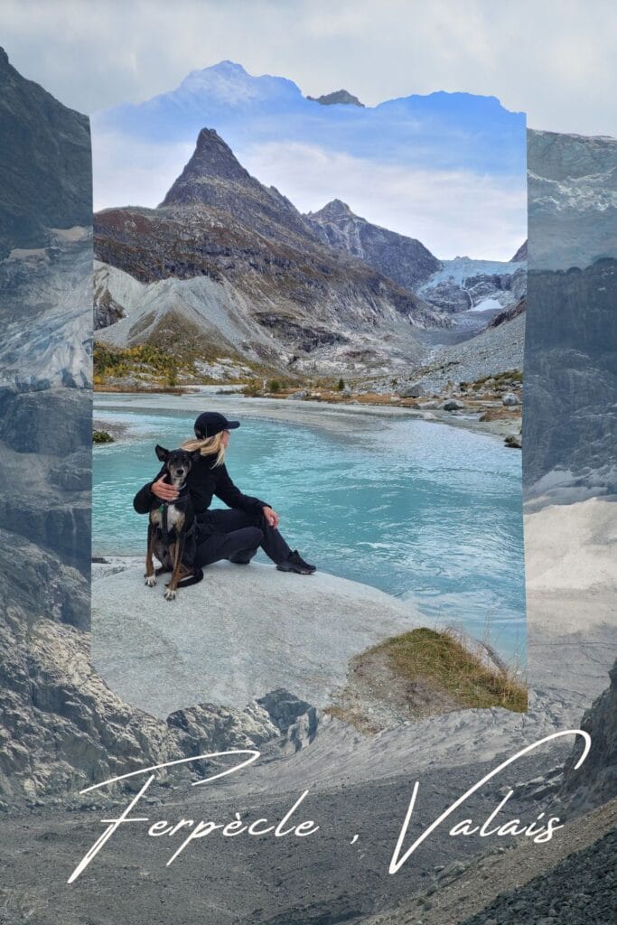
Ferpècle : a feeling of arriving at the end of the world
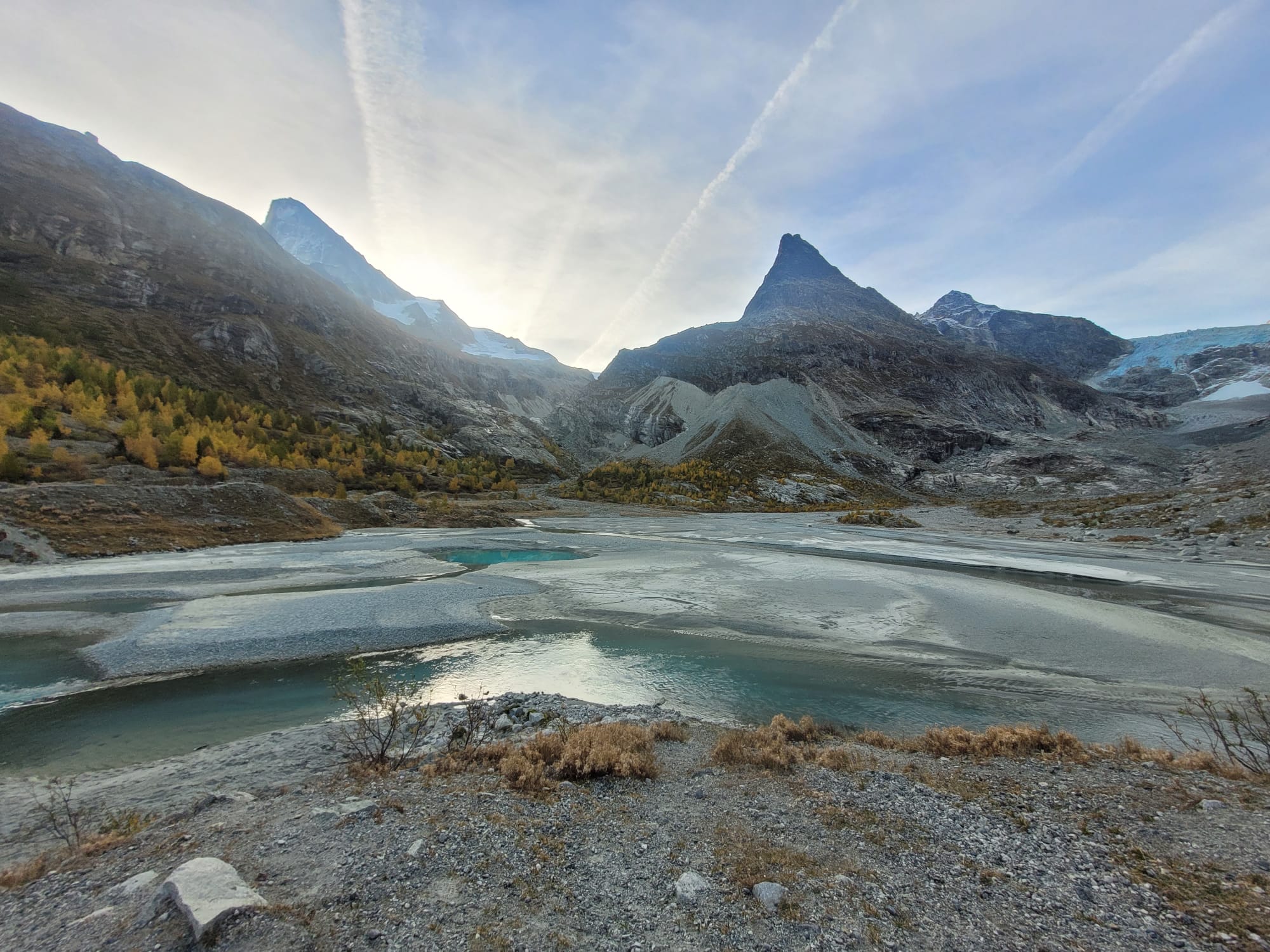
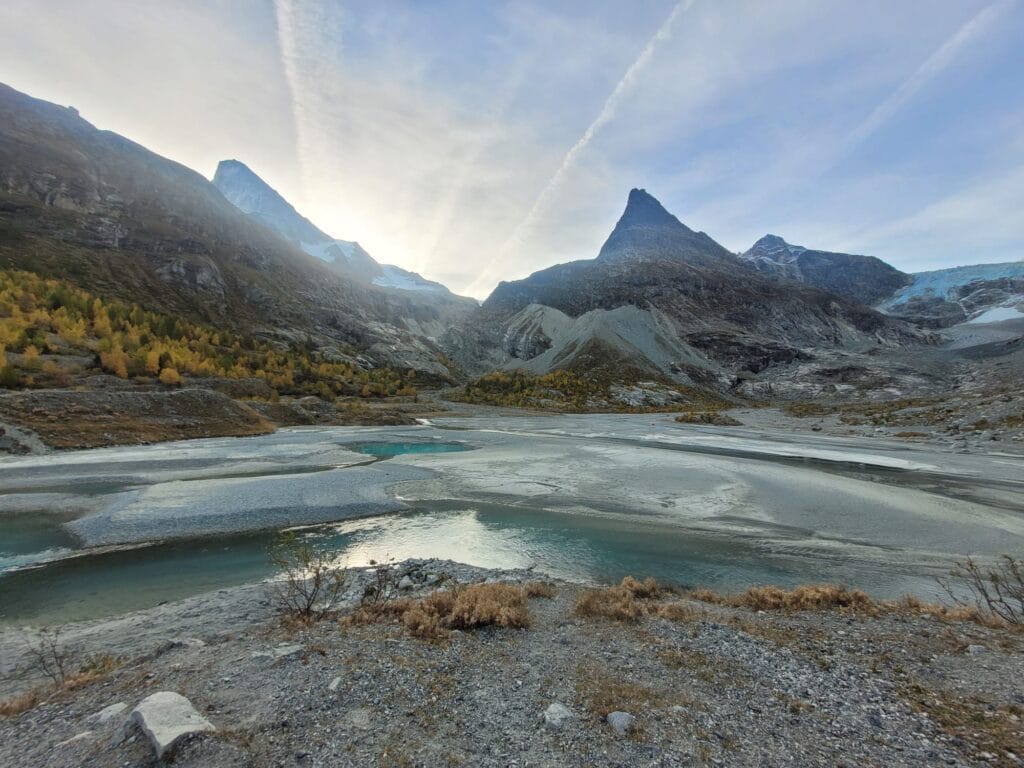
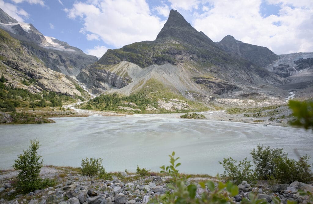
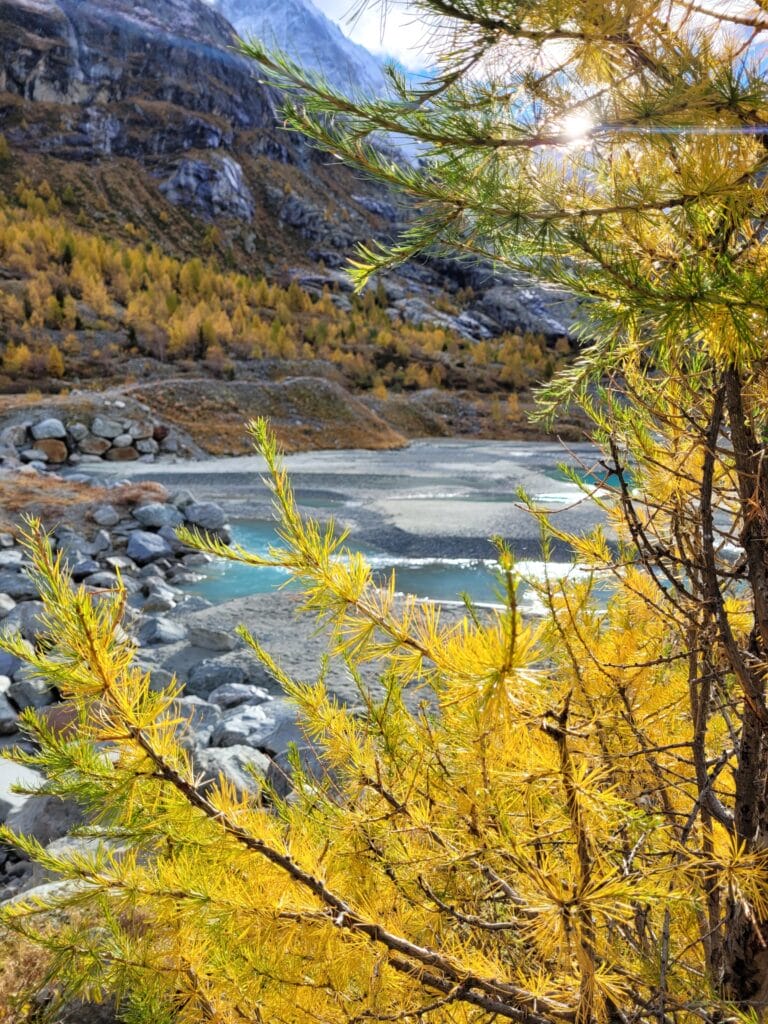
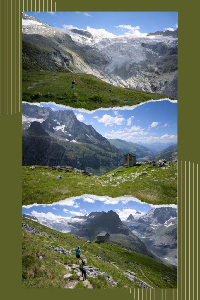
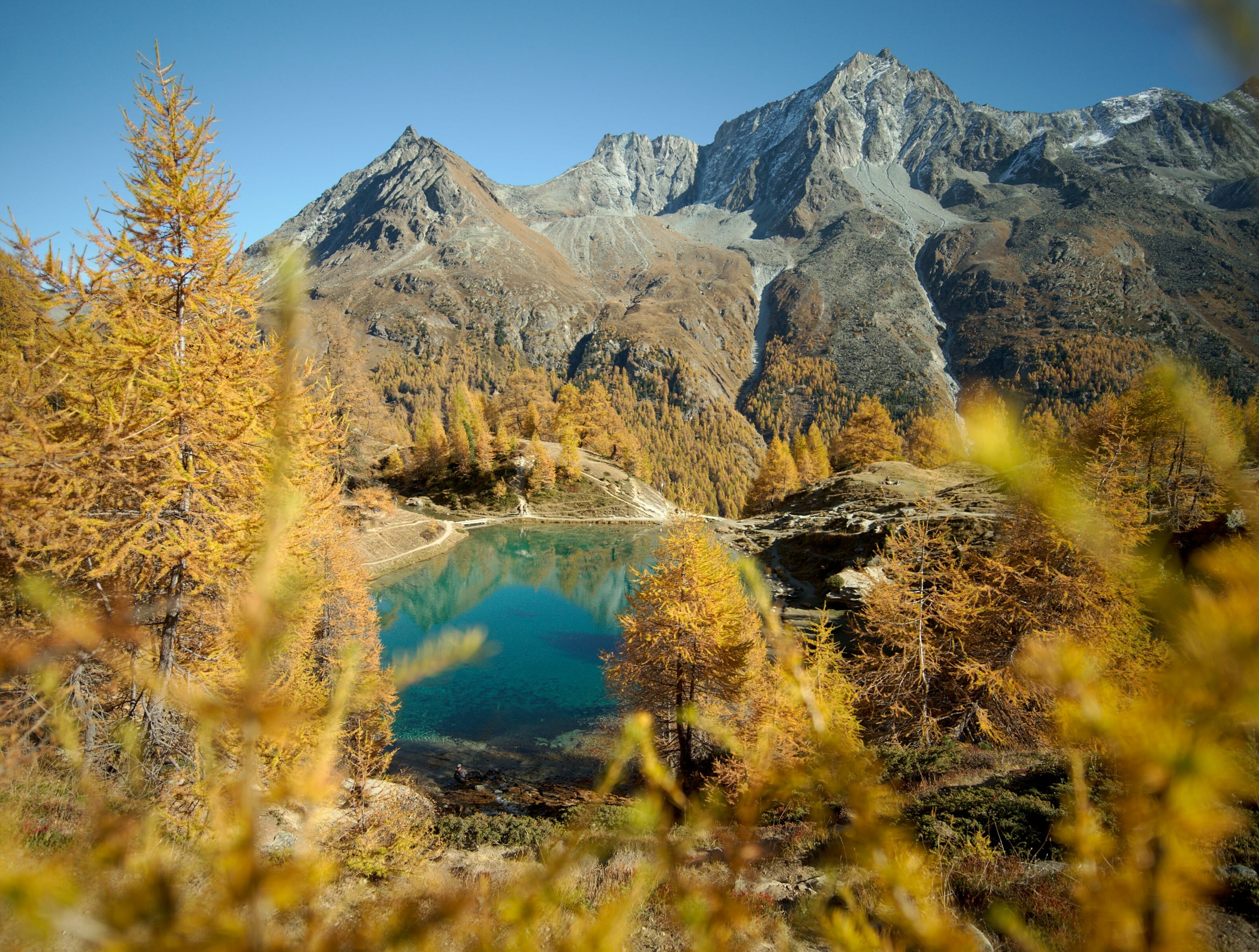
There are plenty of little corners of paradise around us… But if there’s one I keep coming back to, it’s the Ferpècle valley. For a walk, a picnic with a view, a watercolouring session… I went up there probably fifteen times last summer, and there’s no end in sight!
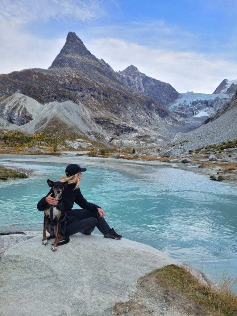
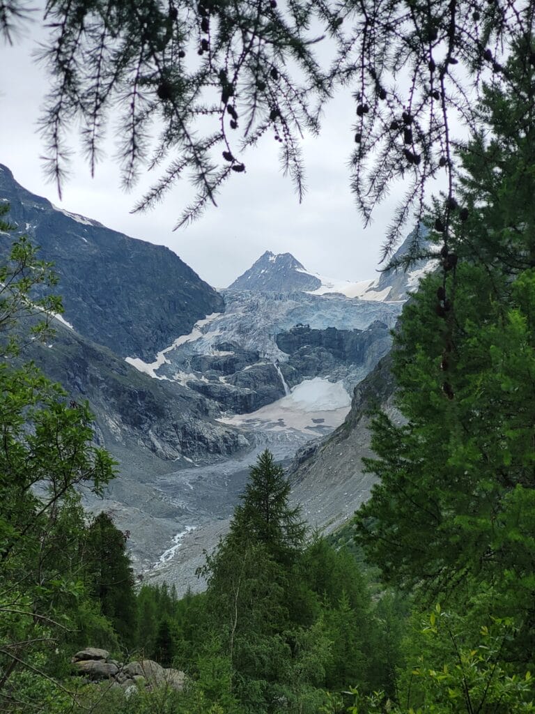
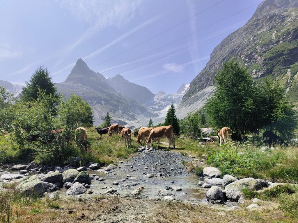
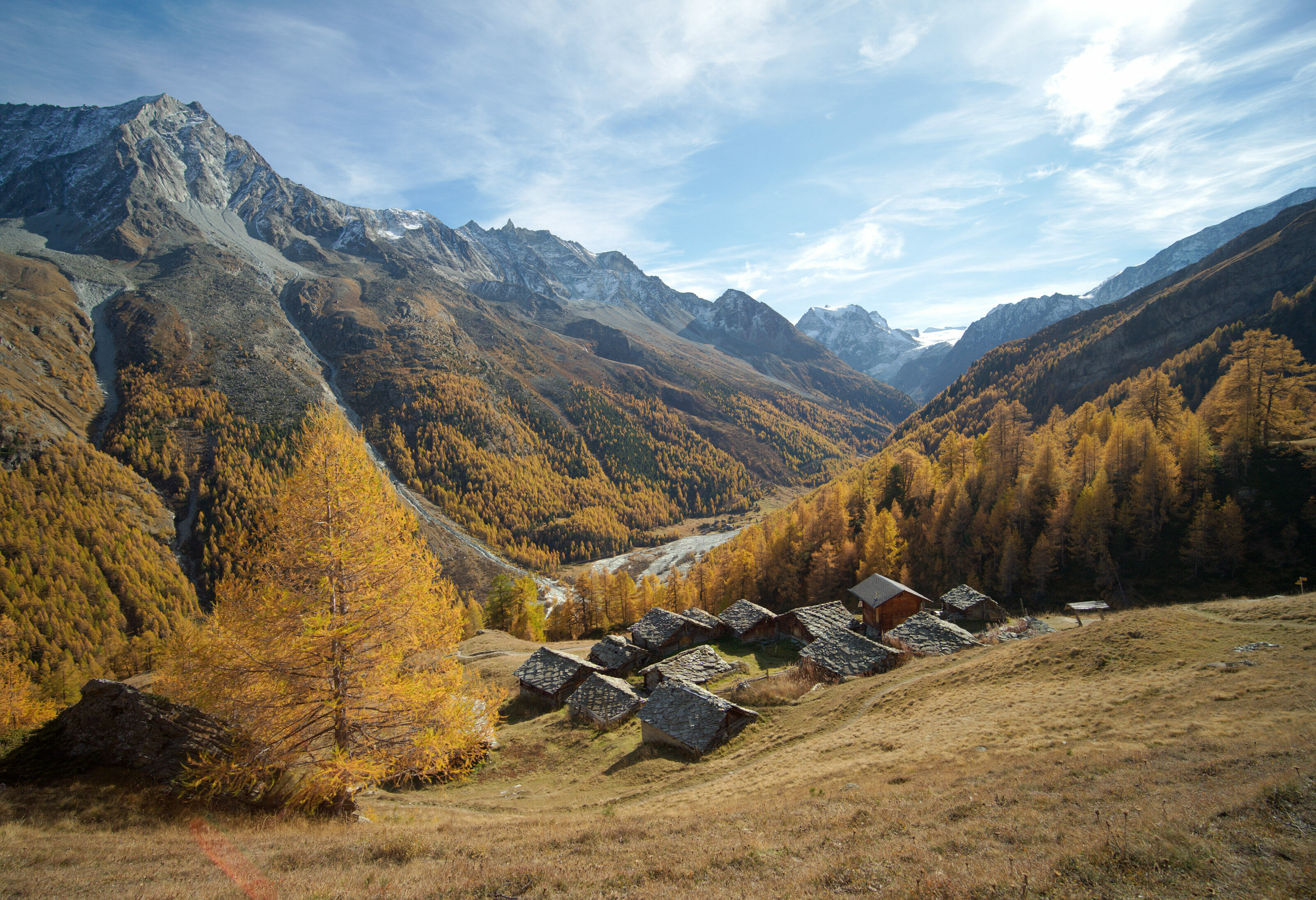
It’s funny because normally I’m not a fan of doing the same walk over and over again, but here I don’t know… I have the impression that the scenery changes so much over the weeks that I’m surprised every time… Because yes, being at the foot of a glacier, the water level varies drastically depending on rainfall on the one hand, but also on the temperature. At the height of summer, the whole valley is full of water, whereas in late autumn or early spring, there’s just a thin trickle meandering along the banks. This is also where the last of the larch trees can be found, so in autumn the valley is literally ablaze as it dons its orange coat.
I’ll let you have a look at the photos below. They were all taken in more or less the same place, but at different times of the season.
If you’re planning a trip to Switzerland or if you live here and wish to discover some new spots, don’t miss our new ebook. Released in May 2025, this 75-page guide will help you prepare for your upcoming stay in Switzerland. We’ve compiled all our best tips and tricks for visiting our beloved little country without breaking the bank. You’ll find advice on transportation, accommodations, where to shop, as well as a list of free activities and events throughout the seasons, along with our personal recommendations for hikes and must-see spots, and a selection of off-the-beaten-path itineraries (with estimated budgets). This ultra-complete guide also includes a fantastic interactive map featuring over 500 addresses and deals.
To learn more about the ebook and the interactive map, the introductory article is available here.
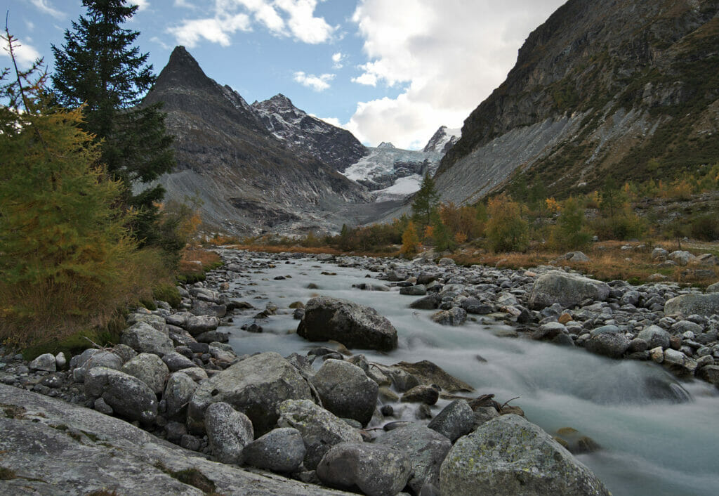
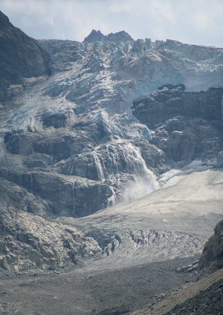
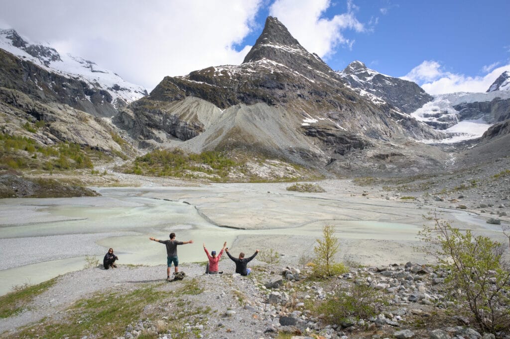
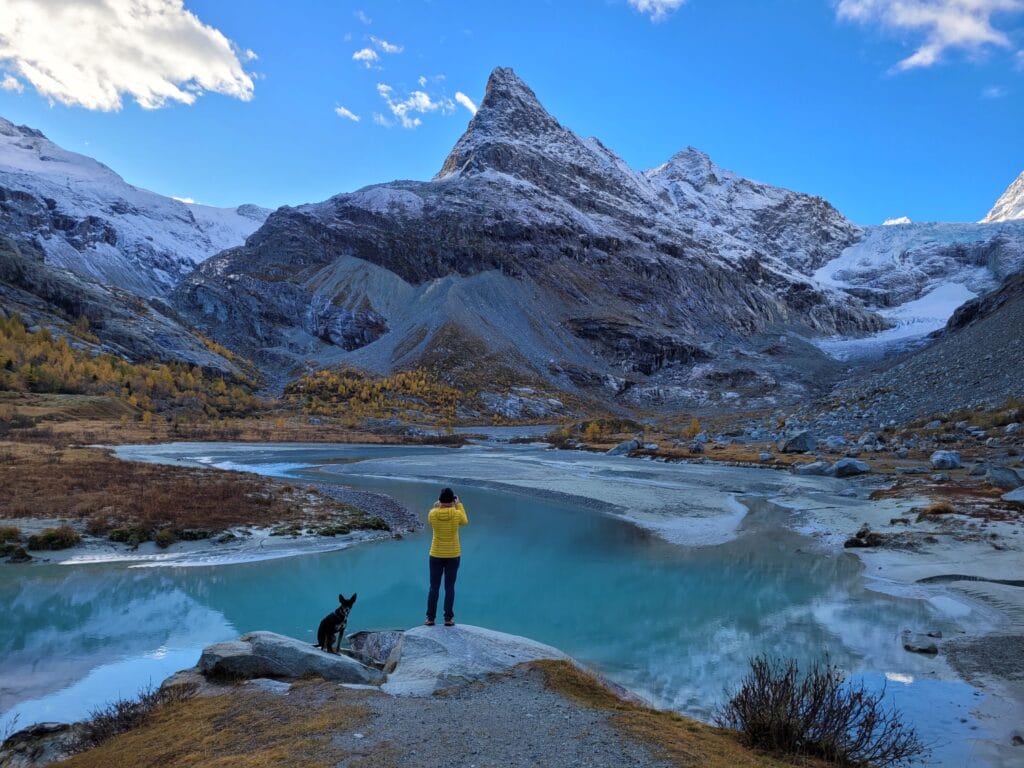
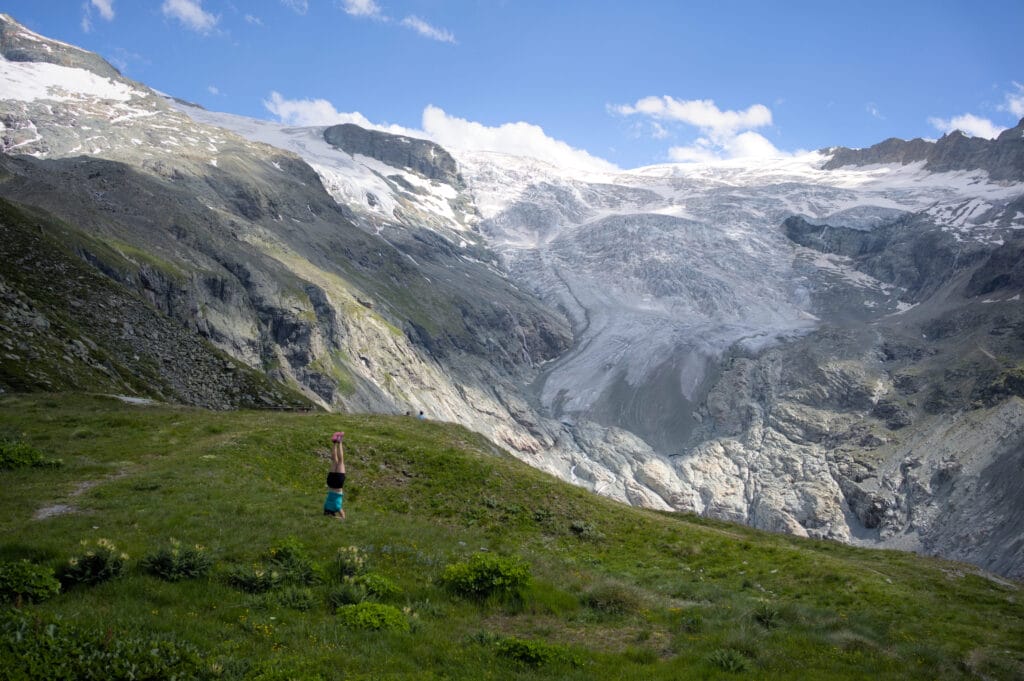
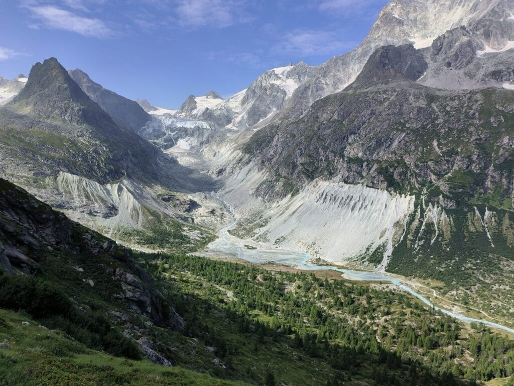
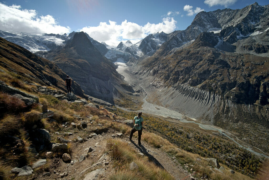
Easy loop hike to discover Mont Miné
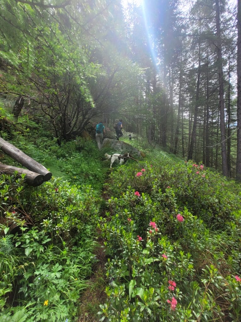
I’m going to start this article with the most accessible (and probably the most popular) hike. To tell you the truth, it’s a walk that I do almost every week with Winchy and the colivers in the summer… It’s really easy and you simply can’t get enough of the incredible scenery.
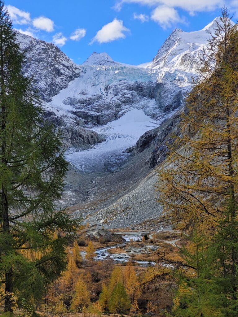
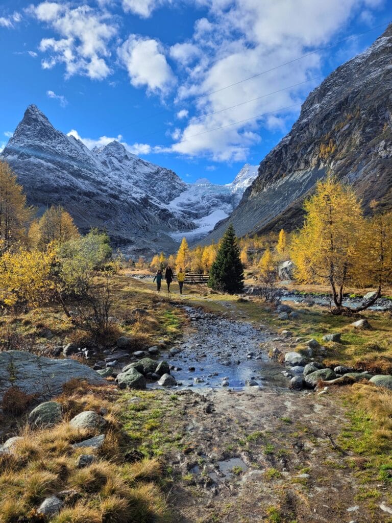
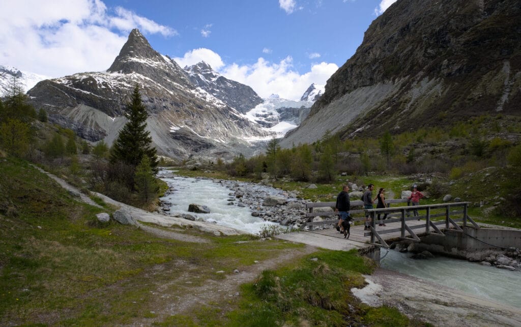
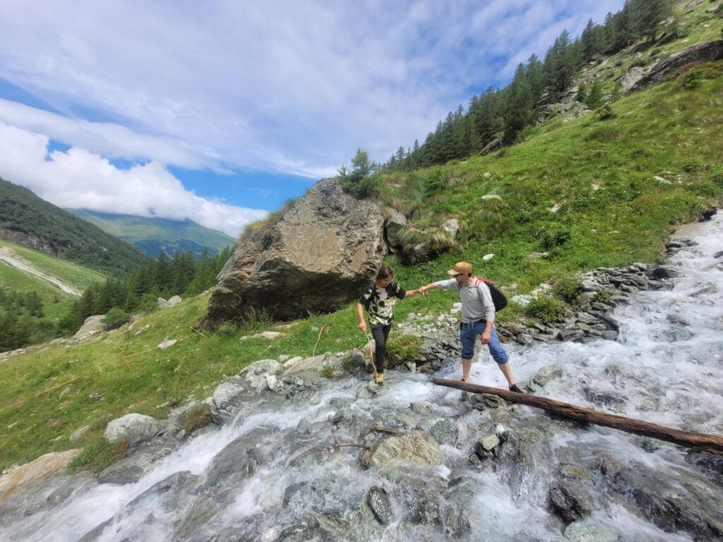
The walk starts at the small hamlet of Les Salays (bus stop). From there, you continue along the road until you reach the dam. From here, there are a multitude of small paths and to be honest you can almost take any. Anyhow, the objective is in sight (Mont Miné is relatively imposing) and as long as you head in that direction, you’ll almost automatically end up at the viewpoint 😉 But below, I’ve included the route I prefer to follow. In theory, you can follow the road (not paved) all the way (which is a good idea if you’re hiking with little ones on a bike, for example, or someone who can’t walk very well). The track is perfectly flat, which makes this walk very accessible.
The alternative via the smaller paths is not much more complicated, but let’s just say that the terrain is a tad less regular.
On the way back, you can retrace your steps, but personally I like to make the detour to the other side of the river. The path climbs a little at first, giving you a more panoramic view of the glacier (without going all the way up to Bricola). A small compromise, shall we say 😉
Infos:
- Total distance: around 6km from Les Salays, 4.8km from the car park just beyond.
- Difference in altitude: around 300m, returning via the other side of the river
- Walking time: we generally take 1 hour 15 minutes to complete the loop, walking at an easy pace.
Hiking map:
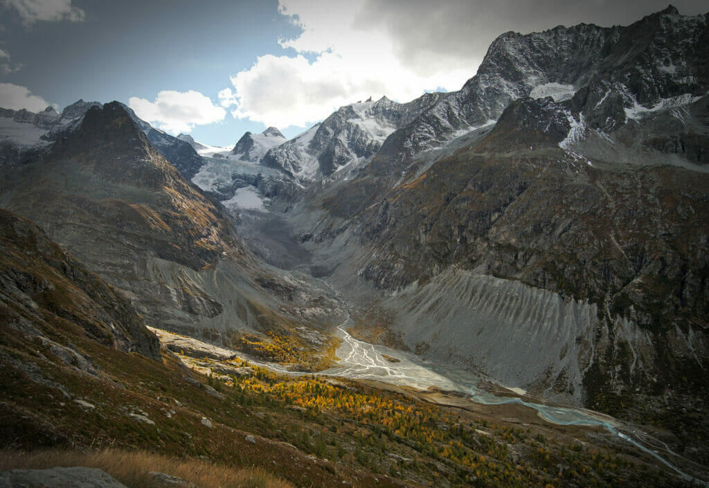
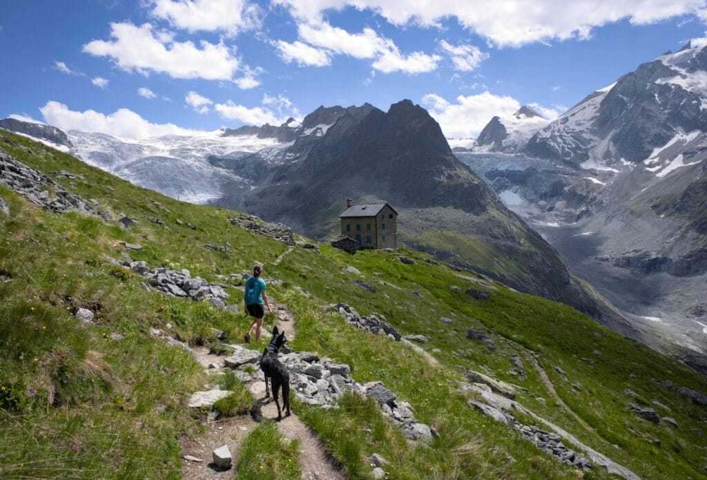
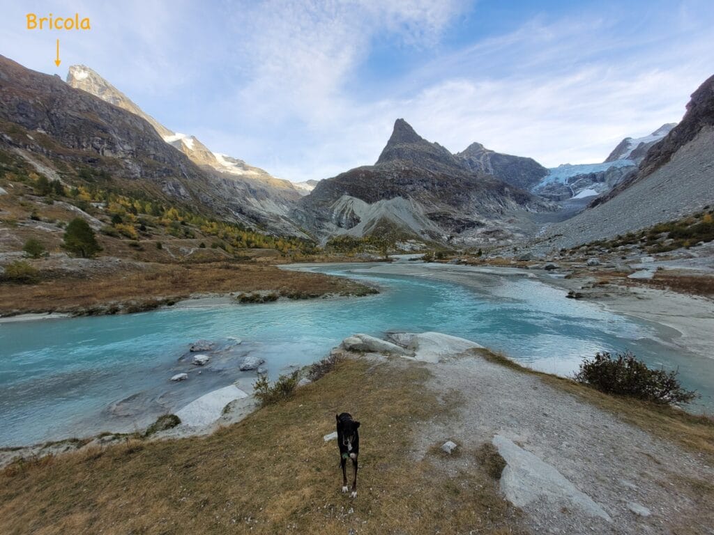
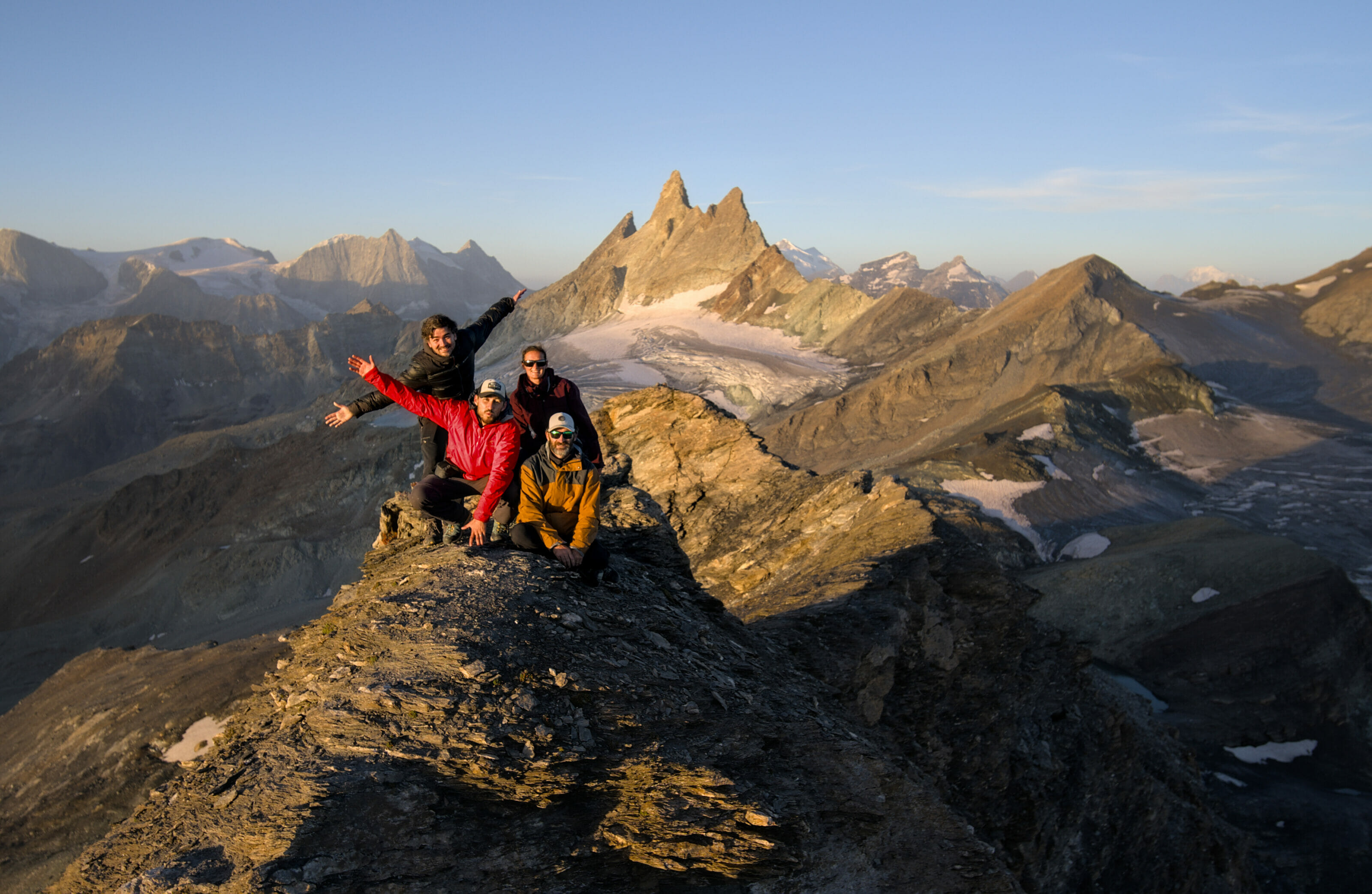
Hike up to Bricola hut
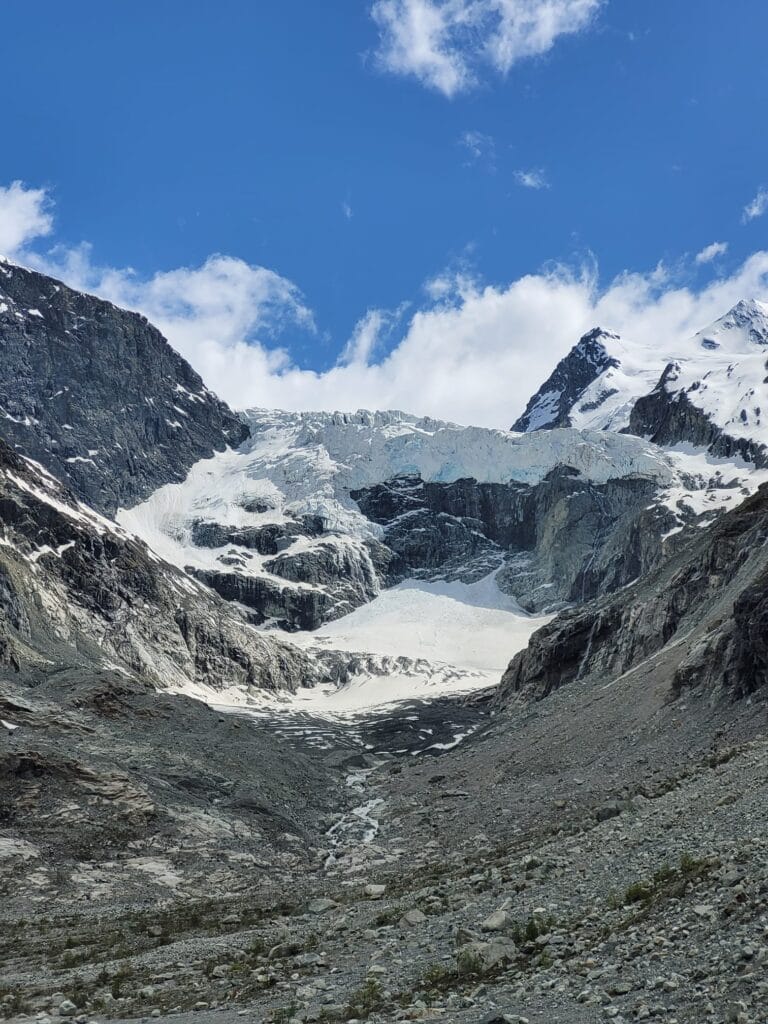
If you’re looking for a slightly more challenging option than the short walk along the river, then I’d definitely recommend the climb to the Bricola hut. Its name is a bit misleading, but Bricola is not really a hut… You won’t be able to stop there to go to the toilet or have a drink, but on the other hand it’s one of the most beautiful viewpoints over the Ferpècle valley there is!
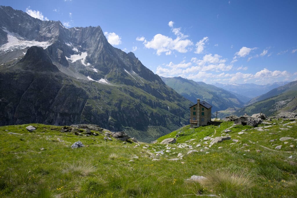
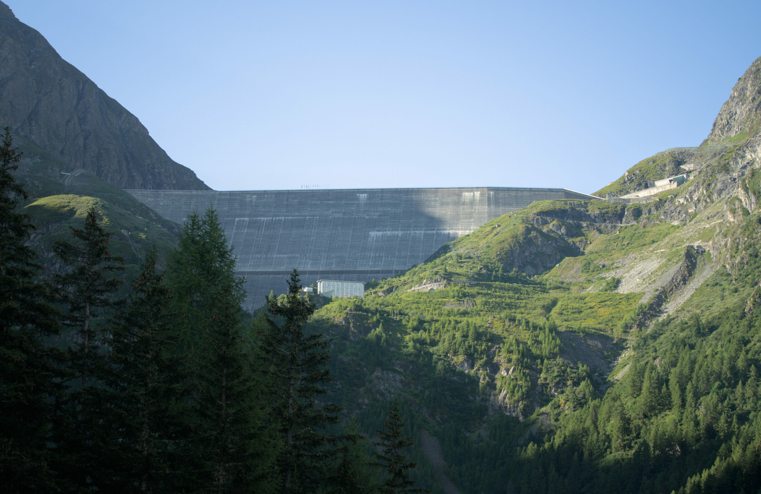
Bricola is actually owned by Grande Dixence SA, the company responsible for building the dam. The building was bought in the 1950s and was used to house the workers who maintained the water intakes (a catchment gallery connected to the Grande Dixence dam ends at Ferpècle). Nowadays, the building seems completely abandoned… Which is a shame, given its location, if you ask me.
Departure from Les Salays and climb to Bricola
To reach Bricola, you can follow the itinerary above and take the path that climbs towards the hut at the bridge. But if you’d like to add a little more variation to your loop, we’d advise you to opt for the “higher” path that leaves the hamlet of Les Salays. This path is not officially signposted (in other words, there are no yellow or red markings), but it is well used and you’ll have no trouble following the GPX track we’ve provided below.
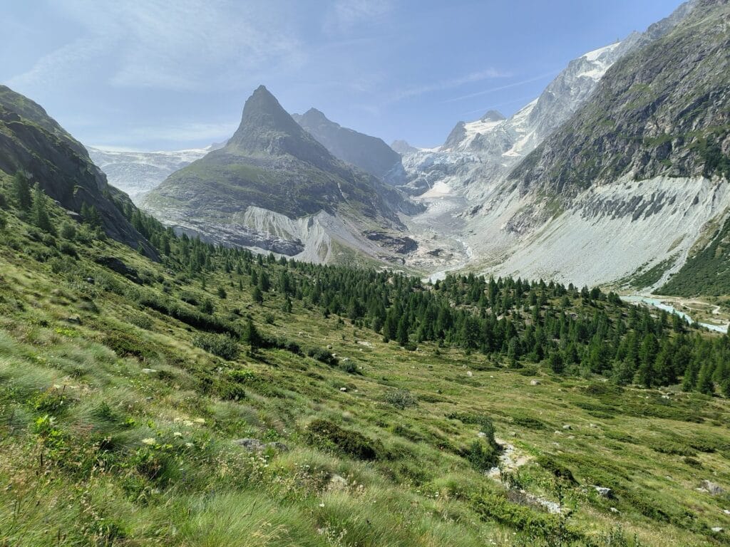
In fact, the idea of this route is to climb gradually through the forest until you reach a first viewpoint of the glacier. You then continue relatively flat until you reach the signposted path that leaves from the foot of the dam.
Shortly afterwards, things get more serious: the path twists and turns towards the plateau on which Bricola lies. The path is well-maintained and well-marked, but we’re not going to lie to you, it’s quite steep 😉 But the views are more than worth it!
Return via the Mont-Miné viewpoint
For the return journey from Bricola, the first few kilometres are on the same route as the ascent, but for the end, I advise you to make a detour via the Mont Miné viewpoint and rejoin the route described on the outward journey above. Firstly, you won’t have to do exactly the same route twice, and secondly, you’ll get a view from below of what you’ve just climbed 😉
Infos :
- Distance : about 10 km for the full route
- Elevation change : about 800m
- Walking time: We generally allow 3h30-4h for the return journey.
Hiking map :
Getting to Ferpècle, eating out, finding your way around: all the practical information you need
Before coming to Ferpècle, here’s some information you might find useful.
Access to Ferpècle – Road opening
Ferpècle is a little corner of paradise in ‘almost’ every season. Yes, it’s not accessible all year round! The Ferpècle valley is not inhabited all year round, and during the winter months the road is closed and access to the valley is strongly discouraged (due to the risk of avalanches and falling ice). The closure period varies according to the snow conditions, but roughly speaking the road is open from the end of April to the end of October. Details of when the road is open can be obtained from the Evolène Région tourist office (it’s best to call them if you plan to come at the beginning or end of the season).
Come to Ferpècle
For all the above walks, we’ve assumed that you’ll set off from the small hamlet of Les Salays. This is the terminus of the bus from La Forclaz to Ferpècle.
To see the bus timetable, go to cff.ch. The bus runs from June to September.
To get here in summer, we strongly recommend that you come on foot (we’ll tell you more below) or by public transport. There are 2 main reasons for this:
- The road to Ferpècle is VERY narrow, making it virtually impossible to cross in many places. At busy times, it can quickly become very difficult to get around… expect to have to reverse a lot to pass other vehicles (particularly the post bus).
- The number of parking spaces is limited!
If you insist on coming by car, here’s our advice:
- Come early! Don’t expect to find a parking space at 11am during the holiday period…
- Check the bus timetable before setting off (timetables are available on cff.ch). I strongly advise you to avoid coming face to face with the post bus. Depending on where you meet it, you may have to reverse for several hundred metres on a mountain road… It’s up to you!
- There is a small car park around 600m after the hamlet (at a hairpin bend).
- Please observe the traffic bans on the road leading to the mountain pastures. From the bend where the main car park is located, the road leading to the dam is closed to traffic, except for local residents and people with reduced mobility wishing to access the restaurant.
Hike to Ferpècle from Les Haudères
If you’re feeling more sporty, you can also take the bus to the “Les Haudères, centre” stop or park your car in the free car park next to the tennis court. From here, you can take the little path behind the sorting centre to La Forclaz and the Ferpècle valley.
From Les Haudères, this “little detour” adds around 4km and 350m of ascent, and you’ll need to allow an extra 1? hours for the ascent (1 hour for the descent). Personally, if you have the time and the courage, I recommend it! It’s very pretty and you can enjoy some magnificent views on the way up, while remaining mainly overlooking the Borgne de Ferpècle.
Map of this additional section from Les Haudères:
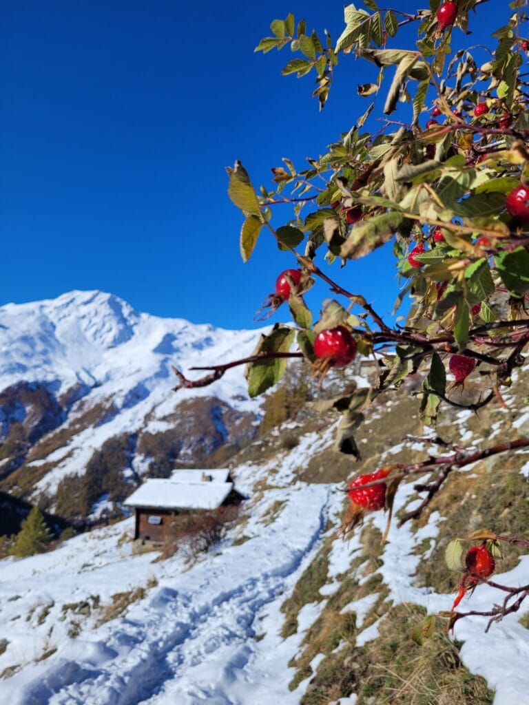
Eat or drink at Ferpècle – Welcome to a little paradise
Just before the dam is the adorable Petit Paradis refreshment bar. It’s a place we particularly like for a drink at the end of a walk or even to eat one of their excellent tarts or cheese crusts! 🙂
Note : From the restaurant, you enter a 100% natural space. There are no bins, toilets or other refreshment facilities. Take something to eat and drink with you if you’re going on a longer tour, and make sure you always take your rubbish with you to the bins in the villages.
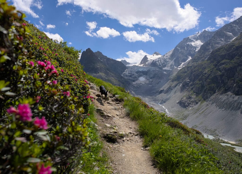
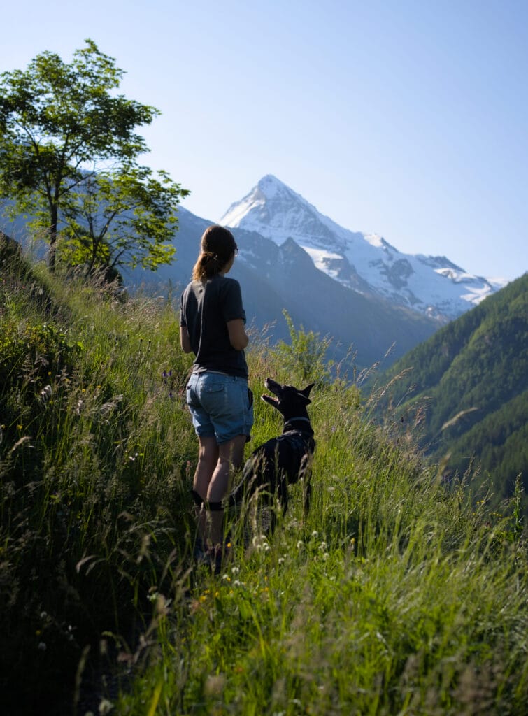
Hiking with a dog?
The walk is ideal for 4-legged friends. Be careful, though, as during the summer months, the Ferpècle valley is a grazing area for herds of cows (sometimes with their calves). Please obey the signs and keep your dog on a lead (and don’t forget to pick up any poop, even out in the open… Our pets’ poop can contain bacteria that are harmful to wildlife!)
Mobile coverage
The Ferpècle valley doesn’t have very good mobile coverage. Rest assured, I’m not worried about your Instagram posts, but the reason I’m giving you this information is for hiking maps 😉 Make sure you’ve downloaded an offline map, taken a screenshot or have the route in mind before you set off. It’s not particularly difficult to find your way around the plateau and the paths are well signposted, but let’s just say you can’t rely on your phone to help you if you get lost 😉
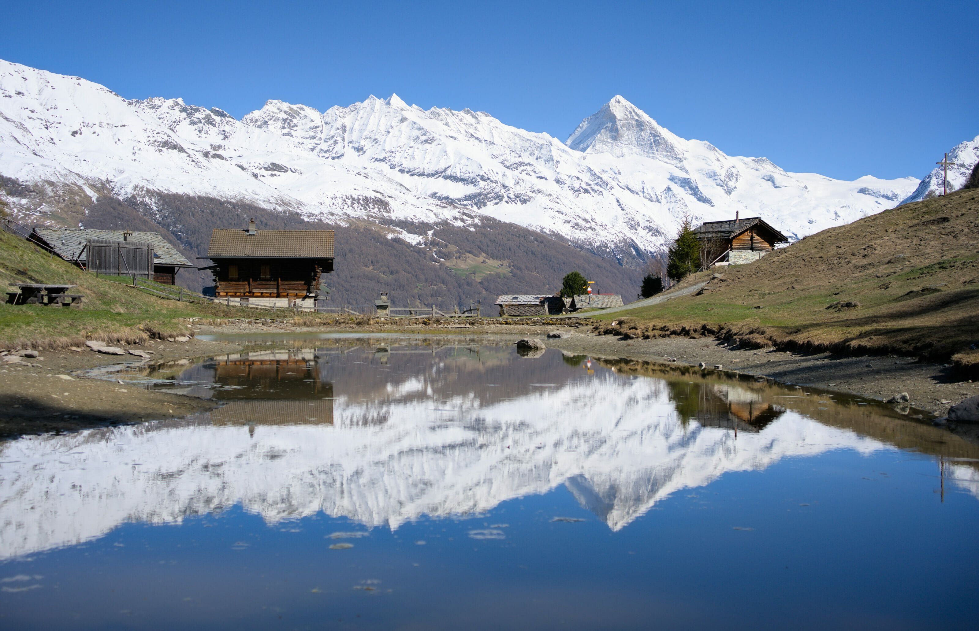
Bonus: View of Ferpècle from the mayens de Bréona
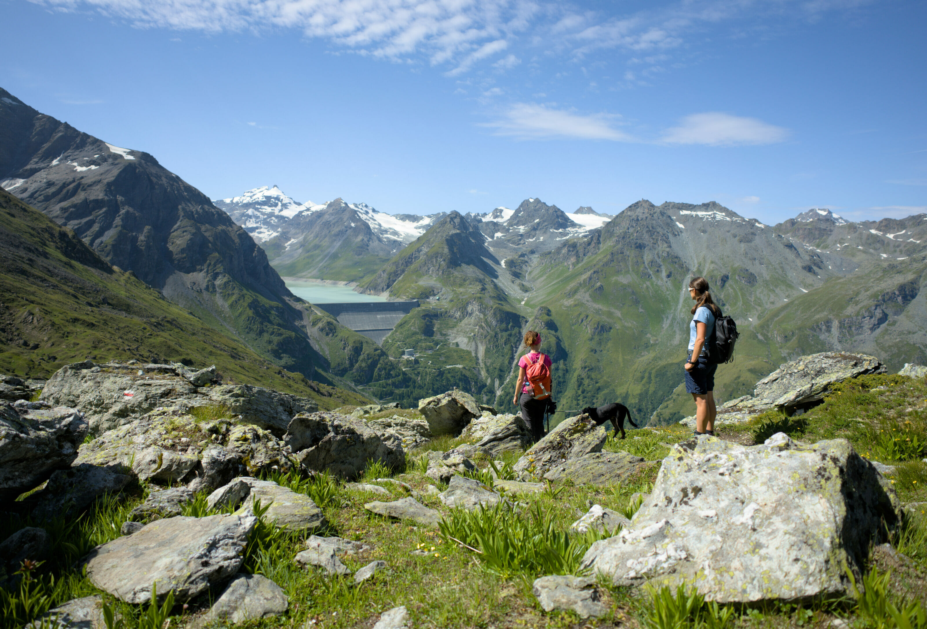
If you’re coming to the Val d’Hérens in winter and you’d like a nice view of the Mont-Miné glacier but access is closed, we’ve got a nice alternative for you. Starting from the village of La Forclaz, you can follow a lovely itinerary (on foot or on snowshoes, depending on snow conditions) towards the Bréona mayens.
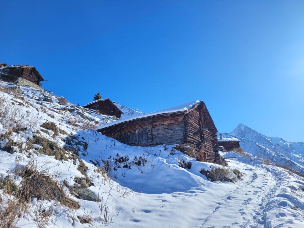
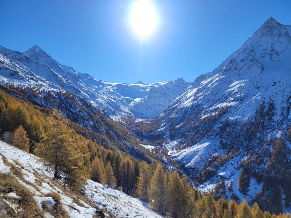
The loop starts at the large car park at the entrance to La Forclaz. From here, follow the road towards the La Terraz ski lift. You then fork right to enter the Tinde forest. The path is a little steep in places, but perfectly marked, and after just over an hour’s effort you come to a small forest road. One last little effort and you reach the heights of the Bréona mayens, a small group of chalets perched high above the valley, offering breathtaking views of the Dents de Veisivi, the Ferpècle valley and its glacier.
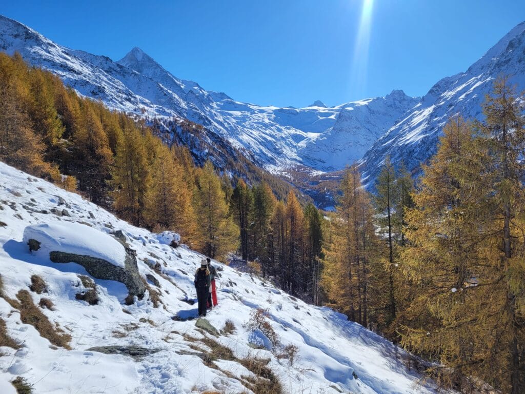
For the return journey, you can of course take the same route, but I’d advise you to make a loop and follow the path that zig-zags down to one of the last chalets. This route is a little longer in terms of distance, but the gentler gradient means that it doesn’t take much longer and, above all, you can enjoy some lovely views along the way.
Hiking map:
That’s all for today! We hope you’ve enjoyed this little glimpse of our lovely region. Don’t worry, we’ll soon be out and about again, bringing you content from outside the Val d’Hérens… But for now, a little chauvinism towards our new adopted region is in order! 🙂
See you soon!
Share on Pinterest
Note: Our links to AllTrails are affiliate links. The app is free to use, but if you decide to take out a paid subscription, we will earn a small commission. To find out about the differences between the free and paid versions, take a look at this article.

Join the discussion