
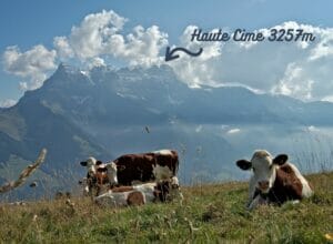
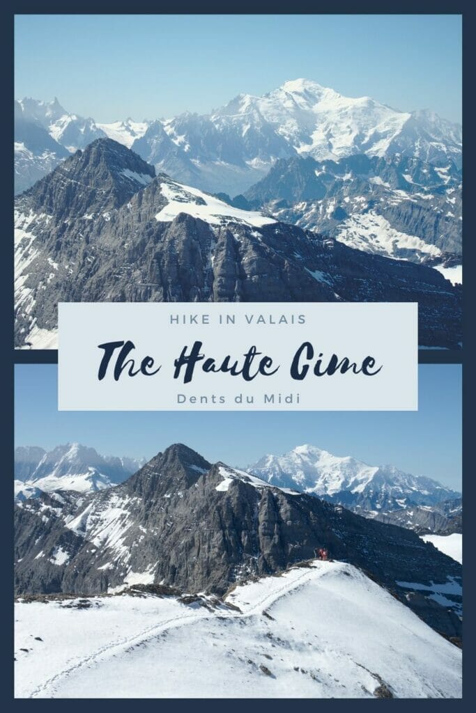
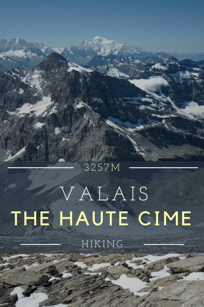
The Haute Cime (or high peak) holds its name quite well since it is the highest peak of the most beautiful mountains in the world, I’m talking about the Dents du Midi of course 😉 . As I grew up in the Swiss Chablais and our base when we are in Switzerland is in Morgins (a small ski resort next to the Dents du Midi), I have already climbed several times to the top of the Haute Cime. But strangely I still hadn’t written a blog post about this nice climb… a gap that I decided to fill today.
So I warn you right away, the climb to the top of the Haute Cime is quite demanding (rated T4 with an unsignposted but well visible path from the Susanfe pass) but the panorama at the top is spectacular. You can see all the Alps (Mt-Blanc, Grand Combin etc…), Lake Geneva, the Chablais and so on… And even if it’s a good climb, the trail is not really technically difficult and is a good introduction to the high mountains (a good challenge as well). It is also the only summit of the Dents du Midi that is accessible by hiking without climbing equipment.
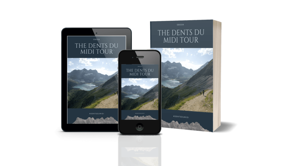
If you are preparing the Dents du Midi tour or one of its alternative routes, we have created a complete guidebook in partnership with the association of the Dents du Midi tour. It will be your indispensable partner both in the preparation and on the trails of the tour 🙂
The different routes to get to the Susanfe Pass
Although the route to the summit from Susanfe Pass is the same, there are several ways to get to the pass. I tried all these variants whether it was via the Salanfe lake or the Susanfe hut, in 1 or 2 days.
So that you can get a better idea of the routes, here is first the map of the ascent of the Haute Cime with the different ways (don’t look at the denivellation line which is the sum of all the itineraries):
You can download our map with the different variants from the AllTrails website (application we use and which we talked about here). To access the files you just need to have an account (free).
The 1st thing to note is that if you want to do the hike in 1 day without sleeping at the Susanfe or Salanfe hut, it will be a long day 🙂 . There are 2 possibilities:
- Leaving from the Grand Paradis parking lot, it’s still more than 21kms round trip with 2200m of positive and negative denivellation. That’s what I did the last time I went up (to visit Fabienne who was working at Susanfe’s hut) and at the end of the day my legs were quite sore.
- Leaving from the parking lot of Van d’en Haut it is 20km for more than 1700m of positive and negative difference in altitude.
Conclusion, if you are not super sure of yourself, I recommend that you do the ascent over 2 days and sleep either at the Susanfe hut or the Salanfe hut. This will allow you to climb the Haute Cime after a good night in the hut and especially early in the morning when it is not too hot yet.
If you’re planning a trip to Switzerland or if you live here and wish to discover some new spots, don’t miss our new ebook. Released in May 2025, this 75-page guide will help you prepare for your upcoming stay in Switzerland. We’ve compiled all our best tips and tricks for visiting our beloved little country without breaking the bank. You’ll find advice on transportation, accommodations, where to shop, as well as a list of free activities and events throughout the seasons, along with our personal recommendations for hikes and must-see spots, and a selection of off-the-beaten-path itineraries (with estimated budgets). This ultra-complete guide also includes a fantastic interactive map featuring over 500 addresses and deals.

To learn more about the ebook and the interactive map, the introductory article is available here.
Hiking up to the pass on the Susanfe’s hut side
This route starts from the Grand Paradis parking lot (at the beginning of the blue and green paths on the map) where you can park your car. If you don’t have a car, it is also possible to take the train to Champéry and then take a shuttle bus to Grand Paradis (bus schedules are here).
Note: It is also possible to go by car to the plateau of Barme.
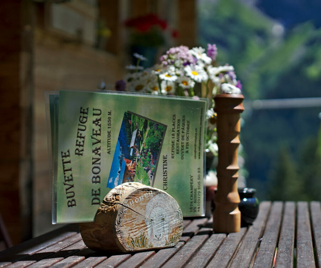
As you can see on the map, there are 2 possible routes: in green by the Bonavau hut and in blue by the Sauflaz waterfall. If you decide to go this way, I recommend you to go up by the waterfall (blue path) and to come down by Bonavau (green path) so that you can always stop for a drink at the refuge on the way down 😉
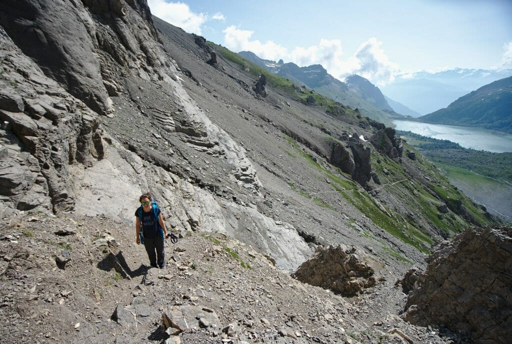
The blue path is very nice and starts by going along the Sauflaz river in the forest to cross it on a small bridge (at this height it is also possible to go to see the waterfall by making a small round trip). The path then climbs by the “roc coupé” with a small passage equipped with handrails but without much difficulty. We then leave the forest to continue to go up to the Belle-Etoile footbridge.
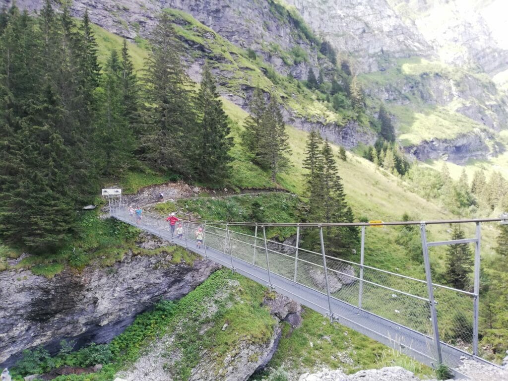
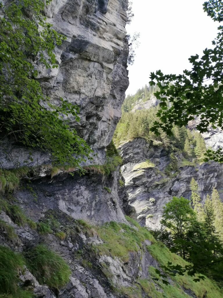
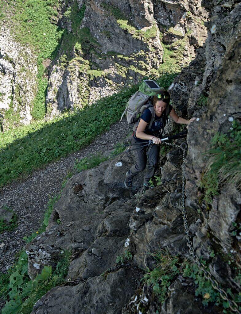
After having crossed again the Sauflaz river, we tackle this time the famous step of Encel which sometimes worries the hikers of the Dents du Midi tour (less those of the Dents Blanches tour which has much more delicate passages). This passage is of difficulty T3 and is a little bit aerial… but it is super well equipped and goes really without problem.
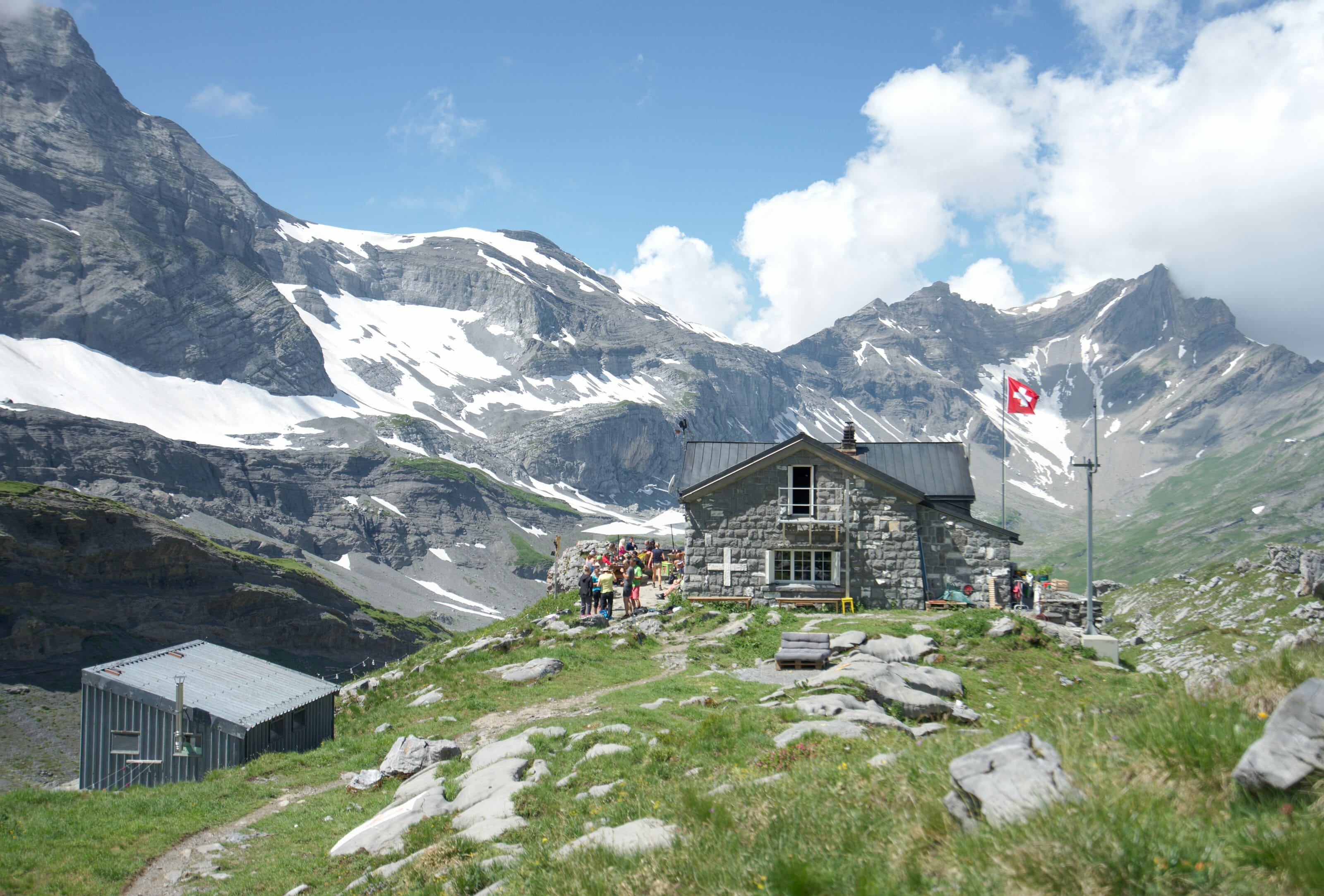
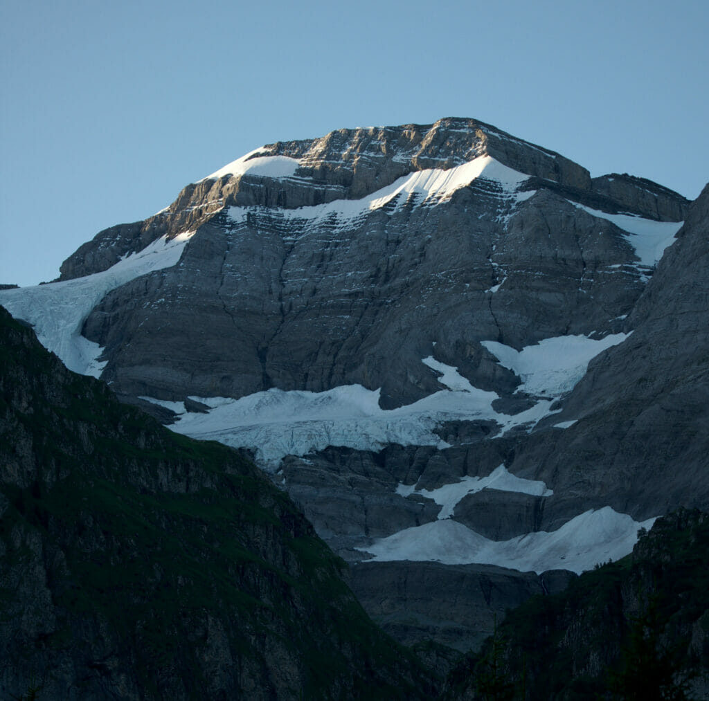
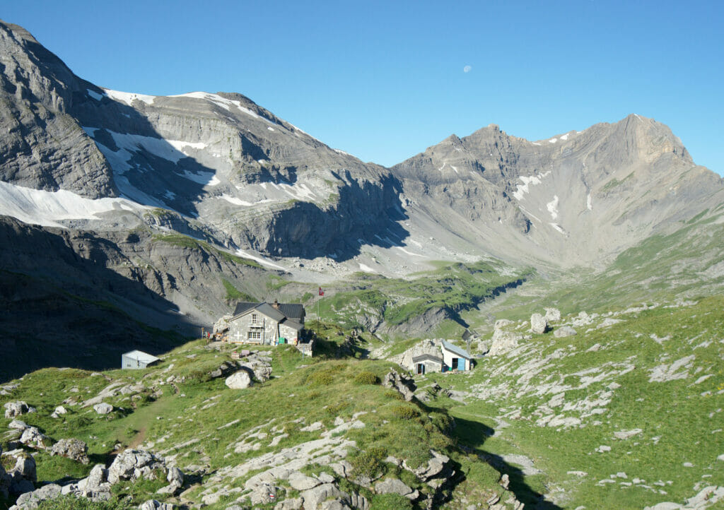
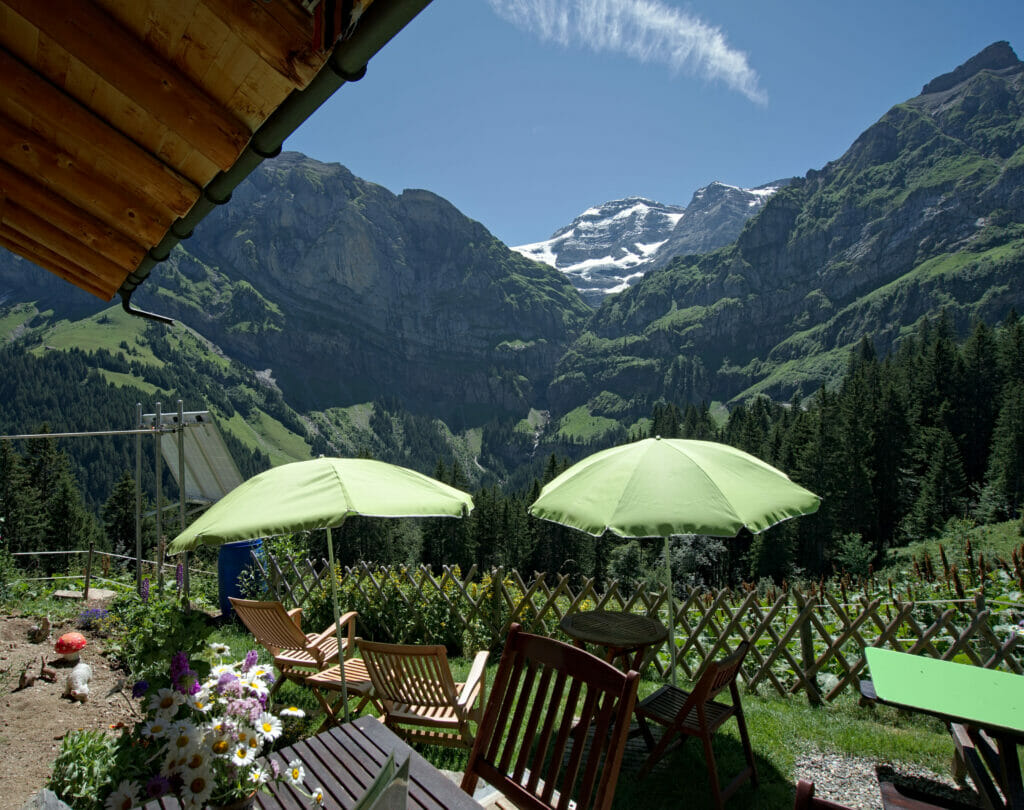
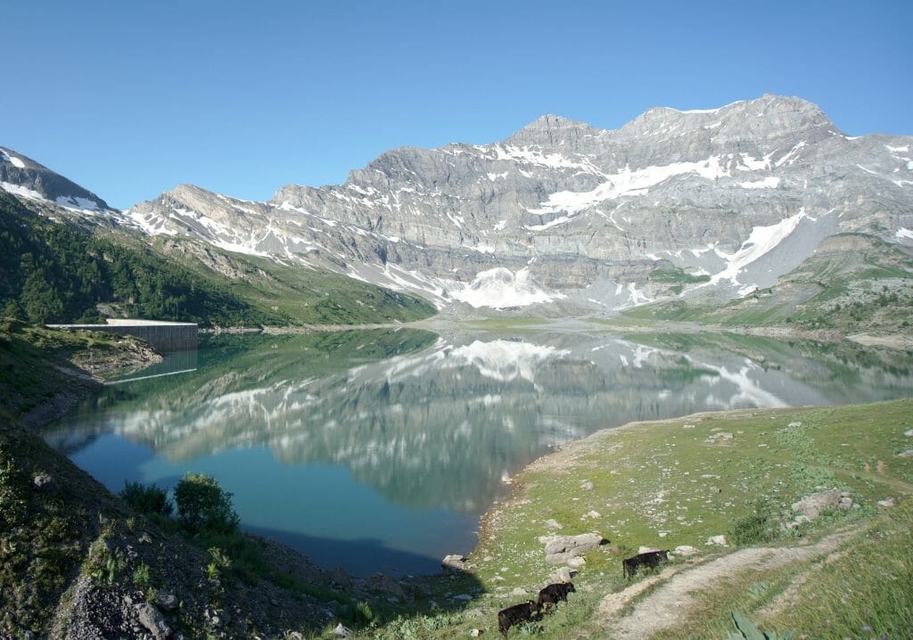
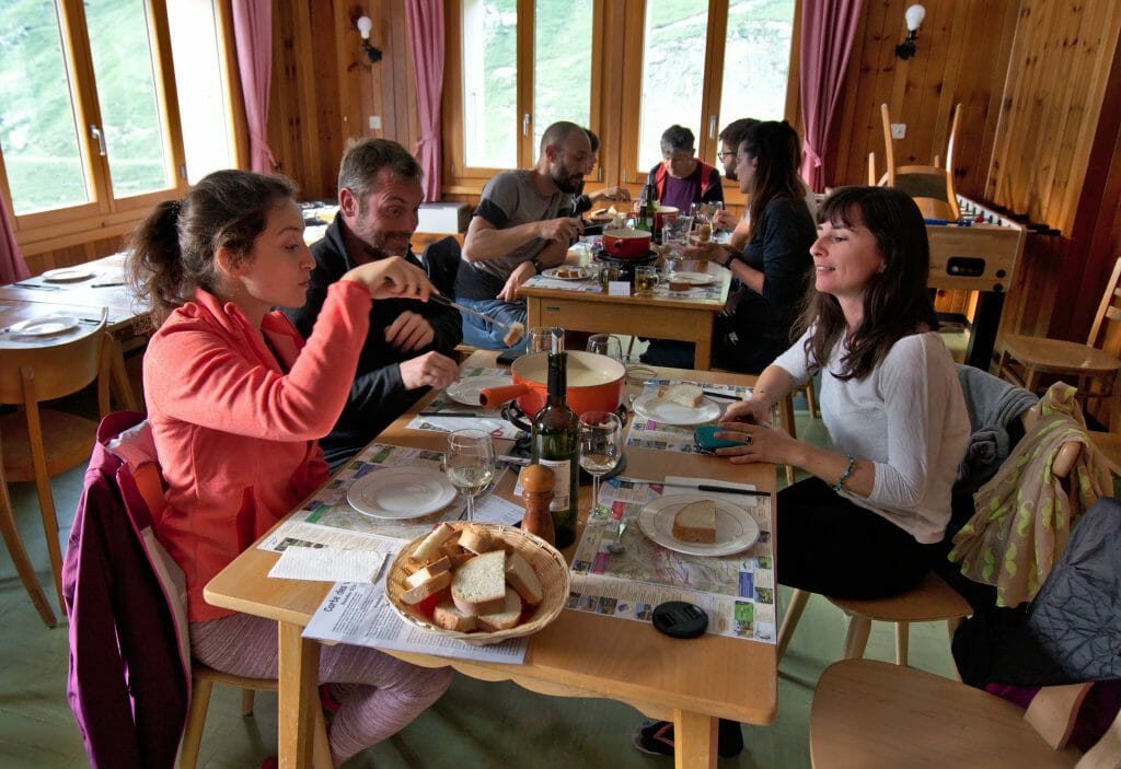
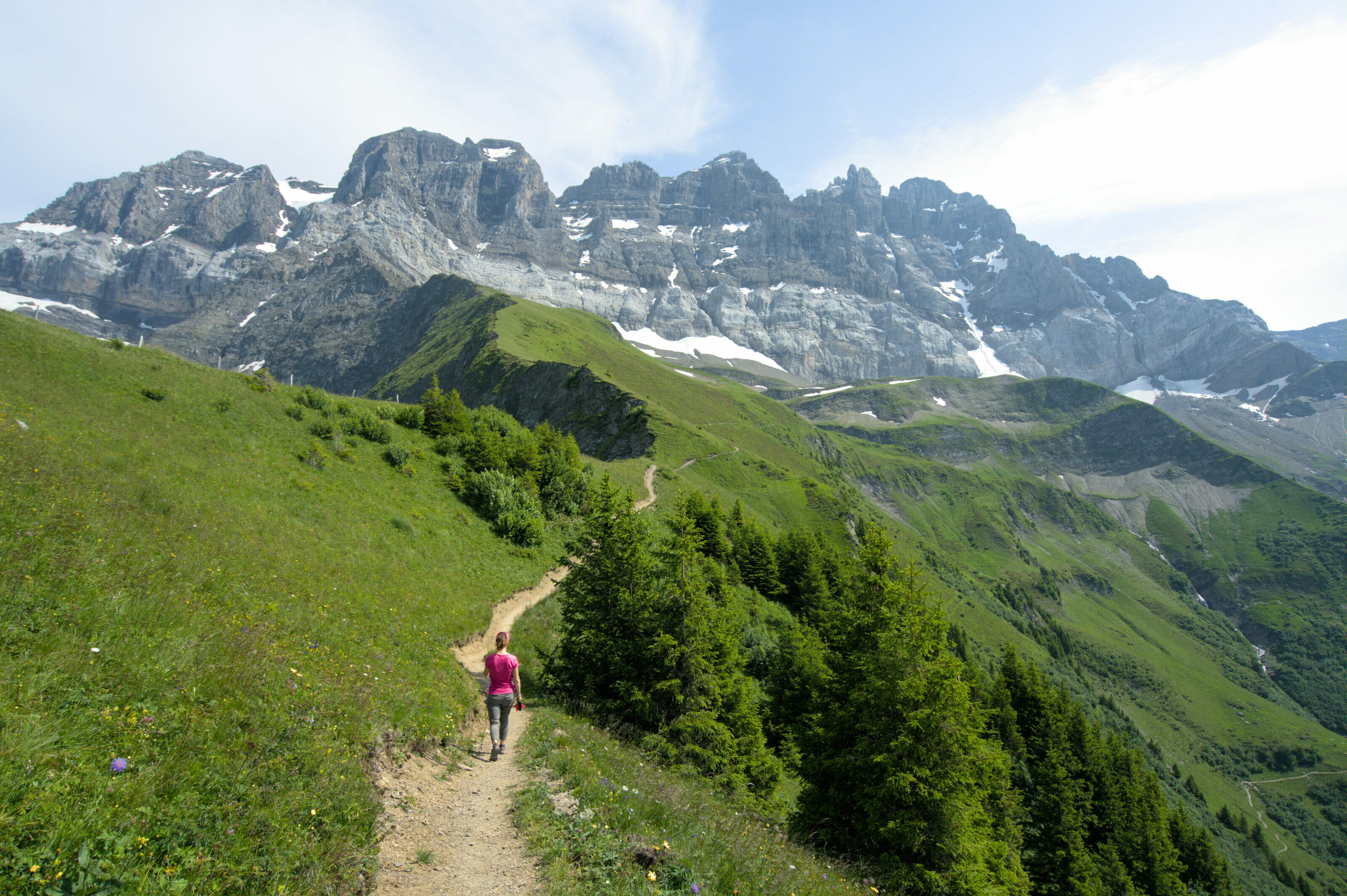
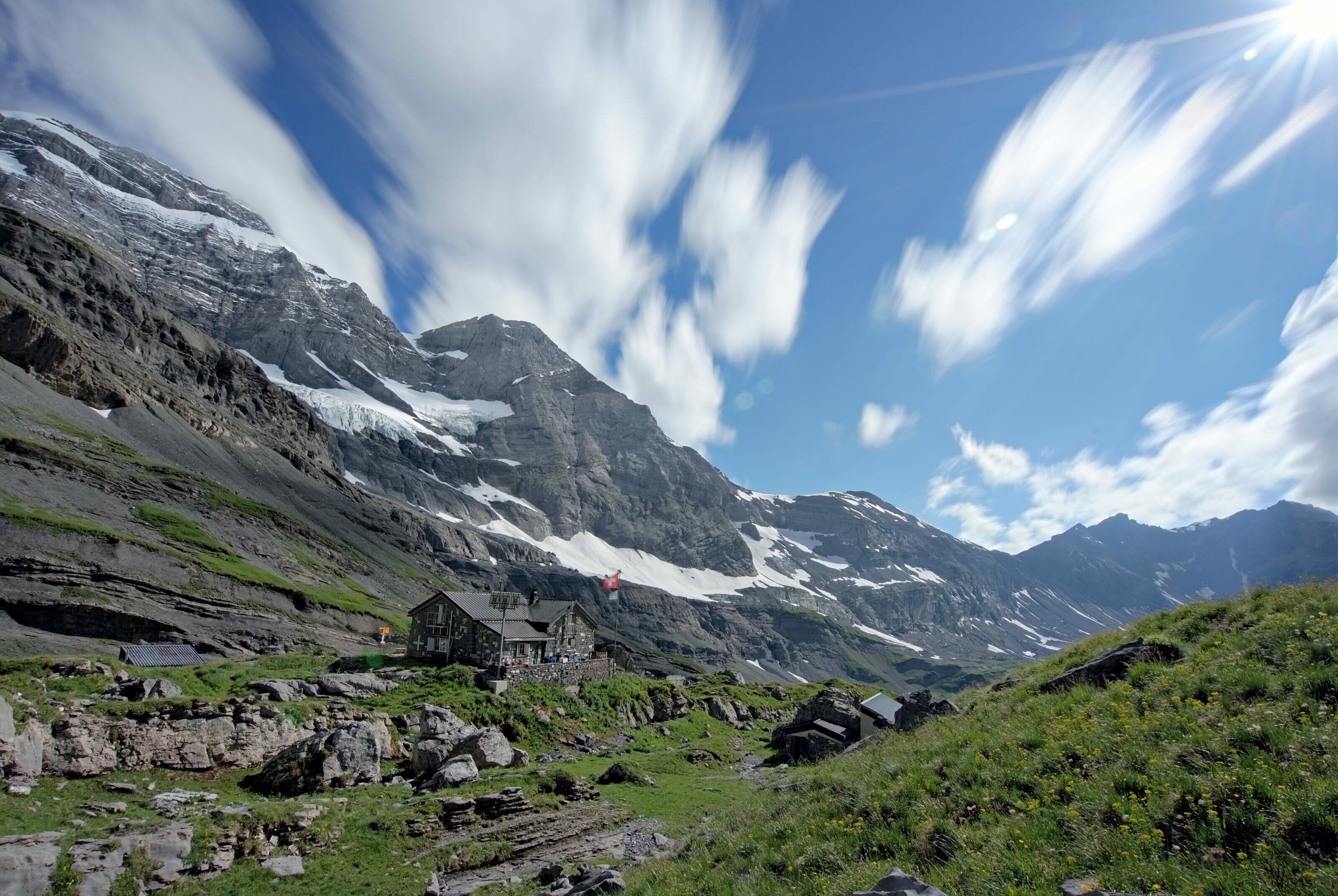
Once this section behind us, we arrive at the height of a small dam to enter the valley of Susanfe with a magnificent view on the small and large Ruan. Then follows a very quiet climb up to the Susanfe hut where you might spend the night (Say hello to Fabienne the hut keeper on our behalf if this is the case 😉 ). From the hut, it takes another hour to go up to the Susanfe pass with its lunar landscapes and its clear view on the Salanfe lake on the other side (I’ll detail the last part up to the top of the Haute Cime below).
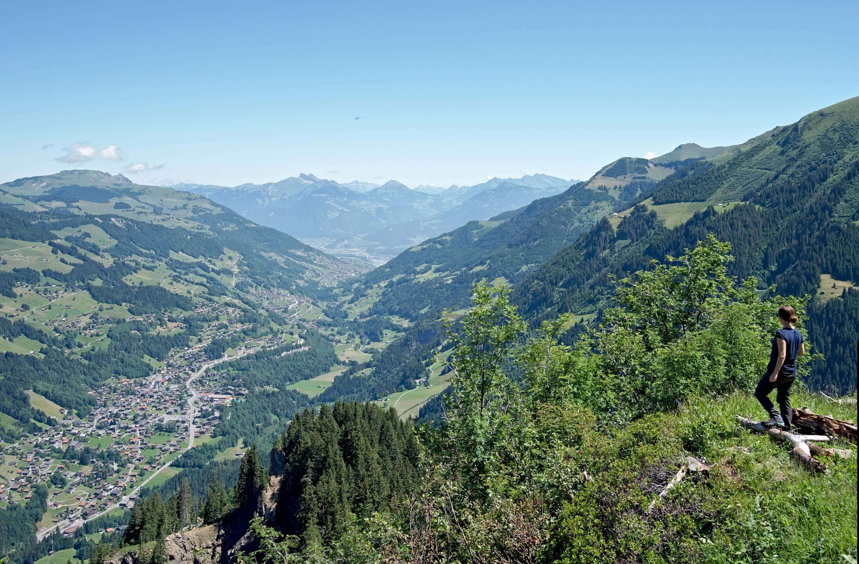
For the descent, you will take the same path until the end of the pas d’Encel. At this point you will turn left in the direction of the Bonavau refuge for a well deserved beer. From Bonaveau, it takes another hour of descent in the forest (not the most interesting part) to complete the loop at the Grand Paradis parking lot.
Ascent to the Susanfe pass by the Salanfe hut
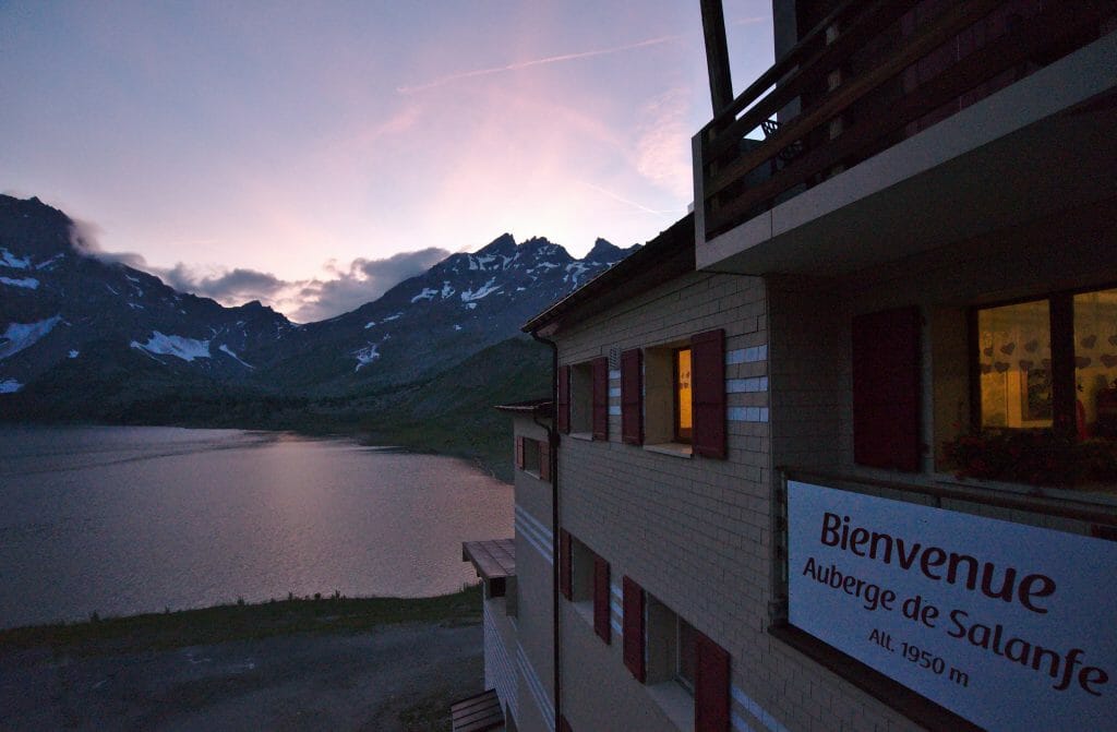
This route starts from the parking lot of the Van d’en Haut campsite where you can park if you are driving. From the parking lot, it takes between 1h and 1h30 of climbing to reach the Salanfe lake and hut.
Note: there are different ways to reach the Salanfe hut (if you don’t have a car for example). For detailed information, I suggest you to read this page on the very good site of the Salanfe hut with all the information or the Fabienne’s article about her hike through the Daillet gorge with a friend.
From the hut, you have to go along the right bank of the lake and then take the path that goes up to the right towards the Susanfe pass. This passage is a bit steep in places but is equipped with handrails and does not represent any technical difficulty. It is also possible to continue to the end of the lake and to go up by the winter road which is wider but less interesting. And anyway if you want to go up to the Haute Cime, the more difficult passages arrive after the Susanfe pass 😉
Climbing to the top of Haute Cime from the Susanfe pass
Once you get to Susanfe Pass, that’s where it really starts!
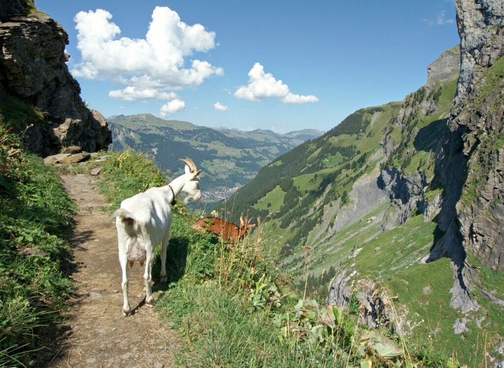
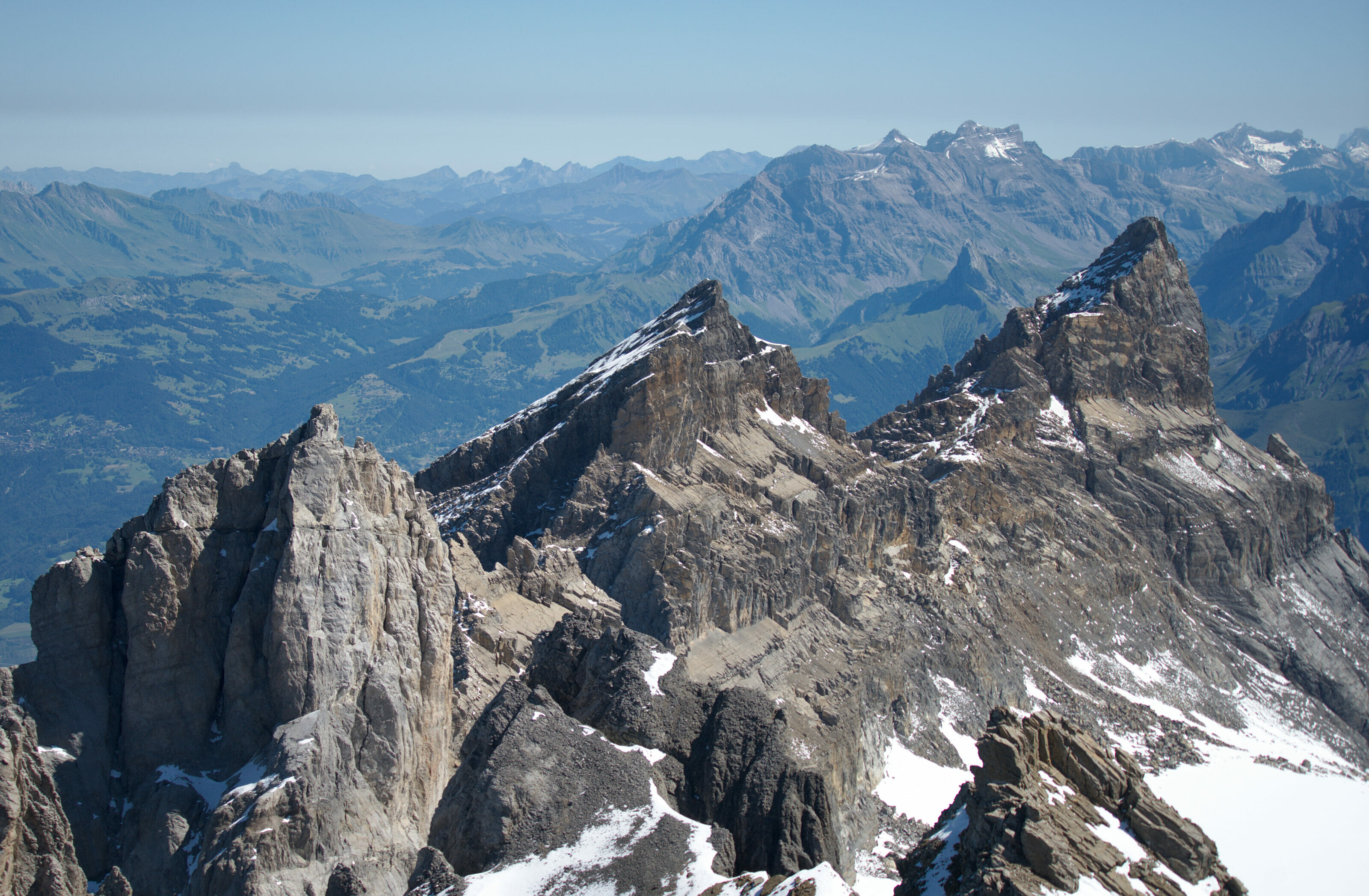
Even if it is not indicated (but well marked because it is a very popular route), follow the path that goes up towards the Haute Cime on the side facing Salanfe. The terrain is very rocky and it is already quite steep. Remember to turn around from time to time to admire the view of the Susanfe pass, the Salanfe lake and the Sallière tower that rises on the other side.
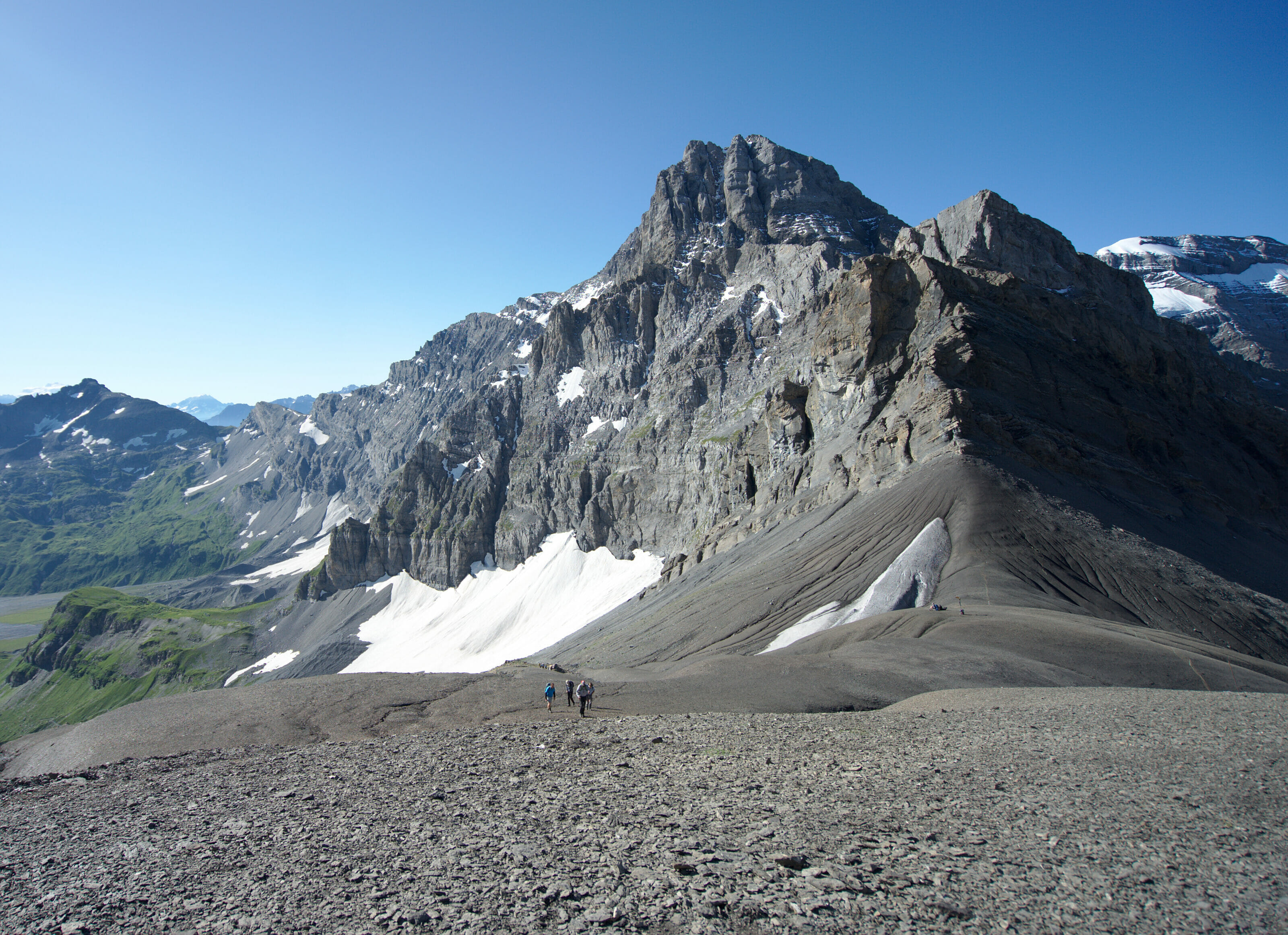
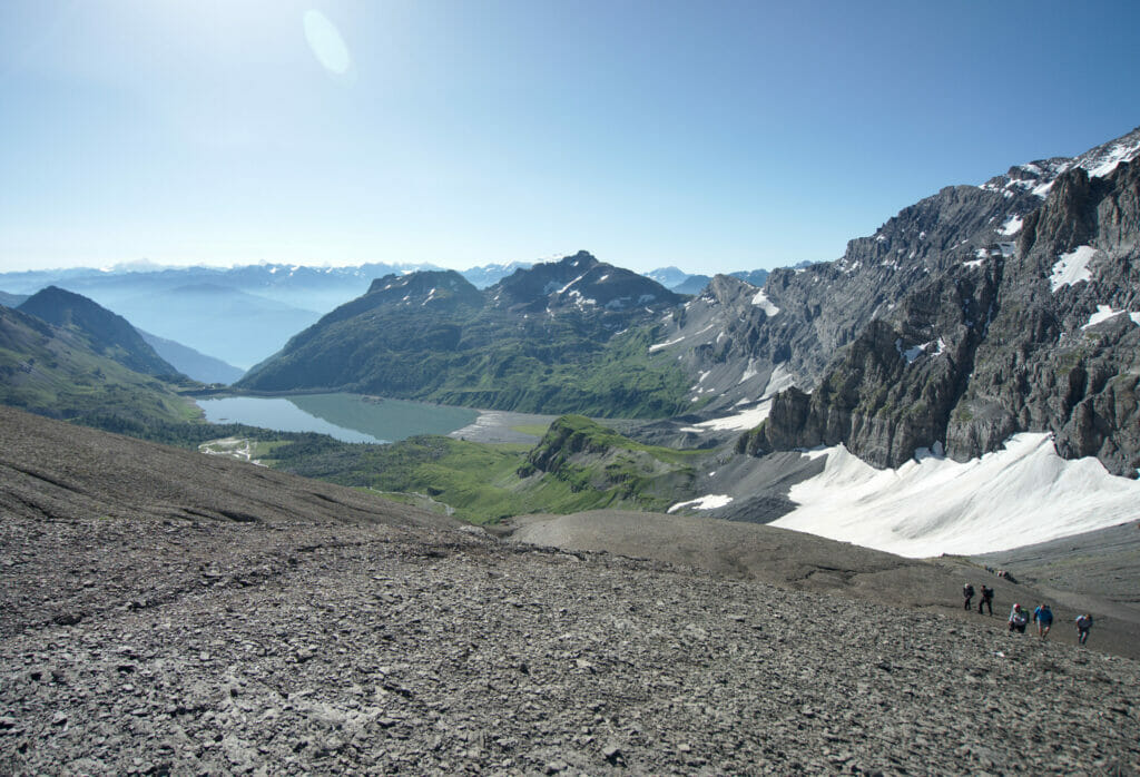
The trail then arrives in a slightly more rocky and steeper part. At this point, the trail is a little more difficult to follow because not all hikers pass through exactly the same place. To orient yourself, follow the cairns and, once above the steeper passage, the trail turns to the left (left contour on the map).

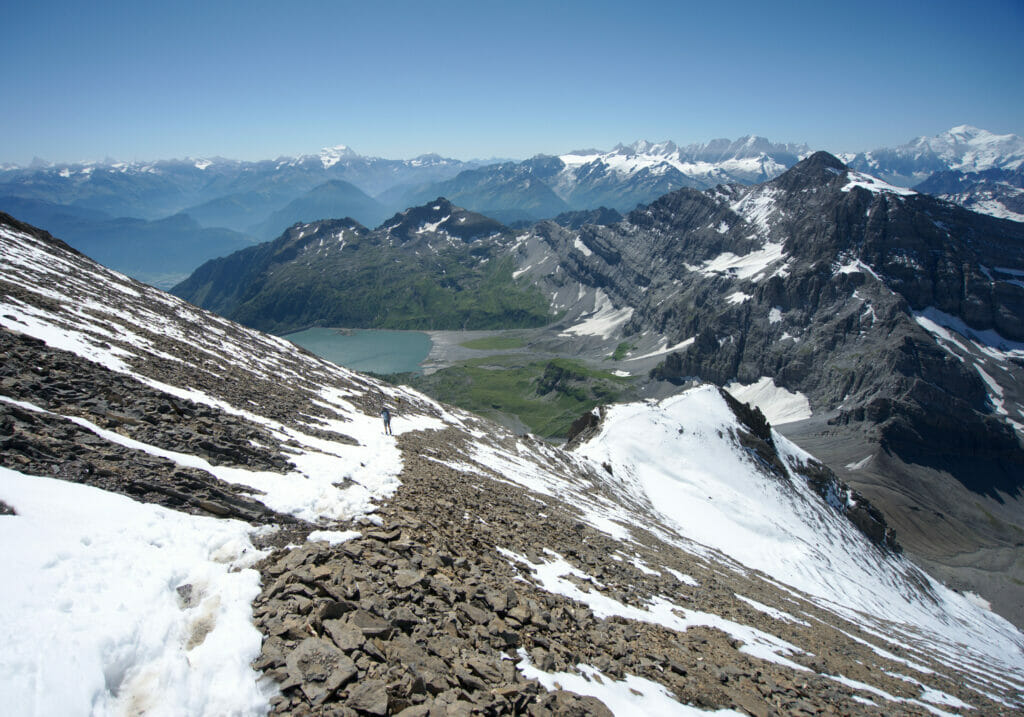
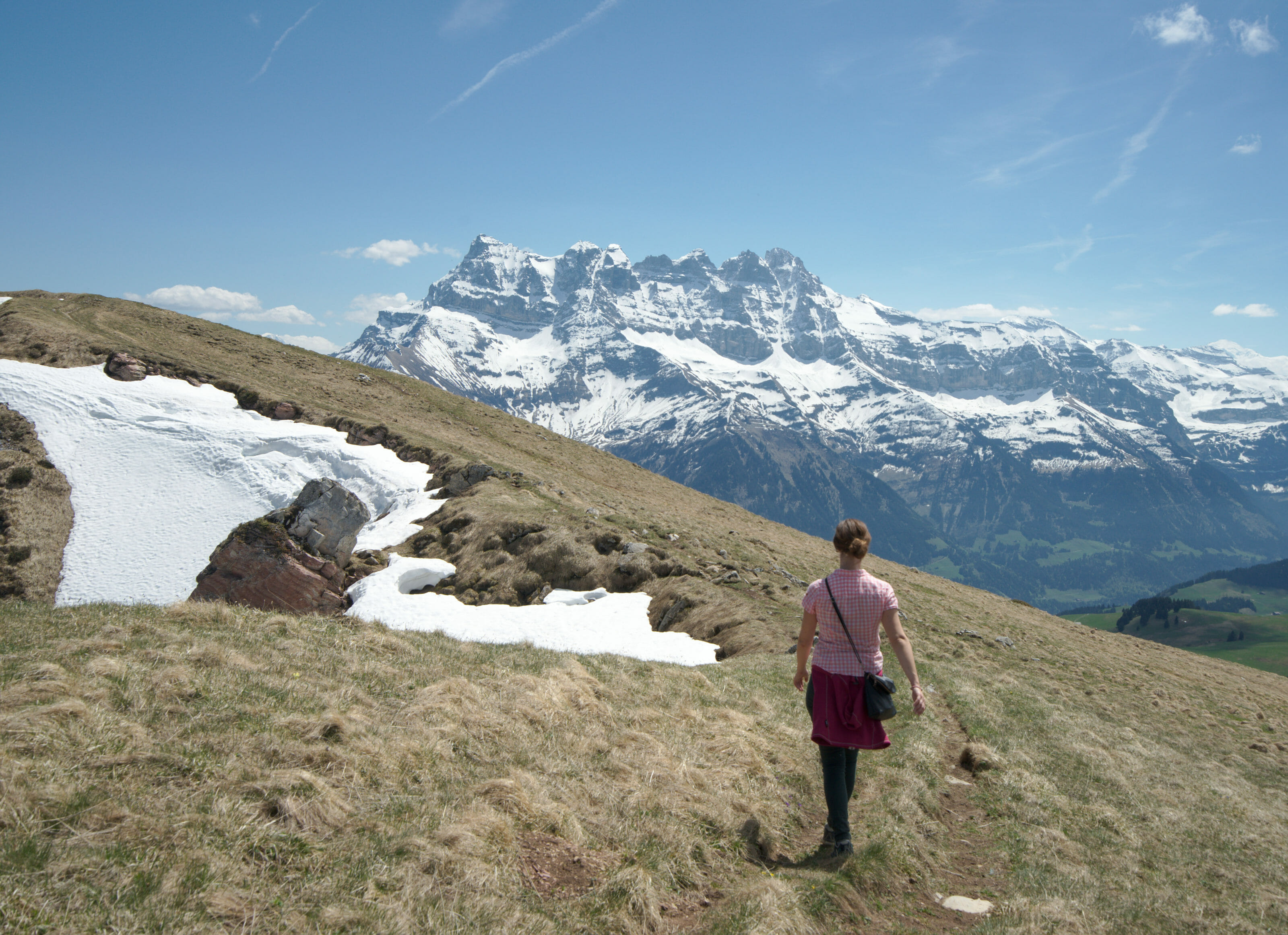
After a crossing on the left, the path then climbs in zig zag. If you see a track going straight up, don’t follow it! This is the track used by some hikers to go straight down in the scree (I took it once on the way up and it’s clearly not a good idea lol). At the end of the zig zag, you will arrive at the ill-named “col des Paresseux” (which means path of the lazy)… it seems that the one who gave it its name had never walked up till there 😉 . There too, take the time to enjoy the incredible view with the Sallière tower and the Mt-Blanc rising just behind you. Plus you will surely need a little break before tackling the last 200m climb to the summit 😉
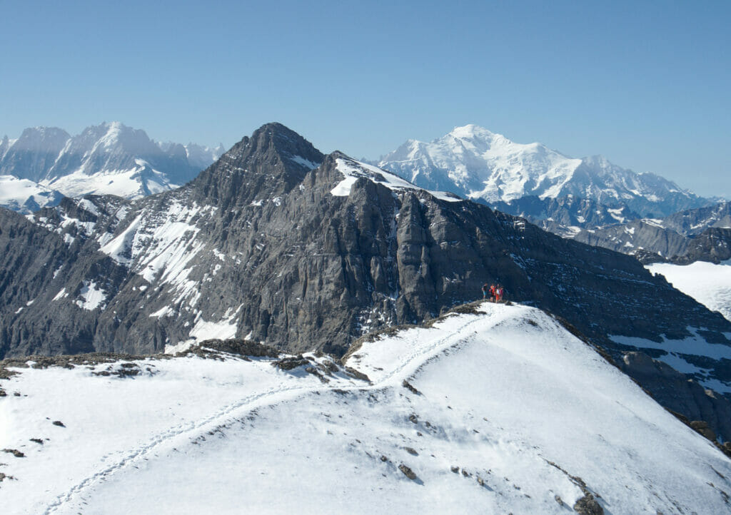
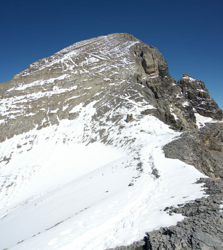
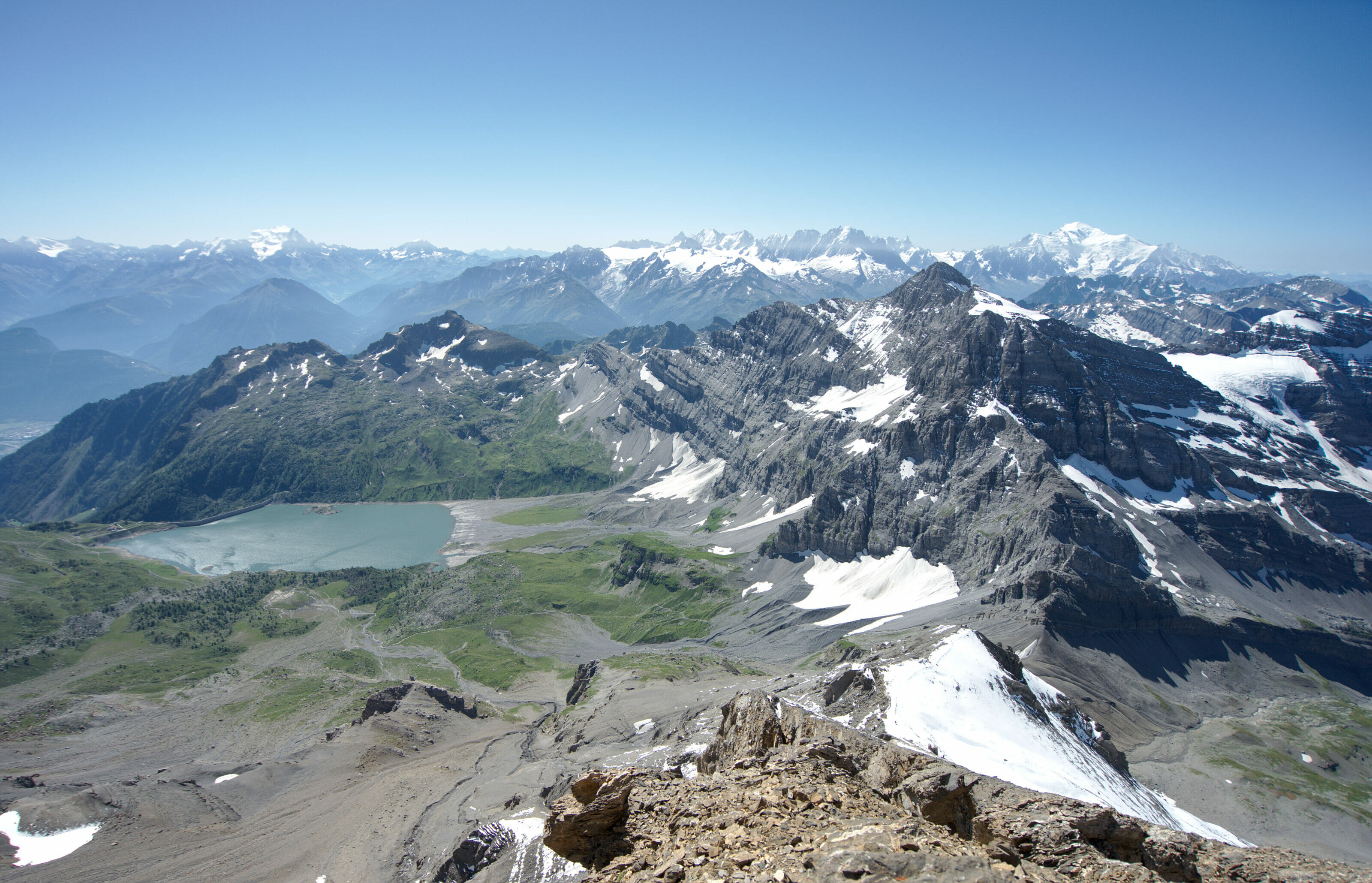
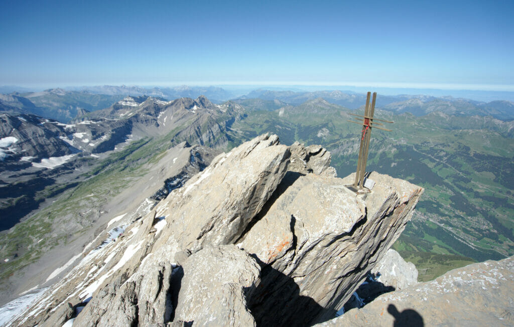
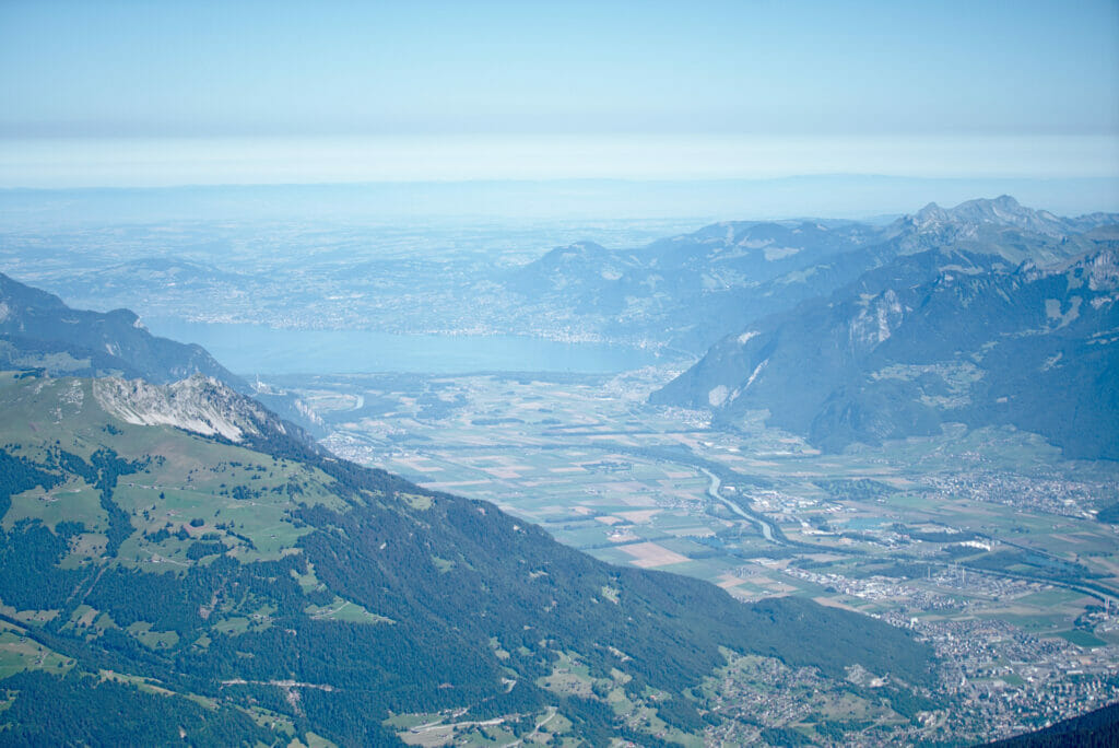
The last section is steep but not technically difficult if there is no snow. You will notice that on my pictures there is quite a lot of snow. During my last ascent in August 2020, it had snowed a few days before which immediately made this part more difficult (especially very slippery on the way down). Ask the hut keepers for more information about the conditions. After a crossing on the left and a last one on the right, you will finally reach the summit of the Haute Cime. You will be rewarded by an incredible 360 degree panorama of the Chablais, the 4000m of Wallis, the Mt-Blanc range, the lake of Geneva…
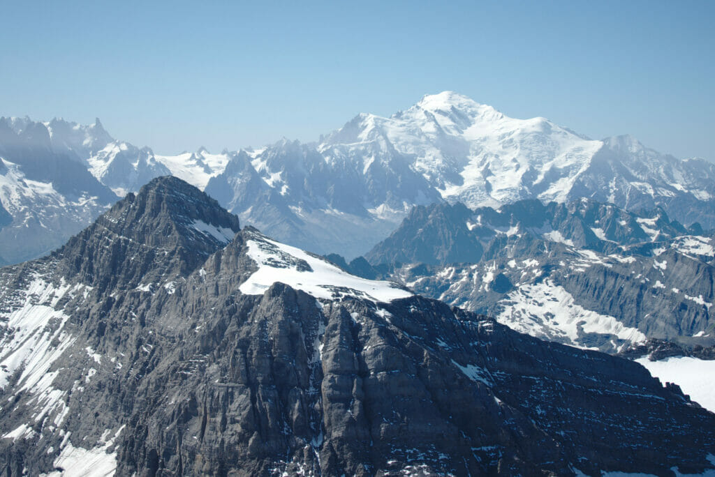
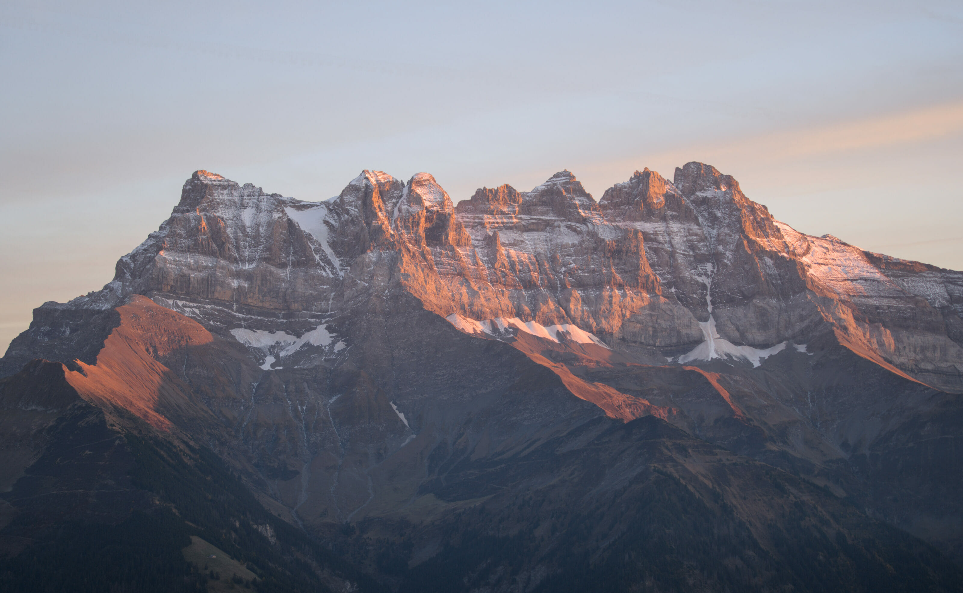
You will also be able to admire all the other Dents du Midi which are not accessible by hiking (in order from the Haute Cime: Les Doigts (3205m and 3210m), La Dent Jaune (3186m), L’Eperon (3114m), La Cathédrale (3160m), La Forteresse (3164m), La cime de l’Est (3178m)). And on the way down you can also enjoy all these peaks with a drink in one of the refuges since the brewery 7peaks has chosen the name of the Dents du Midi for its different beers. 🙂
Speaking of descending, the return trip is exactly the same route as the ascent. If you feel like it (and if you have high shoes), you can cut through the scree to save some time as I mentioned before.
That’s it for this magnificent ascent to the top of the Haute Cime, at the very top of the Dents du Midi. I’d rather say it once again: this route is not marked and is difficulty T4. If you don’t have too much experience on this kind of terrain, I recommend you not to try this climb alone! If you really want to do it, you should climb with a guide or an acquaintance who already knows this route. And if you are a bit dizzy or not comfortable when it is a bit exposed, this may not be the most suitable hike. But otherwise, it’s just beautiful nature and landscapes!
Note: If you are not sure if this hike is for you, you can try to climb the Barrhorn first. The terrain is similar, but the ascent is less vertiginous and the arrival at the summit at 3661m is really impressive too.
Pin it on Pinterest
Nice information. I hope to tackle this next year.
Thanks for the information.
Wonderful hike. I am planning it for this summer. My key objective is the Haute
Cime. I am considering Starting the first day by staying at Auberge de Salanfe, hiking ot the Haute Cime an ddecending to the Cabane de Susanfe. the next day descending to Champéry. I have 2 questions: 1) is there a recommended direction? 2) what is the route and approx. hiking times if I want tot do the tour du Dent du Midi including the Haute Cime in 3 days?
Thank sin advance,
Hubert
Hi Hubert,
No recommended direction but Champery is the most easily accessible place by public transport. On the other side you can reach Van d’en Haut by bus.
For hiking times it’s hard to say as it mostly depends on you hiking speed… but you can find more info on our tour des Dents du Midi page –> https://www.novo-monde.com/en/dents-du-midi-swiss-alps/
Very nice, and informative article!
I hiked the Haute Cime a couple of days ago, it would’ve been way more helpful if I had seen this earlier. I should try the Barrhorn as well next time.
Thanks a lot.
Glad you found our blog post helpful and hope you’ll make it to the top of Barrhorn (not now though as there probably is still some snow up there 😉 )
Hey, very nice article! Going there in a few weeks. Think it’s still possible to complete this in October?
Well it will really depends on the snow conditions… But I would say for Haut Cime it might be too late already