
We have just returned from 6 days in the Dents du Midi region, in our beloved little region of Valais! It is still with the muscles slightly sore and and a bit tired that we give you our impressions after this nice hike in the Swiss Alps.
For us, Dents du Midi is a region that is very dear to us… Benoit grew up at the foot of these mountains and I have spent every weekend there since I was very young. In fact, it was even in the Dents du Midi region, in an after-ski bar, that we exchanged our first kiss! But we’re not here today to talk to you about our first kisses, there’s been a prescription on that for a long time already.
No, today we are talking about the Dents du Midi tour, an incredible hike that can be done in 2, 3, 4 or even 5 days. (I voluntarily omit the possibility of making this hike in one day for the trail runners. To me it seems impossible to do more than 42km and 6000m of altitude difference in 1 day. But hey, there are apparently many people capable of such a thing).
- Our video of the Tour des Dents du Midi
- Where are the Dents du Midi?
- History of the tour des dents du midi
- Itinerary of Tour des Dents du Midi (+ map)
- Day 1: Barmes (or Champéry) to Susanfe
- Day 2: From Susanfe to Salanfe via the Haute Cime
- Day 3: From Salanfe to Mex through the Jorat pass
- Day 4: Mex to Anthèmes
- Day 5: From Anthème to Champéry
- Tour des dents du Midi: How many days does it take to complete the tour?
Our video of the Tour des Dents du Midi
To see what the tour des Dents du Midi looks like in video, just click below and for all the detailed information, that’s all in the rest of the article 🙂
Note: We are sorry, but the video is actually in french (the interview parts). But you can still get an idea of the amazing landscapes by watching it!
Where are the Dents du Midi?
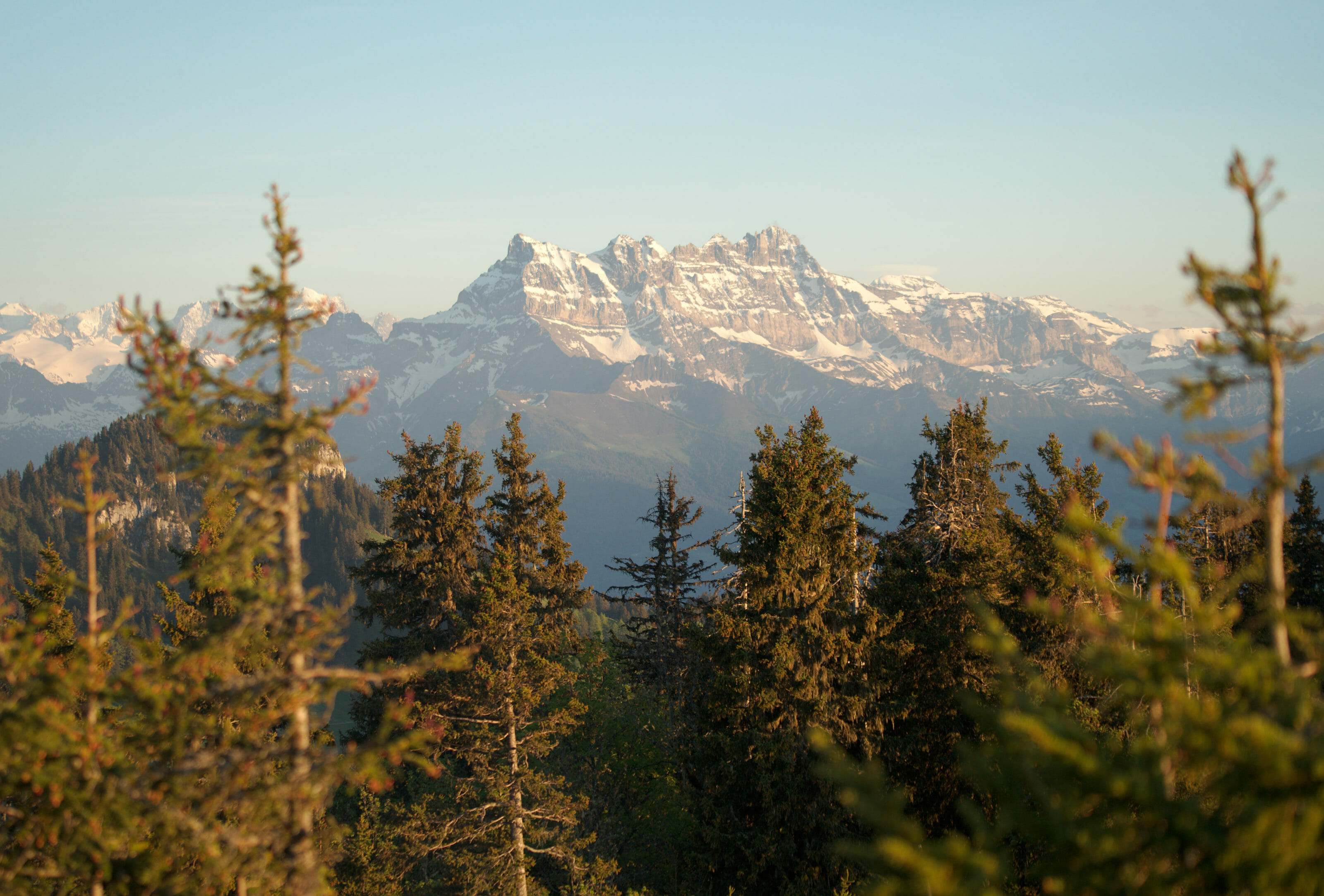
Les Dents du Midi is a 3km long mountain range located in the Chablais region. Formerly called “the Tsallens Teeth”, it was only at the end of the 19th century that they took their current name.
Easily recognizable by their shape, the Dents du Midi are a bit like the emblem of the Lower Valais. For my part, I grew up having them in front of me all my youth, but I won’t hide from you that it had never occurred to me to go around them (and even less to try to climb one of the peaks…).
A small overview :
History of the tour des dents du midi
The Dents du Midi tour was first tested in 1961, created in 1962 by a certain Fernand Jordan. We had the pleasure of meeting the son of the founder of this tour during our hike, but we will come back to it in a future article…
Initially, the Tour des Dents du Midi was not a hiking tour but a 32.5 km mountain race that was held every year. It is worth explaining right away that the course has changed a lot since then, the route has become longer but above all more accessible. In 1972 it was the inauguration of the current hiking trail.
If you are preparing the Dents du Midi tour or one of its variants, we have created a complete guidebook in partnership with the association of the Dents du Midi tour. It will be your indispensable partner both in the preparation and on the trails of the tour 🙂
Itinerary of Tour des Dents du Midi (+ map)
In all, the Tour des Dents du Midi represents 42.5 km and a total of 6000m of altitude difference (positive and negative), which corresponds roughly to 80km effort distance (not counting the ascent of the Haute cime or the approach walk from Champéry).
By tracing the complete route (with the Haute Cime and the approach walk) we reach 59km and 9000m of cumulative altitude difference (positive and negative since it’s a loop).
Tour des dents du midi Map
For this itinerary, we advise you to take the map with you in digital format. To do so, you can download the map below by going to AllTrails. To download the map in the format of your choice (GPX, KML, Garmin), simply create a free account on the app or the website. To continue in free, we advise you to import the track in your usual hiking application (Maps.Me for example with the KML format)
If you want to be able to access the route in AllTrails offline, you will have to switch to the AllTrails+ option. The subscription costs 29,99€ / year, but if you go through this link you will get a 30% discount for 1 year (20,99€) (we have had it for several years and are very happy with this app. To read our full review, you can take a look at this blog post)
- Getting to Champéry:
- By Car it takes about 90 minutes from Geneva.
- By train: Go to Aigle then change trains towards Champéry (the terminus)
- Best time of the year to do this hike: In theory, the trail and huts are open from mid-June to mid-October. In June the opening depends mainly on the weather and snow level. In our opinion, the best season remains August-September

Le Petit Baroudeur: A very nice backpacker in Champéry to start and/or finish your tour des dents du midi.
- Price: from 34 CHF/night in a dorm
- Things making the place special: Catherine’s welcome, the fully equipped kitchen at your disposal free of charge, impeccable cleanliness.
- More information: Le Petit Baroudeur
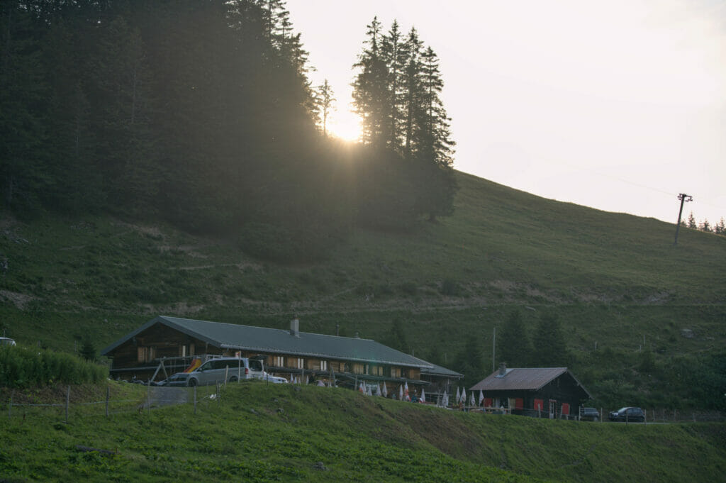
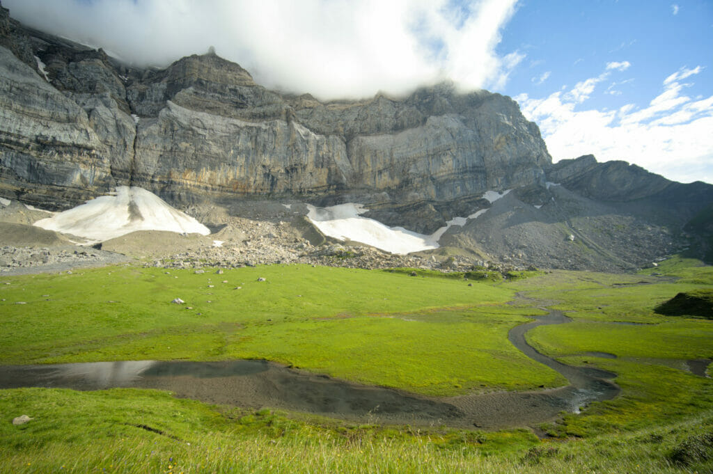
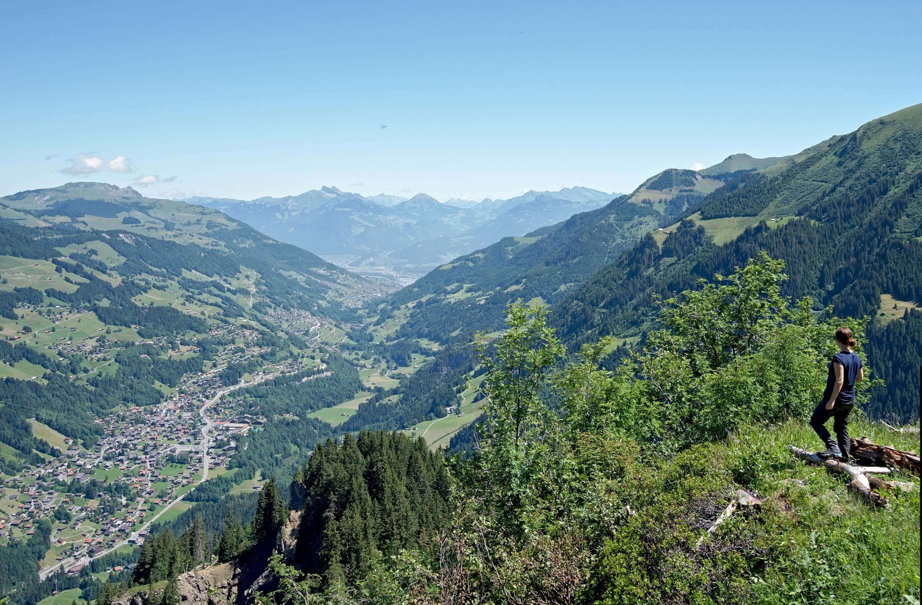
Day 1: Barmes (or Champéry) to Susanfe
For this first day we accepted the kind offer of Catherine from the “petit Baroudeur” who proposed to drop us off at the Barmaz plateau (which is also called Barmes). Benoit knew the area from having already climbed in the area but for me it was a discovery.
In a short 20 minutes drive from Champéry on a winding road we arrive on a small plateau that seems almost frozen in time. Two canteens and a few wooden houses, and nothing more! Oh well… of course there is also:
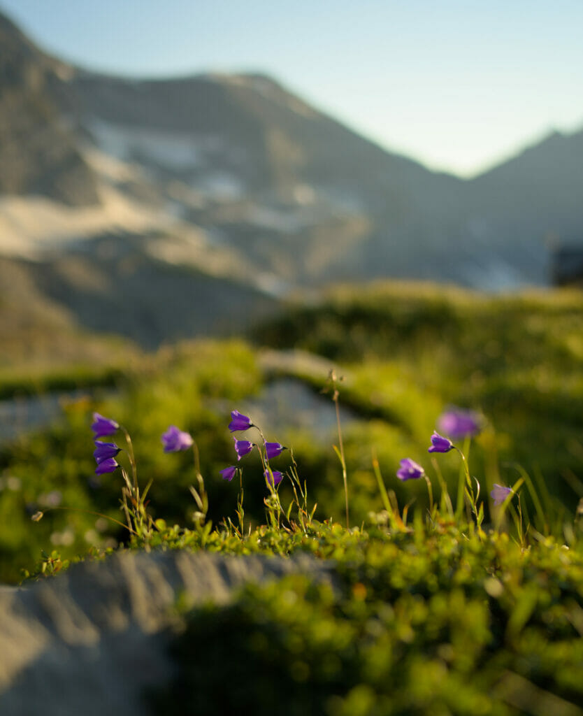
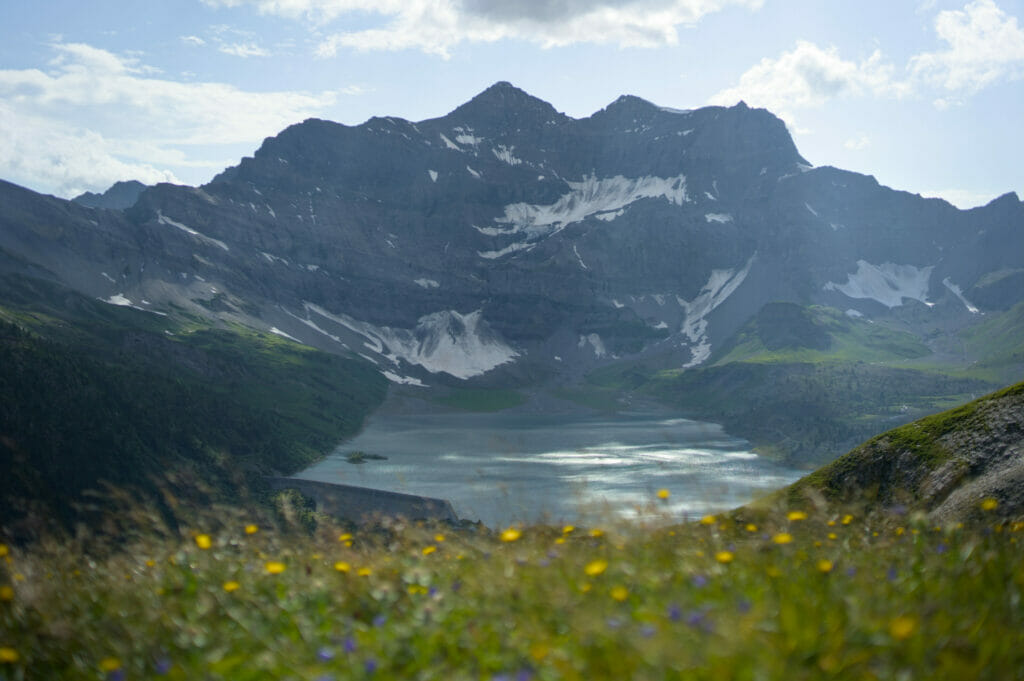
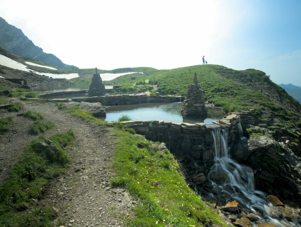
A spectacular panorama of the Dents Blanches and Dents du Midi!
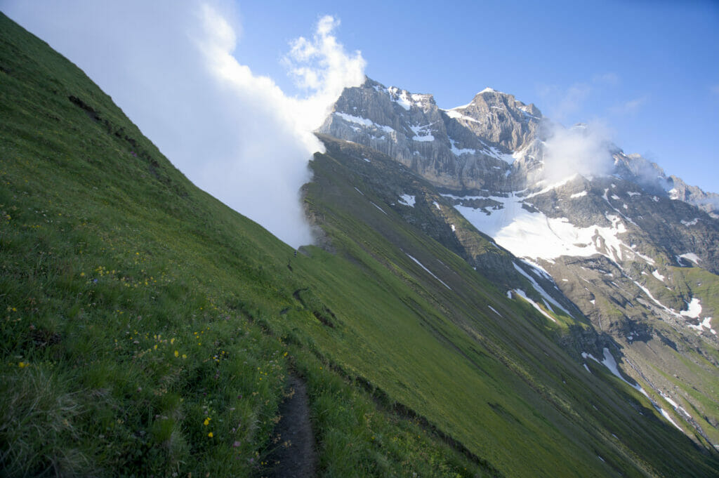
In short, it was after a good coffee on the terrace to Olivier who runs Barmaz’s canteen that we set off. The hike begins gently along the slopes of the mountains until you reach the charming little refuge of Bonavau. Not yet tired, we decided to continue our journey, even if we have to admit that the pretty terrace was pretty tempting…;)

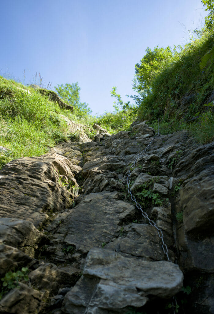
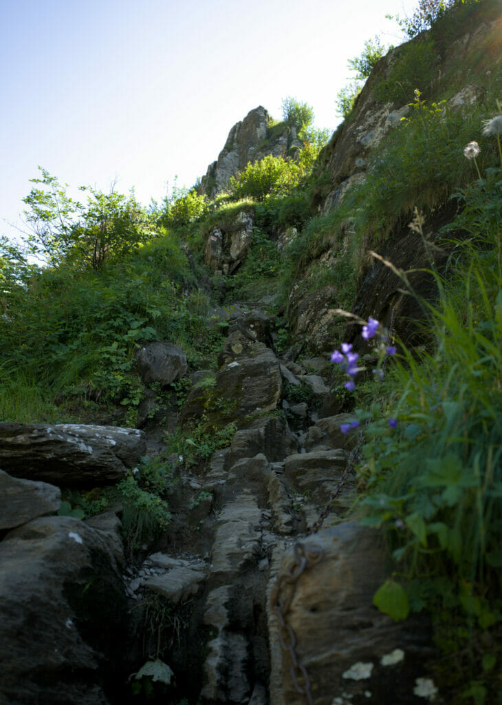
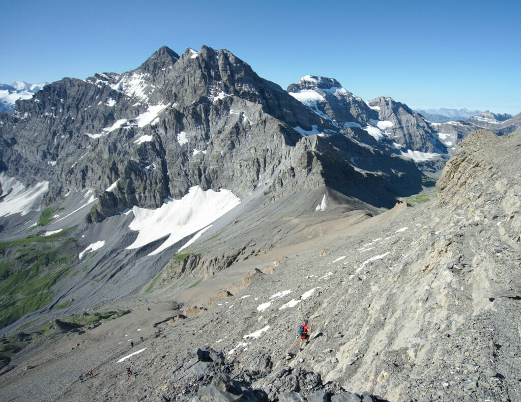
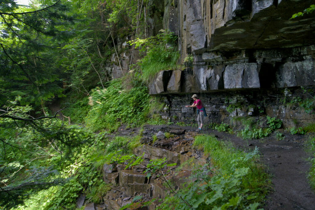
Passage of the Pas d’Encel
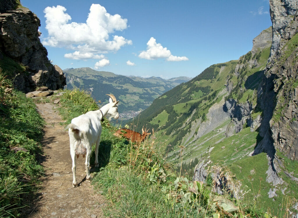
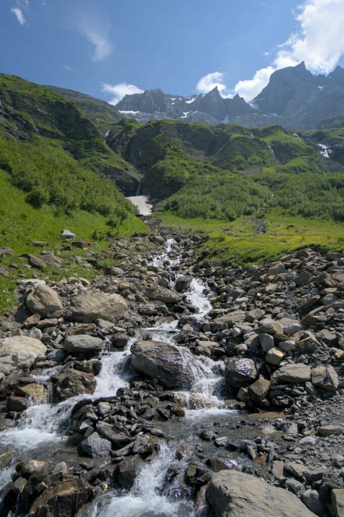
Shortly after we arrive at the famous Pas d’Encel… I say famous because I had heard lots of stories on this passage, which from what I had heard, was really steep and impressive. So to tell you the truth, it was not tha bad, really!
It’s steep and with my fear of height I did not particularly linger to admire the panorama, but frankly it was ok, even for someone prone to vertigo like me!
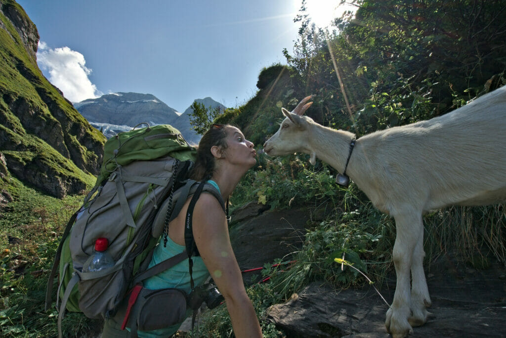
Well then maybe I tell you that, because, as soon as we got to the top. we came across a herd of little goats, each one more adorable than the next! And all my attention was focused on them! 🙂
In fact, one of these young ladies must have particularly liked my sweaty skin, because I got licked from head to toe. Yummy! Hahahaha
Towards Susanfe hut
Once the Pas d’Encel is behind us, the ascent continues quietly through magnificent pastures. The last 300 meters of elevation get by super quickly because the landscapes are just amazing.
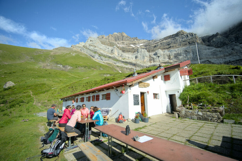
Once at Susanfe’s hut, we started by having a little drink on the terrace. Personally, I think that’s how all hikes should end!
While Benoit left to explore the glacier area in front of the hut, I had settled comfortably on a chair and I was getting to know other hikers who had come to spend the evening here.
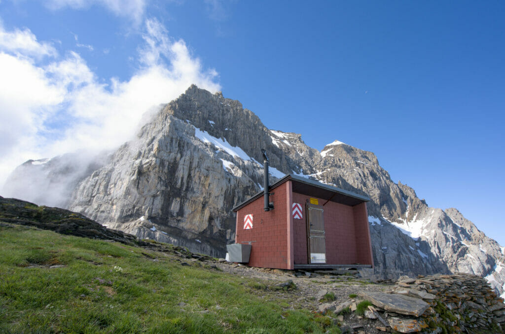
the beautiful Susanfe Hut
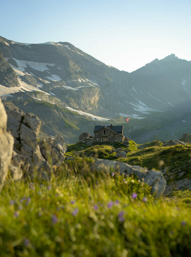
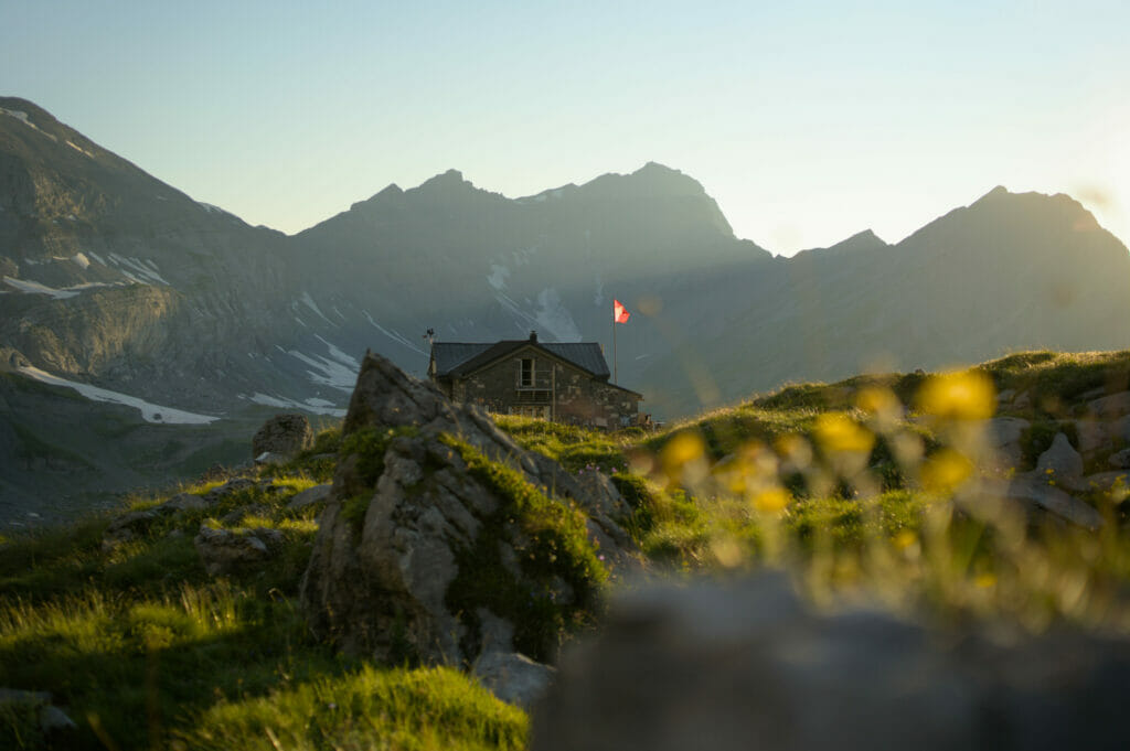
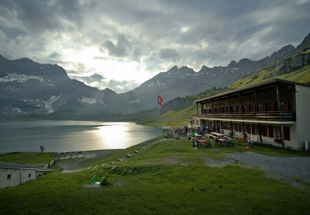
Susanfe hut is really one of those hut where you feel good… Located at the crossroads of the tour des dents blanches, the tour dents du midi and the tour du Ruan, the hut is a meeting point for hikers. The atmosphere, the decoration and super warm welcome make this place a small oasis in the Swiss Alps.
Fabienne (not me) is the keeper of this amazing hut. She’s such an amazing person (I promise I am not only saying this because we share the same name). Moreover, the 2017 season will mark her 10th year spent up there! We strongly recommend you to come by and say hello! promise you won’t be disappointed! 🙂
Hike from Barme to Susanfe
- Distance: 7,3km
- Elevation gain: 874m
- Elevation loss: 279m
- Duration: about 3h30 hiking time
Susanfe hut

- Price: 70 CHF / person for the night in a dormitory including evening meal and breakfast.
Possibility to book a picnic for the next day at 15 CHF. - The hut: No shower or electricity (possibility to charge your phone though) and the toilets are outside (but ultra clean!), but let’s be honest that’s not why we come…. The atmosphere, the panorama, the food, the homemade bread and Fabienne the guardian are the real reasons to come and discover this jewel!
- More information : Susanfe hut
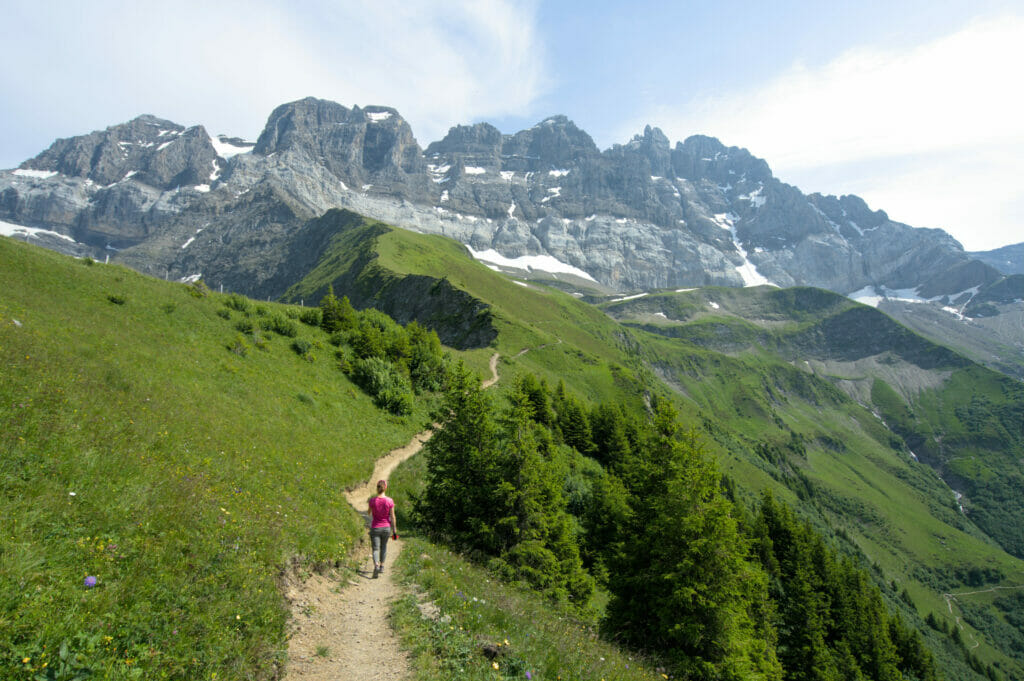
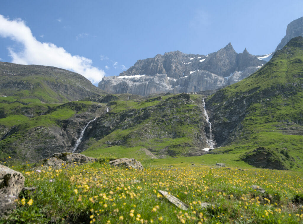
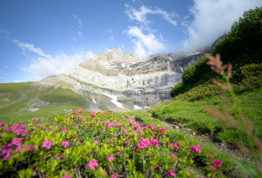
Day 2: From Susanfe to Salanfe via the Haute Cime
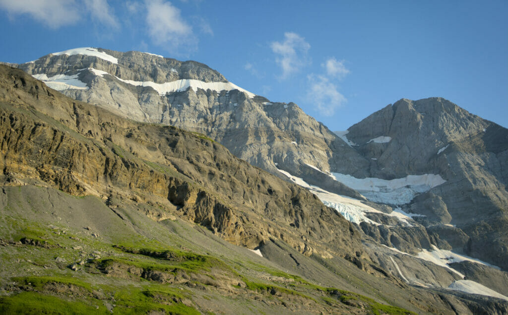
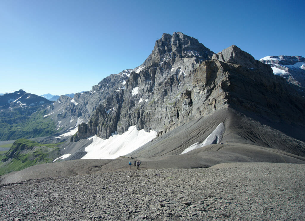
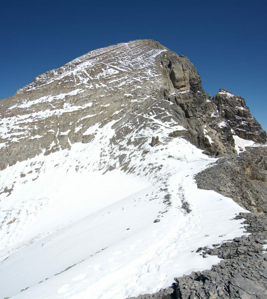
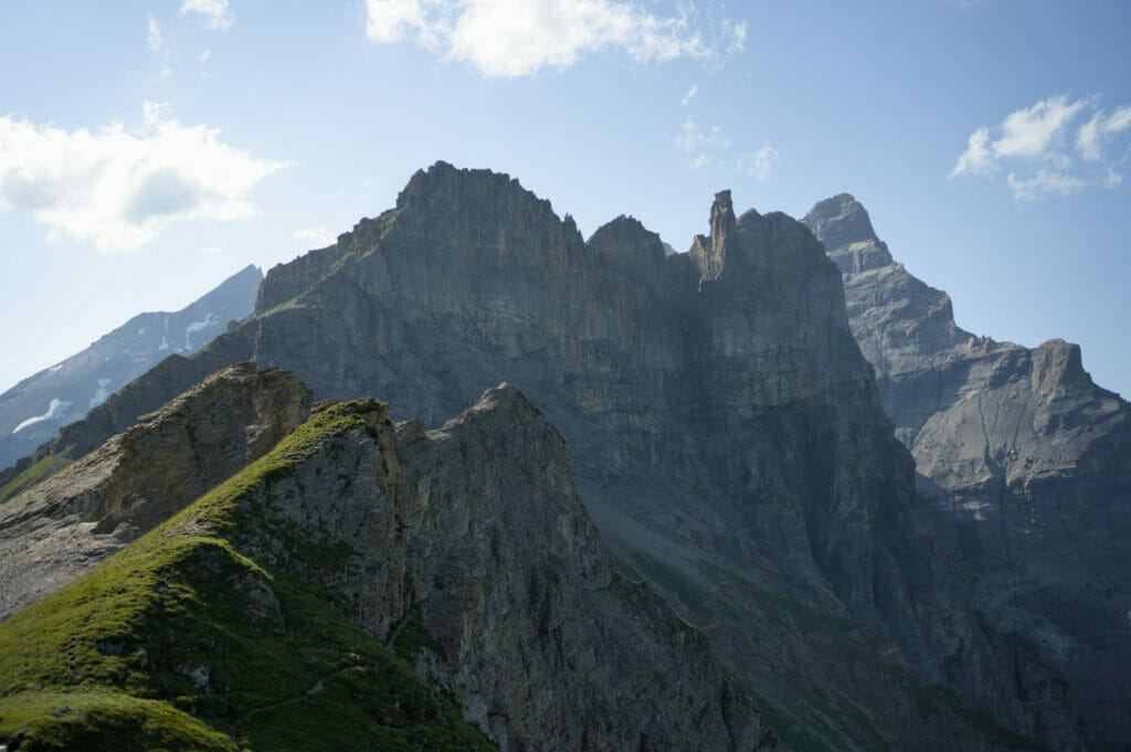
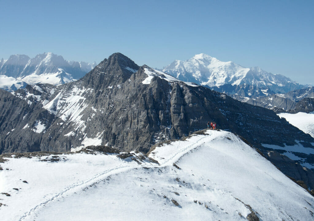
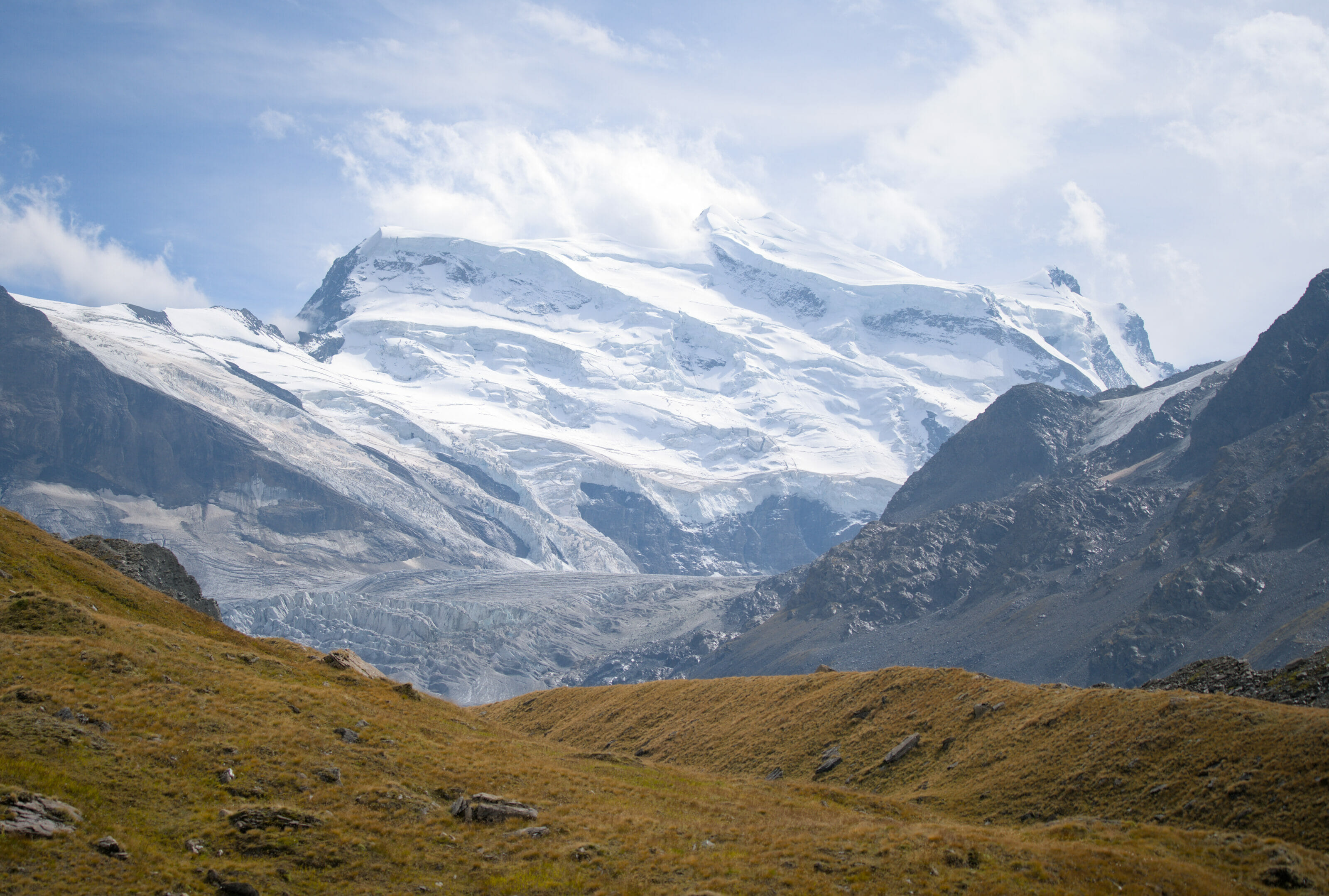
The next morning we started the ascent towards Susanfe Pass early in the morning. First to hike in the shade, but also because we knew that the most difficult part would wait for us once we got to the pass: the Haute Cime (the highest peak of Dents du Midi)
Benoit had already climbed the Haute Cime twice and he kept telling me about the incredible panorama we had from the summit. In other words, I was super motivated and I had told myself that these 755m of elevation gain from the Susanfe pass should not be that difficult and that I, too, would climb on the highest peak of the Dents du Midi (3257m).
It is therefore in great shape that we arrive at about 9 a.m. at Susanfe Pass. There, I carefully fix my backpack on a pole (well yes, I wanted to be as light as possible to go up there).
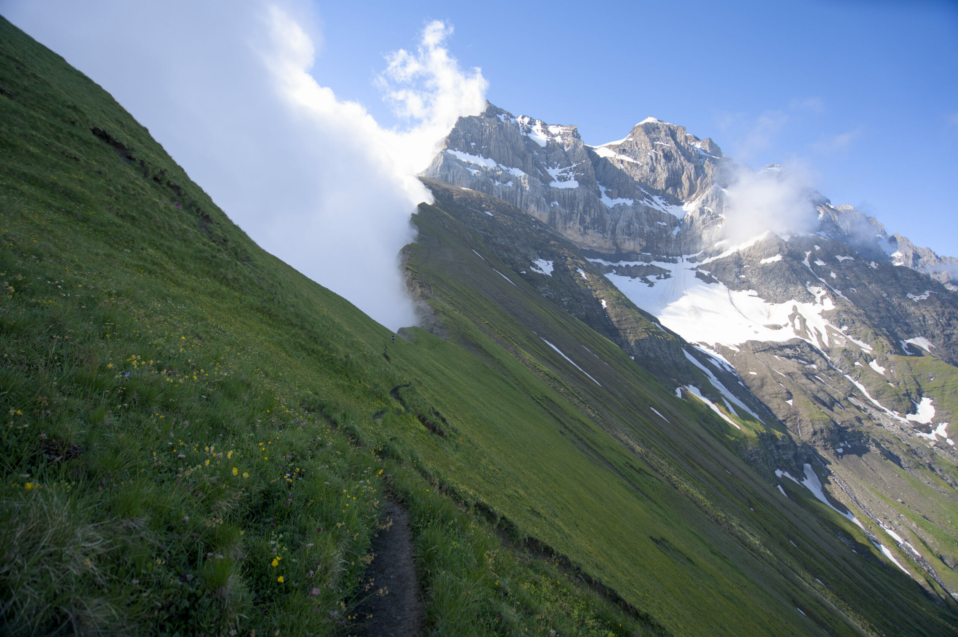
The Susanfe Pass
The atmosphere at Susanfe Pass is incredible, it’s like being on the moon! Have a look:
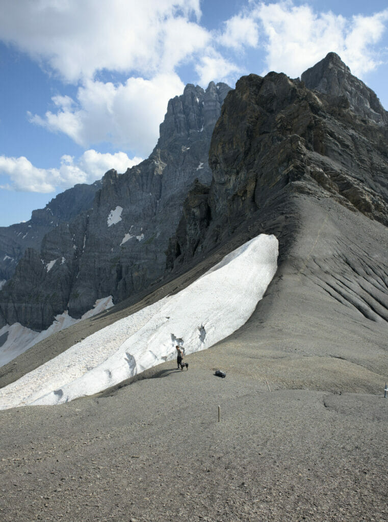
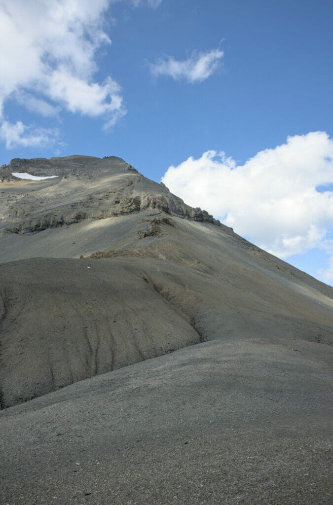
The beginning of the climb is going rather well. It’s steep, but we have a good pace. The beginning of the path is quite clear and it is relatively easy to find your way around, but that’s at the beginning.
Climbing to the top of Haute Cime: beware of vertigo
After a few hundred meters the trails of the different hikers begin to fade and we wonder more and more where we had to climb. The slope becomes steeper, the path narrower and suddenly we were in a narrow path where with the void under us. We quickly realized that we had made a mistake and that instead of taking the “path” we had taken a few meters of a small trail used by climbers. In short, we had to turn around and return to the trail.
That’s when I had the great idea to look towards the pass. When I saw the slope I began to seriously wonder how I was going to get down from there… My legs started to shake, tears started to come. It was over for me…
I’ve never really understood the relationship I have with the void… Sometimes everything goes well, and sometimes well… nothing is going well anymore! That day was one of those days. I was completely paralyzed at about a third of the way to the top.
Benoit comforted me and after a few minutes it was getting better again, but it was obvious that I wasn’t going to make it to the top of Haute Cime. Benoit came back with me to the point where the path was clearly visible again.
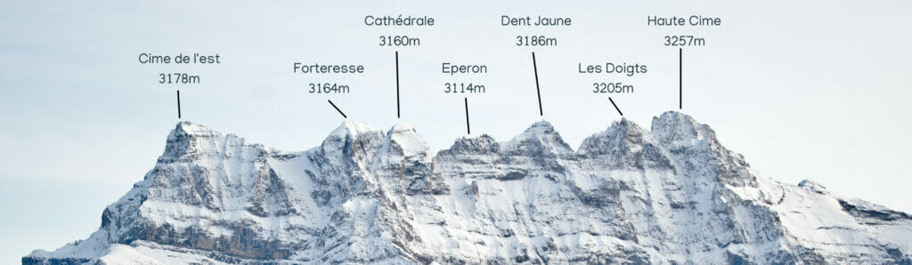
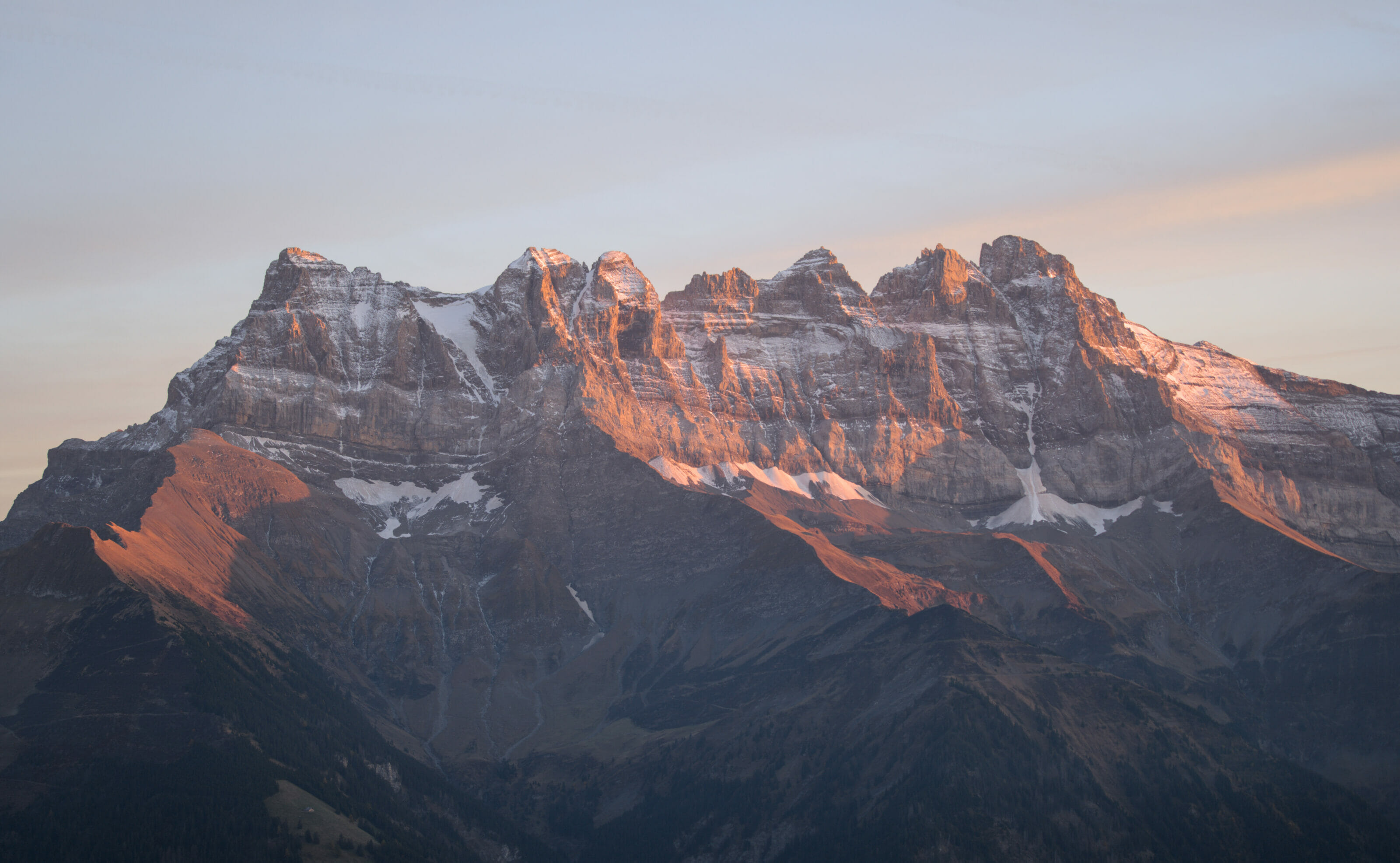
The Haute Cime, highest peak of Dents du Midi
While I was quietly going down to get my bag back, Benoit continued climbing alone towards the highest peak of the Dents du Midi.
He will probably tell you about his climbing another time (note: you will find the blog post with detailed infos to climb the Haute Cime below), but in the meantime here are some pictures of the summit…
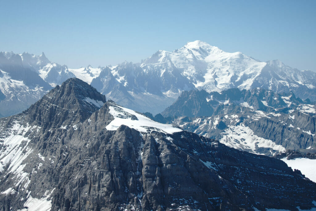
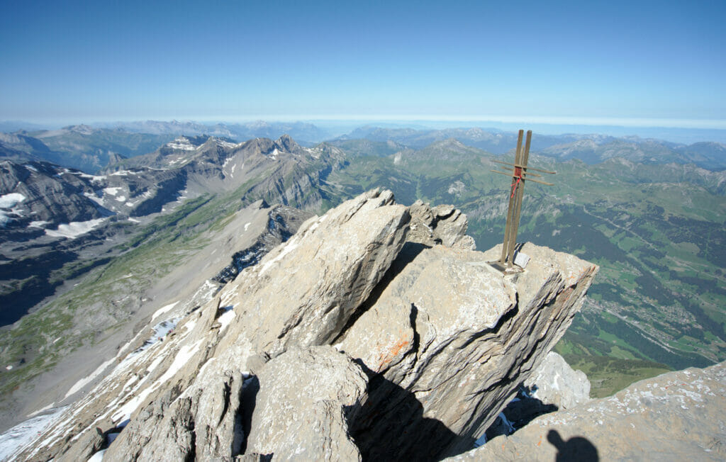
When I see these pictures, I think I really missed something. Who knows, maybe with more practice, I’ll feel more confident with the void and I’ll try it again… But not right away…. Already when he had climbed to La Dent de Morcles (which are just next to the Haute cime), I got to the exact same conclusion…
Update 2020
Benoît climbed up to the top of the Haute Cime for the third time while I was working at the Susanfe hut during the summer of 2020. He took the opportunity to take a few more pictures and write you a complete blog post about this climb.
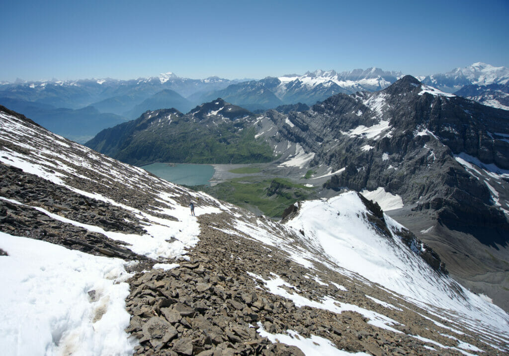
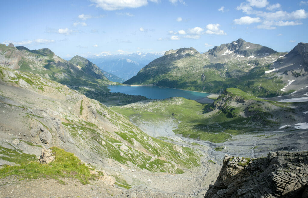
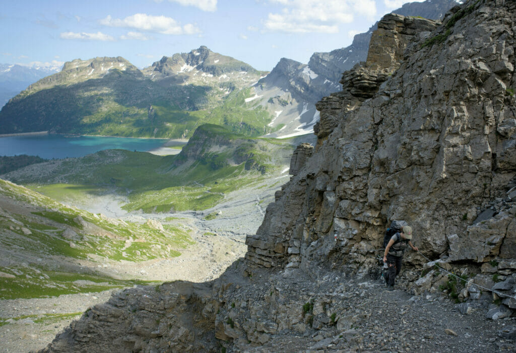
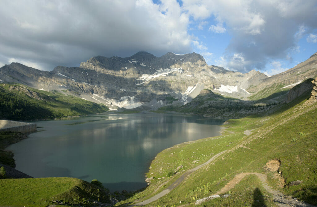
Descent towards Salanfe Lake
Once back at the pass, I started the descent alone towards Salanfe Lake. The descent is not very difficult but it is still pretty steep; I feel the weight of my backpack in the knees and my stomach was rumbling pretty loudly (needless to say that most of my food was on its way to the Haute Cime in Benoit’s bag) 🙂
After 2 short hours I arrived at the Salanfe guesthouse. It was barely 2pm, but with the little adrenaline rush on the Haute Cime, I already felt like I had spent quite a long day…. I spent the rest of the afternoon strolling around on the terrace, chatting with other hikers while waiting for my little husband to return.
Hike from Susanfe to Salanfe (Including the ascent to the haute cime)
- Distance : 11,4km
- Elevation gain: 1200m (about 450m without the haute cime)
- Elevation loss: 1500m (about 700m without the haute cime)
- Duration: about 6h30 hiking time (3h-3h30 without the haute cime)
Salanfe Guesthouse
- Price : 66 CHF per person in a dormitory with half board. 91 CHF per person in a private room with half board.
It is possible to book a picnic for the next day for 15 CHF. - Lodge: Super well equipped with electricity, hot shower and even mobile network if you go up to the chapel. The beds are cosy and the food is excellent!
- More information : L’auberge de Salanfe
- Another hike we did in this area is described in this article
Day 3: From Salanfe to Mex through the Jorat pass
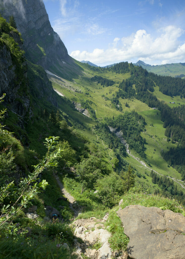
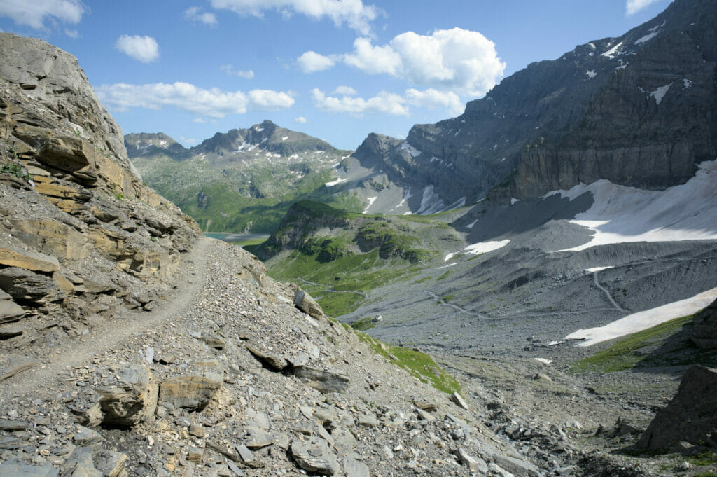
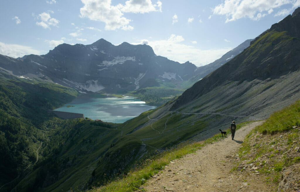
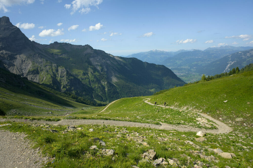
After 2 days of dream weather, we unfortunately woke up under the rain. The forecasts for the day were not really good, but since we knew we had a very small day ahead of us, we found the motivation easily. We took out our rain jackets and hiked to the Jorat Pass.
As we climbed, the rain stopped falling and we were even blessed with a few rays of sunshine! For once, the forecasts were wrong for the better good, and we didn’t complain! 🙂 Especially since from the pass the view of the Salanfe lake is worth the look!
Note: the sunny pictures you see below were taken in 2021 when we passed by again
Descent from the Jorat pass to Mex
Once at the pass, the less funny part of the day began…. 1144m of descent towards Mex! With the weight of our bags the descents are always a little rough, especially for the knees. As we moved forward, the sky became clearer.
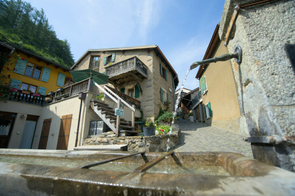
We arrive at the Auberge de l’Armailli at 1pm where we are welcomed by Sébastien and Guillaume. Guillaume is the only farmer in this small village of 154 inhabitants, while Sébastien, a naturalist biologist born in Geneva, came to Mex out of love for the region but above all, out of a passion for animal photography.

 An extraordinary encounter in the mountains
We will spend the rest of the day with Sébastien who made us discover with passion his village but also his small gallery that he has just opened. In this place that he affectionately calls “The Cave” he exposes some of his most beautiful pictures. All his photos were taken in the region and tell how this passionate person hikes the trails and slopes not so frequented by other hikers to capture shots of these animals.
If you do pass by Mex, we strongly recommend you to come and have a look at his gallery. There is no real opening time: if Sebastien is there it is open…. Otherwise you have to come back!
To discover some of these pictures it is over here
A little later we will be joined by Alexandre Gex, a native of the village and a mountain guide by passion. We could spend hours talking to you about this day, so much we left under the charm of this small village but also with our heads full of wonderful memories thanks to these beautiful encounters. But we’ll tell you about these incredible characters in a future article!
Hike from Salanfe to Mex
- Distance: 9,4km
- Elevation gain: 436m
- Elevation loss: 1144m
- Duration: about 3h30 hiking time
L’auberge de l’Armailli
- Price : 30 CHF per person per night in dormitory. 65 CHF per person for half board.
- Opening : All year
- Auberge: The guesthouse has only dormitories, but they are spacious and open onto a pretty little balcony. Kitchen at your disposal.
- More information : L’armailli
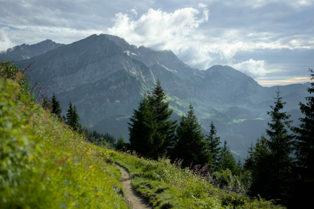
Day 4: Mex to Anthèmes
Note: again, the sunny pictures you’ll see below are from 2021 when we did the tour a second time 😉
On paper, it was our biggest day and, according to the weather forecast, it was the rainiest. A combo that pushed us to set the alarm early and leave once the sun was out! (well… even if we didn’t see the sun)
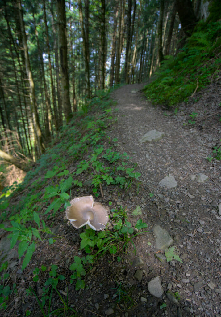
The day begins gently with a short climb through the forest leaving the village of Mex before the trail plunges into the forest. Knowing that our final destination is 1000m higher in terms of altitude these almost 500m of descent are a bit of a pain 😉 . Well, yes, we know we will have to climb them a little bit later.
After a good hour and a half of walking we arrive at a sign indicating that we have 2 alternatives to reach Les Jeurs, our next stop.
- The classic path
- The direct path
A small note mentions that it is better to take the direct path in case of heavy rains… Given the forecasts for the coming hours, it was decided to opt for the so-called “direct” route.
towards the sports centre of Les Jeurs
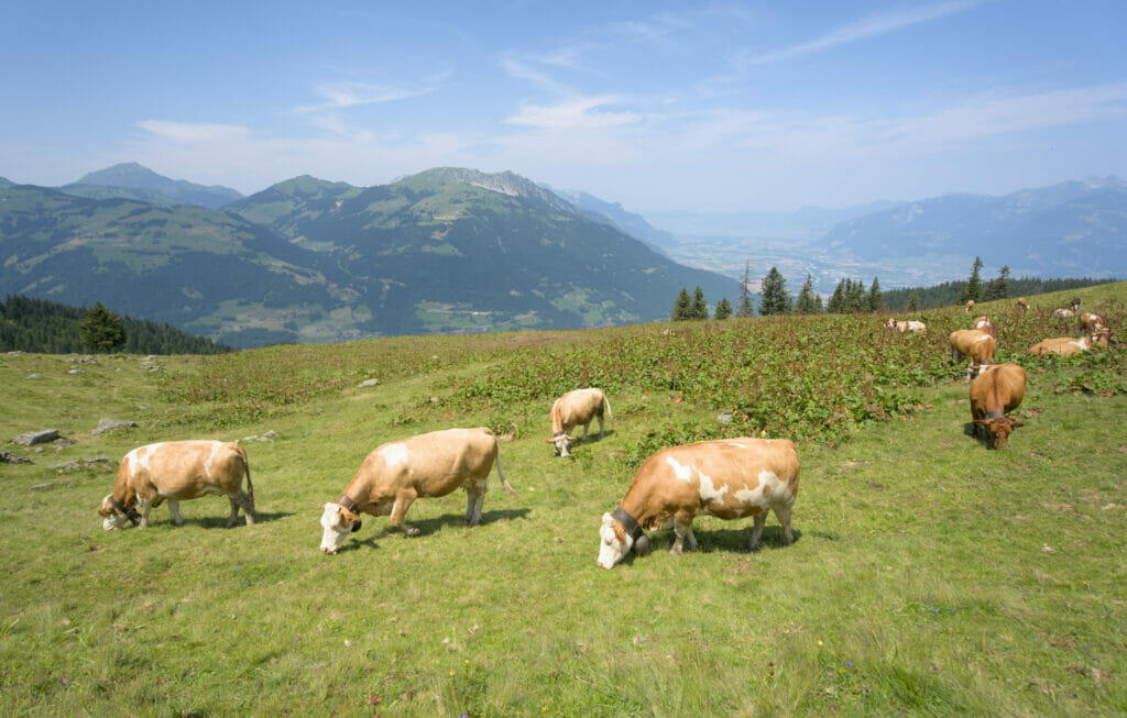
Well, I quickly understood what they meant by “direct”. It climbs almost without detour in the mountain pastures in the middle of the cows.
We were in a thick fog and did not see at 3 meters which gave a very special atmosphere. We hear the cowbells, we feel that they are all close but we do not see them… And suddenly: PAF, they are standing 2 meters away looking at us with their funny face.
After 3h30 of walking and completely soaked we finally reach the sports centre of Les Jeurs where we are welcomed by the son of Fernand Jordan, the creator of the Dents du Midi tour.
Bernard Jordan, son of the tour des dents du midi founder
Bernard grew up in the area and knows all the local stories like the back of his hand. So it is around a good glass of red wine and a cheese/meat platter that he tells us a little more about the history of the tour but also about the anecdotes of the region.

It is now possible to sleep there on the Tour des Dents du Midi route. With the Salanfe hut it is the only place that offers private rooms with hot showers on the tour. more information
After a small aperitif we set off again in the rain towards our next stop: the Chindonne hut.
The journey between Les Jeurs and Chindonne takes only 15 minutes, but it was more than enough to get completely wet in the rain. We might as well explain that we were delighted to be able to settle down in a warm place and enjoy an excellent homemade burger!
The Chindonne hut is accessible by road but it is also located on the Tour des Dents du Midi route. You can spend the night in a cosy dormitory or eat in the nice restaurant (or both).
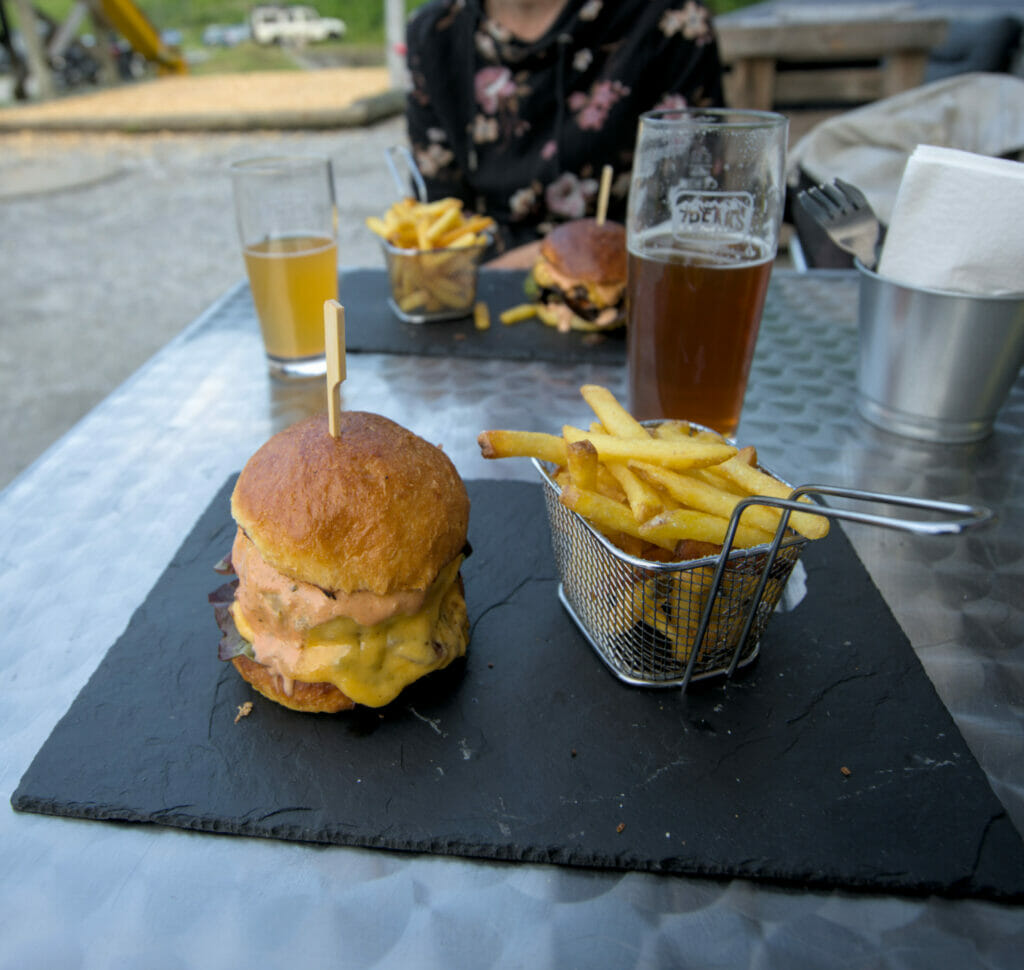
For our part, it was only a short break to have a good meal and let the rain pass a little.
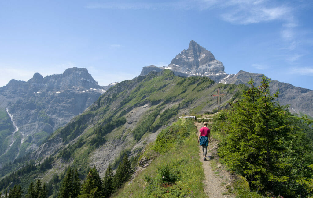
Last effort towards Anthème hut
When we start walking again, the sky is still threatening but the rain has stopped. That’s good because we still have about 3h30 of hiking left before reaching our final destination: the Anthème hut.

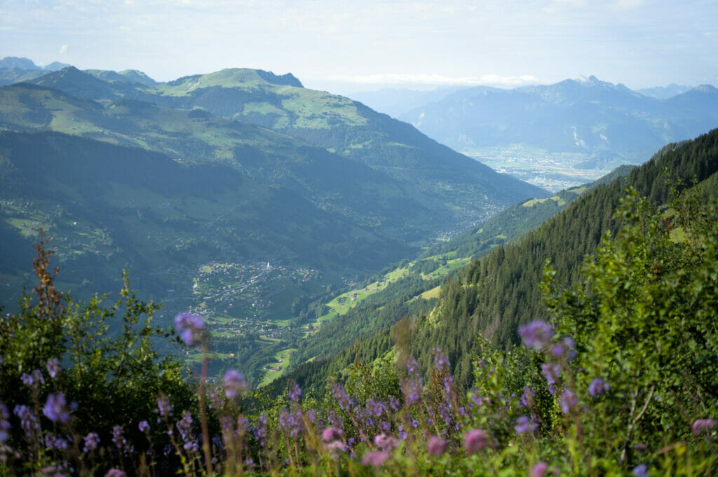
The path between Chindonne and Anthème is very pleasant because the remaining 700m of elevation gain are spread over about ten kilometers which means that we end up more or less advancing at a good pace on a mild slope (at least that’s what Benoit tried to convince me of).
On the way we enjoy a magnificent panoramic view of Lake Geneva! For us the landscape was a little cloudy but we can easily imagine what it can look like on a sunny day! (here is what it looks like when we passed by again in 2021 😉 )
While we were telling ourselves that this weather wasn’t so bad after all, Mother Nature decided to give us a bit of a challenge. That of pouring litres and litres of water on our heads and testing the waterproofness of our rain jackets.
Hmmm…. Result? Even my so-called Gore-Tex shoes decided to let the water in and we reached the Anthème hut totally soaked around 6:30 pm.

But rest assured, the little wet misadventure was very, very quickly forgotten! At Anthème we were very well received by Pierrot who had prepared a special seasonal game menu and a superb dessert: an apricot souffle!
We might as well explain that it is not every day that we eat so well, and even less in a hut! But then, we were really spoiled!
Hike from Mex to Anthèmes
- Distance: 24,4km
- Elevation gain: 1741m
- Elevation loss: 843m
- Duration: about 7 hours of walking time
Anthème Hut

- Price : 62 CHF including half board
- The hut: No shower, but there is electricity. The dormitories are spacious and have toilets in the room. The welcome is friendly and the cuisine simply divine (we will not forget this amazing dessert!) 🙂
- More information : Anthème
Day 5: From Anthème to Champéry
It’s a bit hard to get out of the bed the next day…. Being alone in the dormitory, we had an excellent night, very warm under our blankets. But when we open your eyes, we immediately hear the rain falling on the windows of the hut! Ouch….
It is with little motivation that we join Pierrot in the kitchen. But it did not last for long: his homemade little buns quickly put a big smile on our faces! 🙂
While we were trying to motivate ourselves to set off for the 2h30 descent under the pouring rain towards Champéry, Benoit’s phone started ringing. It was Catherine, the manager of the petit Baroudeur in Champéry. She explains that she has a group of 5 hikers leaving for the tour today. Because of the weather, she proposed to move them forward a little and drop them off at the chalet d’Anthèmes located 30 minutes walk from the hut.
“I’ll be there in 45 minutes, you want to meet me there? So I can drop you off in Champéry and you can take a good shower at the Petit Baroudeur…. »
She didn’t have to make her proposal twice. We gathered our things and set off for a 30-minute descent (or rather a slide into the slush). It was with wet shoes and muddy pants that we got into her car. Phew!
But if you want to see what this stage looks like under the sun, here are some more recent images from the summer of 2021. Anthème hut is a real little paradise 😉
Hike from Anthème to Champéry
- Distance: 12,3km
- Elevation gain: 191m
- Elevation loss: 1200m
- Duration: about 2h30 hiking time
Tour des dents du Midi: How many days does it take to complete the tour?
You will have noticed, for this tour we took our time… 🙂
In all we left 5 days, even if in the end we walked 3 days. The first day we started walking around noon, in Mex we enjoyed the afternoon with Sébastien, Guillaume and Alex and the last day we will have walked only 30 minutes…

After that, we must also admit that for the moment we did not do the hike in “light” mode…. As we wanted to bring you back lots of pictures but also to make a video, we left with almost 13kg of computer equipment in addition to the hiking equipment. This equipment was obviously distributed in a completely egalitarian way (understand by this that Benoit must have had 8.5kg and I 4.5kg hihihi)
In short, if you ask yourself how many days to select, I would say that everything depends on your physical fitness. We have a few suggestions for itineraries to help you get an idea.
Of course these are only suggestions, the tour can be done in any direction with the stages you want.
For distances and elevations you can refer to the map above in this article or find information on the tour des Dents du Midi website
2 Days :
For experienced hikers and sports enthusiasts! Personally, it seems like a big deal to me, but apparently it can be done…. If you want to climb the Haute Cime we would advise you something like:
- Day 1 : Champéry-Susanfe-Col de Susanfe-Haute Cime- Col de Susanfe- Salanfe-Mex.
- Day 2 : Mex-Chindonne-Anthème-Champéry.
3 Days :
The option for athletes including the Haute Cime:
- Day 1 : Chindonne-Anthème-Susanfe
- Day 2 : Susanfe-Haute Cime-Salanfe
- Day 3 : Salanfe-Mex-Chindonne
3 Days for regular hikers but not necessarily great sportsmen
it’s possible too, but then I’would remove the Haute Cime. So the itinerary would be more like:
- Day 1 : Chindonne-Anthème-Bonaveau
- Day 2 : Bonaveau-Susanfe-Salanfe
- Day 3 : Salanfe-Mex-Chindonne
4 days or 5 days:
Accessible to all! We did the tour over 5 days (see above our itinerary) and it is really possible for everyone to do it! The distances are not too long and we really have time to take advantage of breaks, arrive early at our accommodation and enjoy the atmosphere of the huts.
Proposal if you prefer to do it over 4 days:
- Day 1 : Mex-Chindonne-Anthème
- Day 2 : Anthème-Susanfe
- Day 3 : Susanfe-Haute Cime-Salanfe
- Day 4 : Salanfe-Mex and visit the village of Mex
You can find other examples of possible routes on the site of the association of the tour des dents du Midi. There are as well different alternatives (the ascent of the Haute Cime is one of them) which allow to extend the fun a little bit, like for example
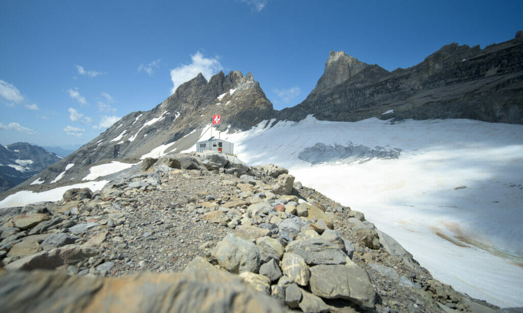
- Climb to the Dents du Midi hut from Salanfe (good alternative to the Haute Cime as it is a little less difficult)
- the ascent of the Haute Cime des Dents du Midi
- Climb to the Dent de Valerette and to the Chalin refuge between Chindonne and Anthème. An aerial and less traveled itinerary which offers magnificent landscapes
- Climb to the aiguille de Mex
- Pass by the very nice lake of Soi between Chindonne and Anthème
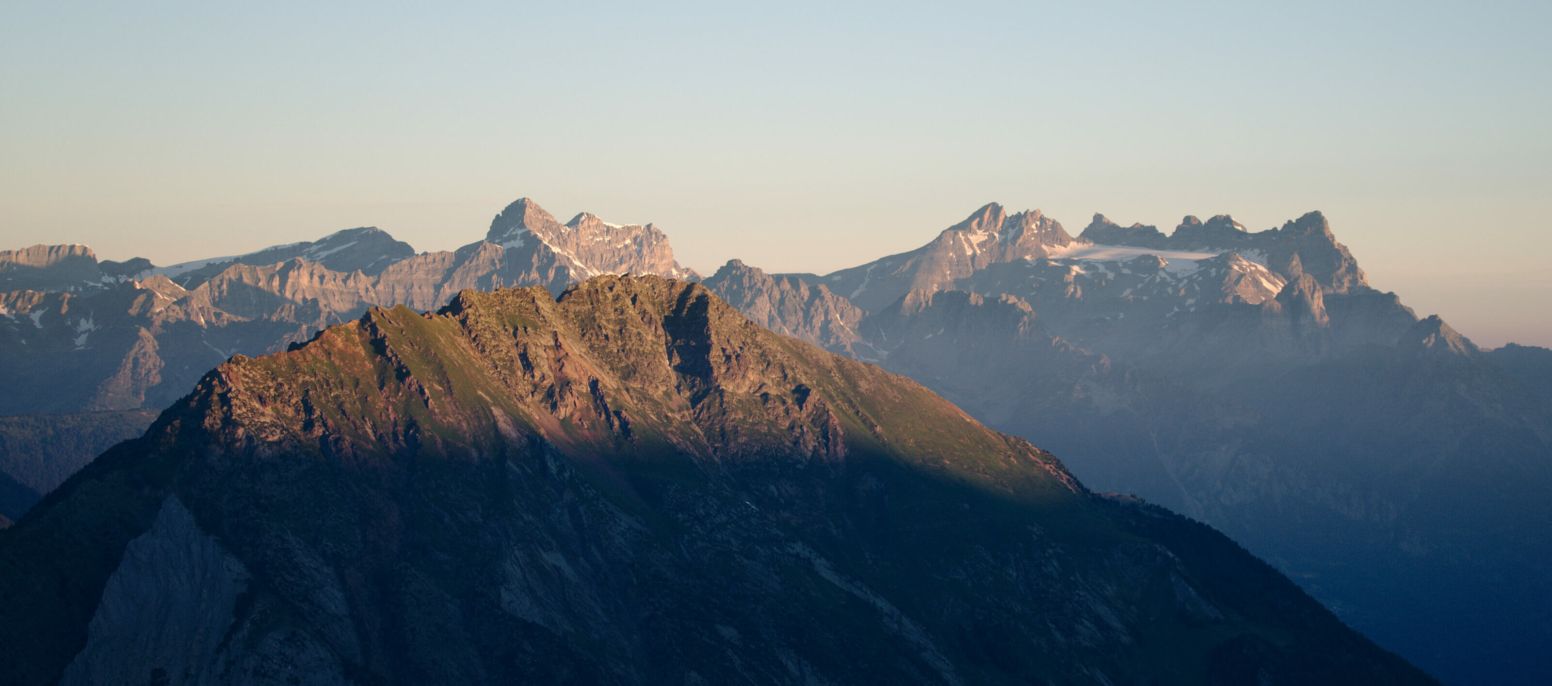
Here are some pictures of all these alternatives to make you want to try one or the other and to extend your tour of the Dents du Midi
We warmly thank all the people who made this tour possible and for their outstanding welcome! This hike was organized in collaboration with the association of the tour des dents du midi, the Champéry and Morgins tourist boards.

So I am very curious: did you consider dents du midi or dents blanche a better hike? Which one do you recommend if you must choose one to do this summer?
I Em,
I would say it depends on if you have some hiking experience or not. Dents Blanche is more exposed and difficult (difficulty T3-T4 in some places) and landscapes are wilder as you stay higher in the mountains. Dents du Midi is much easier but is less alpine (even if you can hike the Haute Cime to spice it up). I would say that if you are an experienced hiker, go for Dents Blanches as it’s going to be more challenging thus more fun. But both are beautiful hikes.
Bonjour,
Quelle est le niveau de difficulté si l’on veut réaliser la tour des dents du midi ?
Faut il avoir une expérience en alpinisme ? Devons nous être encordées ?
Niveau : bons randonneurs
Non non Anne le tour des Dents du Midi est un tour accessible à tous qui ne nécessite aucun matériel d’alpinisme. Il y a juste 1-2 passages côté T2-T3 sur l’échelle du CAS (comme le pas d’Encel) mais rien de bien méchant.
Hi, what are the risks related to wild animals. I’ve heard there are wolves around this area? What about bears, etc.? What precuations need to be taken if any?
Hi,
there are no bears in the area. There are indeed wolves, but to be honest it is highly unlikely you’ll see them. There have never been encounters with humans in this area and this is definetly not something you should be worried about. Enjoy your hike!
I have two questions as we plan our tour . I really love your website.
1 – Why did you start in Champery ? Any particular advantage ?
2- Mex to Antheme walk seems longer than other days . The antheme hut looks awesome so would like to reach it. How did you feel ? Was it exhausting ?
Thanks! Lillian
Hi Lillian,
I just updated the alltrail map in the post as there was a mistake in the Mex to Antheme stage… but yeah this stage is quite long but has less elevation change than the other stages. But imo it’s really doable (but always hard to answer those question as it really depends on the fitness level of people).
For Champery, it’s just easily accessible by train so that’s why we started there
Hi hi ! So we are all booked up and ready but show making Susanafe to Salanfe challenging. Do you see any disadvantage going the reverse , start at Anthème , then Chindonne , Mex, etc ? This could give more time for snow to melt. Any thoughts ? Thanks ! Lilly
Hey Lilly,
I don’t see any disadvantage but yeah this year we have a lot of snow remaining… I think the best is just to call the salanfe or susanfe hut to ask what the conditions are. But I checked on the Salanfe fb page (https://www.facebook.com/aubergedesalanfe) and they say it’s possible to pass taking the winter path instead of the normal trail which is still full of snow
as always – great write up of an amazing trek.
Couple of questions:
[A]: is it safe to assume that it is possible to setup a tent near the refuges?
Not trying to take business away from locals (will be happy to pay) – but to enhance my ‘wild outing’ experience :).
[B] in which month did you go for the hike?
I tried to find the info in the write, but may have missed it.
Hey,
Thanks a lot for your kind words.
Yeah I think next to most of the refuges it would be ok to camp (Susanfe, Salanfe, Antème). They will probably ask you to pay a little something (around 10 bucks I guess) but it shouldn’t be a problem. Plus if you eat or drink something there it’s also nice 😉
For the months, usually you can do the hike from the beginning of July till the end of Septembre, even October sometimes but the refuges will be closed (but if you camp it’s fine)
Hey! thanks for this article, definitely the most detailed one I have seen so far. I know you haven’t done this exact route between Auberge Salanfe and Refuge des Dents du Midi (booked a stay there) but hope you might still have some ideas and can help me here as I couldnt find more info on the internet.
1. So i know it’s a T3 white red white route, well marked and supposedly no dangerous parts. But now looking more detailed on the maps it seems SO rocky (problem is i usually dont hike well on those rocky paths on a slope, honestly could be even similar to you with the void, once I actually froze and need to rest), so now im really concerned if i made the right choice. I know you didnt do this exact one, but maybe you still remember or have some ideas about it?
2. on the map it also indicates a circular hiking route, meaning can do clockwise or counterclockwise. Wondering you know which direction would be easier and manageable.
Hi,
Thanks a lot for your message.
We have not done this part in our original tour, but we’ve done it later on (it’s included in the ebook we published). What are you planning after the Dent du midi refuge? Do you plan to do the traverse to Susanfe? I’m asking, because personnally I found the trail that goes from Salanfe to Refuge des Dents du Midi totally fine (it is indeed rocky, but I personnally had no major issues). The part from Dents du Midi towards col de Susanfe (the direct trail, not the official route which is on the map in this blog post) is however more rocky and technical. We hiked this section with our dog and it was fine (dogs are agile, but in very rocky terrain it can be tricky). If you are not confortable in rocky terrain and plan to go to susanfe, I would maybe tend to recommend to come back down to the lake and follow the “official” trail.
As for the direction, I think it is pretty similar. There are 2 “rocky” parts which can be a bit harder :
– from salanfe lake to col de susanfe
– from susanfe to Champery (pas d’encel)
No matter the direction you’ll have to do one on the way up and the other one on the way down.
Personnally, I don’t mind these parts of the trail anymore (done them multiple times) but generally speaking, people tend to favor the counterclockwise hike to go “up” pas d’encel and then down to the lake.
Enjoy this wonderful hike! And don’t worry too much, it is rocky terrain, but the trail is well marked and there are many people hiking it. 🙂