
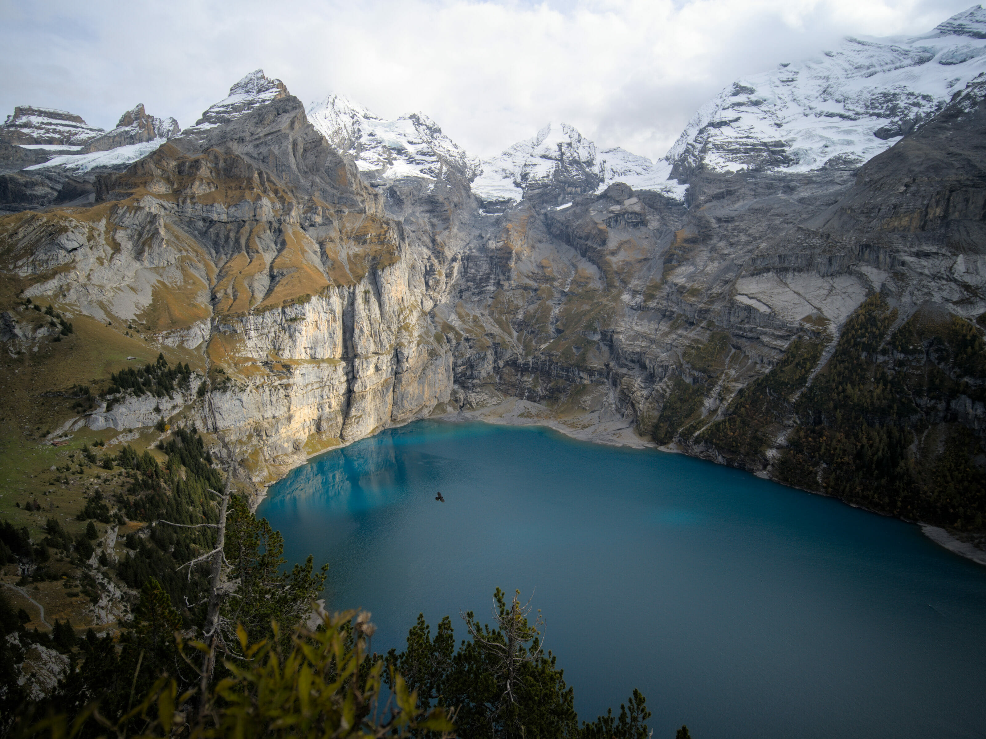
In October 2022, we left for a small road trip in German-speaking Switzerland. After a first stop at the lake Oeschinen and a few days at Lauterbrunnen (places we already knew), we decided to come to Brienz and especially to the Brienzer Rothorn.
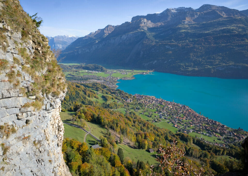
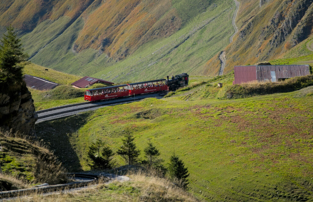
The Brienz Rothorn is a relatively well known excursion place across the Saane. But it’s funny, because in French-speaking Switzerland it’s not so well known… Well, let’s say that I personally had never heard of it, and I think I’m not the only one! 🙂 So no, this spot is not “secret”, but believe us it is worth it! The view on the lake of Brienz and the lake Lucerne is simply exceptional from up there and today we take you for a little steam train-hike combo.
- Brienzer Rothorn Bahn – a unique panoramic steam train
- From Planalp to Chruterepass
- Small detour along the famous Hardergrat
- From Chruterepass to Brienzer Rothorn
- Summit of the Brienzer Rothorn and return to Brienz by steam train
- Information about the hike from Planalp to the Brienzer Rothorn
- Practical information to prepare your hike to the Brienzer Rothorn
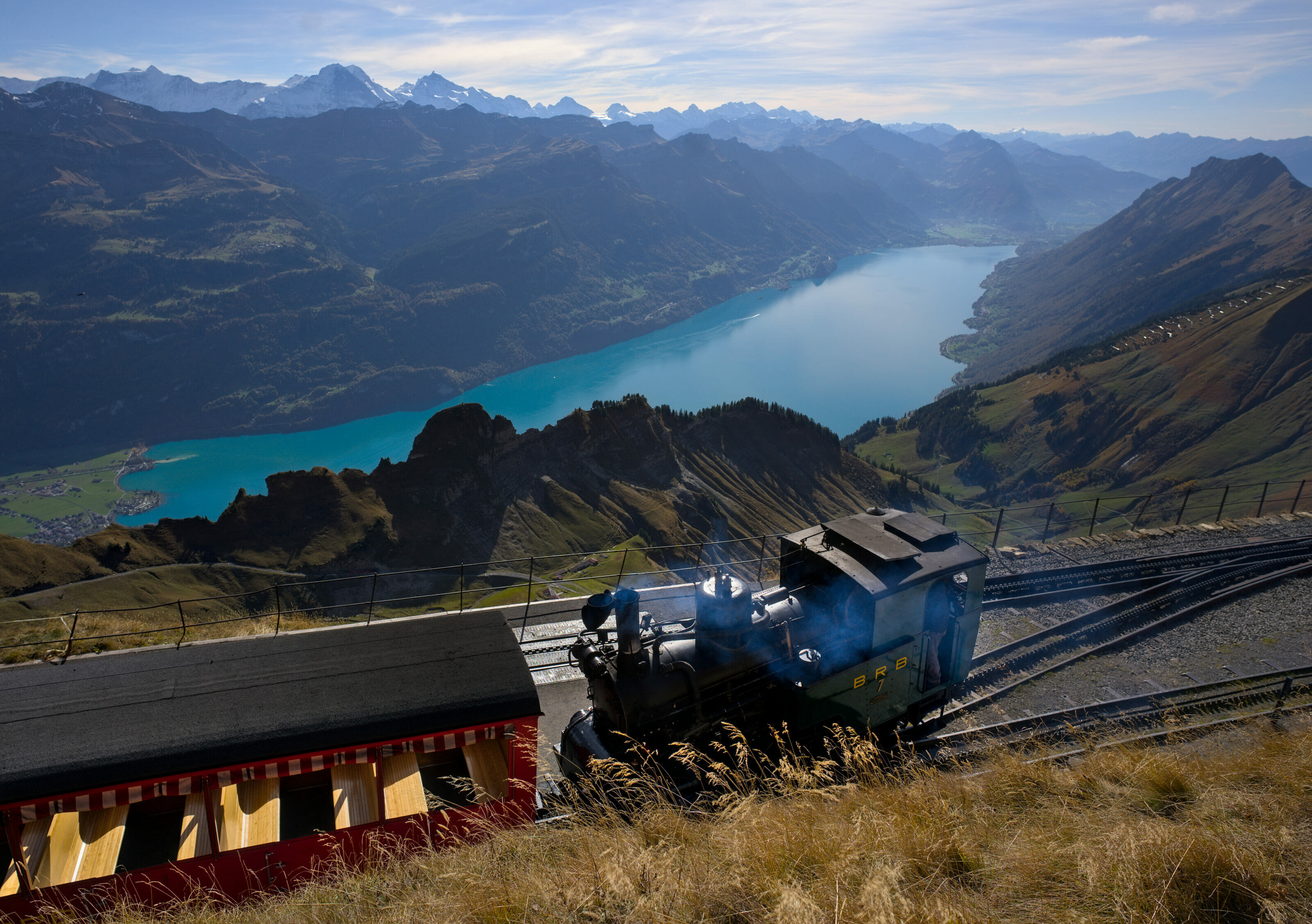
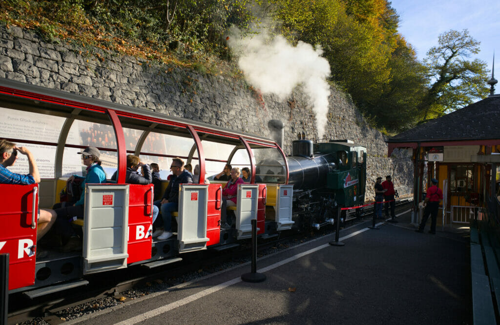
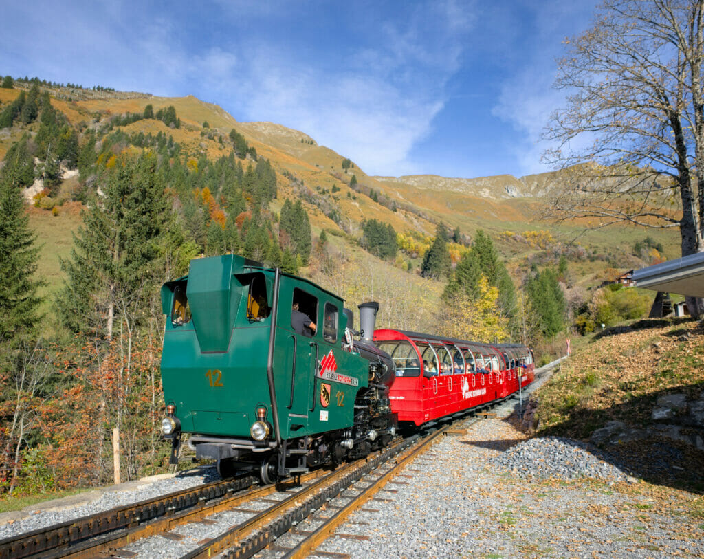
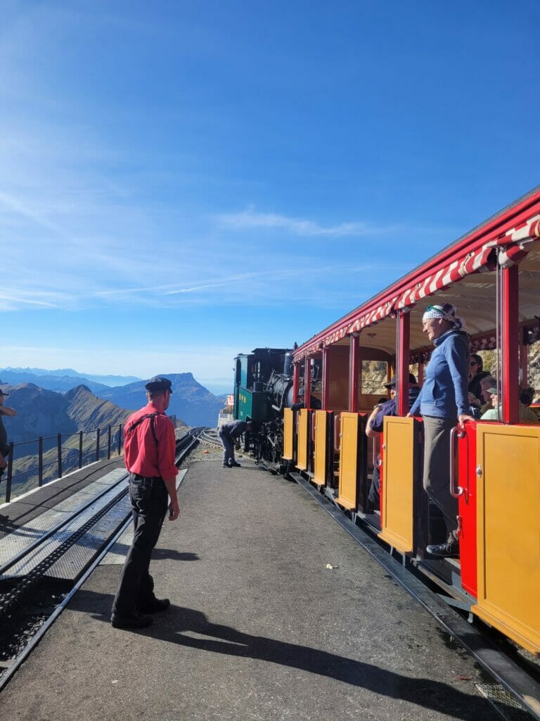
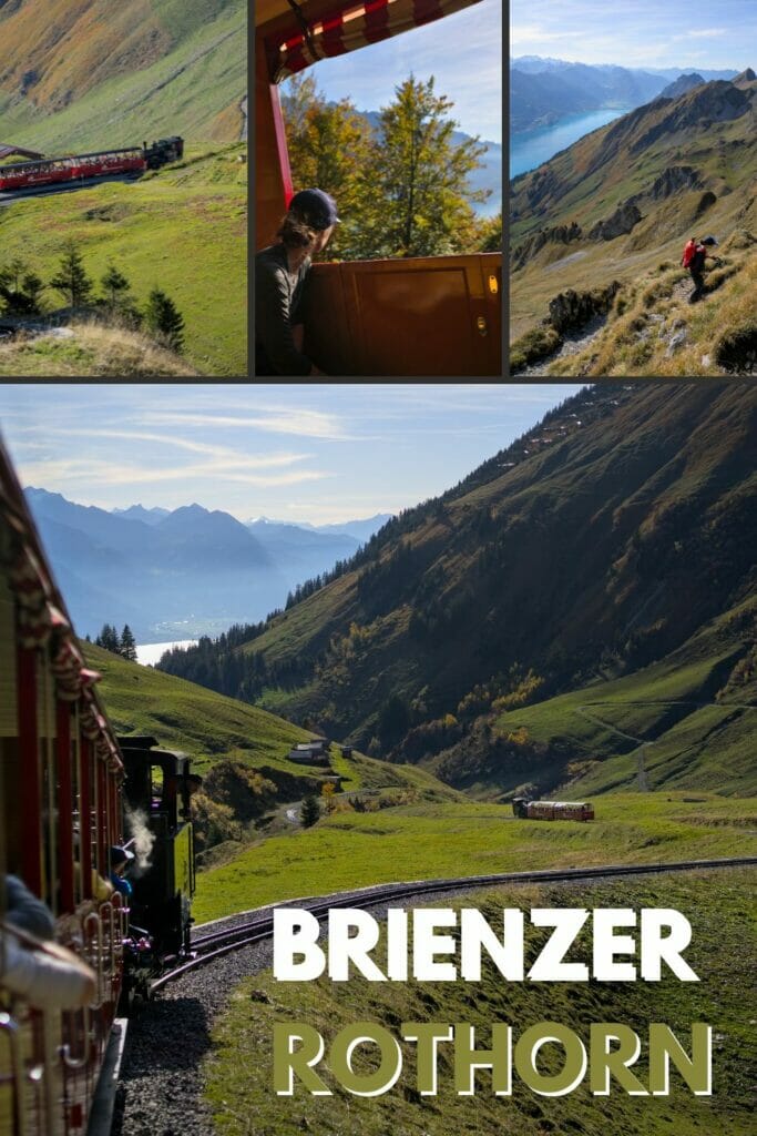
Brienzer Rothorn Bahn – a unique panoramic steam train
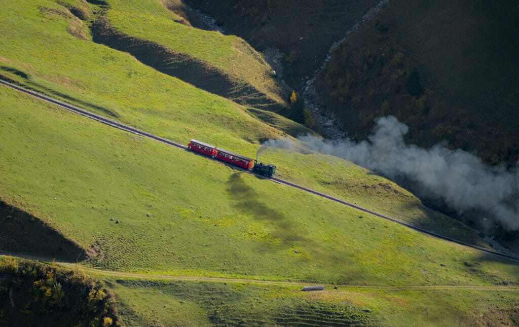
Before I tell you about the hike, let me tell you a few words about the steam train that takes you to the summit. The Brienzer Rothorn Bahn was inaugurated in 1892. Even then, its sole purpose was tourism. The idea was to take tourists to the top of the Brienzer Rothorn and to develop a hostel business. Designed to carry 25’000 passengers per year, the project was not really successful as the first year only had 5000 passengers… Financial difficulties followed one another until the line was closed in 1914 at the beginning of the war.
After the war, the vast majority of Swiss railway lines were electrified. The Brienzer Rothorn line, which remained out of service, “escaped” this fate because it was thought that it would never be restarted.
In 1931, the line was reopened and this time it was a great success. Tourists arrived in droves. In the 60’s, Switzerland experienced a strong development of the cable cars. This means of locomotion makes it possible to arrive much more quickly at the top of the mountains and especially the expenses related to the exploitation are much lower than those to maintain a line of steam railway… To give you an idea, a round trip Brienz – Brienzer Rothorn with a steam train requires not less than 350kg of coal and 2000 liters of water!
At one point it was even decided to destroy the railroad and replace it with a modern cable car. But the inhabitants of Brienz organized themselves in associations in order to preserve this piece of their heritage. Nevertheless, in order to reduce costs, the locomotives were largely replaced by diesel models, more economical and easier to maintain.
To see officially the return of steam it was necessary to wait until 1991 and the creation of the association of the friends of steam traction. Still today, this association is in charge of the maintenance of the tracks and the locomotives.
The Brienzer Rothorn Bahn is today the only rack railway operated by a steam locomotive in Switzerland.
From Planalp to Chruterepass
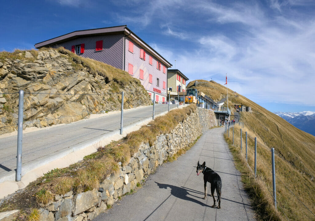
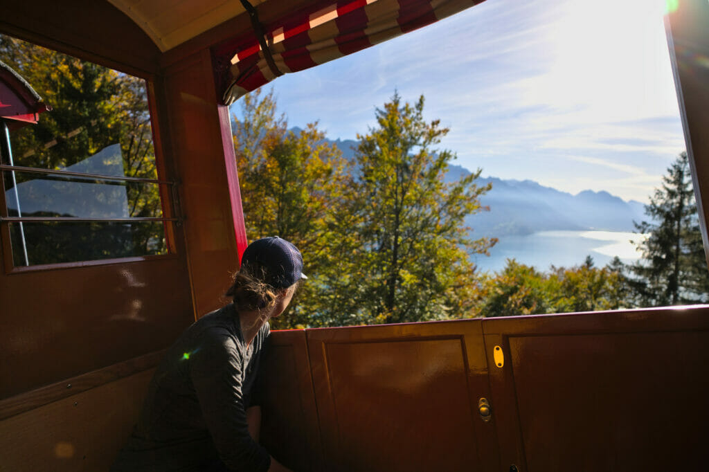
Our plan for the day was to walk and enjoy the view of the lakes from the ridges, so we decided to get off the train at the Planalp mid-station and continue towards the summit on foot.
Officially, there are 2 routes to the summit of the Brienzer Rothorn from Planalp:
- A (shorter) route that roughly follows the train tracks: the best choice if you are afraid of heights and/or if you want to see the trains up close
- A variant via the Lättgässli and the Hargergrat ridge: the ultimate panoramic option
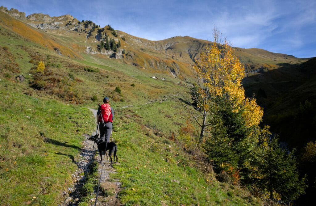
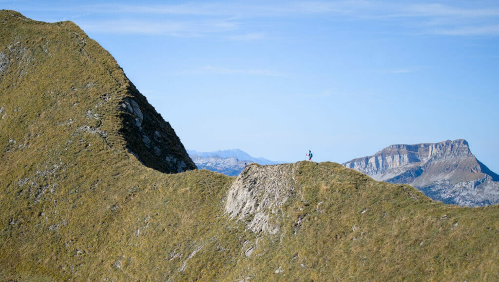
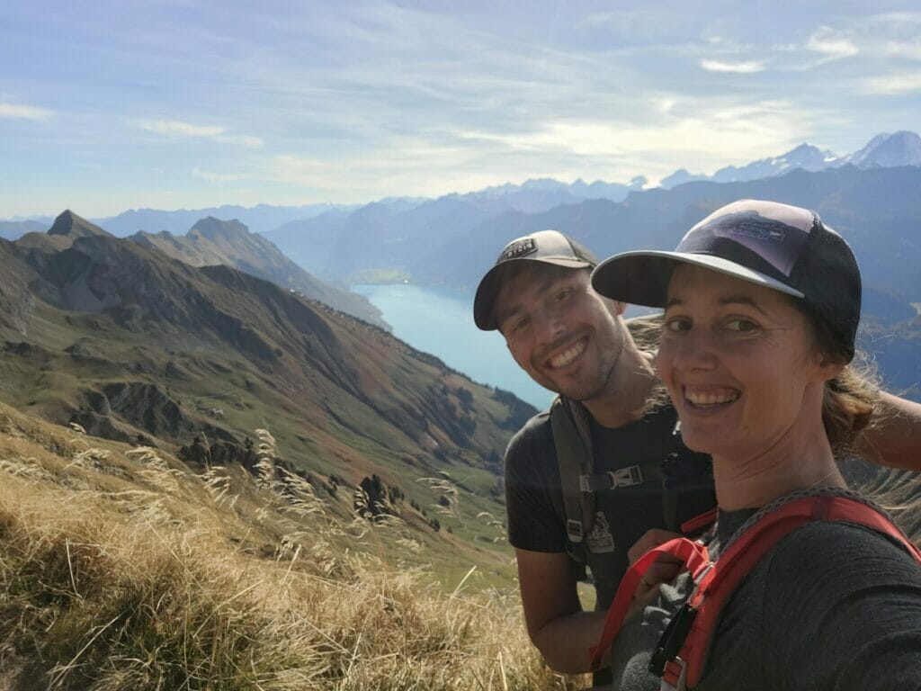
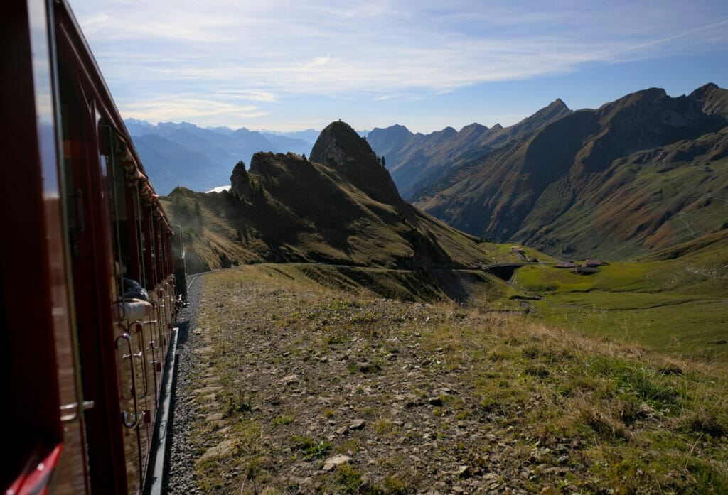
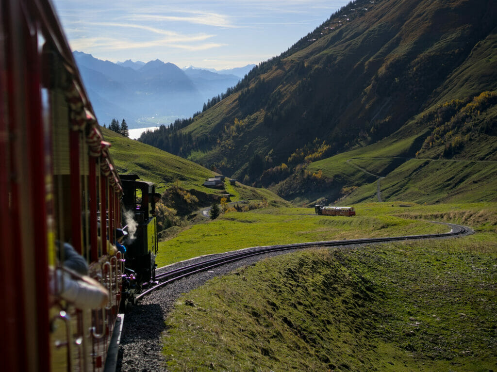
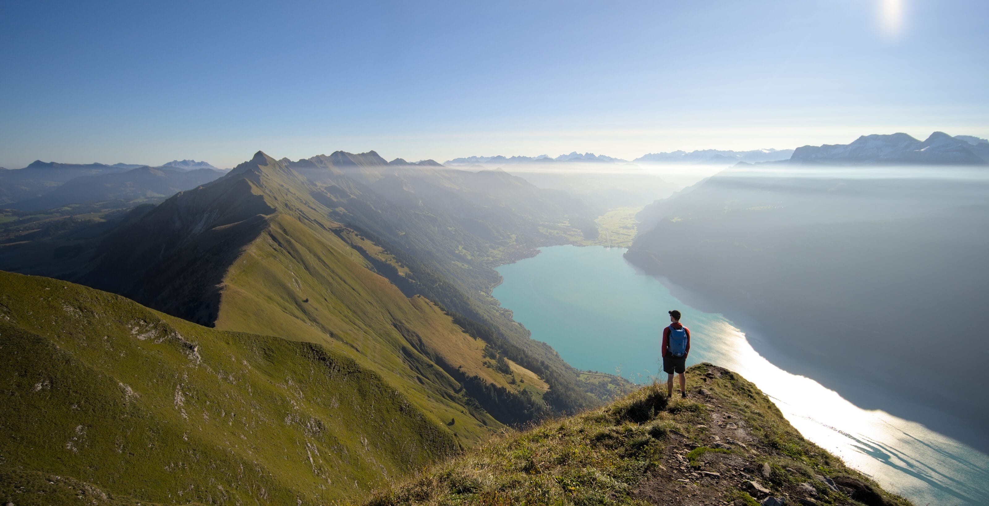
Not surprisingly, we decided to go for the panoramic option. 🙂 The first part of the hike consists in joining the ridge. Here, relatively little suspense… As soon as we get out of the train, we quickly see the objective.
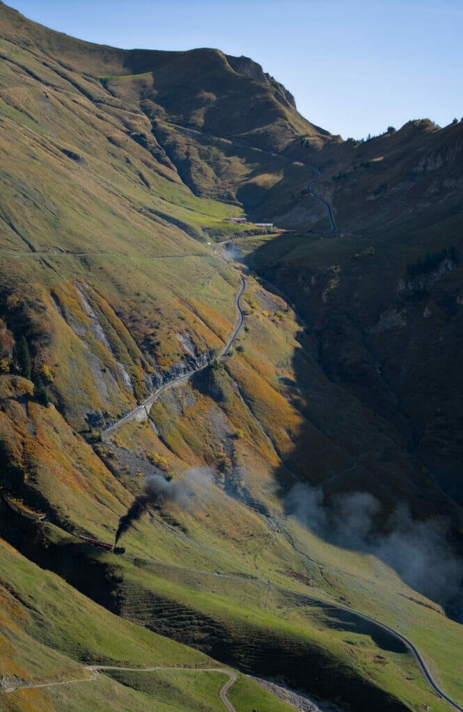
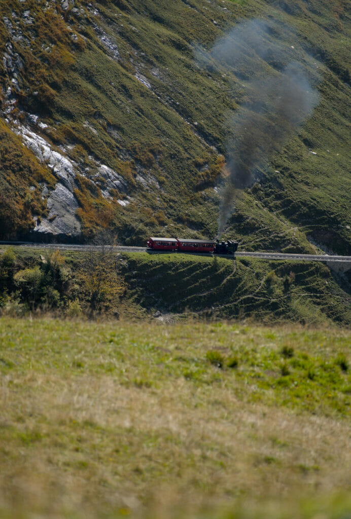
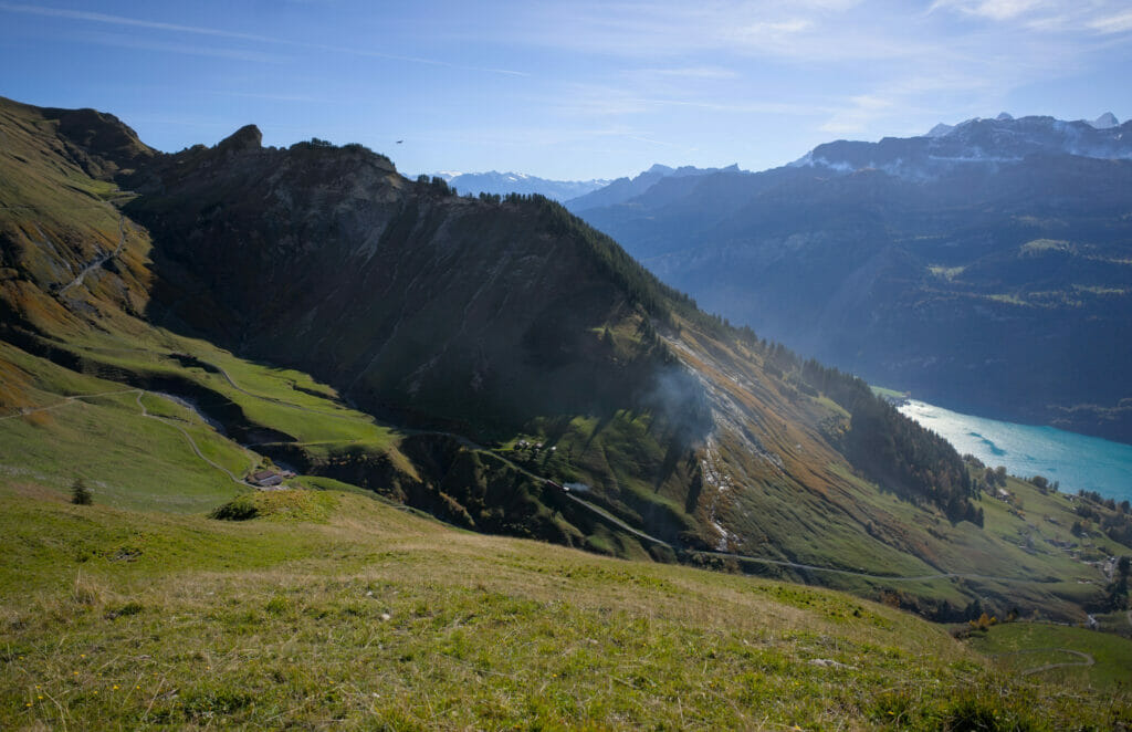
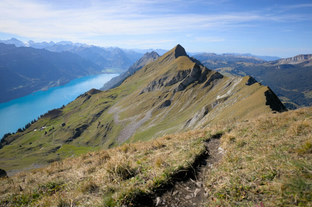
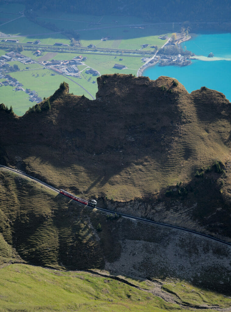
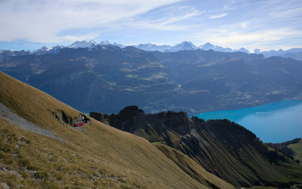
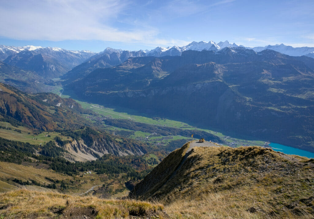
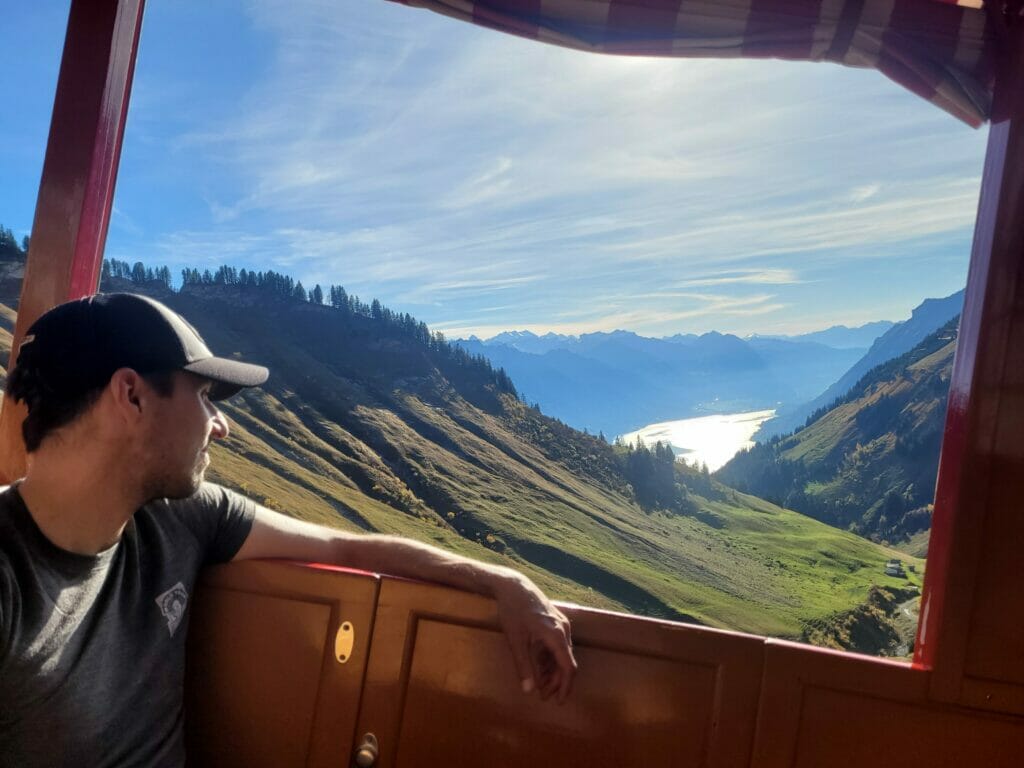
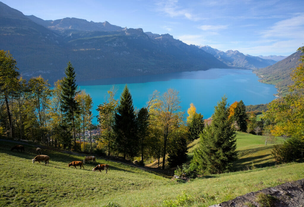
The climb itself does not present any particular difficulty. The route alternates between a wide track and paths in the middle of alpine meadows. The 700m climb from Planalp to the Chruterpass is about 4km long. During the ascent there are beautiful views of Lake Brienz and the valley where the steam train goes up to the Brienzer Rothorn.


If you’re planning a trip to Switzerland or if you live here and wish to discover some new spots, don’t miss our new ebook. Released in May 2025, this 75-page guide will help you prepare for your upcoming stay in Switzerland. We’ve compiled all our best tips and tricks for visiting our beloved little country without breaking the bank. You’ll find advice on transportation, accommodations, where to shop, as well as a list of free activities and events throughout the seasons, along with our personal recommendations for hikes and must-see spots, and a selection of off-the-beaten-path itineraries (with estimated budgets). This ultra-complete guide also includes a fantastic interactive map featuring over 500 addresses and deals.

To learn more about the ebook and the interactive map, the introductory article is available here.
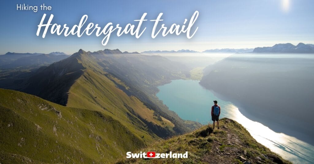
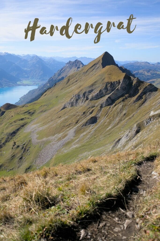
Small detour along the famous Hardergrat
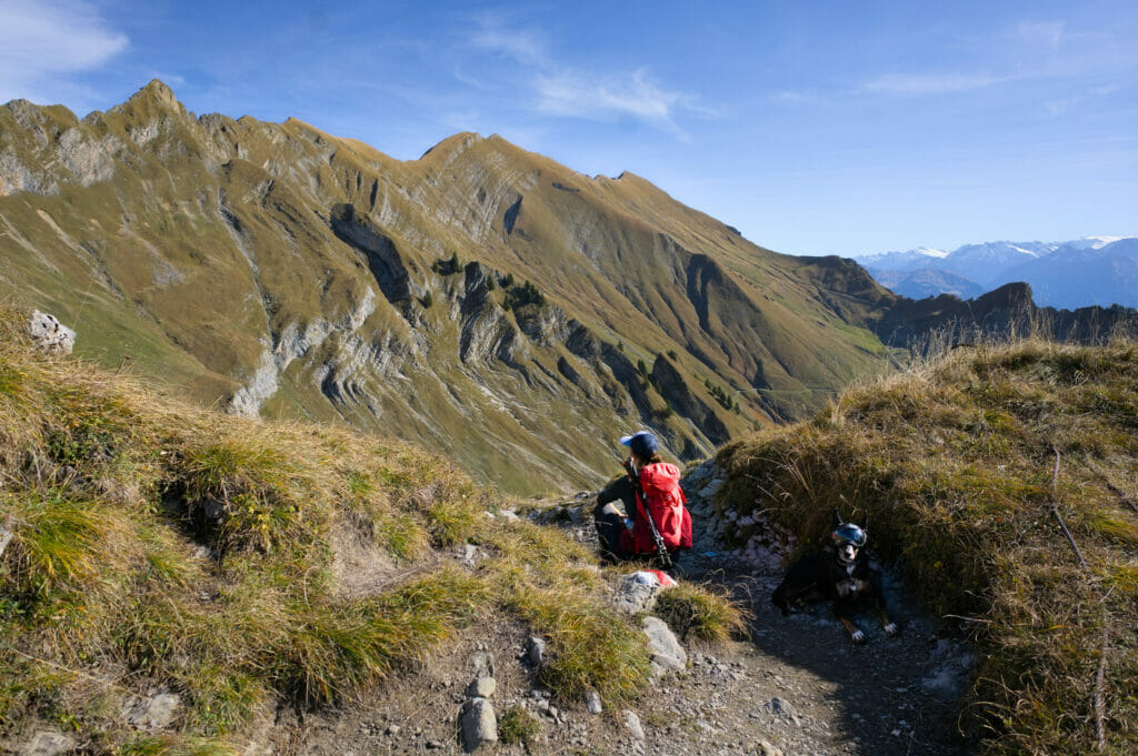
Once we reached the pass, we took advantage of a small grassy area to eat our picnic lunch. At this point, the path continues with red and white markings in the direction of the Brienzer Rothorn, following the ridge of the mountain. But on the other side of the crossing, the path also continues in the direction of the Harder Kulm (without markings this time until the Blasenhubel).
The Hardergrat, for those who don’t know it, is a “mythical” route for trail lovers. About 24km from Interlaken to the Brienzer Rothorn with the vast majority of the route taking place on a huge ridge. Benoit has been dreaming of doing this trail for several years now… He has already tried to organize an outing with friends several times, but each time the plans fell through because of the weather (because yes, to go hiking on the ridges, the weather must be perfect and the ground must be dry, meaning that there has been no rain for a few days). And to go there with his wife? Not even in his wildest dreams! On a personal note, walking 20km with the void on both sides sounds like the worst torture! 🙂
Although part of the trail is marked, there is still a section of almost 10km that is not marked. Some passages are really VERY exposed and the Tannhorn passage is officially rated T5 (the rest would be more like T3-T4). It is not for nothing that this route is sometimes called “the most difficult trail in Switzerland”.
Needless to say, once at the Chruterpass, Benoit couldn’t resist exploring the ridge path. While I was enjoying the view at the pass, he went up to the Briefhörnli, a kind of mini foretaste that will have the merit to rekindle his desire to come back here to follow the whole path.
Ben has now fulfilled his dream of completing the Hardergrat in 2023, and has put together a comprehensive article about his adventure. You’ll find all the info you need to know if you too want to attempt the Hardergrat as well.
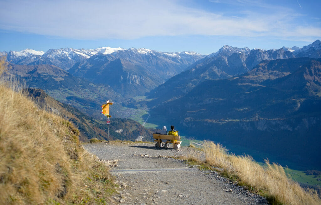
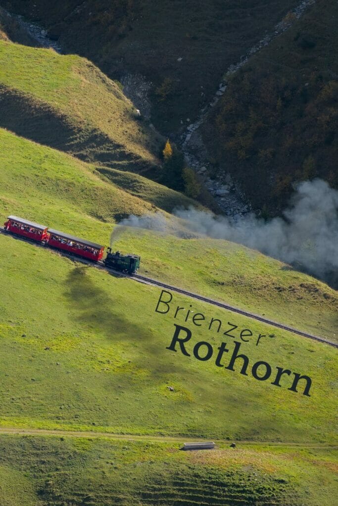
From Chruterepass to Brienzer Rothorn
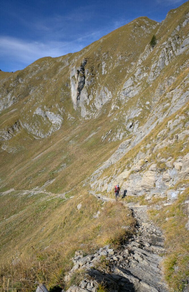
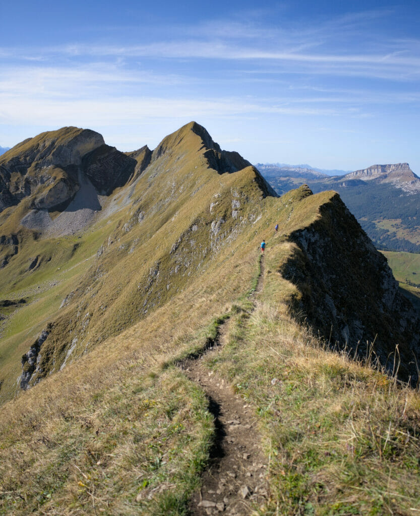
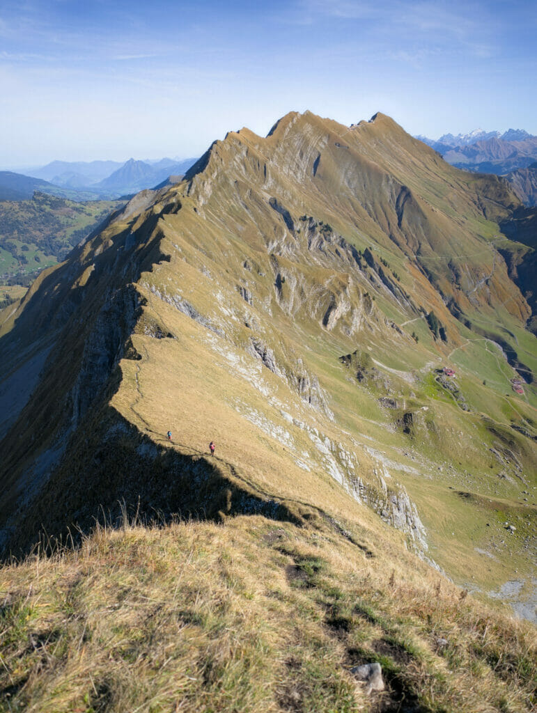
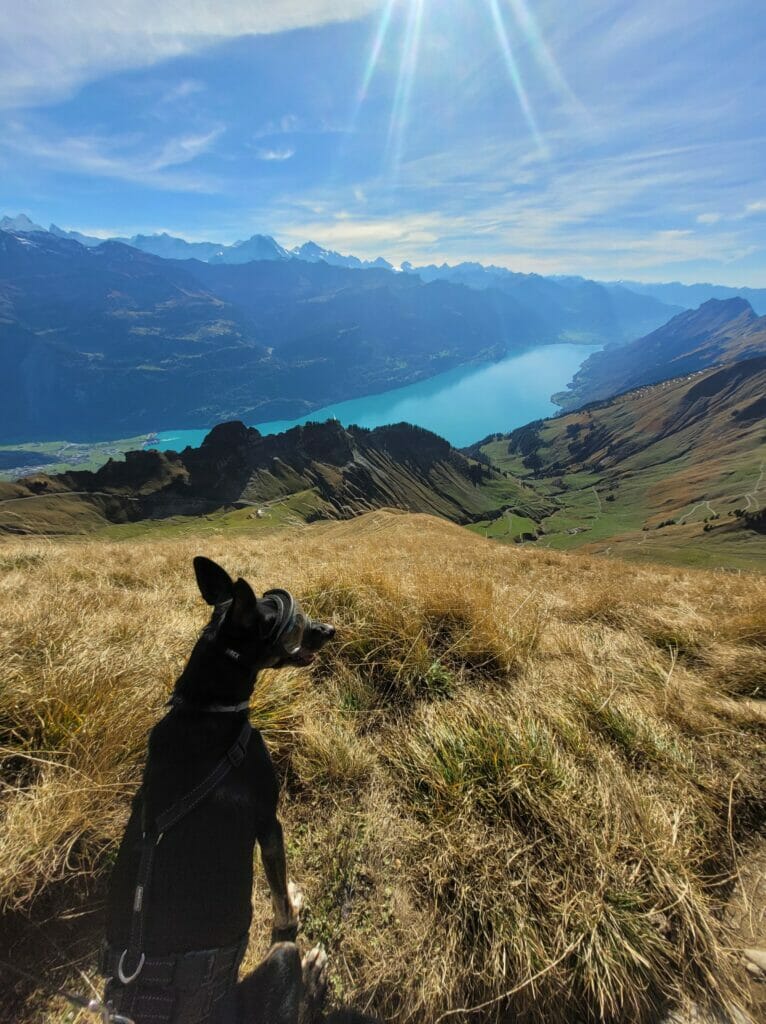
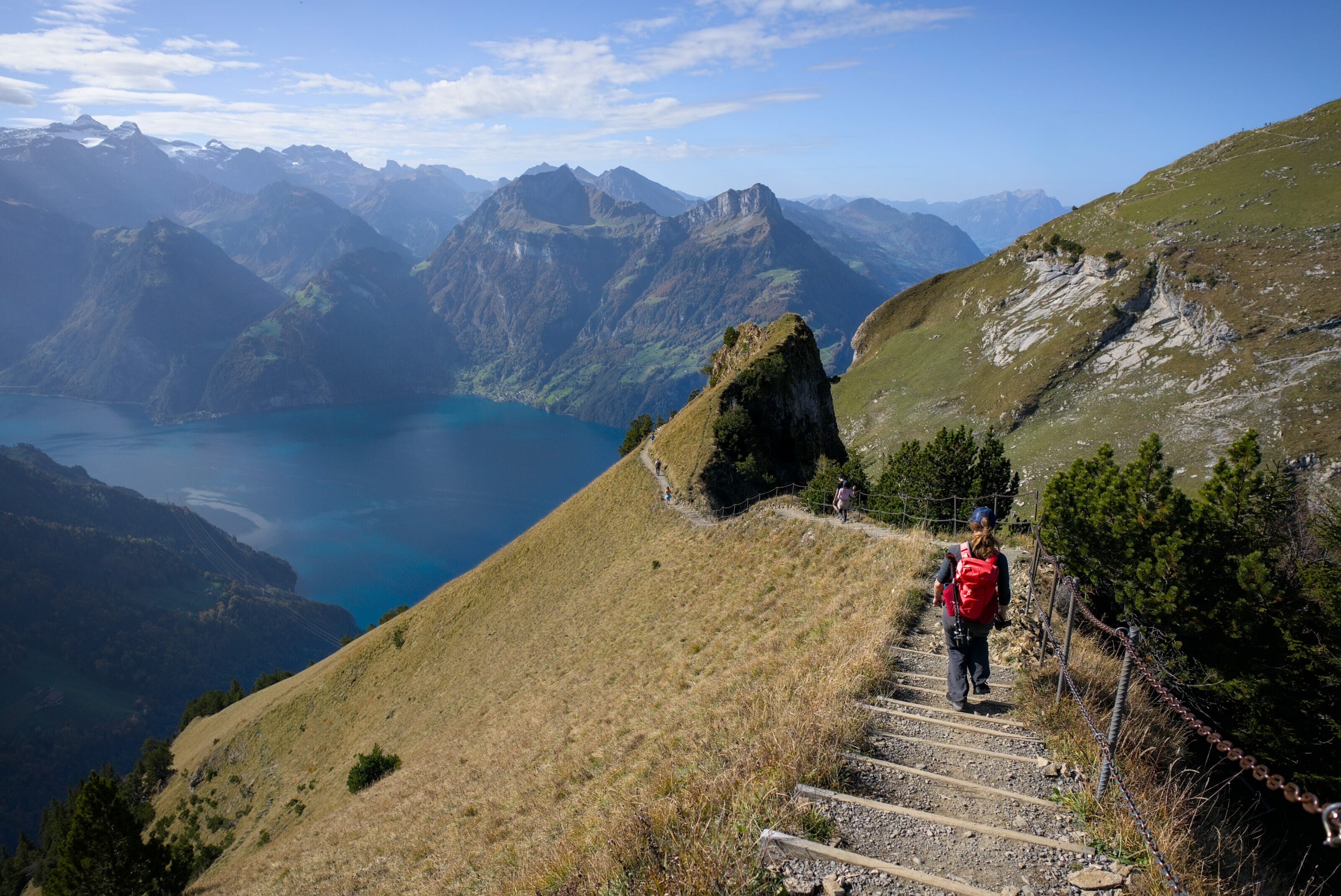
Once my man was back from his little escapade, we took the official trail to the Brienzer Rothorn. And phew… what can I say except that it is really a spectacular trail! As we went along, we kept on pausing to admire the view. I don’t count the number of times we exclaimed “Ohhh but it’s sooooo beautiful!
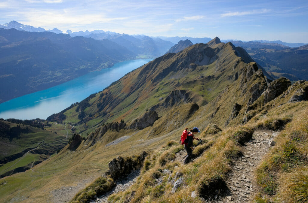
When I left the pass, I naively thought that the remaining path would be “almost flat” by following the ridge… So yes, most of the way follows the ridge without a particularly important difference in altitude, but I would like to point out that there is a short passage that hurts quite a bit! The rascal is called the Lättgässli. After some very steep switchbacks in a scree, stairs have been installed which makes the climb much easier. Nothing very complicated, but personally I was happy to do it upwards and not downwards.
Latgässli:


And what about the vertigo of this ridge path? Well, I’ll be honest, for me it didn’t cause any problem. On the one hand, I think I can say that I have made a lot of progress on my fear of heights these last years 😉 On the other hand, I found the path really well maintained and quite wide. The very steep part is mainly on one side and on the other side, the slope is a little bit softer (or let’s say that psychologically we have less the impression that we could kill ourselves) 😉
Summit of the Brienzer Rothorn and return to Brienz by steam train
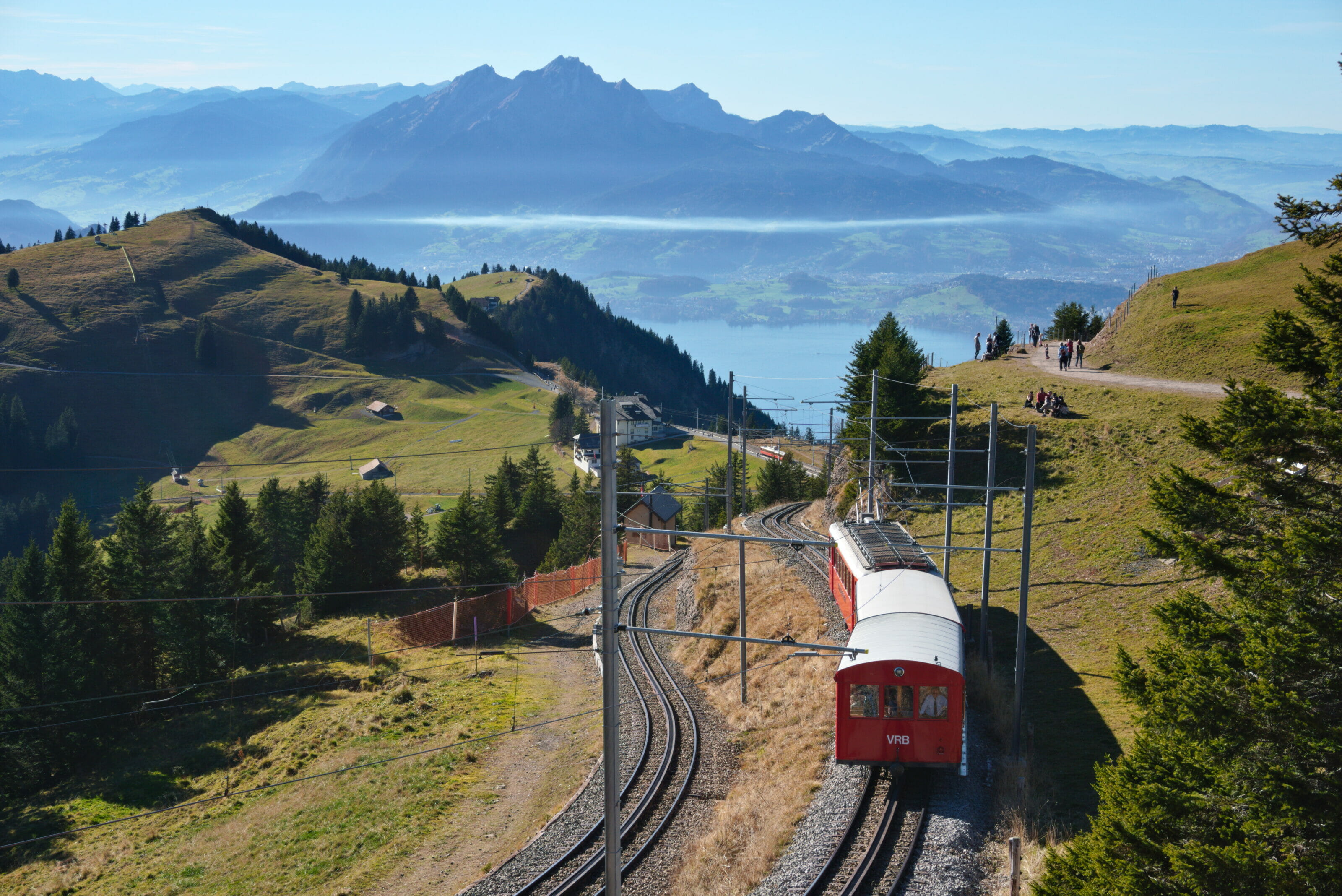
At the end of the ridge, we arrive at the Brienzer Rothorn station. We arrive just as a train was leaving down towards the lake. We decide to let it go and to go and see the summit before making our way down.

Indicated at 20 minutes on foot, it is a little difficult to imagine taking so much time 😉 It is literally at 800 meters from there… Who knows who put these estimates in place, but I promise, if you arrived here on foot like us, there is a good chance that the round trip will take you less than 30 minutes (small photo break at the top included) 😉
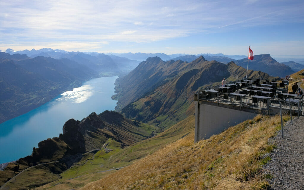
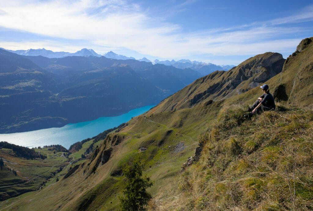
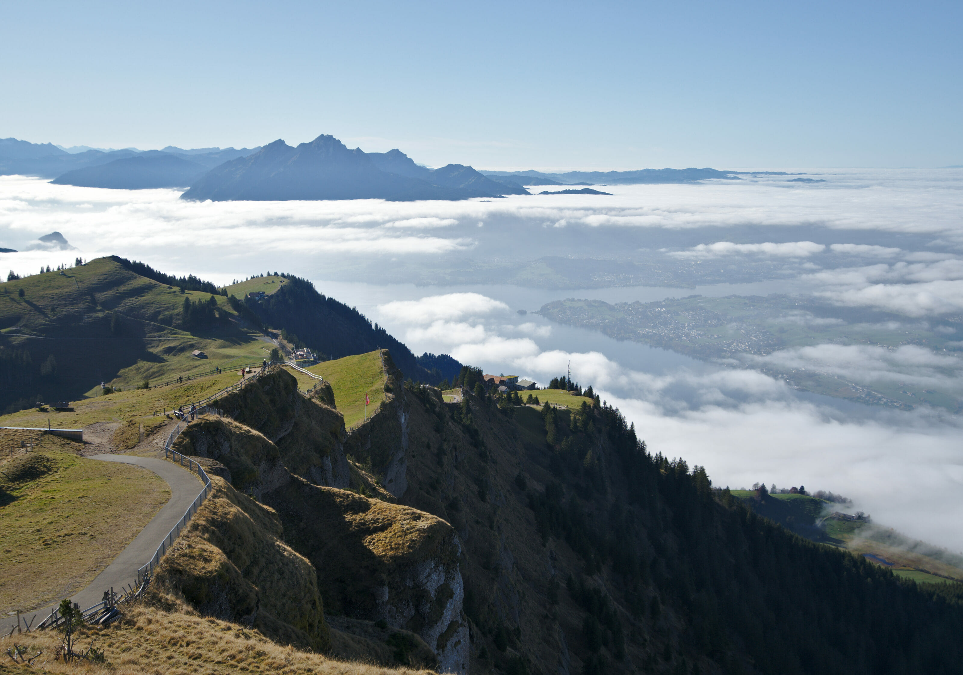
The view from the top is spectacular, but I admit that after the magnificent hike with this crazy panorama all along, we find that in the end the ridge is more spectacular than the official summit. A question of taste you might say.
Oh by the way, if you don’t want to or can’t walk that far and decide to take the train both ways, we still encourage you to walk a bit towards the Chruterpass!
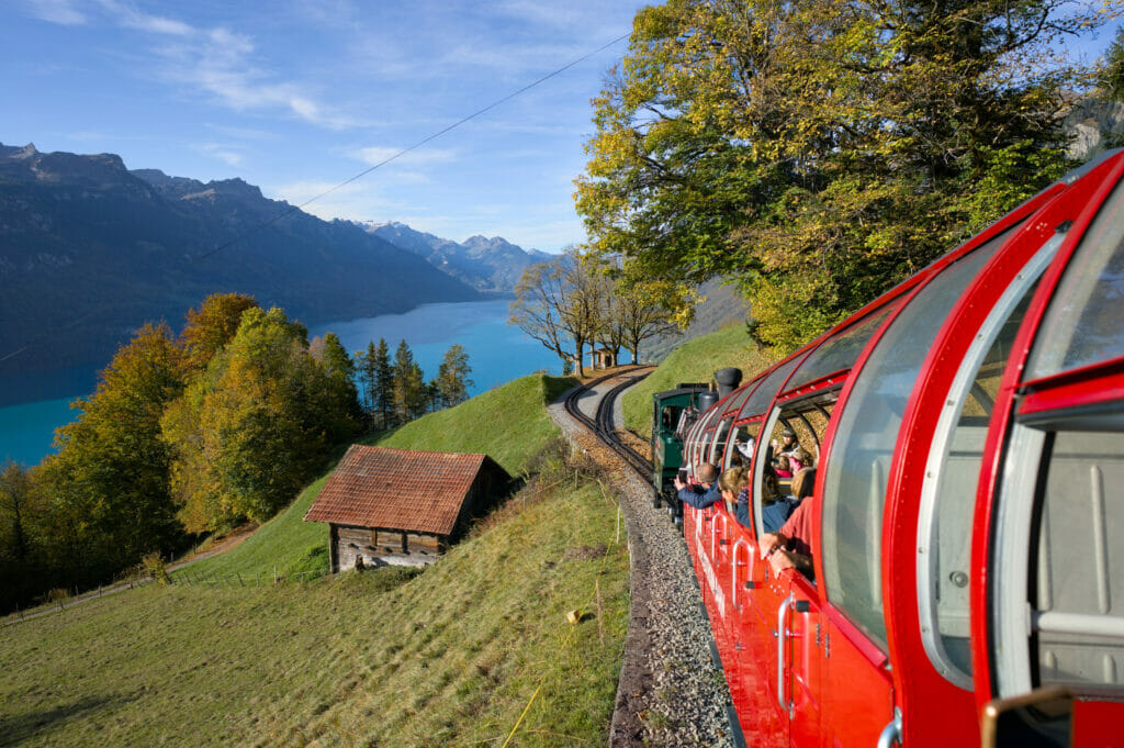
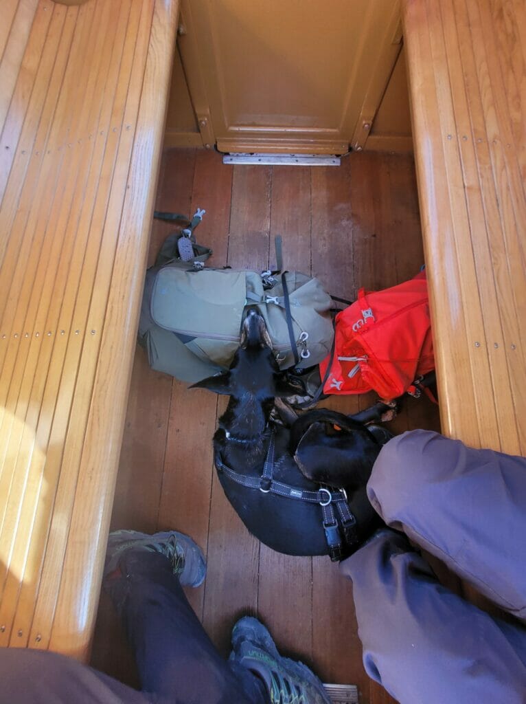
Once that we had taken advantage of the sight and bought a (totally overpriced) Rivella, we settled in the train for the descent. In the return, the train makes much less noise because it uses its brakes much more than the steam force, what was not to displease to Winchy. He even fell asleep during the descent, it is to say you that he was more at ease than on the way up. 😉
The descent in train was really a magnificent moment!!! We could not help thinking that it must be even more incredible at sunset time!
Information about the hike from Planalp to the Brienzer Rothorn
- Start: Planalp train station
- Finish: Brienzer Rothorn train station
- Distance: about 7,5 km
- Elevation change: about 1100m D+ (100m D-)
- Hiking time: Count 3h-3h30 from Planalp to Brienzer Rothorn (excluding breaks and detours)
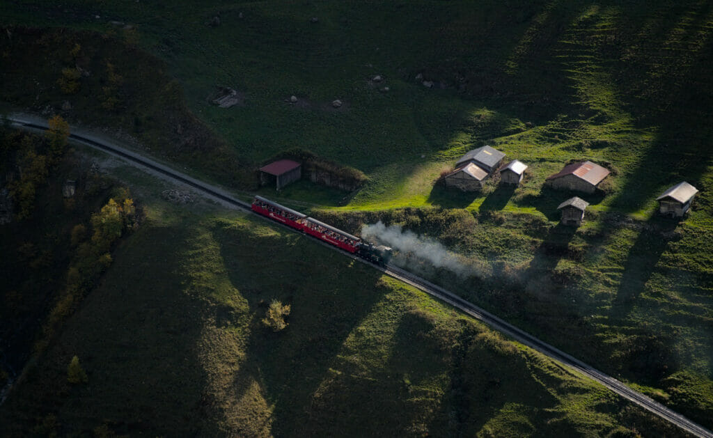
On the map below, you can see the itinerary we followed (in red) and the detour Benoit made on the Hardergrat (in blue). To give you an idea of the time to calculate for the return train: we left Planalp at 10:30 and took the train back at 16:30. Benoit took about 1 hour for his little detour and we took the time to have a picnic on the way, to enjoy (a lot) the panoramas and to climb to the top of the Brienzer Rothorn before taking the train back.
Hiking map:
Are you planning to visit Switzerland by train? We advise you to read our article which will allow you to compare the Swiss travel pass with the half-fare card. The article also includes 3 examples of train routes through Switzerland and the associated budget depending on the ticket you take.
If you prefer not to take a travel pass, but rather take advantage of the Supersaver tickets and day passes, then go to this post for all the details.
Practical information to prepare your hike to the Brienzer Rothorn
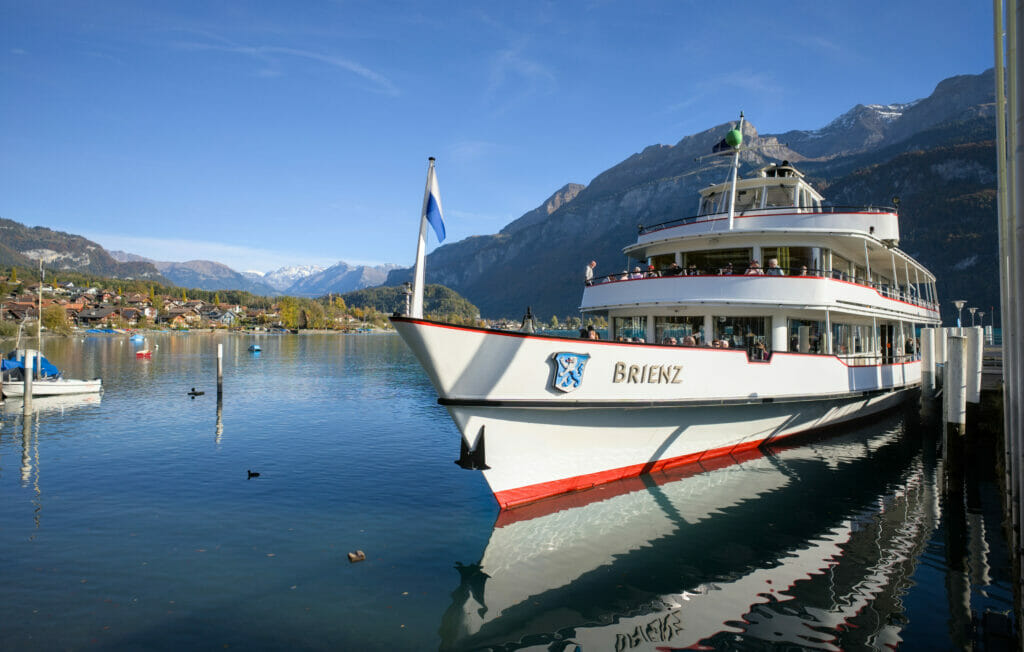
To take the train, you must first go to Brienz. The departure of the steam train is just in front of the main station. During our visit we were traveling with our van “Dahu” and we therefore looked for a parking place nearby. Coming out of season (and early in the morning), we had no trouble finding a space. Nevertheless, we think it is important to mention that the number of parking spaces is not unlimited. We can imagine that in high season it can be difficult to find a spot… If you can, we advise you to come by train (or by boat as the station is right next to the pontoon) 😉
Circulation of the steam train – schedules
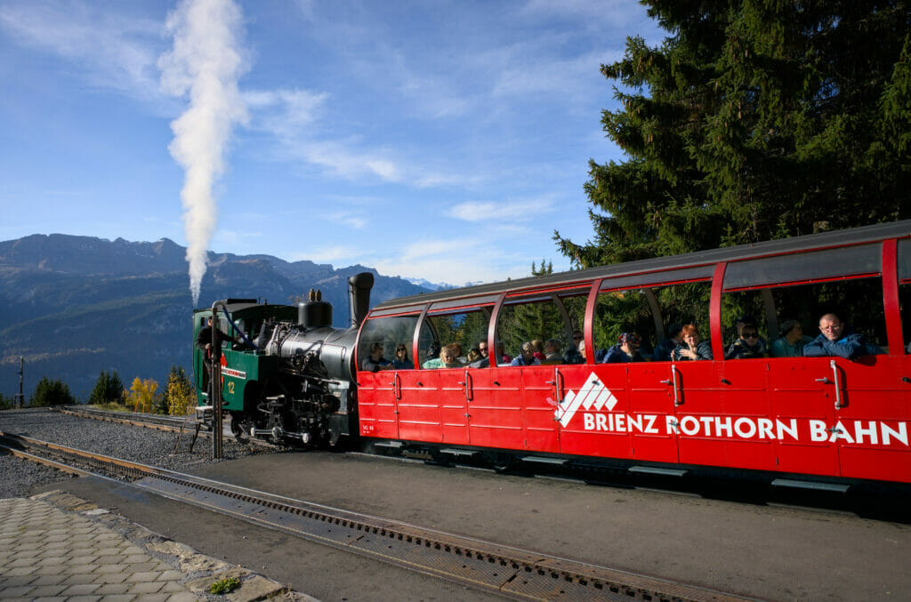
Please note that the Brienzer Rothorn train does not run all year round! The train only runs from May to October. During the month of May, the train only goes up to the intermediate station of Planalp. To reach the summit by train, you have to come between June and October. The journey takes 1 hour from Brienz to the Brienzer Rothorn (yes, the steam train is not particularly fast 😉 )
During the traffic period, there are trains every hour. You will find the timetable on their website.
Note : It was written that on busy days, it is possible that diesel trains will complement the steam ones (basically 2 trains in a row leave at the same time to bring more people). At the time of our visit, all the trains were steam powered, but I like to warn you so that you won’t be disappointed if it happens.
Ticket for the steam train – Brienzer Rothorn
The Brienzer Rothorn was a huge favorite for us and it is without any reservation that we encourage you to come and discover this place! After, it is important to note that this excursion is relatively expensive…
The standard fare for the return trip is 96 CHF / person at full fare. For holders of a general or half-fare card the price is 48 CHF. Their children’s fare, on the other hand, is very nice: free for children under 5 years old and 10 CHF for children from 6 to 15 years old. Oh, and dogs travel free! (max 1 dog per adult, 10CHF for each additional dog) 😉
For our part we opted for the ” Hiker ” ticket. It cost us 39,5 CHF per person (we have the half-price pass). This ticket allows you to do 3 of the 4 sections of the route, which is very practical for hikers (and a little cheaper than the return trip). 3 of the 4 routes means that you either go up to the summit by train and walk down to Planalp to take the train back, or you do as we did and get off the train at Planalp on the way up and then do the whole descent by train.
On their website, you can buy tickets in advance. But be careful, if you buy in advance you have to pay a supplement of 8CHF for the “seat guarantee”. Out of season, this reservation is of little interest, but we admit that in high season it can be worth it (let’s say that otherwise there is the risk of having to wait for an hour).
Our advice? Go to their online shop and check the number of tickets left for the day and time of your choice. If you see that the number is limited, it might be worth booking, but if not, just go there and buy the ticket at the normal price. On our roadtrip, we checked the day before and they were still advertising 97 seats available for the train we wanted to take, so we skipped the reservation.
Well, this time you know everything (or almost) about the Brienzer Rothorn! Benoit hopes he’ll have the opportunity to come back here to do the whole Hardergrat, while I’m looking forward to seeing his pictures haha!
See you soon
Pin it

Join the discussion