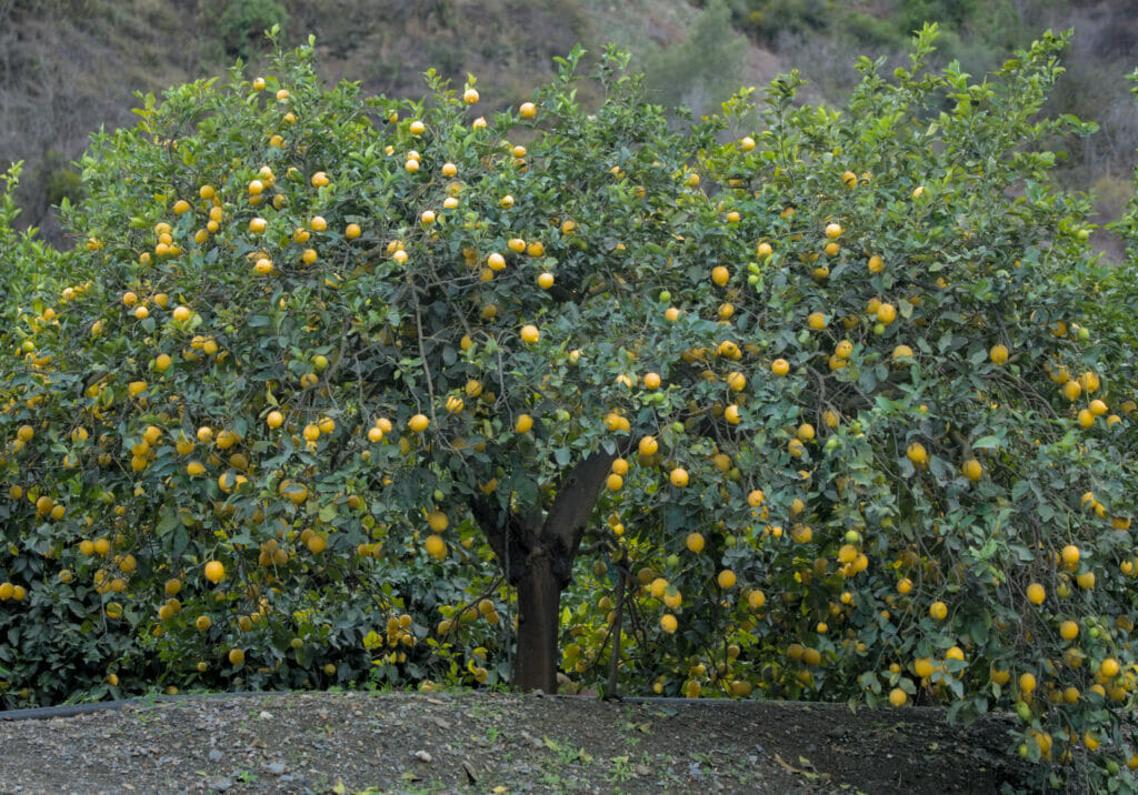
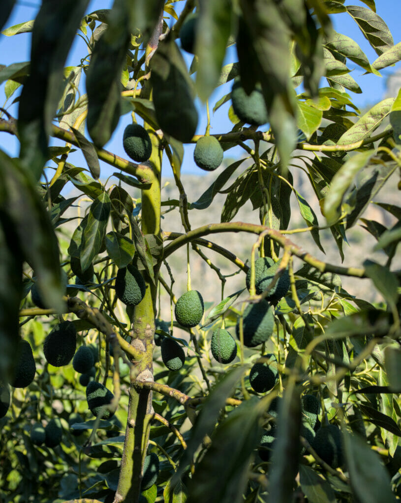
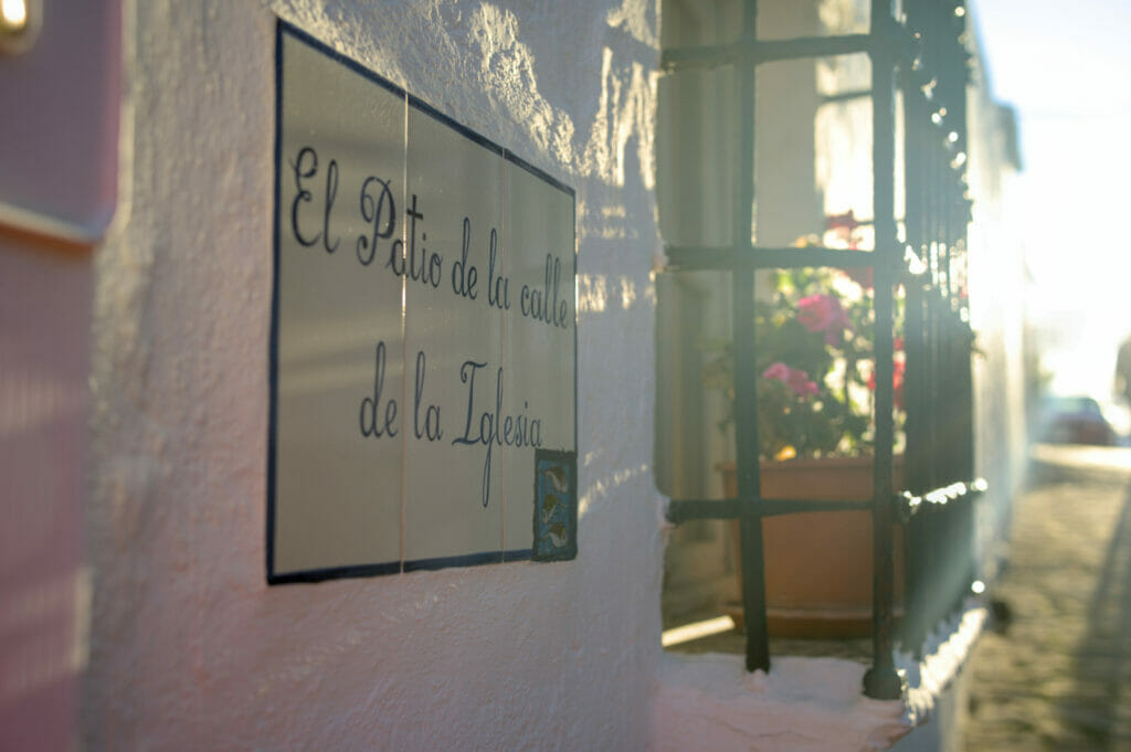
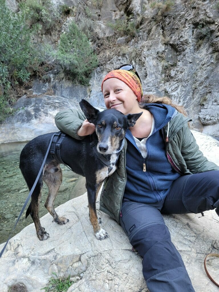
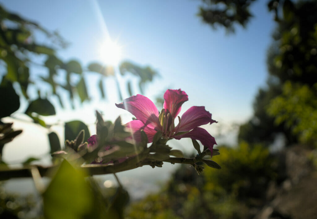
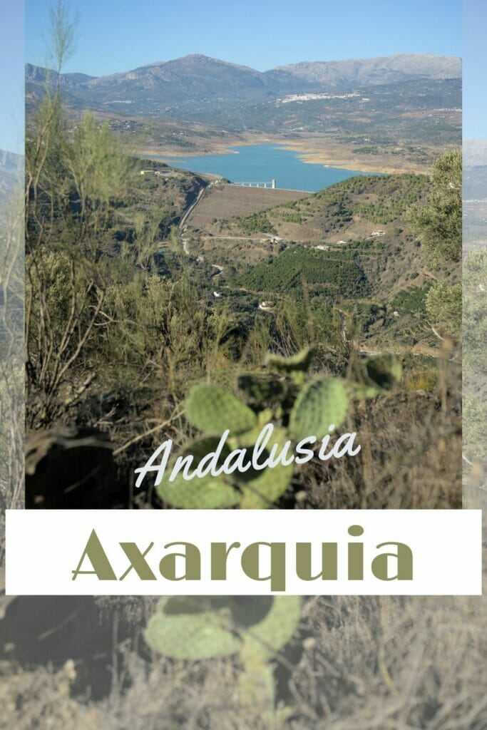
This year, we spent the Christmas holidays with our English friend Caroline in the region of La Axarquia, not far from the city of Malaga. We rented a nice house for 2 weeks in the small white village of Salto del Negro, in the middle of lemon, orange and avocado trees. The idea was to settle down a little after a month of roadtrip with our van down to Andalusia and especially to enjoy the end of the year celebrations with our friend while visiting the region.
La Axarquia literally means “the eastern part” and it is indeed the most eastern district of the province of Malaga. We have to admit that we ended up there a bit by chance! As our friend lives in Málaga and she didn’t mind going to the countryside for a while, we thought it would be a good place to meet.
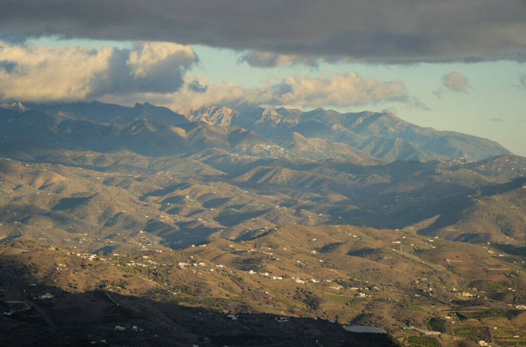
But even if we didn’t check too much beforehand, luck often makes things right and it happened that we liked La Axarquia a lot. It is a place with a lot of mountains (therefore perfect for hiking and there is La Maroma, the highest peak of the province of Málaga which rises to more than 2000m) at the edge of the sea and where you can visit many white villages so famous in Andalusia.
Let’s take you with us to discover the region of La Axarquia!
- Our little house in Salto del Negro
- Comares: the white village on top of its hill
- Walk between Benamargosa and Cutar
- El Borge: the raisin capital
- Canillas de Aceituno: a white village nestled at the foot of La Maroma
- The Kalachakra Stupa and the Atalaya tower
- Frigiliana: a beautiful village overlooking the sea
- The famous Nerja caves
- Walk to the playa Cañuelo in the natural site of acantilados de maro
- Our map of the things we did in the La Axarquia region
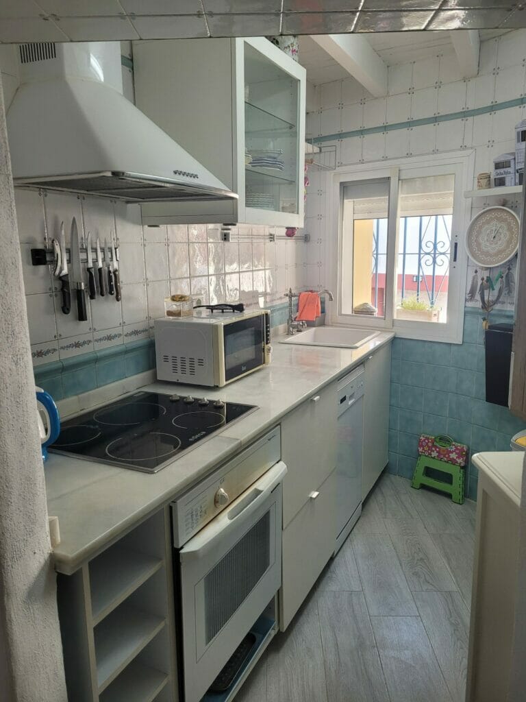
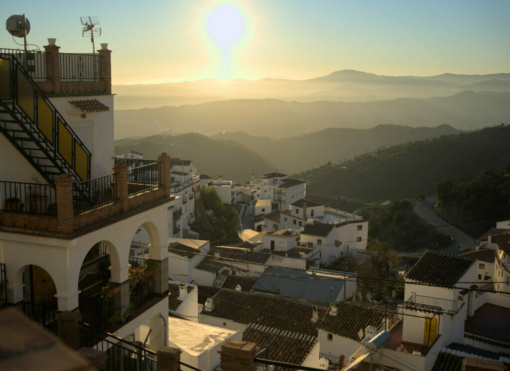
Our little house in Salto del Negro
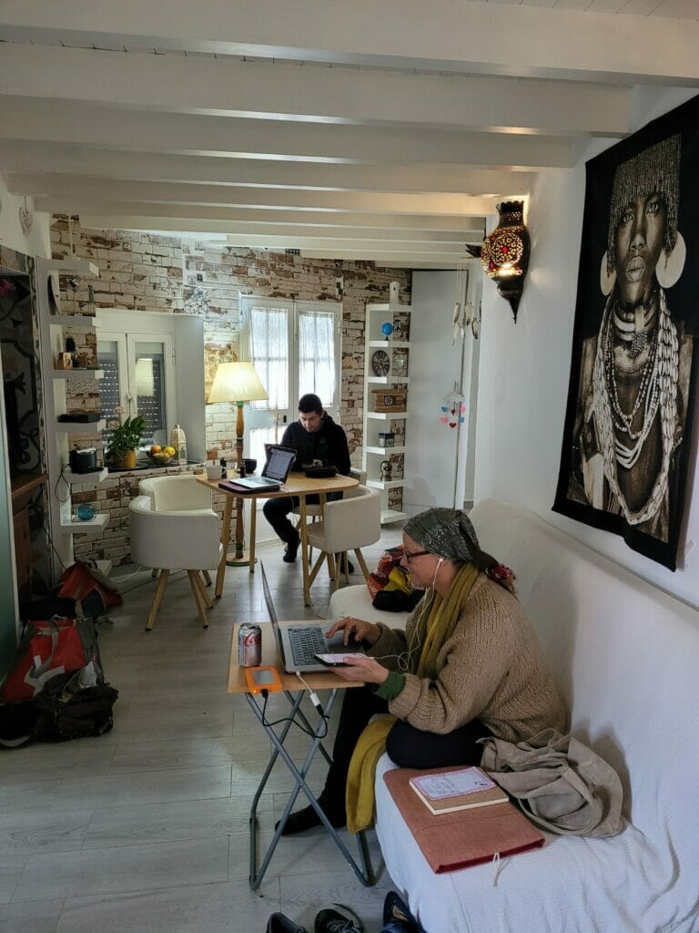
Let’s start by showing you our nice little house in the hamlet of Salto del Negro. We stayed there 2 weeks and we found that it was a very good base to discover the region. We had everything we needed and even more (1 kitchen, 2 bedrooms, 2 bathrooms, 2 living spaces, an interior terrace, a terrace on the roof with a nice view)…
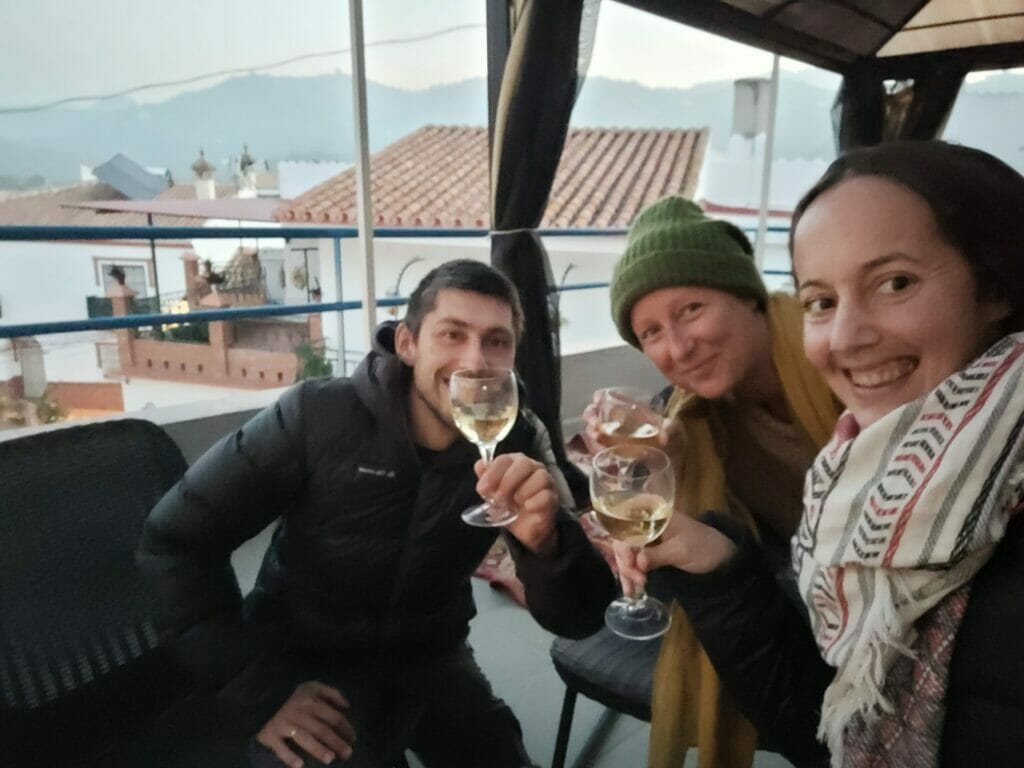
Frankly for 3 people in the house it was really perfect. We had enough room to work and have each our space, terraces for the apéro, in the middle of avocado and lemon trees :), the whole at a really correct price ( about 40 something € the night). Honestly, we warmly recommend it! (you can see more pictures and our review by clicking on the link below)
The bonus: we were welcomed with a box full of avocados, lemons and oranges of the village. And once finished we had literally 50m to go to pick some directly on the trees 😉
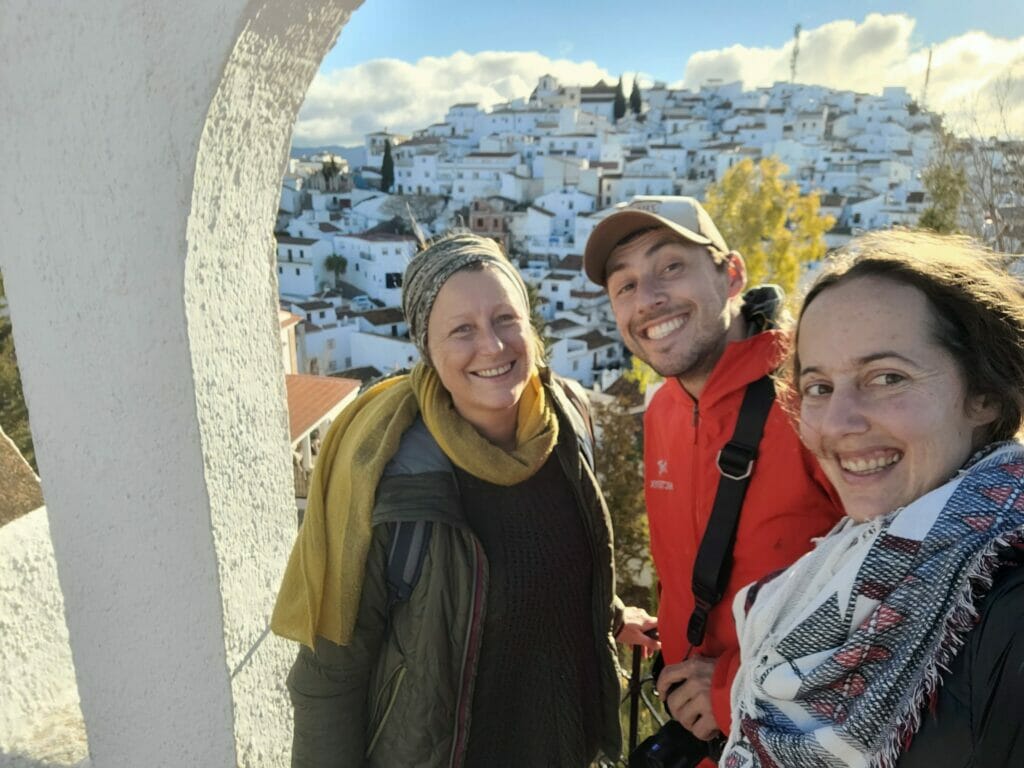
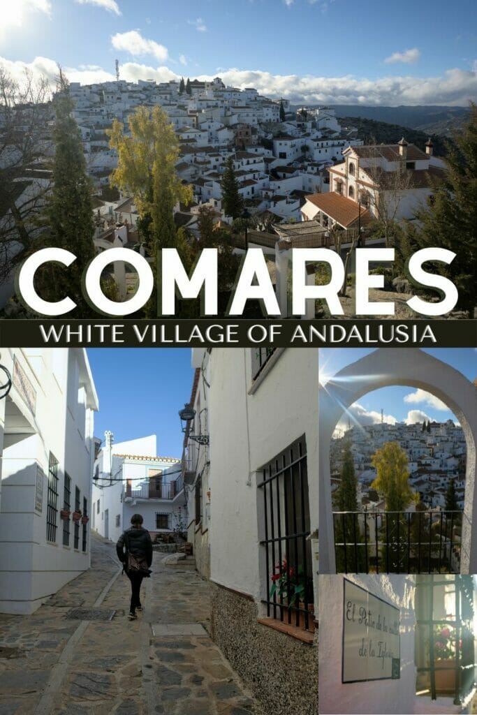
Comares: the white village on top of its hill
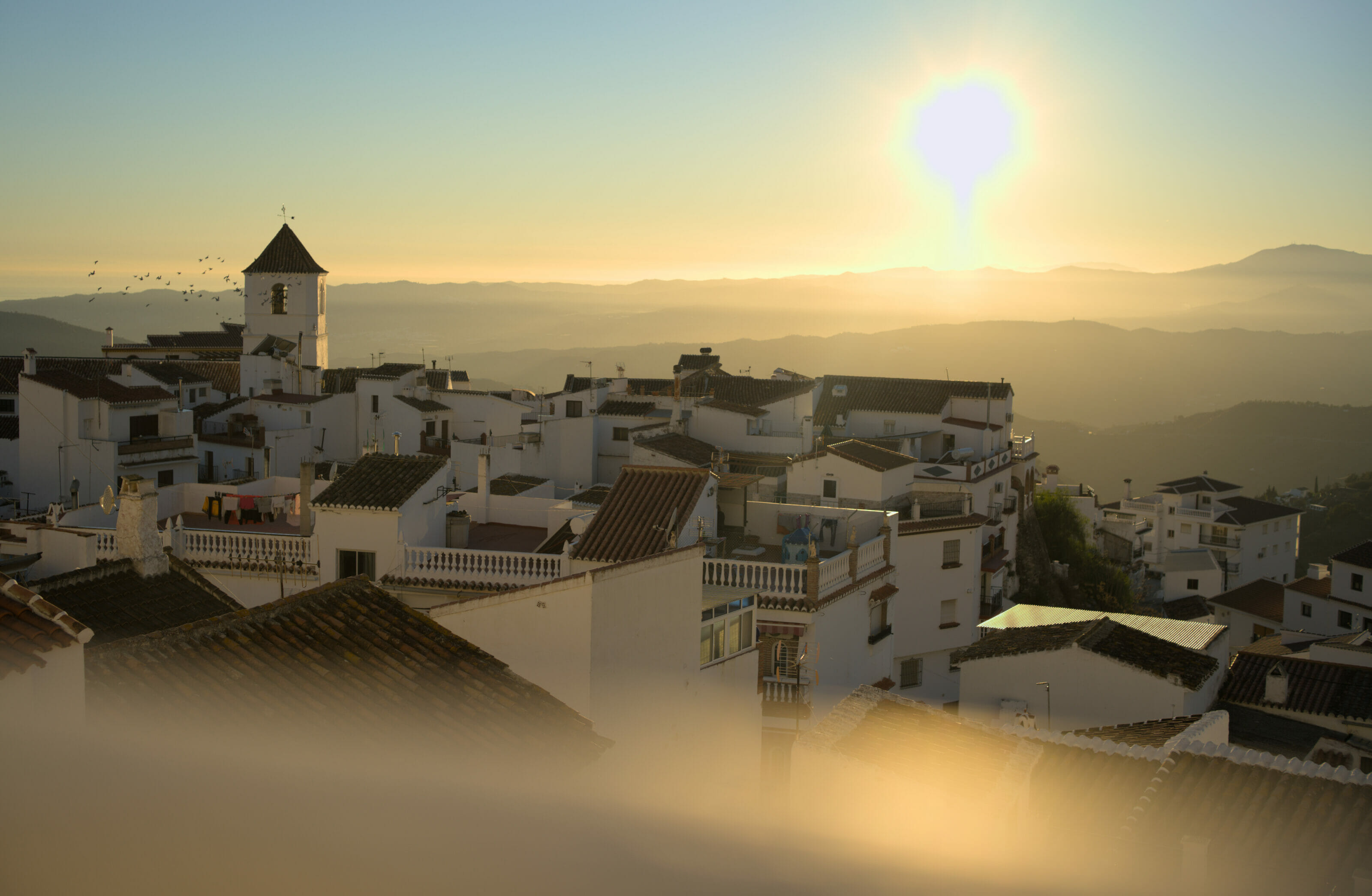
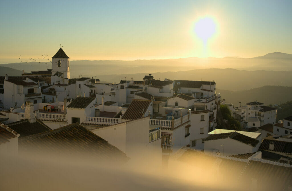
We could see the small village of Comares on its hill from the terrace of our house. We quickly wanted to visit it by observing the magnificent colors that it took at sunrise and sunset. Moreover, we thought that from there we would have a great view on the surroundings! Perfect to have an idea of the region.
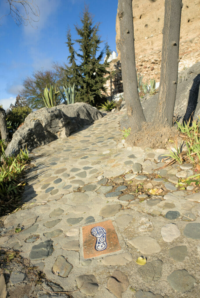
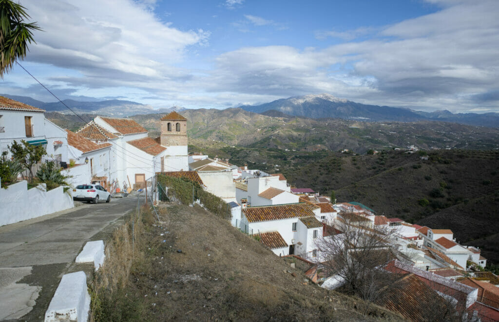
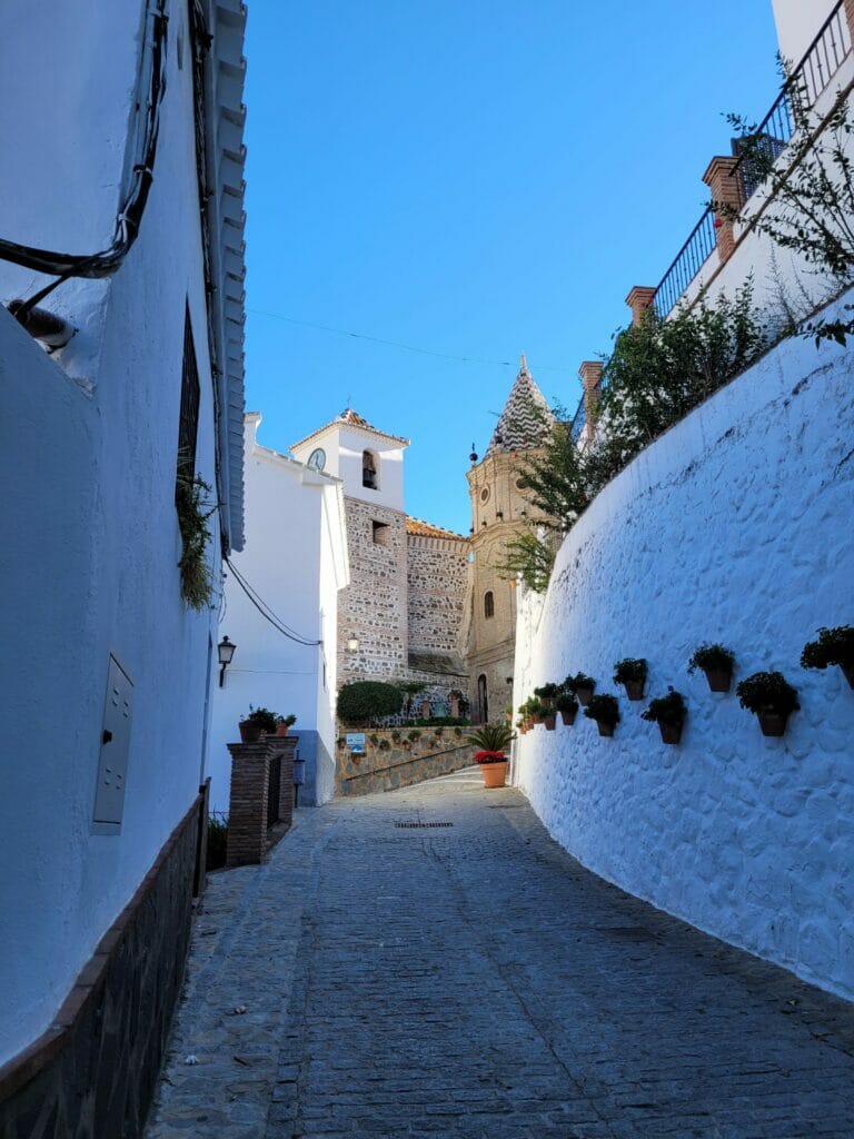
Like most of the villages in the area, the architecture reflects the Muslim influence of the Moorish people who occupied Andalusia and much of the Iberian Peninsula between the 8th and 15th centuries. The village is built on a rocky promontory at 720m above sea level and the houses literally follow the shape of the rocks on the hill. You will certainly enjoy as much as we did walking through its small paved streets, interspersed with arches, between the typical whitewashed houses.
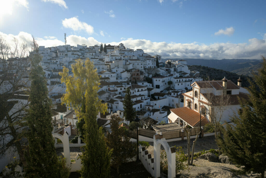
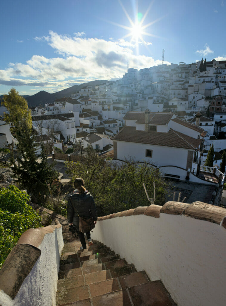
If you follow the ceramic footprints in the streets, you will be able to do a short walk that will make you discover the most beautiful views of the village. The panorama from Comares on the surroundings is spectacular and you will have a breathtaking view of the sea and all the surrounding mountains. It is while admiring the view from here that we wanted to go and discover La Maroma, the highest peak in the province of Málaga (which we will talk about below).
Small bad point nevertheless, we feel well that Comares is a rather touristical village! We have been almost “forced” by a granny to enter her house to buy things we did not need for a not very reasonable price. We can easily imagine that in high season it can be much worse.
Walk between Benamargosa and Cutar
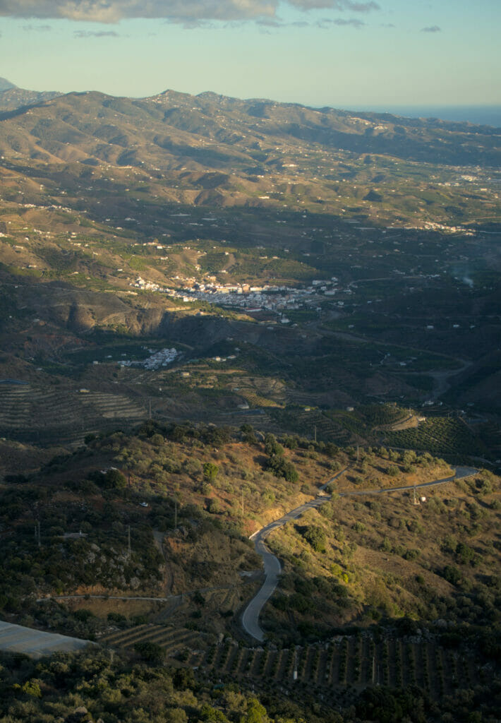
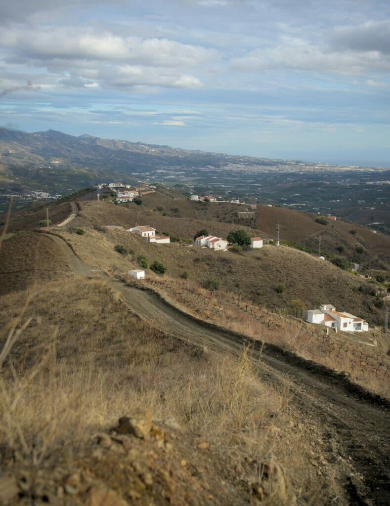
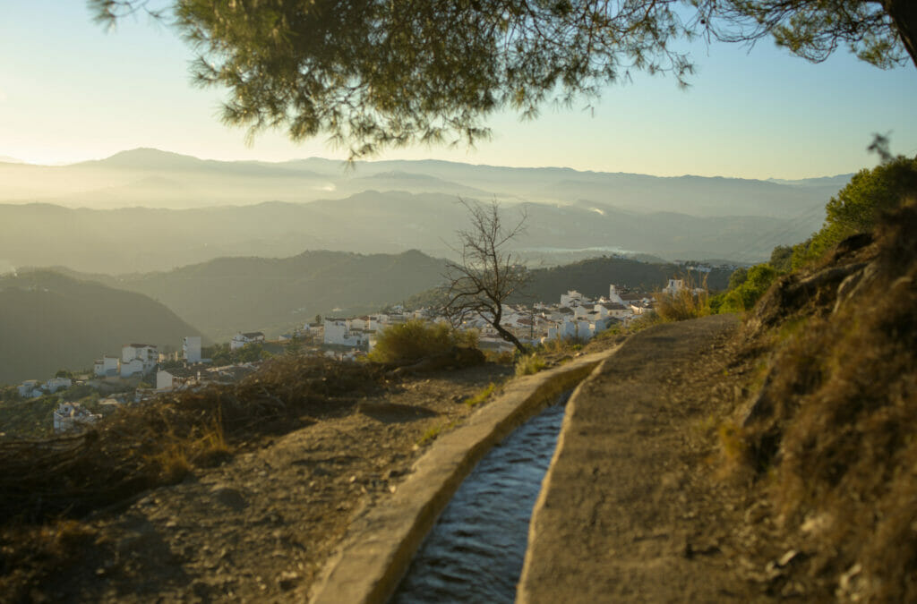
This is the hike that we could do directly by leaving the house since Salto del Negro is located just between the villages of Benamargosa and Cutar. This hike gives the opportunity to discover peacefully these two villages while offering very nice viewpoints on the whole region of La Axarquia (in its 2nd part above the village of Cutar).
The hike starts in Benamargosa, a village that is famous in the region for its tropical fruits such as avocado, lemon, mango and oranges. During the first 3 kms of the hike, we follow the bed of a dry river that passes right in the middle of the lemon and avocado trees. Opposite, at the top of the hill, you can see the village of Comares, which overlooks the whole region.
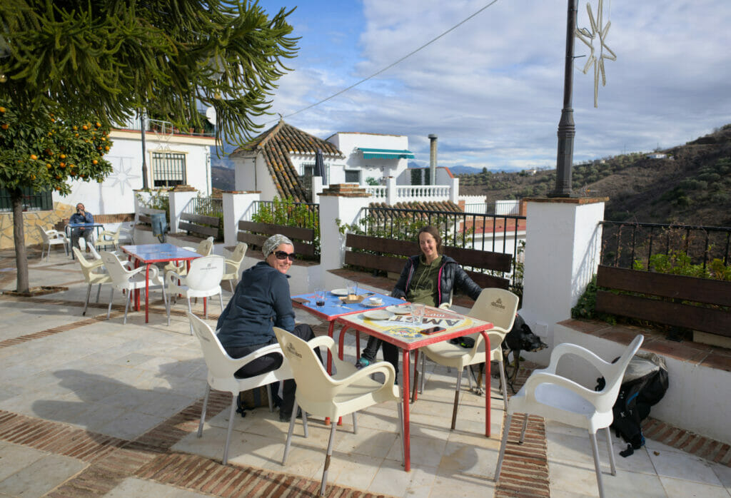
We begin then a good little climb up to Cutar. Fortunately the ascent to the village is not very long and there is a pretty small terrace on the village square which will let you have a drink and eat some tapas (the olives that we ate there were delicious). Around Cutar, olive trees and vineyards have replaced the avocado and lemon trees.
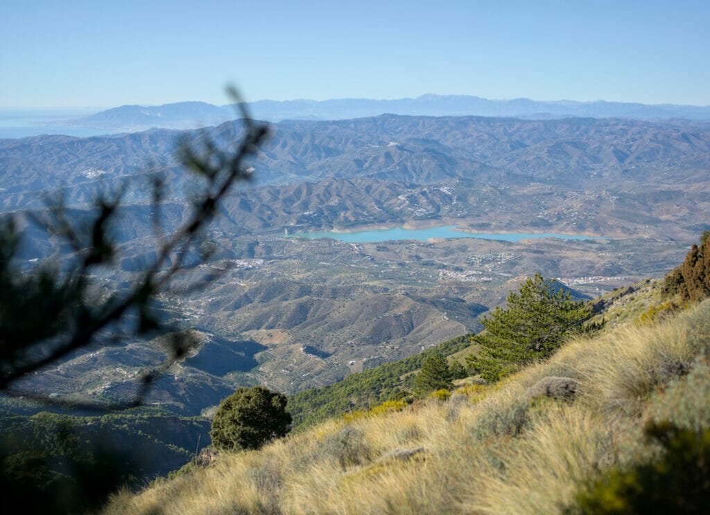
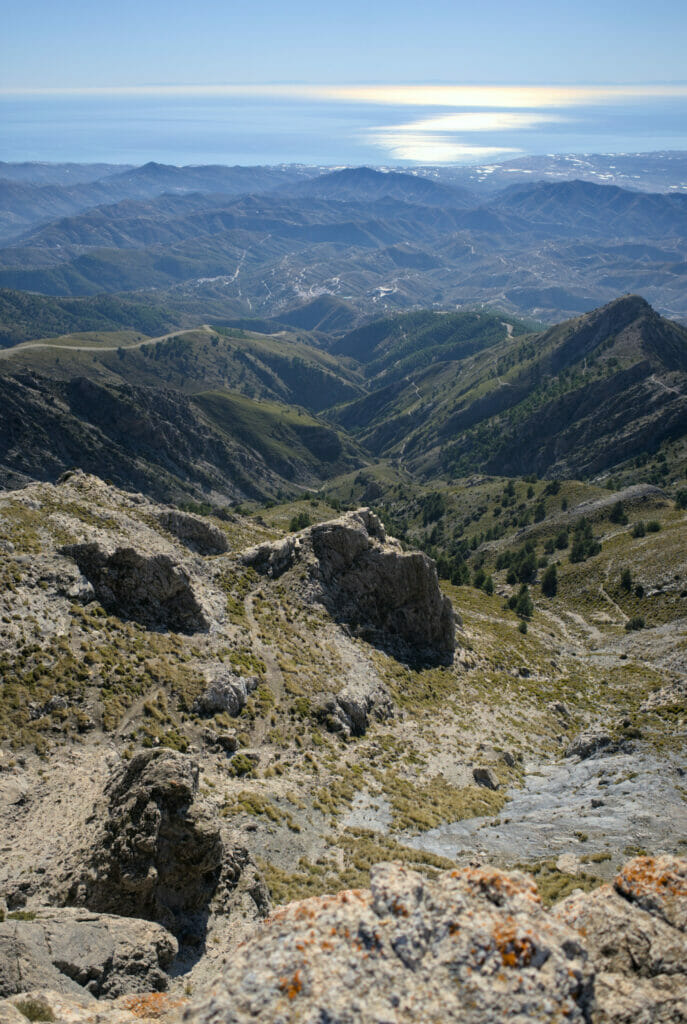
The path keeps going up until you reach the top of a ridge where you will have an almost 360-degree view of La Axarquía. On one side you will see the village of El Borge, on the other almost all the rest of the region overlooked by La Maroma and in front of you the sea and the town of Velez Malaga.
From the top, you just have to follow the track that goes down gently along the ridge to reach the village of Benamargosa 4 km further. In total, the hike is about 9kms long with 360m of d+- and you should count 2-3h to do the tour. You will find the map of the hike below:
We told you about the sea of plastic in the region of Almeria where a good part of the vegetables eaten in winter in Europe are produced. Another sad observation that we make since we are in the south of Spain (in Catalonia it was less visible for us), it is the abundance of waste abandoned everywhere in the nature and on the roadside. On a hike like this one, we could fill dozens of garbage bags with plastic or other waste. It happens regularly that we pick up what is lying around our van when we stay on a spot, but frankly, what can we do in front of such an abundance of waste in the nature?
Beyond the sadness / anger that it raises in us every time (hard to understand why in 2022 there are still so many people throwing waste on the ground or out of their car window), it reminds us how important it is to minimize our consumption of single-use packaging as much as possible.
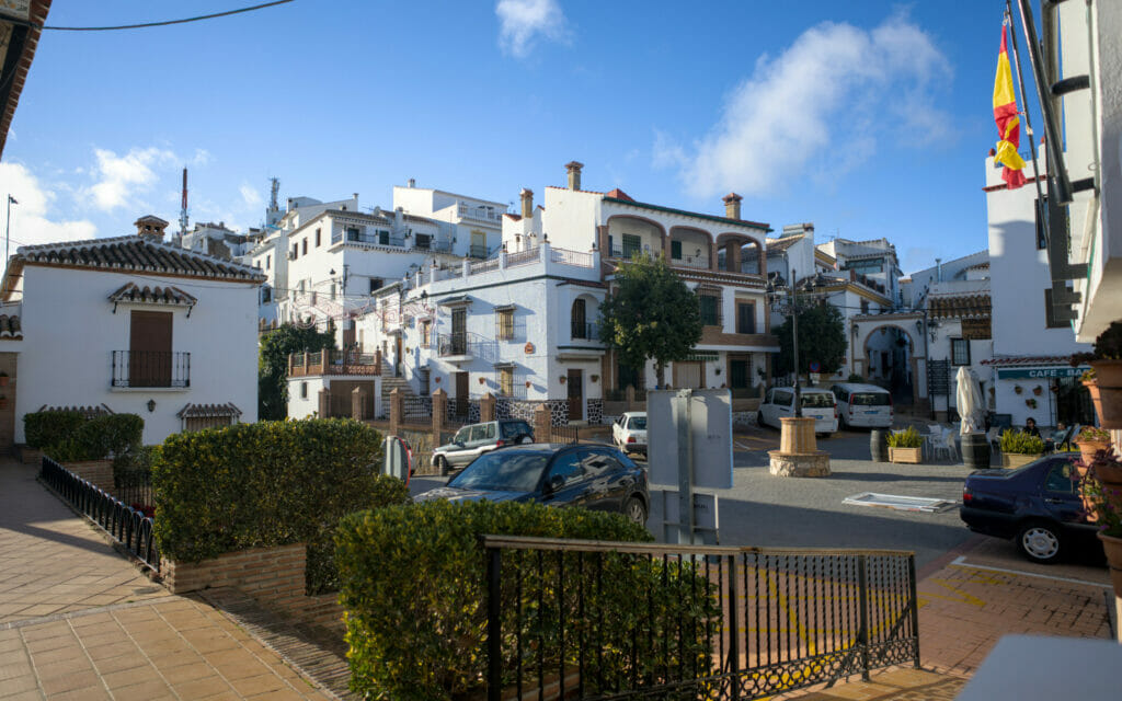
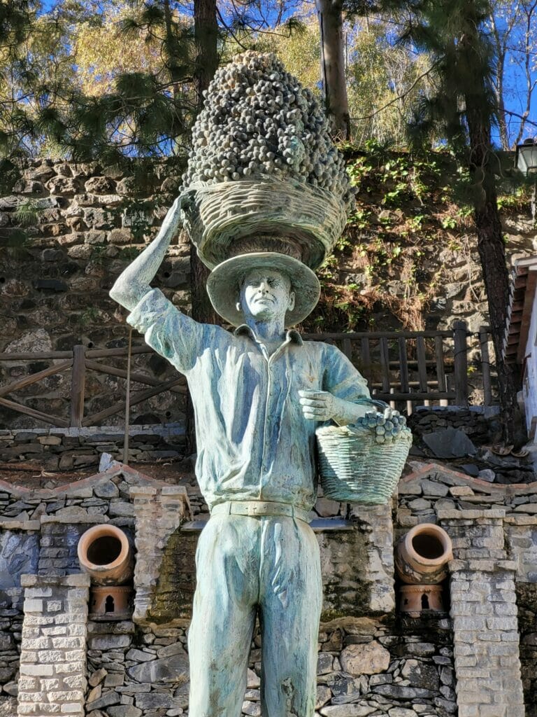
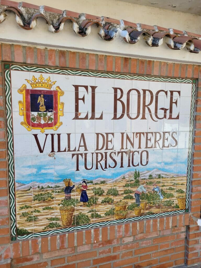
El Borge: the raisin capital
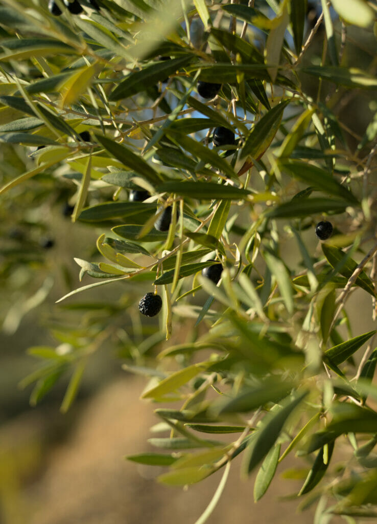
Just on the other side of the Cutar hill lies the small village of El Borge, also known as the raisin capital. El Borge earned this title because it is one of the largest producers of raisins from the Moscatel vineyards. The grapes are dried in the sun on Paseros to produce raisins that are renowned for their sweetness. The grapes from the vineyard are also used to produce the famous Moscatel de Málaga, a sweet white wine that is very popular in Spain.
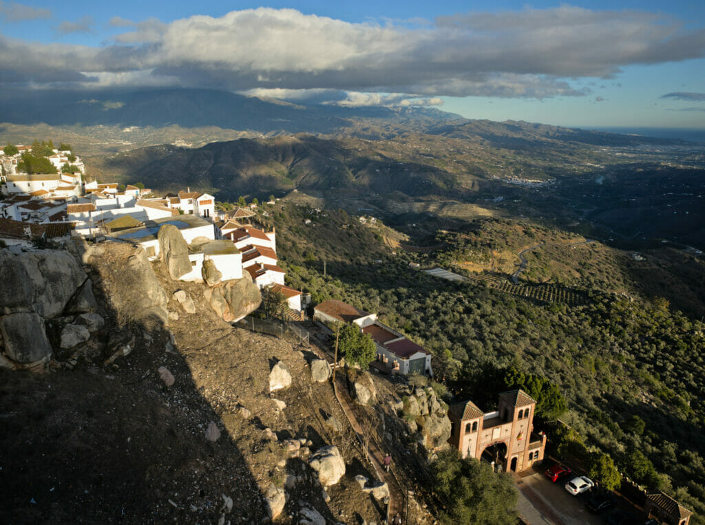
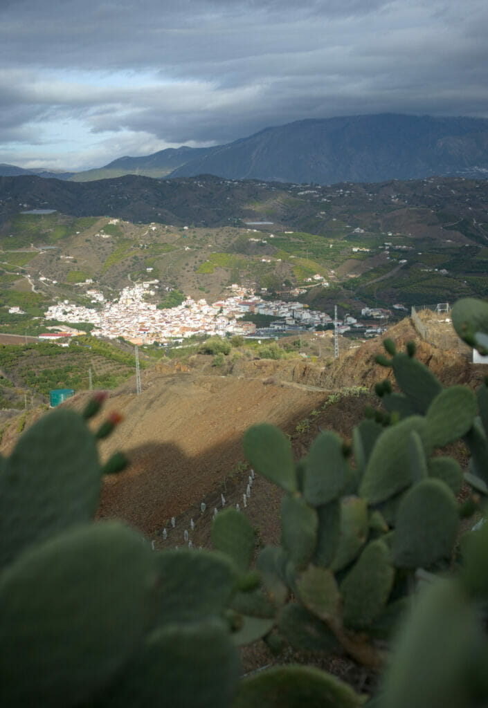
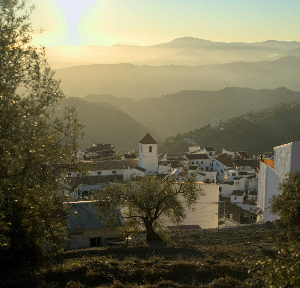
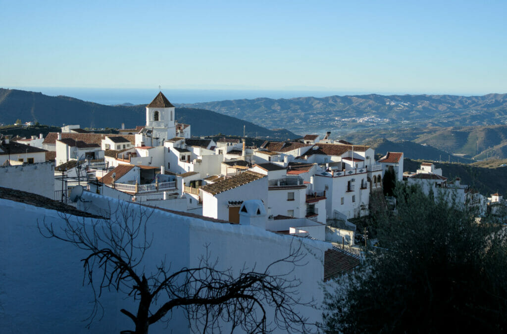
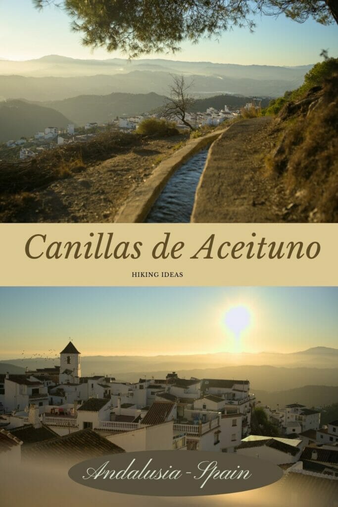
Canillas de Aceituno: a white village nestled at the foot of La Maroma
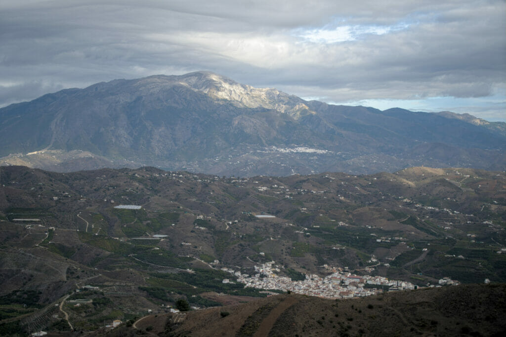
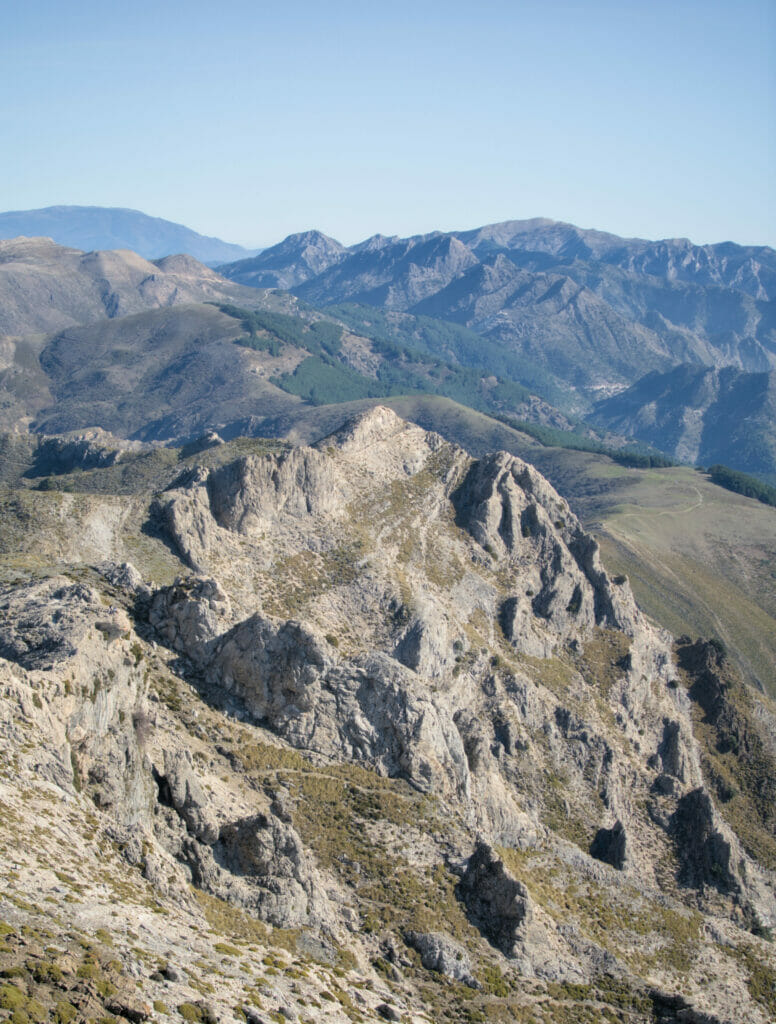
Canillas de Aceituno was our favorite part of the region along with the village of Frigiliana I think. Nestled at the foot of La Maroma, the highest peak in the region, this village offers spectacular views of the sea and the Moroccan coast. It is also the ideal starting point to go hiking in the natural park of the Sierra de Tejeda, Almijara and Alhama, where the walking possibilities are many.
If we can give you any advice, it would be to walk through the upper streets of the village at the end of the afternoon, when the sun is setting. You will have a breathtaking view of the white houses of the village with the sea in the background. Bliss for the eyes!
Our only regret, to not have succeeded in finding a pretty sunny terrace in the village to enjoy this spectacle. But well, we will have to be “satisfied” with a small beer bought in the corner mini-market and enjoyed on a bench with view 😉
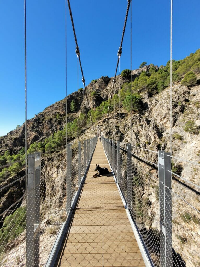
El Saltillo hike and its hanging bridge

As we told you, if we came to Canillas de Aceituno it is primarily for hiking. The most famous walk from the village is undoubtedly the el Saltillo path that connects the villages of Canillas and Sedella through one of the largest hanging bridges in Spain. At the beginning of the path in the village of Canillas, there is a sign that says and I quote:
You have to be really fit and an expert in extreme trekking!
Then you can be relieved right away, the path that takes you to the hanging bridge and to the “waterfall” of El Saltillo is not, according to us, difficult at all (I voluntarily put quotation marks because the waterfall of El Saltillo is not really one 😉 ).
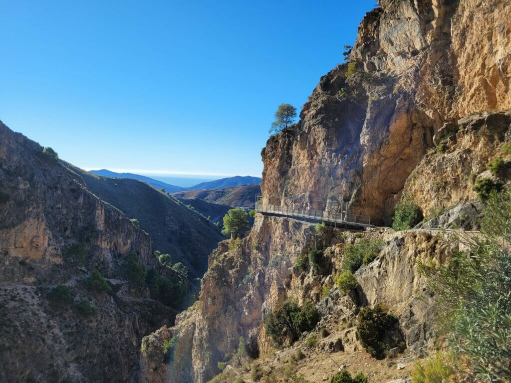
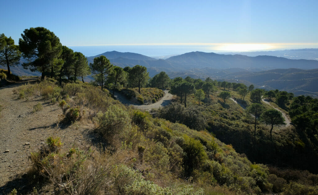
The path first climbs to the top of the village with beautiful views of Canillas and the sea and then continues along a kind of “bisse” (a stream used at the time to irrigate the fields). The path then continues along the hillside following the pipe that collects water from the river.
After about 3.5 km, you will arrive above the hanging bridge of El Saltillo. Either you can continue straight to the waterfall and the river by passing through some nice footbridges along the cliff, or you can go down to the suspension bridge. Obviously we recommend you to do both 😉
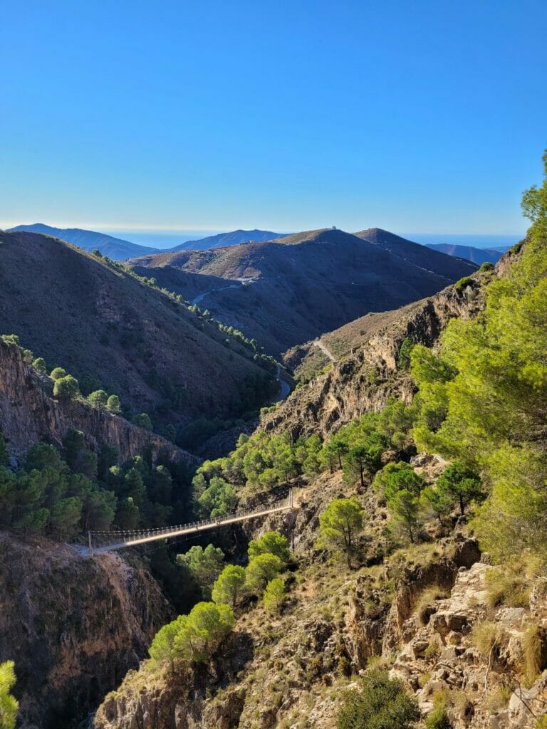
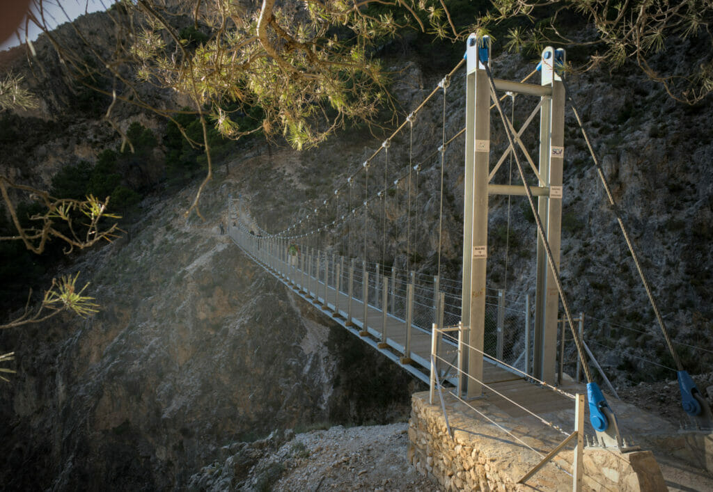
In total the round trip to the river including the descent to the bridge is a little less than 9kms with about 400m of d+- on a very well prepared trail. You don’t need to be an “expert in extreme trekking” to do it 😉 . Here is the map of the hike:
Note: however, if you want to continue to the village of Sedella on the other side of the bridge, the part that goes up just after the bridge is clearly more technical and difficult (see the hike below).
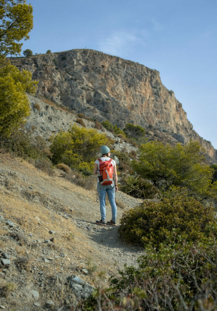
Big hike to the top of La Maroma from Canillas
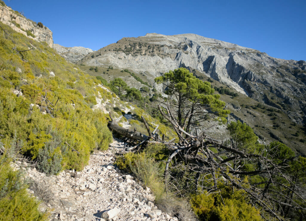
As I told you above, since we arrived in the area of La Axarquia, the summit of La Maroma was on my mind. So while the girls and Winchy were doing the hike to El Saltillo, I started a more challenging hike to the summit of La Maroma.
Warning: The loop to the top of La Maroma from Canillas is more than 23kms with 1650m of d+- . For its length and altitude difference alone, it is already a difficult hike. Even if there are some steep passages, it is not a very difficult route technically. But if you don’t know what it means to walk more than 20kms with more than 1500m of elevation change, I don’t recommend you to try this hike.
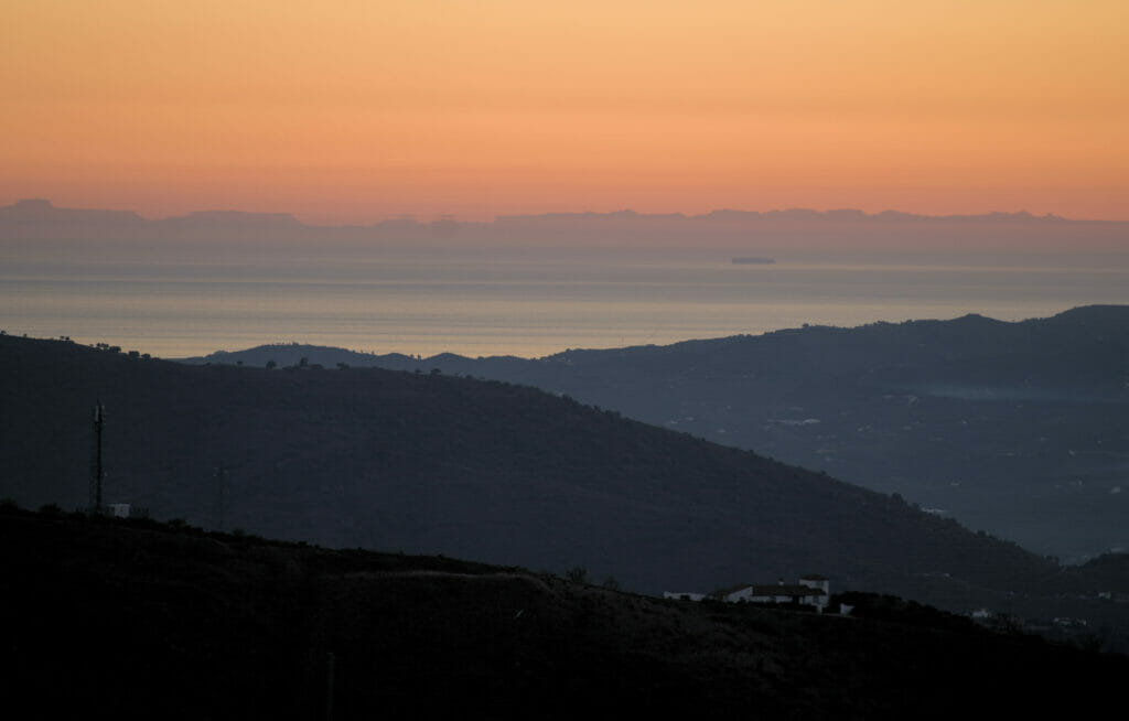
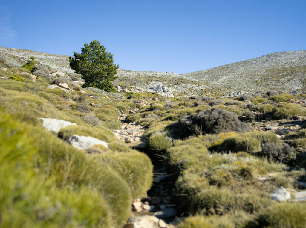
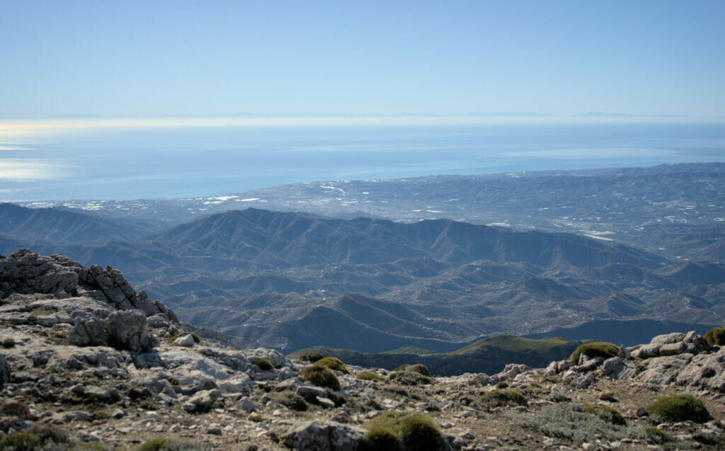
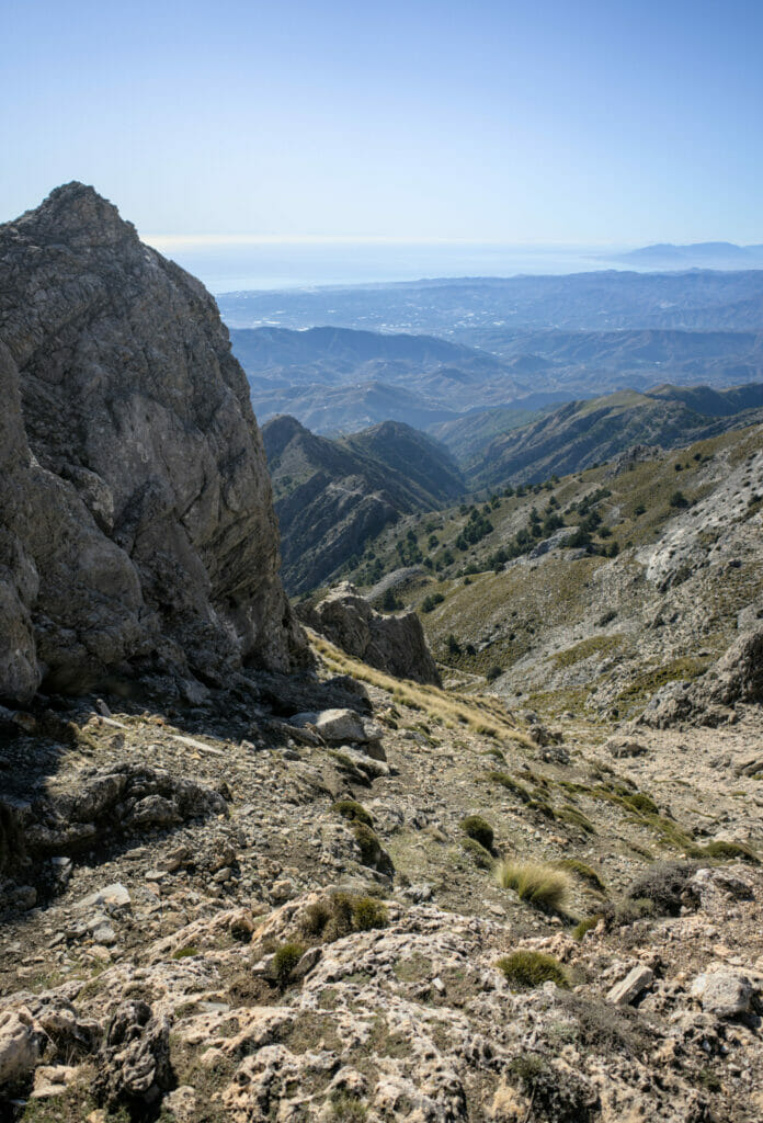
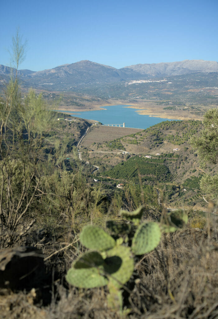
That said, the trail that goes up towards La Maroma from Canillas de Aceituno is really well marked and very pleasant. The ascent is steady and you go from a pine forest over the village to a more and more mineral world as you go up. Underneath, we have a splendid view on the sea, the Moroccan coast (even Algerian), all the region of La Axarquia with a special mention for the Vinuela artificial lake which has a magnificent color seen from above.
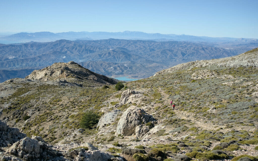
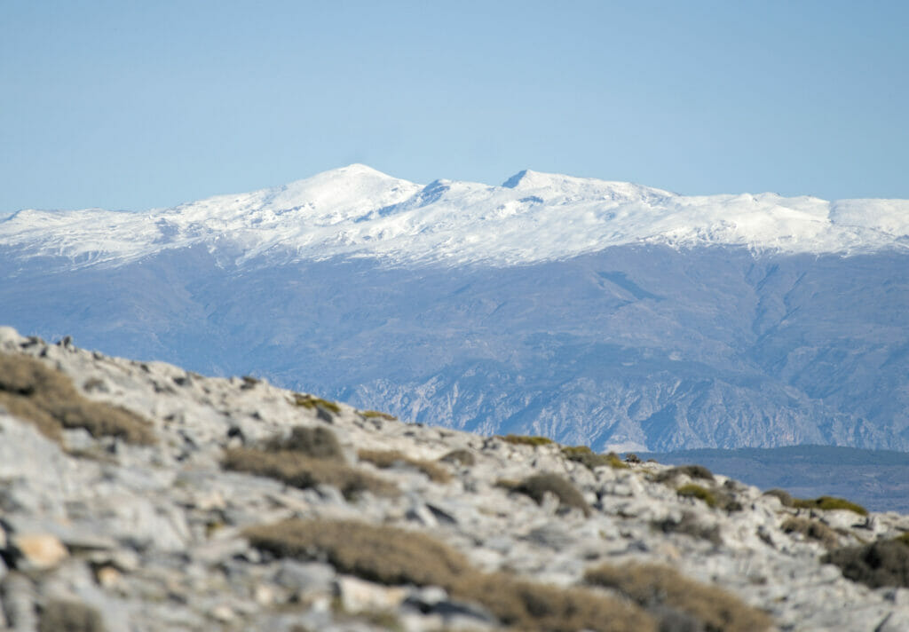
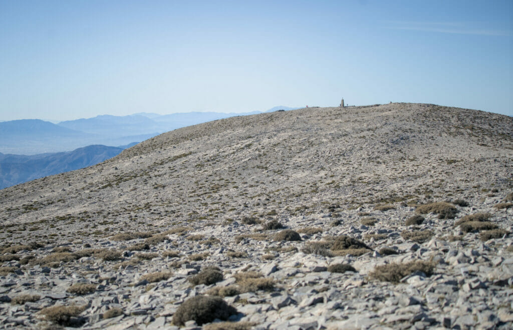
After 9kms and a good climb, I reach the top of La Maroma and its 2069m. It’s funny because the summit is almost flat! I stop to have a picnic while enjoying the magnificent 360 degree view. As it is the highest peak of the province of Malaga, we can see not only the whole region of La Axarquia, the sea and the African coast but also the Sierra Nevada which is located just behind the city of Granada and which reaches almost 3500m (highest peak of continental Spain).
After finishing my picnic, I make a small detour before going back down passing by the summit of Tejeda just a little further to have a better view on the snowy peaks of the Sierra Nevada.
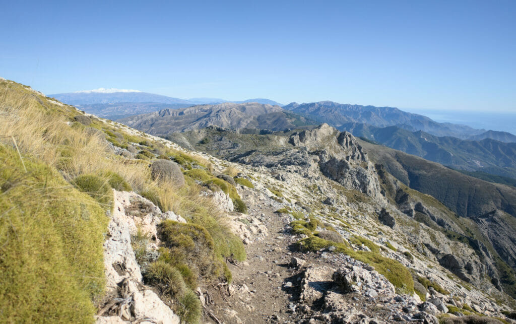
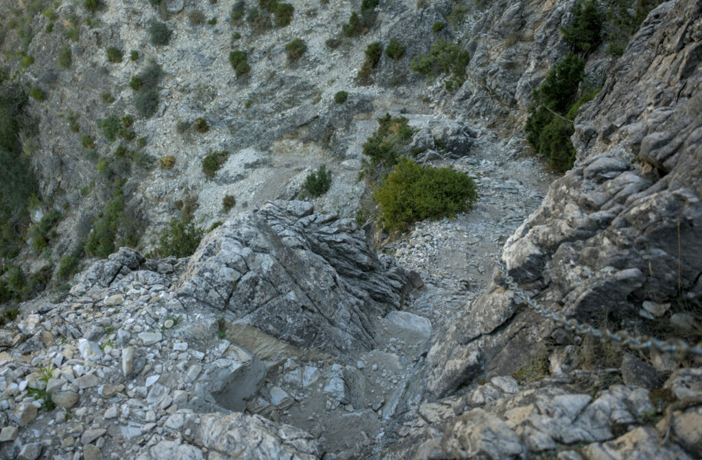
Well, I still have more than 13kms of hiking to do and a big descent to finish the hike. Once I reach a small pass, I dive to the right in a steep and stony corridor. After a short portion where the path is sometimes a little difficult to follow, the path becomes more obvious and I continue my descent along a ridge with a magnificent view on the sea.

After a good 4 km downhill, I reach a track that continues to wind down. At an intersection, I turn right towards Canillas de Aceituno on a track that goes up a bit. At the km 18,6 on the map below, the trail leaves the track to go down towards the suspension bridge of El Saltillo (there is a sign that says “puente colgante del Saltillo”). The last part that plunges down to the bridge is quite steep but the trail is well laid out and equipped with handrails.
I cross the suspension bridge and then go up on the other side to join the part of the hike that the girls did earlier in the day. I start to feel my legs and I’m not unhappy to be back in the village. When I arrive, I am rewarded for my efforts by the beautiful lights of the sun which sets on the village… I will finish this beautiful day with Fabienne, Caroline and a good beer on a bench of the village square while admiring the sunset.
Note: if you take this hike, don’t forget to bring enough water with you because it is not possible to refill on the way.
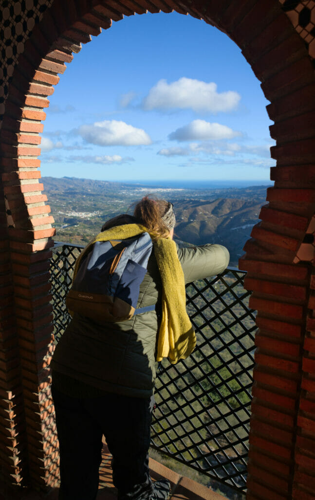
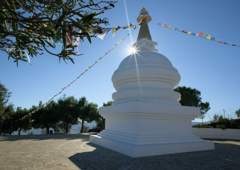
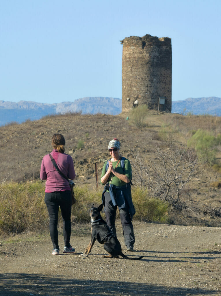
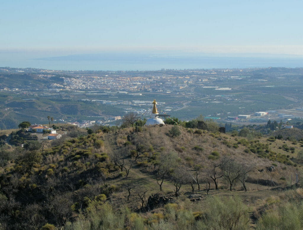
The Kalachakra Stupa and the Atalaya tower
So we don’t know much about Buddhism but we must say we were surprised to learn that there was a stupa not far from the house we had rented. And as we didn’t expect to find a stupa on the Costa del Sol, we thought that it would certainly be interesting to go and have a look at it.
The Stupa is located in the small village of Karma Guen, on a hill overlooking the town of Velez-Malaga and the artificial lake of Vinuela. And the reason why there is a stupa there is because there is an important Diamond Way Buddhist center right next to it. This center can accommodate up to several thousand people and this stupa, created under the supervision of Lopon Tshechu Rinpoche (a highly respected lama), is unique in the western world.
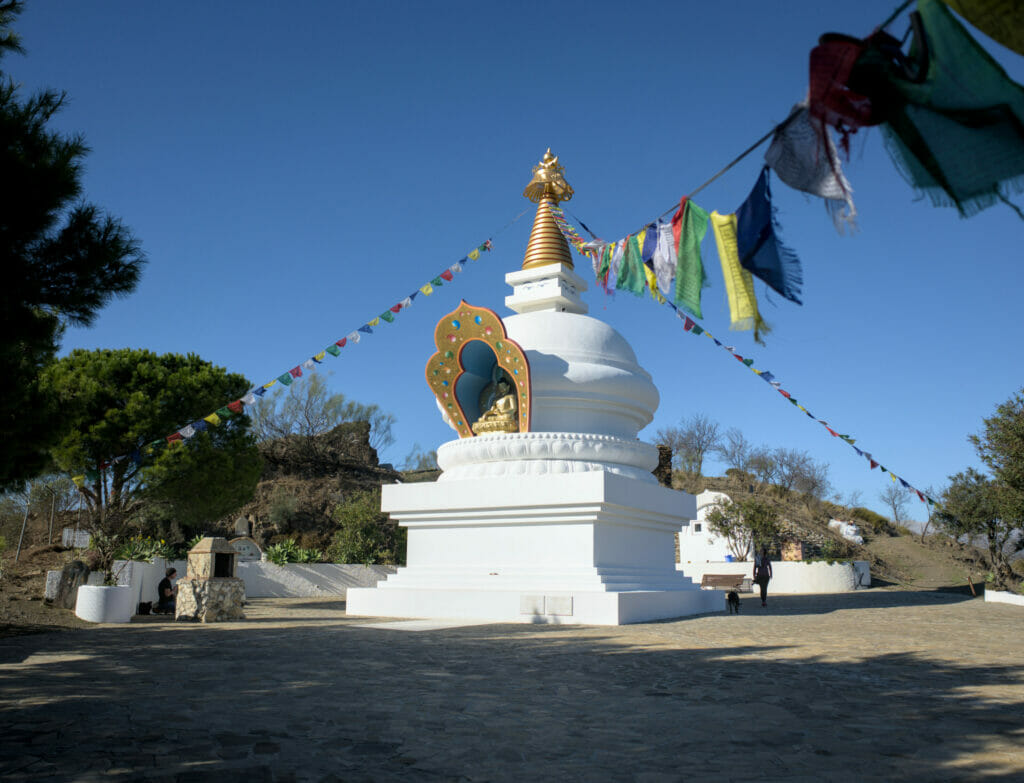
Note: the road up to the Stupa is not necessarily easy to find. From Velez-Malaga you have to turn left onto the MA-3113 and then turn right onto a small road at the Jardines del Trapiche following the signs for “Karma Guen”. Then go up this road as far as possible. We parked the van about 1km from the Stupa but we saw people driving up to the top.
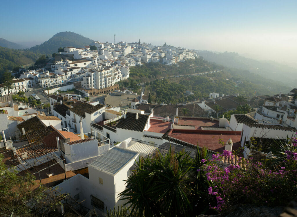
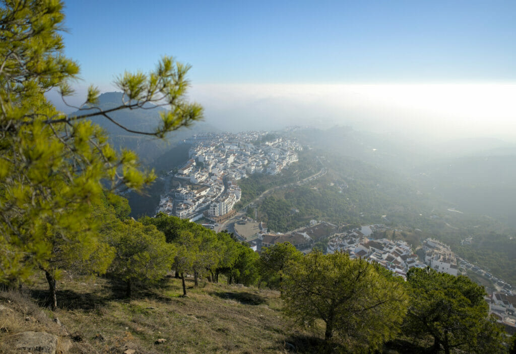
Frigiliana: a beautiful village overlooking the sea
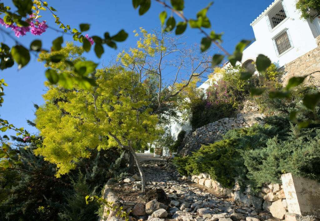
Just like Canillas de Aceituno or Comares, Frigiliana is a beautiful white village sitting on the side of the mountains. We find there as well the influence of the Moorish people with whitewashed houses, a maze of small paved streets, arches… (by the way, if you’re interested, we could do a post about our favorite white villages in Andalusia because I think we visited between 10 and 20). Frigiliana obtained the label of the most beautiful villages of Spain.
But what we really liked about Frigiliana is its location overlooking Nerja and bordering the natural park of the Sierra de Tejeda, Almijara and Alhama. The view of the sea from the village is magnificent and there are great hiking possibilities directly from Frigiliana. In short, we liked it so much that we have concocted a dedicated article for you below:
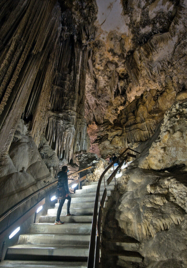
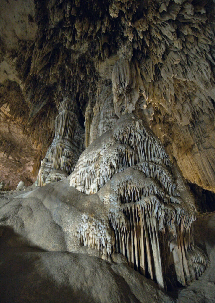
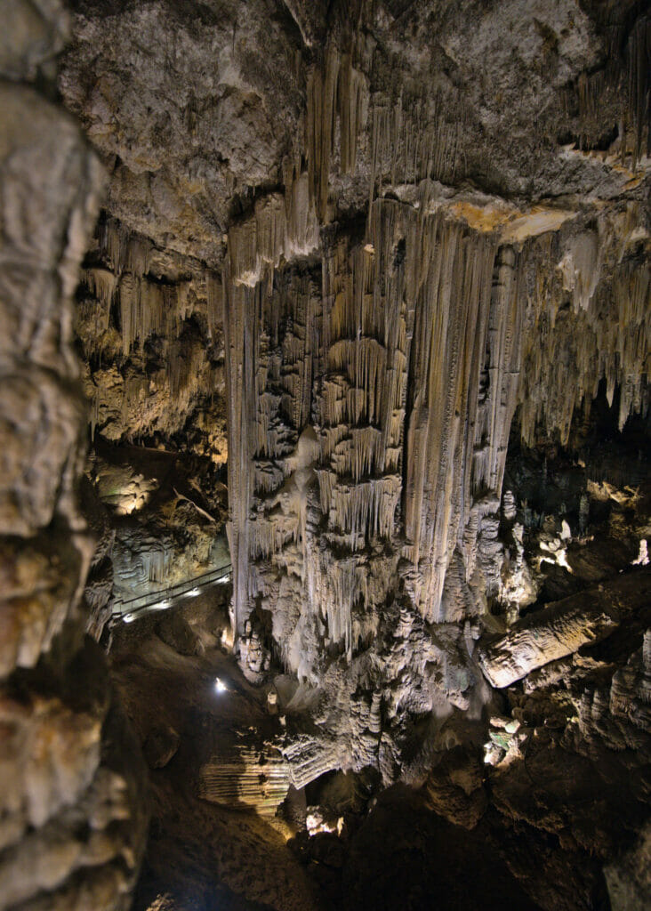
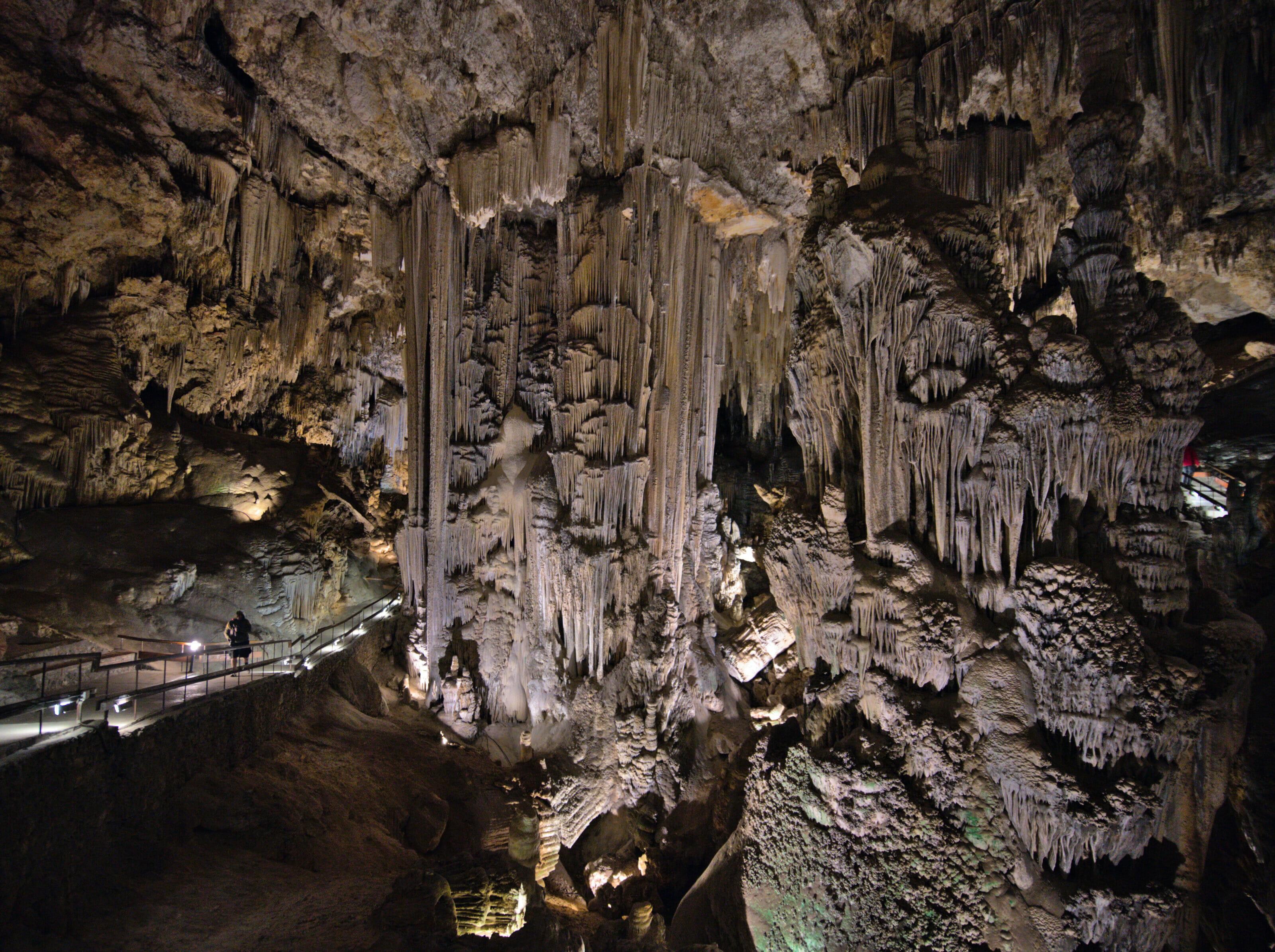
The famous Nerja caves
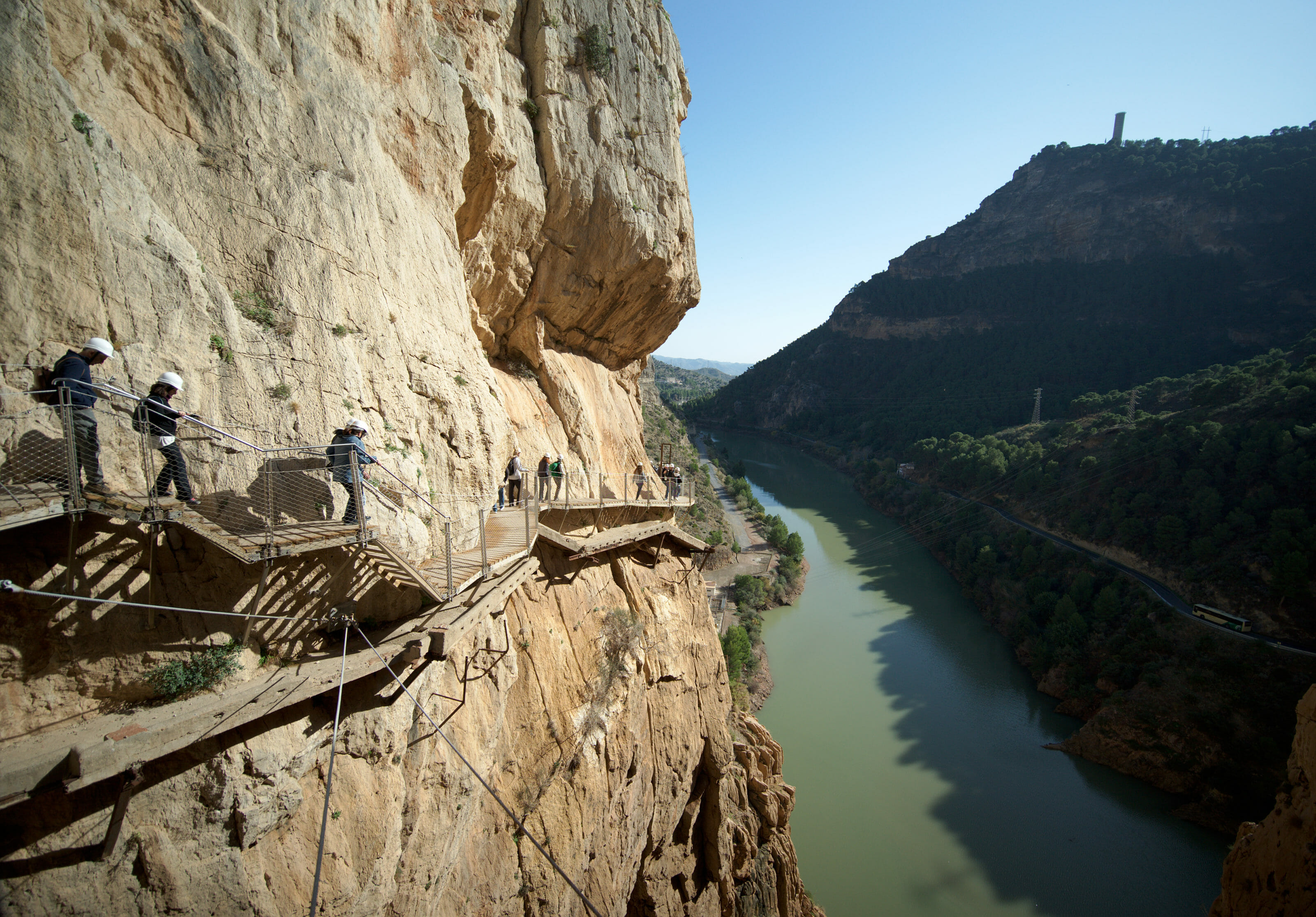
Together with the Caminito del Rey, the Nerja Caves are undoubtedly one of the most visited places in the province of Malaga. And for a good reason! These caves are really massive! You will find the largest column ( the combination of a stalactite and a stalagmite) in the world.
We had the chance to visit these caves on January 31 while everyone was preparing the evening of the new year. So there were very few people and it was really pleasant to visit. For more information about the Nerja caves, we have prepared a dedicated post which contains everything you need to know before your visit.
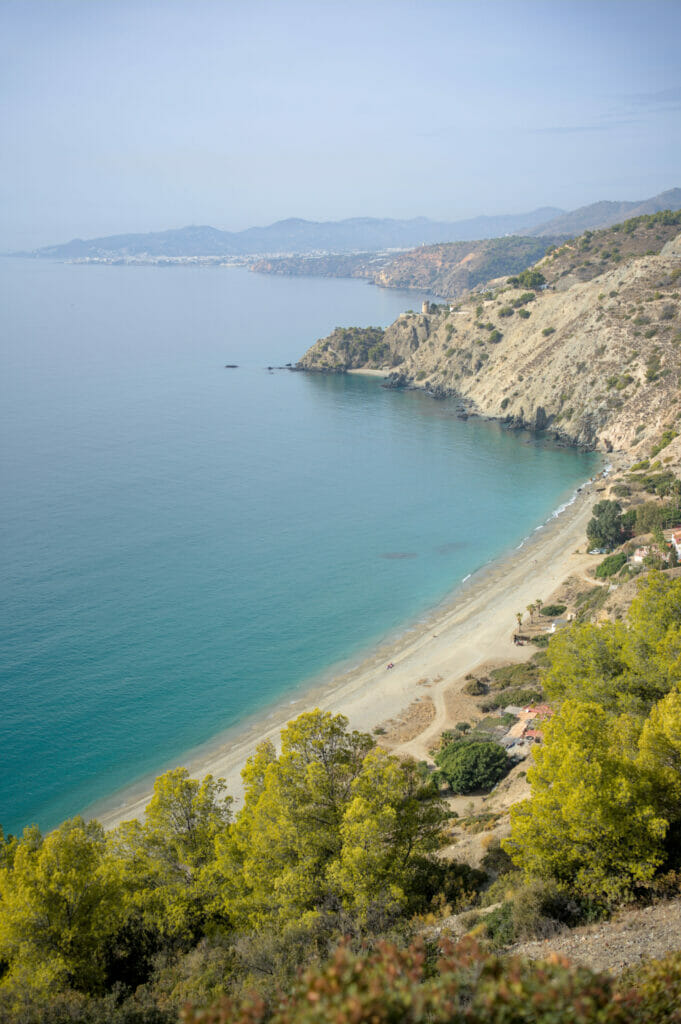
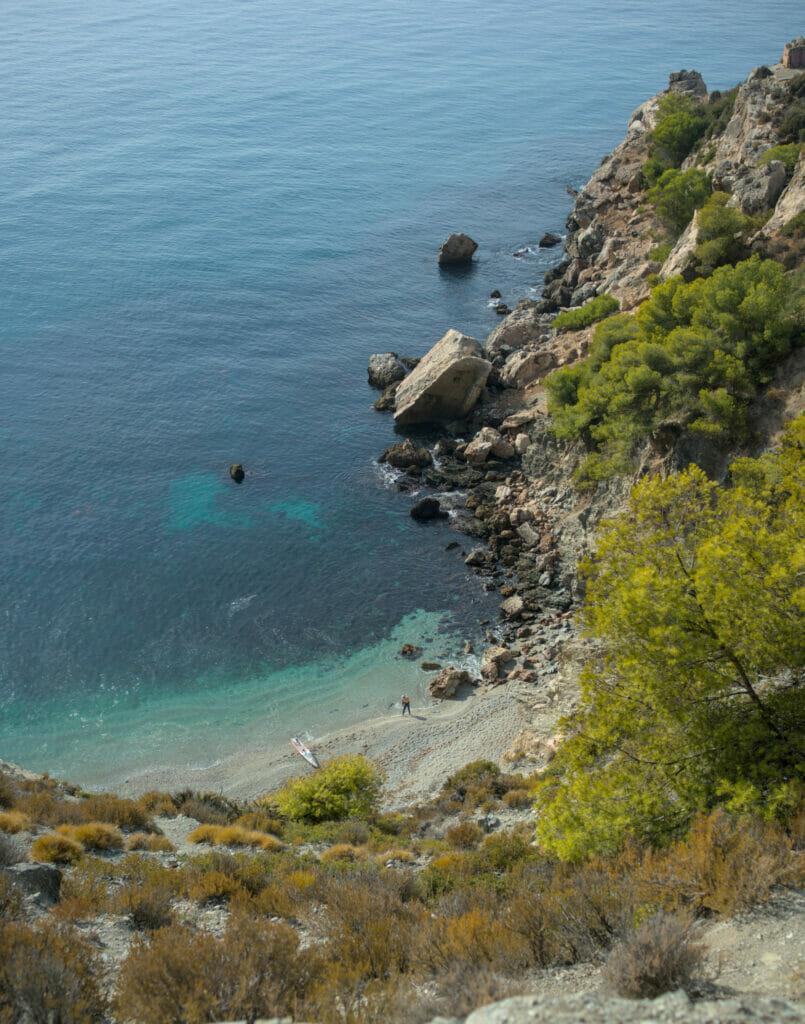
Walk to the playa Cañuelo in the natural site of acantilados de maro
Finally, we finish this post on the La Axarquia region with a short walk to the Cañuelo beach in the natural site of the acantilados de Maro. It is in fact the place where the natural park Sierra de Tejeda, Almijara and Alhama ” falls “ into the sea. You will find beautiful pine forests, cliffs and beaches that well represent the diversity of landscapes that you can find in this region!
For more info about this place, we let you have a look at the end of this blog post:
Our map of the things we did in the La Axarquia region
Here is a small map of the La Axarquia area with the places I mentioned above to help you situate them:
Well, let’s not lie, if you don’t have a car it is unfortunately almost impossible to get around the area by public transport (there must be 1-2 buses a day if you are lucky that go to Frigiliana or Canillas de Aceituno from Velez Malag or Nerja and that’s it).
The first option is to rent a car for your stay. As usual we recommend you to have a look at rentalcars which compares the best offers on the market. Otherwise you could also rent a van and go on a roadtrip in the region
Alternatively, if you are visiting Málaga, Nerja or Torre del Mar, you could take an excursion organized from one of these cities to Frigiliana or Canillas de Aceituno with the Saltillo hike.
That’s it for our discoveries in the Axarquia region in Andalusia. We hope that our posts about this nice place in the south of Spain have been useful for you and we’ll see you soon for the next part of our roadtrip in Andalusia. We will take you to the region around the small town of Ronda where we made a lot of nice discoveries (Edit: our post about the ronda region is out).
Pin it on Pinterest
Note: if you go through one of our links to rent your car or take a trip in the area, we will get a small commission (and you won’t pay a cent more). By doing this, you support us in creating free and independent guides like this one. Thank you for your support!

Join the discussion