To be honest, when we were planning our trip to Norway, we weren’t really sure if we wanted to do the famous hike to Preikestolen above the Lysefjord. It’s definitely Norway’s most iconic (and most photographed) rock, and you’ve probably already seen it online or even in the final fight scene of Mission Impossible 6, haha.

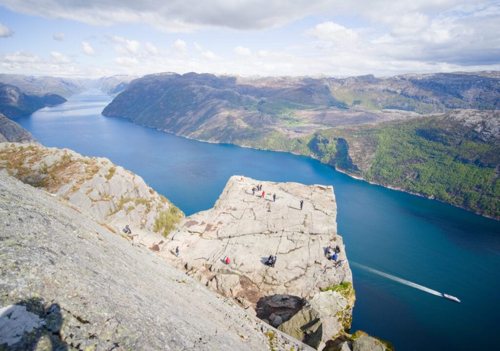
If you’re not familiar with Preikestolen, it’s a sort of almost perfectly square ledge that juts out from the mountain to a vertical cliff more than 600 meters above the Lysefjord. This spot is so popular that it attracts over 300,000 hikers a year!!! (Yes, you read that right). On busy days in the summer, there can be anywhere from 3,000 to 6,000 people hiking up to the Preikestolen rock. It’s just completely crazy, and it didn’t really make us want to go there.
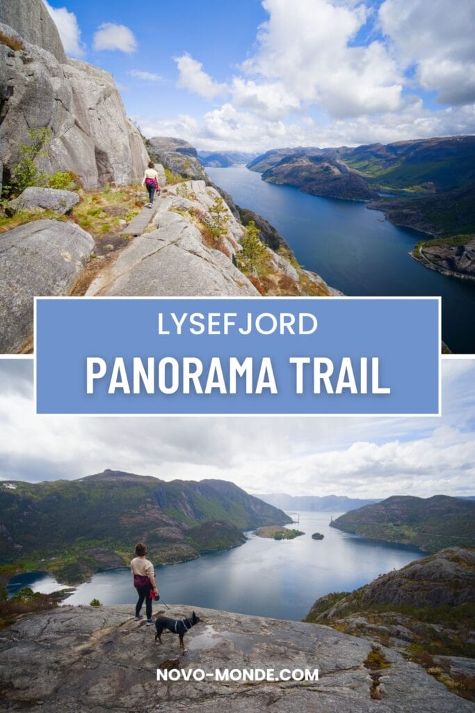
But while looking for alternatives around the Lysefjord, Fabienne came across the Lysefjord Panorama Trail, a newly developed trail that runs along the cliff above the Lysefjord, offering spectacular views of it. We had planned to do that hike instead… but upon studying the Alltrails map in a bit more detail (their new heatmap is great for that!), we realized there was a path leading to Preikestolen from the Panorama Trail.
That’s how the idea came about to kill two birds with one stone by combining the two through trail running (or a long hike). Let’s dive in, I’ll explain it all in detail in this article.
Lysefjord Panorama Trail and Preikestolen: Practical Information and Logistics
The Lysefjord Panorama Trail
To hike the Lysefjord Panorama Trail, you have two options:
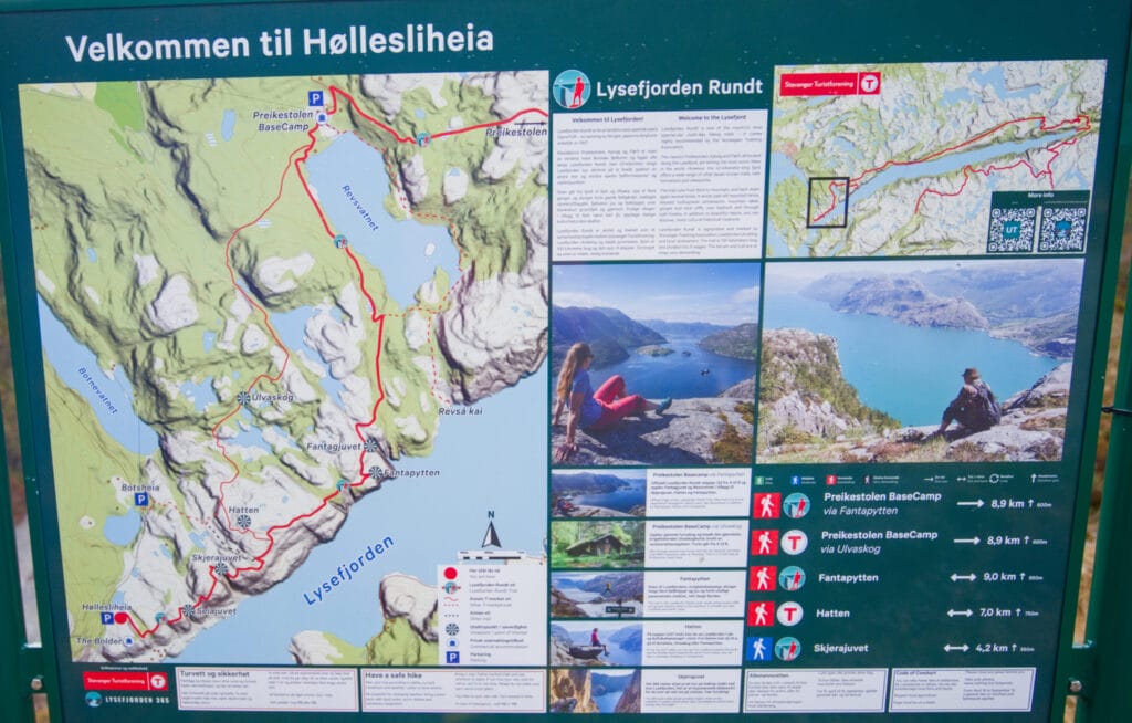
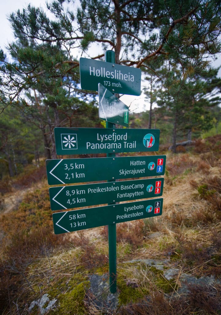
- Doing a round trip from the Høllesliheia parking lot: This is the option we chose because this parking lot is free, unlike the one at Preikestolen, which costs a fortune. In this case, the distance will depend a bit on how far you decide to go. We’ll let you decide as you read on, but if you go all the way to Revsvatnet Lake, it’ll be a 12–13 km round trip. But if you go as far as Fantapytten (the Fountain of Youth), you’ll pass by most of the viewpoints, and that’ll be a 9-km round trip.
- Do it as a one-way trip by parking at the Preikstolen parking lot and then taking the shuttle bus to Høllesliheia: This option will allow you to hike the entire Panorama Trail without having to make a round trip. However, you’ll have to pay 275 NOK for parking plus 70 NOK for the shuttle, which runs only from May to September, once a day at 11 a.m. If you choose this option, the distance between Høllesliheia and the Preikestolen parking lot is 9 km.
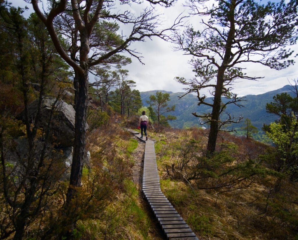
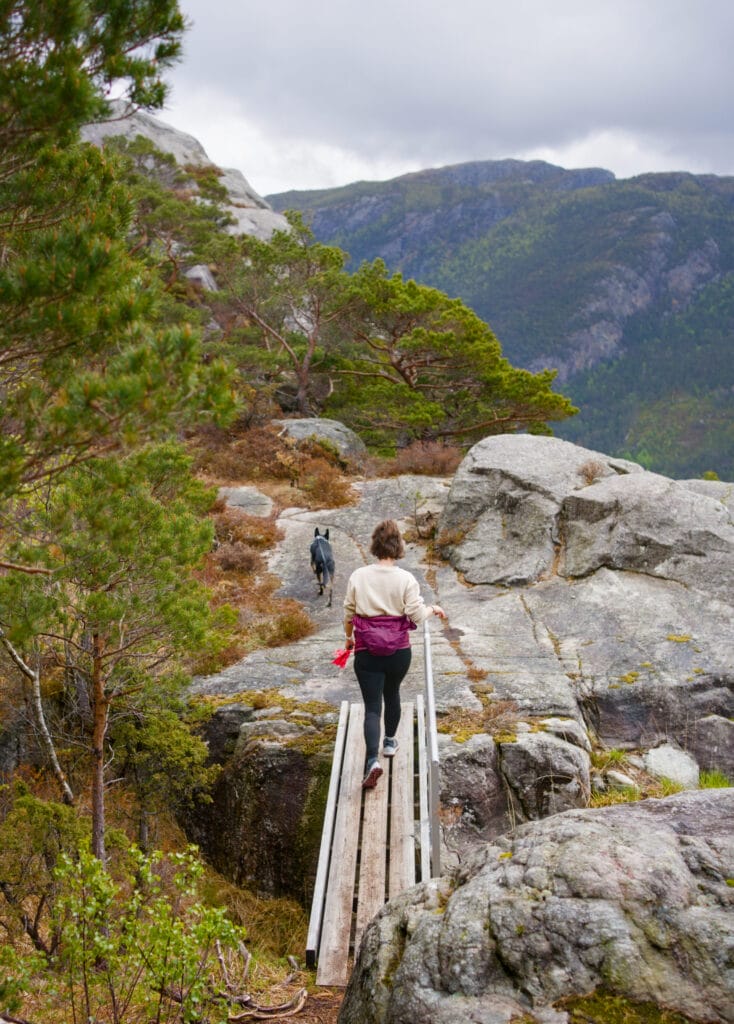
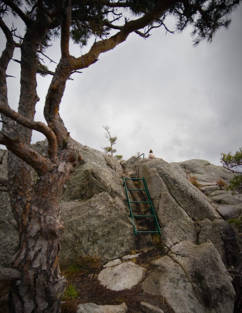
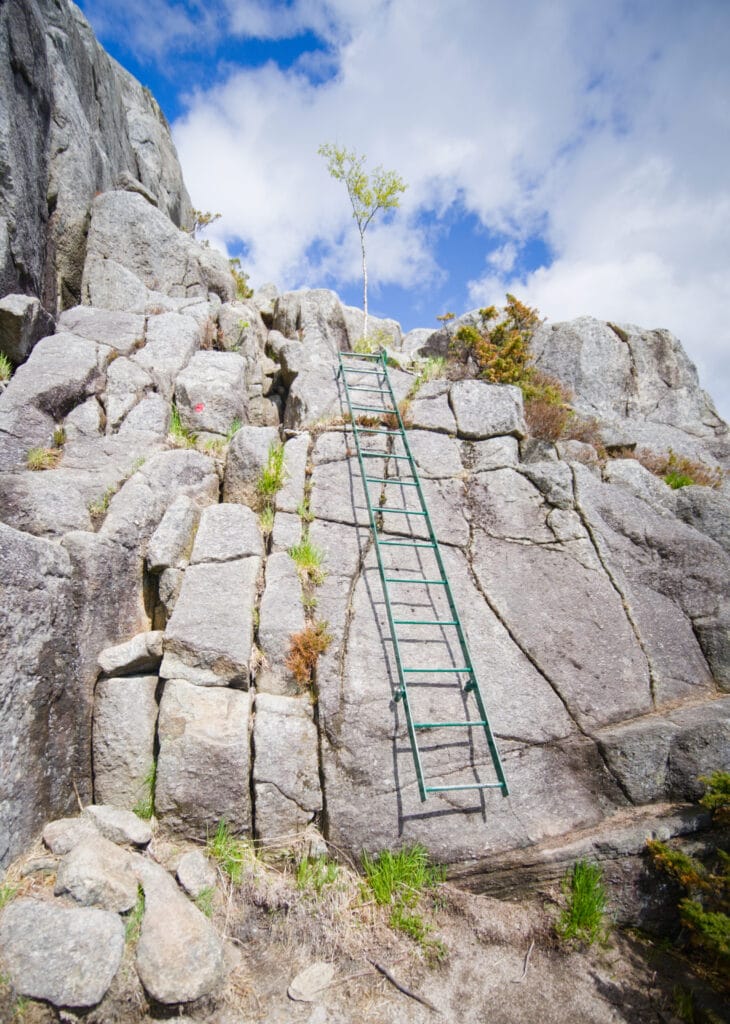
As for the difficulty, I’d say it’s moderate, but it’s still a hike that shouldn’t be underestimated. If you hike to the lake and back, you’ll still do around 900 meters of elevation gain, which is no small feat. On the other hand, the trail is much better maintained than the average Norwegian trail. There are wooden planks everywhere the ground is wet. Then, on the most exposed section just behind Hatten, there are great ladders at every slightly more difficult spot (more details below).
The Preikestolen Hike
Officially, there’s only one way to get to Preikestolen, but I’m going to share an alternative route with you:
- The classic route from the official Preikestolen parking lot (shown in light blue on the map below): This is the route I mentioned earlier, which can see between 3,000 and 6,000 people per day during peak season. From P1, the trail is extremely well-marked and is just over 9 km (round trip) with 540 m of elevation gain. If P1 is full (it can hold 400 vehicles), P2 is a bit further away and will add about 2 km to the hike.
- The trail that climbs up from behind, starting at Lake Revsvatnet (marked in purple on the map): I found this route after seeing on the AllTrails heatmap that people were accessing Preikestolen from this side. So I’d better warn you: this trail is rather poorly marked, and I got a bit lost a few times while hiking up there. But if you keep your phone closeby to check the route, it’s not that complicated (no real technical difficulty). And this way, you’re practically guaranteed to be alone all the way to Preikestolen! I literally didn’t run into a single person until I reached the summit of Neverdalsfjell.
If this option interests you, you can either do it as a loop starting from the Preikestolen parking lot (about 12 km with 700 m of elevation gain) or combine it with the Lysefjord Panorama Trail. However, the latter option is quite challenging, as the round trip covers 21.5 km with about 1,600 m of elevation gain, or about 16 km with 1,300 m of elevation gain if you take the shuttle bus back to the Preikestolen parking lot. Personally, I did it as a trail run by combining the Panorama Trail with the alternative trail, and it was a long outing (meaning I was pretty tired by the end).
Map of the different hikes (+ GPX)
Getting to Preikestolen
Of course, it depends on whether or not you have a car to get there. If, like us, you have your own vehicle, there are two ways to get to Preikestolen:
- From Stavanger, take the A13 tunnel (which is currently still the longest and deepest undersea road tunnel… a record that will be broken in 2033 by a tunnel currently under construction right next to it). However, it’s not cheap, and you should expect to pay around 170 NOK to cross it
- By taking the ferry from Lauvik to Oanes, which also costs around 180 NOK. That’s the option we chose since we were coming from Frafjord.
So as you can see, when you factor in the parking fee at the start of the hike, visiting Preikestolen really isn’t cheap… which is why the alternative trail from Lysefjord the Panorama Trail is a good option if you have the stamina and the time 😉
If you don’t have your own transportation, we don’t think it’s worth renting a car if you plan to do the official hike (it’s too expensive with parking). Instead, we recommend that you:
- take the Preikestolen Express bus from Stavanger
- Check out GetYourGuide for a tour that combines a boat ride on the Lysefjord, the Preikstolen hike, and a return trip by bus.
Bus between the Preikestolen parking lot and the start of the Lysefjord Panorama Trail
This bus service is a new offering that was introduced along with the Lysefjord Panorama Trail. As I mentioned earlier, during the high season (May through September), there is one bus per day that departs from P1 at Preikestolen to take you to the start of the Panorama Trail at 11 a.m. for 70 NOK. In October, the buses run only on weekends at noon. You can find more information on the Lysefjord Panorama Trail page.
Prices for the various parking lots
I mentioned this briefly earlier, but here are the various parking options available around Preikestolen and the Lysefjord Panorama Trail:
- P1 and P2, the official Preikestolen parking lots, for 275 NOK per day (details here)
- the Høllesliheia parking lot at the start of the Lysefjord Panorama Trail (which is free)
- The Hatten parking lot: The Lysefjord Panorama Trail runs right behind the summit of Hatten and also follows part of the official loop trail around the summit. Along Route 523, there is a parking lot designated for this hike with about 50 spaces, costing approximately 20 NOK per hour. So this is also an option if you want to do something in between the Panorama Trail and Preikestolen.
Lysefjord: Where is it? What is it?
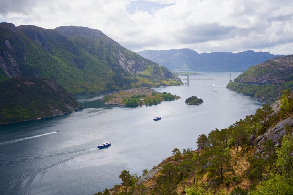
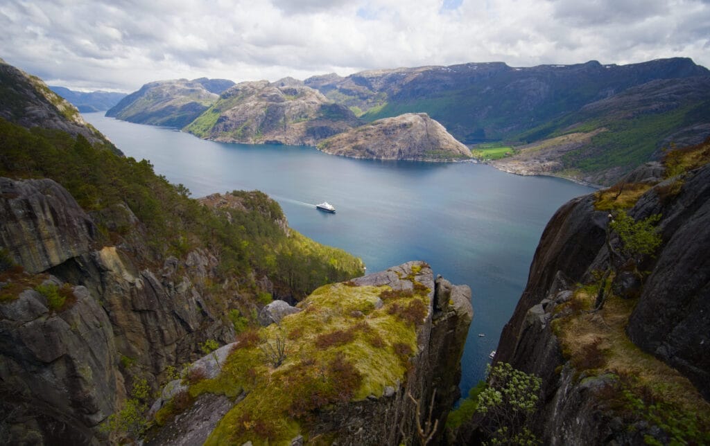
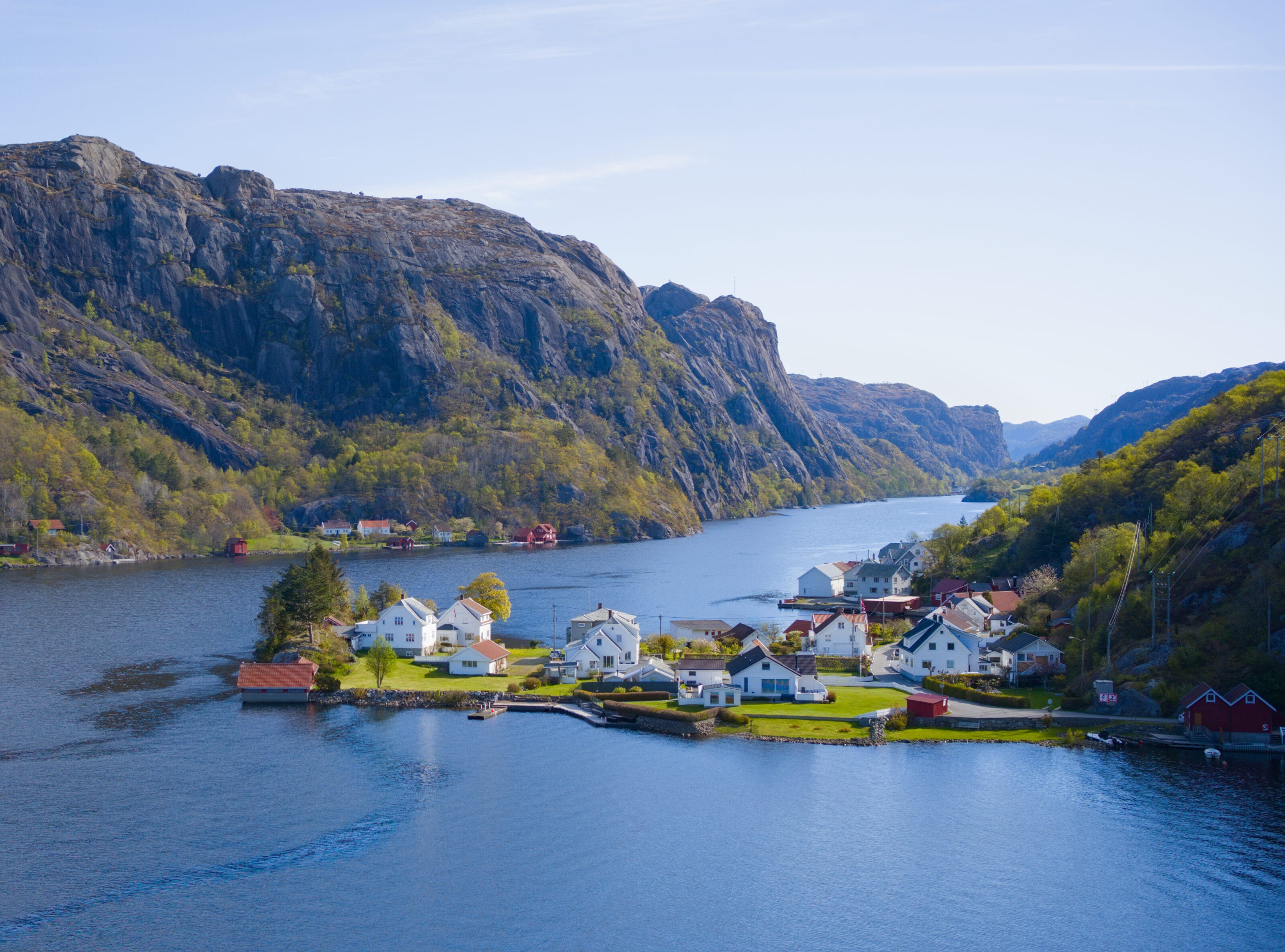
Lysefjord is located in southwestern Norway, near the city of Stavanger, and is 42 kilometers long (it is by no means the longest fjord in Norway, as Sognefjord is over 200 kilometers long). It is best known for the steep cliffs that surround it, with the highest ones reaching about 1,000 meters at the head of the fjord near Mount Kjerag.
Its name means “the fjord of light” because the granite of the surrounding mountains is light in color, which contrasts with the dark blue of the water. But it’s also so well-known because two of Norway’s three most famous rock formations are located there (Preikestolen, Kjeragbolen… the third being Trolltunga, which is located a bit further north).
Yet there’s plenty to see and do beyond those two little islands in the Lysefjord… and the Panorama Trail is one of them.
Our experience on the Lysefjord Panorama Trail
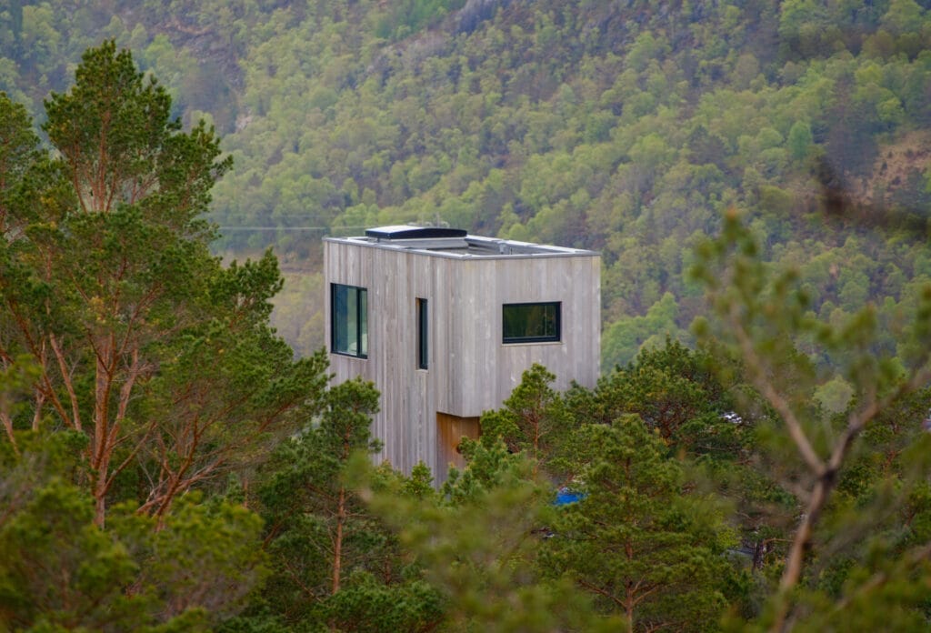
So we parked at the free parking lot at Høllesliheia, right next to the luxurious lodges at The Bolder (it looks pretty nice, but it’s not exactly within our budget lol). The hike starts at a large information sign that gives you more details about the Lysefjord Panorama Trail, as well as the hike that goes all the way around Lysefjord (over several days, of course), of which the Panorama Trail is just a small part. I have to admit that now that we’ve done the Panorama Trail, hiking all the way around the fjord could be a great project for a future trip 🙂
We start by heading up toward the fjord, with the lodges at “The Boulder” overlooking the Lysefjord to our right. The great thing about the Panorama Trail is that the path actually runs along the cliffs overlooking the fjord 75% of the time. So you have plenty of time to enjoy the view as you walk.
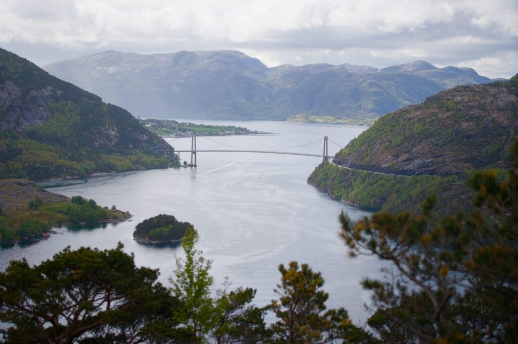
The first part of the trail is fairly easy and offers beautiful views of the fjord’s entrance and the imposing bridge that spans it. Since it’s Norway’s National Day (May 17), there aren’t many people on the trails… But the few people we do come across are all carrying Norwegian flags in various forms, and everyone greets us (whereas up until now, Norwegians haven’t exactly been very demonstrative, shall we say).
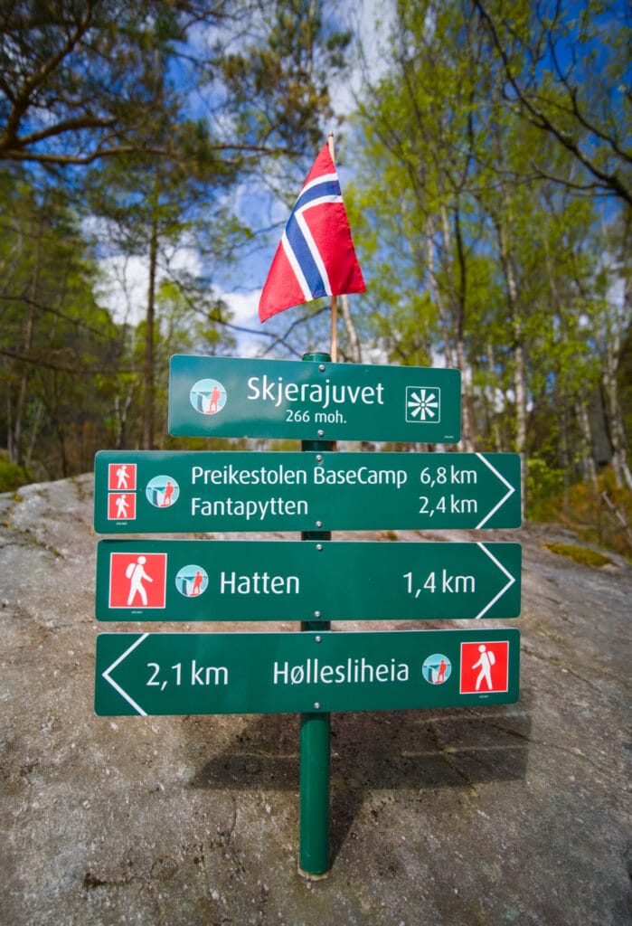
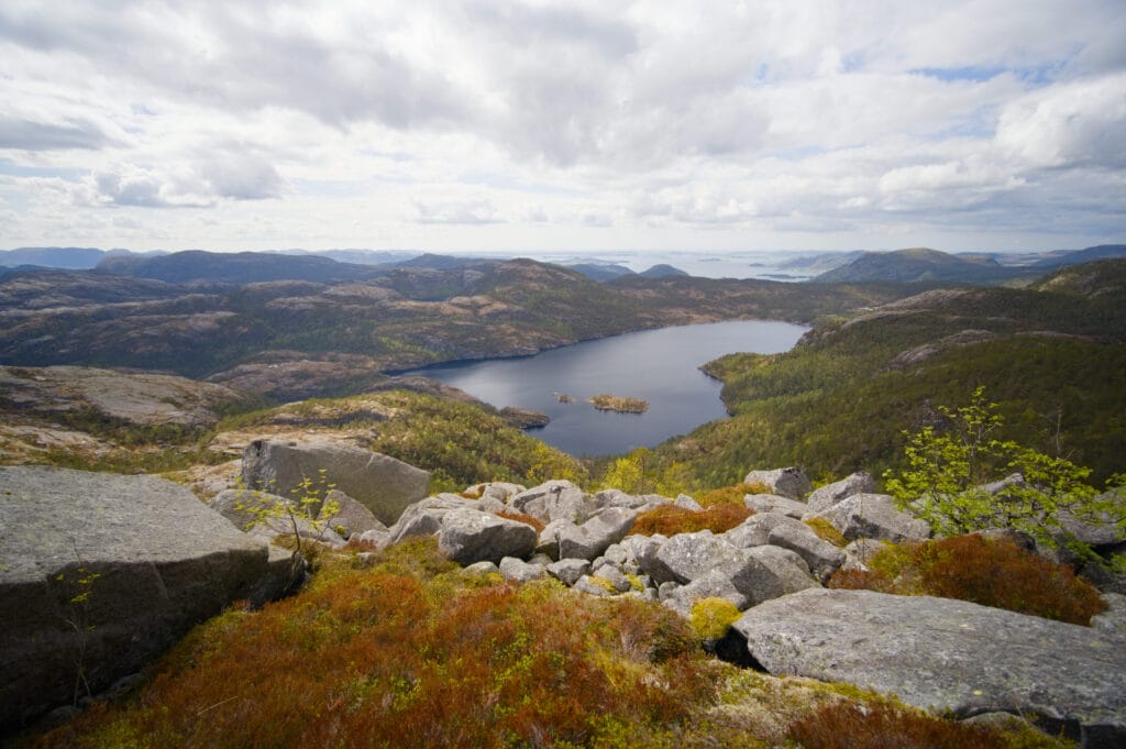
After reaching a small peak (Skjerafjellet) with a breathtaking view of the fjord, we head back down to a place called “Skjerajuvet,“ a sort of steep gorge that descends all the way to the fjord. There we come across a Norwegian couple in the middle of a National Day photo shoot. They even leave a small Norwegian flag on the hiking trail sign to celebrate!
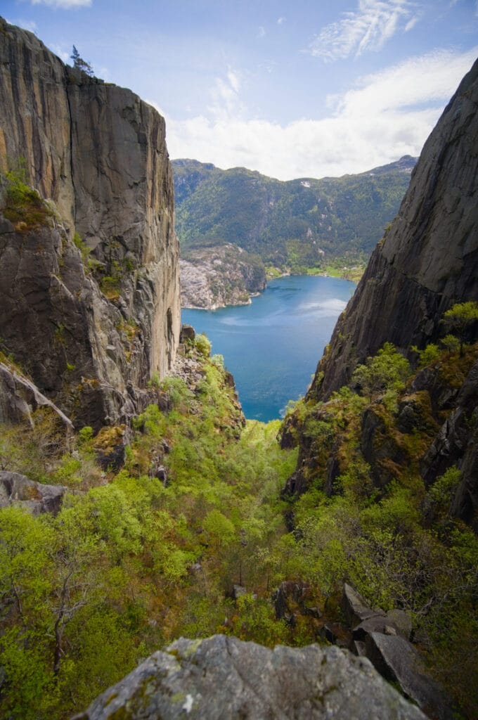
The next section, which climbs toward Hatten, is a bit more challenging but still very well maintained. As you climb, the view of the rest of the Lysefjord opens up, and you begin to understand a little better why it’s nicknamed “the fjord of light.” The contrast between the light color of the rocks and the blue of the fjord is striking.

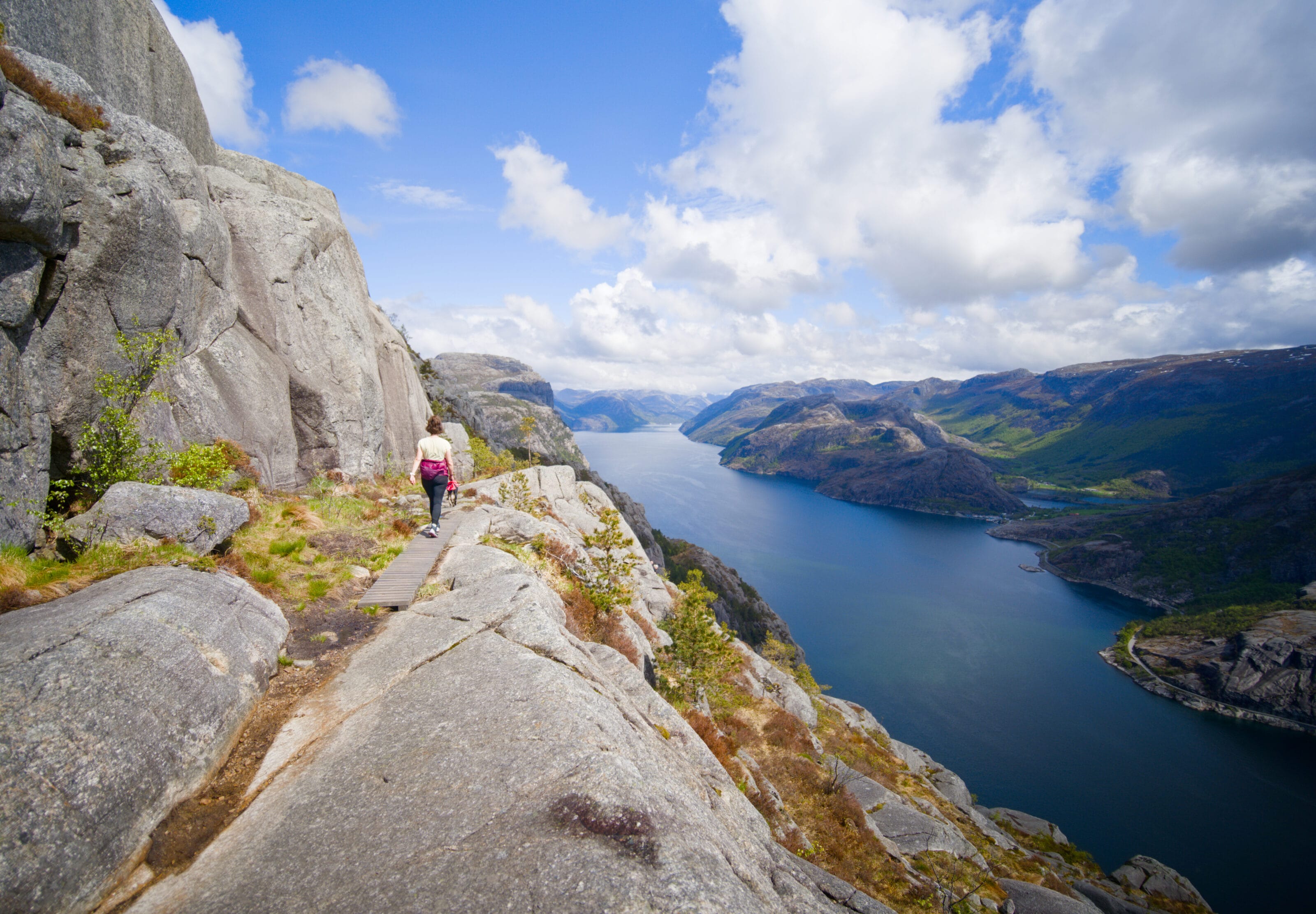
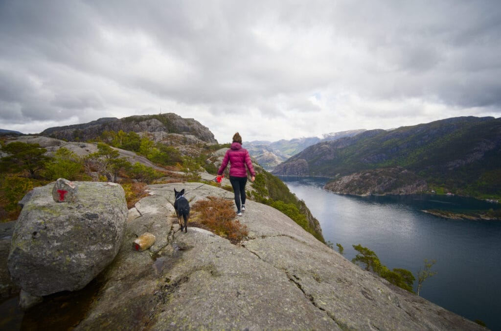
Then, unfortunately, we come to the bottom of a slightly longer ladder that’s difficult to climb with our dog Winchy (this section is marked “Hatten (hard)” on the AllTrails map). So this is where we’ll part ways with Fabienne, and I’ll continue on my own in trail running mode all the way to Preikestolen. Fabienne doesn’t really have any regrets, since the trail up to this point has already been incredible! If you want to tackle this section with your dog, make sure you have a harness suitable to carry him.
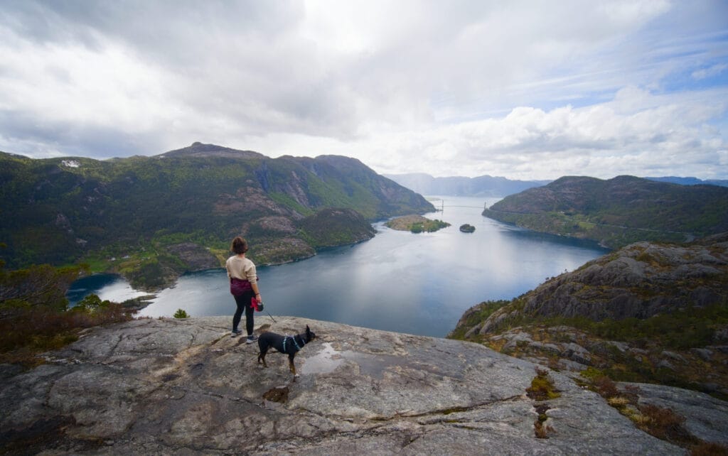
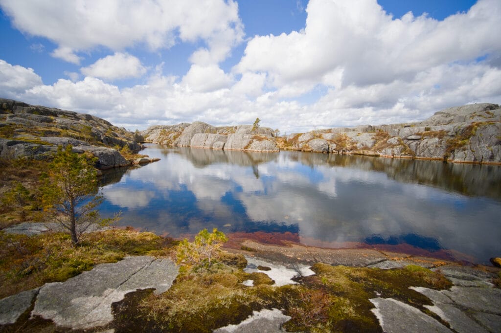
After a quick change of clothes, I continue on my own along the rest of the Lysefjord Panorama Trail. After a second similar ladder, the trail descends toward “Fantapytten,“ the fountain of youth. When I arrive, I find another couple in the middle of a photo shoot: on one side, the woman is striking the “bridge” yoga pose while her partner takes photos as best he can. I snap a quick shot of this pool, which looks like an infinity pool overlooking the Lysefjord, and leave them to their photo shoot 😉
Note: I also think this is a good spot to turn back if you need to head back to the parking lot where the hike started. By this point, you’ll have seen most of the scenic overlooks, and I don’t think it’s necessary to go much further.
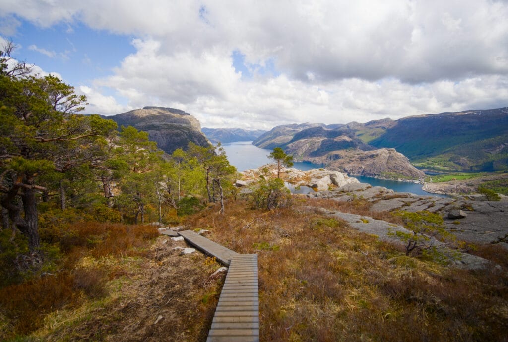
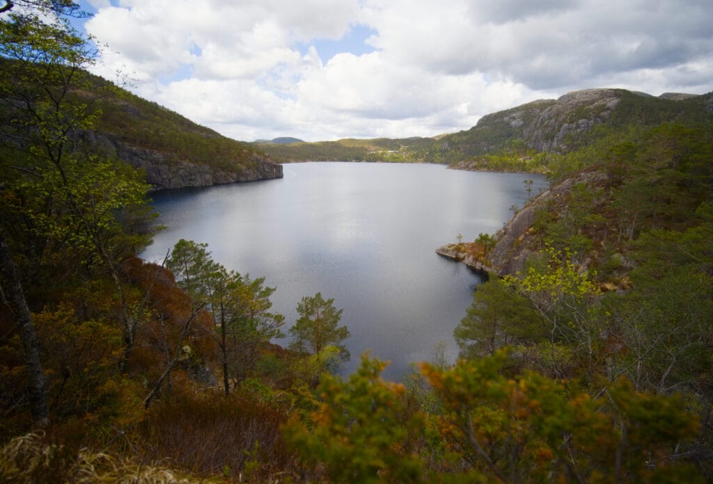
If you plan to continue on to the Preikestolen parking lot, you’ll pass by the Fantagjuvet gorge again and then reach Lake Revsvatnet, which you’ll need to follow along the left shore (Preikestolen’s P1 parking lot is located just across the lake).
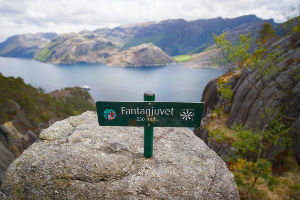
Alternative route to Preikestolen from the Lysefjord Panorama Trail
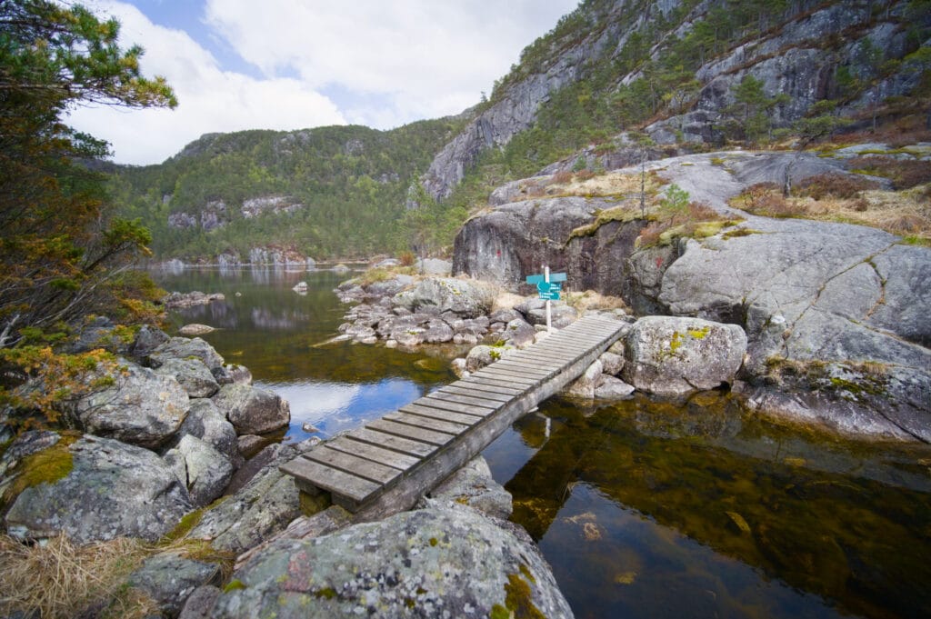
To continue on to the famous Preikestolen, simply follow the well-marked trail that runs along the right side of the lake. After crossing a small bridge, turn right onto the path that climbs toward “skapet.“ So far, so good, but that’s when things get a little trickier.
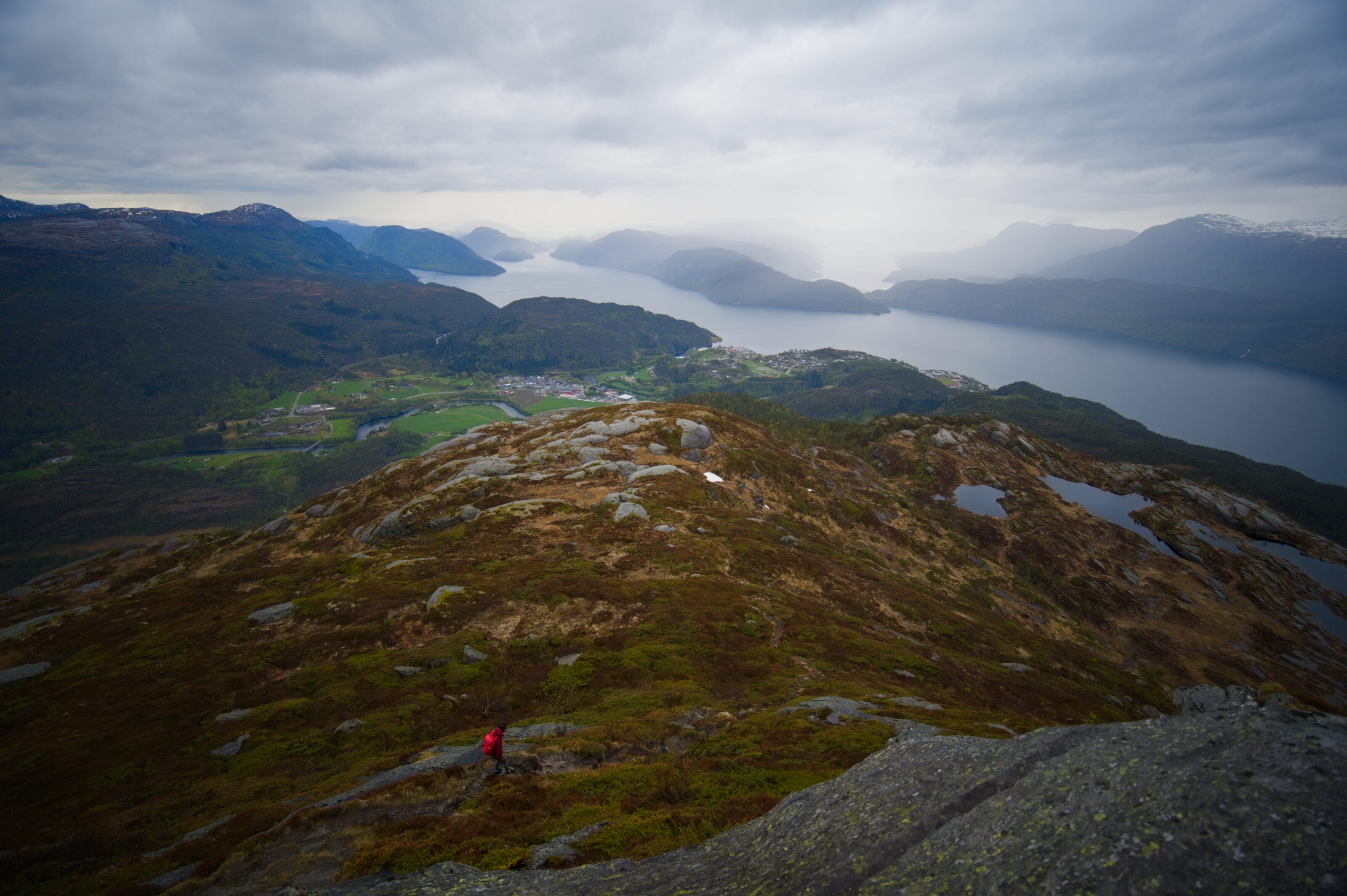
Instead of continuing toward “Skapet,“ keep climbing to the left toward the summit of Neverdalsfjell (the mountain overlooking Preikestolen). However, the trail is difficult to follow because it isn’t very well marked. It’s probably not used very often, and part of it runs over rocky slabs, making it hard to see.
My advice is to keep your phone with the GPX track at hand and check fairly often to make sure you’re still on the track. As for me, every time I strayed a bit from the route, I ended up getting stuck. So it’s still best to try to stick to it 😉
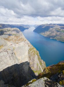
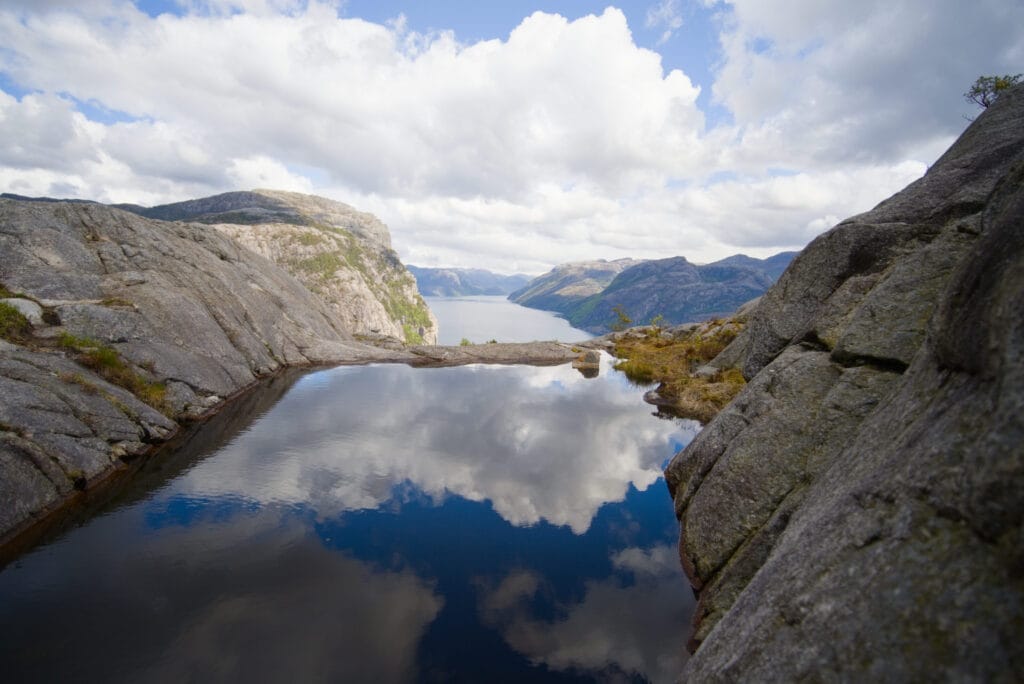
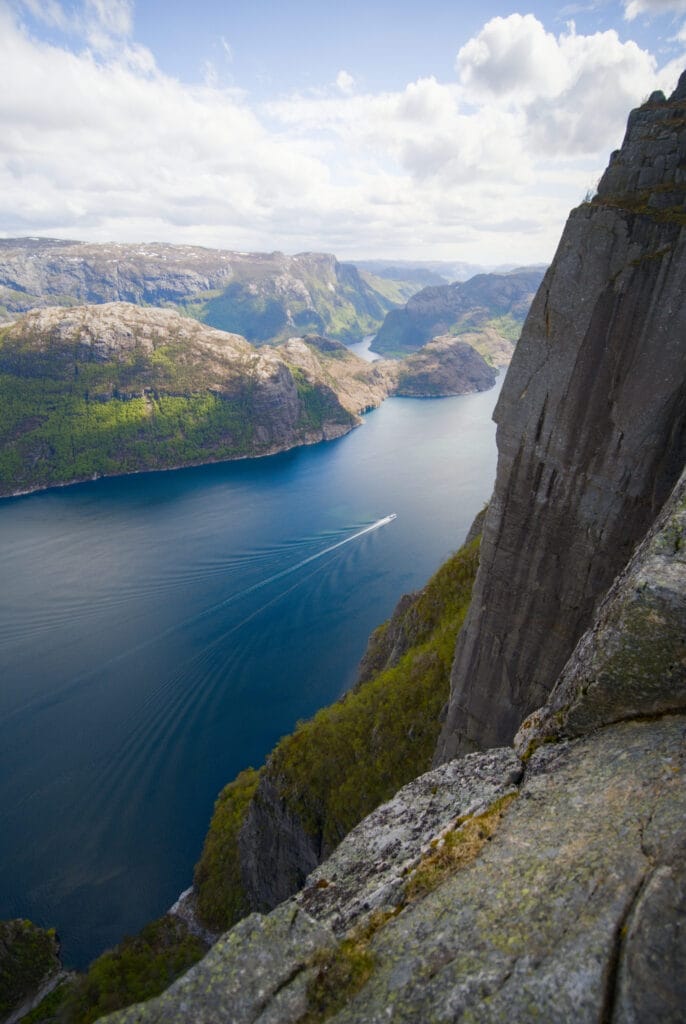
As I climb toward the summit, the view opens up to the lake behind me, and I can even see all the way to Stavanger. Just below the summit, I walked a few times along the cliff that drops sheer down to the fjord 600 meters below. Honestly, some of these viewpoints are just as impressive as Preikestolen, except you’ll have them all to yourself 🙂
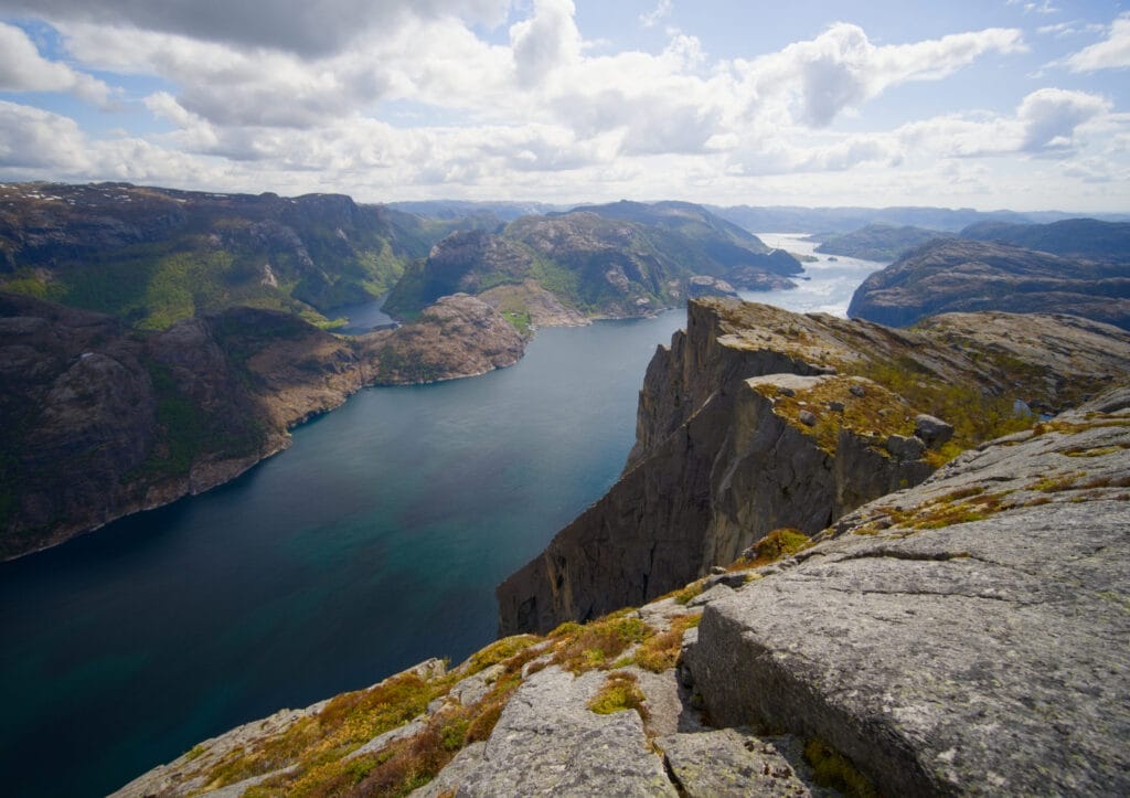
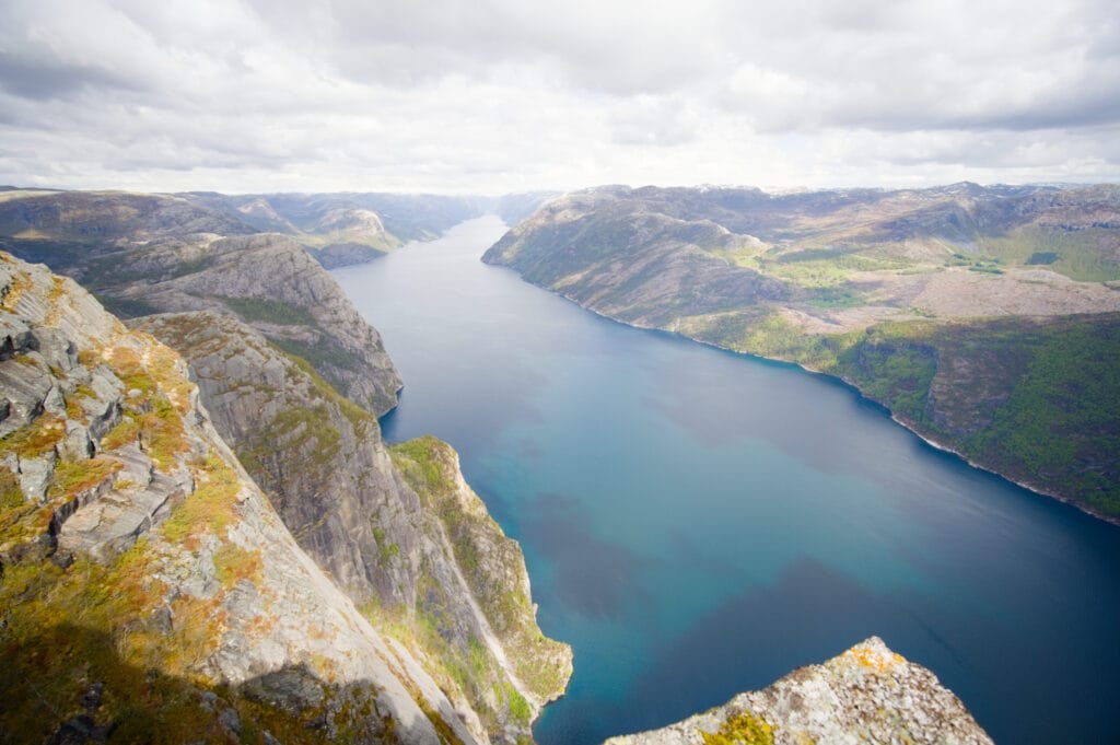
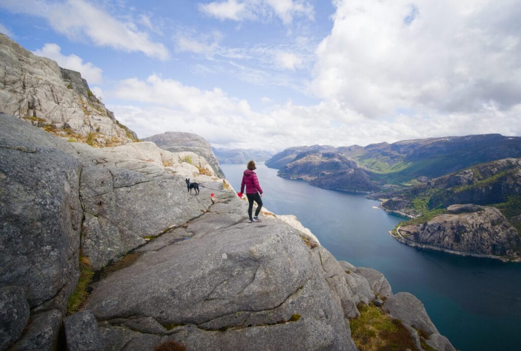
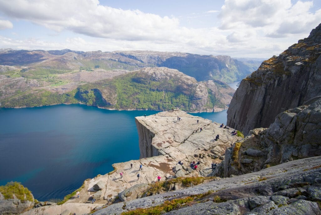
Once you reach the summit of Neverdalsfjell, just head down a short distance on the other side to reach the Preikestolen rock. On this side, there are trails leading off in all directions, allowing you to photograph Preikestolen from every angle. I recommend heading right first as you descend to get a great view of the rock from above (it gives you an idea of the cliff’s height).
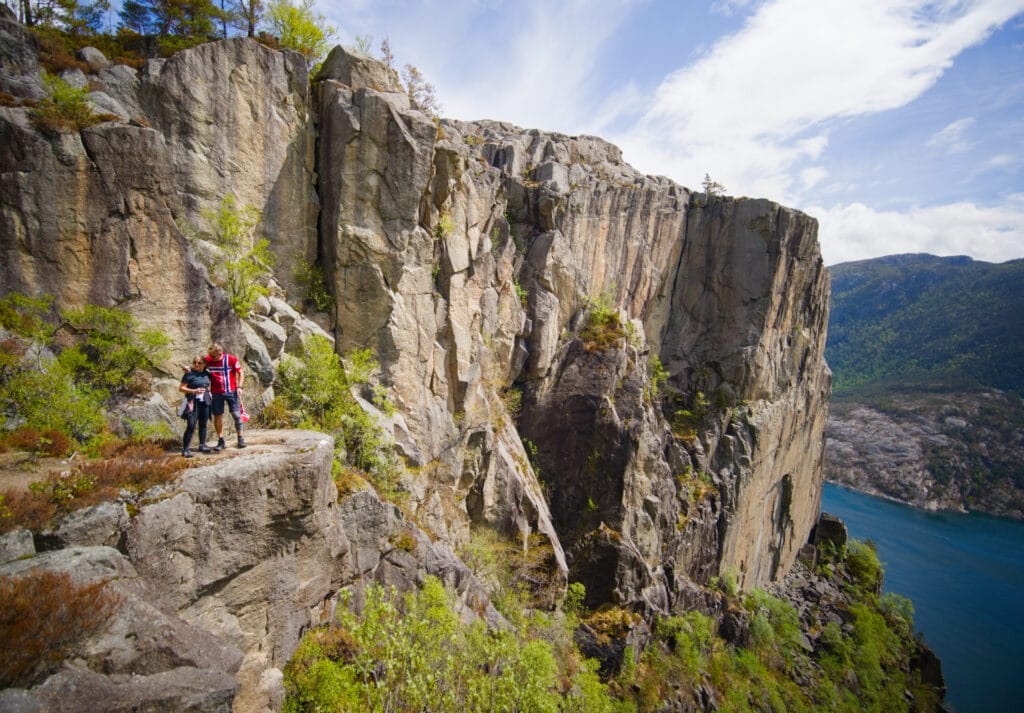
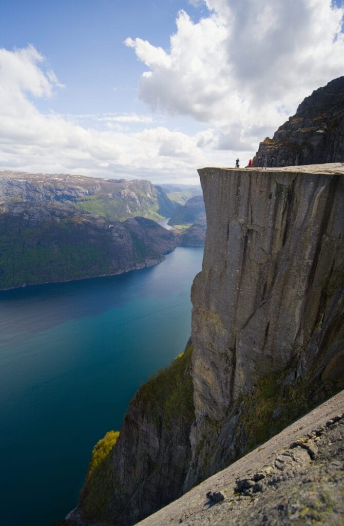
Next, the most impressive viewpoint in my opinion (where the most famous photo is taken) is on a small platform right next to Preikestolen (on the left before you climb up to the main platform). From there, you get a real side view of the cliff, and with people standing at the edge, it really gives you a sense of the rock’s size 😉 .
The main platform is an almost perfect square measuring 25 meters by 25 meters, with a cliff dropping sheer down to the fjord 604 meters below. When I got there, there weren’t many people (though there were still about 30… probably because it was the start of the season and the national holiday), but it seems that on busy days, you sometimes have to wait in line to take your photo at Preikestolen. You’ve been warned 😉

After taking in the view for 30–45 minutes, I didn’t linger any longer since I was only halfway through my run. I have to admit I was pretty exhausted by the time I reached the Høllesliheia parking lot at the start of the Panorama Trail. But it was totally worth it!
The classic Preikstolen hike
If you prefer to take the classic Preikestolen trail, that’s obviously the easiest way to see the famous rock (if you don’t mind the crowds and the parking fees). We didn’t do it ourselves, but apparently the trail is extremely well-marked, which makes the hike fairly easy (though it’s still an 11-kilometer round trip with nearly 600 meters of elevation gain).
For more photos and information about this route, I’d like to direct you to the article on Horizon Rando, an excellent website we used quite a bit to plan our hikes in Norway.
If you want to spice up the classic route a bit, you could hike up to Preikestolen via the standard route and come back down via the alternative route I mentioned. Instead of doing a round trip, this will give you a nice loop, and you’ll be away from the crowds for at least half the hike.
There you go! I think now you know everything there is to know about the Lysefjord Panorama Trail and the different options for hiking up to Preikestolen. Honestly, if you have the time and energy, we highly recommend doing both (either together or separately). Preikestolen isn’t famous for nothing! But if you want to enjoy the Lysefjord at a more leisurely pace, the Panorama Trail is a must in our opinion.
Pin it on Pinterest

Hello guys,
Thank you very much for this post!
This is very very useful.
I’ll be in Norway in August with my boyfriend and we were planning to do Preikestolen hike (and possibly adding Lysefjord Panoramic Trail on the same day).
I have a couple of questions though and I was hoping you could help me out.
Hi Nicolas,
Just post your questions here in the comments. This way I can try to answer as good as I can and it can benefit other readers as well