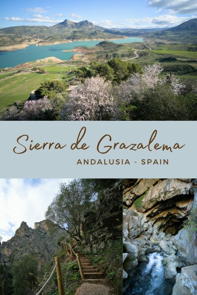
When we started planning our roadtrip in Andalusia, the Sierra de Grazalema natural park was on our list of things to see! for hiking and nature lovers like us, we simply couldn’t miss this natural park of almost 50’000 hectares located between the provinces of Malaga and Cadiz, next to the beautiful city of Ronda.
Between the karstic mountains, the rivers, the numerous caves, the charming small white villages, the almond trees in bloom… we really took a lot of pleasure in the area. And as you can imagine, we also warmed up the calves with beautiful hikes in the park.
- The Sierra de Grazalema natural park
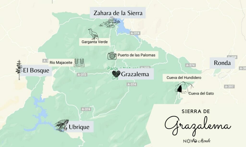
- Map of things to see and do in the Sierra de Grazalema
- The cueva del Gato (Cat’s Cave)
- interesting place: the Hundidero cave
- Zahara de la Sierra: small town at the entrance of the Grazalema Natural Park
- Puerto de las Palomas: an unmissable mountain pass and road
- Hike to Cerro Coros
- Hiking along the Rio Majaceite
- Other routes to do in the Sierra de Grazalema natural park
- Useful information for visiting the Sierra de Grazalema Natural Park
The Sierra de Grazalema natural park
Officially, the area was classified as a natural park in 1985, but it has been recognized as a biosphere reserve by UNESCO since 1977. The Sierra de Grazalema straddles the provinces of Cádiz (9 municipalities belong to this province) and Málaga (which has 5 municipalities in the park).
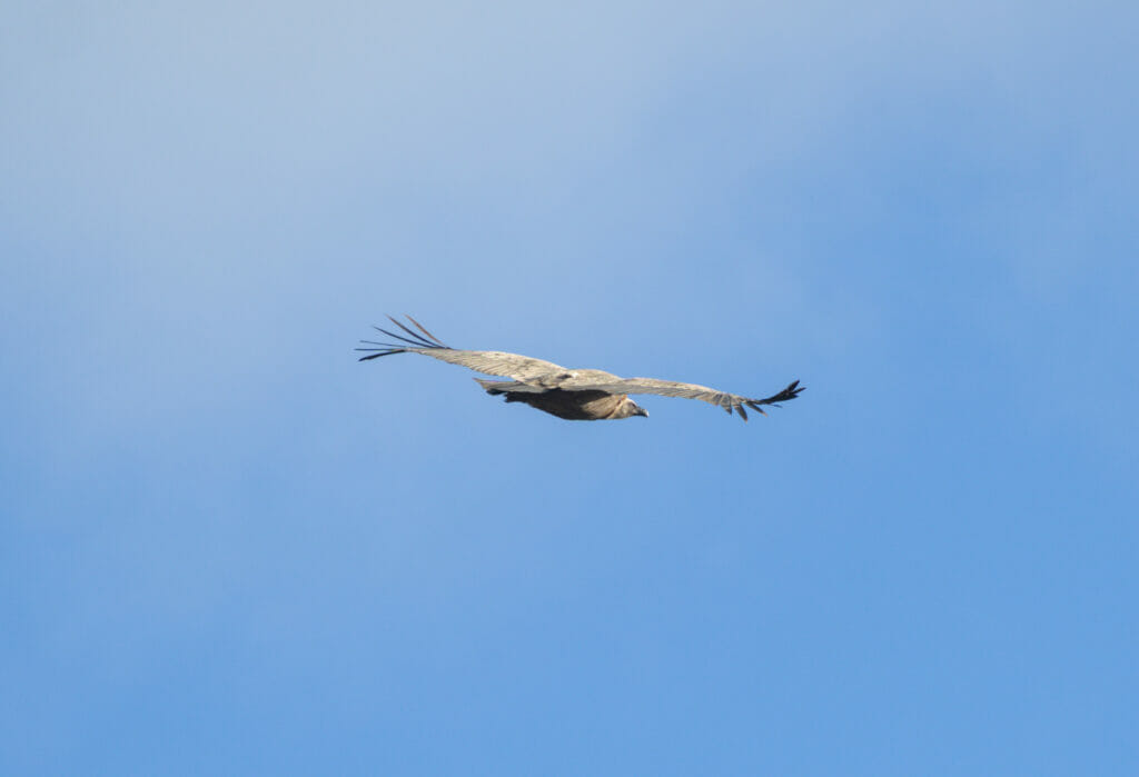
A karstic region par excellence, Grazalema is known for its caves, which are home to numerous bats, as well as its gorges and peaks where vultures and other birds of prey (including various species of eagles) nest.
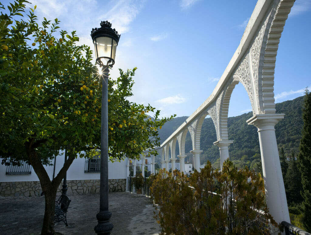
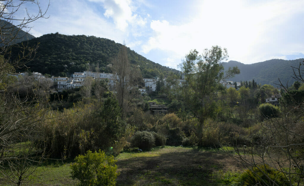
Besides the natural landscapes, the park is also worth a visit for its numerous white villages! Unfortunately we didn’t have time to go down to Ubrique, but for example Zahara de la Sierra which is located at the extreme north of the park is not to be missed under any pretext! But enough of blah, let’s go to the visit!
Map of things to see and do in the Sierra de Grazalema
Below, we will present you a little bit what we had time to do in the park as well as 2-3 additional tips of things to see (for which we either didn’t have time or that we had to leave aside because dogs are not allowed). But before going into more details, we thought that a small representation of the park on a map could help you to locate a little all that.
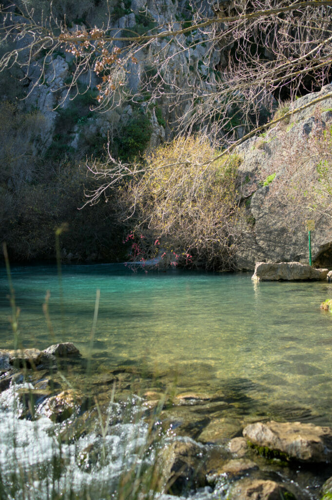
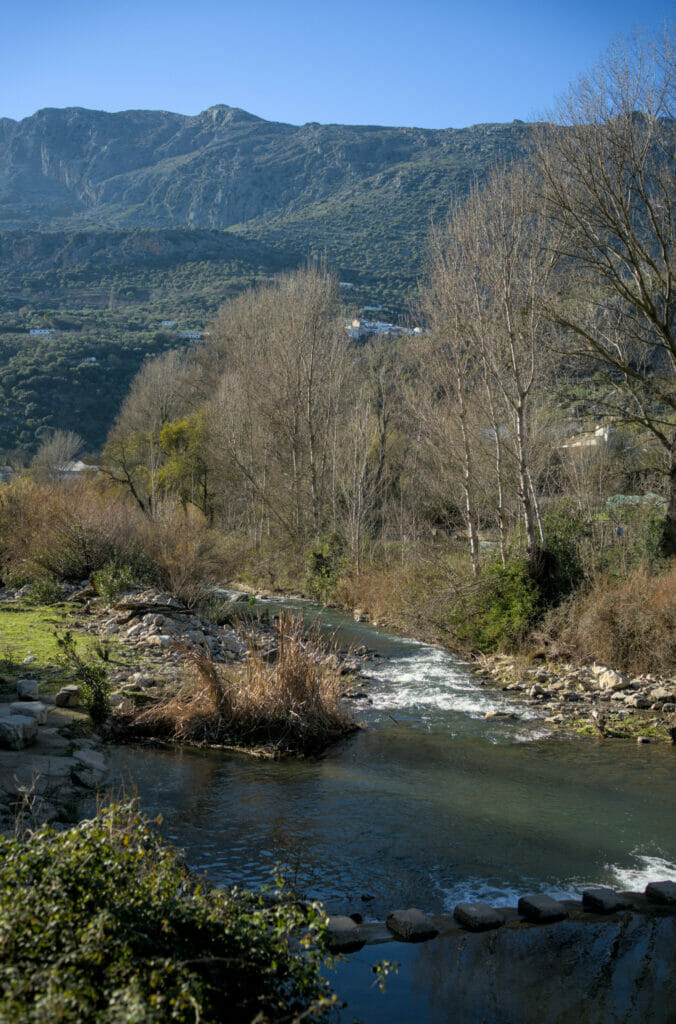
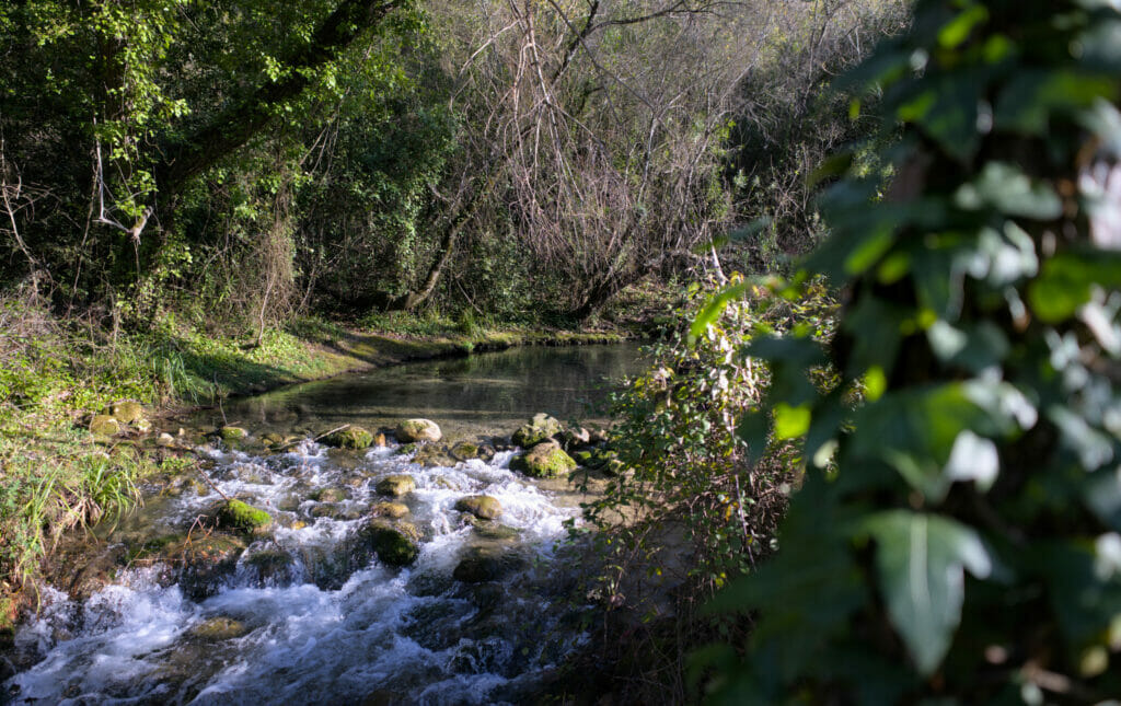
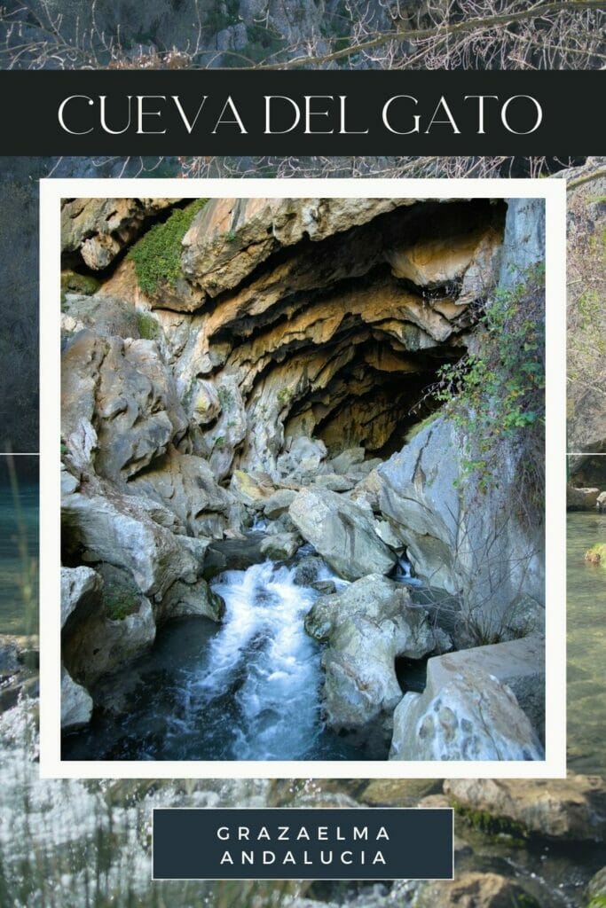
The cueva del Gato (Cat’s Cave)
Often mentioned as a trip to take from Ronda, the Cueva del Gato is a cave that is located in the municipality of Benaojan. The place is easily accessible (there is a small parking lot next to the MA-7401 and from there it is a 5-minute walk). However, the cave itself cannot be visited… In fact, the access is blocked by barriers and reserved only for excursions with a guide.
Afterwards, the visit is still worthwhile (especially in the summer) because it is possible to swim in a beautiful little pond that is at the exit of the cave. We can imagine that the place is quite popular in summer, but no surprise, in January we were the only ones 😉
Note: We had seen online that the entrance to the cave was paying (2€). Once on the spot, we saw a cabin which could make think of a ticket office but the building seemed to be half destroyed (and a bridge was as torn off). In short, in winter, it was free that’s for sure… Is it the case in summer? We must admit that we did not find any additional information. If anyone knows the answer, please leave us a comment and we’ll update the article.
Hiking route to the cueva del gato
Coming here in winter, we must admit that we didn’t feel like enjoying the place for a swimming session… 😉 Instead, we decided to go for a little hike to enjoy the panorama from the pass above the cave. #SomeThingsWillNeverChange
Leaving the cave, we started by following a small path that first climbs towards a paved road that climbs to the pass.
In fact, once on the paved road, we joined the GR249 route. This long-distance hiking route in Andalusia is generally known as the “Great Málaga Route”, a marked route of more than 650 km that goes almost all the way around the province!
At the pass, there is a very nice view of the white village of Montejaque (worth a visit if you are passing nearby!)
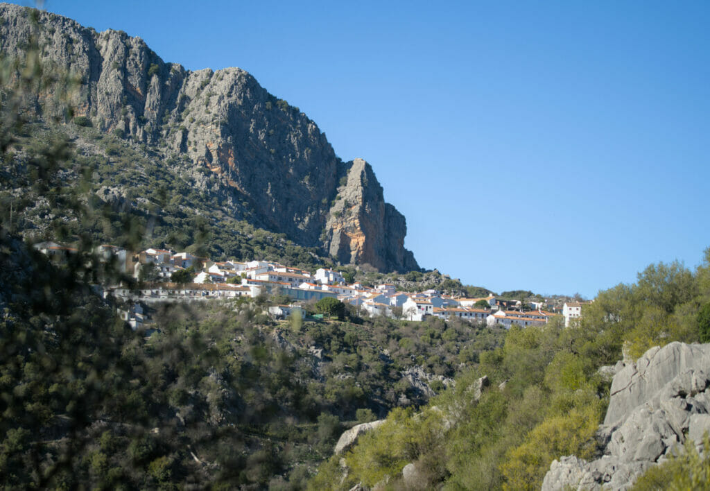
From the pass, the paved road gives way to a wide track that we follow until we reach the village of Benajoan. Not particularly ugly as village, we will admit that we did not find him particular charm either.
In short, it is without lingering too much that we crossed the high part, then we took on the right a path which goes down towards the station. We find here the river and after a small crossing on stones we follow it on 2,5 km until joining again the cave and the parking lot.
Map and Info for the hike
- Departure and Arrival: parking lot of the Cueva del Gato
- Distance: 7,3 km
- Elevation change: 250 m (+ and -)
- Dificulty: Easy
- Note: Possibility to start the hike in Benajoan and have the caves halfway through
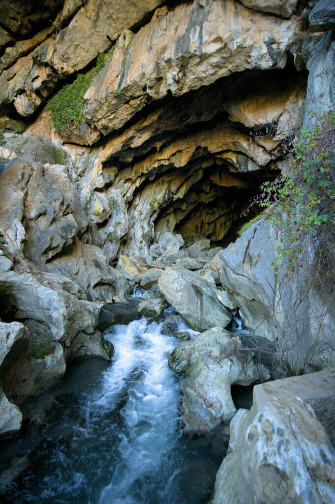
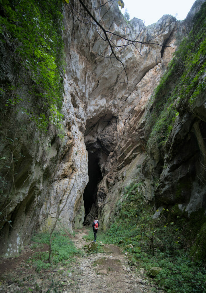
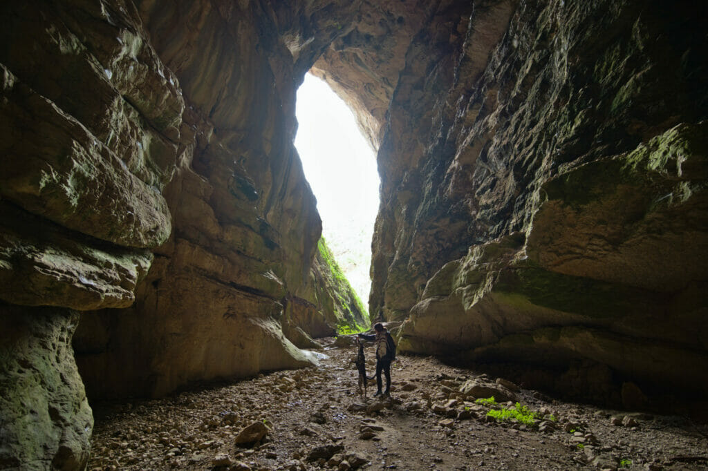
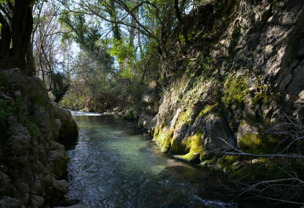
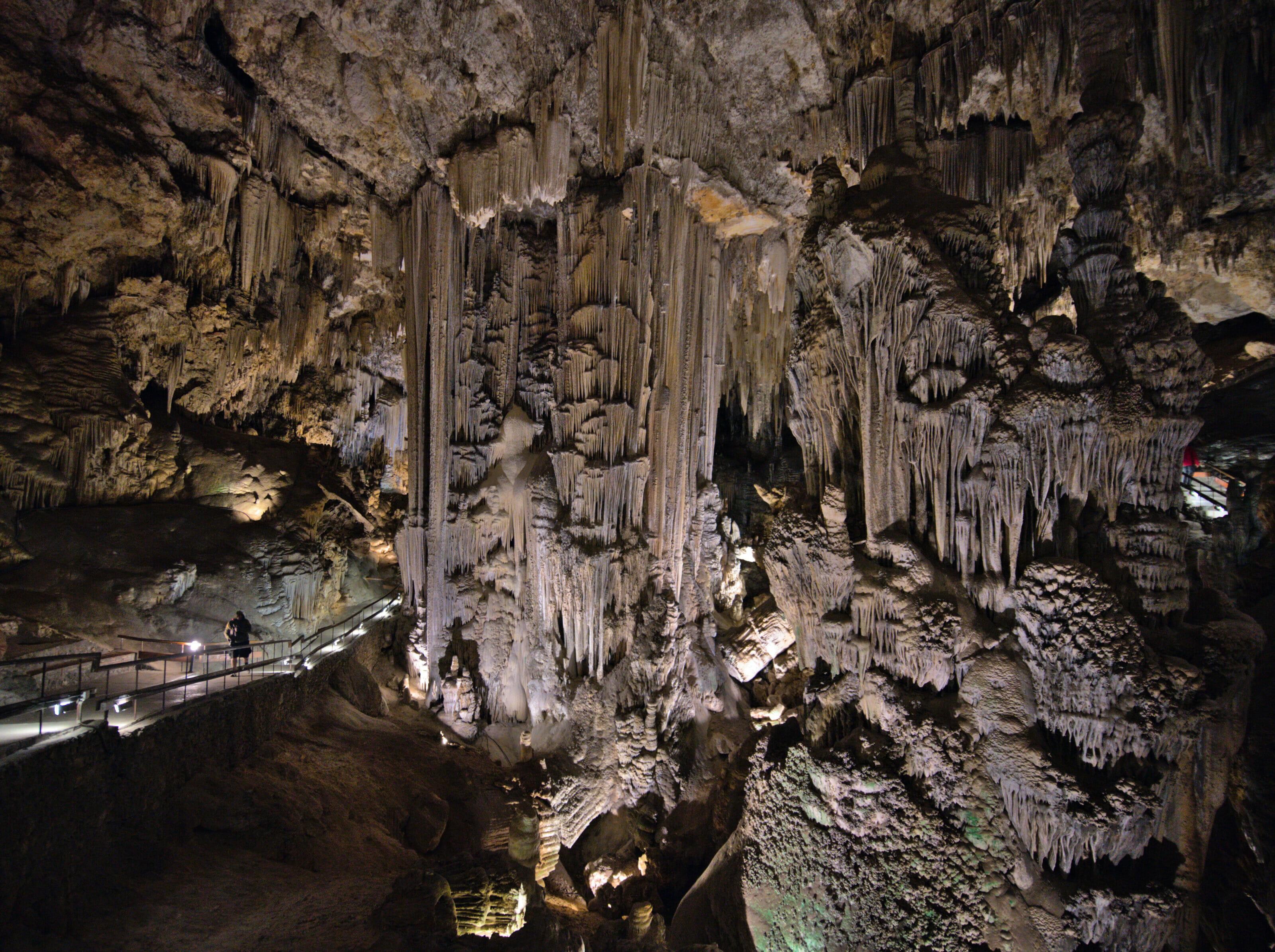
interesting place: the Hundidero cave
By car, it takes about 15 minutes to drive from the Cueva del Gato to the entrance of the Hundidero cave.
But you know what’s amazing? These two caves are in fact connected and cavers do the crossing. Unless I’m mistaken, this activity was proposed as a tourist activity at one time, but it’s not (anymore?) the case nowadays from what we could read. Because yes, when we saw that, we clearly tried to see if we could not do it!
In short, if we didn’t want to be spelunkers, we still wanted to go and see the “other side”. Well, the least we can say is that it is INCREDIBLE! It’s strange, because when we see the information online, the cueva del Gato seems to be more highlighted, but sincerely, if we had to choose only one for us it would be Hundidero!
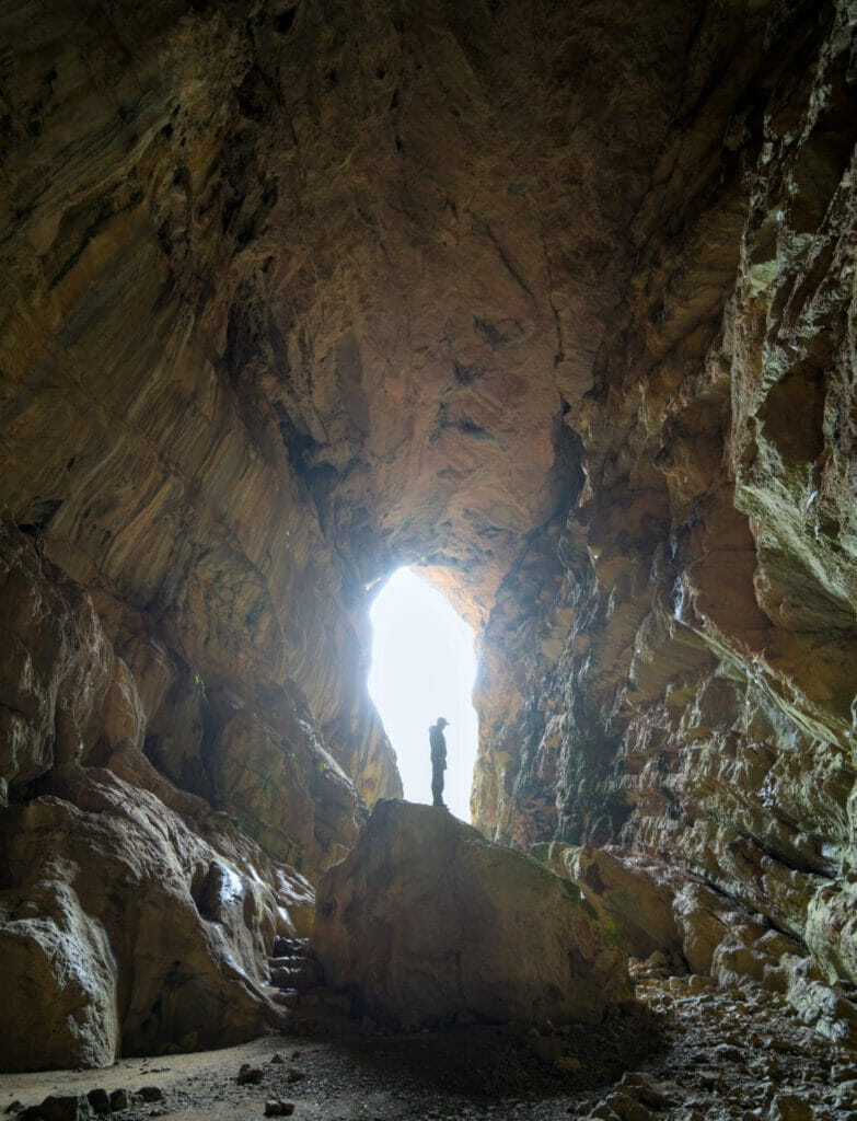
To reach the cave, you have to park on the small parking lot at the edge of the MA-8403 and then follow the path (which seemed brand new at the time of our visit in January 2022). We plunge, so to speak, of 80 meters in this “hole” and we find ourselves in front of a gigantic opening leading to a first room of almost 50m high!
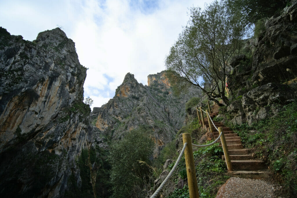
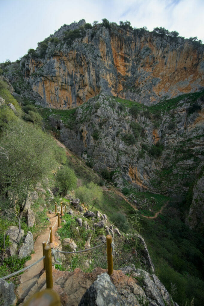
Without headlamp and without equipment, we didn’t go very far… but pfiouuu… it’s beautiful! Judge for yourself:
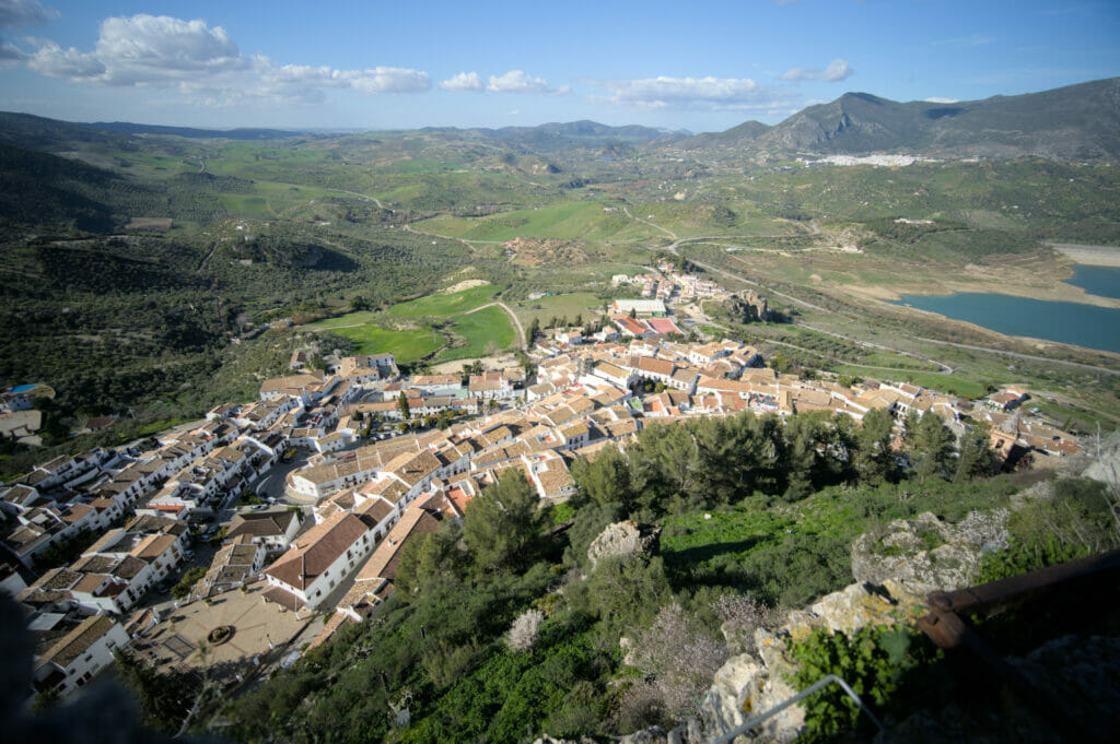
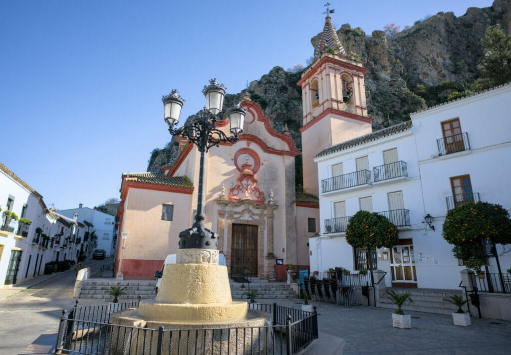
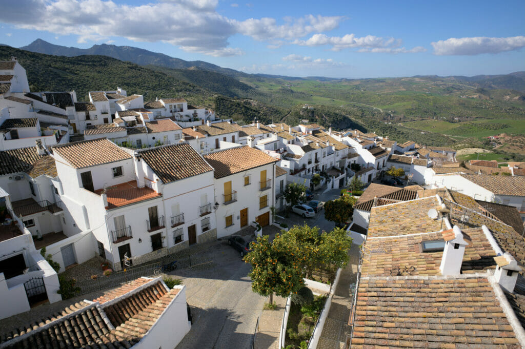
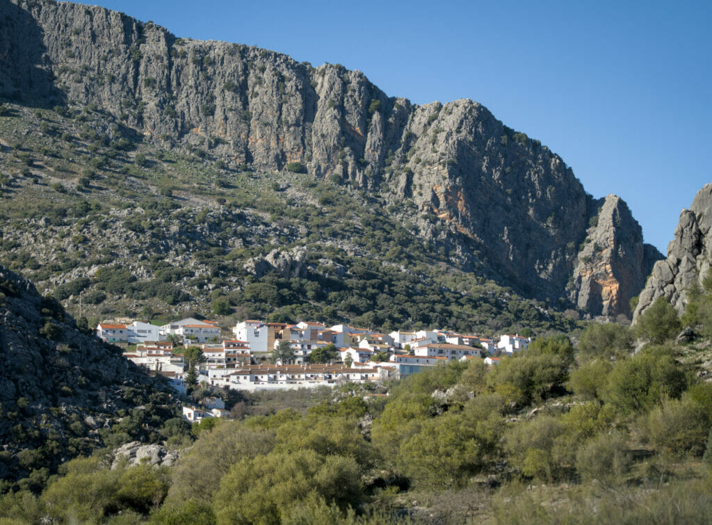
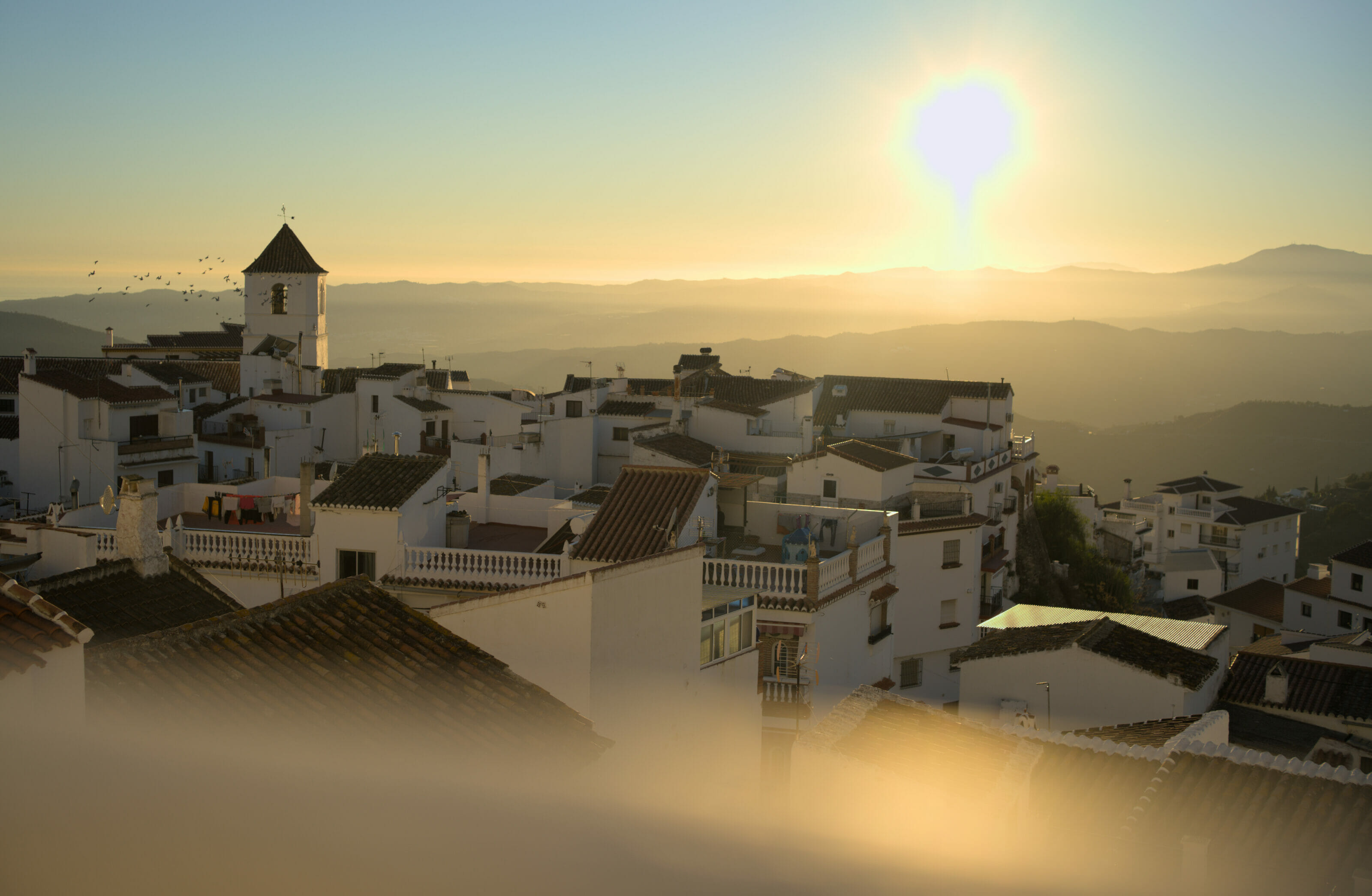
Zahara de la Sierra: small town at the entrance of the Grazalema Natural Park
The white perched village of Zahara de la Sierra marks the entrance to the natural park by the north and it is a stop not to be missed if you want our humble opinion… You will see it, but the village is not very big and we make the tour rather quickly 😉 But if there is one thing we recommend you to do, it is to go up to the top of the castle which overhangs the old city; the view from above is simply incredible!
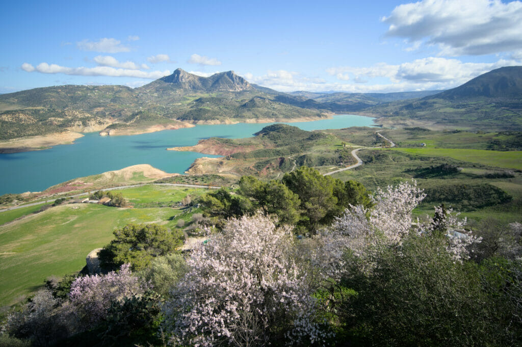
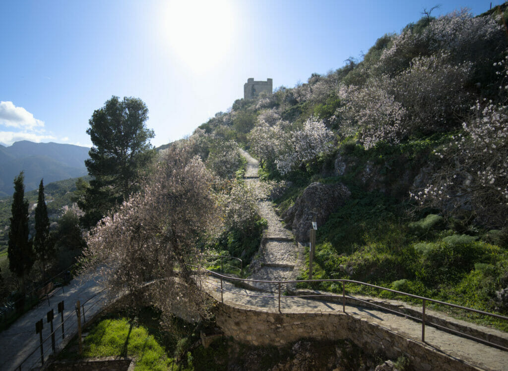
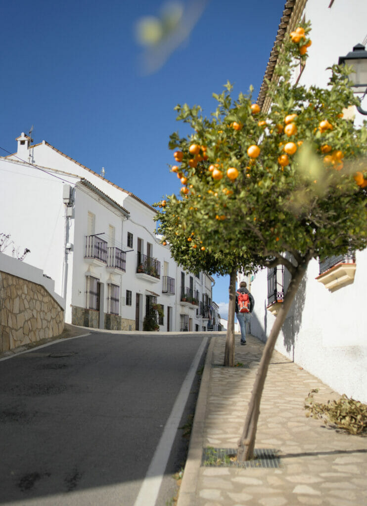
We were very lucky because at the time of our visit the almond trees were all in bloom and this gave an even more magical atmosphere!
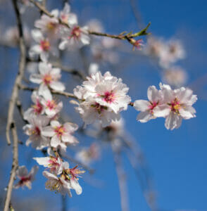
It’s funny, because we often read that cherry trees in bloom are something magical… well the least we can say is that since we are in Andalusia we have literally fallen under the spell of almond trees!
In Switzerland we are not particularly used to this tree, but I think that Benoit and I agree that it is becoming our favorite tree! Because in addition to the beauty of the flowers, you have to imagine the sweet smell that goes with it (we are sorry, it will be complicated to write this down… but it is undeniable, the smell of the almond tree will remind us forever of this Andalusian stay!)
For the visit of Zahara de la Sierra: we advise you to park along the main road (the C-9104) or maybe in the small parking lot at the entrance of the old center on the side of Calle Nueva. We strongly advise you not to enter the town by car (and even less by van or RV); the streets are very narrow!
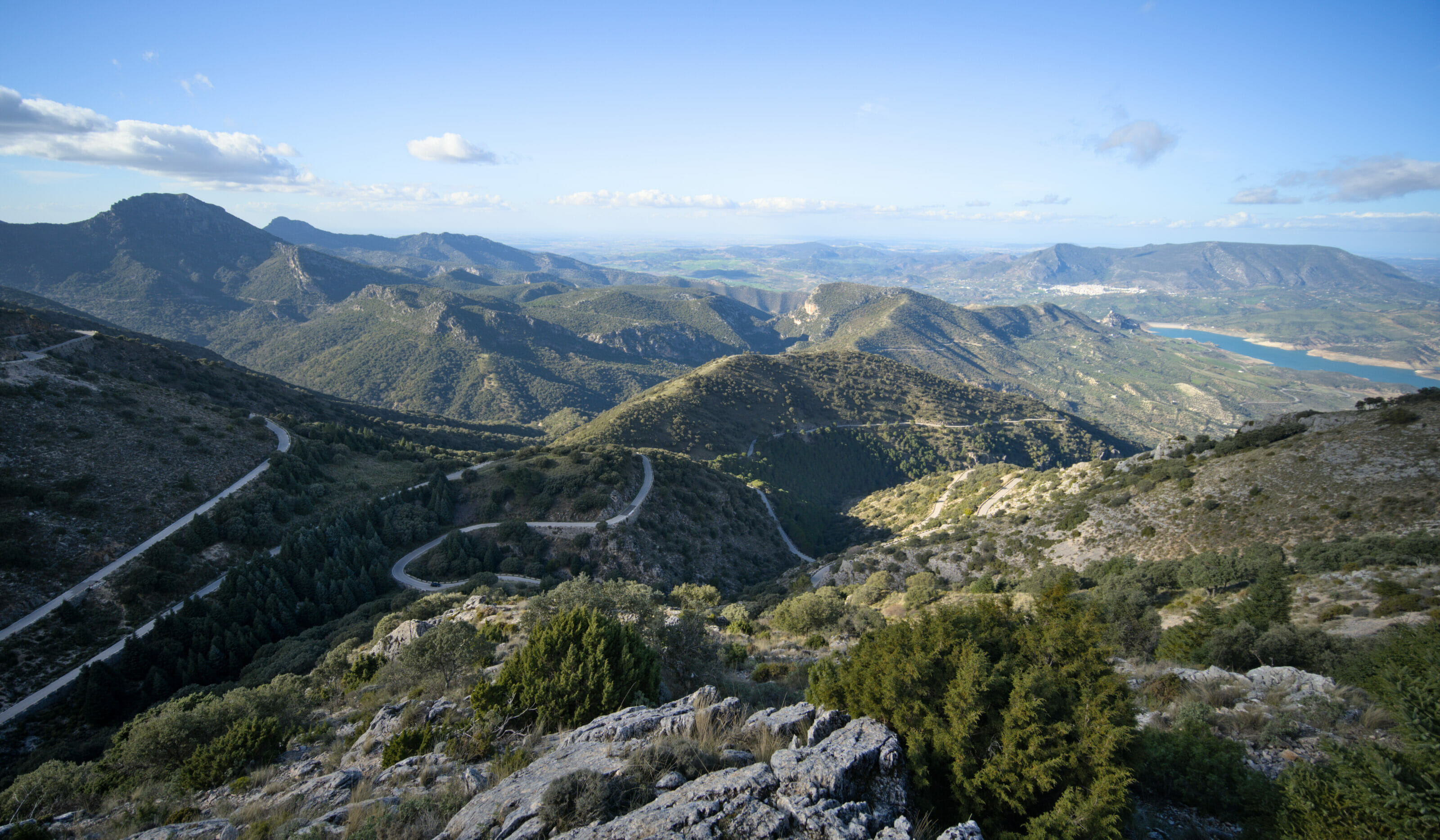
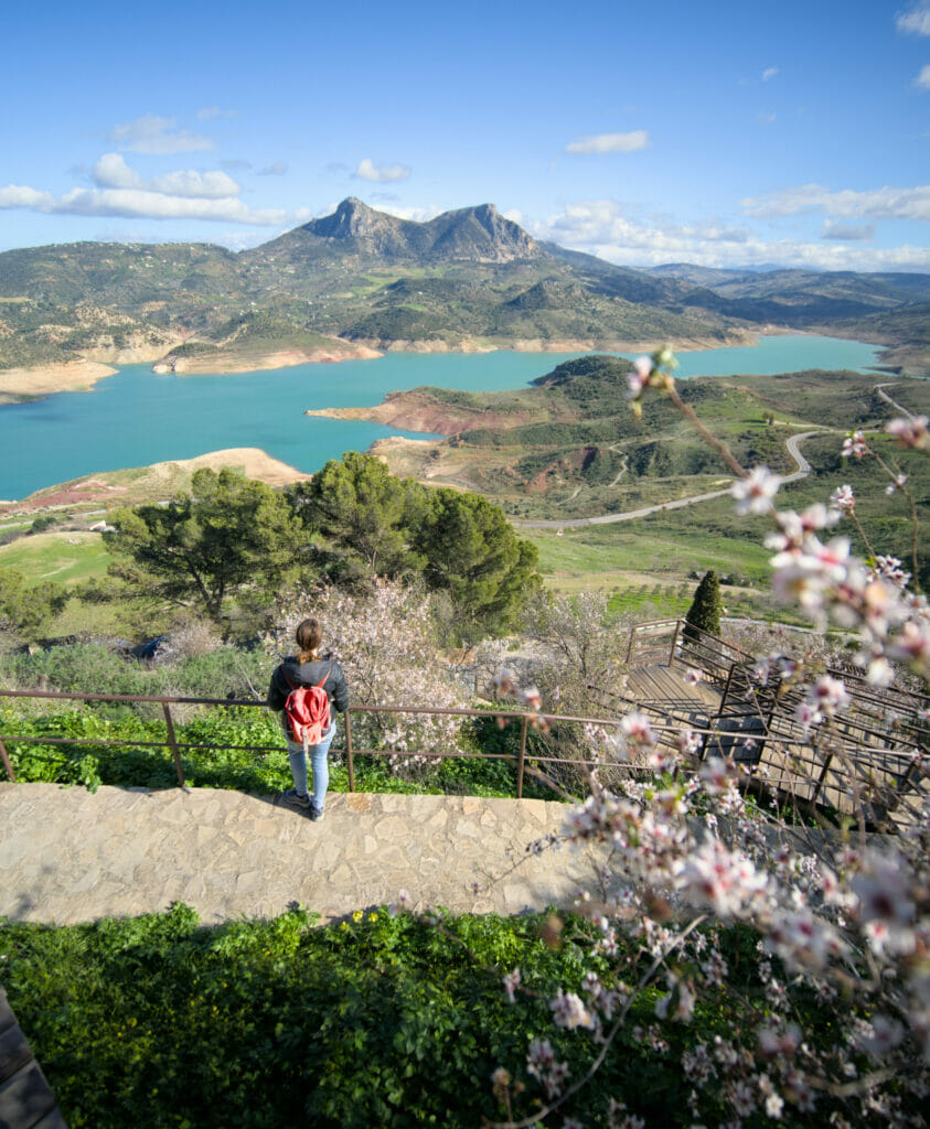
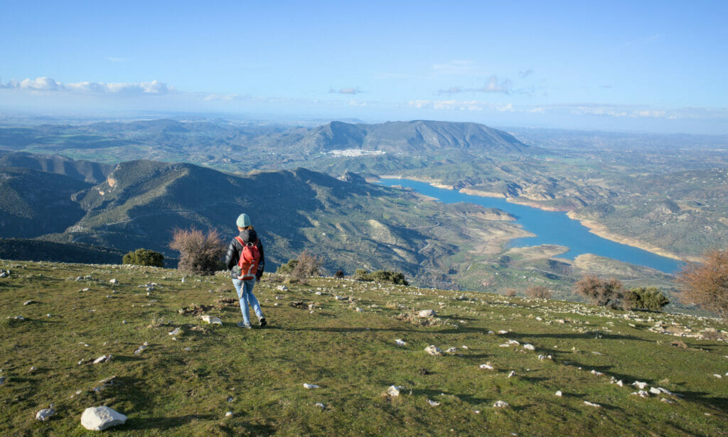
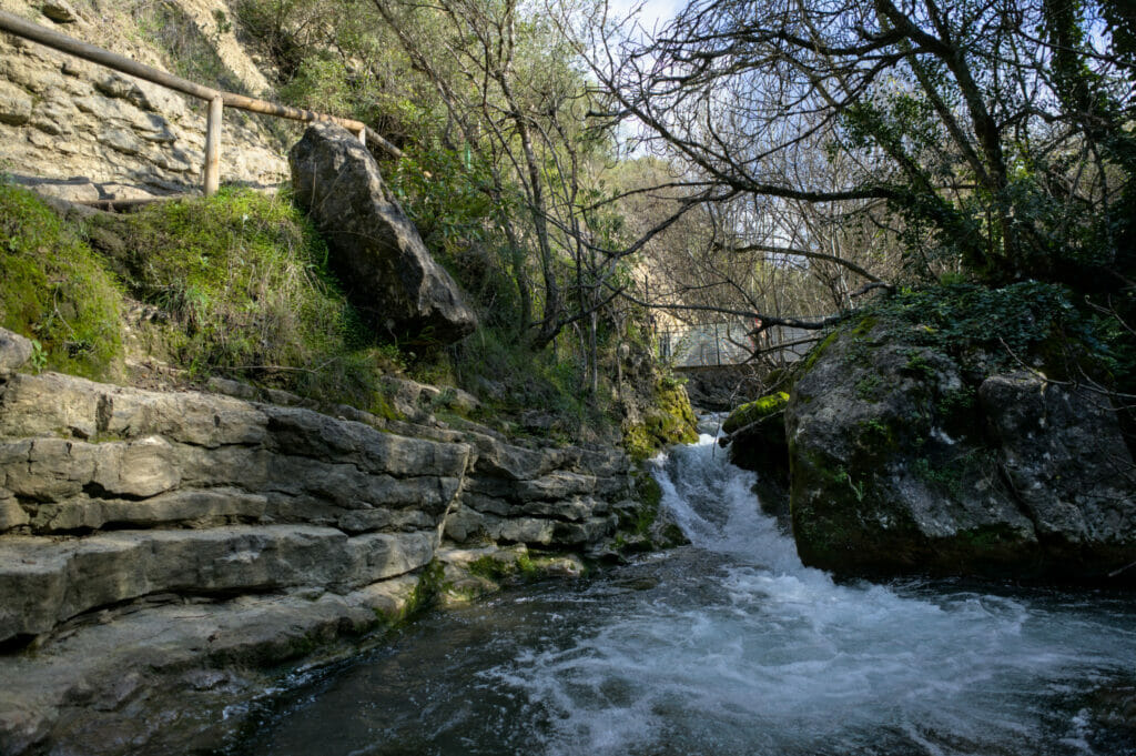
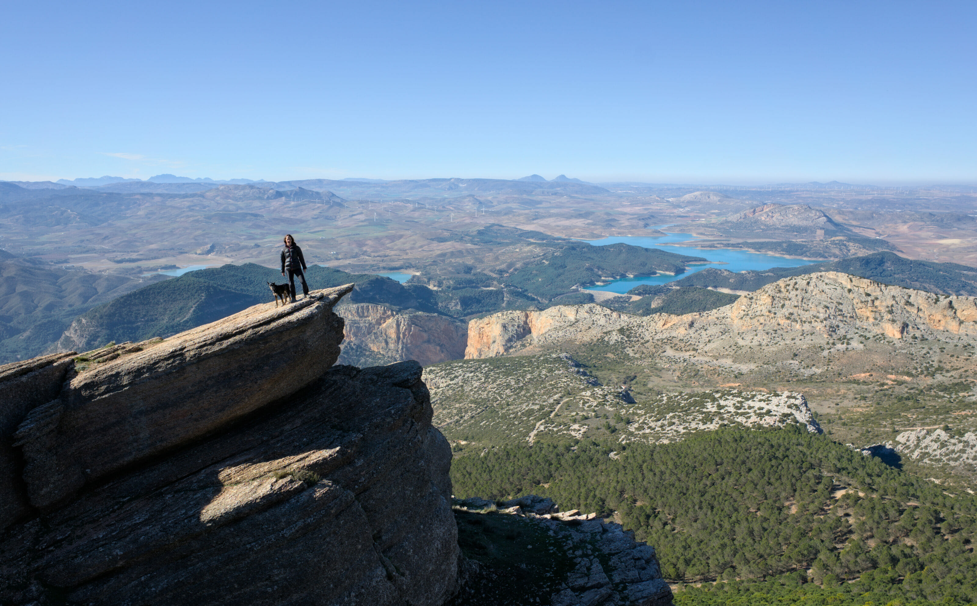
Puerto de las Palomas: an unmissable mountain pass and road
From Zahara, the GPS will tend to make you bypass the center of the park to go to Grazalema (the village) or even El Bosque… However, we advise you not to miss the winding road that climbs to the Puerto de las Palomas pass!

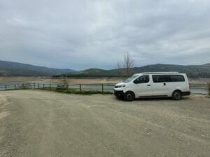
A mountain road as we like them with hairpin turns but especially with a CRAZY view on the lake and the surrounding peaks! After, it is important to note that it is not the widest road in history… With our van we didn’t have any problems, but let’s say that with a wider vehicle the crossings could be a bit complicated in some places (even if we have to say that there is not much traffic on this section; it seems that the locals rather favor the bypass roads (you can drive faster and you probably save time).
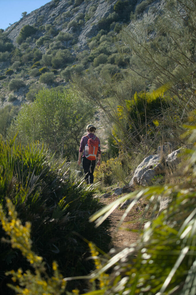
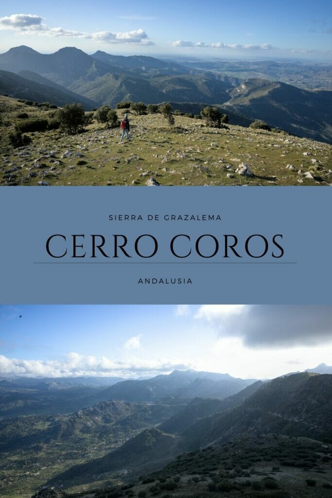
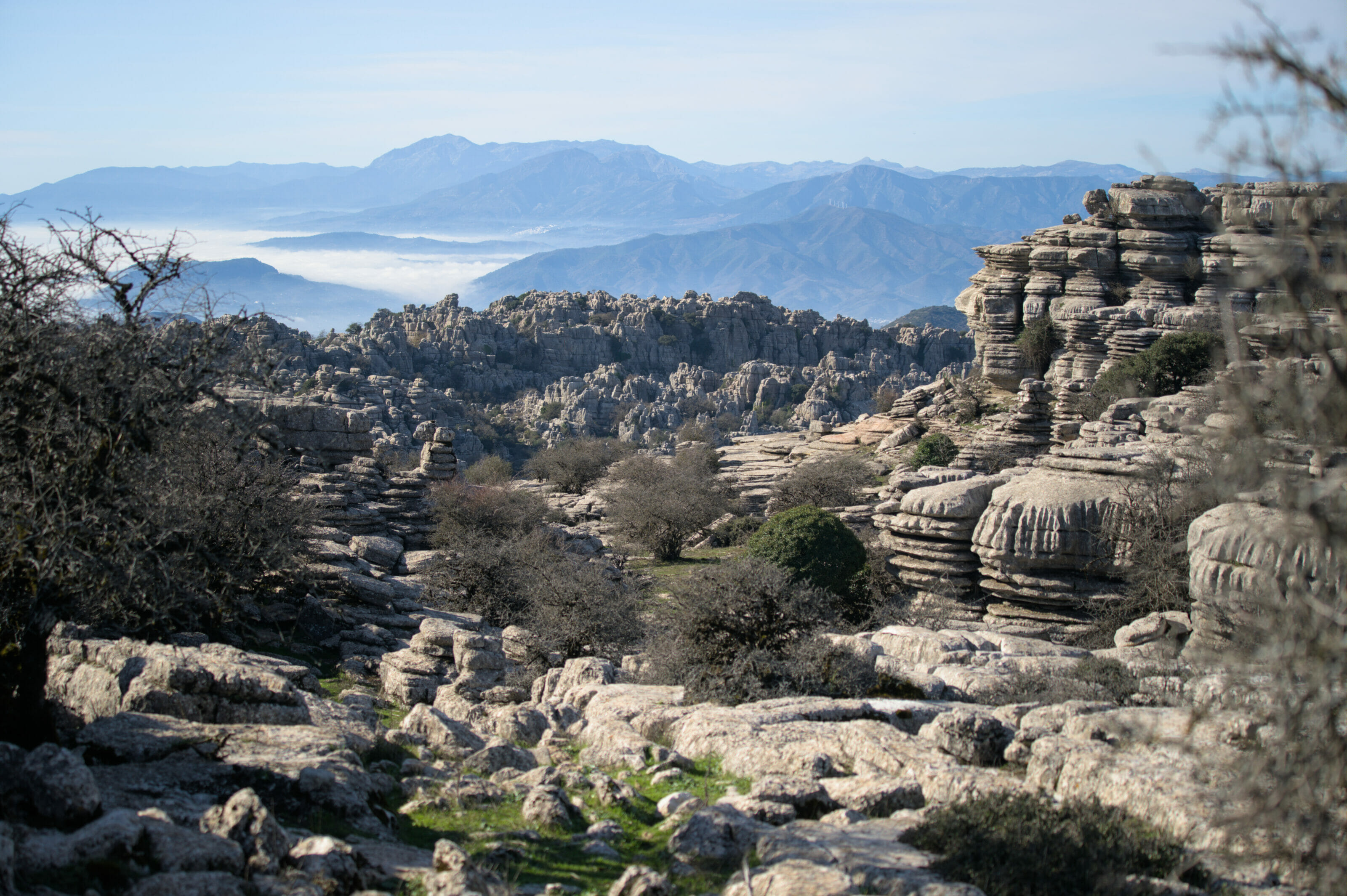
Hike to Cerro Coros
The view from the pass is beautiful, but you are starting to know us… it’s hard to stay at a pass when a summit is right next to it and we can’t help going up to see the view 😉
The trail
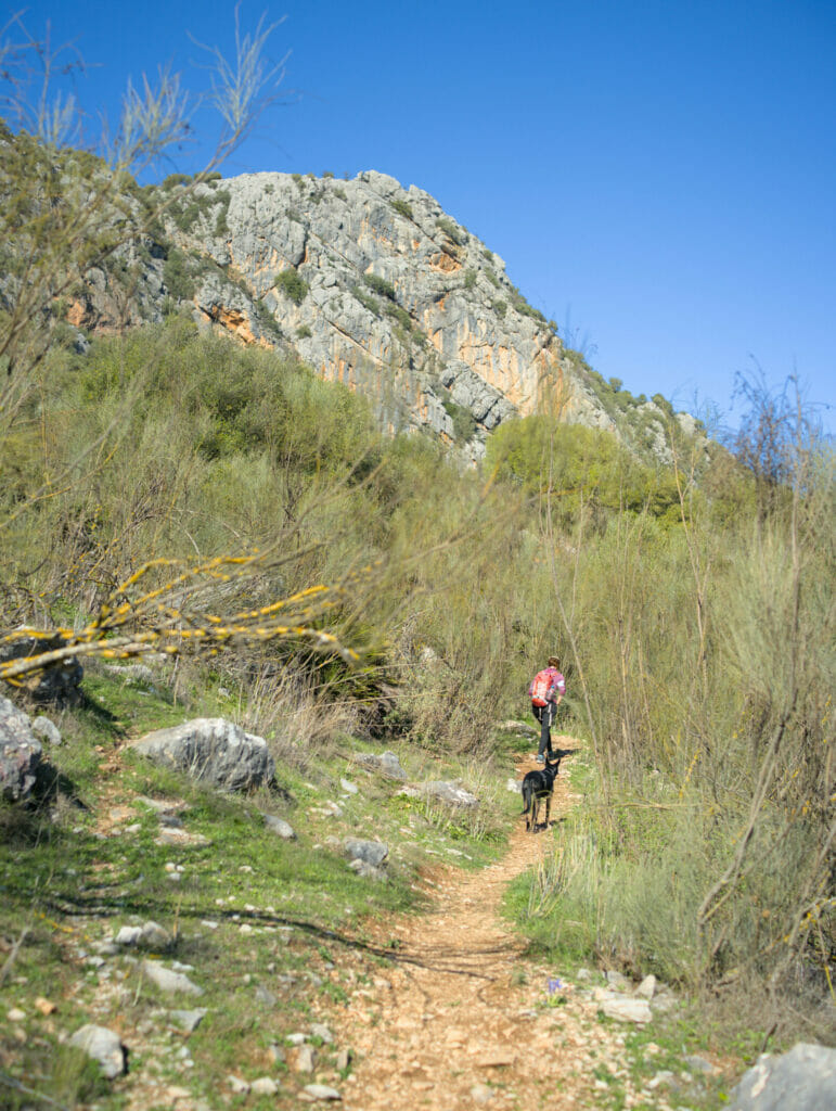
From the pass, it is possible to go up to the summit of Cerro Coros in about twenty minutes by following the track which leaves the pass (and which becomes a path at the end). But well, as we do not like particularly the idea of doing round trips, we preferred to opt for a small loop. From the parking, we thus began to follow the magnificent path which leaves in balcony on the left of Cerro Coros and which allows in a way to circumvent it. This section is grandiose because we have permanently the view on the lake and the road which climbs in laces until the pass.
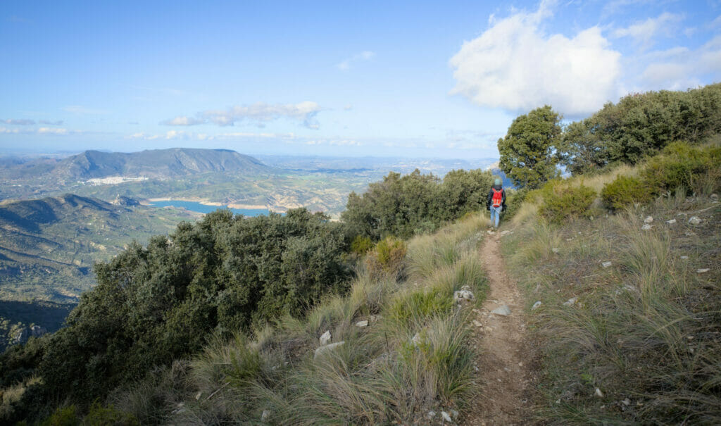
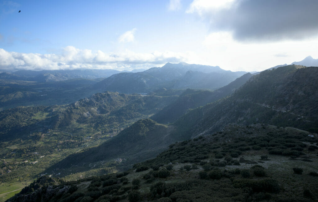
Once on the other side, all that remains is to follow the path that climbs towards the summit. The slope is quite gentle and this path does not really present any difficulty. The summit is almost “rounded”. To know that you are at the highest point, you have to trust the small stone stele. From there, the view is stunning and we are in the first row to observe closely the numerous vultures which make circles just above our head!

To go back down, the route is very easy. In fact, you can even see the pass from above. You just have to follow the trail and then to join the track which returns to the pass in about fifteen minutes.
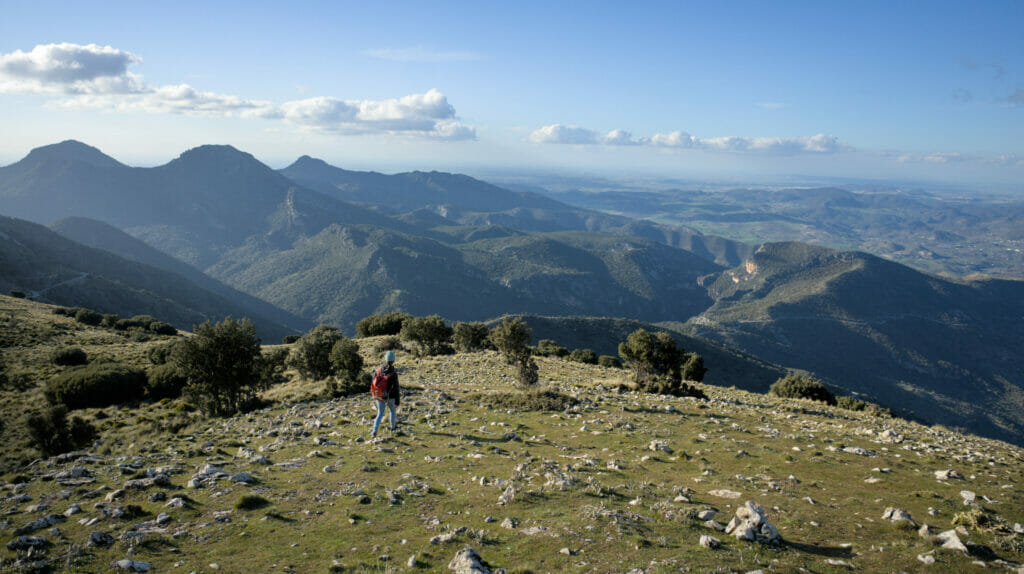
The itinerary is not very long (3,3 km) and it took us something like 1h30 taking our time.
Map of our hike to Cerro Coros
Note: We advise you to make the hike in the same direction as us (by starting with the path on the left). In this way you will have the beautiful view on the lake in front of you and not in the back 😉
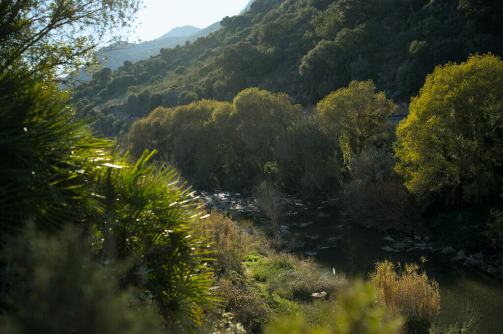
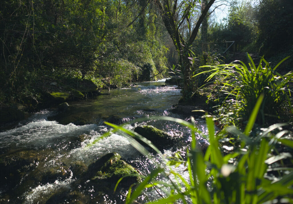
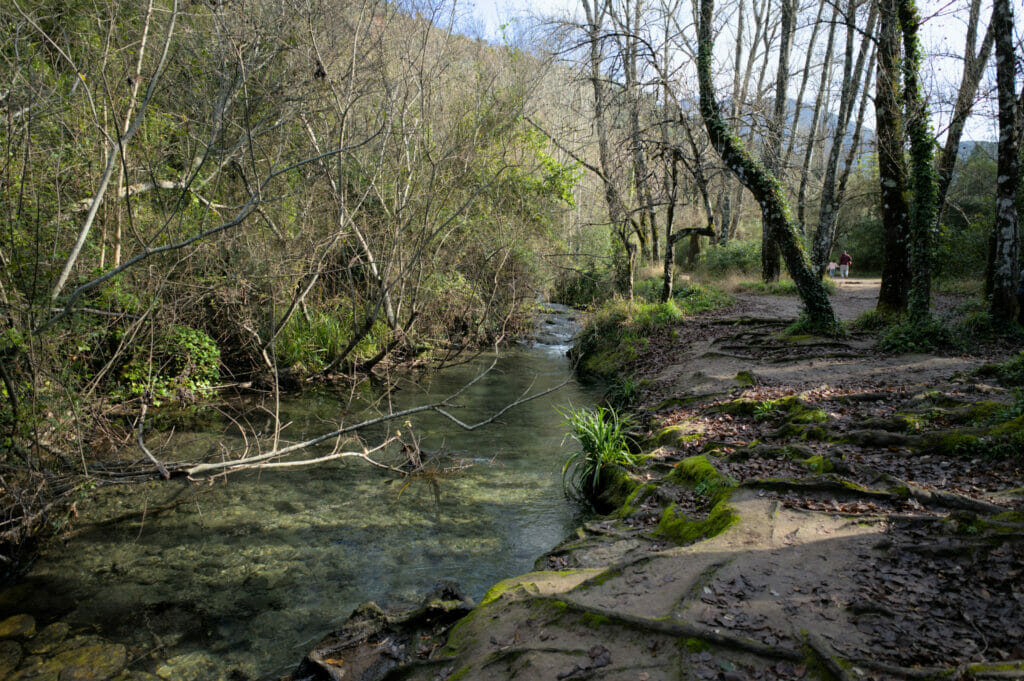
Hiking along the Rio Majaceite
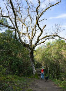
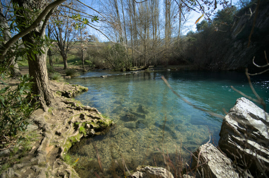
The route of the Rio Majaceite is probably one of the most known (with the one of the garganta verde about which we speak to you below) and rightly so! In fact, the marked trail goes along the Rio Majaceite for about 5 km between the small town of El Bosque and the village of Benamahoma. The place is quite idyllic and especially in total contrast with the generally rather dry landscapes of Andalusia; here one is really plunged in an oasis of greenery! The water is crystal clear and when the sun is shining, it’s just magical.
It is possible to do the route in both directions (parking lots are available in both villages). We left our van in El Bosque, but if we had to do it again we would maybe leave it in Banmahoma. Indeed, the first kilometer when leaving El Bosque follows a wide track without interest; by doing the hike in the other direction you can turn around before and thus shorten the walk of these 2 “useless” km.
The itinerary is a round trip (same route). There is a cab service that allows you to return to the parking lot if you don’t want to walk the 13km (ads with the numbers to call are posted at the end of the route). Or, if you are several people (with 2 vehicles), nothing prevents you from leaving a vehicle on each side (there is only 10 minutes drive between the 2 localities).
From El Bosque to Benamahoma
We left Dahu at el Bosque to start the hike. There are several parking lots and an area for campers…. Oh yes, small note on the side: do not enter the old town of El Bosque with a van! We landed there “by accident” (meaning that we took the wrong road once and then we were thrown into a maze of one-way streets); and frankly… It’s a pain in the ass! The streets were almost the same width as our van and some 90° turns in the narrow streets gave us some good cold sweats. In short, stay on the main road (the A-372) and in the alleys of the new city and forget about the old city!
After this parenthesis let’s go to the hike 😉 From el Bosque, we begin by following a track for 1 km. This part is not particularily interesting and as we mentioned before, it can be avoided if you park in Benamahoma instead.
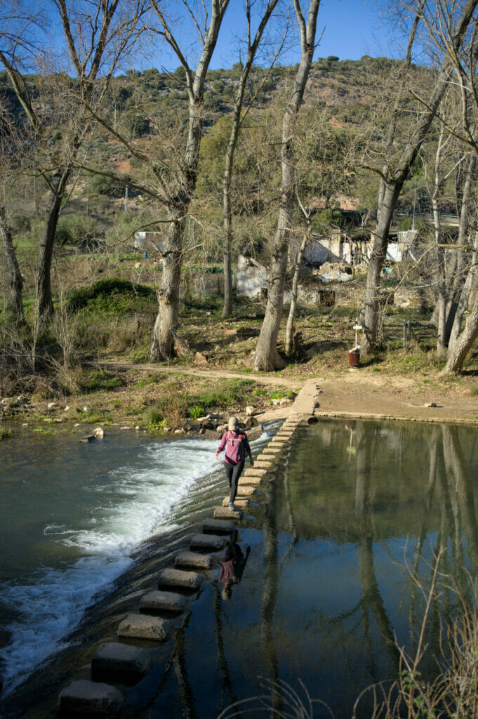
Once at the bank of the river, we arrive in the really magical part of this hike! The path borders the Rio Majaceite permanently and small footbridges make us pass from a bank to the other one over the kilometers. On the difficulty level there is really nothing to report, the path is very well indicated and easy to follow! Enough talking, here are some pictures of this small paradise of greenery…
The village of Benamahoma and return to El Bosque
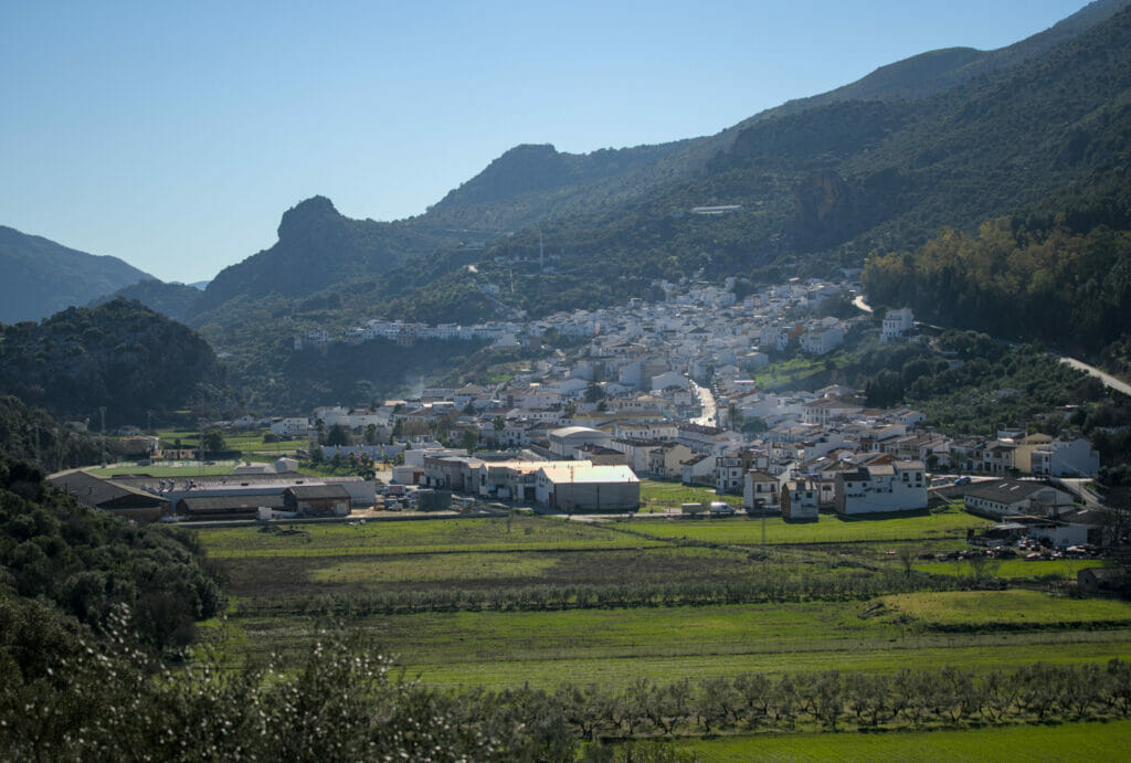
After 4 km along the water we arrive at the foot of the village of Benamahoma (with a parking lot by the river if you start the hike on this side as well as several bars and restaurants). Most of the hikers turn back here, but for our part we were intrigued by the steep slope that goes up towards the white houses of Benamahoma. We did not regret this little detour!
The village is perhaps not the most known of Andalusia (nor the most flowery and photogenic) but we nevertheless found it very pleasant to visit. We drank a coffee on the terrace of a small bistro in the main street and then went to the eco-museum of water. Unfortunately, we can’t tell you more about this museum which was closed when we were there, but it was a good way to make a small loop to come back to the parking of Benamahoma.
The rest of the route is exactly the same as the one we took on the way in but in the other direction. After, I want to say to you that the area is so pretty that for once we did not especially mind to take the same path twice.
Map and Info of the Rio Majaceite hike
- Distance: about 13 km
- Elevation change: about 300 m (+ and -)
- Time: count 4 h for the return trip
- Dificulty: easy
- Permit: This route does not require a permit and dogs are allowed (on a leash)
- Food: it is better to bring water and a small picnic even if it is easily possible to eat and drink something in Benamahoma (several bars and restaurants at the arrival of the trail and in the village)
- Conseil: Evitez les week-ends! Cette randonnée est très appréciée des locaux dans la région et le week-end il y a VRAIMENT beaucoup de monde.
Other routes to do in the Sierra de Grazalema natural park
To tell you the truth, we had originally planned a very different program for our little trip in the Sierra de Grazalema… In fact, there are 2 hikes that we really wanted to do but that unfortunately we had to leave aside: La garganta verde and the climb to Toreron.
Why did we not do these routes? 2 reasons…

- These hikes being in a protected area, access is forbidden to dogs. Being here in winter, we could have, theoretically, deal with it (at least for the garganta verde)… Winchy loves chilling in the van (and in winter it’s not too hot to leave him there), so we could have easily gone for a walk elsewhere before and then done the Garganta verde itinerary in 1-2 hours. For the Toreron it would have been more complicated because the itinerary is longer… and clearly we didn’t want to leave him 4 hours alone in the van.
- These 2 routes are subject to a permit! It is finally this point which will have made us make the final decision… When we arrived at the beginning of the trail we saw that we had to ask for a permit beforehand (information that we had totally missed during our research). The request for a permit can be done at the visitors center of El Bosque or by email (at least 24 hours before). Email address: cvelbosque.amaya@juntadeandalucia.es Important note: Due to the risk of fire, permits for individual visitors (i.e. without a guide) are only given between October 16 and May 31.
If you come to the region at the right time and ask for the permit, here are the tracks of the routes we would have thought to follow: The Garganta Verde and el Torreon. If you go there, don’t hesitate to tell us how it was… 😉
Useful information for visiting the Sierra de Grazalema Natural Park
Getting to the Sierra de Grazalema
As I said in the introduction, Grazalema is located between the provinces of Cadiz and Málaga. Within the park itself, the roads are few but they allow to easily connect the different villages and starting points of hikes. Personally, we would recommend you to plan at least 2 days to discover the park, but if you have less time then we advise you to focus on one area (the closest to where you arrive).
From Ronda: Ronda is probably the closest city and the one with the easiest access. The village of Grazalema is a 40-minute drive from Ronda, while the Caves of El Gato and the Hundidero are less than 20 minutes away!
From Cadiz: It takes about an hour to drive to El Bosque (and to hike the Rio Majaceite). To reach the village of Grazalema it is necessary to count 1h30.
From Marbella: Marbella is 1 hour from Ronda. From there, the times are given above.
From Seville: It takes 1 hour and 15 minutes to get to Zahara de la Sierra (the northern entrance to the park). From there, it takes 30 minutes more to reach Grazalema.
Permit to hike in the sierra de Grazalema natural park
As mentioned above, it is important to note that some routes in the park require a permit. In total there are 4 areas where a permit is required:
- Pinsapar
- El Toroen
- Garganta Verde
- Llanos del Rabel
The permits are free and can be obtained directly at the park’s visitor center in El Bosque (address: Calle Federico García Lorca, 1, 11670 El Bosque), by phone (+ 34 956 70 97 33) or by email (cvelbosque.amaya@juntadeandalucia.es). During the busiest time of the year, it can be difficult to get the permits and on the official website they recommend to book 1-2 months in advance… This sounds crazy to us, but as we told you, we didn’t try to apply for it. We sincerely think that out of season it should be possible to get them with a little less delay (at least we hope so). By the way, if someone has experienced the application process, don’t hesitate to leave us a comment to tell us more about it, so we can update the article!
For more information: go on The official Junta de Andalusia homepage
Hotels / getting around in the Grazalema natural park
If like us you travel by van, it is important to note that it is strictly forbidden to spend the night in your vehicle inside the natural park! There is a parking area in El Bosque and there are small spots in Zahora (on the other side of the lake and therefore outside the natural park area). Or if you prefer a campsite, it is possible to base yourself at the one in Ronda and go back and forth. If you don’t have a van yet but you want to rent one in Andalusia, we advise you to have a look at our article on van rental, you will find a comparison of the different rental sites.
If you are travelling by car and you are looking for an accommodation then we strongly advise you to look at Booking. More than taking a hotel, we advise you to go for a small rural house! In the small villages of the park there are many houses to rent and no doubt that it is very nice! We rented a casa rural in another white village (we’ll tell you more about it later) but it’s really a great experience! Personally we found that the villages of Benamahoma, Zahara and Montejaque had a lot of charm and it’s probably there that we saw the most houses for rent (the tourist houses in Andalusia have all a small plate hung in front of the entrance door and we recognize them easily 😉
If you want to rent a car, we advise you as usual to look at Rentalcars. Note however, that cars are much cheaper from Malaga or Seville (you can find cars from 8€ per day depending on the period), while in Ronda it’s rather around 50€ per day…
Grocery shopping in the Sierra de Grazalema natural park
No worries on this side! There are small supermarkets in all the main towns / villages of the park, i.e. in Zahora de la Sierra, Grazalema and El Bosque. Of course, we are talking about small supermarkets, but let’s say that there is way enough to get by easily.
That’s it for this article about the Sierra de Grazalema! We hope you enjoyed it and that it will help you prepare your trip. If you want to see our other articles about Andalusia (there are a lot of them since we stayed there for more than 2 months), it’s over here.
See you soon for the continuation of this journey in the south of Spain!
Pin it
Note: This article contains affiliate links. When you use our links to book an accommodation or a car, you will of course not pay anything extra, but we will get a commission. These commissions allow us to continue to offer you our independent, free and ad-free content. All the sites we recommend are the ones we also use when we make a booking. We thank you for your support.

Beautiful blog! Very informative, thanks for sharing.
Very helpful, thank you.