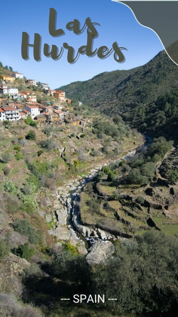
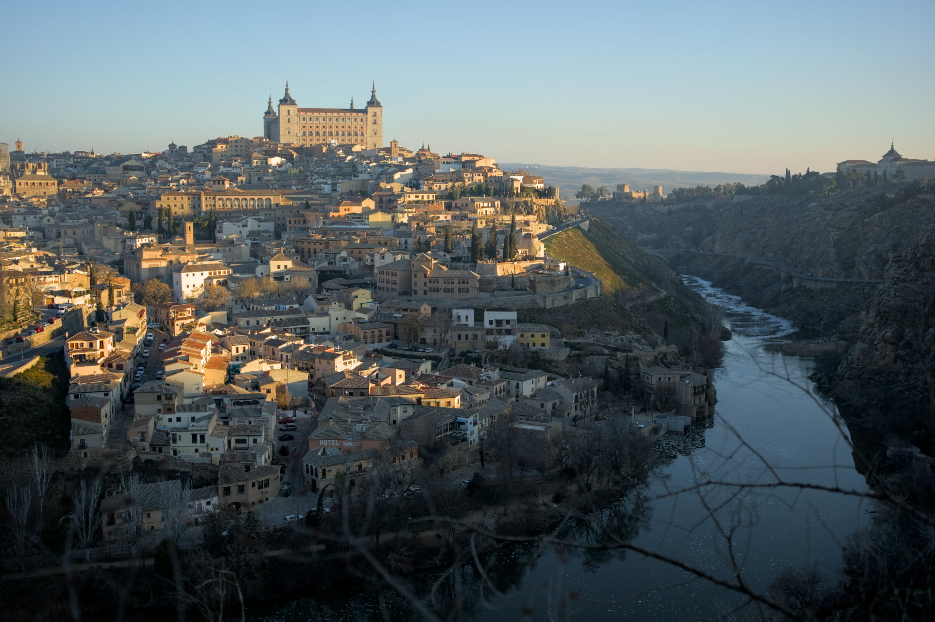
After leaving Andalusia, we set off towards our beautiful Galicia. But after visiting the city of Toledo and before reaching Anceu Coliving, we decided to stop for a few days to discover a region of Spain that we did not know yet: the region of Las Hurdes in Extremadura as well as the Sierra de Francia and the village of La Alberca in the province of Salamanca (Castilla y León region).
In all, we spent a small week in the area and we propose you a small summary of our adventures with obviously our favorite things to discover and hikes to do in the surroundings.
- Las Hurdes and the Sierra de Francia: but where is it?
- Riomalo de Abajo: a small village at the doors of nature
- The Melero meander
- Hike to the Meancera waterfall
- The beautiful road from Casares de las Hurdes to Riomalo de Arriba to La Alberca
- The Monastery of Las Batuecas – Sierra de Francia
- Hike to the Chorro waterfall, Sierra de Francia
- The village of La Alberca – province of Salamanca
- The path of the hundred-year-old chestnut trees, La Alberca
- The panoramic view from the sanctuary of Peña Francia
Las Hurdes and the Sierra de Francia: but where is it?
Las Hurdes and the Sierra de Francia are two absolutely splendid nature regions in Spain, but let’s be honest, they are not the most known… I don’t know about you, but we had never heard about them before and probably wouldn’t have come across them if we hadn’t been actively looking for a natural place to stop for a few days between Andalusia and Galicia.
Anyway, enough of blah, here is a small map to help you situate all this:
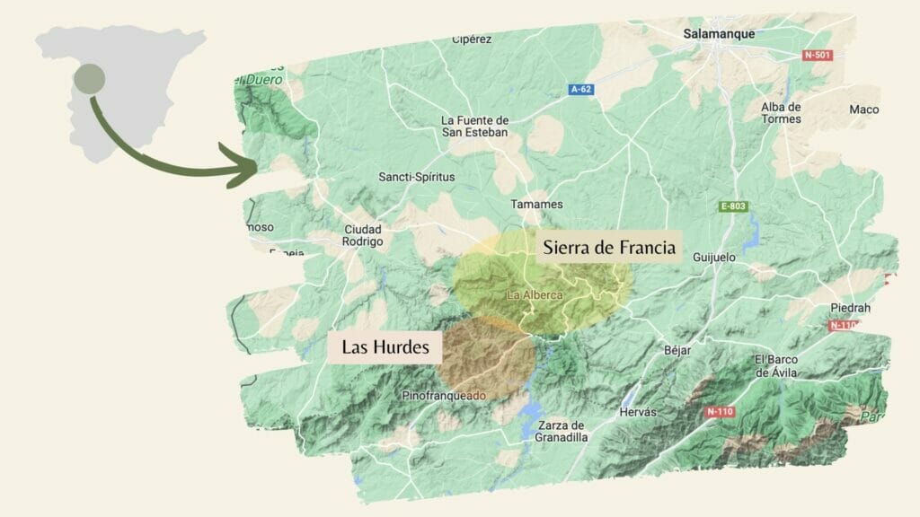
Salamanca is well known in Spain, and to get to the Sierra de Francia you have to go a little further southwest, towards the Portuguese border. Not far away is the famous Ribeira del Duero (if you like wine, chances are that name will sound familiar).
The Sierra de Francia and its natural park of Las Batuecas are located in the very south of the region of Castilla y León.
Las Hurdes is another natural space that is located just next door (that’s why we decided to put them together in the same article). And for this second area, we change of region and are now in Extremadura.
Riomalo de Abajo: a small village at the doors of nature
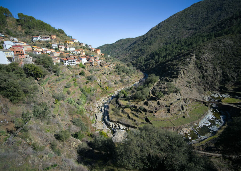
To explore the region of Las Hurdes we decided to base ourselves in the small village of Riomalo de Abajo. This choice turned out to be excellent in terms of location and also for the charm of the small hamlet, but we must admit that the reason of our choice was much more practical. In the middle of February, the majority of the campsites of the region were still closed and only the one of Riomalo was open 😉 .
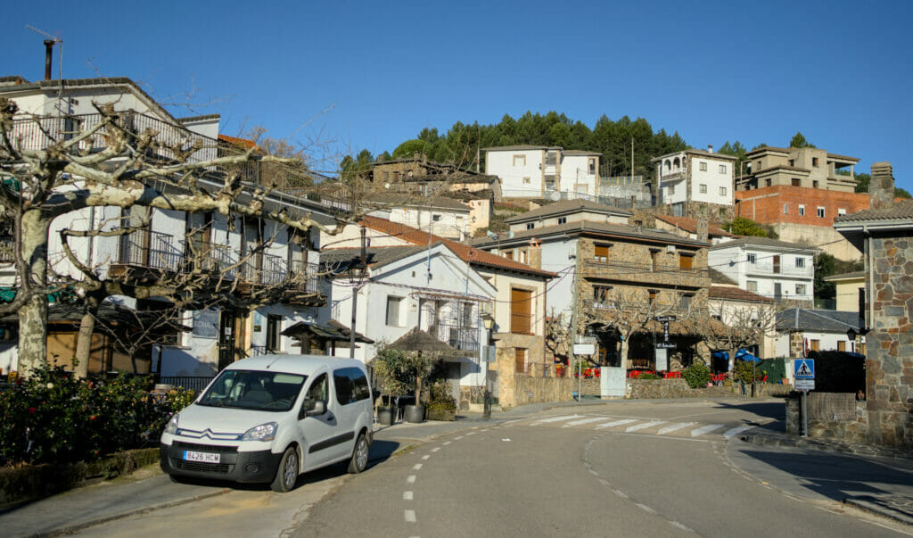
About the village itself there is not much to tell… about 50 inhabitants, 2 bars-restaurants (a hell of a population-bar ratio if you want our humble opinion 😉 ), a hotel and that’s about it… But what makes the place unique is its location at the gateway to the Hurdes region and the Sierra de Francia. More than a “travel destination”, it is more an ideal stopover to explore the surrounding area.
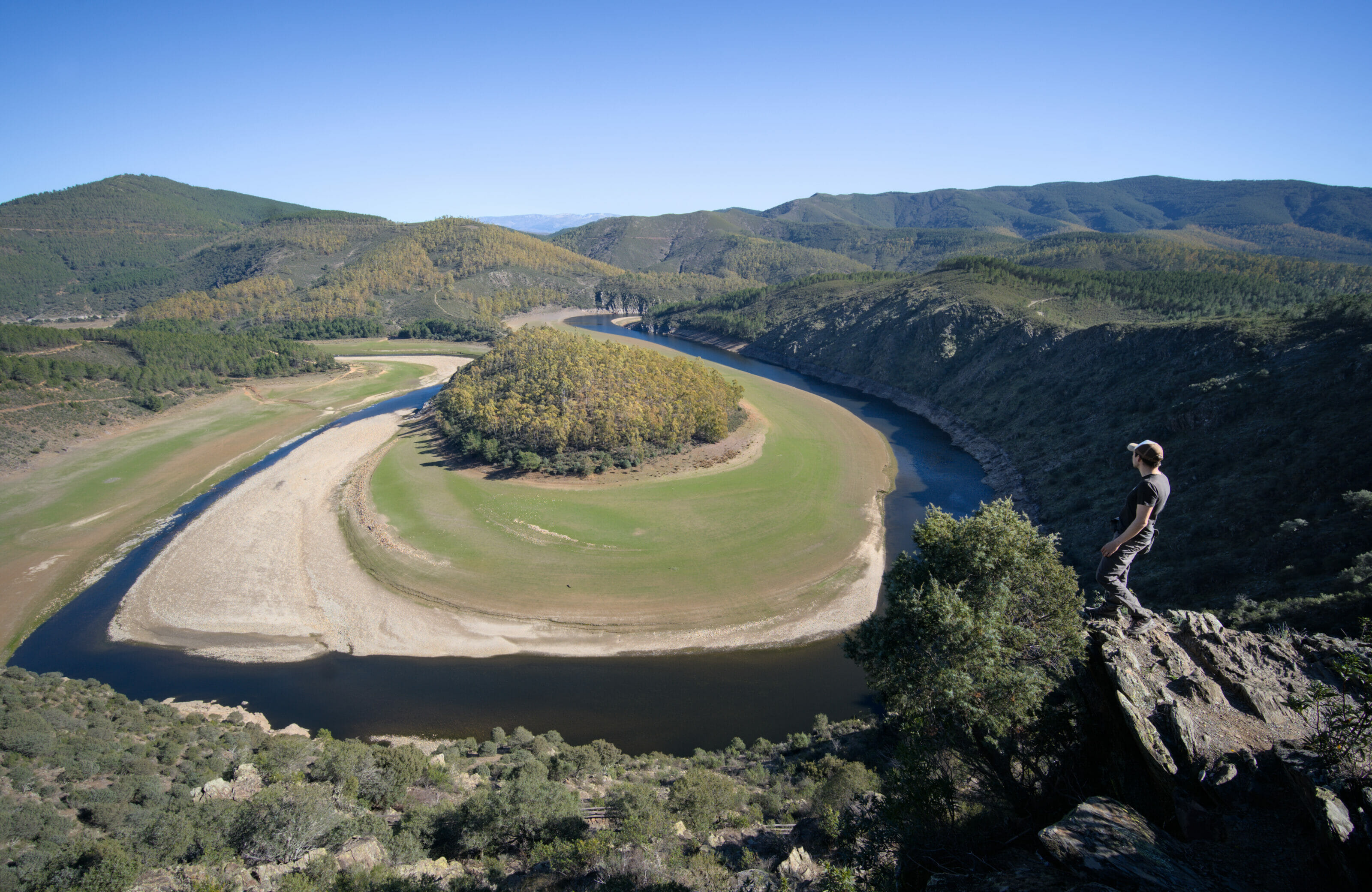
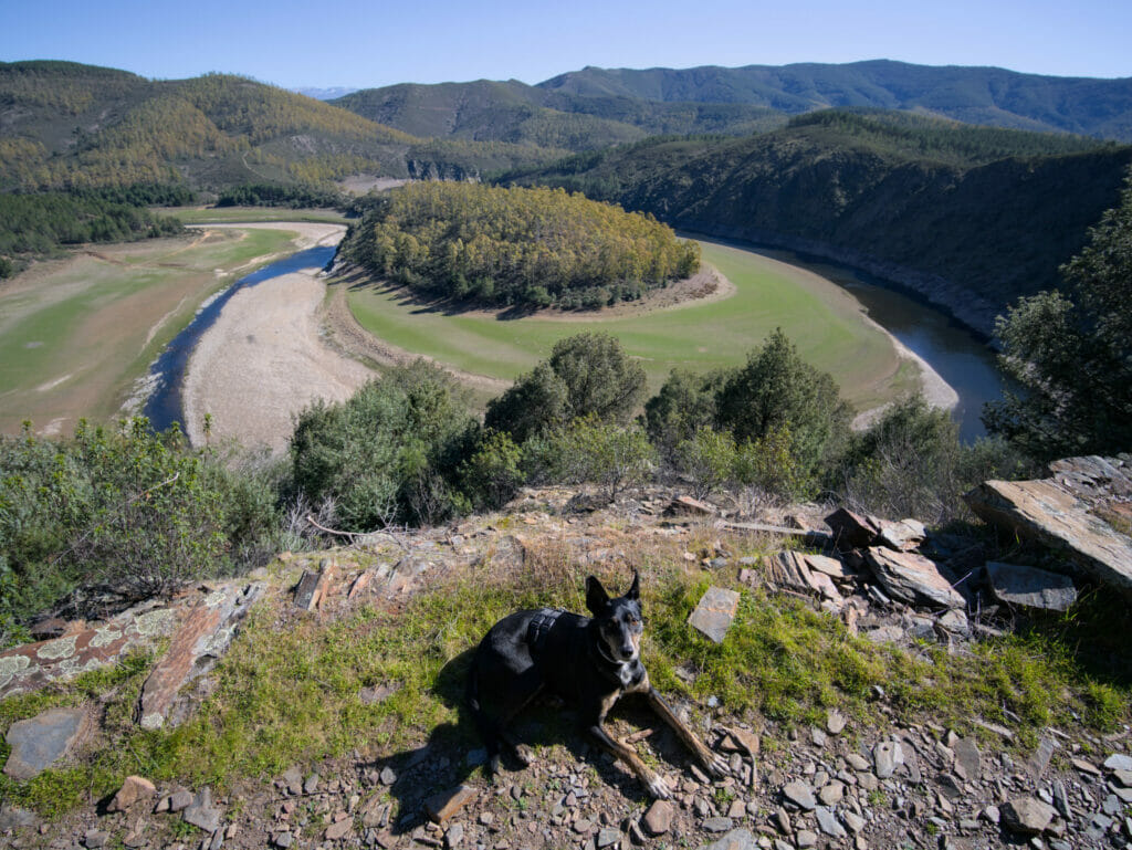
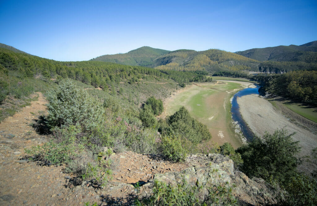
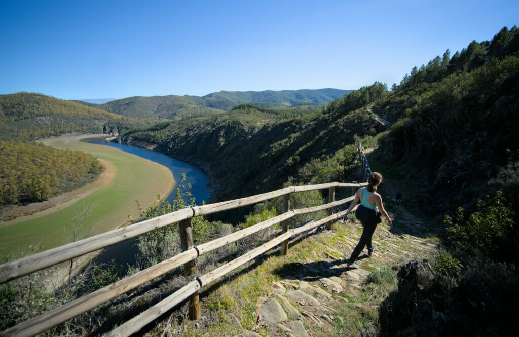
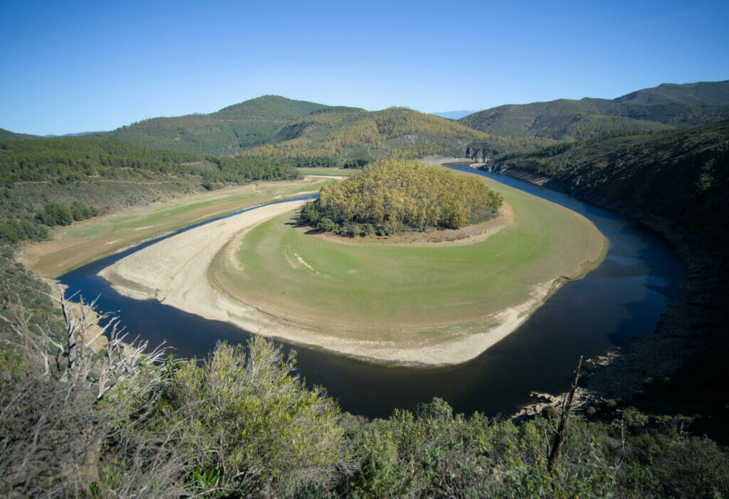
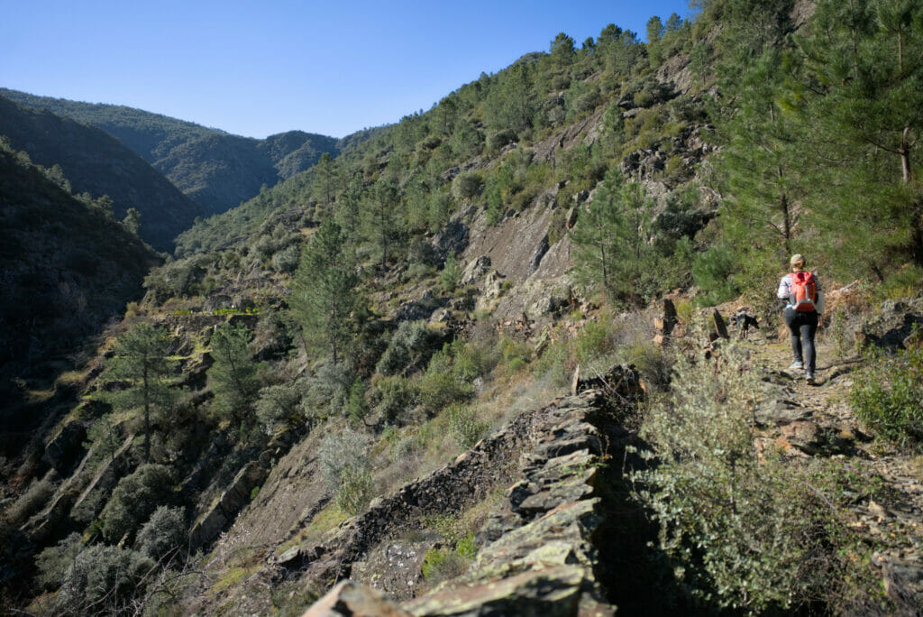
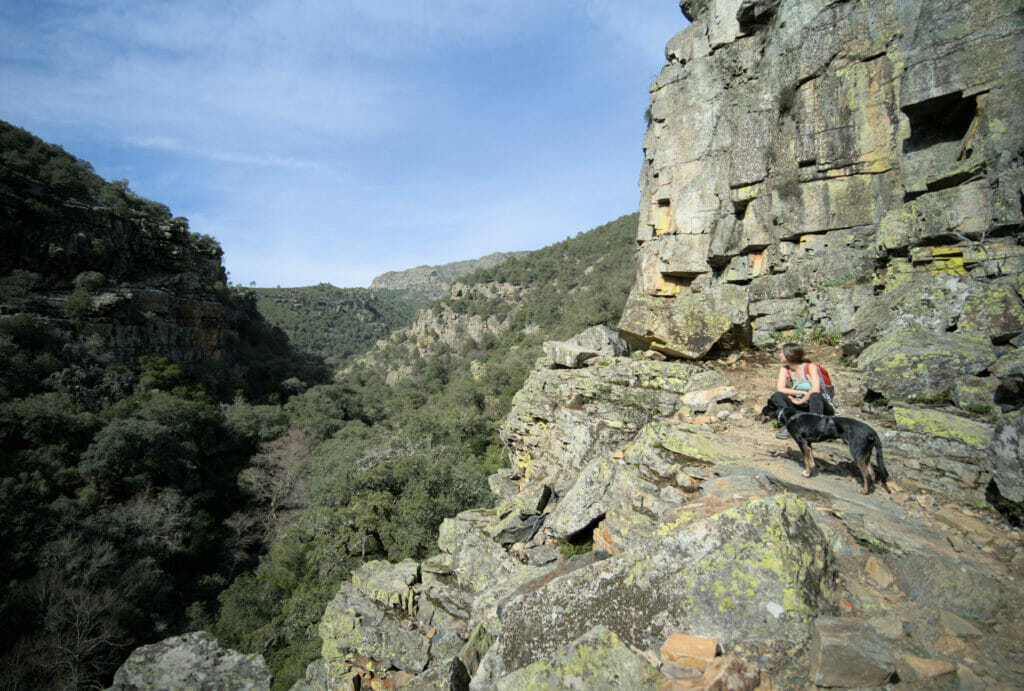
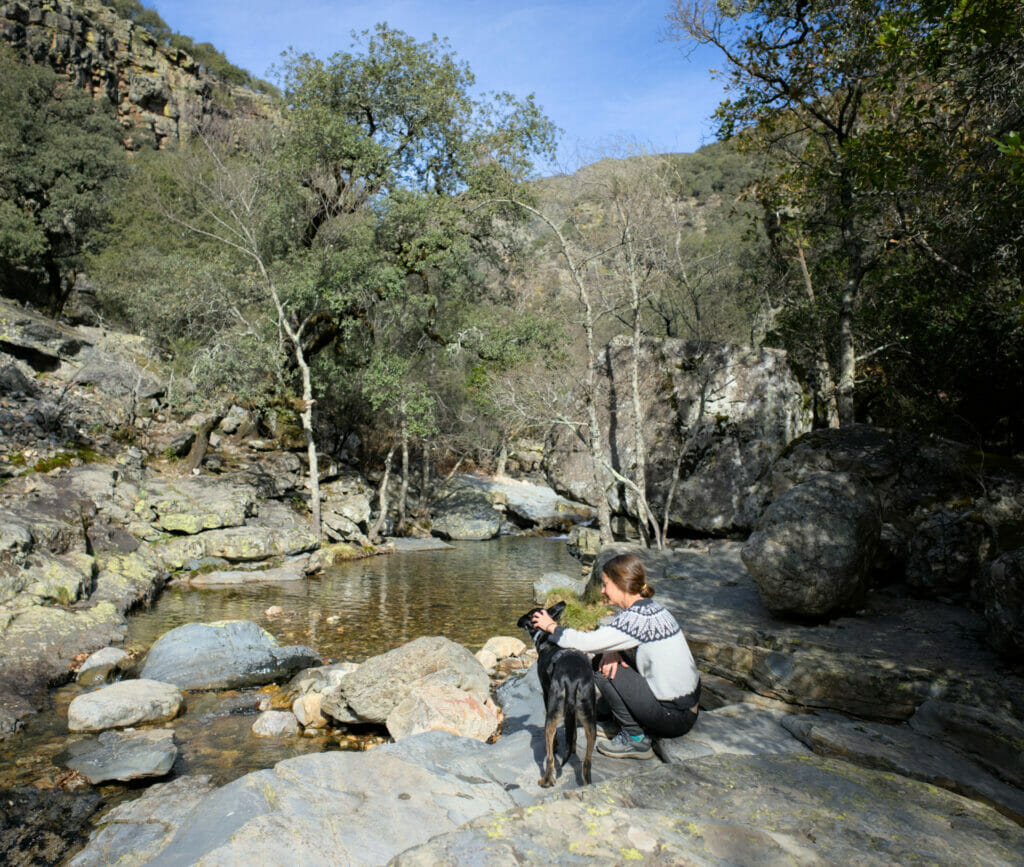
The Melero meander
I was a little bit hard on Riomalo de Abajo when I said that there wasn’t much to see there… Because, in fact, the village is the starting point for a beautiful hike leading to the Melero meander.
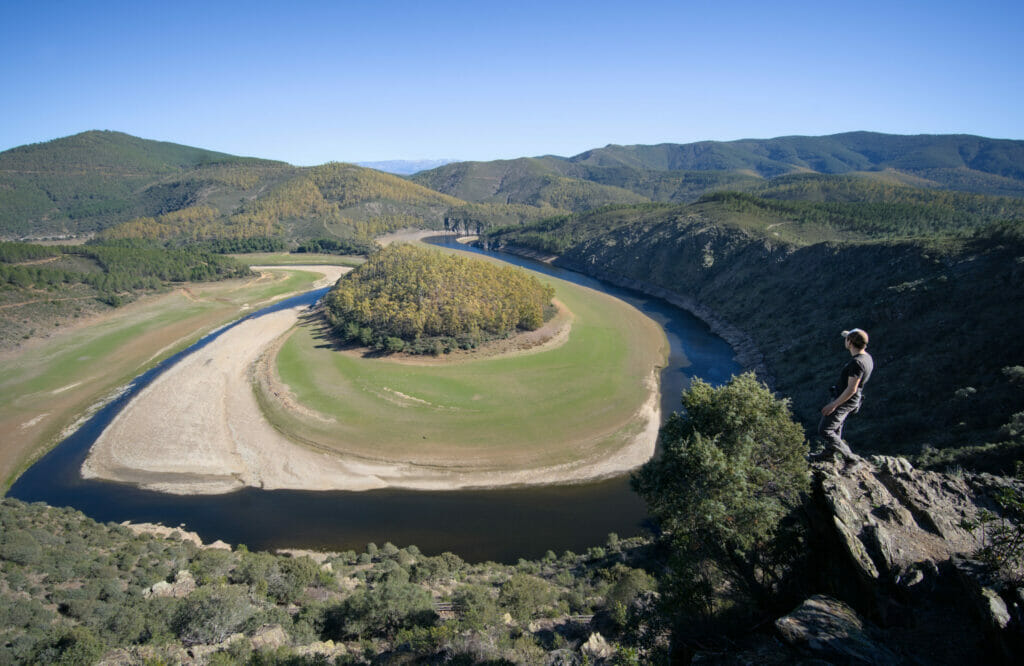
We had seen a first Spanish meander during our road trip in Catalonia and it is a picture of the Melero meander that gave us the idea to come to the region of Las Hurdes.
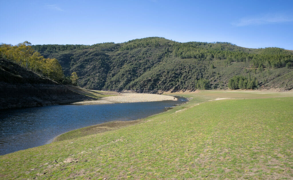
From the village, we followed the wide track that passes in front of the campsite. After the second turn, we followed the track which goes down to the edge of the river. We admit it, we secretly hoped to be able to join the continuation of the hike by going along the riverbed… This last point will have been a failure because the water level was too high and rocks will have prevented us from making the junction.
But in the end it’s not a big deal because the large plain at the water’s edge is really beautiful and clearly worth a look. If you look at the map below, you will see that this little “detour” is clearly optional.
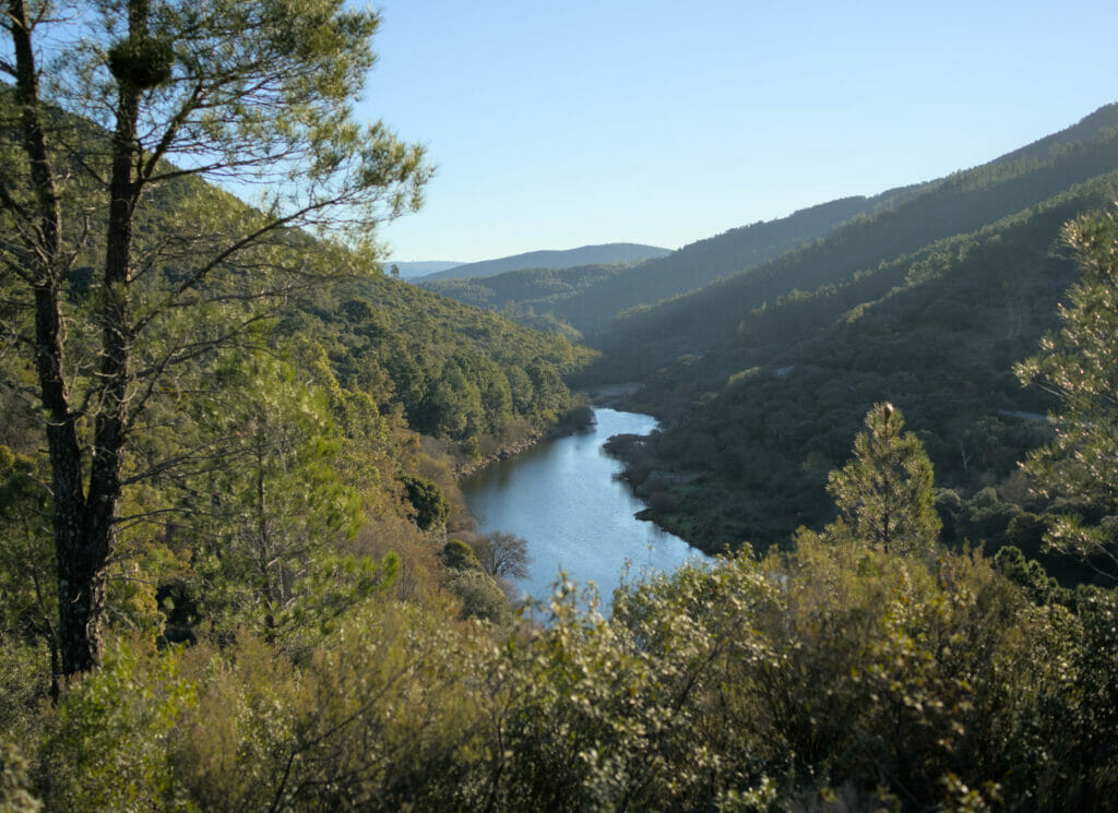
Once back on the track, we continued to the second crossing. This time we really recommend you to go down!!! Once at the water’s edge we have a beautiful view of the meander “from below”, then the trail goes up gently towards the official viewpoint.
To tell you the truth, we even found that the view on the meander was just as beautiful from this path as from the “official viewpoint” located on the road 😉
At the end of the climb, the path returns to the track and this time we follow it to the right in the direction of Riomalo, passing by the viewpoint of La Antigua.
At the mirador, we advise you to go down to the different viewpoints that are below the road to enjoy an even better view!
To return to the starting point, simply follow the track.
In all, the hike is just under 11 km (including the first detour to the riverbed). The shorter version is 7.5 km long. There is really no difficulty and we advise you to allow 3 hours for the loop.
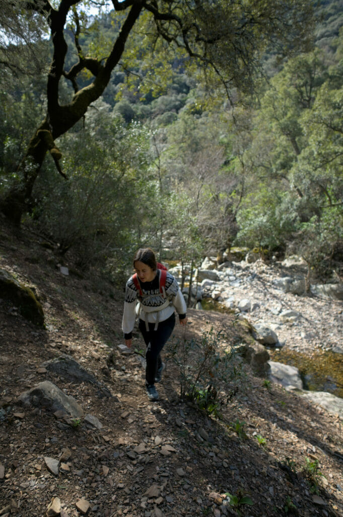
Hike to the Meancera waterfall
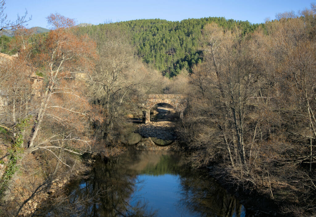
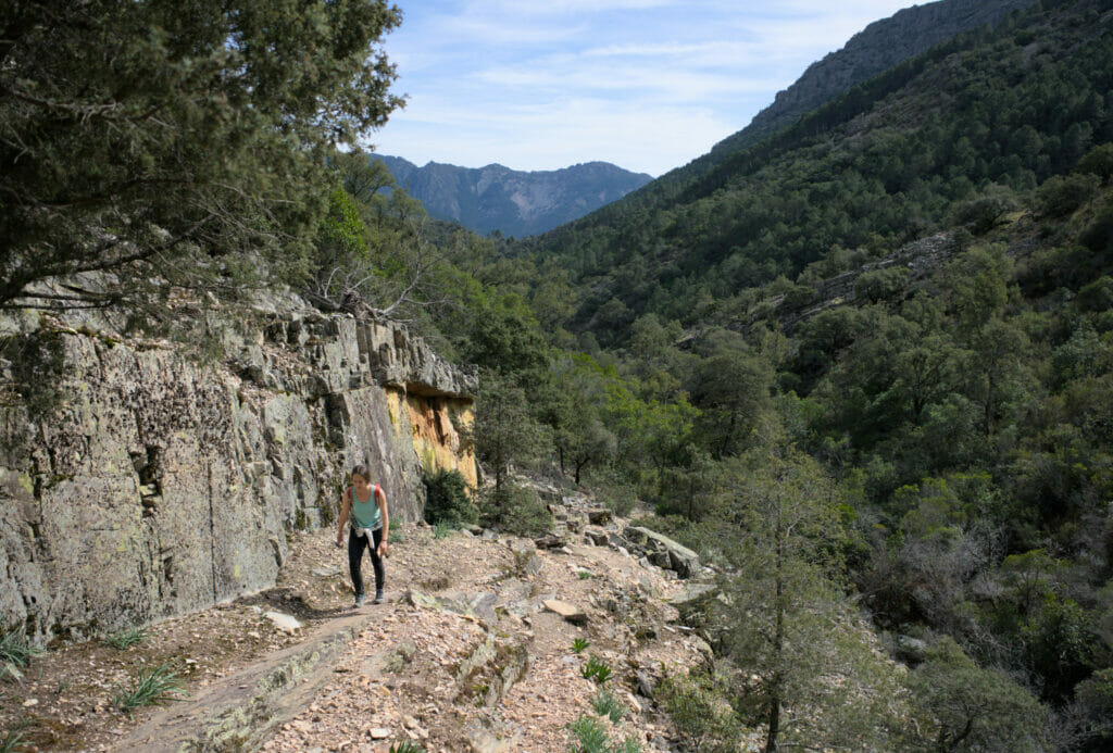
During our little stop in Riomalo de Abajo we explored the surroundings and if there is a nice little hike that we would recommend, it would probably be the one to the Meancera waterfall. To get to the beginning of the hike, you have to follow the road on the left that leaves Nuñomoral and goes into the valley.
We parked in the small village of Martilandran and from there we went on foot along the Rio Malvellido. The itinerary follows the road for a while, before plunging towards the river at the level of the hamlet of Fragosa.
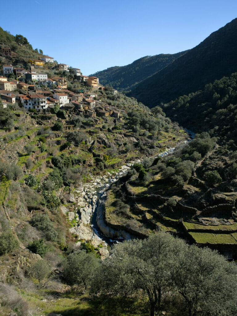
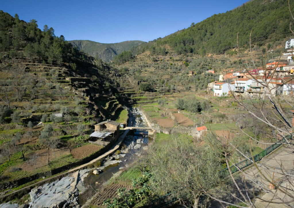
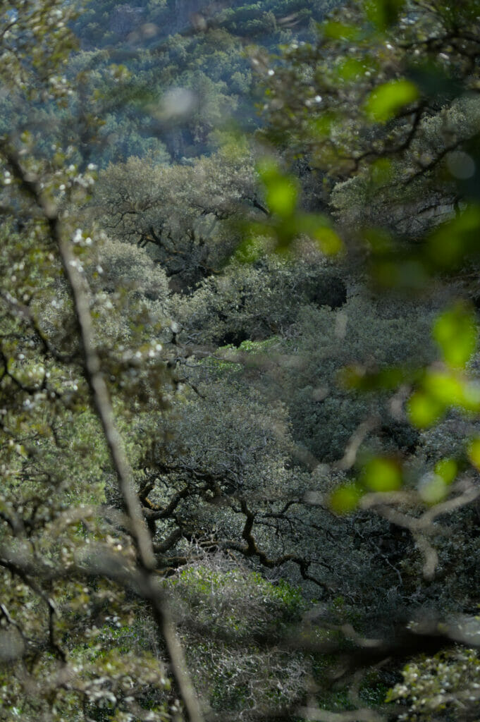
After having crossed the river, we go up on the other side and we follow a magnificent path which makes us overhang the river. The landscapes are superb and I will not hide you that at certain moment we asked ourselves if we had not landed in Peru. I don’t know, but these cultures in terraces have furiously reminded us the landscapes in the surroundings of Cusco!
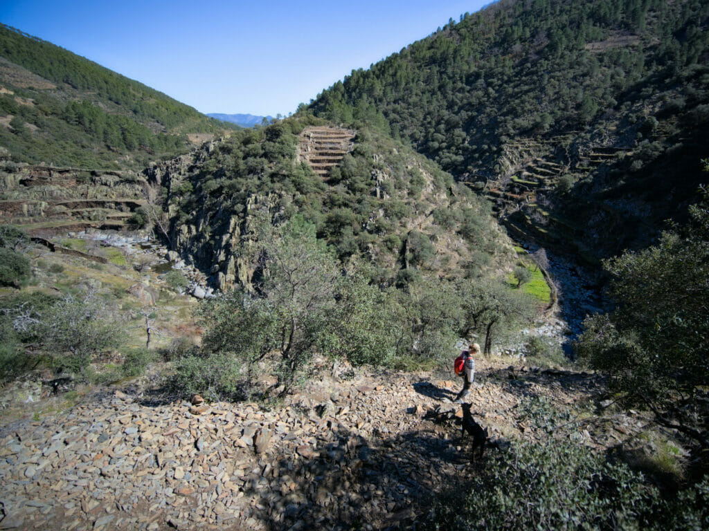
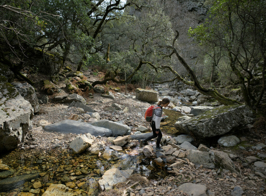
After 3.5 km, we return to the water’s edge and cross the small bridge that spans one of the tributaries of the Rio Malvellido. At this point we find a larger path that connects the village of El Gasco to the Meancera waterfall.
The amount of water in the waterfall depends strongly on the rainfall and the season. Normally, winter is the best period to come and observe it… But this year having been particularly dry, the inhabitants confided to us that the waterfall had rather a “summer” looking like flow.
For the way back, we simply retraced our steps to Martilandran.
- Round trip from Martilandran
- Distance: 8 km
- Elevation gain: about 500 m (+ and -)
- Duration: count 3 good hours for the round trip
- Note: it is possible to shorten the walk considerably if you park at the end of the road in “El Gasco”. A path built on footbridges leaves the village and goes to the waterfall. The version we followed allows us to see more of the terraced crops and to follow the river for a longer distance.
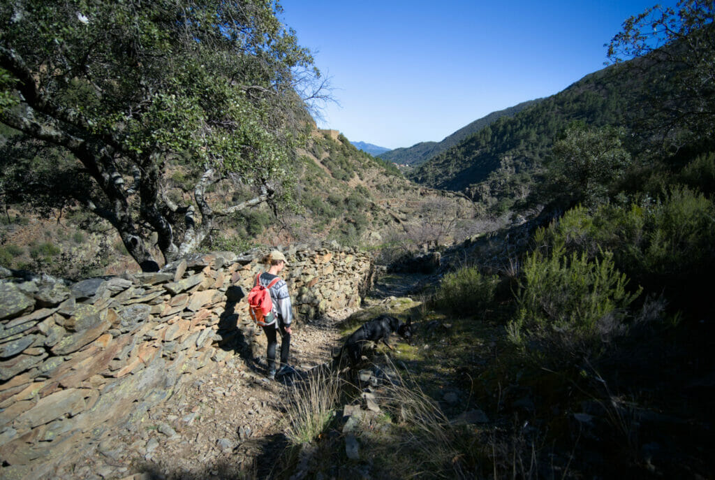
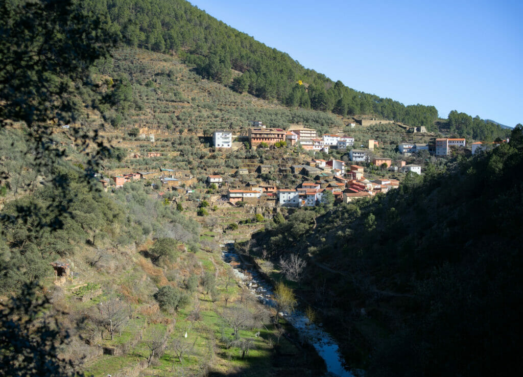
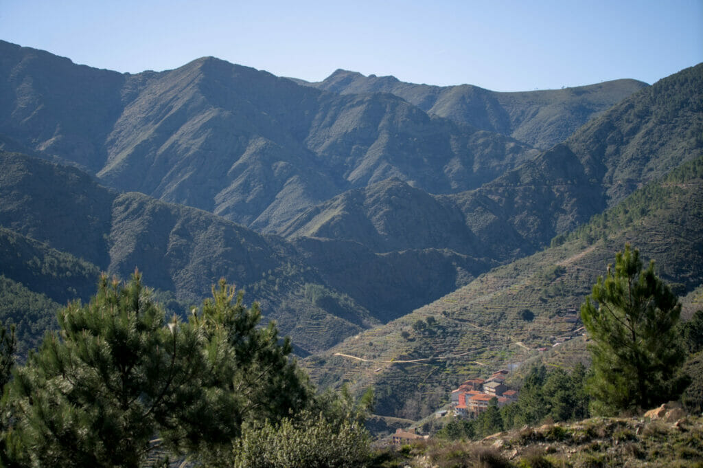
The beautiful road from Casares de las Hurdes to Riomalo de Arriba to La Alberca
After visiting the Meancera waterfall we headed back to our next stop: La Alberca. The most logical way to go to the Sierra de Francia would probably have been to go back, but we opted for a small detour to see Casares de las Hurdes and Riomalo de Arriba. Well ok, in reality we took this route because we had spotted a lot of viewpoints and potential sleeping spots for the van… but I promise, even without that, the road is worth it! 🙂
On the way we stopped at the mirador de las Estrellas and the mirador de las Carrascas. But there is another one (which has no name) that is located 2 turns above the one of Las Estrellas that also offers a magnificent view (GPS coordinates: 40.445153, -6.289829).
In the village of Las Mescas we then turned left towards La Alberca (but again, not without making a few stops along the way)
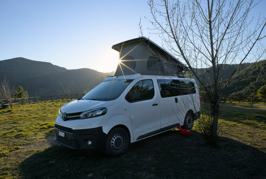
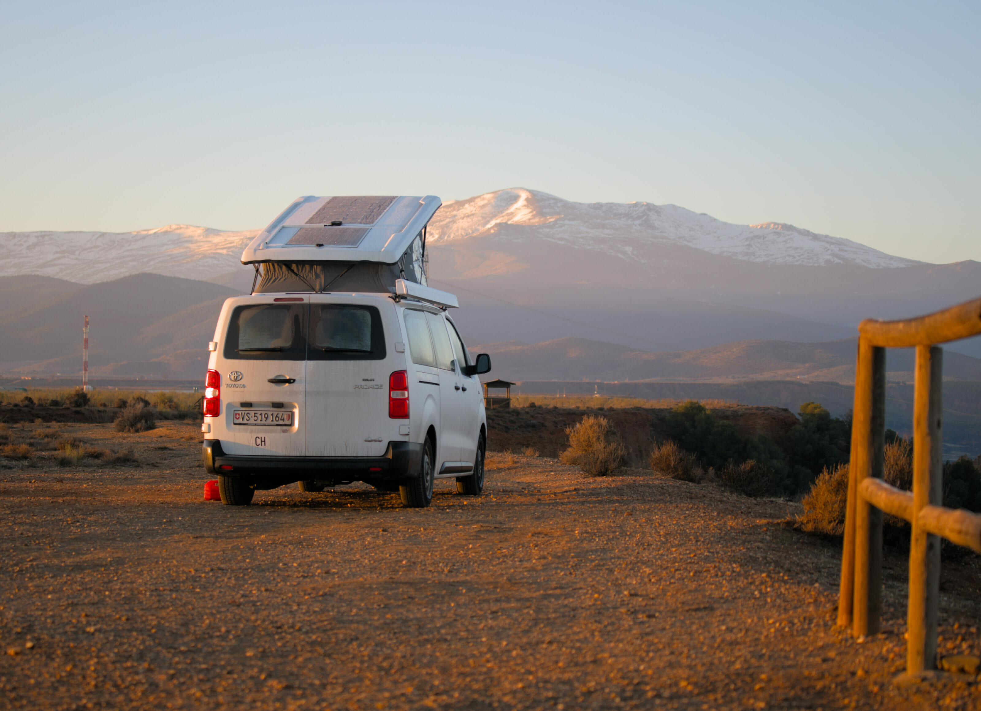
Visiting Spain by van is a really great experience! The region of Las Hurdes and the Sierra de Francia is very well suited for this type of travel. There are many parking areas and campsites available.
The campsite of Riomalo de Abajo is not particularily nice, but it’s there. Be careful though, it is only suitable for vans because the campsite is quite narrow and low branches restrict the access to big vehicles like RV’s.
If you want to rent a vehicle for your trip we let you take a look at our article in which we present all the alternatives to rent a van (from private person to private person or from a professional).
The Monastery of Las Batuecas – Sierra de Francia
That morning Benoit told me something like that:
Oh, today on the way to the Alberca we can make a stop at a monastery. I saw that there is a waterfall to see… It will be a very flat path along the water, which unless I am mistaken is even wheelchair-accessible. In short, a round trip of 11km that should take us 2h30 max and that will stretch the dog’s legs.
Hmmm… spoiler : it didn’t go as planned! 🙂 Well… let’s say that Benoit had only partially studied the route. In short, a story in 2 steps!
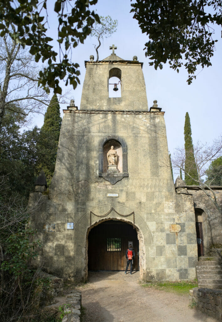
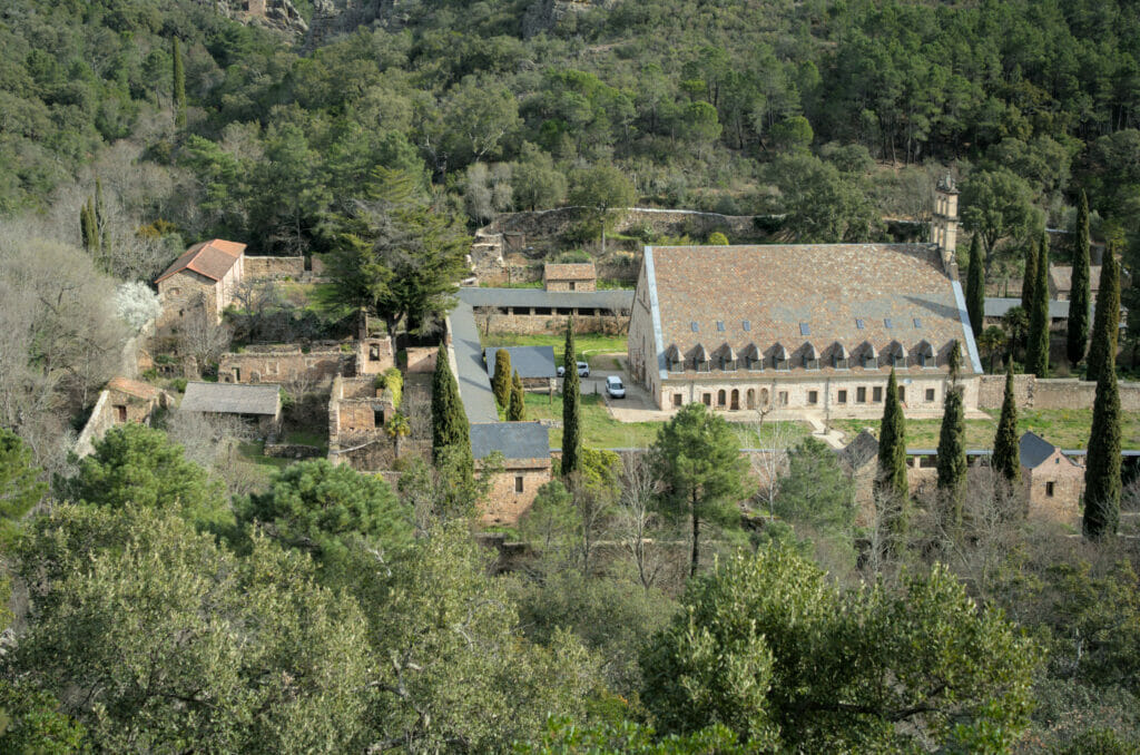
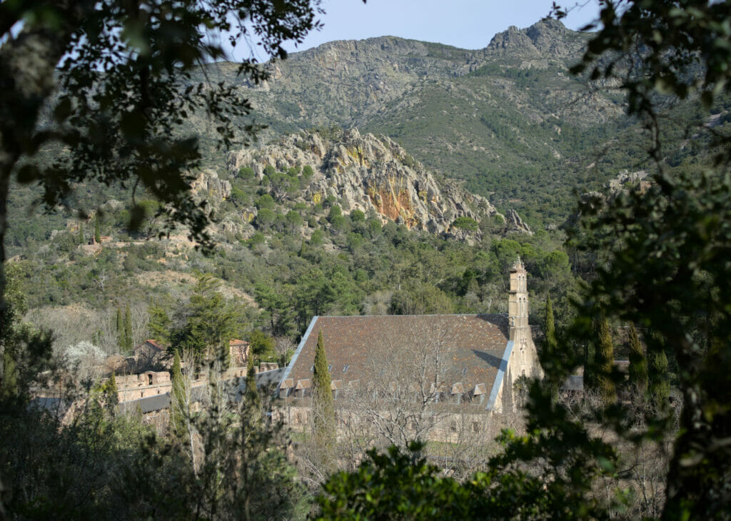
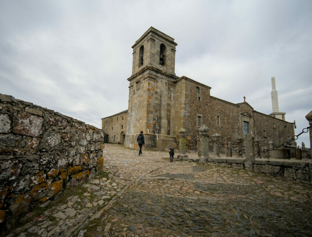
Let’s start with the monastery part if you agree! The monastery of San Jose de las Batuecas is a spiritual place where religious of the order of the Discalced Carmelites live, a contemplative, apostolic order that lives from public donations in a 100% silent and isolated place.
For this very reason, the convent itself is not open to the public and only the main entrance can be seen. The main building is located further back in the property.
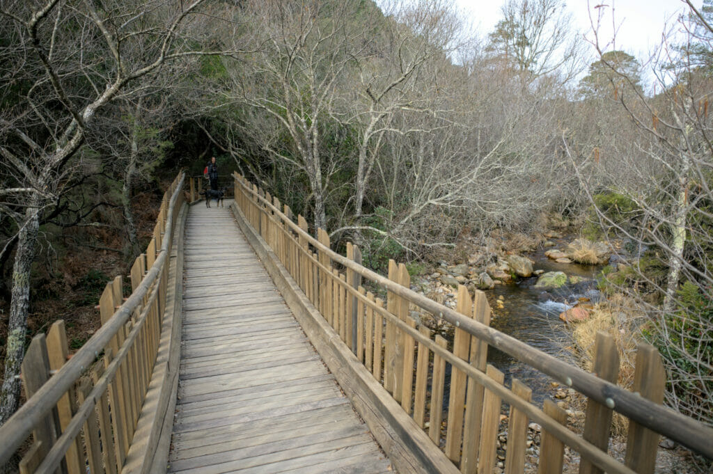
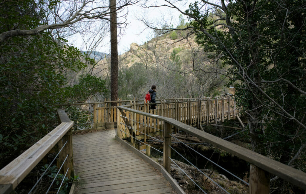
The access is from the main road following a very nice path on wooden footbridges (well and truly accessible to people with wheelchairs).
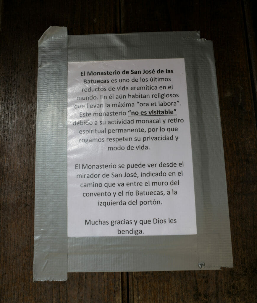
Once in front of the main door, a small note explains that the monks live here as hermits and that visits are not allowed… But on the other hand, it is possible to have a panoramic view on the domain by going to a viewpoint not far from there. You can imagine that we couldn’t resist to take a little bit of height to see that 😉
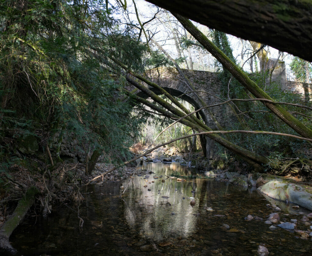
To get to the viewpoint you have to go along the wall of the estate and then turn left to cross an old stone bridge. From there, the path is marked and goes up in a zig-zag pattern in the forest.
Note: On the map below, the path that goes up to the viewpoint is very approximate (the path does not exist on the topo maps… But don’t worry, on the spot the path has been perfectly marked out by the monks and you will arrive at this viewpoint:
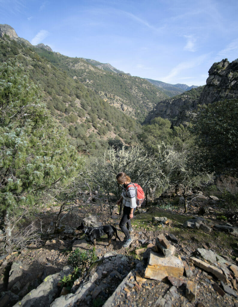
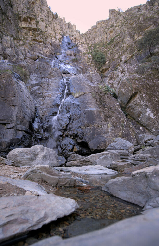
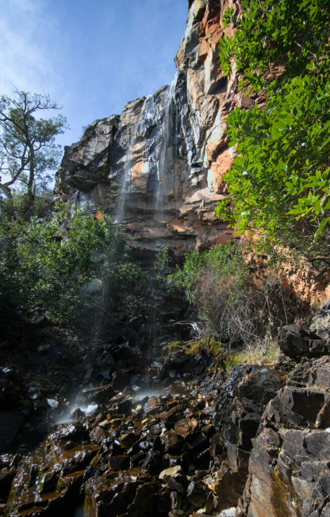
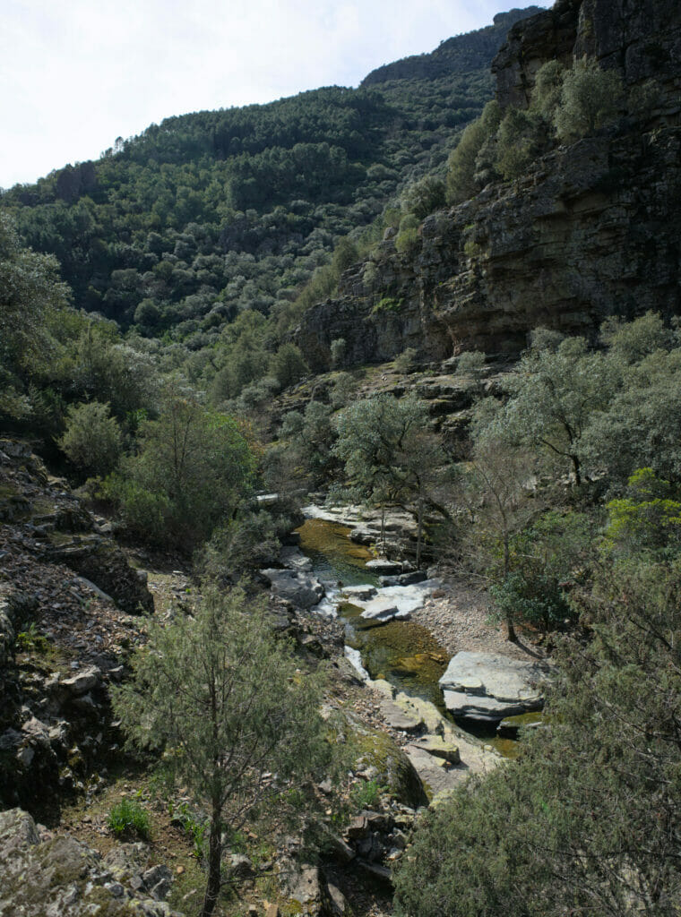
Hike to the Chorro waterfall, Sierra de Francia
After the small round trip to the viewpoint we returned to the river and it is here that the serious things started (yes yes, we said goodbye to the accessible path).
So don’t panic, there is nothing very complicated, but let’s say that in my head I had left for a Sunday stroll and suddenly we found ourselves on a hiking trail in the forest. The first part is relatively flat (all things relative). On the way there are several places where we can make a small detour to go to admire rock paintings. There is not much left, but with a little imagination we can still see some drawings!
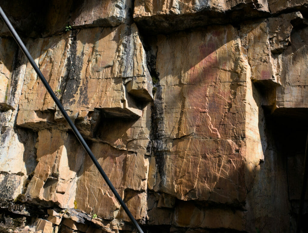
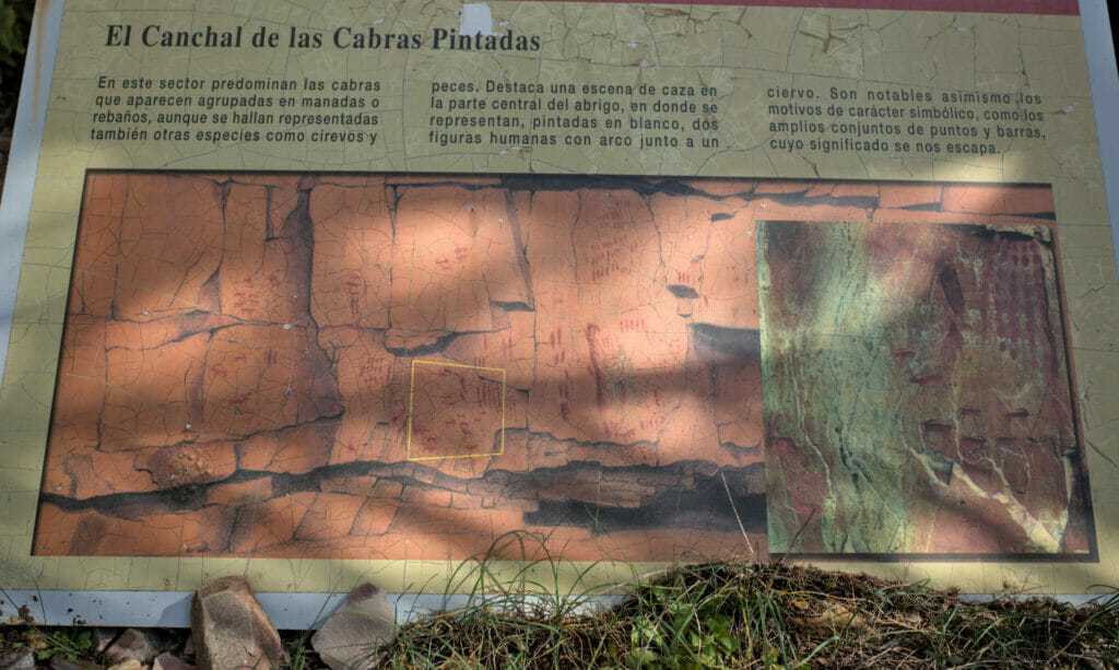
By the way, at the second crossing, we advise you to go up to the paintings and then to follow the “high” path which passes on the cliffs. On the way out, we followed a path along the water and we got a little lost and we found ourselves having to climb off the path until we found the official path that passed over our head.
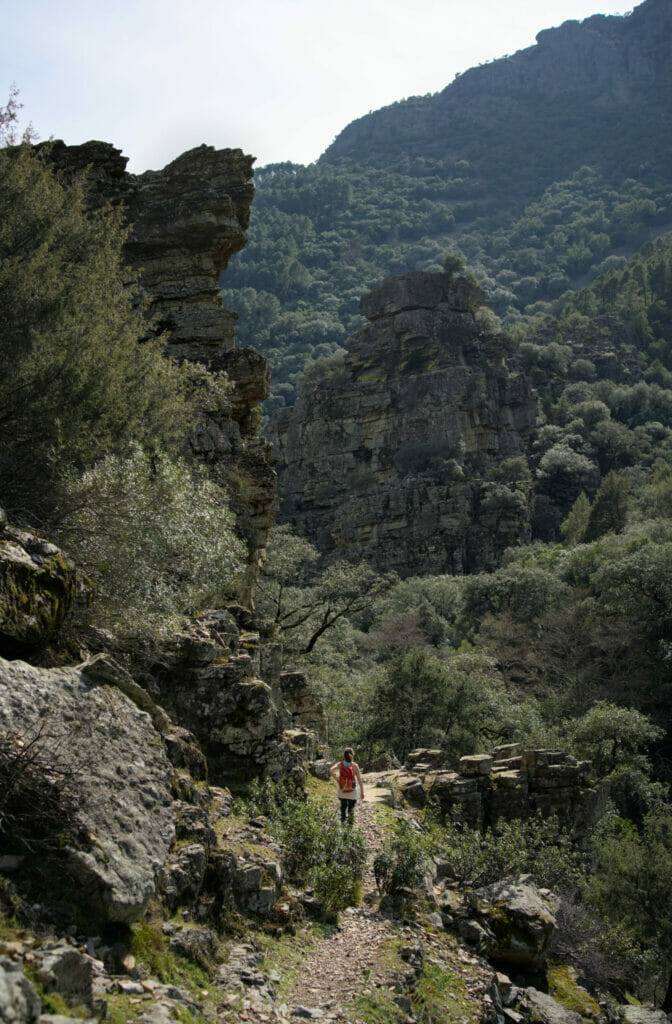
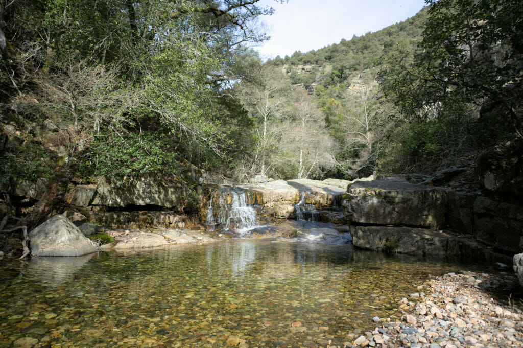
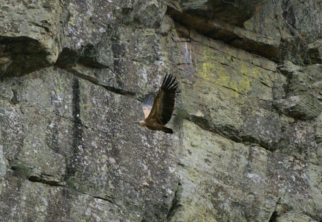
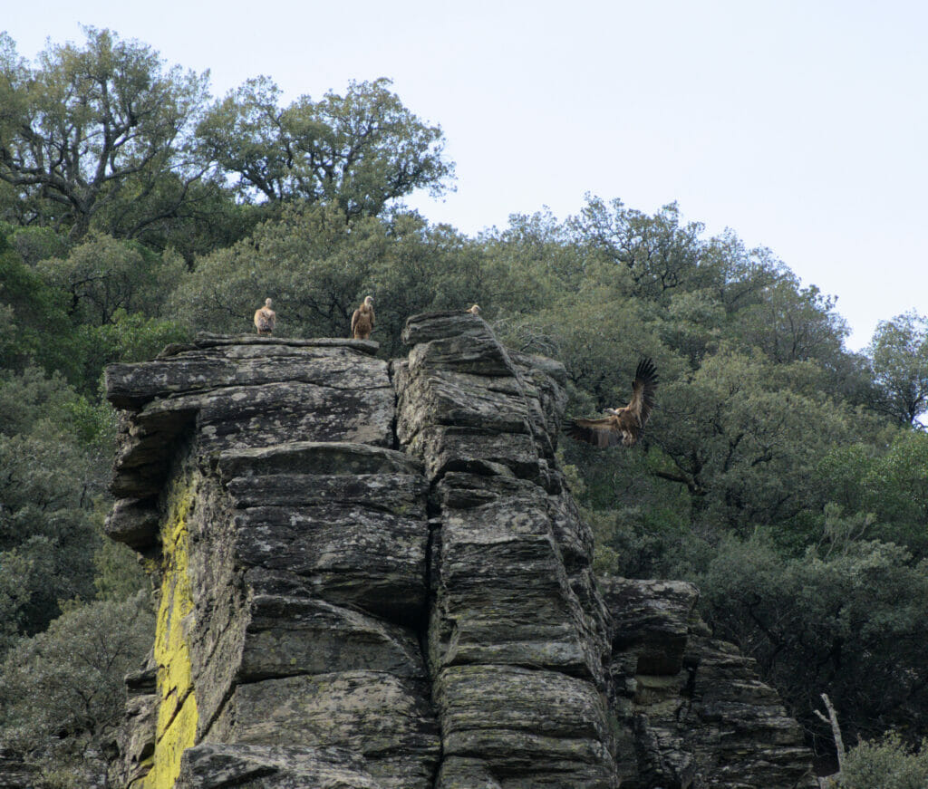
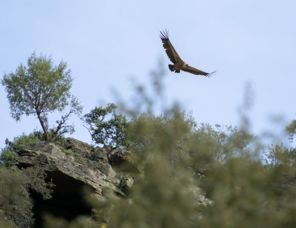
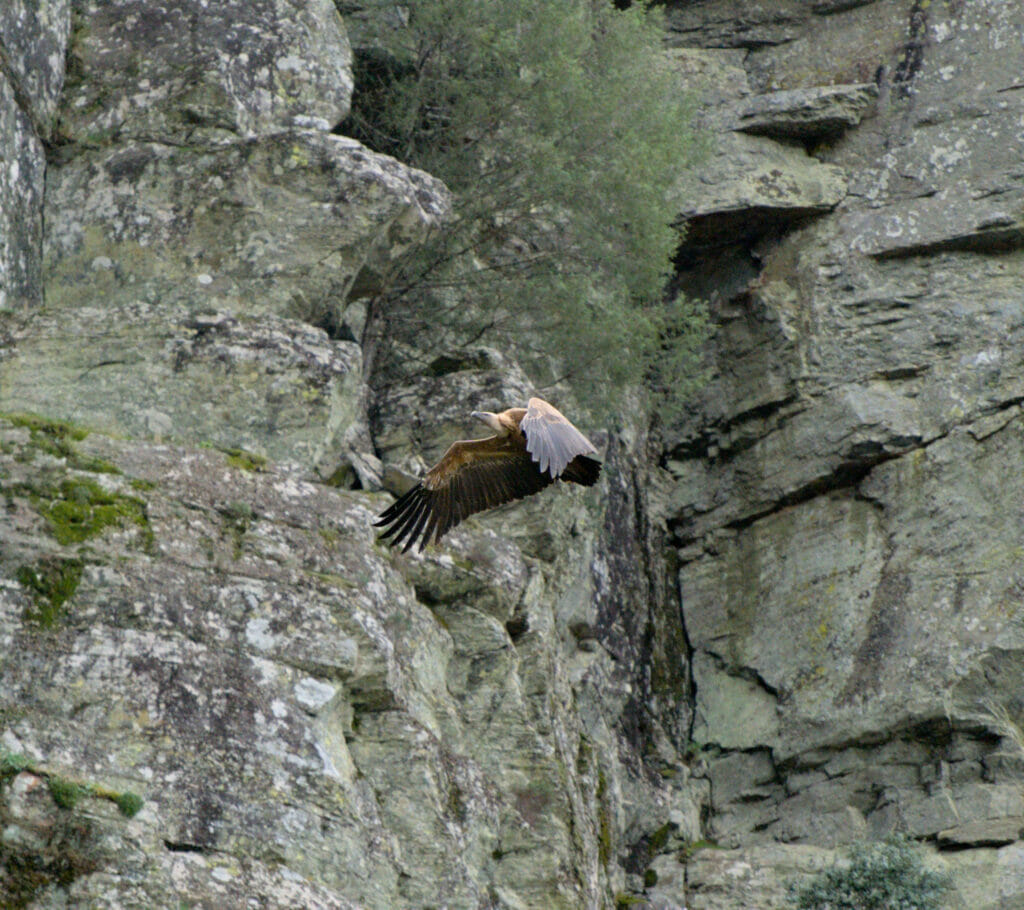
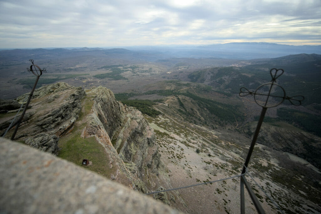
At kilometer 5 of the hike, we cross the river and from there the slope becomes a little steeper until the waterfall. This place is absolutely crazy! We are in a kind of wide canyon and above our heads we had permanently tens of vultures which turned around us or which were looking at us from the rocks!
Once there, it is possible to reach the foot of the waterfall by following a small path on the left. But if you have the courage to climb a little more, it may be worthwhile to go up on the right to have a view “from the front” on the waterfall.
For the return we follow exactly the same way as for the outward journey.
In the end, we will have needed something like 4-5h to make the round trip (counting that we got a little lost at the outward journey and that we made a longer break at the waterfall)
More pictures of this beautiful hike:
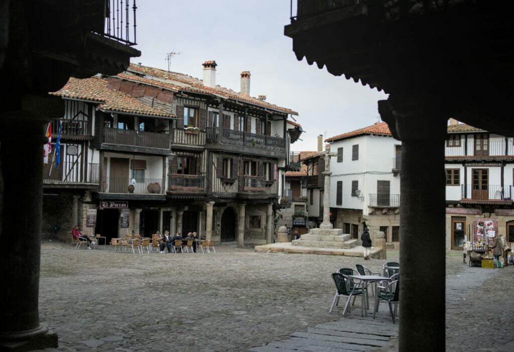
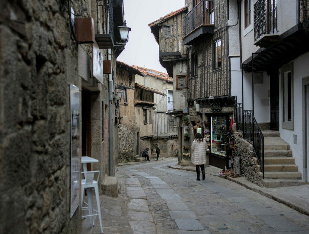
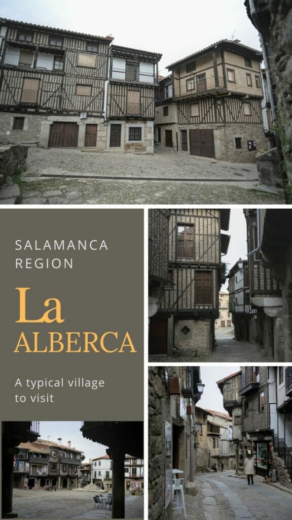
The village of La Alberca – province of Salamanca
Located at 1 hour drive from Salamanca, the village of La Alberca is often cited as a must-see in the region! In fact, this village is part of the association of the most beautiful villages of Spain, an association created in 2013 on the same model as that of the most beautiful villages of France. The goal of the association is to highlight the attractions of some particularly charming villages in rural areas (little industrialization and low population) in order to develop tourism.
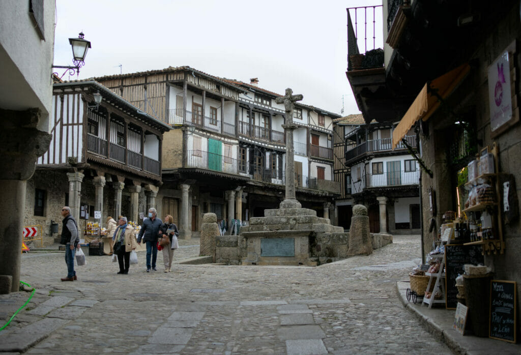
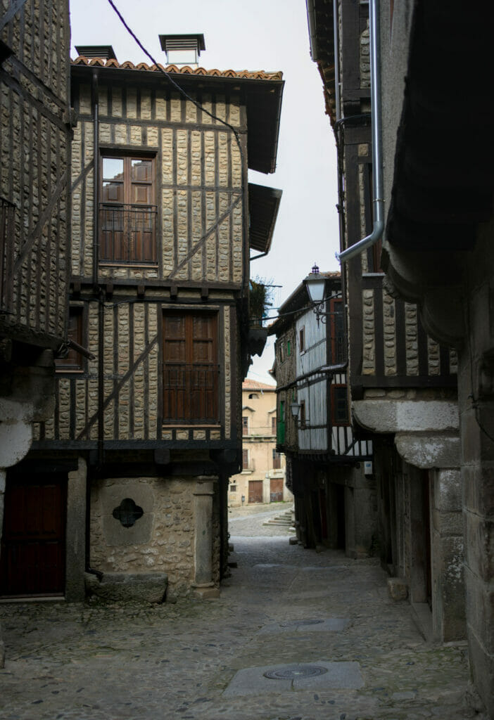
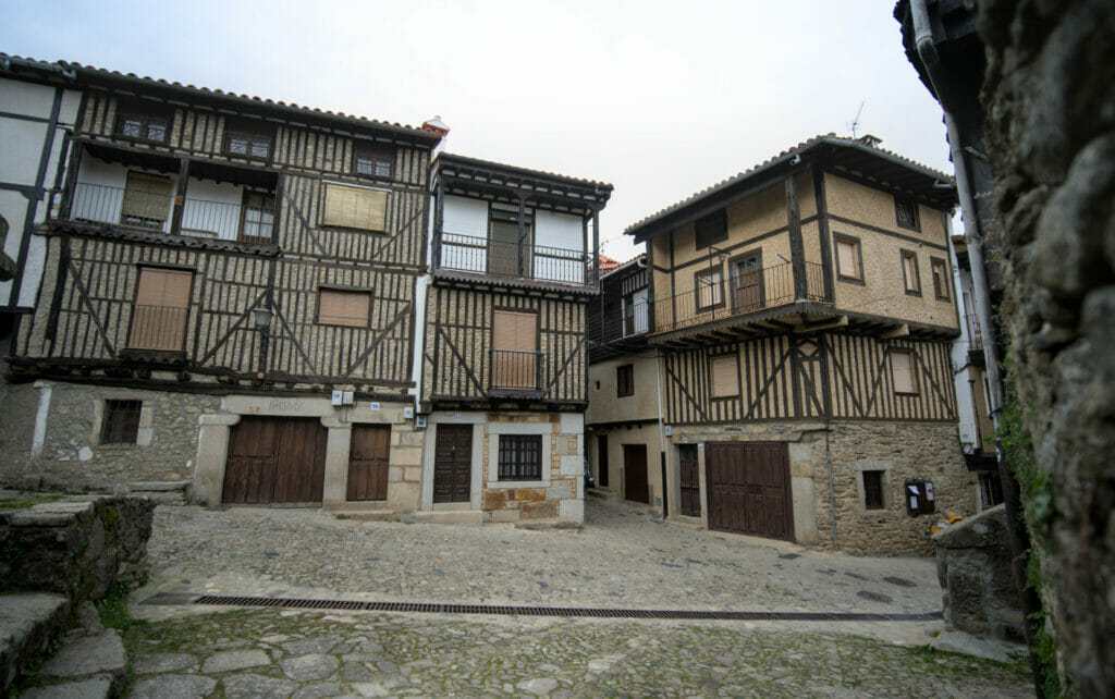
For the visit of the Alberca we don’t really have any advice in particular to give you except to walk in the old center and especially not to hesitate to take the small streets parallel to the main ones. We spent a good 2 hours in the center and I think we took all the alleys at least once. Honestly, there is nothing to complain about, the village is really beautiful!
Unfortunately, we were off season and the vast majority of the restaurants we found were closed for the annual vacation… The village is relatively touristy which means that, compared to the size of the place, there are a fair number of restaurants and stores (and small hotels too).
Afterwards, we will admit that the region is not ideal if you prefer to eat veg… Their specialty is clearly meat and especially game meat. In short, in normal time there would have been pizzerias or tapas bar but in the middle of February we were rather on a choice that looked like “wild boar vs deer” and we thus decided to head back “home” to cook something in the van after having taken a small aperitif on a terrace.
Oh, by the way, hats off to the municipality which has put at the disposal of vans and camping cars an area 2 steps from the city center. It’s not particularly glamorous (a big parking lot) but the services are free and we are close to shops and restaurants (and above all we have the right to spend the night there… important point knowing that we are in a natural park!)
If you are not traveling by van and are looking for a hotel then the Alberca is an excellent place to stay. From there, it is easy to get to the different sites presented in this article. To find a hotel the best is to look directly on Booking.
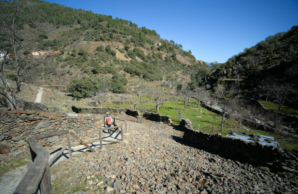
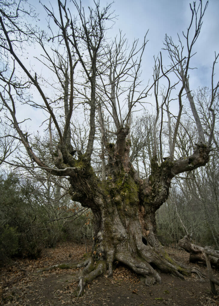
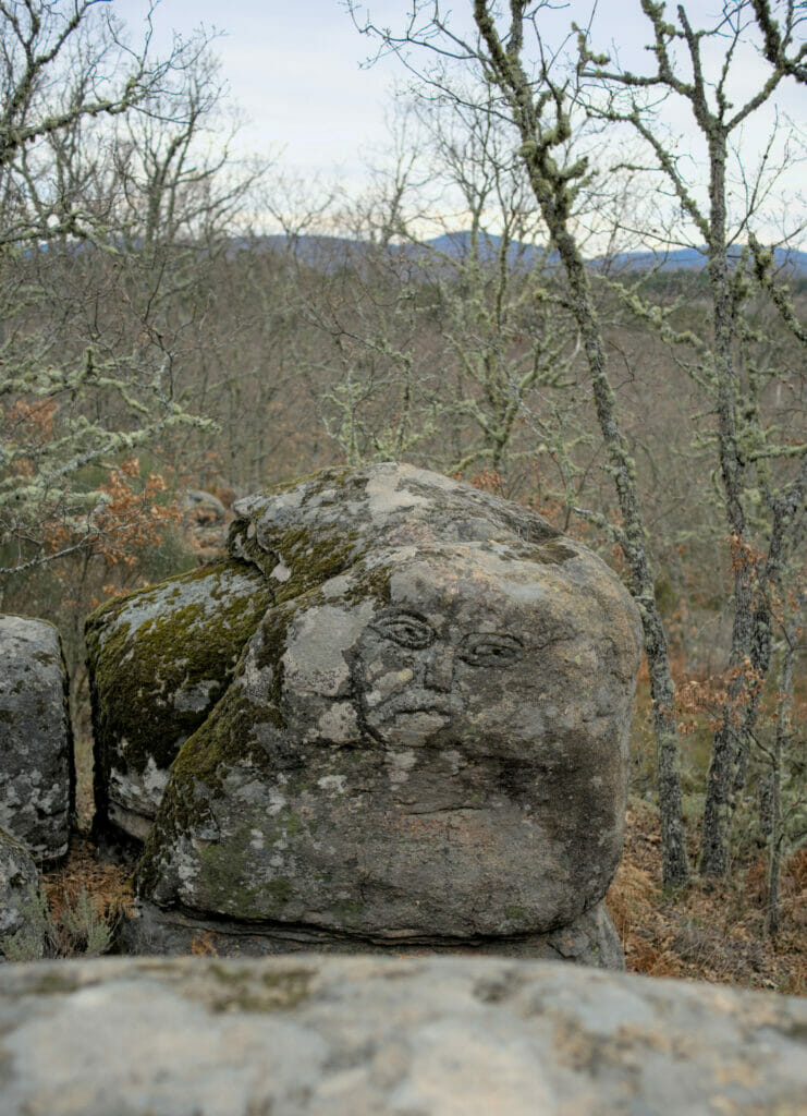
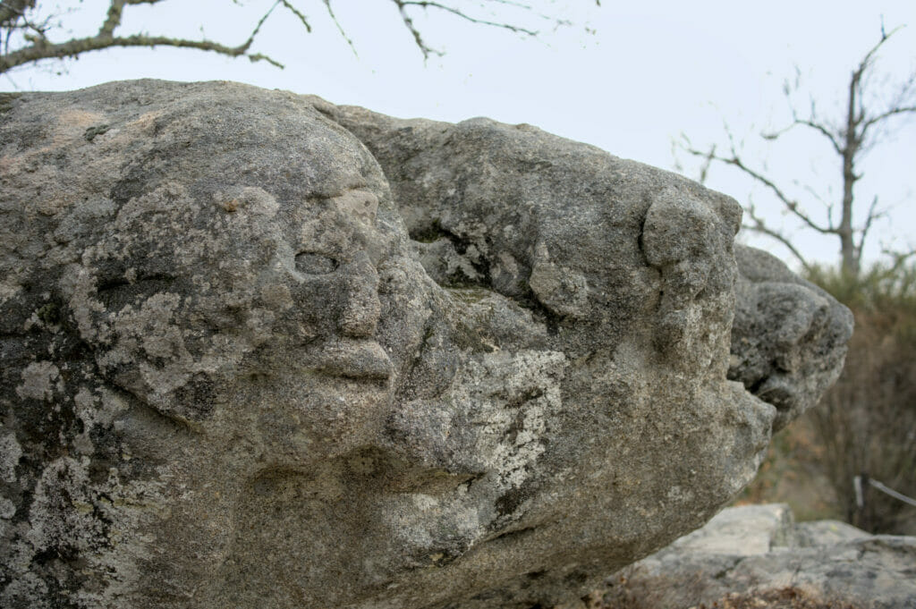
The path of the hundred-year-old chestnut trees, La Alberca
In search of a walk for the dog, we came across this little 2 km marked itinerary. So I warn you, we won’t talk about hiking here, but about a small digestive and/or family walk through a magnificent chestnut forest.
Note : this trail has the particularity of being adapted for people with reduced mobility (and therefore also accessible to strollers).
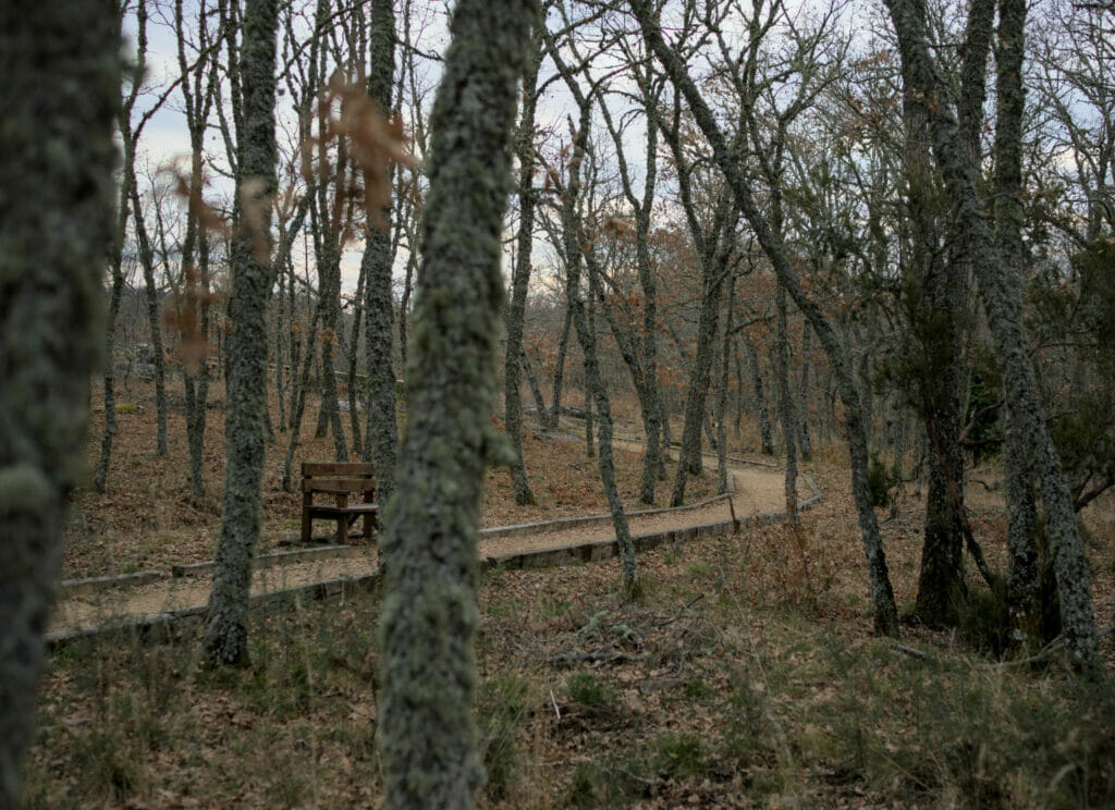
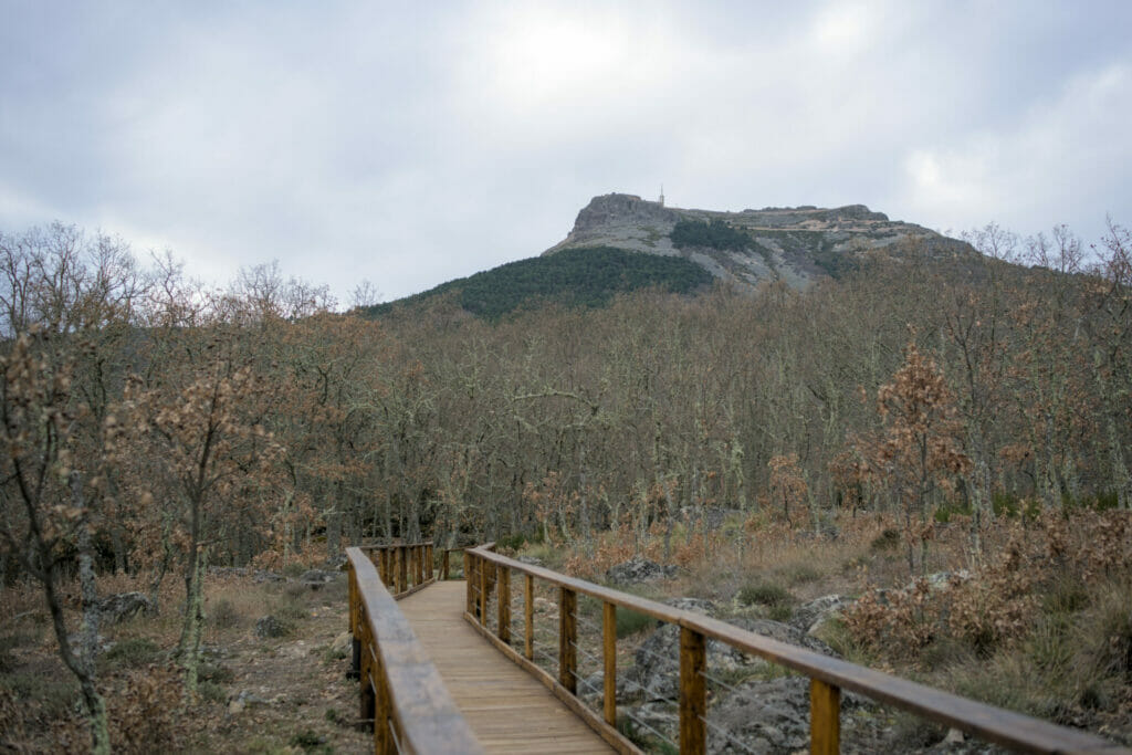
The departure is from a recreational area on the main road (at the level of the campsite) and we start by joining some footbridges. In the middle of the footbridges we reach a nice viewpoint from which we have a clear view of the Peña de Francia (the mountain with its sanctuary at the top that we will talk about below).
After the footbridges we arrive in the chestnut tree area. There are trees of all sizes and ages! But some of them, which are more than 500 years old, are really impressive!
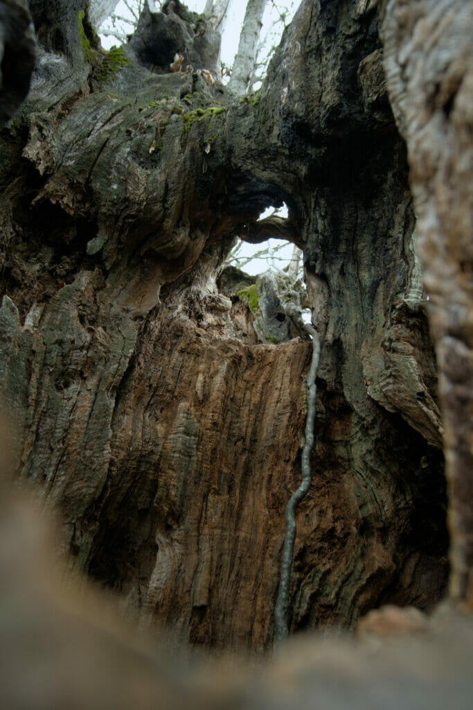
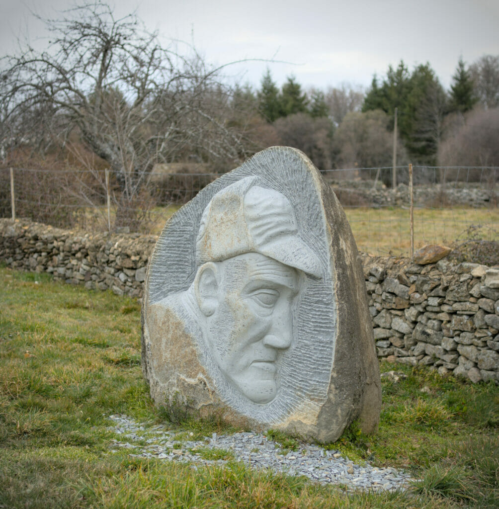
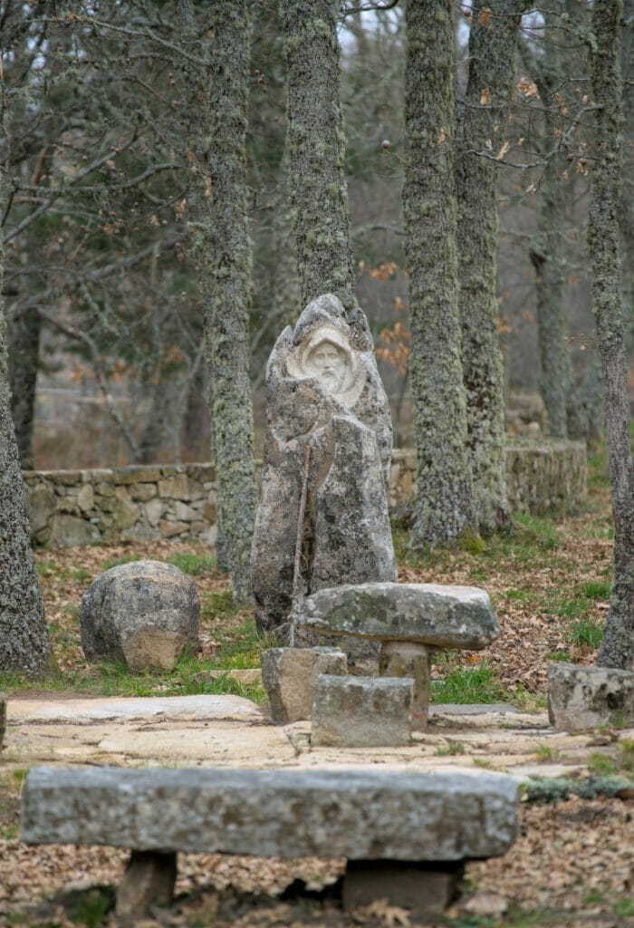
In addition to the trees, the walk also passes by many rocks, some of which have been sculpted with the shapes of faces. These sculptures were made by a certain Manuel Tomé and clearly give a very special atmosphere to this magical forest!
- The walk is really easy! 2km and strictly no difficulty
- Count 30 to 45 minutes to make the loop at an easy pace
- Parking spaces are available in front of the campsite
If you are in Salamanca or Madrid and are looking for an idea for an excursion then the Sierra de Francia and the village of La Alberca can be a great option! If you want to rent a car, as usual we recommend you to compare the different rental companies via the website Rentalcars.
Note on rental prices: as is often the case, the more offers there are, the cheaper the prices. From Madrid you can rent vehicles from 10€ per day (from Salamanca it will be inevitably more expensive). So don’t hesitate to compare prices according to your itinerary.
The panoramic view from the sanctuary of Peña Francia
To finish our stay in the region of La Alberca, we opted for a last detour to the Peña de Francia, a 1727m high mountain on the top of which there is a sanctuary. However, I warn you, we cheated a little… The tradition wants the pilgrims to go up there on foot but after all our hikes we opted for the easy solution: to take the road with Dahu 😉
For the more motivated, there are several paths that reach the summit, including one that leaves the path of the hundred-year-old chestnut trees (markings clearly visible from the small loop we described above).
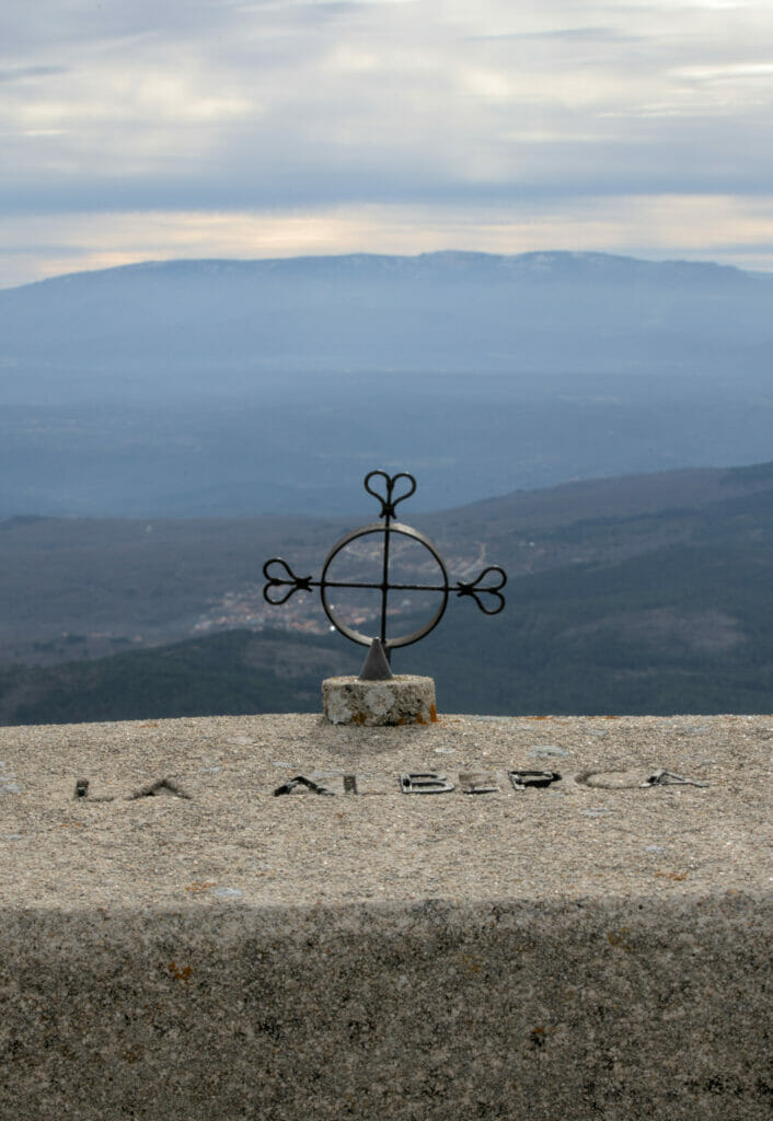
At the top of the mountain is the sanctuary (which seemed closed when we visited) as well as a small café and a store (also closed early in the morning). But don’t worry, even if you come outside the “official hours”, the view will be there! 🙂 And on this level, nothing to worry about: it is really spectacular! The Peña de Francia is quite isolated and we really have a 360° panorama on the surroundings.
Oh and with a bit of luck you might even see some ibex! We stayed a good half hour watching them below the antenna.
That’s it for today! We hope you enjoyed this little dive into a lesser-known area of Spain, but one that is clearly worth a visit. Had you already heard about it?
Pin it
Note : This article contains affiliate links. By using our links you don’t pay anything extra, but we do get a small commission. This helps us to continue to provide you with independent, ad-free articles. These sites are the ones we also use when we make reservations.

Join the discussion