
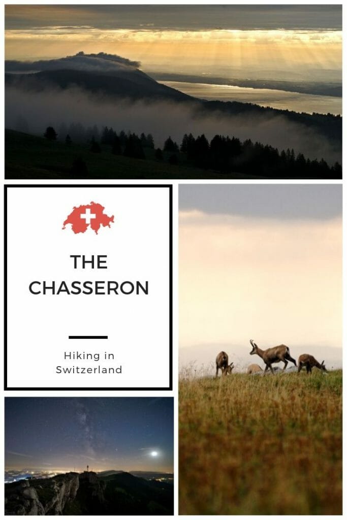
In our last article we left you in the area of Vallorbe and its beautiful caves. Today, we will stay in the north of Vaud and focus on hiking, but this time we will leave for Sainte-Croix! For the rest of our stay in the region of Yverdon-les-Bains we decided to come and spend an evening at the top of Le Chasseron.
Our initial plan was to leave from Le Chasseron to make the long crossing along the ridges to reach the aiguilles de Baulmes and then Le Suchet, but unfortunately the weather gods decided otherwise. Unfortunately, we woke up in a thick fog and changed our plans to opt instead for a nice walk in the Covatannaz gorges. Do you want to know more about these two lovely hikes?
Update 2020
We came to the region in September 2019. In the spring of 2020 we passed through there again during our 3 weeks hike along the Jura crest trail. Rather than doing a second article we thought it would be more relevant to update this one. So, at the end of the article you will find more pictures and an alternative way to climb the Chasseron from Les Rochats or directly from the Creux du Van (which we did). Find the details of this alternative as well as the map of the hike at the end of the article.
Hiking to the Chasseron: our itinerary from Sainte-Croix
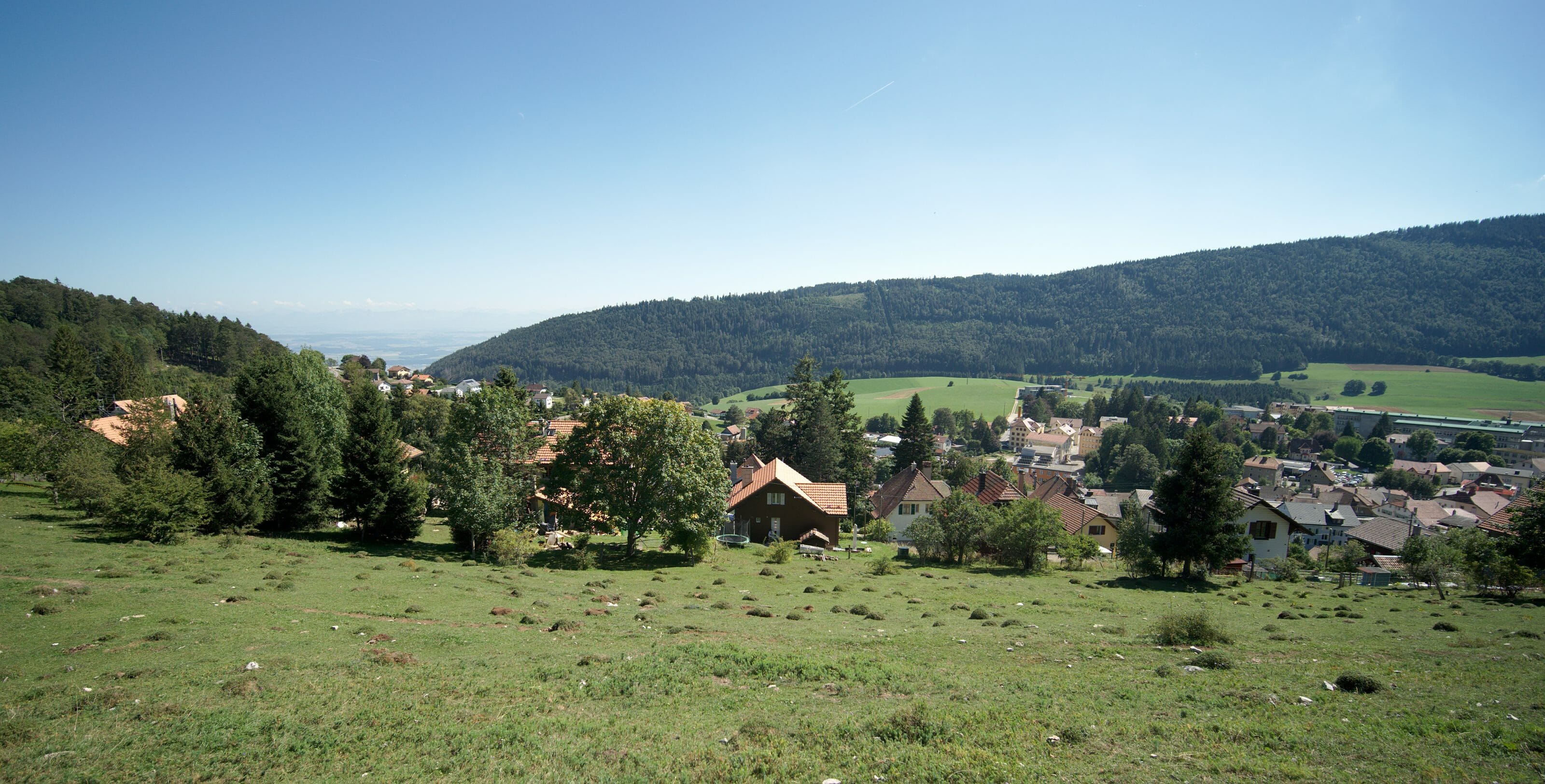
To start this hike we started by going to Sainte-Croix, a pretty commune of nearly 5000 inhabitants located a little on the heights. The small town is world famous for being the capital of the music box (who knew that????), but if we came here it wasn’t quite for that…;)
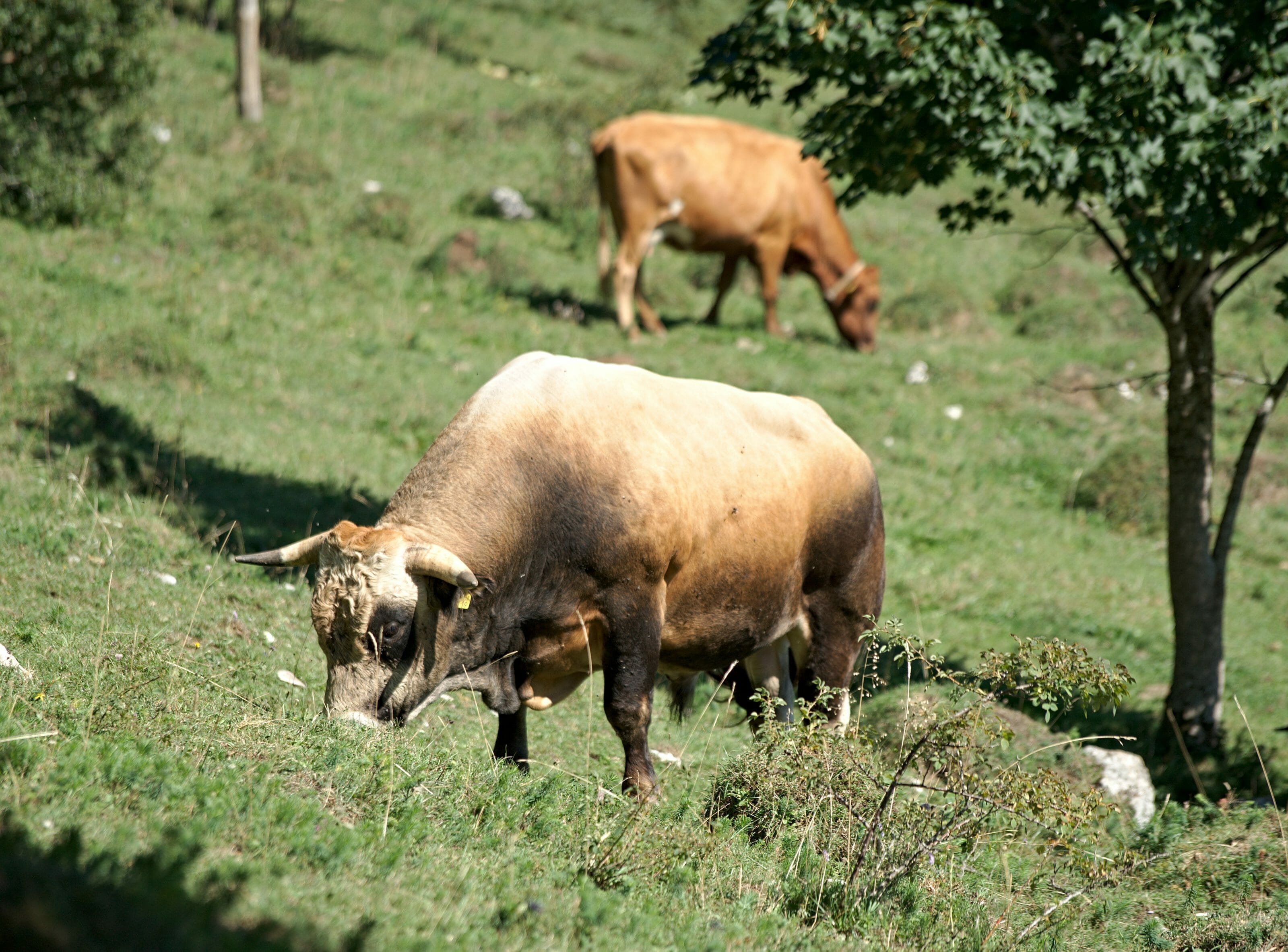
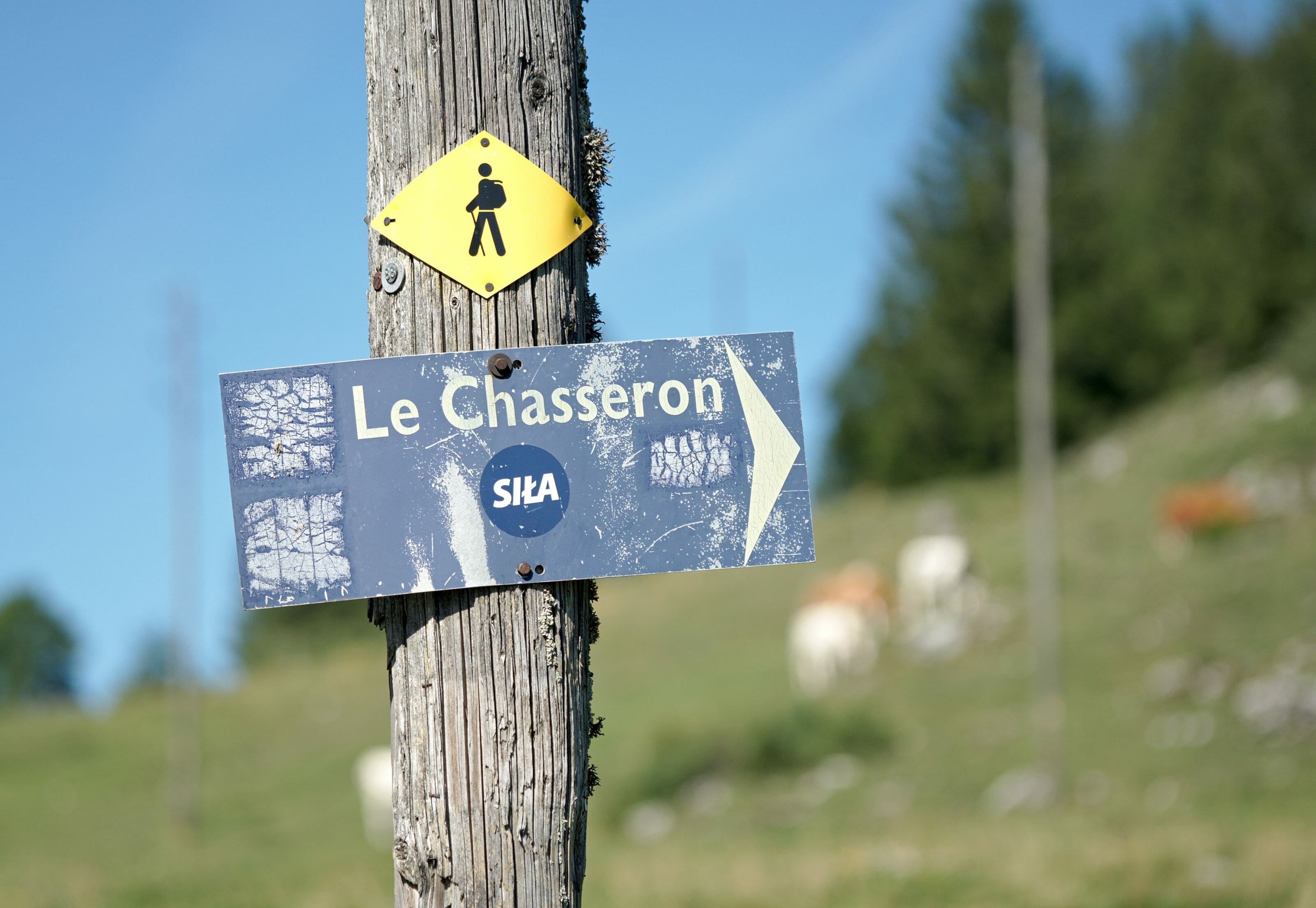
The Chasseron hike starts in the centre of the village (or at the station) and starts by going up towards the church. To the right of the church we follow the large asphalt road which quickly makes us rise up into the pastures. We will pass through the middle of a herd of cows watched over by an impressive bull! Fortunately, he seemed much busier grazing than hunting hikers… 🙂
After this first ascent we arrive on a track. Officially (or at least according to our map), the route went straight on, then back after an almost 90° turn. But when we reached a pylon, we noticed a hiking sign pointing to the right. On Maps.me a path was well indicated even if “in real” it was difficult to distinguish a path across fields…. Well… We didn’t dither too long and followed the sign.
Note 1: this route is more “direct” in the sense that it allows you to cut the “detour”.
Note 2: It’s very steep! On the way up it is fine, but on the way down we preferred to stay on the track… Frankly, it doesn’t change much in terms of time!
We then return to the track that we follow for a short kilometre before taking the path that goes up towards Les Avattes. This first section of the hike is cute and rural, but it is only at Les Avattes that the show really begins!
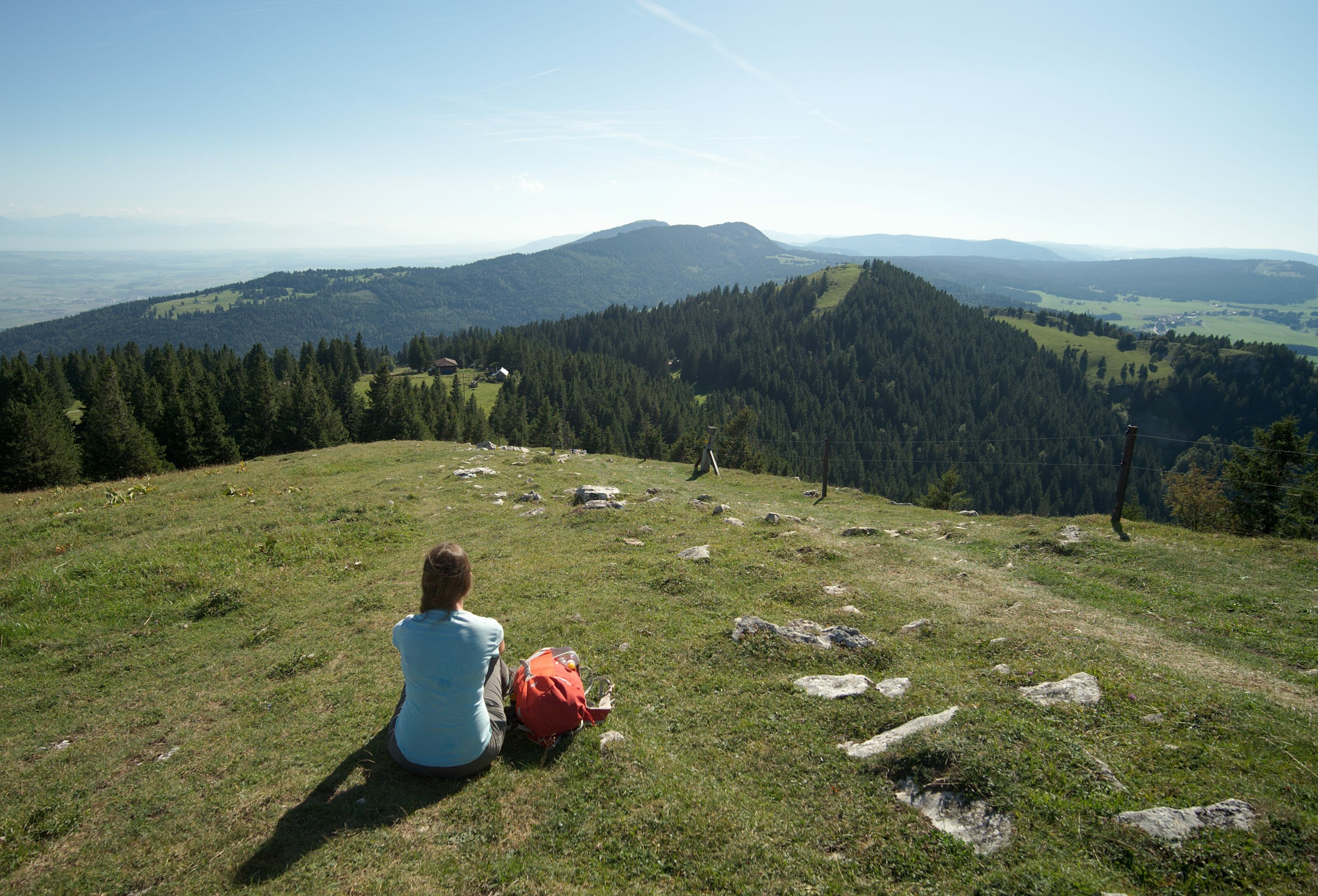
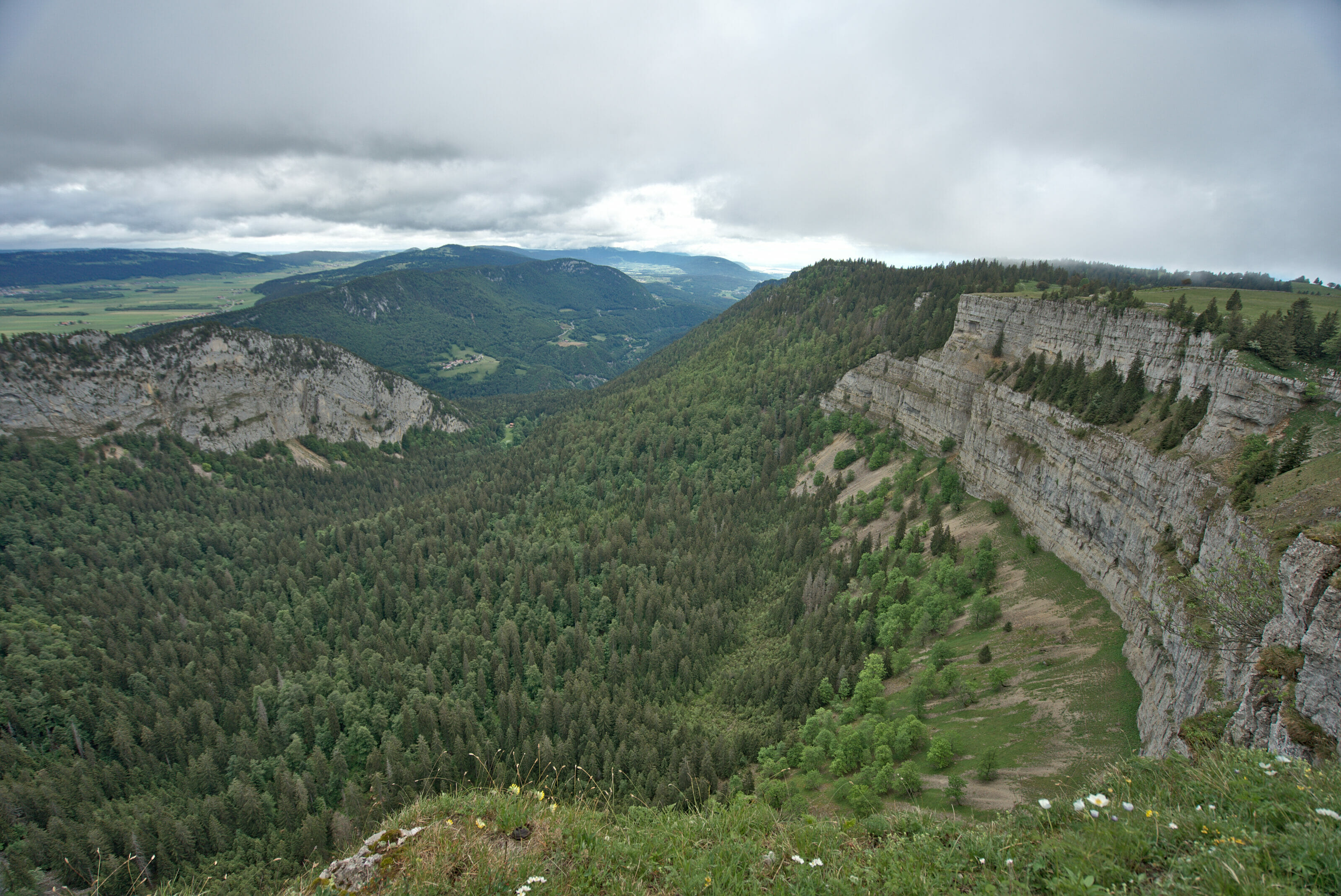
From the small restaurant we start to climb the ridge and as we climb, we see the view around getting better and better. The next 3 kilometers, passing through the “Petites Roches”, are simply incredible! To do these 3 kilometers it would take 30-45 minutes in absolute terms, but we easily doubled it as we took so many photo breaks. 🙂
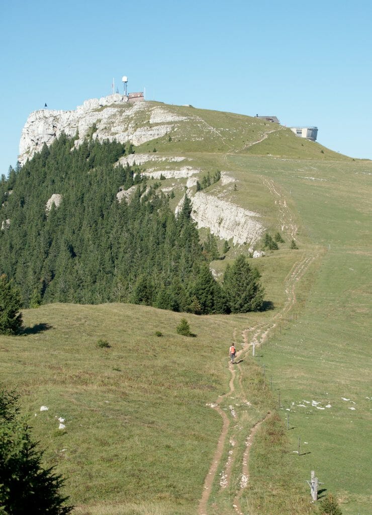
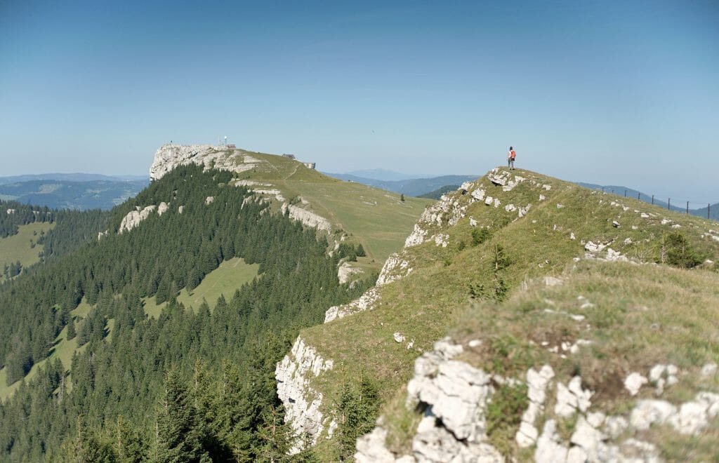
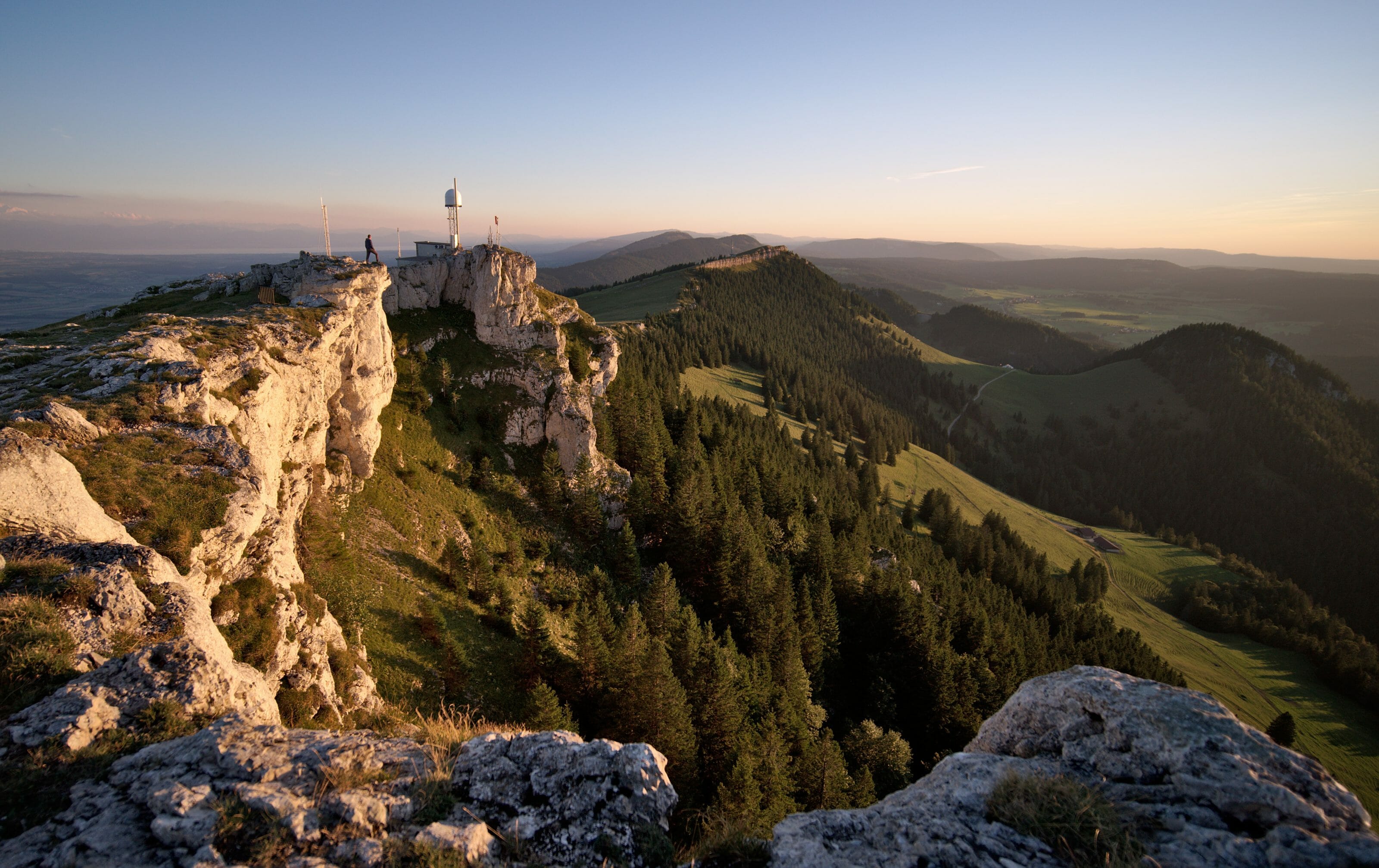
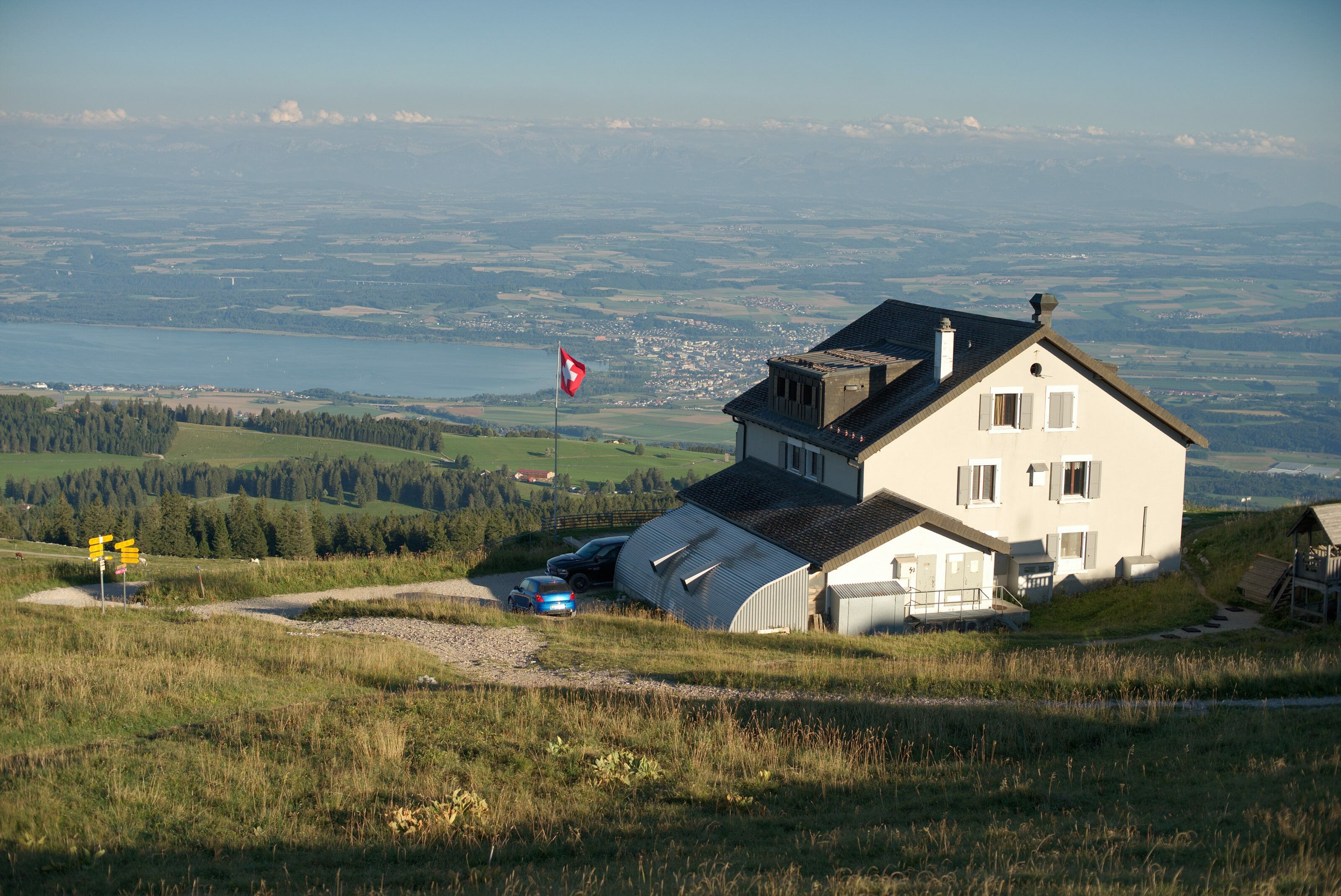
At the end of the ridge we reach the summit of Le Chasseron and its hotel.
Evening at the Hôtel du Chasseron
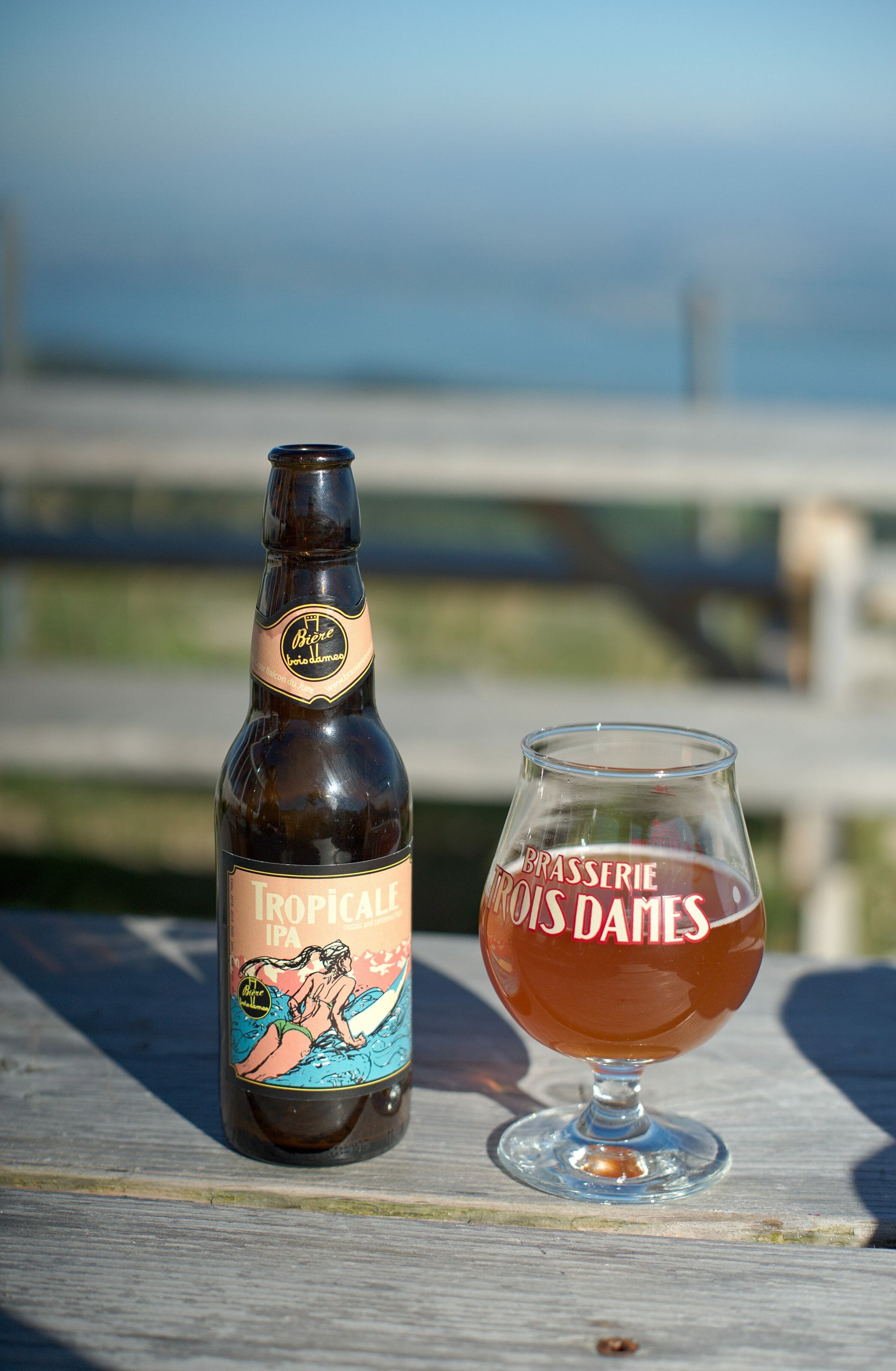
Once we arrived at the hotel we started the evening with the most important thing: a good artesanal beer from the region! 🙂 (well what? we wrote the guide “Randos Bière in France” (Beer hiking France))
And let’s face it, in Sainte-Croix there is one of the best artisanal breweries in French-speaking Switzerland: Les 3 dames (translates to “the three ladies”! Founded in 2003 by Raphael Mettler, this brewery has established itself over the years as a reference. The name of the brewery? Raphael named it that way because it turns out he has 3 ladies at home (his wife and 2 daughters). 😉
By the way, fun fact, we had beers from this brewery at our wedding back in 2016! At that time we were still far from imagining that one day we would write a book on beer and hiking, but we already had a good preference for artesanal foams! 🙂
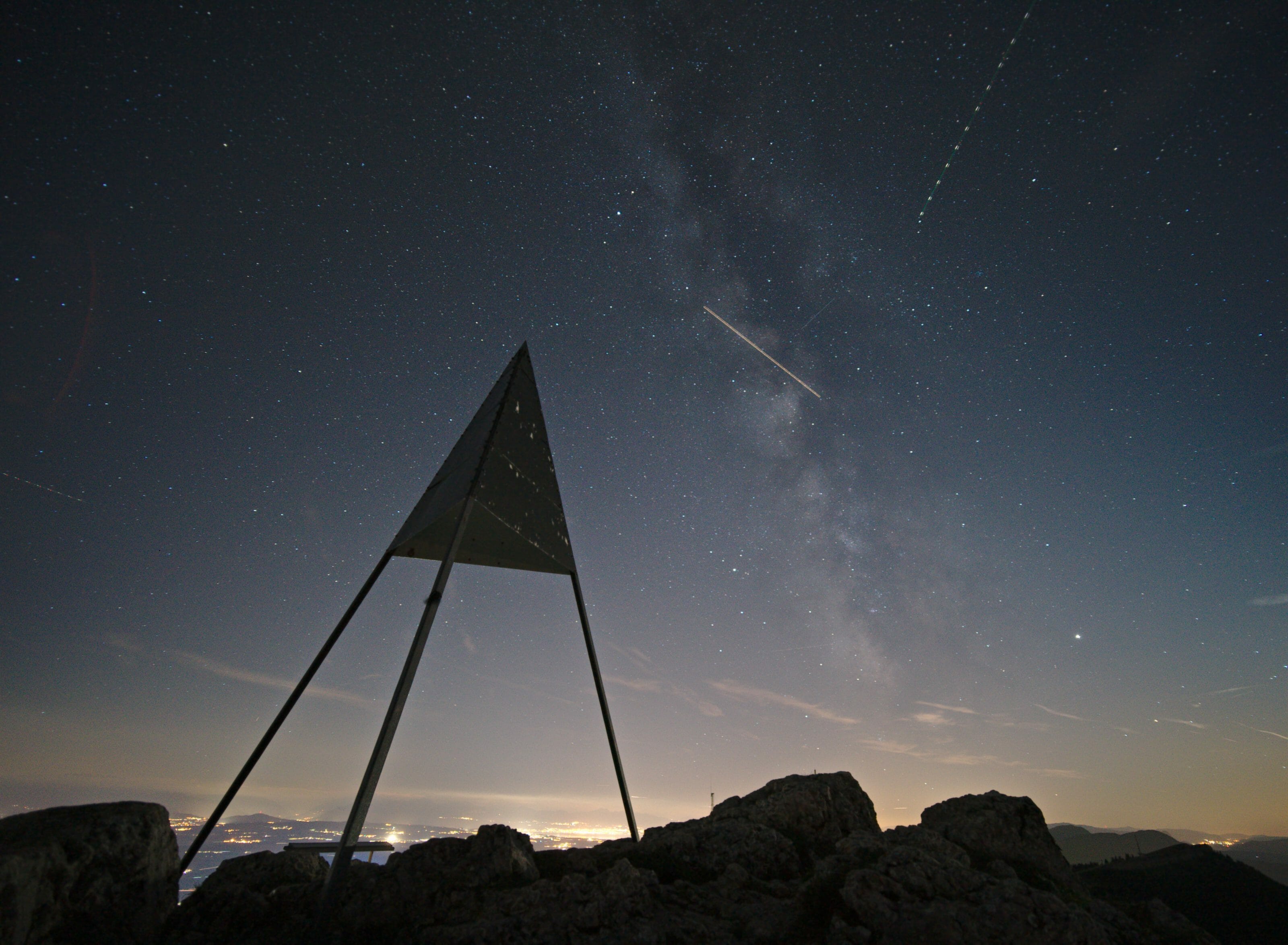
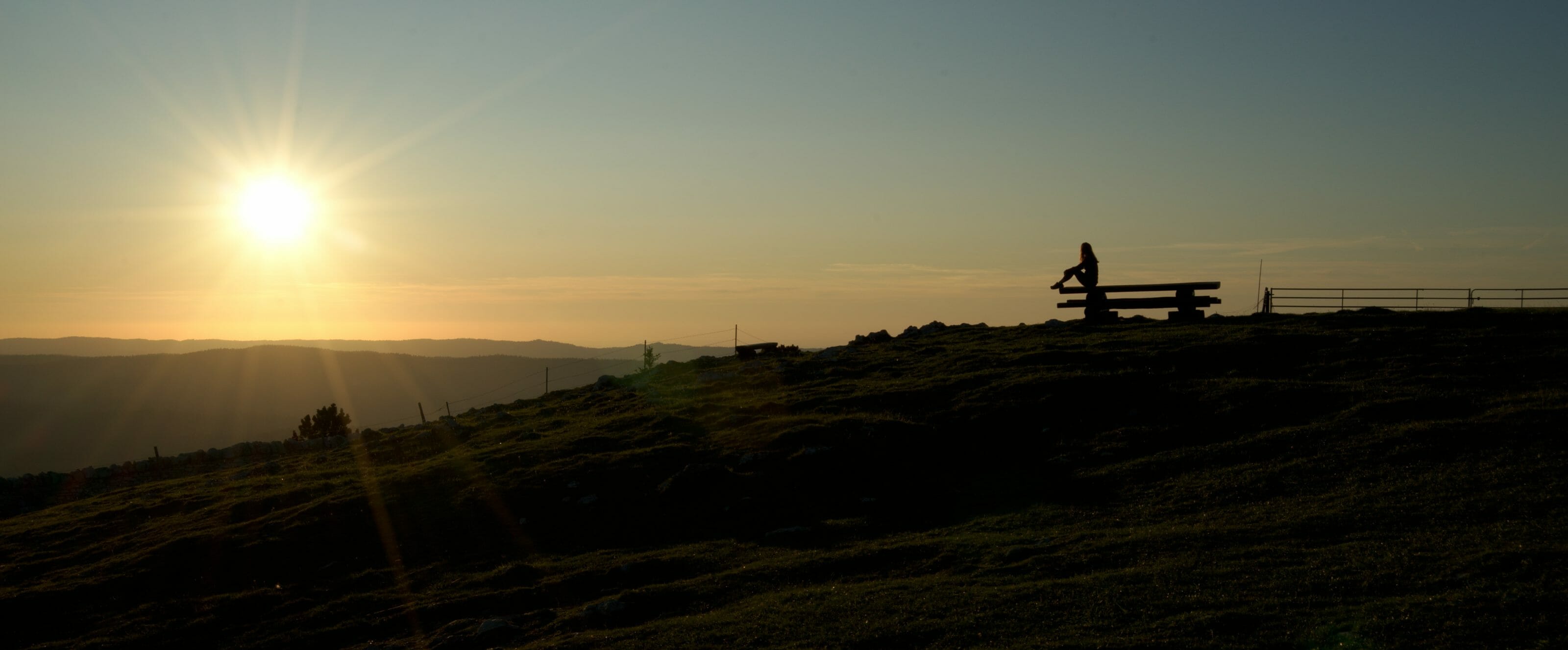
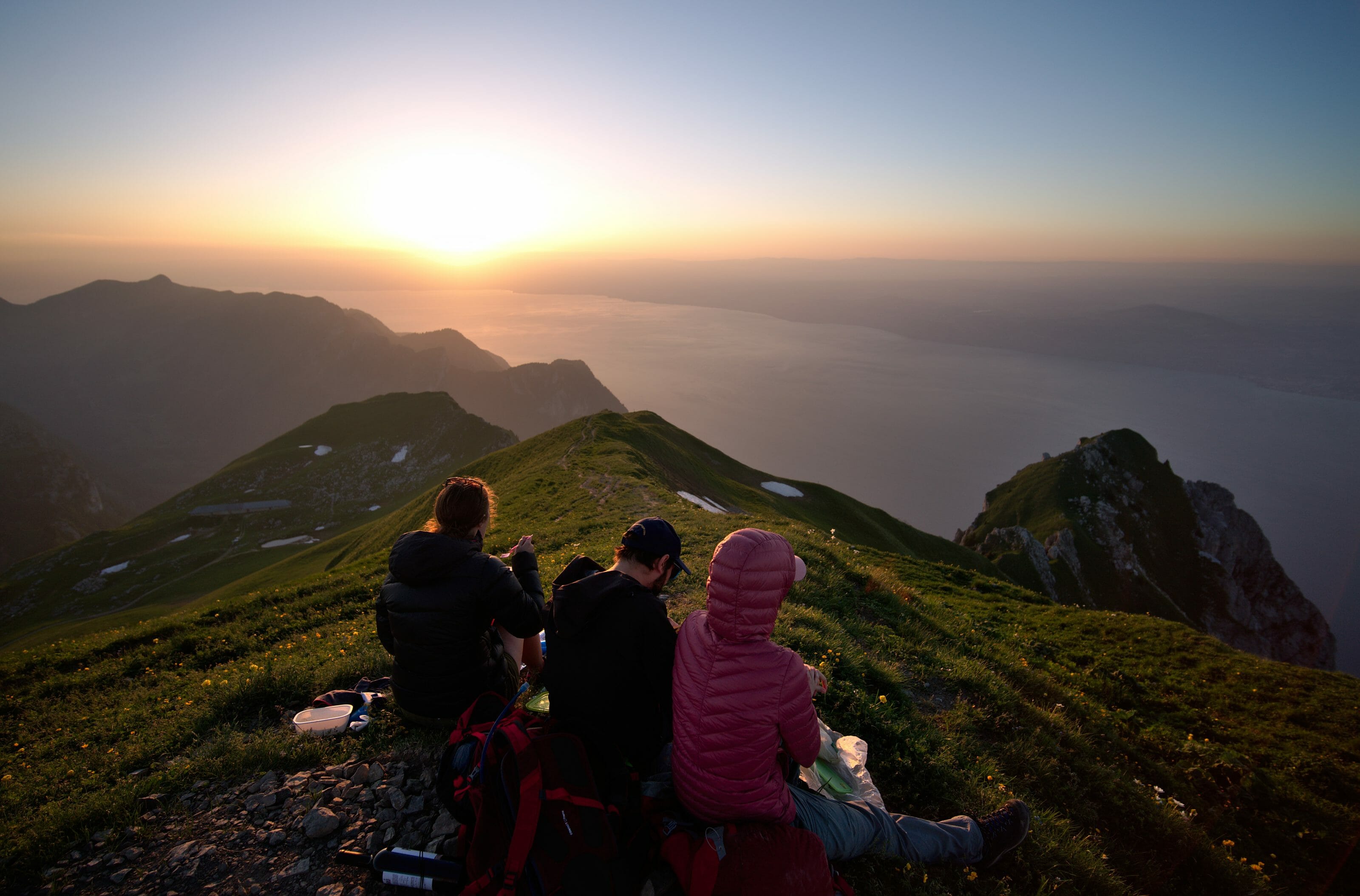
After the beer, we went up under the antenna to capture the beautiful lights at sunset. There’s not much to add: there’s nothing like climbing a little higher to get the most beautiful views at the end of the day!
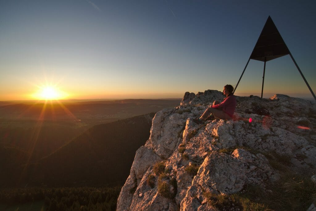
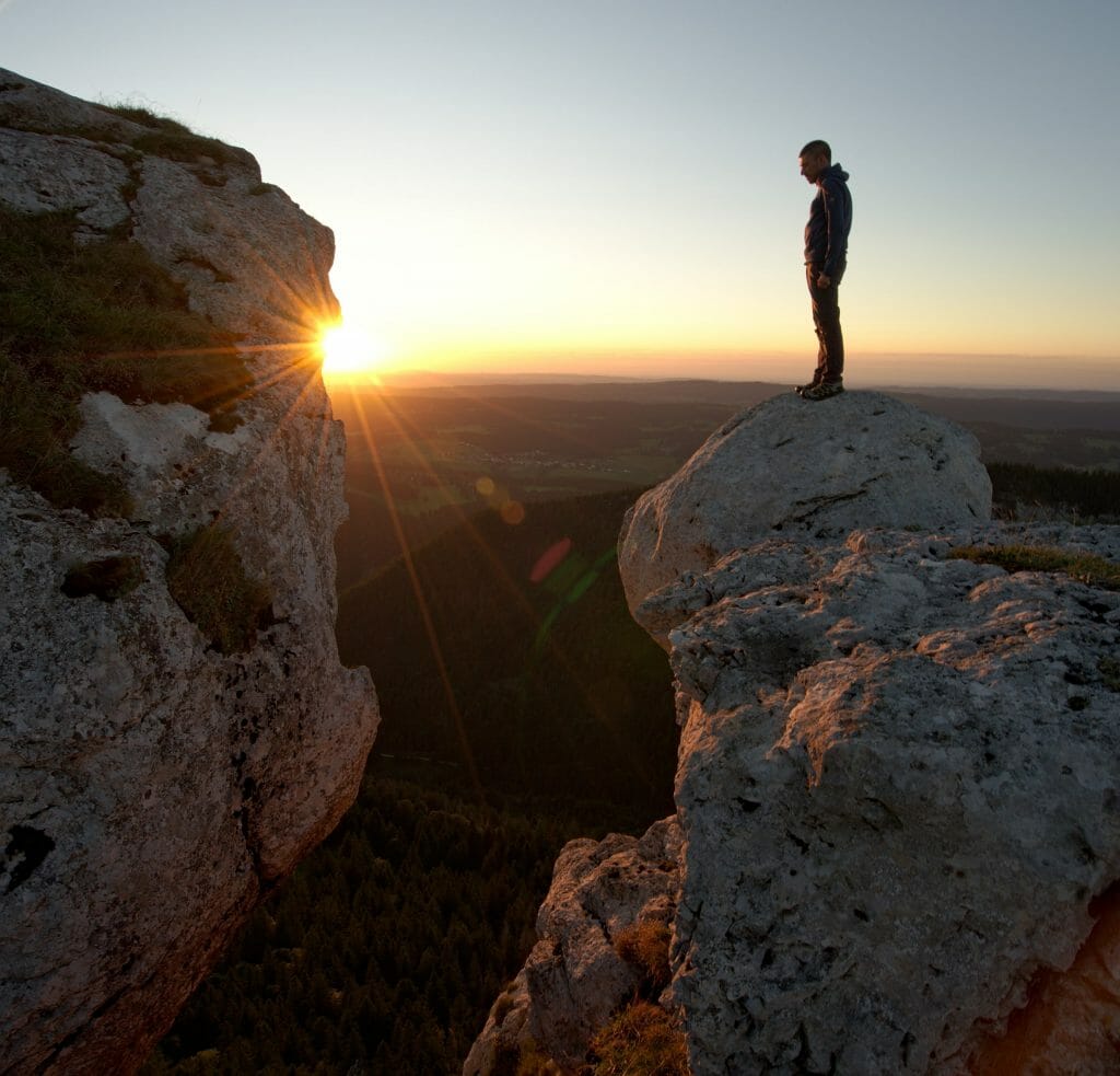
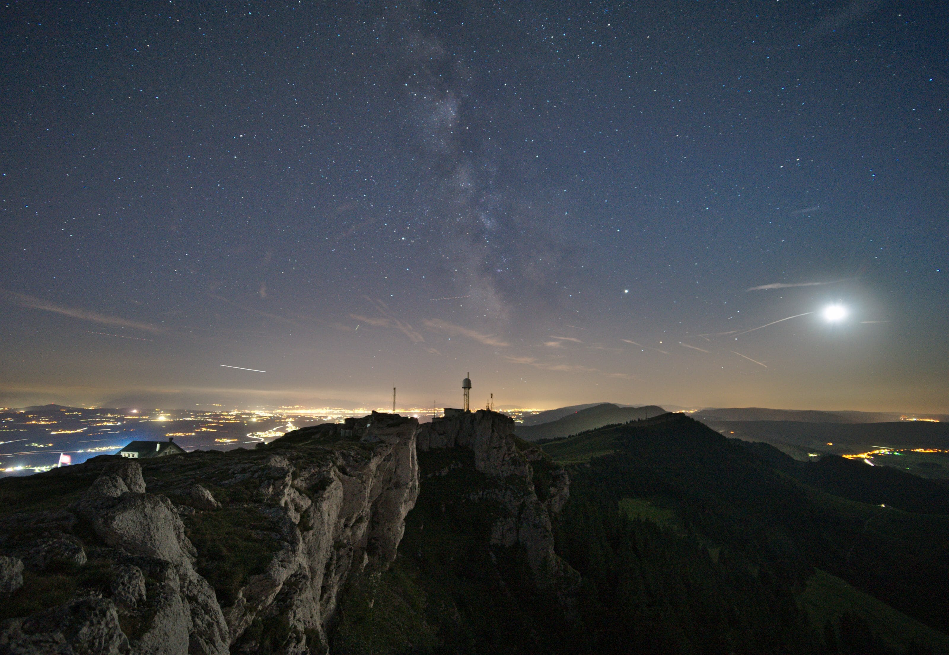
After an excellent dinner at the hotel and a last little trip to the summit to take some night pictures, we quickly fell asleep.
Info Chasseron
The Hôtel du Chasseron was one of our big favorites in the area! The food is delicious, the rooms are comfortable and the welcome is very warm! We really recommend that you spend the night there to enjoy the evening and sunrise over the region!
Price: from 45 CHF in dormitory (breakfast included). Double and family rooms are also available.
Infos and reservation: The Chasseron homepage
And if you happen to want to make sure the view is beautiful: See their webcam
Le Chasseron: hiking map, route and practical info
Infos
- Start (& Finish): Sainte-Croix, VD
- Distance: abotu 6km (one way)
- Elevation: about 600m + (and thus 600m – on the way back)
- Duration: Allow 2h-2h30 for the ascent, 1h30-2h for the descent
- Difficulty: Easy
The Chasseron hiking map and route
Note: You can download the map of the hike to have it with you on the smartphone via the AllTrails app. Creating an account is free and you will have access to over 30 download formats.
Note: If you do not want to go back and forth by the same path it is quite possible to make a loop. For the loop the separation is done at the Avattes level (see map) and rather than going through Petites Roches twice, you can do one of the routes by going through the Sollier. For our part, we liked the ridge so much that we took it twice.
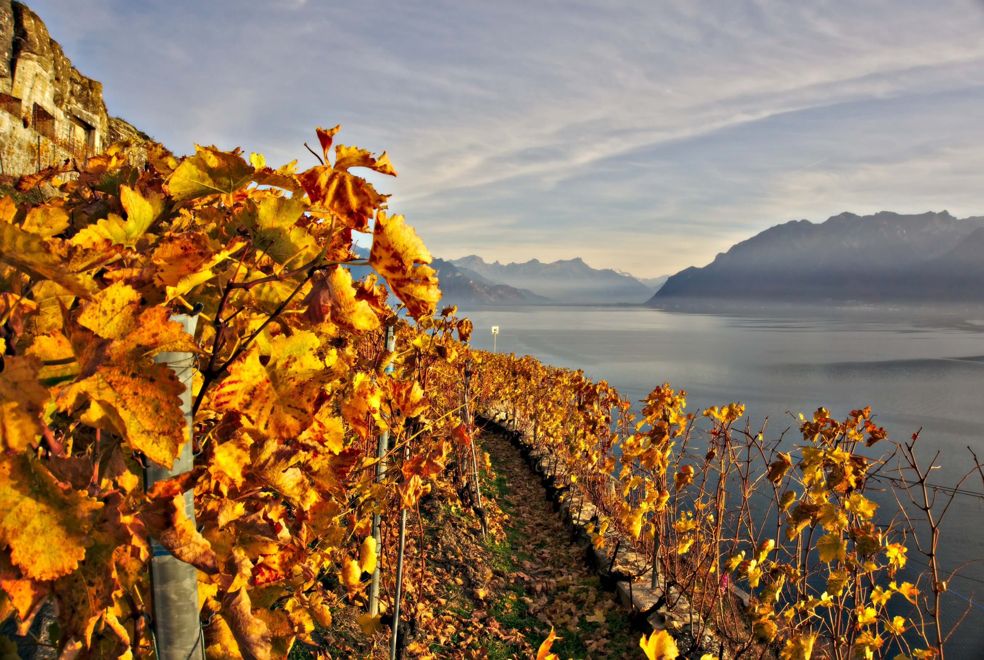
The north of Vaud and its mist 🙂
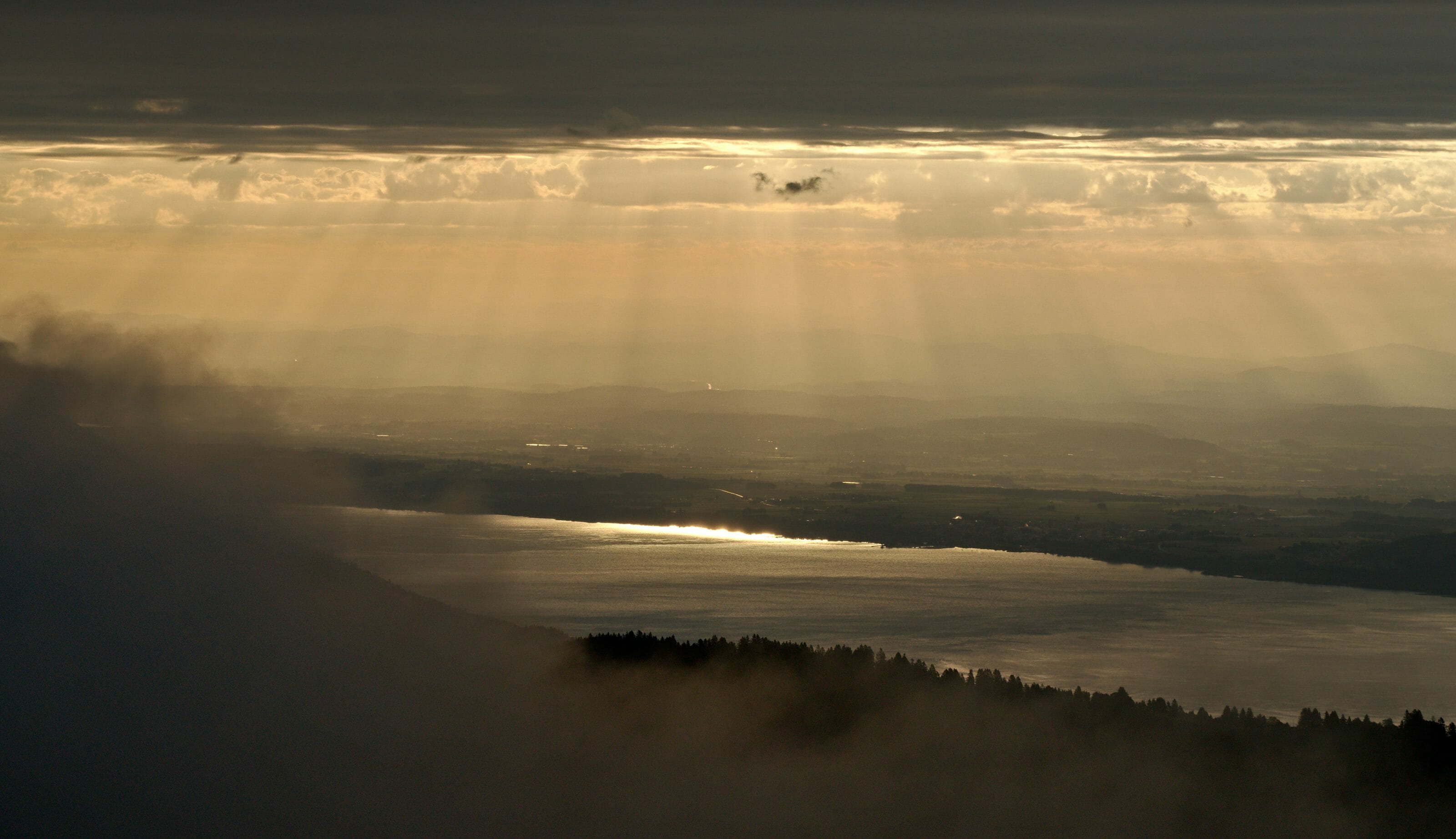
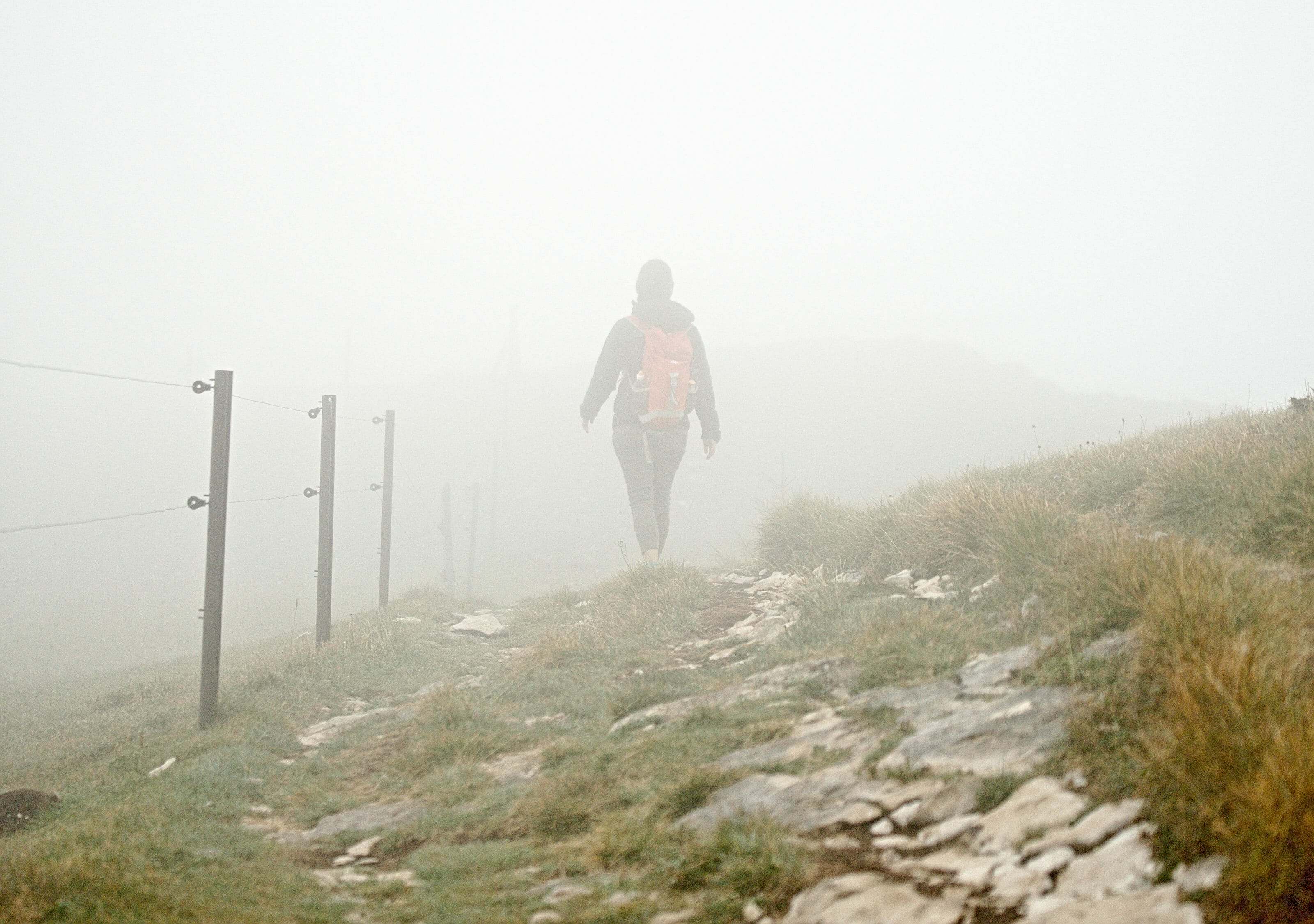
The evening before I was just saying, a little jokingly, that the north of Vaud was known for its mist and that we were lucky to have a dream weather without the slightest cloud. Well, I think I spoke a little too loudly and the weather gods heard me, because the next day we woke up feeling like we were swallowed by a cloud. 🙂
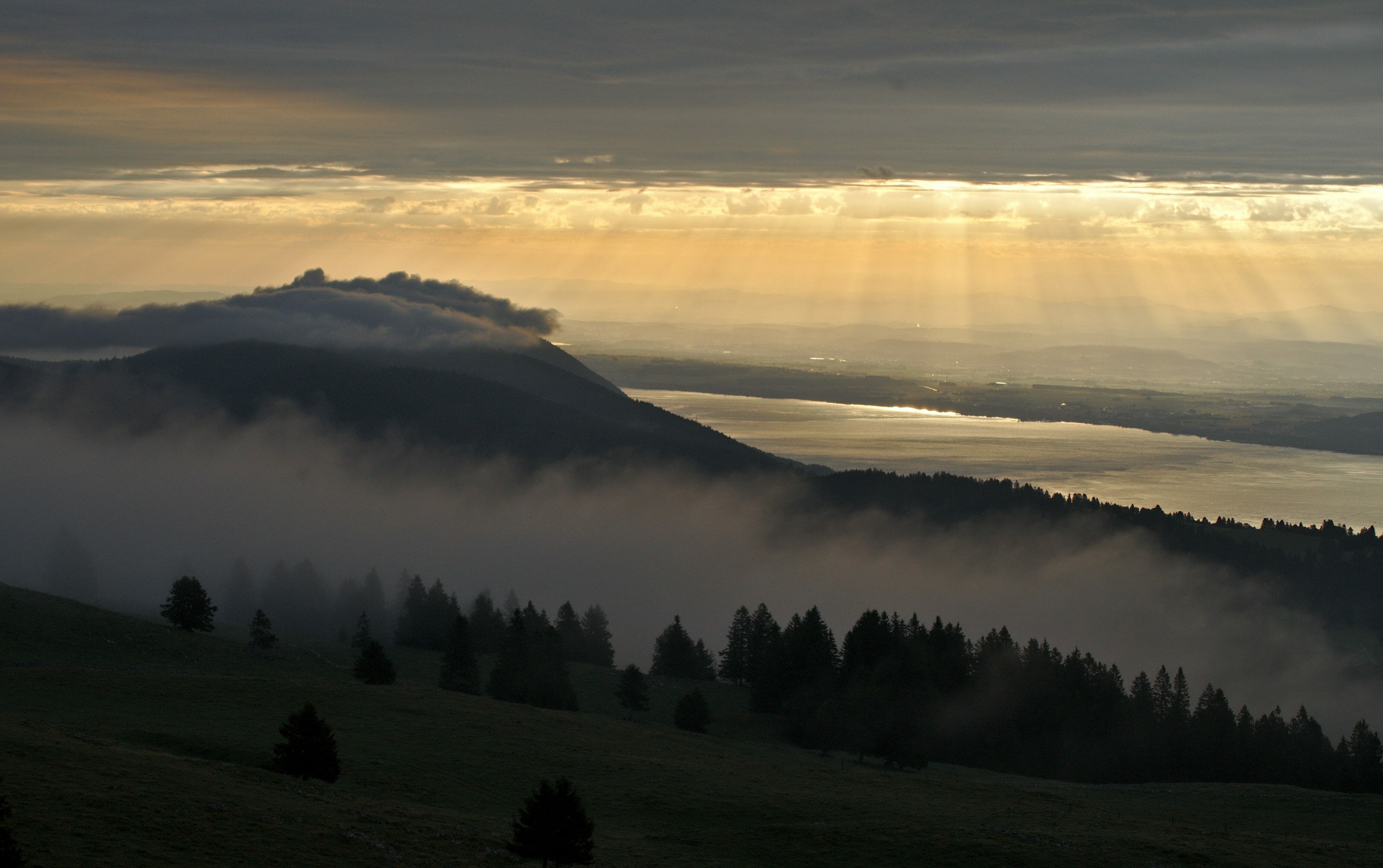
But let’s face it, a “busy” sky is not necessarily synonymous with a gloomy hike, oh no! Because when you say cloud, you also mean the possibility of sun breakthroughs! Just as we had finished our breakfast, we were surprised to see the fog dissipate a little and the first rays began to break through on Lake Neuchâtel. The atmosphere was quite magical!
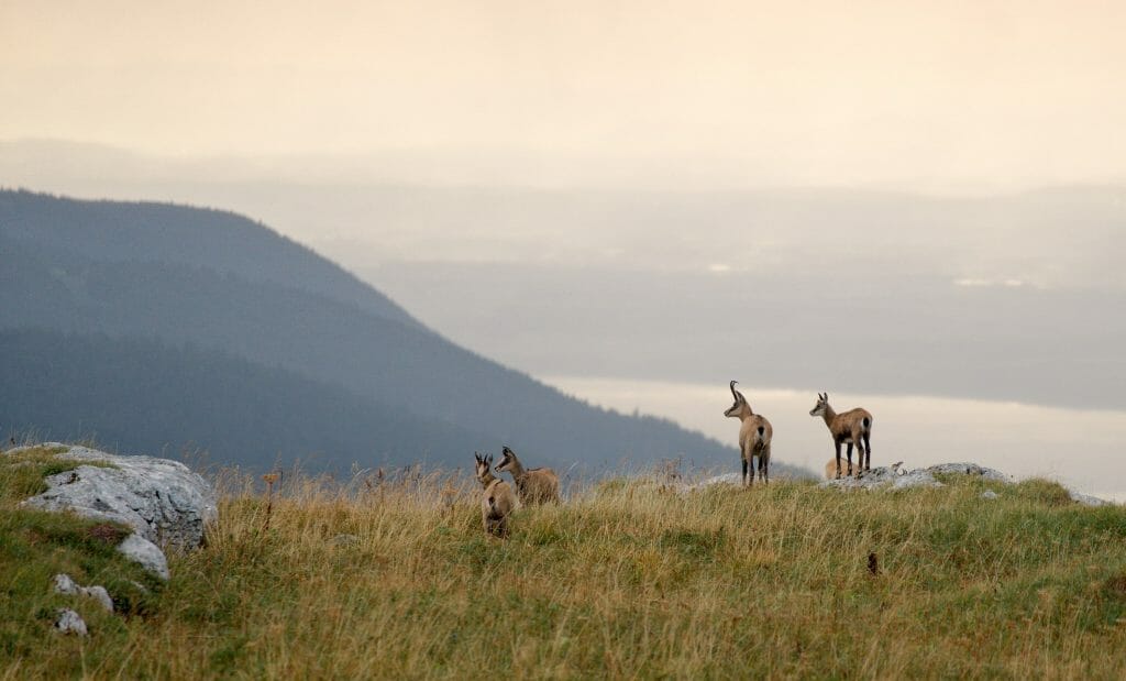
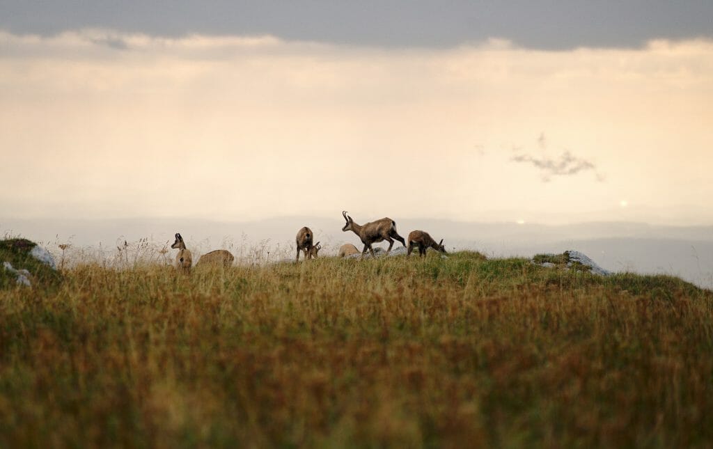
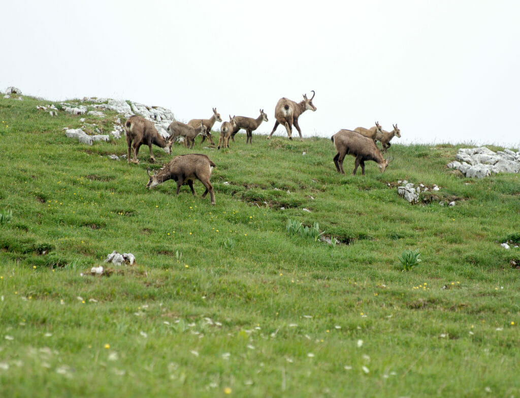
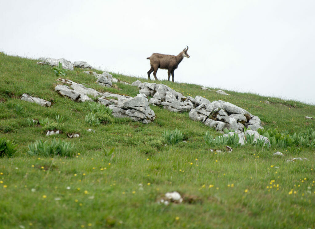
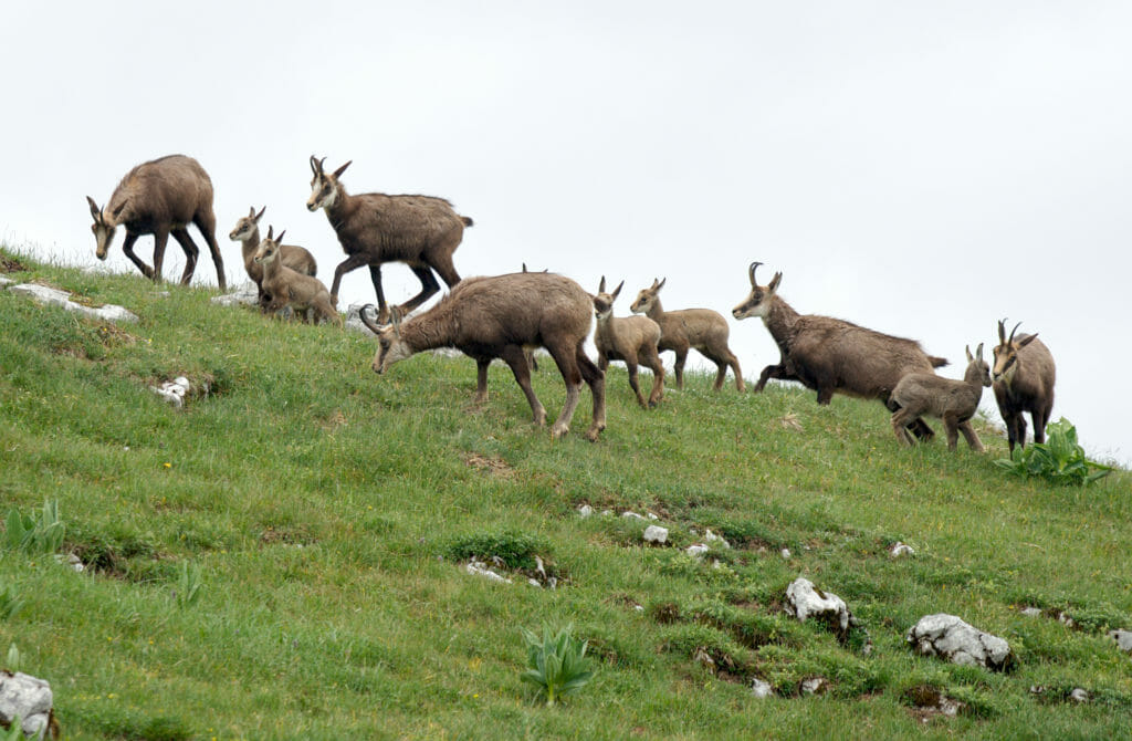
As a bonus? A small group of chamois was just next to the hotel…. Needless to say, we went out and took lots of picture of them. 🙂
Then we’re not going be kidding…. It quickly covered up and our descent took place with a view that could be described as quite “unclear”. 😉 We were very happy to have Maps.me with the GPS track because at times we couldn’t see much anymore and we had a tendency to lose the path…
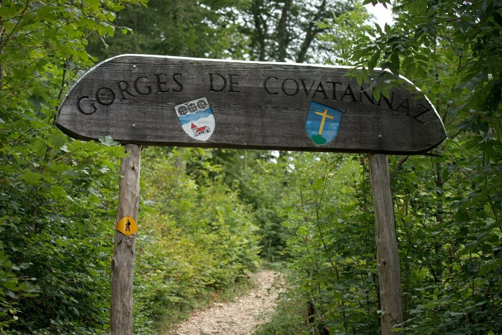
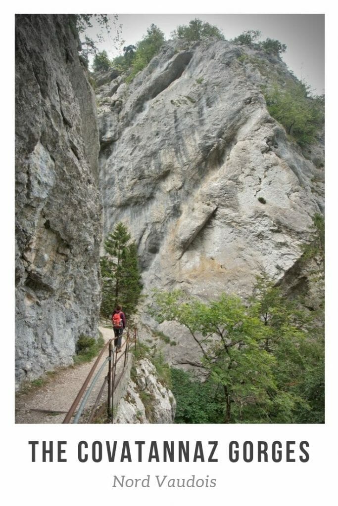
The gorges of Covatannaz
Description of the gorges
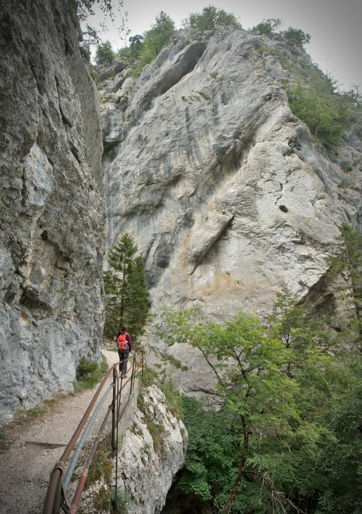
The peaks being totally in the fog we followed our instincts (and the good advice received live on Instagram). 😉 Once back in Sainte-Croix we walked towards the Covatannaz gorges. I’ll be honest with you, I had no idea these gorges existed… My friends who grew up in the north of Vaud all seem to have already come here on school trips, but apparently it wasn’t on the list of Lausanne school trips….
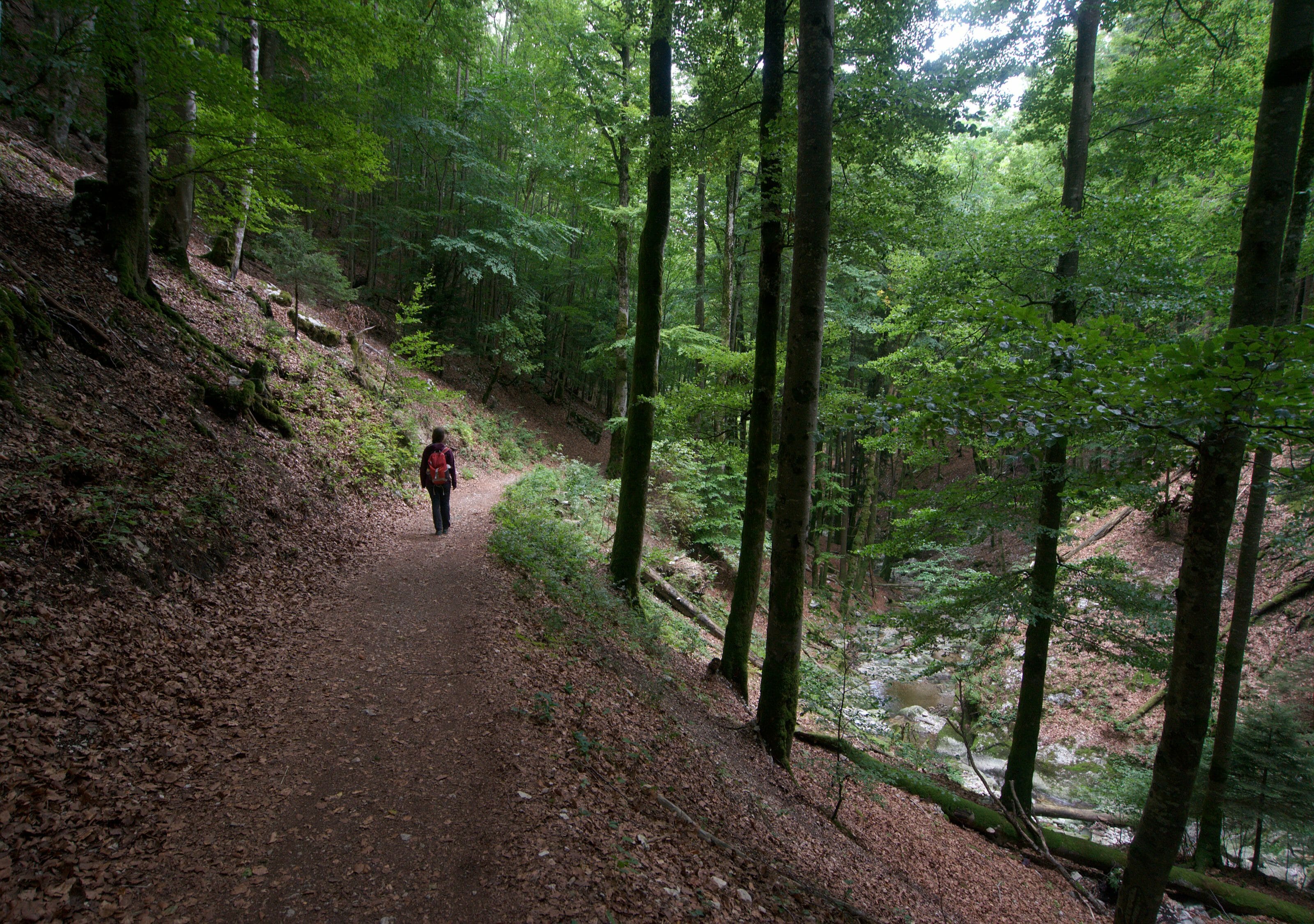
From Ste-Croix we first followed a trail through the forest and through the fields before reaching the gorges themselves. All along the way we follow the Arnon, the river that flows down from Sainte-Croix to the village of Vuiteboeuf.
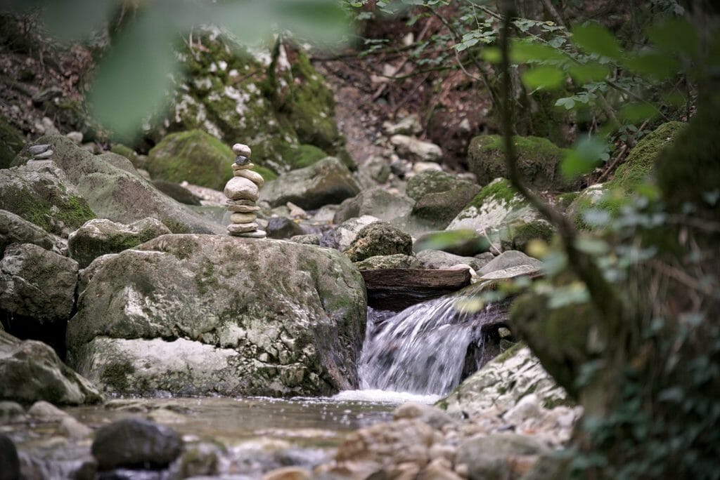
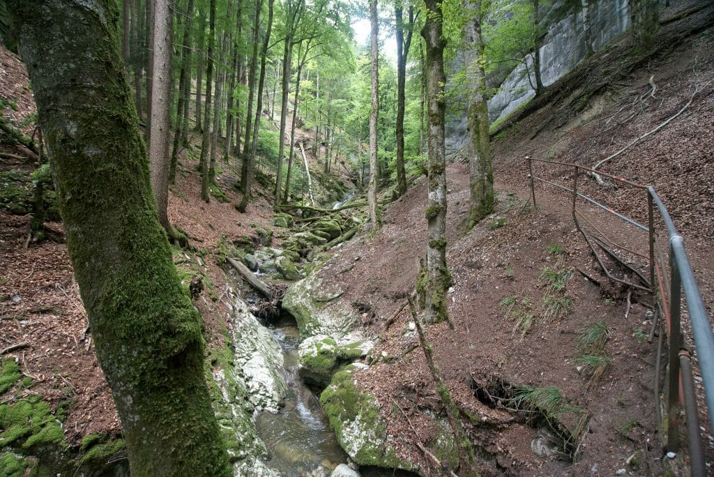
Despite a rather gloomy weather, this descent of the gorges was great! It’s really incredible to see what the passage of water has been able to dig over the years…
Then we won’t lie to each other, for us the walk could have been a little more “sporty” but we caught up by going a bit “off-track” on the small paths that go down towards the Arnon. And well, we had already walked more than 30km in 2 days, so we weren’t so unhappy to end the stay with a quieter walk. 🙂
In short, the gorges of Covatannaz is a very nice walk to do with the family or to rest your legs after the peaks of the Jura!
Once in Vuiteboeuf we followed the markings to Baulmes where we took the train back to Ste-Croix (we had left the car there). Afterwards, if you are tired or simply have less time, you can also take the train from Vuiteboeuf directly (the section between Vuiteboeuf and Baulmes was clearly less impressive than the first one).
Infos
- Start and Finish: From Saine-Croix to Baulmes (or Vuiteboeuf for the shorter version)
- Distance: 7,5 km (or 4,5km until Vuiteboeuf)
- Elevation change: 80m+ and about 500m –
- Duration: Allow 1h-1h30 to reach Vuiteboeuf, then 30-45 minutes to Baulmes
- Difficulty: Very easy. A hike that lends itself very well to a family excursion
- Transports: Possibility to return to Sainte Croix from Vuiteboeuf or Baulmes by train. (between 1 and 2 trains per hour depending on the time of day).
Map of the Covatannaz Gorge hike
To help you find your way around, here is a map of the route we have taken.
Note: from the station of Sainte-Croix we opted for the path that follows one end of the road and then the descent to the Arnon river. It is also possible to use the path along the railway tracks that joins the path we took just before “La Villette”.
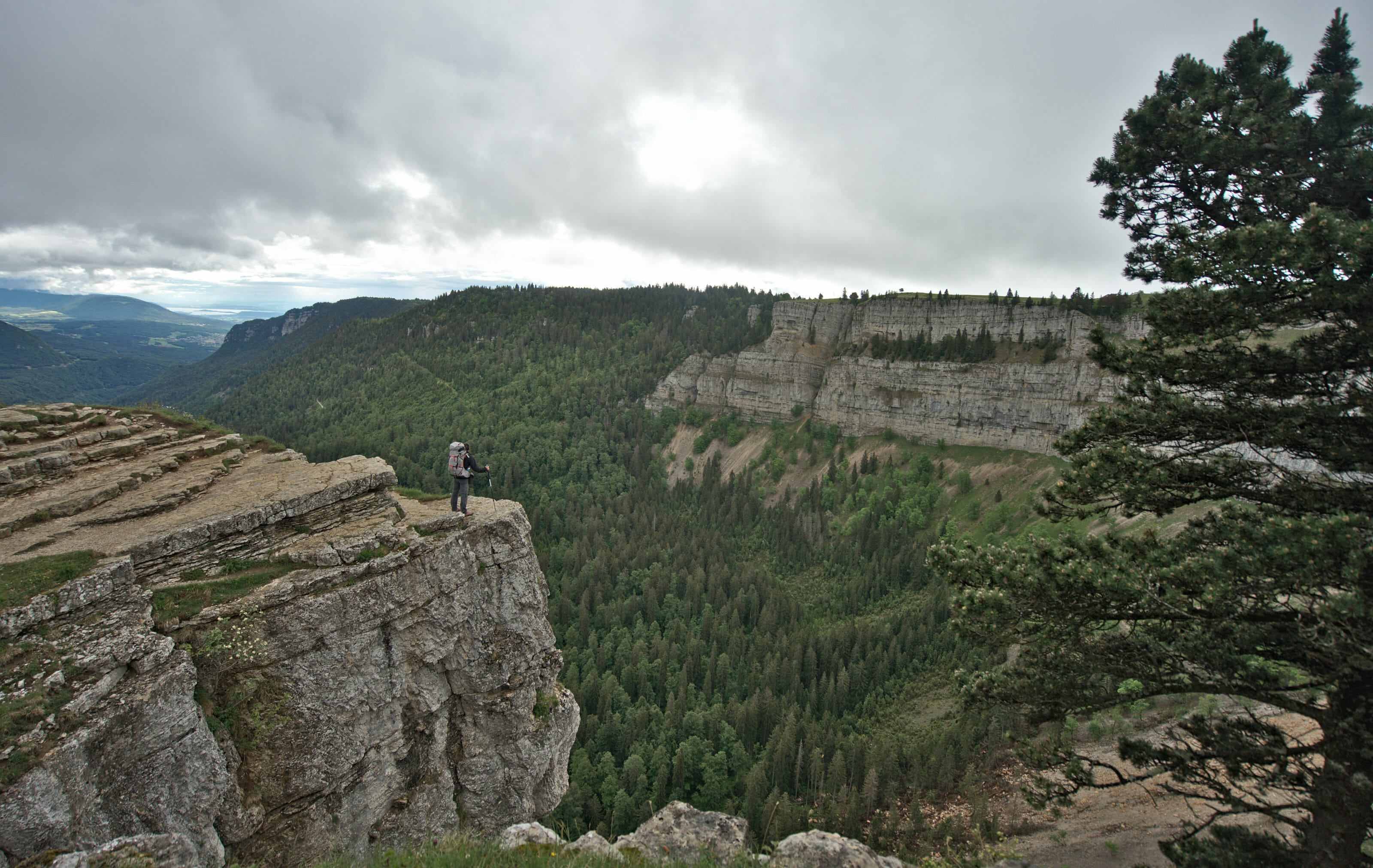
Hiking between the Creux du Van and the Chasseron
In the spring of 2020 we decided to return to the region to hike on the Jura crest trail. Starting from Dielsdorf in the canton of Zurich, we walked 320km to Nyon. During this hike we passed through the region again and it was without any hesitation that we set our route so that we could spend a night again at Le Chasseron. We thought that our stage between the mythical Creux du Van and the Chasseron would be a nice addition to this article and that it could give you more ideas of walks to do in the area.
The night before we had spent the night at the chalet du Soliat, the farm that is perched just above the Creux du Van. When we woke up, the weather was not what you would call nice, but luckily it wasn’t raining yet!
We leave early and start by going to the edge of the impressive rocky cirque before going down towards the chalet de la Barone and then Les Rochats. The part that leaves the Creux du Van is not the most “exciting” as we follow the road for quite a long time. But given the bad weather, the traffic is very light and it is therefore without too much trouble that we arrive towards the restaurant of Les Rochats. We didn’t really plan to stop there for coffee, but a sudden heavy rainfall will have taken away our motivation.
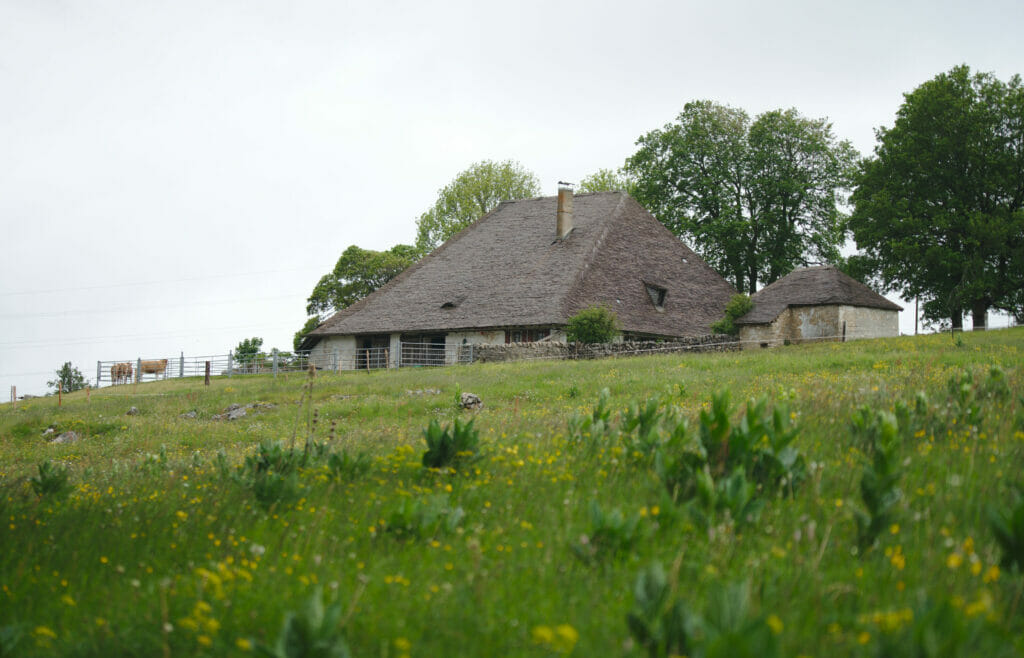
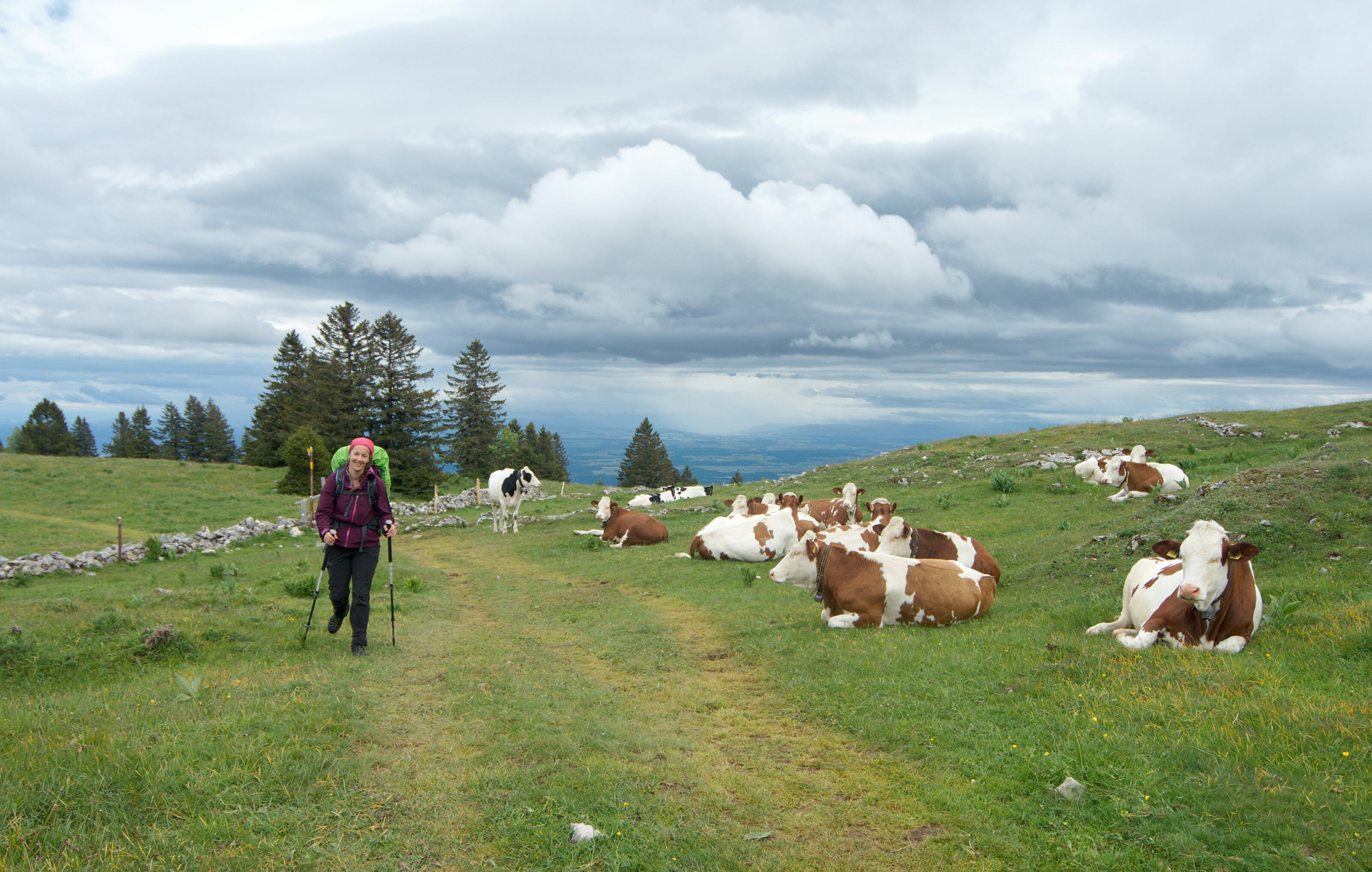
Once the storm was over we set off again in the direction of Le Chasseron. The first part is still very wet and we had to cross many herds of cows, taking care to avoid puddles. 🙂 After a good half hour we arrived at the Redalle, a beautiful farm with a thatched roof.
The ascent
Once you get to the restaurant of La Combaz, the “serious things begin”, so to speak. A large part of the day’s ascent is done on the last 10 kilometers. It’s nothing insurmountable but clearly there is a small change of pace compared to the beginning of the hike.
For our part, we unfortunately did not take advantage of the view on this part of the course. The rain and especially the thunderstorm were threatening quite seriously and we decided not to hang around too much (and therefore not to take too many pictures ;))
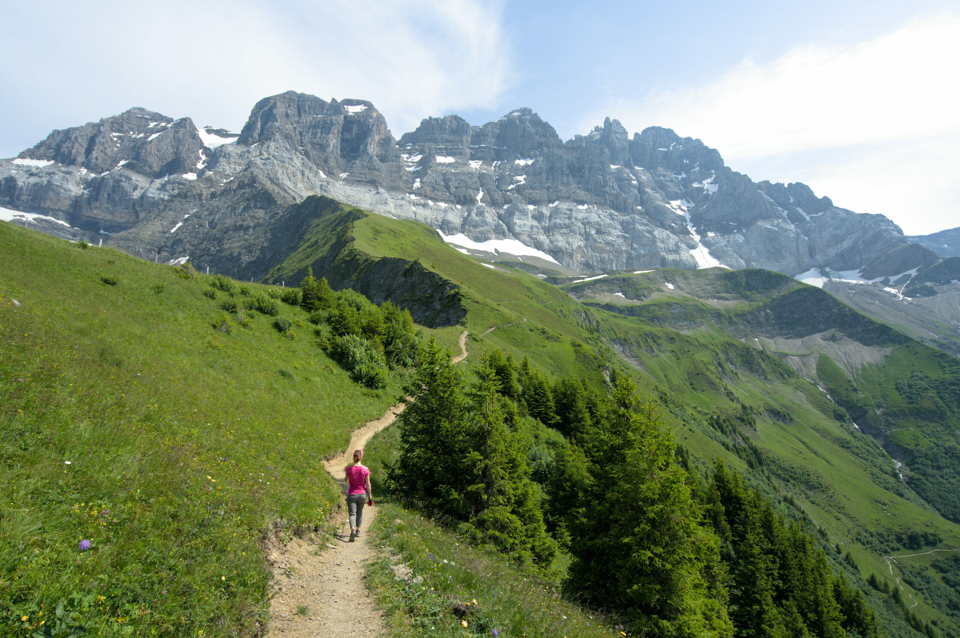
The ascent is really very beautiful and we have no trouble imagining that when the weather is clear the view must be superb! For our part, we were content to observe the numerous cows and to try to guess the lake through the clouds.
In spite of this “gloomy” weather we had a very nice surprise just before our arrival at the summit! Last year we had already seen chamois at Le Chasseron (see above) but this year it seems that the family has grown! We saw the herd in the distance and they were right next to the hiking trail. Naturally, we thought they would probably run away as we approached. But they didn’t! As we walked along we saw the males looking at us out of the corner of their eyes but it didn’t seem to worry them much (they must have quickly realized that we weren’t going to be able to chase them with our tired faces and our big bags. 🙂 We were very lucky to be able to admire this beautiful family of chamois very closely and it is clearly a moment that we will not forget!
Maps of the Creux du Van Chasseron hike and practical information
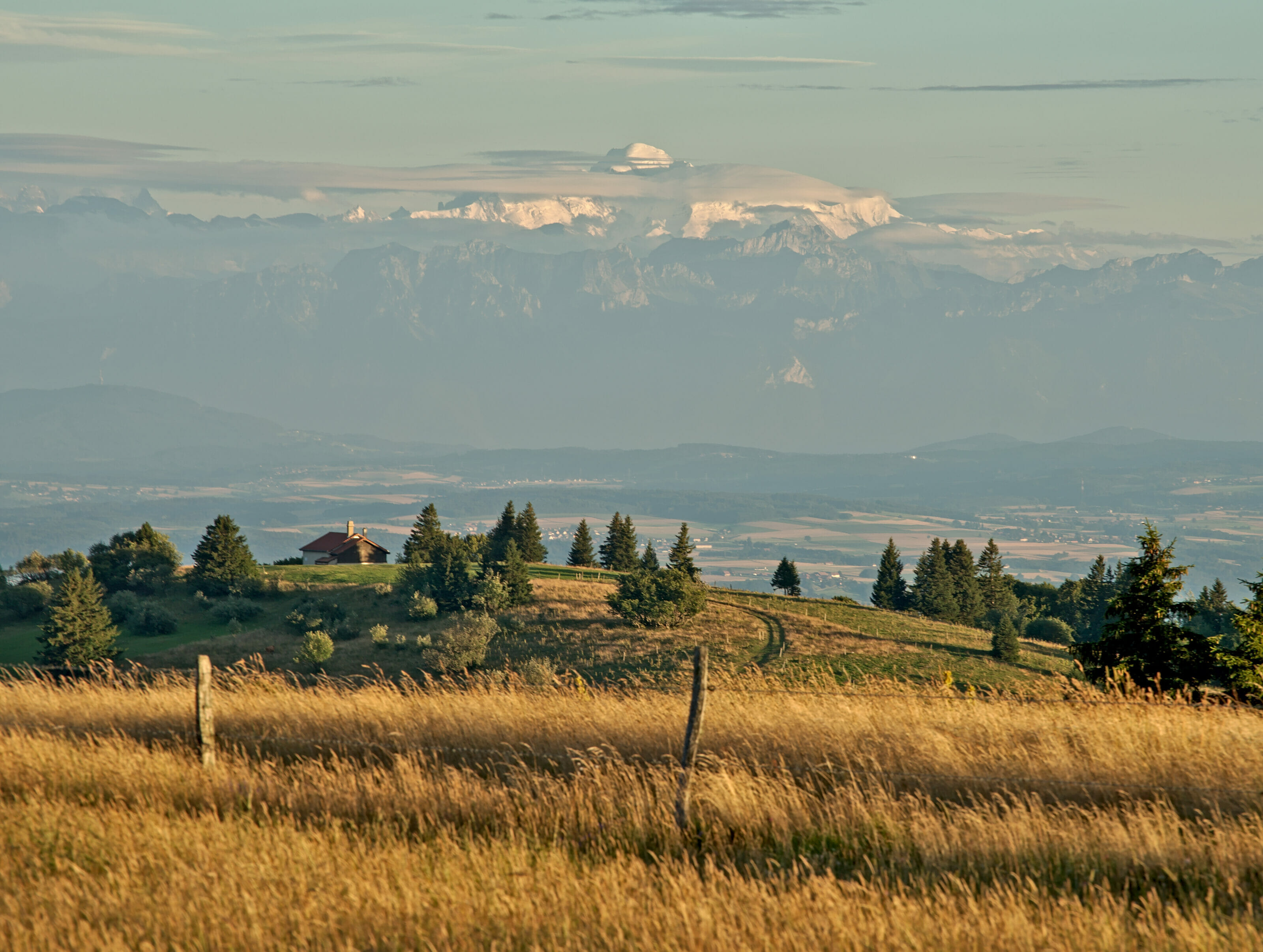
The section between the Creux du Van and the Chasseron is really superb! When the weather is clear you have a magnificent view of the Mont-Blanc. The distance is relatively long (about 22km from the chalet du Soliat) but the hike is still very accessible and presents no difficulties.
There are several places on the way where you could stop for a drink or lunch:
- La Combaz
- Les Rochats
- La Barone
Hiking map:
Our next adventures
This time you know all about our beautiful hikes in the north of Vaud! We look forward to seeing you soon for new articles about Switzerland before we leave for the Canary Islands at the end of the month. We hope you enjoyed following our hikes in the Yverdon area. Feel free to share these articles with others to make these beautiful corners of Switzerland known! For our part, we leave with the firm intention of returning in the spring to hike from the ridges to Le Suchet and why not also once in winter to go up with snowshoes to Le Chasseron!
See you soon!
Note: This stay was carried out in collaboration with the tourist office of Yverdon-les-Bains Region. For this trip the region gave us an envelope and gave us carte blanche to organize our program and book the accommodation of our choice. We thank them infinitely for their trust and especially for having given us the opportunity to discover their beautiful region “in our own way”.
Pin it!

Join the discussion