

I particularly like the pictures of those people who take their tents and photo equipment to simply go out into the wild. (I am thinking in particular of Alex Stroh or Yohan Lolos and many others). The result is often magnificent with photos that breathe freedom and make you want to pack your backpack on the spot to go on an adventure.
After losing a few minutes on the pages of these photographers, I, too, wanted to take out my tent and go for a weekend walk. Armed with my new camera (this also makes you want to go and do some tests 🙂 ).
And then, there are worse things than Switzerland for an improvised hiking and photo weekend, right?
The Churfirsten on the Walensee
We had already gone for a few walks along the Walensee and each time I was speechless in front of these cliffs that fall into the lake. I remember thinking that the view must be absolutely incredible from the top of one of these peaks. So, as I was looking for a hiking itinerary, I thought it might be nice to plan something with a bivouac at the top of one of the seven Churfirsten!
I quicky start researching the hiking opportunities in the area. I pack my backpack and go to bed to be in shape the next morning.
Nice climb on the Leistchamm as a warm-up
After getting up early, I take the train from Zurich to the village of Ziegelbrücke. Then, the bus to the village of Arvenbüel, located just above the magnificent Seerenbach Falls (which we saw already this spring when hiking along the Walensee). The weekend looks great and I’m not the only one who had the idea of going for a walk in the region. The bus is full! (not surprising in Switzerland 🙂 )

To my great pleasure, most people do not follow the same path as me and I find myself very quiet to start the ascent to Leistchamm. After a good hour of climbing, I arrive on a first ridge. From here, I can see for the first time the Toggenburg and Mount Säntis, which dominates the whole region. (We had already climbed the Säntis with Fabienne).
On top of the Leistchamm
After a short break to rest my shoulders (the backpack is quite heavy with the photo equipment), I set off again following a wet and slippery path that will take me to the top of the Leistchamm. It will take me a good hour more to reach the summit but believe me, I was greatly rewarded for my efforts by the absolutely spectacular view that awaited me.
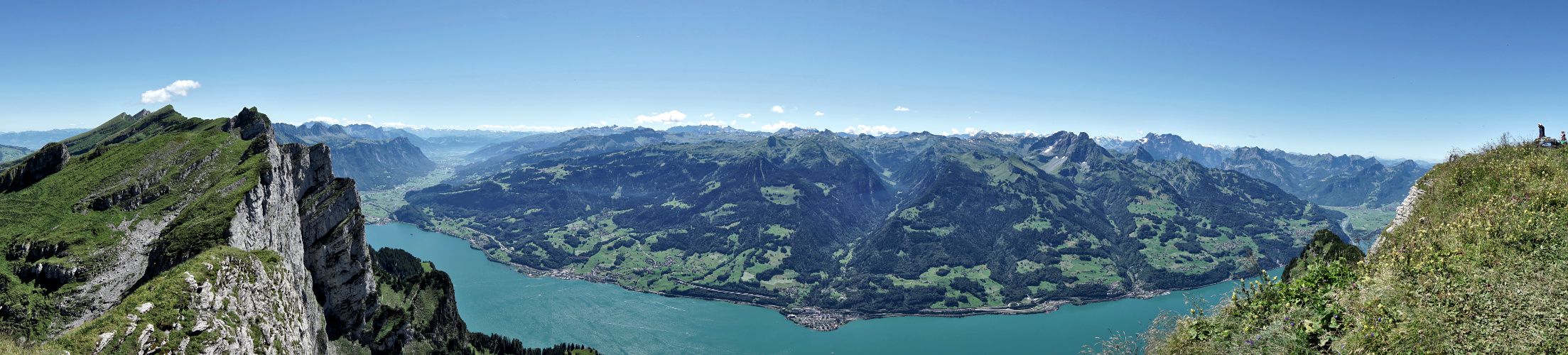
From up there, you can admire the whole Walensee. It is located 1600 m below! If you are afraid of heights, it is better to abstain going to close to the ridge :). I decide to take advantage of this incredible panorama to rest and picnic quietly.
I was not alone at the top:). There was also a couple who had settled there with their little camping chairs to enjoy the view. Pretty nice! 🙂

Hiking towards the Selun
")
I could have stayed there all afternoon but I still had a long way to go until the evening. So I take the same slippery path again (Don’t forget your hiking sticks if you come in the area… the descent is pretty rough 🙂 ). On the way, I pass by a huge hole…
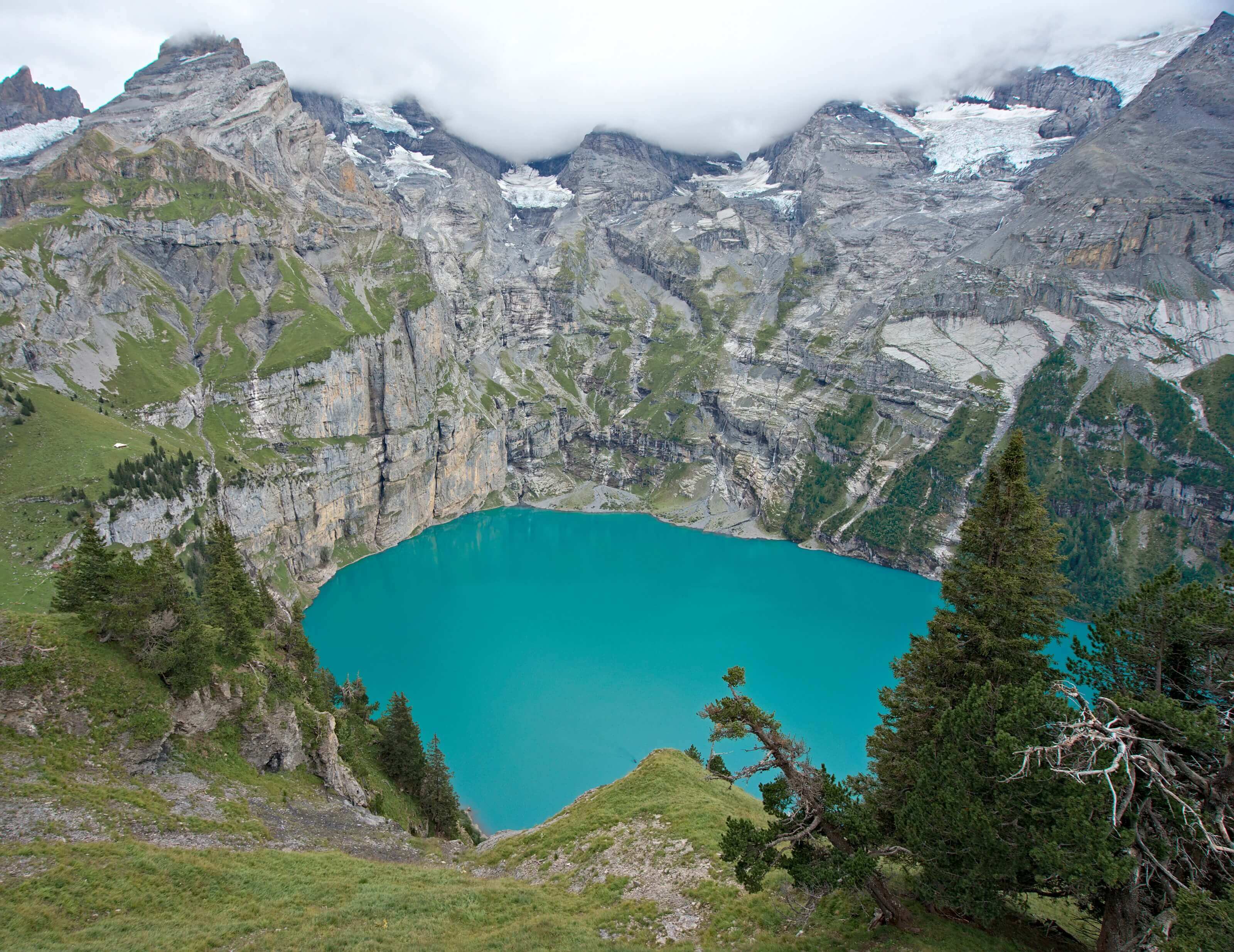
As I was wondering what it was, I saw an explanatory panel. He teaches me that the Churfirstens are actually all perforated! And that all the rainwater and snowmelt flows into this cave system and then flows into the Walensee. (That’s why there are waterfalls gushing out of the rocks on the banks of the Walensee).
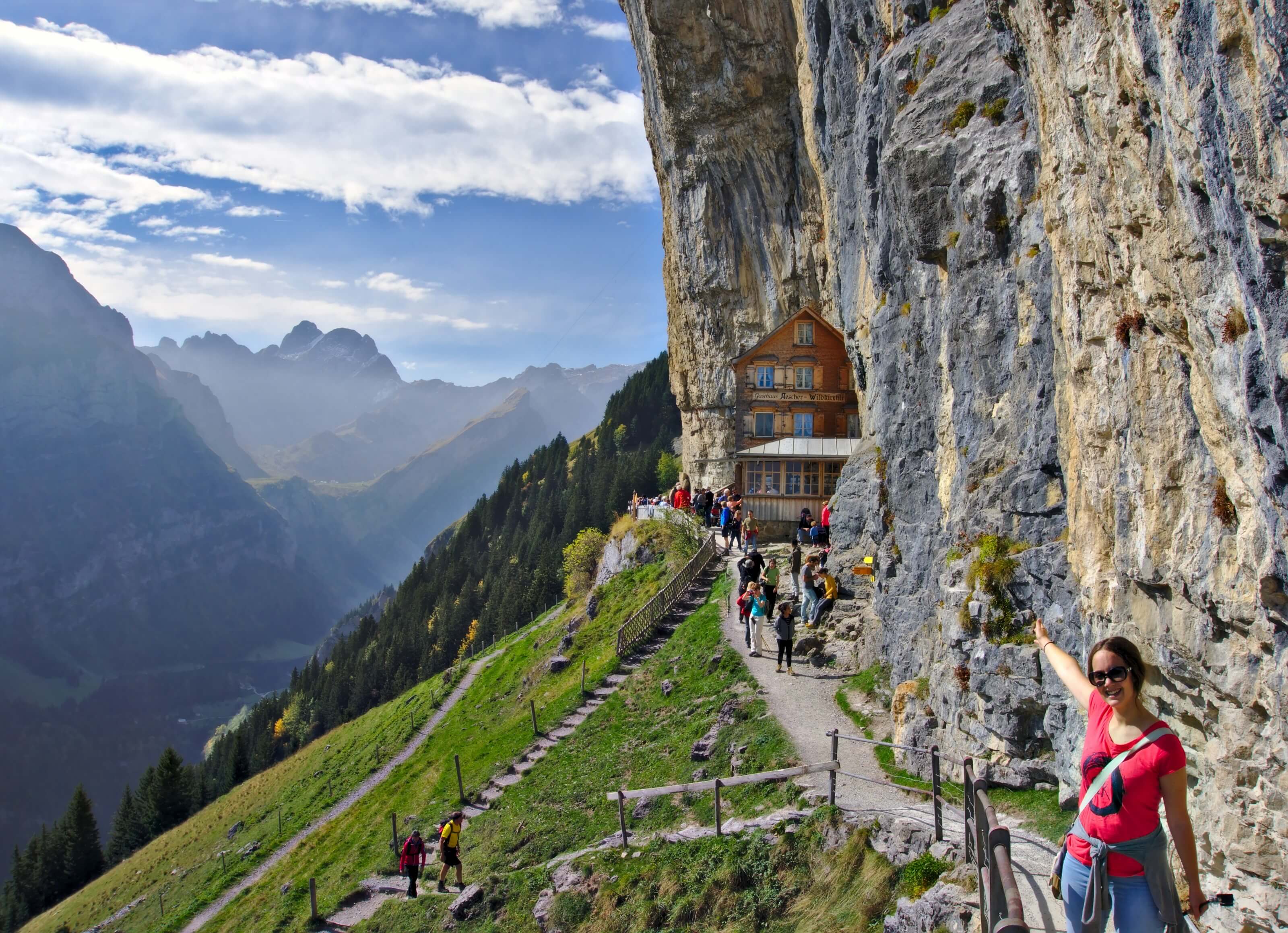
Ochsen Hut

After a good 2 hours of walking through the mountain pastures, I reach the Ochsen hut (“Ochsenhütte”) located at the foot of the Selun, at the top of which I plan to camp. Before starting the last climb of the day, I take advantage of the cabin’s snack bar to enjoy a small iced coffee and a good Rivella (if you don’t know what Rivella is, it’s a typical Swiss lemonade made with whey). The best drink for a hot summer day if you ask me! 😉

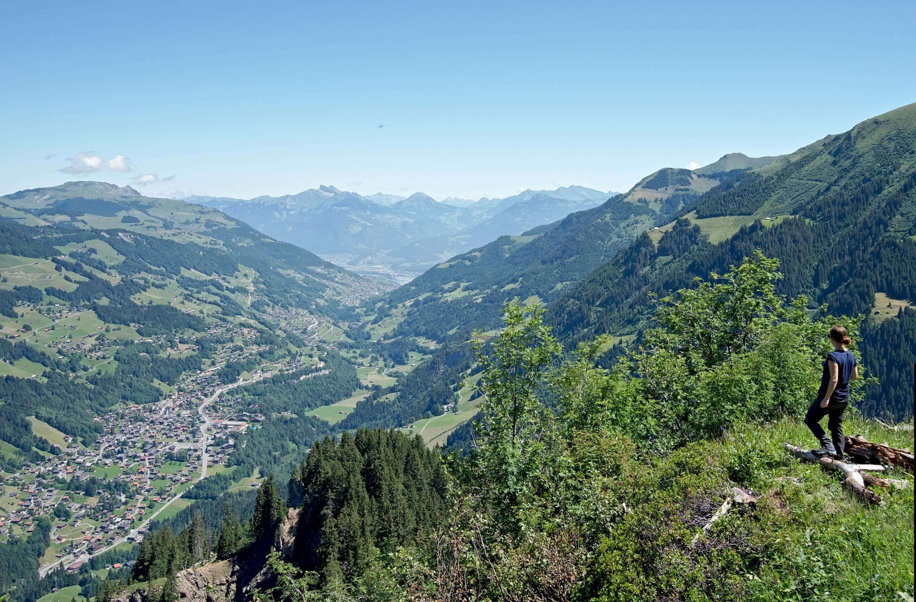
From the Ochsenhütte, there is actually a not-so-obvious path to see that joins the path to climb to the top of the Selun. (cf map) This one avoids making a detour. The path is not very marked but there are signs every 50m or so (it wasn’t like that in South America eheh) up to the main path that runs along the Selun ridge. The climb is regular and pleasant. As it is summer, there are cows almost to the top. I think they must be quite happy here with the magnificent view of the Säntis.
If you’re planning a trip to Switzerland, don’t miss our new ebook. Released in May 2025, this 75-page guide will help you prepare for your upcoming stay in Switzerland. We’ve compiled all our best tips and tricks for visiting our beloved little country without breaking the bank. You’ll find advice on transportation, accommodations, where to shop, as well as a list of free activities and events throughout the seasons, along with our personal recommendations for hikes and must-see spots, and a selection of off-the-beaten-path itineraries (with estimated budgets). This ultra-complete guide also includes a fantastic interactive map featuring over 500 addresses and deals.

To learn more about the ebook and the interactive map, the introductory article is available here.
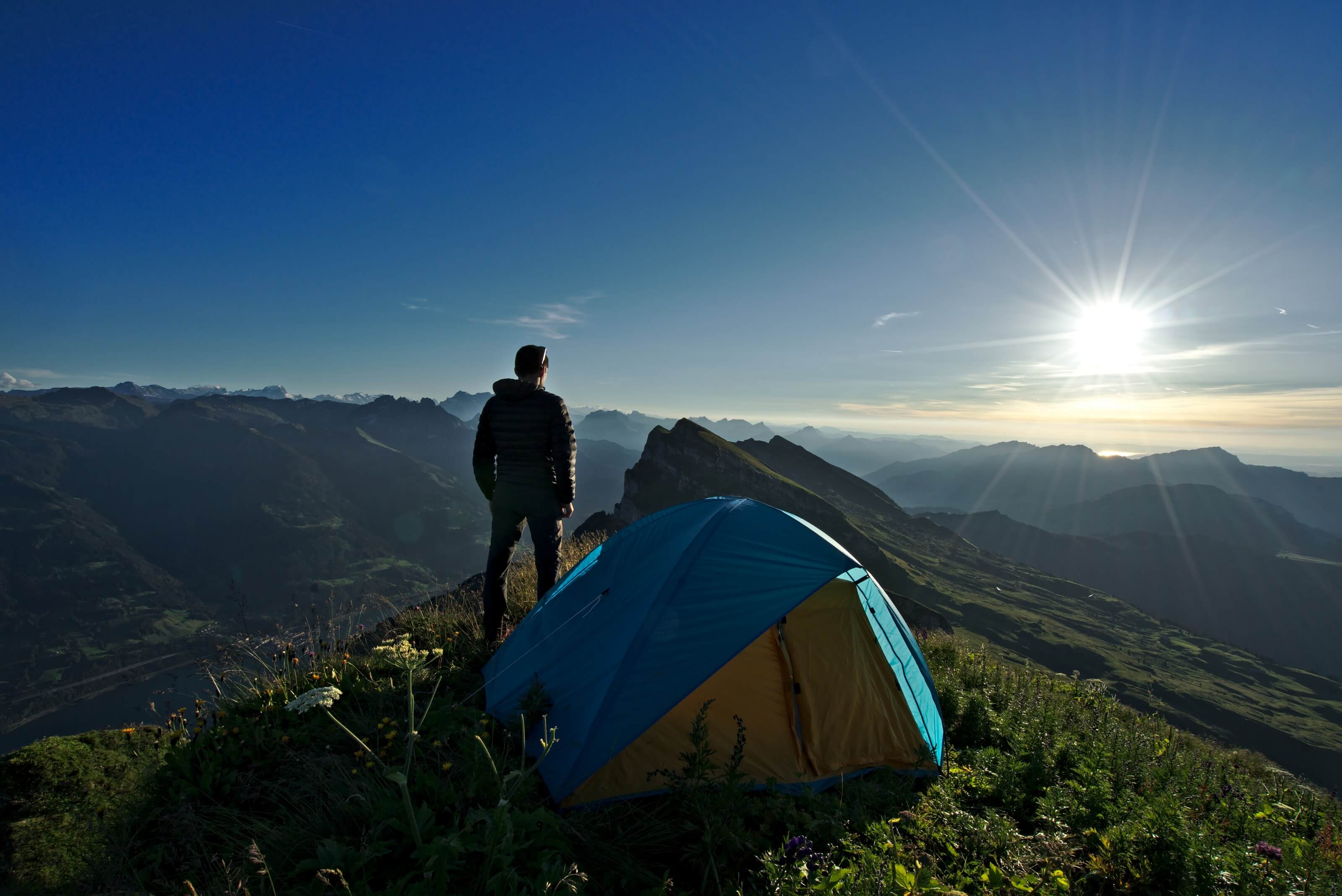
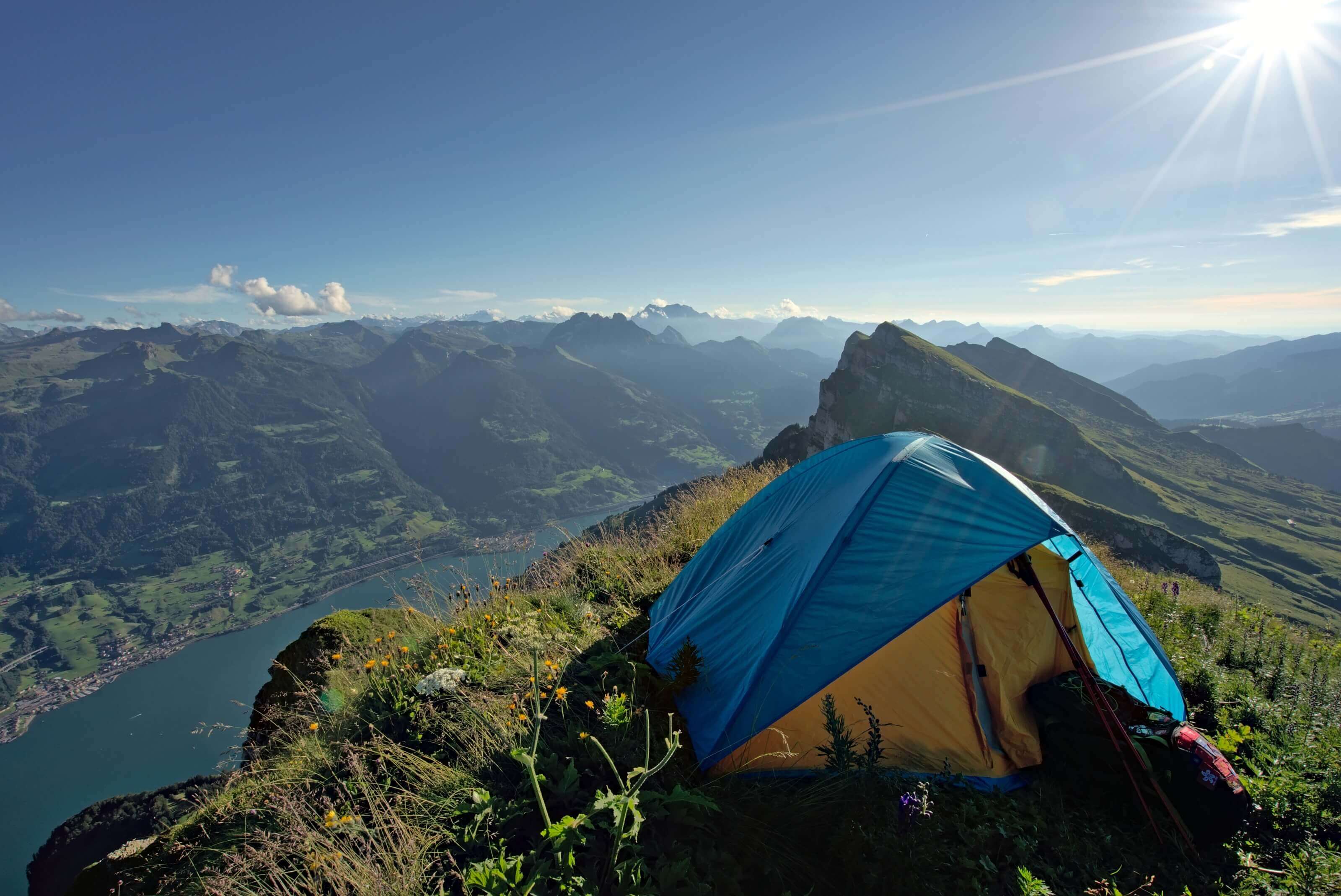
Arrival at the summit of Selun and bivouac
I reach the top at 17:00 and I am simply amazed by these landscapes. I am all alone with a magnificent 360 degree view of the Swiss German Alps, the Säntis, the Toggenburg region and the Walensee below…
“Frankly, I couldn’t have found a better camping spot! “
After settling in quietly, I take advantage of this beautiful late afternoon to take some pictures so I can share this with you. 🙂 (I also took the opportunity to do a silly gif 🙂 ) ).


Evening above the Walensee
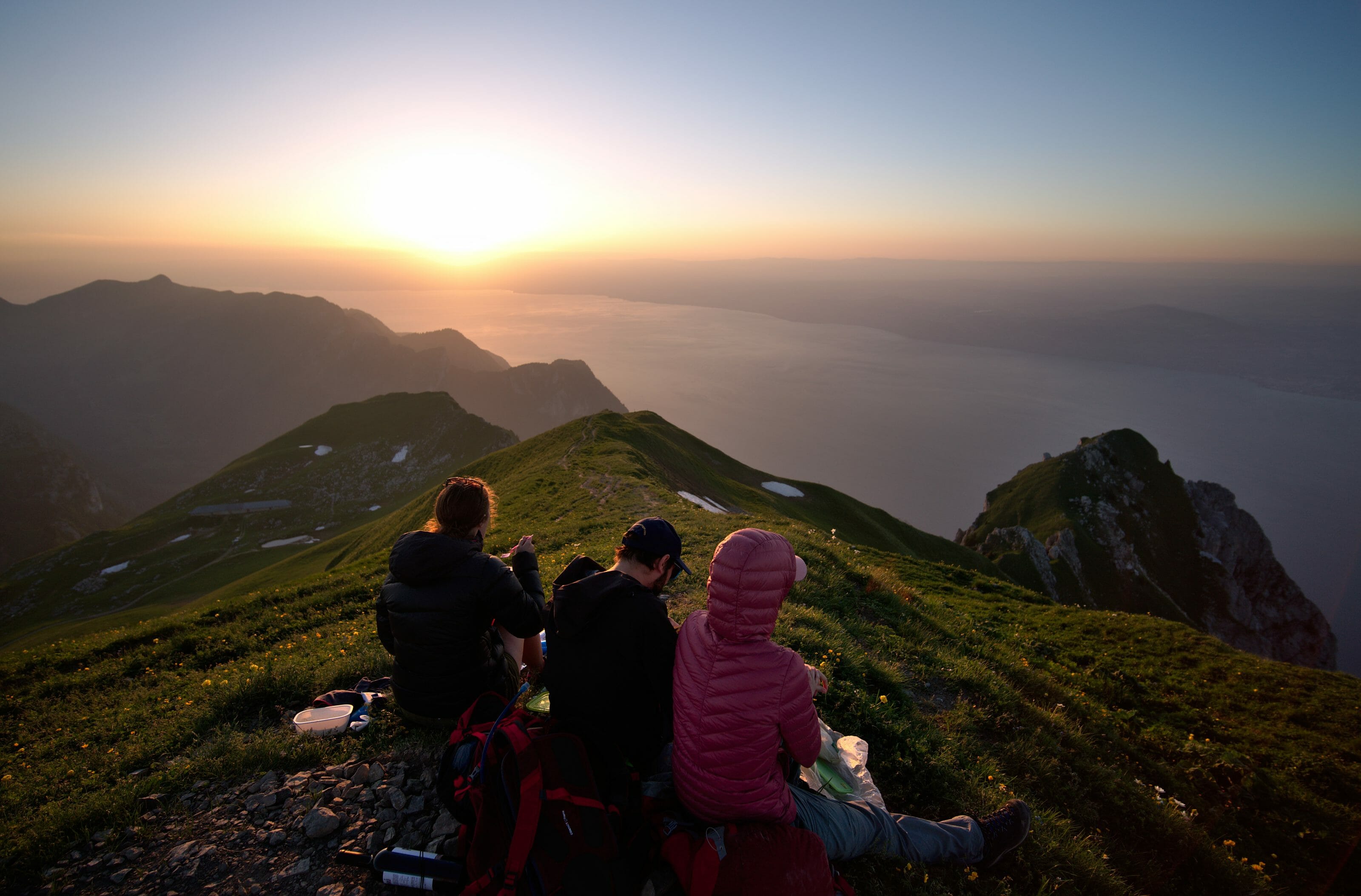
After a beautiful sunset, I was quietly sitting in front of my tent when I heard voices coming from a little lower down. Yes, I wasn’t the only one who had the idea of sleeping at the top of the Selun. Two Swiss German friends had planned to prepare a small fondue and sleep under the stars. I chat with them for a moment sharing a glass of white wine before returning to my tent to enjoy this beautiful starry night. A great time!
")

After a short night (I spent too much time looking at the stars and playing with the camera 🙂 ), I get up early to watch the sunrise. I have always liked watching the colours change in the hour before sunrise. And for my greatest pleasure, this morning, the sky is clear again and the show is on!
Some athletes running along the ridge of Churfirsten
To my surprise, while I’m busy taking some pictures, a couple passes me by. They quickly explain to me that they are making the 7 summits of the Churfirsten by going along the cliff. (It is barely 6am and they are already at the top of the 3rd. 😉
Then, I see them going down just below me in a super steep hallway laughing as if this would be nothing special! They must have been some pretty serious athletes, because the slightest faux pas on this “trail” would send them directly 1000m lower! (especially since they are simply in trail running shoes, without anything else)… Impressive!
")
On the way to the Chäserrugg summit

After sharing breakfast with my 2 Swiss-German friends, I pack up again my equipment. Then, I go down to the foot of the Selun to get closer to the last of the Churfirsten: the Chäserrugg. From this perspective, these Churfirsten have really had an impressive shape. It almost looks like some kind of waves or springboards (I know, I have a lot of imagination). From time to time, I also try to spot the couple I met in the morning. I think they must be somewhere between Selun and Chäserrugg. But I won’t see them again.
I stop at the place called Hinterlücheren (see map) to eat before attacking a good 800m climb to the top of the Chäserrugg via the Hinderrugg. At times, the path is very steep but once again, my efforts are rewarded by an impressive view over the entire Churfirsten mountain range.
After a last impressive part where we climb quite close to the cliff, I arrive at the top of the Hinderrug. There I am greeted by a gentleman who plays the Alphorn. Frankly, it was the icing on the cake! Imagine for a second with the panorama of the Churfirsten, Walensee and the sound of the Alps horn in the background. A just magical moment that I must share with you. 🙂
Video of the Alphorn in Switzerland
After this little concert, as I’m quite tired, I continue my way to the Chäserrugg cable car which goes down to the village of Unterwasser. I could also have walked down to Walenstadt but I didn’t feel like doing the 2000m of negative altitude difference after these 2 days of walking. 🙂
Infos
- Distance : 22 kms
- Elevation gain : 2400 m
- Elevation loss : 1400 m
- map Hiking map:
You can download the track of our hike to have it with you on your phone/connected watch. To do this, simply create an account (free) on AllTrails and download the map in the desired format.
Télécharger la trace sur AllTrails
- Transports : To reach the beginning of the hike, take the train to the village of Ziegelbrücke and then take the 650 bus to the village of Arvenbüel (bus terminal).
Once at the top of the Chäserrugg, it is possible to descend by cable car to the village of Unterwasser or on foot to Walenstadt. (If you still have the courage) - Food & Water : Not too much to worry about on that side. You will always find water on the mountain pastures and there are also several mountain huts if you want to eat something. As far as I’m concerned, I had 3l of water in the bag and food for 2 days. Consider taking a Lifestraw to make sure water is safe.
Here, I hope I would have made you want to discover this little corner of paradise in Switzerland. As far as I’m concerned, this is probably not the last time I’ll improvise a hike around a bivouac with a view. The panoramas, the calm, the colours that you can appreciate in these moments are so many reasons that make me love hiking on my own.
And you, what makes you want to go on a hike?
NB: Please note that this article contains affiliate links to partner sites. If you buy a product on one of their sites you will not pay more but we will receive a small commission. This will help us to keep this site alive. Thank you! 🙂
Join the discussion