
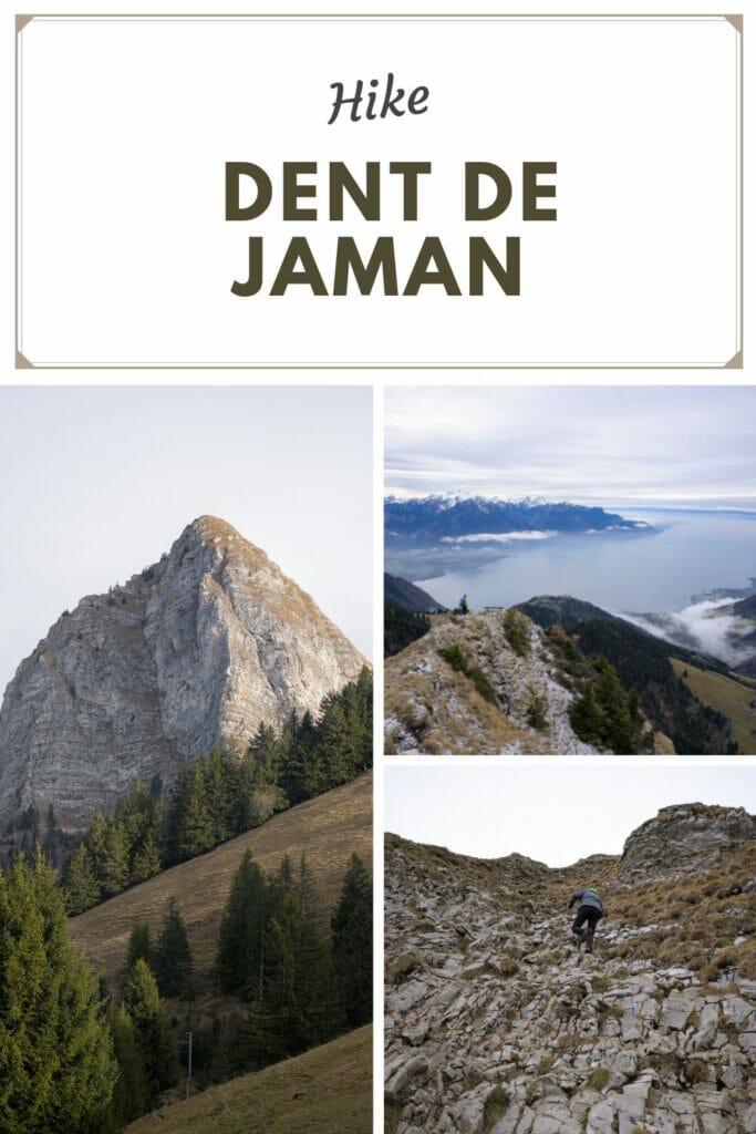
During the holidays, we had 2 friends visiting and we were looking for hike idea near Lausanne. We already knew the Rochers-de-Naye for having completed the Via Alpina, but we had never been to the Dent de Jaman. Bingo: a not too long itinerary but with an incredible “effort-view” ratio!
And as often, we couldn’t help but add a little scenic “detour”. In short, in this article we take you for a loop hike of 11km passing by the Dent de Jaman but also the summit of Merdasson.
Important note: We did this itinerary in early January, but it is important to note that in 2023 the situation was quite exceptional from a climate and snow point of view. This itinerary is clearly more thought to be done during the summer season. We advise you to do this itinerary between May and October (in the absence of snow)
Hike start in Haut-de-Caux
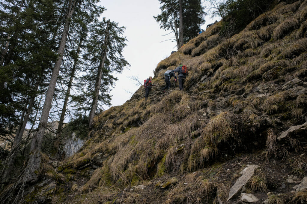
To start the hike, we drove to the Haut-de-Caux parking lot, a well-known place to start the climb towards the Rochers-de-Naye. At the station, we start the climb towards the summits. And the least we can say is that the itinerary does not give you a chance to warm-up: from the first meters it climbs very steeply!
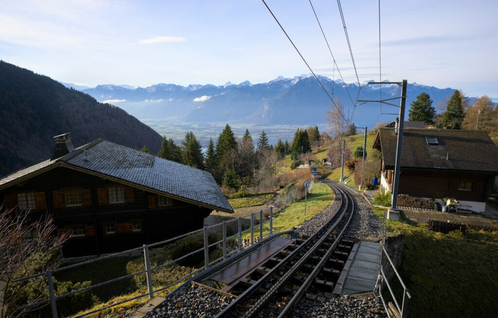
The first 700 meters go along the rail tracks until you reach the small station of Crêt d’y Bau (by the way, if you come by public transport, you can get out at this stop and avoid the strech along the tracks).
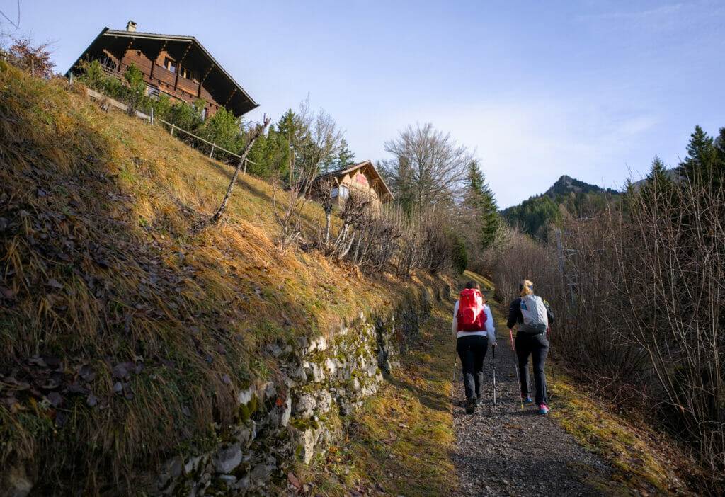
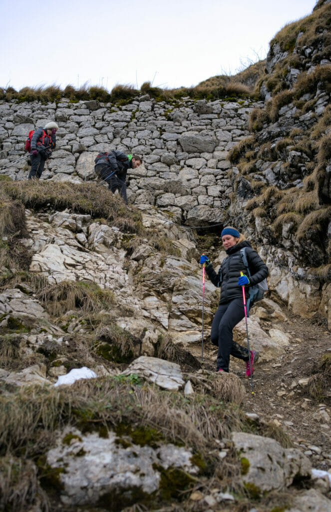
From the station, the trail crosses the tracks and climbs “steeply” up a grassy slope. During our walk, the path was very wet which contributed to complicate our task a bit (and to ensure that we would be completely covered with mud by the end of the day) 😉
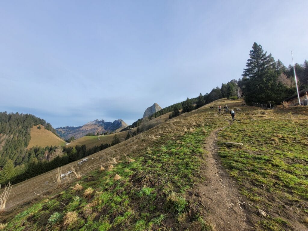
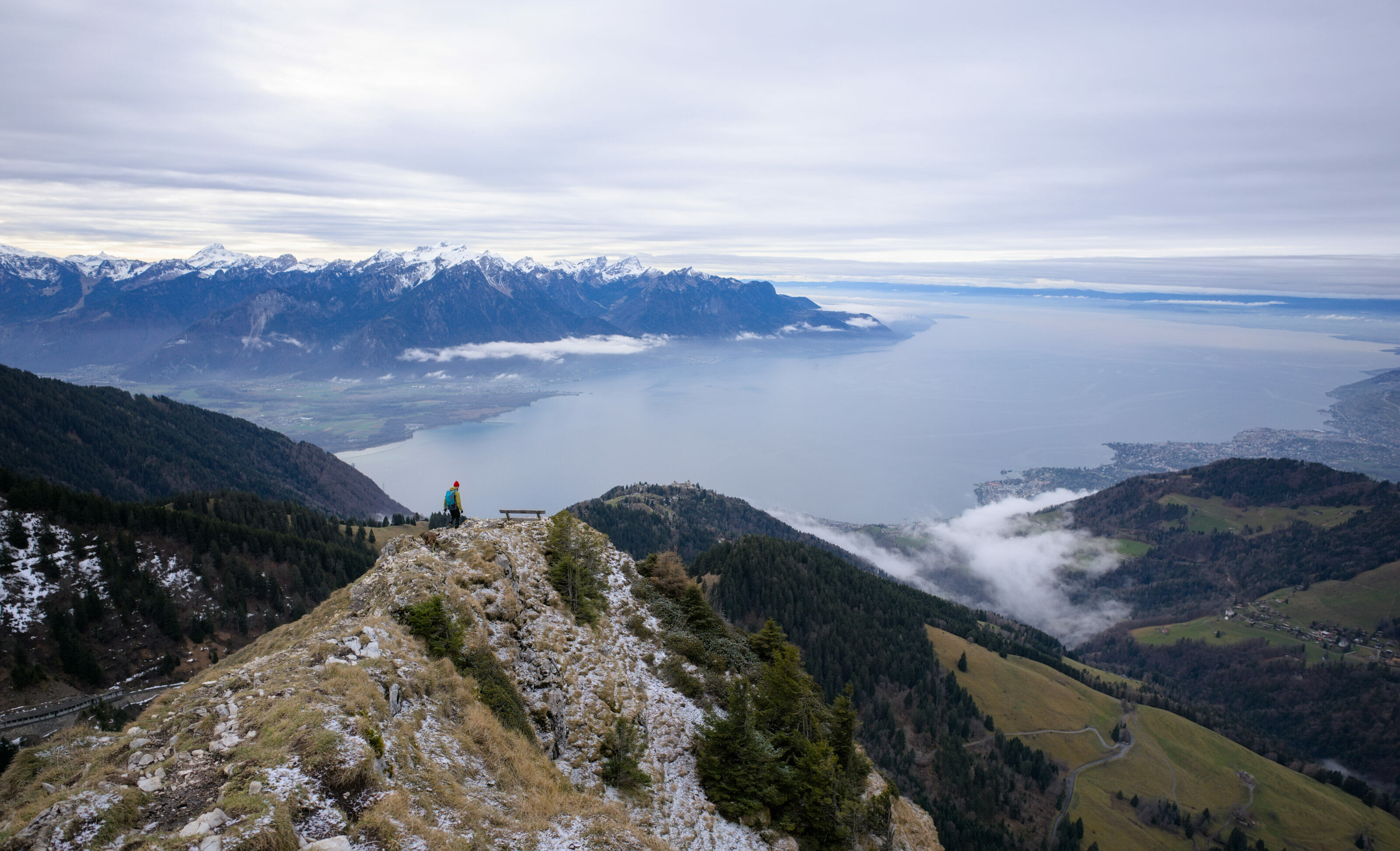
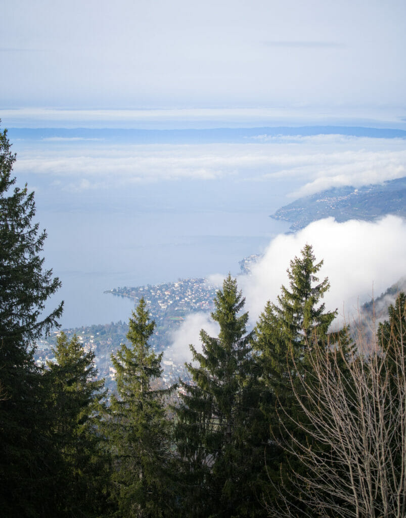
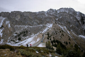
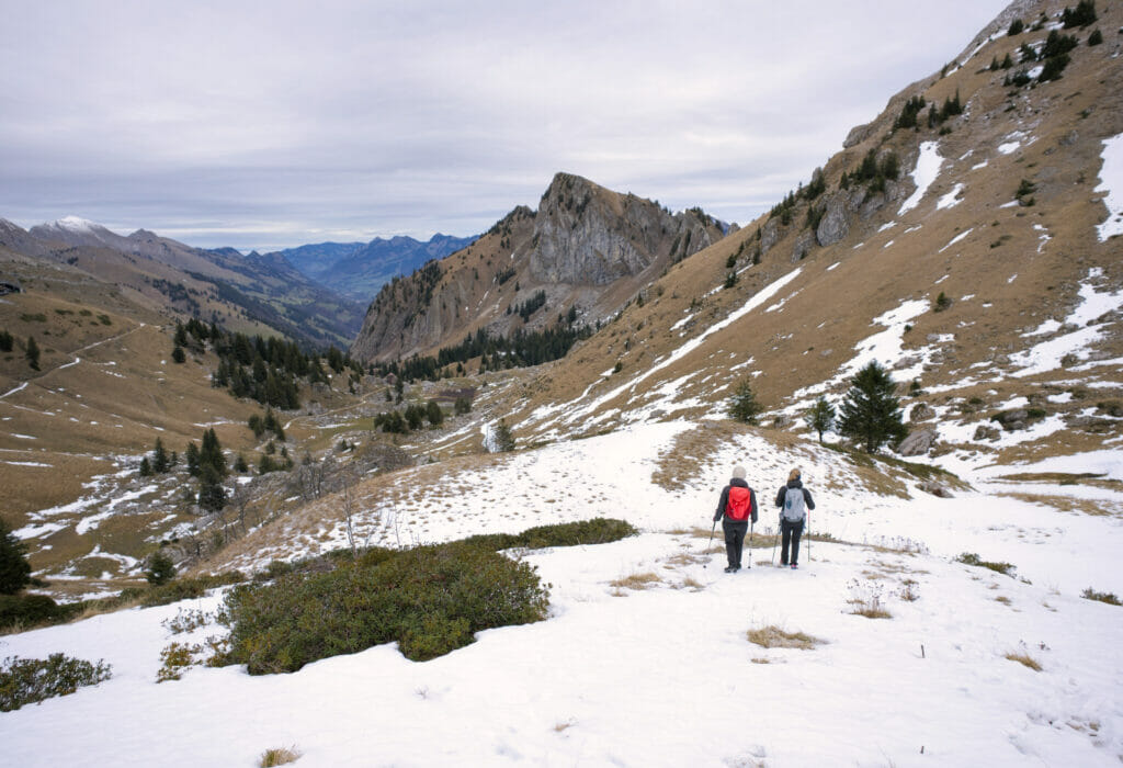
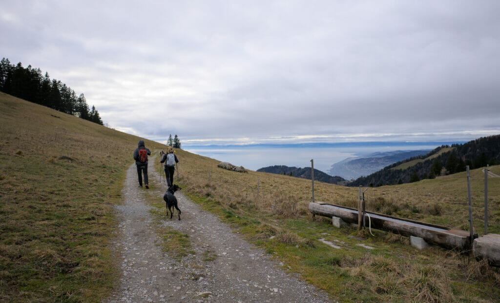
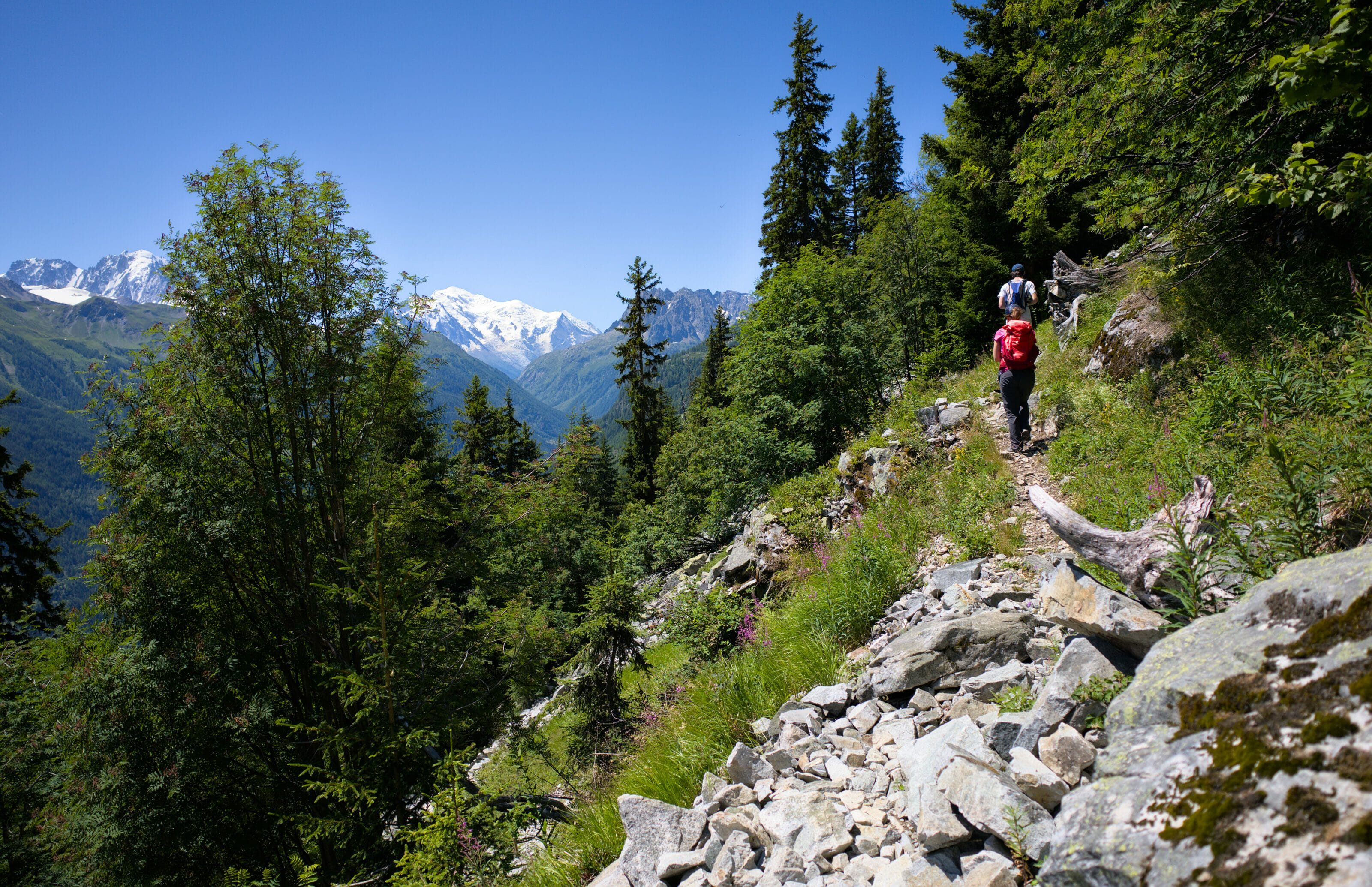
When we arrive at a first crossing, we follow to the right to go to the alpage of Chamossale which is below the Merdasson. Although rather “rough” for the cardio, this part is also particularly scenic. On one side, we have a breathtaking view of Lake Geneva, and on the other side we have both the Rochers-de-Naye and the Dent de Jaman in sights.
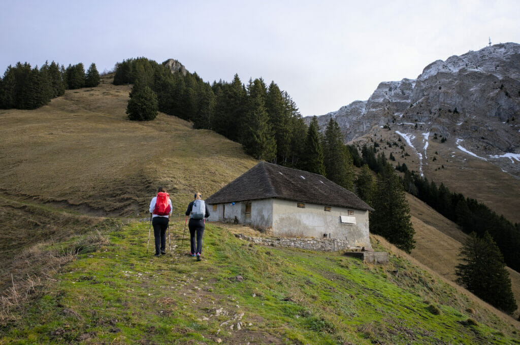

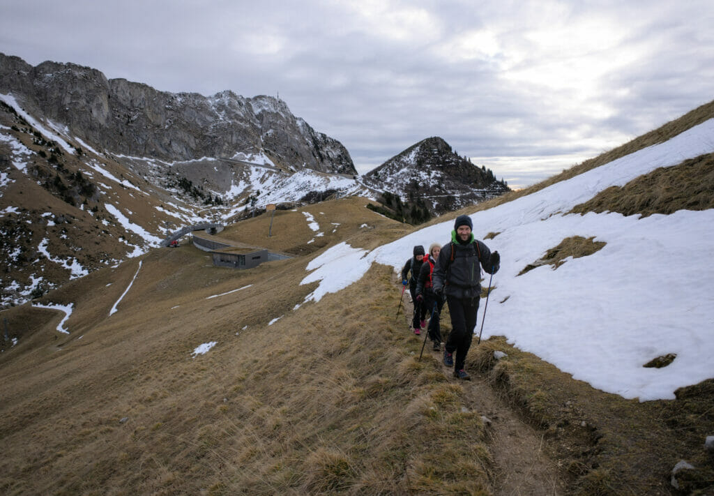
At the mountain pasture, we follow the path on the left and we start the last climb in direction of the train station “La Perche”. From the chalet, there is still something like 1,4 km and 230m of positive difference in altitude to reach the first summit of this hike. But let’s say it right away, the view during the ascent is absolutely stunning and makes us want to get to the top as fast as possible to see even more of it!
If you’re planning a trip to Switzerland or if you live here and wish to discover some new spots, don’t miss our new ebook. Released in May 2025, this 75-page guide will help you prepare for your upcoming stay in Switzerland. We’ve compiled all our best tips and tricks for visiting our beloved little country without breaking the bank. You’ll find advice on transportation, accommodations, where to shop, as well as a list of free activities and events throughout the seasons, along with our personal recommendations for hikes and must-see spots, and a selection of off-the-beaten-path itineraries (with estimated budgets). This ultra-complete guide also includes a fantastic interactive map featuring over 500 addresses and deals.

To learn more about the ebook and the interactive map, the introductory article is available here.
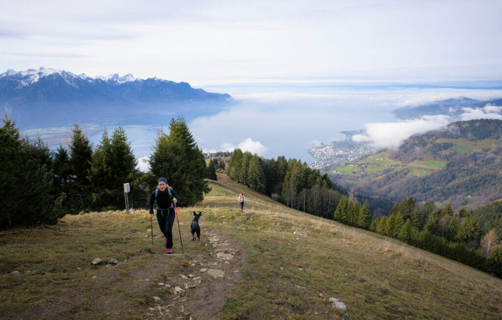
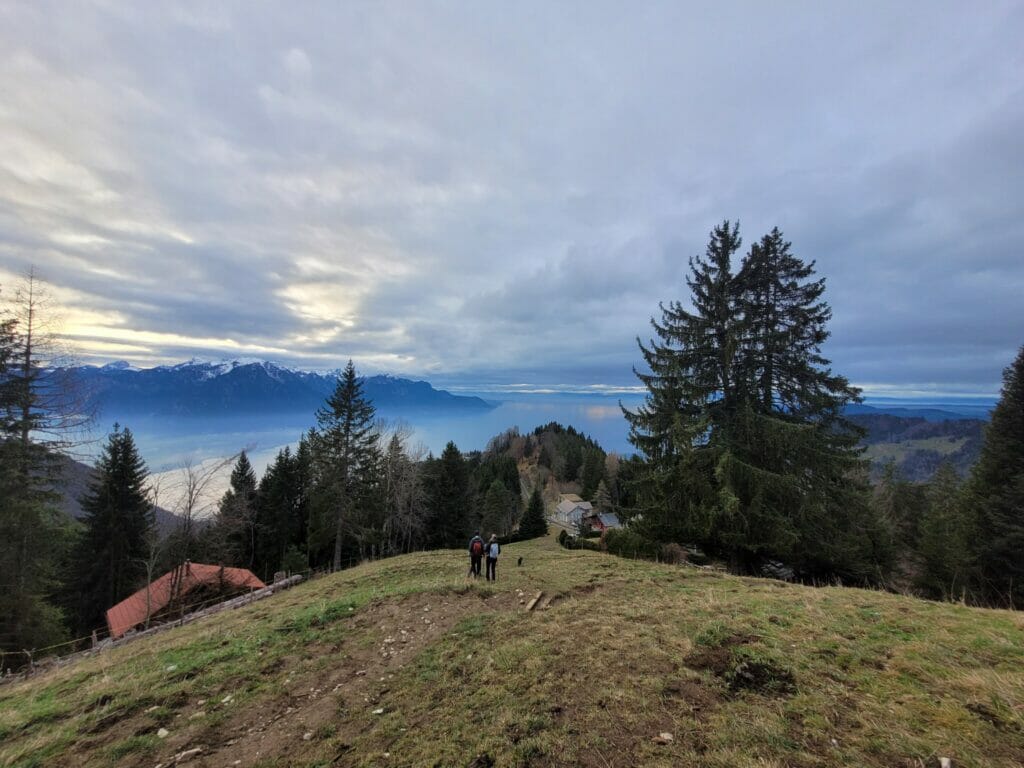
The Merdasson summit and its view of Lake Geneva
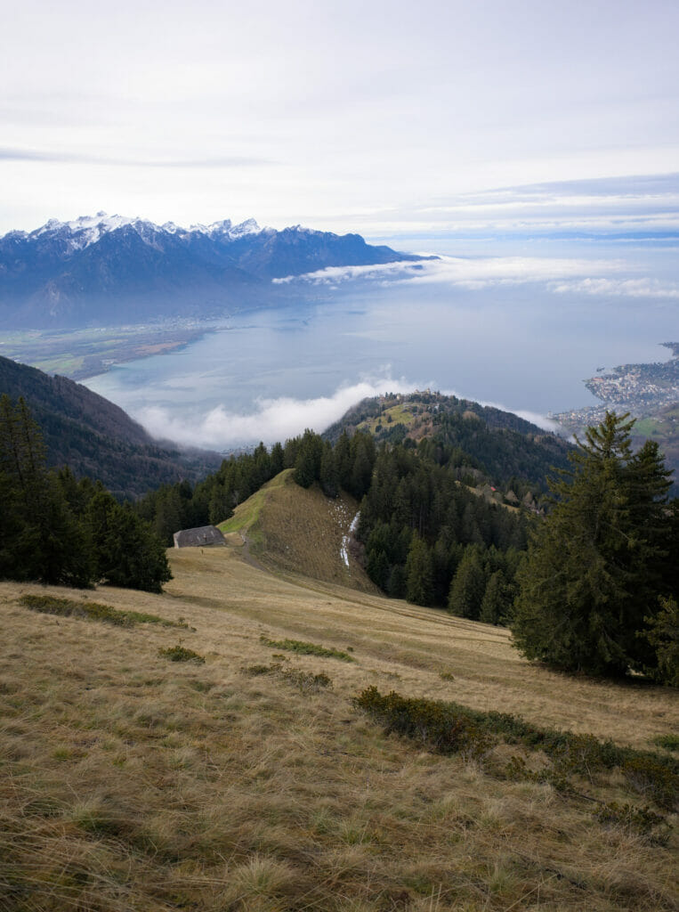
Once at the Perche station, the summit of Merdasson is only a few meters away (200m to be exact 😉 ). There is no “official” path that goes up to it, but you will have no problem to reach the summit by following the tracks. It is relatively steep, but the path being well used, there is absolutely no difficulty (and we enjoy a nice view on the Rochers-de-Naye in our back).
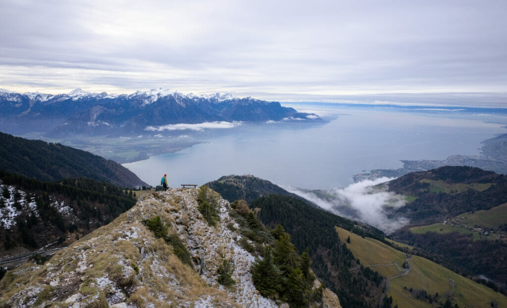
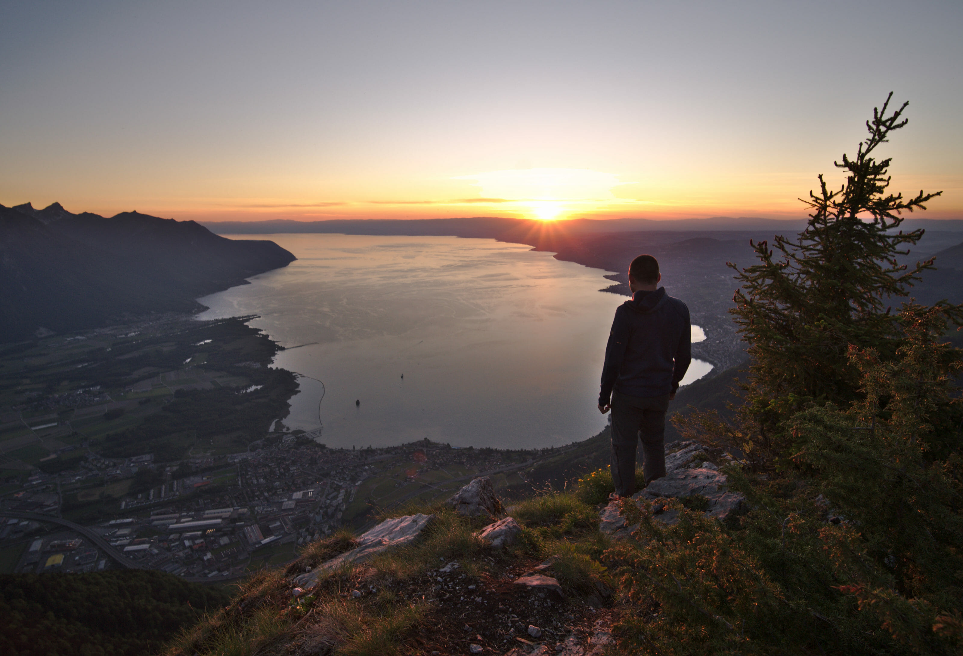
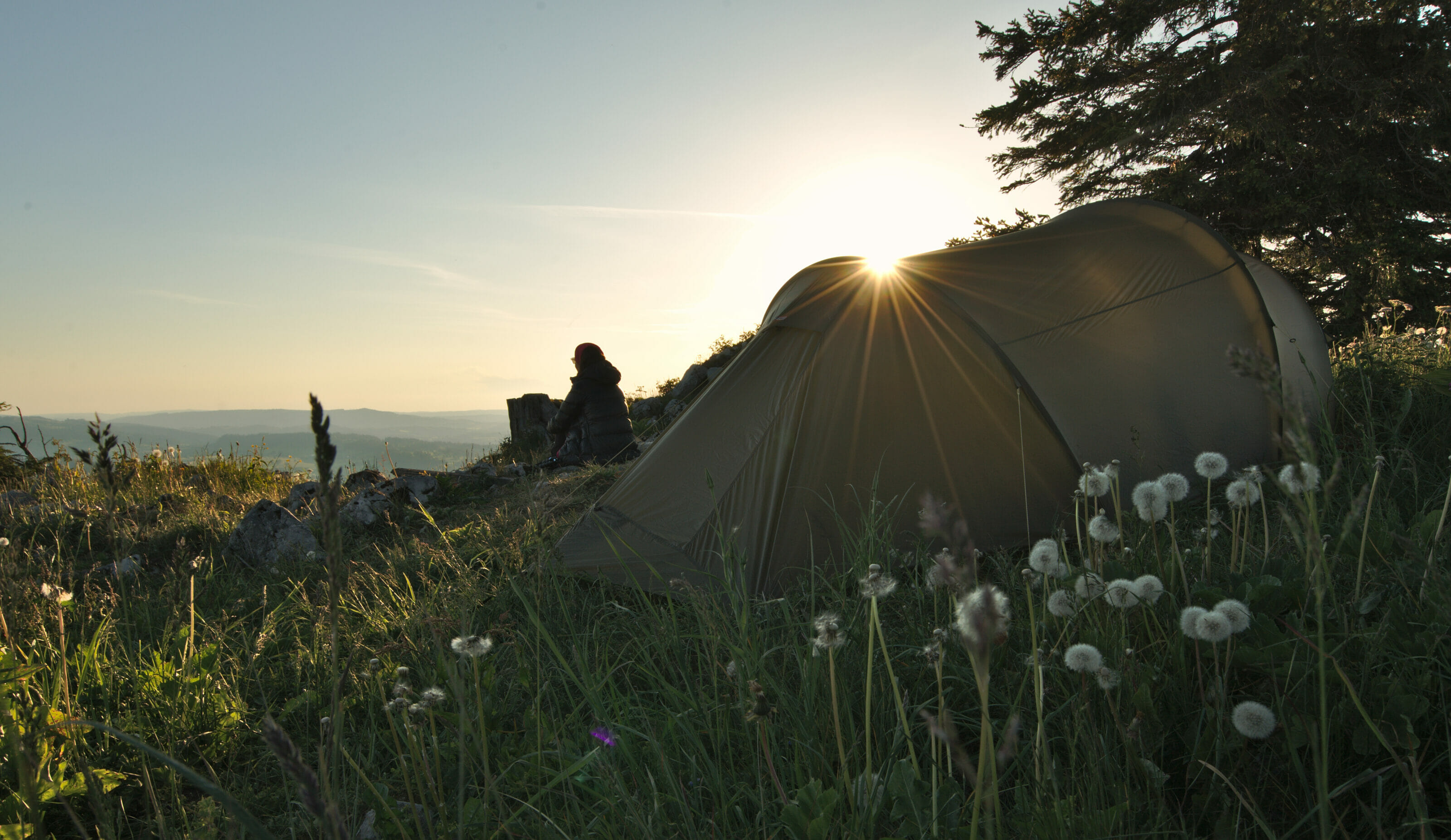
When you reach the top, you are immediately rewarded by an absolutely spectacular view of Lake Geneva. We couldn’t help but think that this spot would be really good for a night under the stars during the summer… 😉 #JustSayin
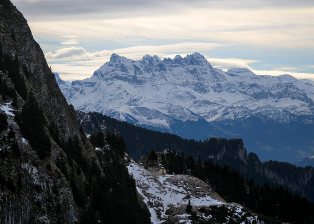
The Merdasson, apart from its name which can make you smile (in French it translates to something like “little shit”), is really a nice little summit much less known (and crowded) than the Rochers-de-Naye or the Dent de Jaman and well… the view is still incredibly nice! 😉
Towards Jaman
Afterwards, we will admit that we did not linger particularly long at the top… As much as we were warm during the ascent, once at the top, the icy wind quickly came to remind us that we were in January. Within 5 minutes, we were all freezing!
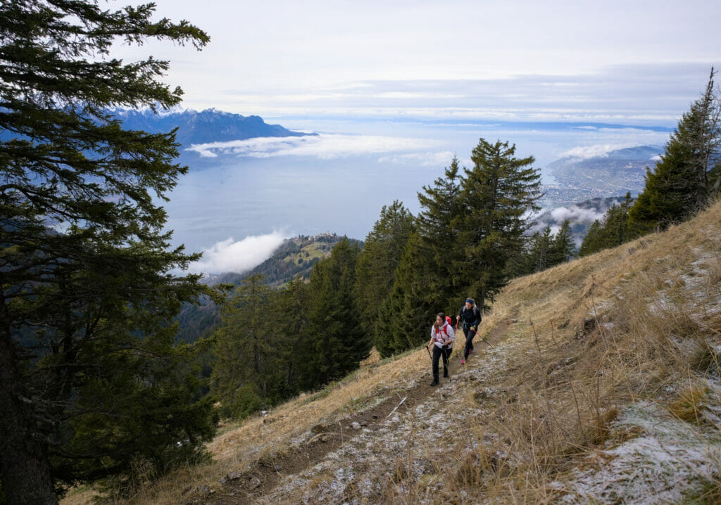
In short, we put on all our layers and we go back down to the station of the Perche. Here, we cross the tracks and follow the path which leaves on the northern side of the Rochers-de-Naye. Who says north side, also says less sunny side and we had the “surprise” to find ourselves the feet in the snow (at the same time in the beginning of January what else could we have been expecting?).
The slope is relatively gentle so it’s not a particular problem, even if it will have caused us some problems to find our way because the path was not visible because of the snow (and we were the first to pass by there).
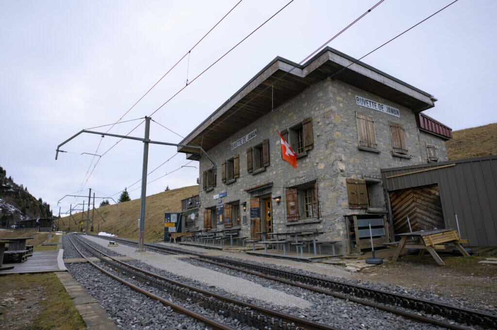
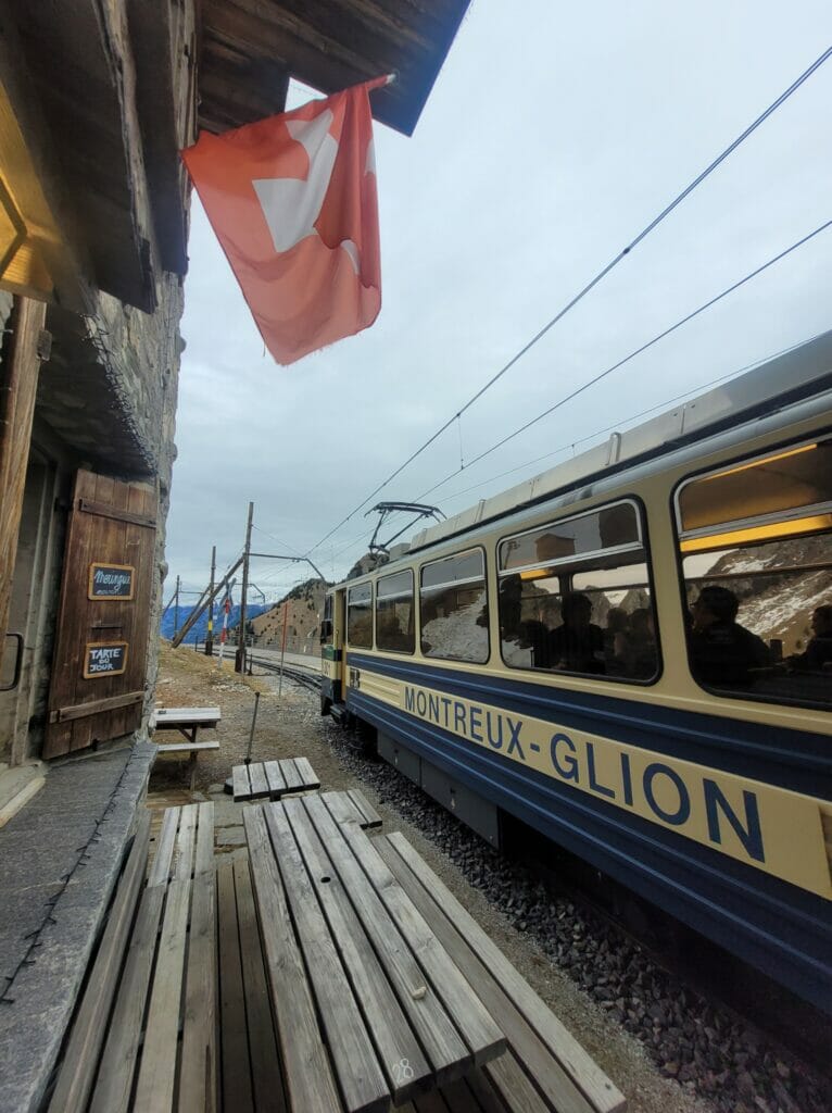
After a few “non-voluntary” detours, we find the way back to the Montagne d’Amont road with the buvette de Jaman (and the train station) in sights.
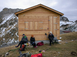
We settle down behind a small chalet for our picnic break to avoid a little the icy wind… But nothing will help, I am frozen! The dog doesn’t look much warmer neither… with his spanish dog coat, he gives me the sad look while shivering and I end up leaving him my wind-breaker.
At the time of leaving in direction of the dent de Jaman, I declare a forfeit: Winchy and I go to have a warm coffee at the restaurant and I let the others leave in direction of the summit. Laurène decides to join me and that’s how these gentlemen will be alone for this second summit of the day.
The Dent de Jaman
From the buvette to the top of the dent de Jaman there is “only” 560m of distance and 140m of positive difference in altitude. It’s typically one of those cases where it seems like it’s “right there”. So yes, if you walk at a good pace, you can reach the summit in about 20 minutes, but the Dent de Jaman is not what I would call an easy stroll either. The last part before the summit is quite steep. It’s not “technical” nor excessively dangerous, but it’s still better to be a bit careful about where you put your feet and to have good shoes (going up in Converse from the train station or with young children doesn’t seem to us to be the idea of the century…)
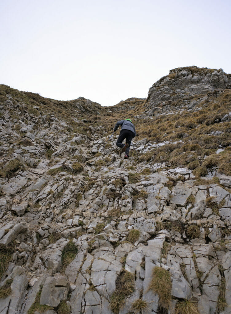
When Benoit and Olivier went up, a family with young children was climbing. Afterwards, it is important to specify that the parents knew what they were doing and had the necessary equipment to secure the children for the descent (harness + rope). For adults, no harness is useful nor required.
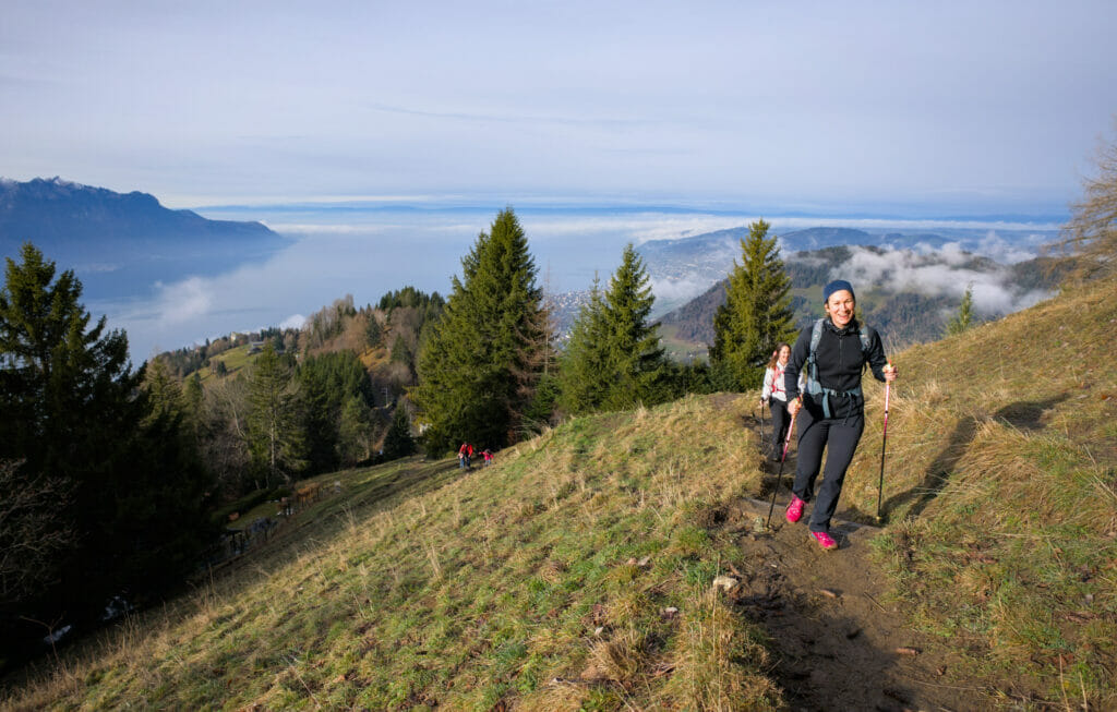
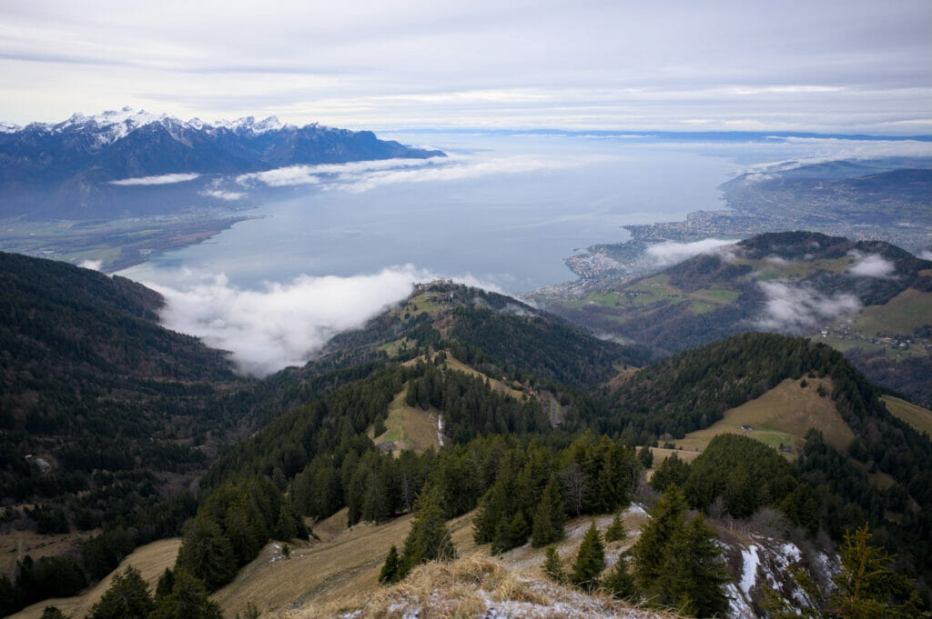
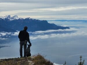
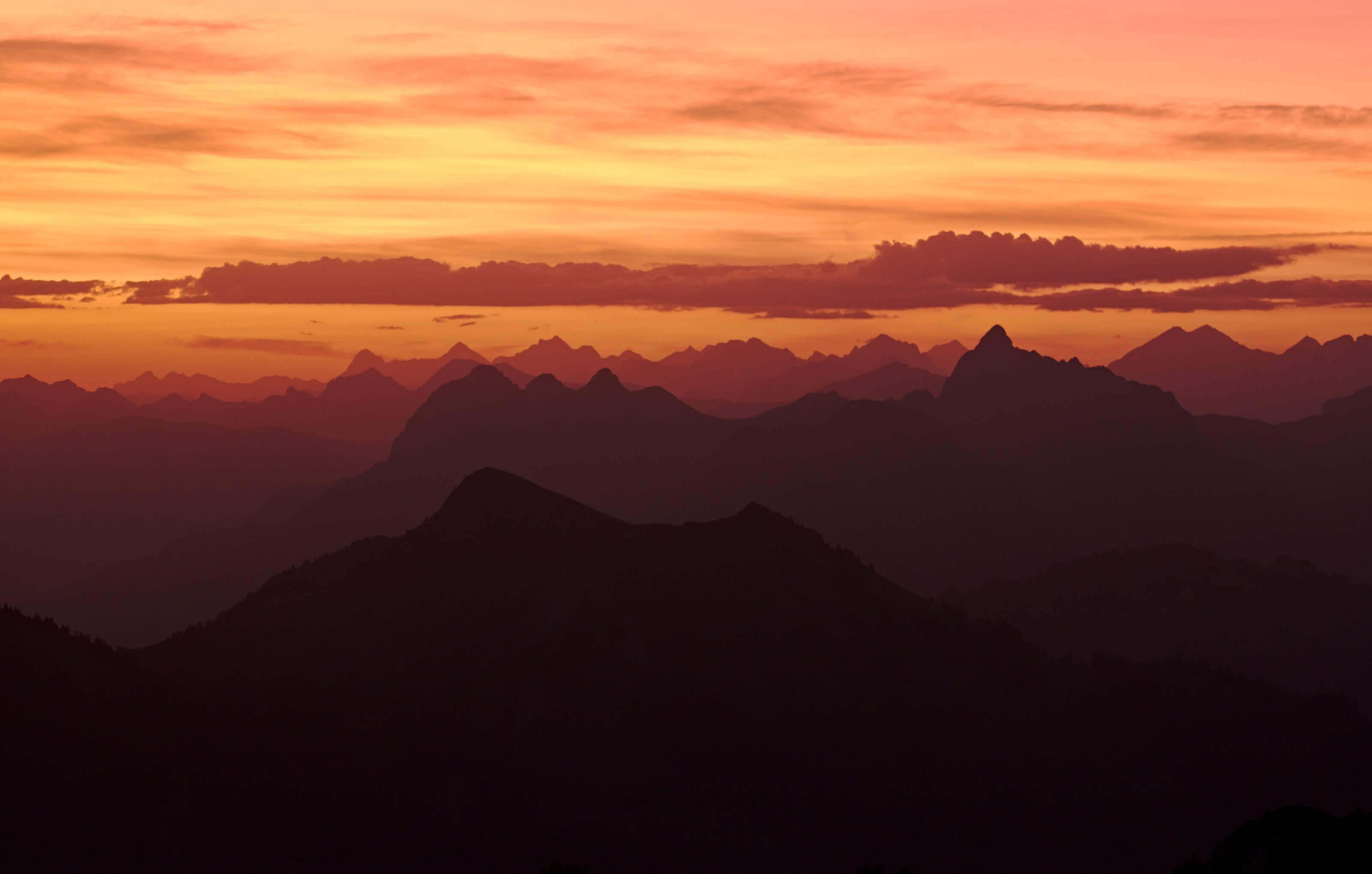
But then again, a climb also means a reward at the top! And there, the dent de Jaman does not disappoint: the panorama on the lake of Geneva and the Alps is simply exceptional! It’s not surprising that this spot is so appreciated at sunset… For sure, we will come back there in the summer (in order to enjoy the summit a bit more and not to freeze on the spot) 😉
Back down to the col de Jaman
After their climb, these gentlemen joined us at the bistro for a small coffee and we set off again. For the descent, we had traced a route based on the paths visible on Maps.Me, without paying particular attention to the markings. In short, we went up a little bit in the direction of the dent de Jaman and then we bypassed the summit by the right and started a steep descent on the other side. The snow was a bit of an issue and the path was quite slippery in places. Fortunately, we had our hiking poles and the path is equipped with cables/chains in some places.
I think that by dry weather this way is really not difficult, but with the snow, it was probably not the most clever decision of our day to want to pass by there. In short, we probably took a little longer than anticipated, but it is without too much concern that we reach the parking lot located at the pass of Jaman.
At the end of the article, I have put 2 other itineraries to come back to the col de Jaman from the buvette which are less exposed and probably more adapted if you are there on a day when the ground is wet/slippery.
From col de Jaman to Haut-de-Caux
For the return, the path goes down in a gentler way than on the way out. From the pass, we start to follow the track in the direction of the lake, then, at the first crossroads, we turn right onto a smaller path that takes us gently down through the forest in the direction of the Paccot station.
Arrived at the station, we cross the tracks and some meters further we join the first crossing that we had passed during the ascent. From this point, we follow the same itinerary as on the way up to the station of Crêt d’y Bau and then the station of Haut-de-Caux and the parking lot which is next to the restaurant le Coucou.
Infos and map of the hike to the dent de Jaman + Merdasson
- Start (and Finish) of the hike: Haut-de-Caux
- Distance : about 11km
- Elevation change : about 800m (+ and -=
- Difficulty : Average – difficult
- Difficult parts: the last part to reach the Dent de Jaman, the descent to the pass by the “direct” way (possible variants)
- Access: A parking lot is available in Haut-de-Caux and otherwise it is possible to come by train from Montreux.
Note : To go down from the Dent de Jaman there are 3 routes (the 3 are above). The one in the center, which we followed, is the steepest. The route on the right follows a trail and is therefore the easiest. In terms of distance, the 2 alternative routes are “longer” (about 700m-800m more) but the terrain makes them not longer in terms of walking time 😉
Itineraries From the Dent de Jaman to the Col de Jaman
There are 3 itineraries to reach the Dent de Jaman from the pass of the same name:
- Path by the Chalet des Chèvres, white red white markings (mountain hiking trail)(red)
- Itinerary by the Montagne-d’Amont, yellow markings (wide track, hiking trail)) (yellow)
- Direct route north of the Dent de Jaman, no Swiss trail markers. Path equipped with chains (blue)
Here is a schematic representation of the routes. For more details, we let you look at the map above and download the GPX/KML from Alltrails.
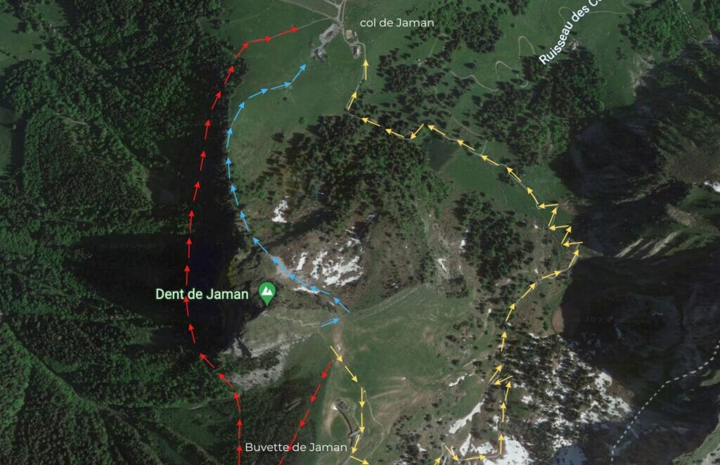
We’ll be honest with you, when planning our route we didn’t do much research… We based ourselves on the trails of Maps.Me and followed the path that seemed to us the most direct (the blue one). All good hikers and quite athletic, we didn’t think it was necessary to do more research. If you are not comfortable on the more exposed trails or if the terrain is wet, we recommend you to fall back on the 2 other “official” routes.
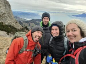
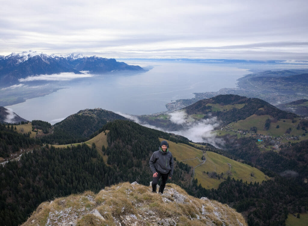
That’s it for today. We hope you enjoyed this little sporty escapade at the Dent de Jaman. We’ll see you soon for new hikes in French-speaking Switzerland. For the road, here is a little souvenir picture of our team of the day. For this walk we were accompanied by our friends Laurène and Olivier (if you don’t know Laurène, we advise you to go and discover her 2 blogs: carnets d’escapades as well as My Week-end in Alasace)
See you soon!
Pin it

Join the discussion