

Switzerland is known worldwide for its watches, banks and chocolate, but that’s not all! A very special feature of Switzerland is its mountainous landscapes and the very natural beauty of our regions. So we reassure you, we have running water and electricity (almost everywhere) and even wifi…
But sometimes for a short weekend it feels good to cut yourself off from all this! In short, when a friend of Benoit’s invited us to his cottage located at My’s Mayen, we immediately jumped at the opportunity.
At the end of the post, you’ll find all practical information to do the hike (including a map). But first, let’s talk a little more about the Mayen.
The Mayen
The word mayen was used in Swiss jargon to define a mountain chalet in which the herds stayed in spring and autumn. Some Mayan owners have since decided to restore these barns and make them a quiet place to live in the mountains.
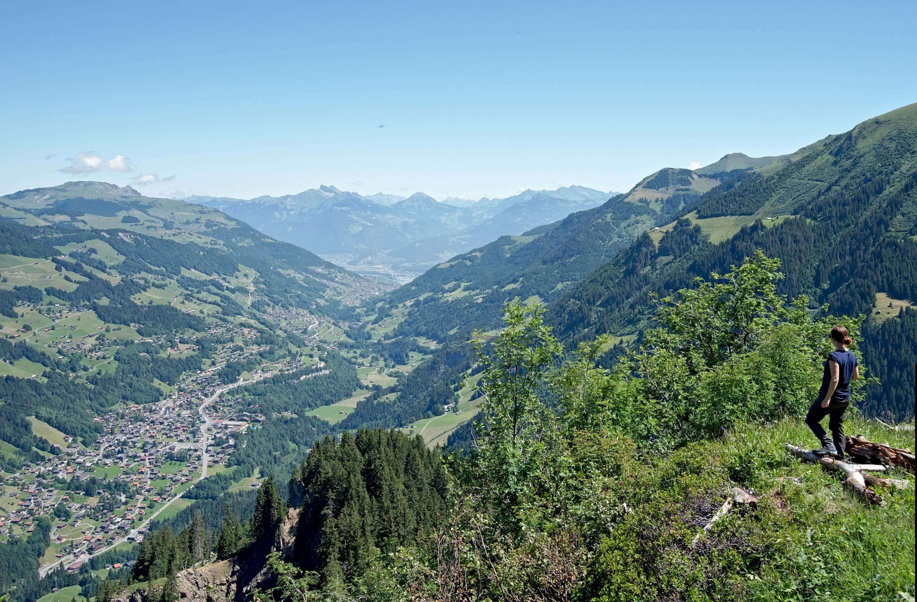
Generally the mayens are not connected to electricity (although this is happening more and more) but the one where we were was still powered by solar energy. After two years spent in Vienna breathing pollution and zigzagging between cars and buses, we can tell you that this short stay in the mountains was a real breath of fresh air that we had been dreaming of for some time…

In short, these two days spent at Mayen de My were simply punctuated by grill parties, walks and short hikes! What could be better? 😉
The Sanetsch Pass
 The second day we took the car from My Mayen to go up to Sanetsch Pass. This pass is also called the Sénin pass in French. The goal is to go for a short hike. However, our friend had warned us that the snow was still very much present, so we set off with hiking poles and walking shoes.
For the minute general culture for those who do not have the vocabulary of the mountain in them (I admit I did not have it either eh);) “Nevé” is the term that refers to the accumulation of snow that lasts during the summer without falling into the category of eternal snow…
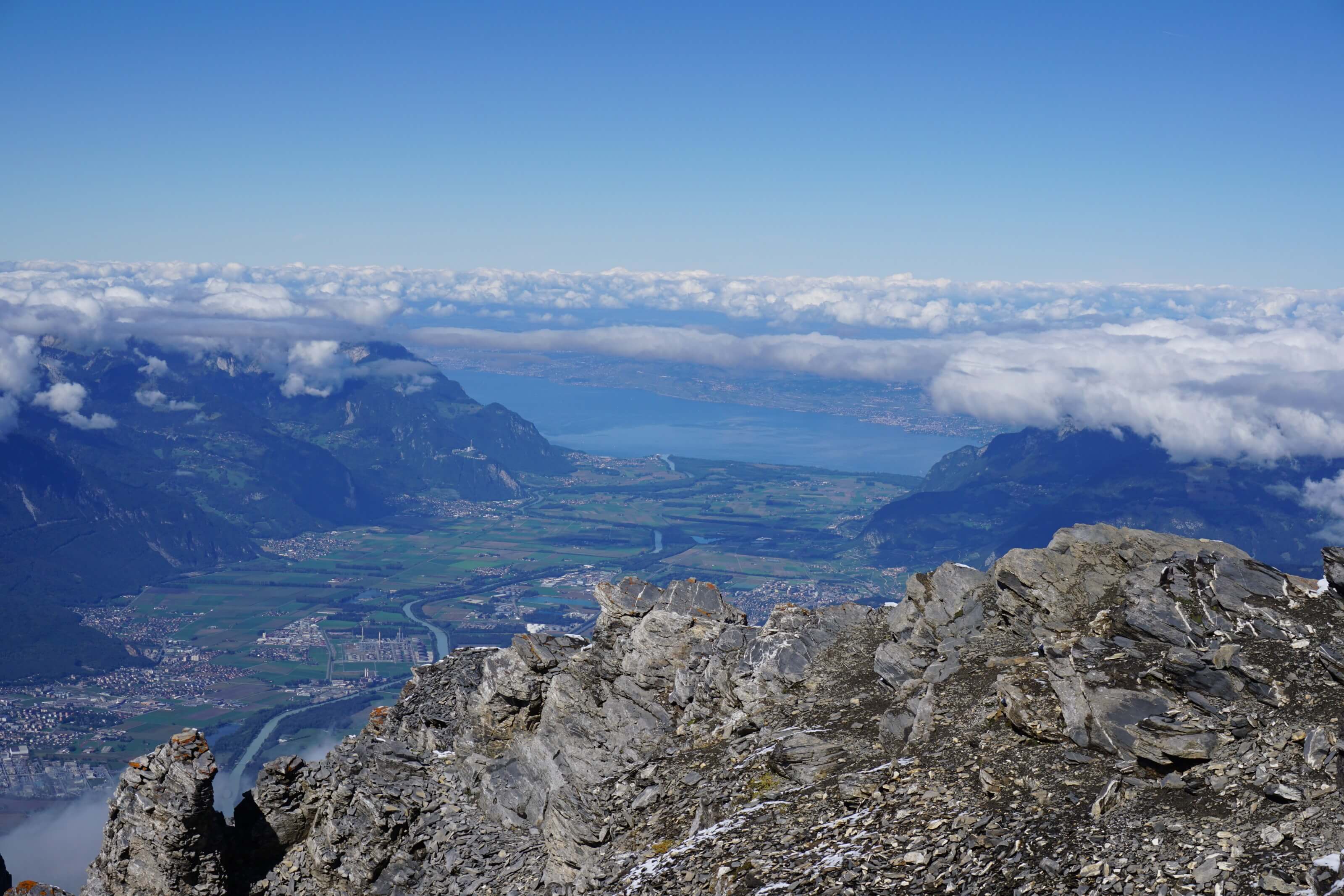
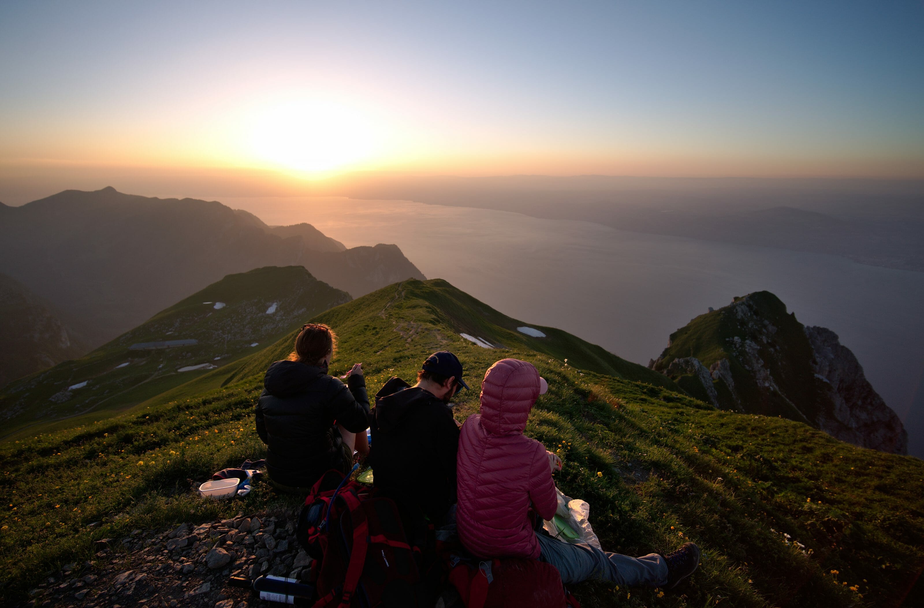
From the Sanetsch pass you can continue a short distance along the road to reach the Sanetsch dam. Moreover, the road is in fact a dead end; it arrives from the Rhone Valley in Valais and ends at the Sanetsch dam. Once you can’t drive farther, you have to turn back. On the other hand, no matter how far you are in Valais, you will have a bird’s eye view of the canton of Berne.

Valais weather forecast
Do you notice the change in the weather? The Valaisans would probably tell you: “It’s because the weather in Valeeeuuuuh is always good, the Bernese people are the unlucky ones!”
It’s very pretty but the Sanetsch pass is not only the place where Valaisans can show off with their weather! No, no, no! The Sanetsch Pass is also a linguistic border! So beware, if you take the cable car down into the valley you may well find yourself confronted with a magnificent ultra melodious language (or not) I named the Swiss German!
The Sanetsch pass is also located on water divide line. This means that the rains that fall in this region, but also the melting snow ,is just as likely to end up in the Mediterranean via the Rhone (on the Valais side) as in the North Sea via the Rhine (on the Bern side)…
Well it’s nice but it’s time to get serious: Hiking!
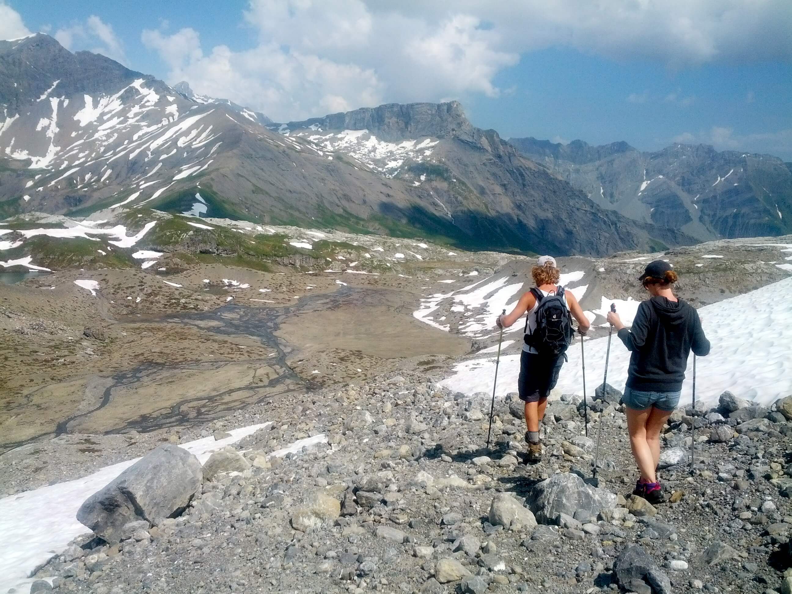
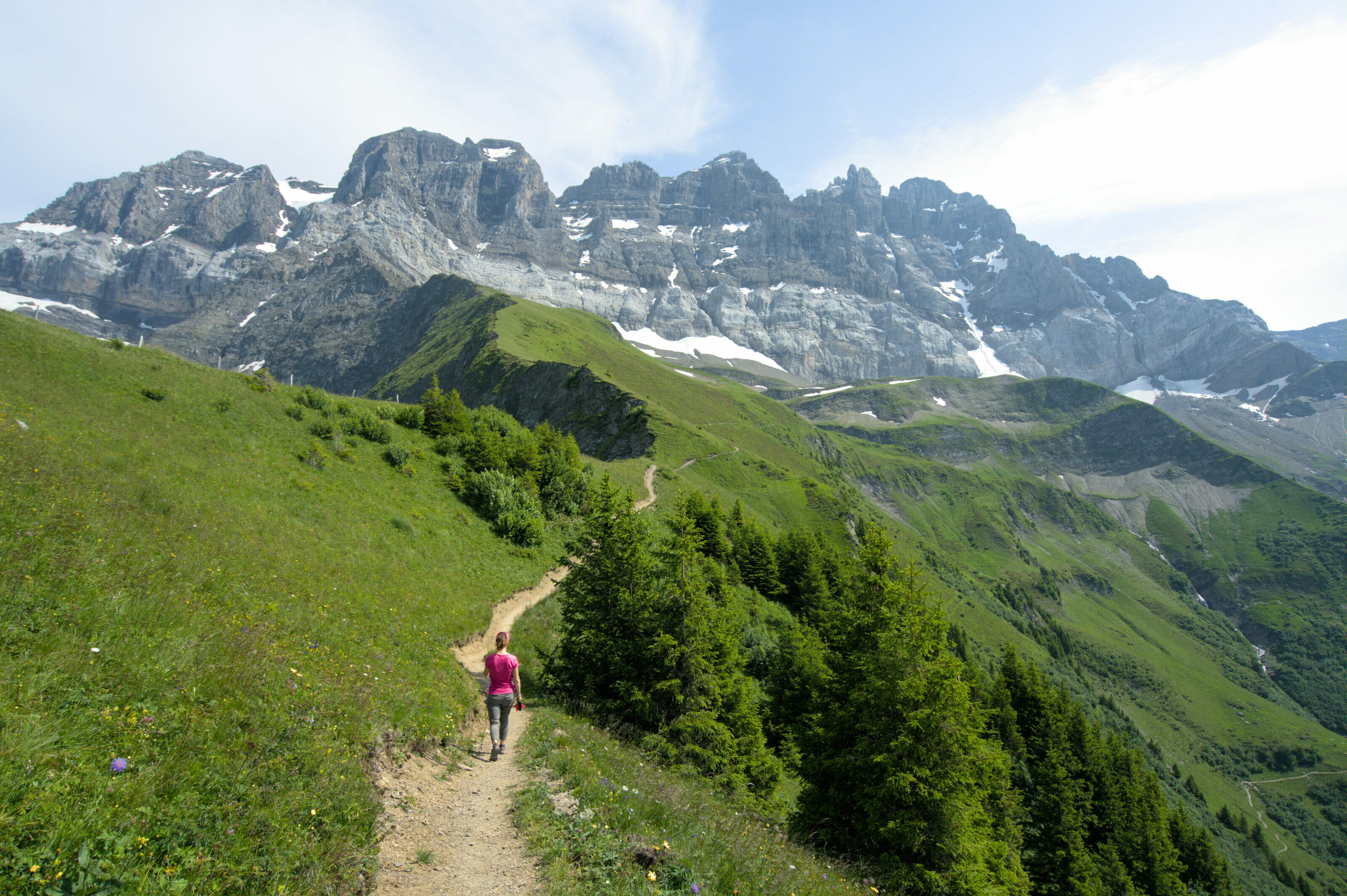
Hike: Santesch pass – Prarochet Hut
 Once you reach the top of the Sanetsch pass there is a small car park to accommodate your car. As you can see on the day we were there, there wasn’t much of a crowd, and I want to tell you that it’s much better this way!
From the car park, the walk begins quietly in pastures lulled by the whistling of marmots! Besides, there are a lot of marmots in the area, so don’t hesitate to stop for a few minutes in silence to have a chance to see them comnig out of their holes!
After about half an hour of walking you will start to see the Tsanfleuron glacier in front of you. As for finding your way around, the path to the hut is indicated by small grey and red posts that are planted about every 200-300 metres. All you have to do is aim at about one of these posts to be accurate…. But at the same time, during this walk the risk of getting lost is relatively low I assure you…
Getting to the Prarochet hut

We quickly see the hut in the distance which helps to orientate us! As we move forward, the landscape changes, we feel that we are approaching the glacier. The pastures give way to snow and rock, and many small translucent blue “lakes” formed by melting snow can be seen.
These small lakes are absolutely beautiful! We would only want to go for a swim because the water is so clear… So then we think about it for two seconds and remember that it’s the water of a glacier, so we change our minds… but the idea is there I guarantee you!

The Proarochet hut
Walking quietly and enjoying the landscape it will take you about 2 hours to reach the goal of this short walk: the hut of Prarochet. The duration of the hike obviously depends a lot on the amount of snow left, because the advance is slower when you sink into the snow than on the rock…. But in any case this hike is perfectly adapted to beginners (the proof: I made it) and I would say that it is also largely feasible with children.

Prarochet’s hut is guarded from July to mid-September, and you can also spend the night there if you wish! In all there are 50 places at the cabin, and it is really an optimal starting point for the most sporty people who would like to go for a walk on the Tsanfleuron glacier or the Red Sex glacier.
For our part, the hut will have been only a small picnic stop at 2556m altitude! So it was after a good meal that we headed back to the parking lot. On the other hand, this time by taking another path than the ascent. The latter is also marked out and you just have to follow the small red pickets to find your car. This second path literally passes through the glacier bed, and the landscapes in front of us are almost lunar! Well, images speak louder than words, I think…

For cheese lovers
On the road to the Sanetsch Pass (about 10 minutes from the summit by car) there is a mountain pasture where excellent cheese is prepared. If you are travelling by car, don’t hesitate to stop and buy a piece! You can choose it directly from the cellar where the cheeses are prepared and matured! We had opted for Serac. It is a fresh cheese made from whey. Topped with a little salt and a piece of rye bread, it is the star of mountain aperitifs!
Infos
- Duration about 1h30 to 2h from the Sanetsch pass to the Prarochet hut depending on the amount of snow. Count a little less for the return.
- Ascent 340m
- Descent 340m
- Difficulty easy to medium depending on the amount of snow, but perfectly suitable for children too!
Hiking Map
Note : You can download our map! For this, you simply need to create a (free) account on AllTrails and you’ll be able to access all our maps in the app or directely download them to use them on your desired mobile app or smartwatch.
Get There
By car: Take the highway to Conthey, then follow the Sanetsch road (it is well indicated). Allow about 35 minutes from Conthey to the pass.
By public transports: By train to Sion then a Postbus takes you directly to the pass in about 1h50. Another alternative is to go to Gsteig (via Gsaadt) and take the cable car that climbs directly to Sanetsch.
price: free of charge (excluding public transport costs)
Well? Tempted by a short stroll between the Valais and the canton of Bern?

Join the discussion