Spring is here in Galicia! It’s a good thing because after the big Covid restrictions of January and February, we have more and more freedom in the northern part of Spain which allows us to enjoy the beautiful spring weather.
We left you last time after a 4 days road trip north of Pontevedra… We discovered the small island of Arousa and its ria, the peninsula of O Grove and some pretty nice spots inland. This time we change direction to go down a little more in the south between the rias of Vigo and Pontevedra with some cool hikes on the road map (us and hiking… maybe you start to know us 😉 ).
- What exactly are rias in Galicia?
- From Loira beach to Lapaman beach
- Hiking around the Udra Cape
- Coto Redondo Mirador
- Paralaia cross and Mirador de Chans
- Hiking to Cabo Home
- Salinas de Ullo and the old abandoned salt factory
- The Redondela miradors (and another best bench of the world)
- Useful Infos to prepare a Road Trip in Galicia
What exactly are rias in Galicia?
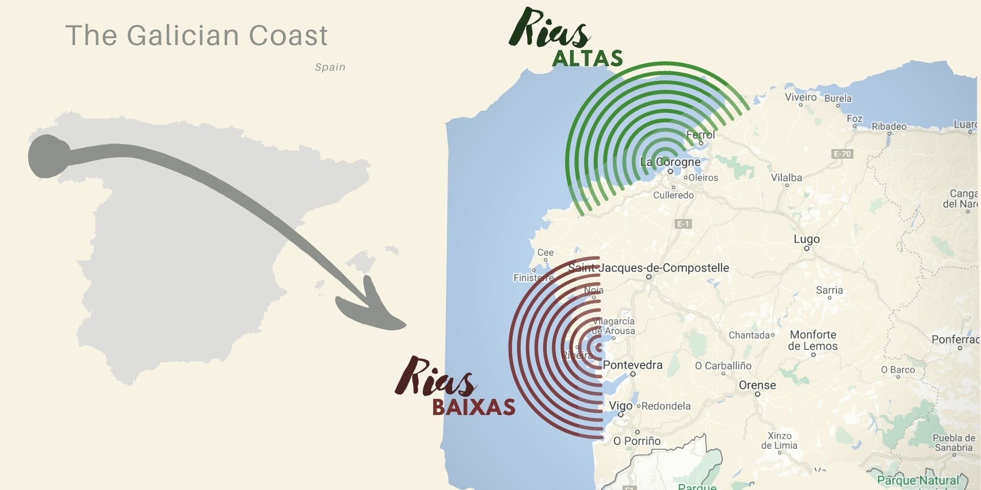
If you look at Galicia on a map, you will certainly notice that the Galician coast is very irregular. If you look closely, these sort of large estuaries (which are in fact ancient valleys with rivers that have been flooded by the sea) are called rias. The origin of this word comes from “rio” in Spanish which means river (for flooded rivers I guess).
In Galicia, we mainly talk about the rias baixas (lower rias in Gallego which includes the rias of Vigo, Pontevedra, Arousa and Muros-Noia) and the rias altas further north around the town of A Coruna (we actually wrote a blog post about the Rias Altas here if you are interested). In this article we will take you to the two southernmost rias of the Galician coast: Vigo and Pontevedra.
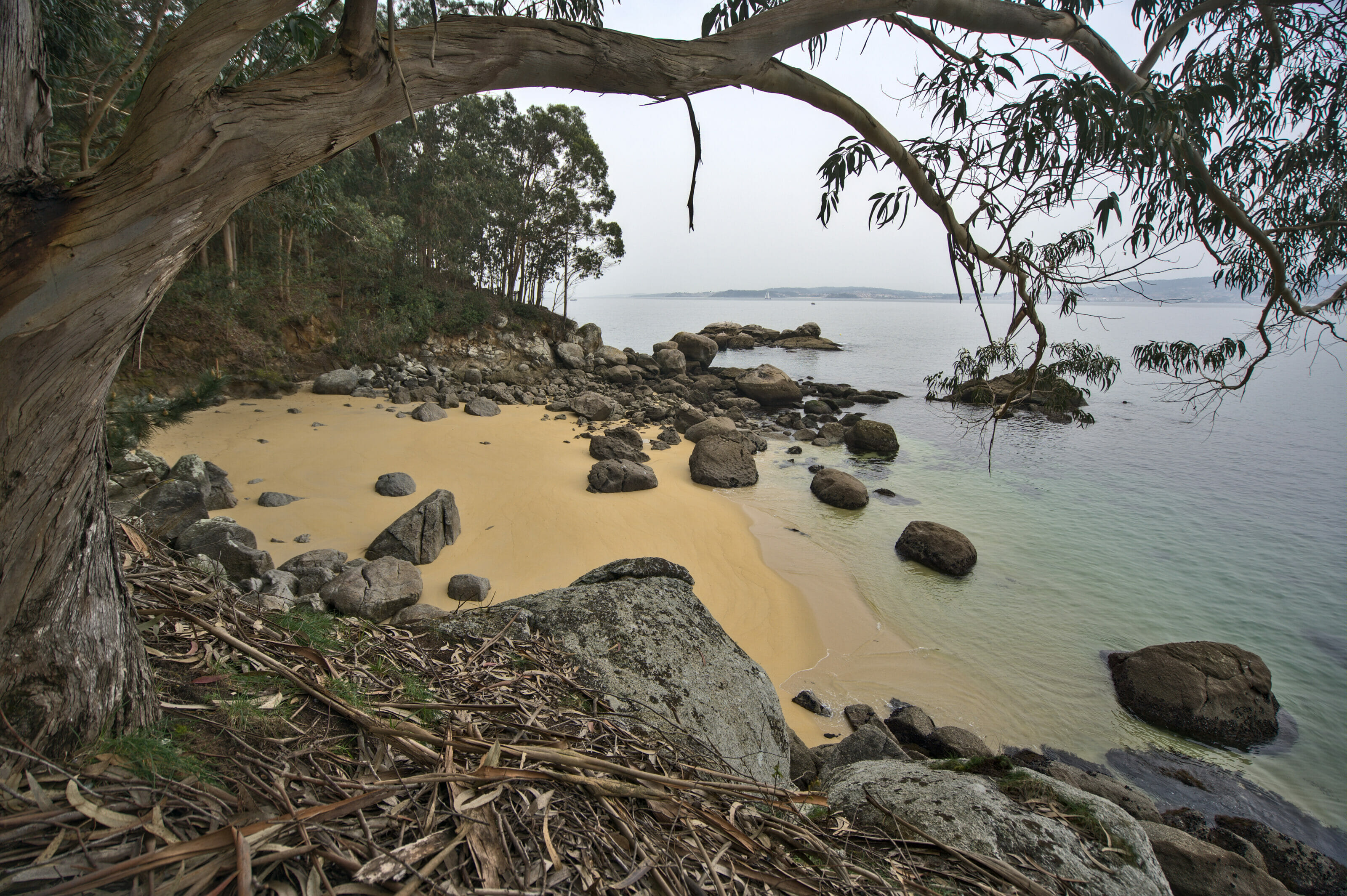
From Loira beach to Lapaman beach
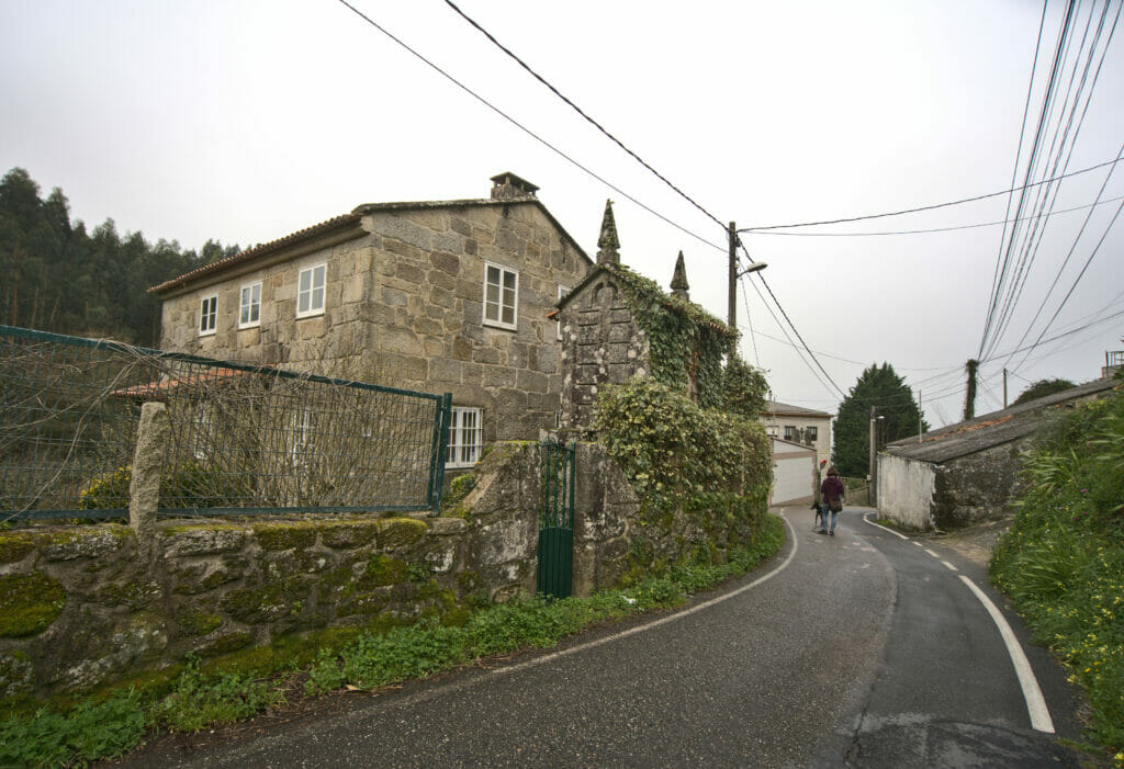
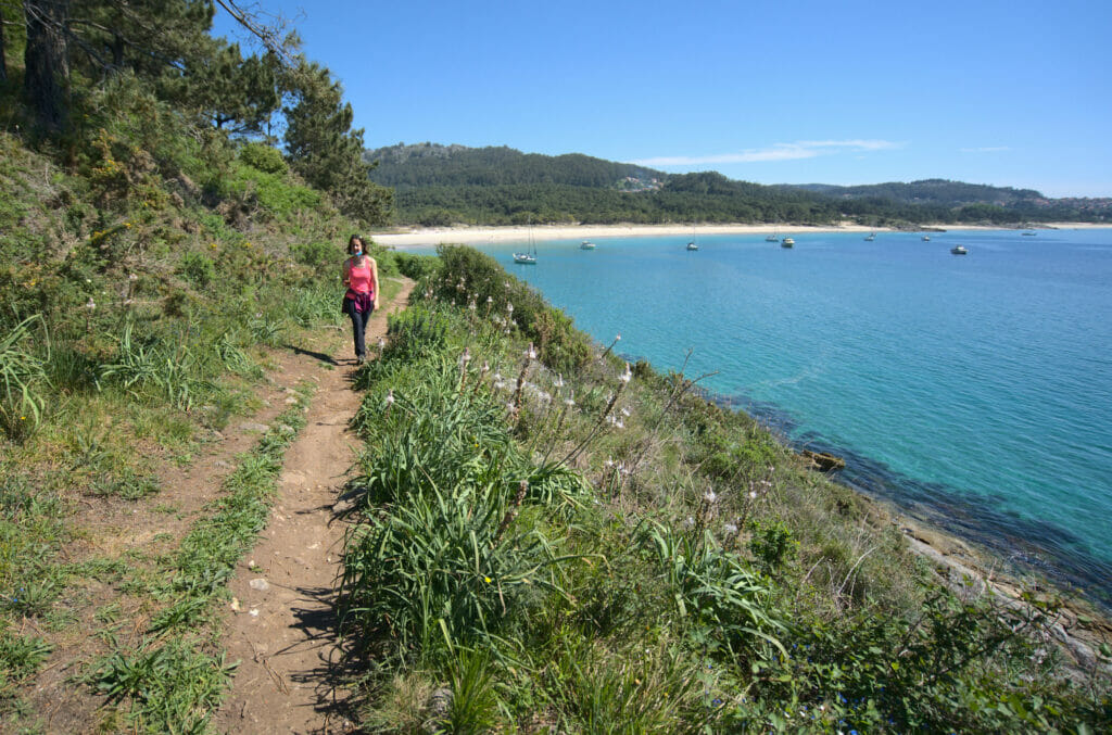
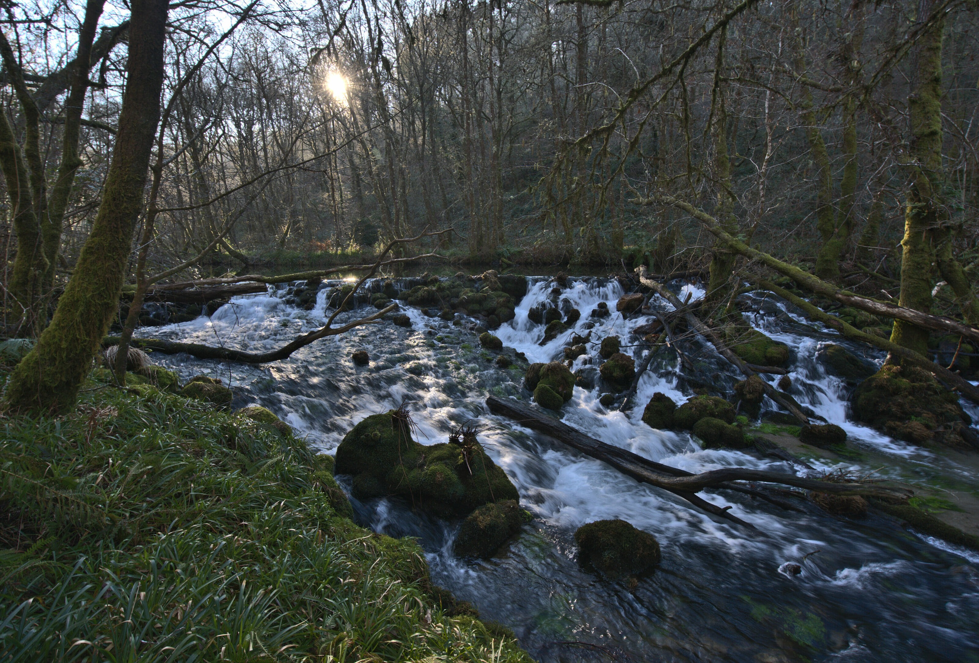
We begin our exploration of the region by a rather hazardous discovery 🙂 . We had planned to go along the Loira river to see all the old mills there (similar to this hike along the river Barragan). But as it happens sometimes in Galicia, the path was not at all maintained and it was simply impossible to hike…
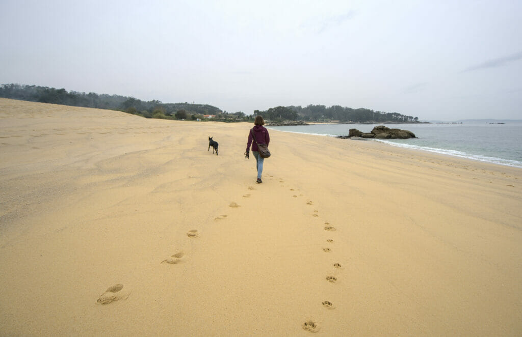
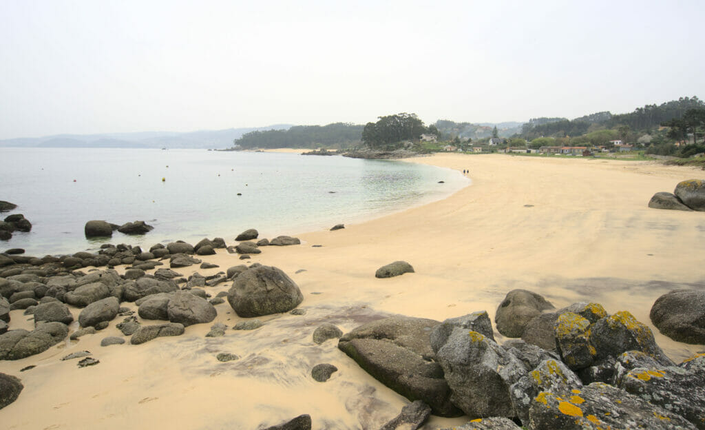
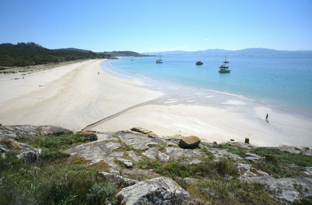
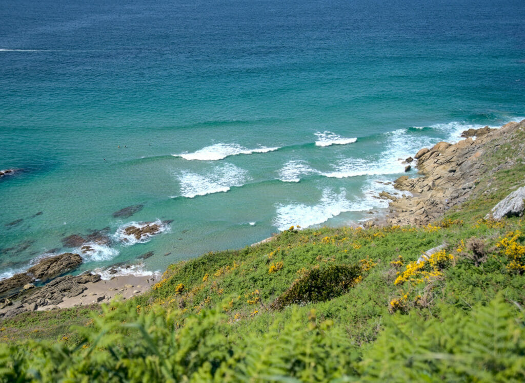
So we fall back on a walk along the coast between the beaches of Loira and Lapaman… And as you will see on the pictures, it was finally not so bad for a plan B 😉 . We began to walk along the beach of Loira with a great view on the village of Aguete… there was not so many people as that on the beach for a Saturday (cool to visit Galicia in March 😉 )
We then continued along the coast through the natural park of Sobareiro with some pretty views on the sea, the small town of Bueu and the Atlantic islands. After the park, we kept on going through small streets to go down to the beach of Lapaman where we took a little nap well deserved.
In short, if you want to go for a nice easy walk (7-8 kms round trip), to relax on the beach for a while and have a drink on the terrace of a Chiringuito, we can only recommend you this place. Here is the map of the hike for those who are interested:
Note for dog owners: We were told that during the low season, the beaches are not forbidden to dogs (unless it is clearly indicated for wildlife protection reasons). On the other hand, when there are more people on the beaches, it is better to choose the explicitly “dog friendly” beaches (and there are unfortunately not many in Galicia).
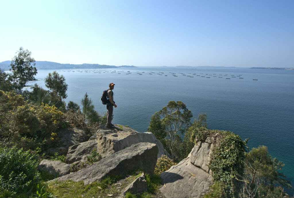
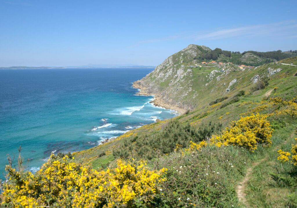
Hiking around the Udra Cape
We had initially planned to go to the cape of Home which apparently offers splendid views on the Cies islands… But unfortunately we had to give up because of the Covid restrictions which prevented us from going there (we planned to return there in the coming weeks, as we would like to go on the Cies islands 😉 ).
Update: Since the publication of this article the measures have eased a bit here in Galicia. We were finally able to go to Cabo Home and had a great hike! We have updated the article and you will find it a little further in the text. And in 2022 we finally had the chance to visit the Cies Islands.
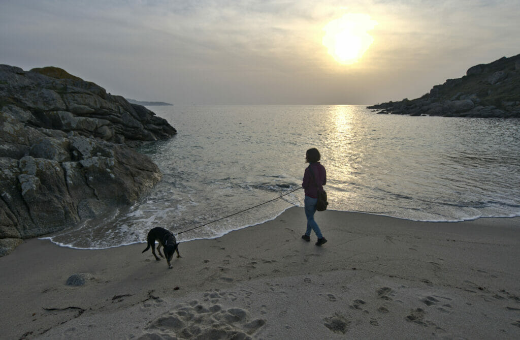
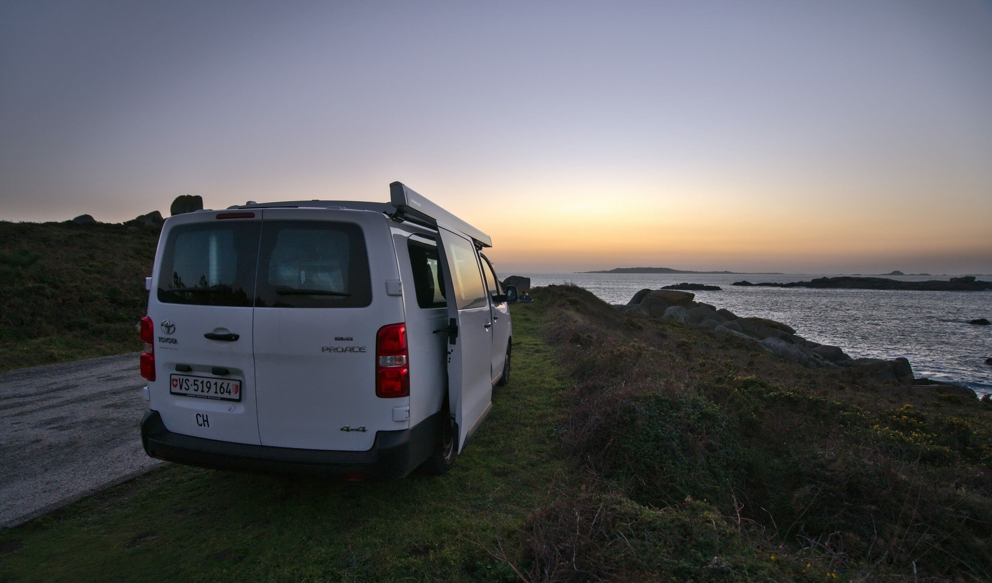
So we went to park our van rather in the Udra cape area which offers nice points of view on another of the Atlantic islands: the island of Ons. As usual since we have the van, we find a small spot not far from a beach to go for a walk with Winchy and to enjoy the sunset with a beer 😉
The next morning, the weather is not of the most sunny but we decide nevertheless to explore a little the area on foot. We had in particular spotted a pretty coastal path of 7-8 kms passing by several beaches which looked quite nice. We imagined a loop of 11 kms around this coastal path which kept us busy a good part of the day.
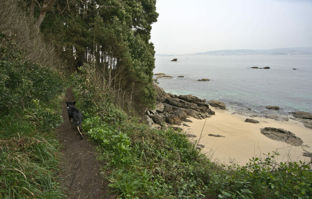

The most beautiful part of this hike is obviously the whole section that goes along the coast by the beaches passing by the Udra Cape. The section that goes inland in the middle is less exciting but has the merit of completing the loop as we say. Anyway, if you feel like walking along these beautiful beaches, here is the map of the hike we did (nothing difficult, count 3-4 hours of walking).
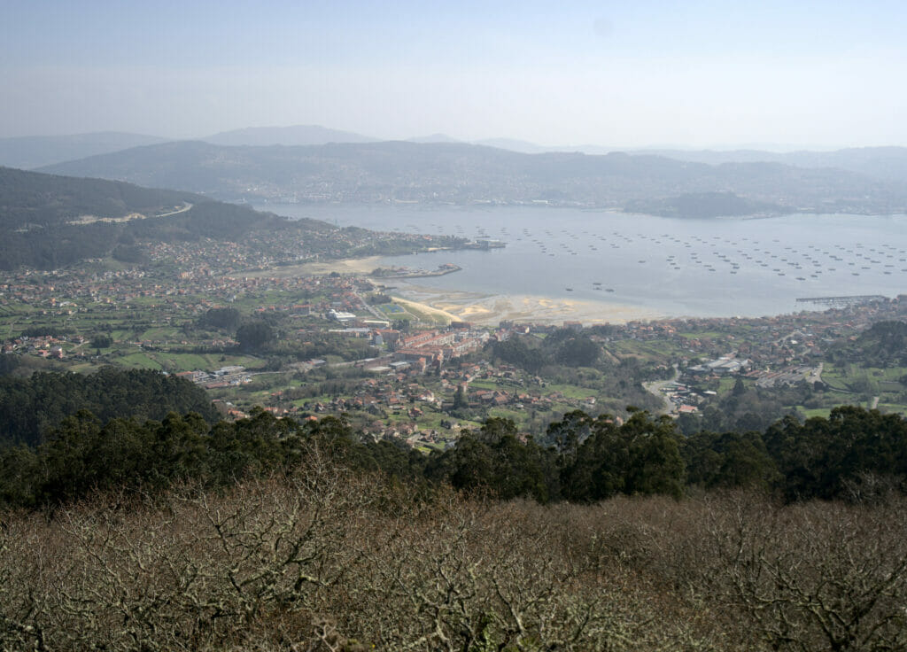
Coto Redondo Mirador
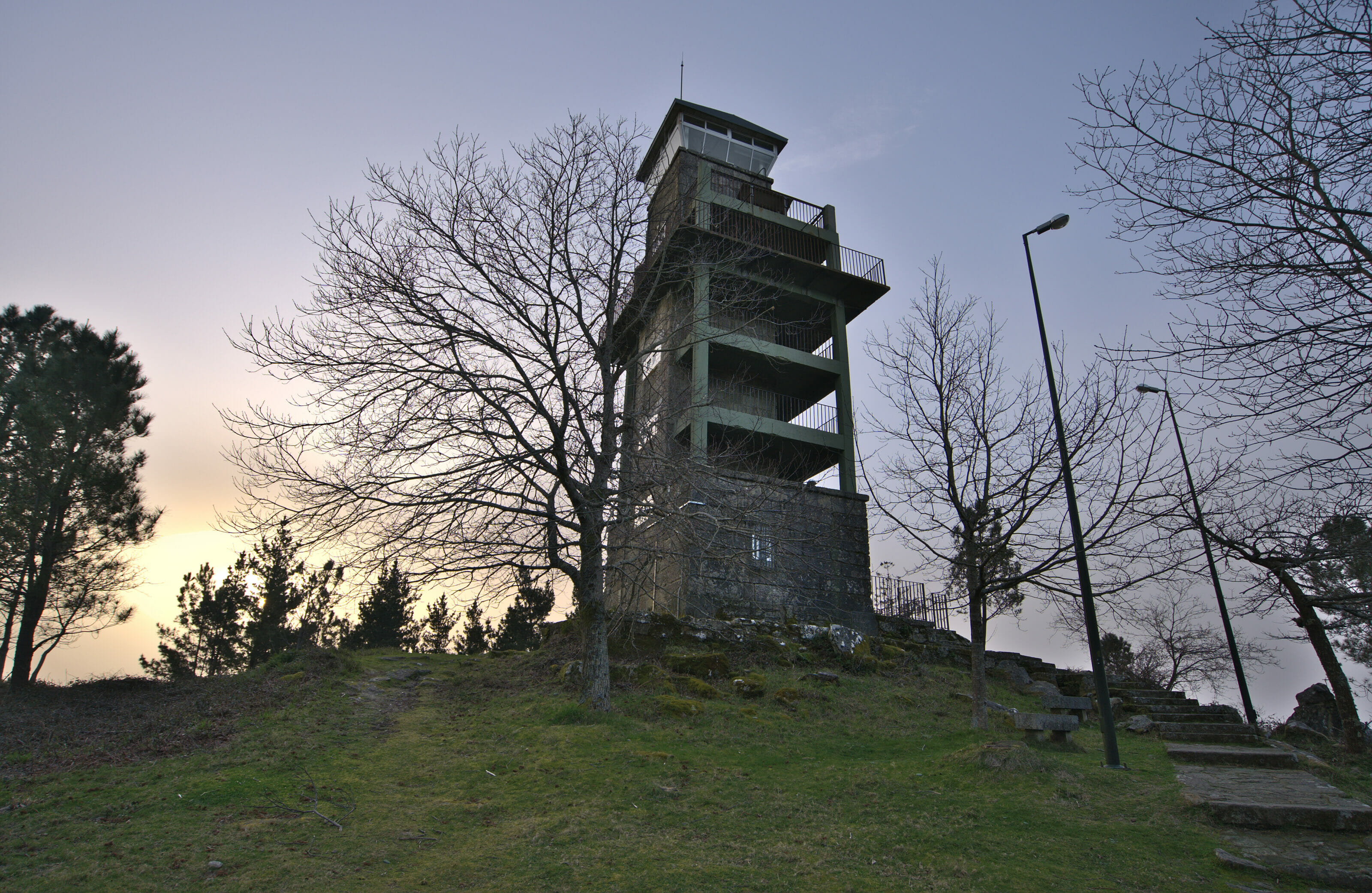
After this nice shot of beaches, we decide to go a bit higher for the rest of our road trip. As there are some small mounts which should offer beautiful points of view on the rias of Vigo and Pontevedra, we decide to try our chance first towards the mirador of Coto Redondo. We find a nice spot to park our van for the night not far from the mirador… so far so good.
We go to the mirador which is in fact a big tower of observation at the top of the mountain (well mountain mountain… 527m high 😉 ). But the problem is that the access to the inside of the tower is closed because of this damned Covid… We can easily imagine that from the top of this tower the views on the rias of Vigo and Pontevedra are beautiful. Unfortunately, you’ll have to check that yourself 😉
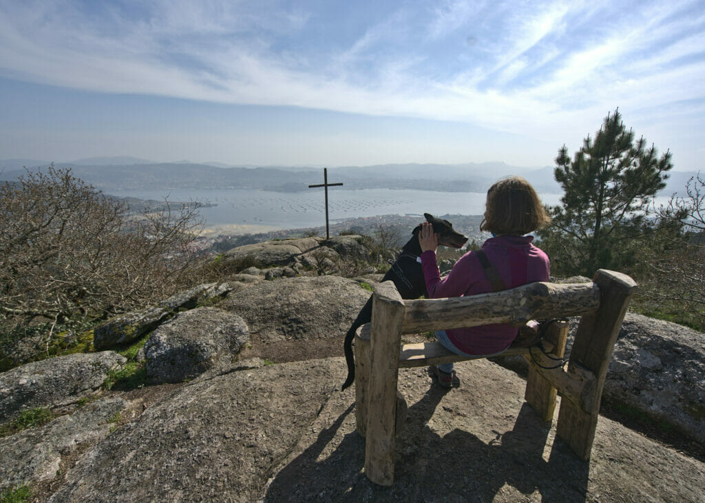
Paralaia cross and Mirador de Chans
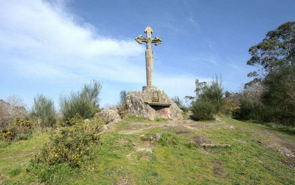
As we are not the kind of people to be discouraged so easily, we decide to try our luck again the next day to find nice viewpoints overlooking the ria of Vigo and Pontevedra. After some researches on wikiloc (the best website to find hikes in Galicia), we find a hike, although a little long, passing by 2 points of view which look pretty nice.
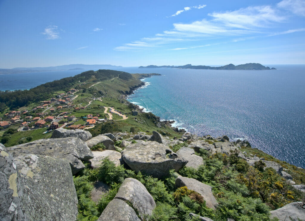
We thus leave in direction of the pretty small village of Ermelo from where the hike of the day begins… I just omit to say to Fabienne that the hike is actually 18kms oouuuppssss 😉 (well she is used to it don’t worry). From the village, we go up to the cross of Ermelo and then continue in a forest that is super pleasant to hike. After 4-5 kms of walk, we go up to reach the cross of Paralaia which offers a superb views on all the ria of Vigo. Even if the weather was a little cloudy the day of our walk, it is clearly one of the nicest point of view which we found during this trip and this place is clearly worth the detour.

We continue then to reach the mirador of Chans which is still 6-7 kms from there. Then honestly I found this part between the 2 miradors not necessarily the most exciting (mainly on tracks in forest). It is besides at this moment that Fabienne began to realize that the hike was rather long 😉 .
But the mirador of Chans is also a very nice viewpoint perfectly oriented for the sunset (view on Bueu with the island of Ons in the background). So what I would recommend is to make a shorter loop to the mirador of Paralaia (in the forest around Ermelo) and to come by car for the sunset at the mirador of Chans (there is a paved road that arrives at a few hundred meters away from the mirador).
But so that you can spot where the viewpoints and hiking trails are, I put the map of our hike below:
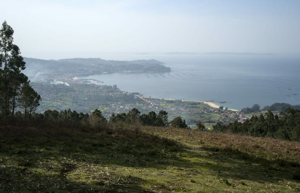
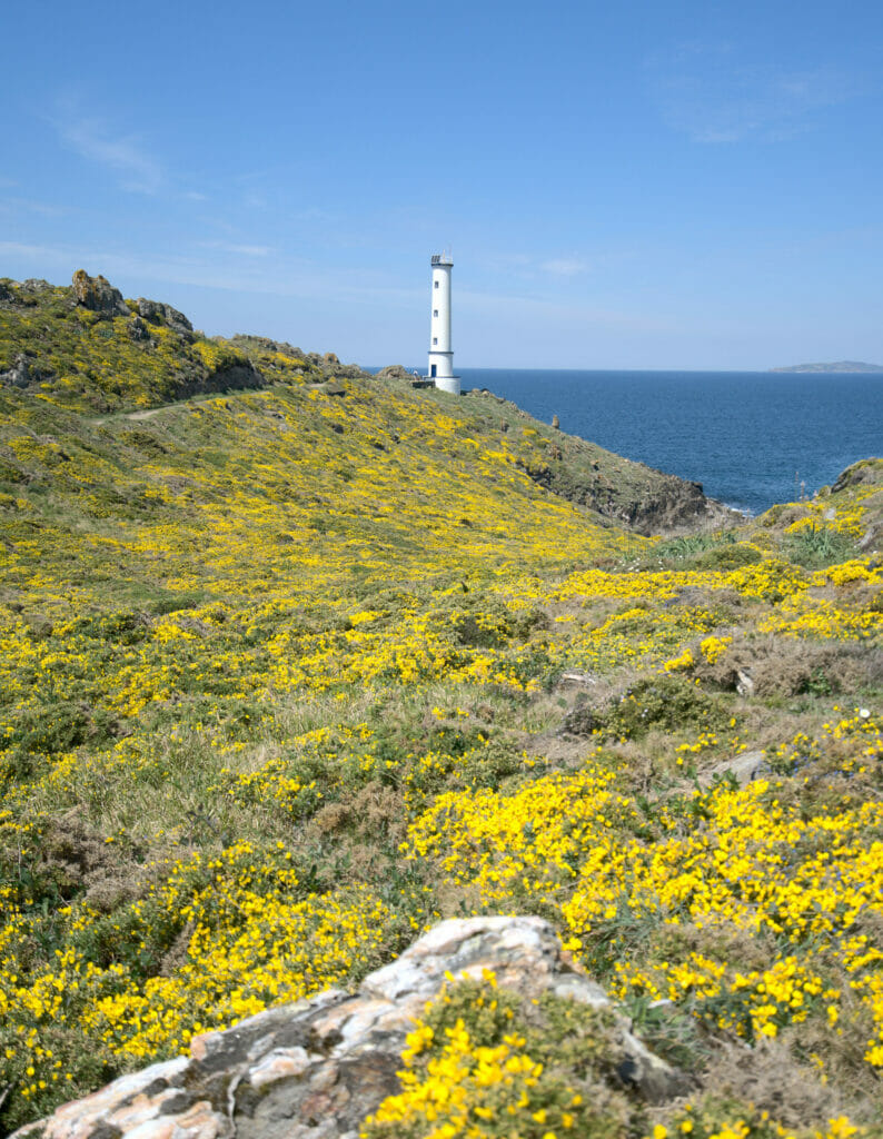
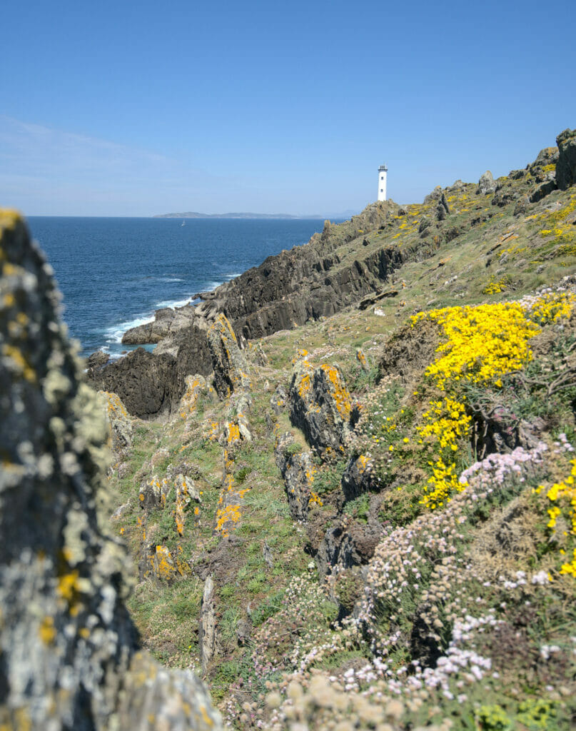
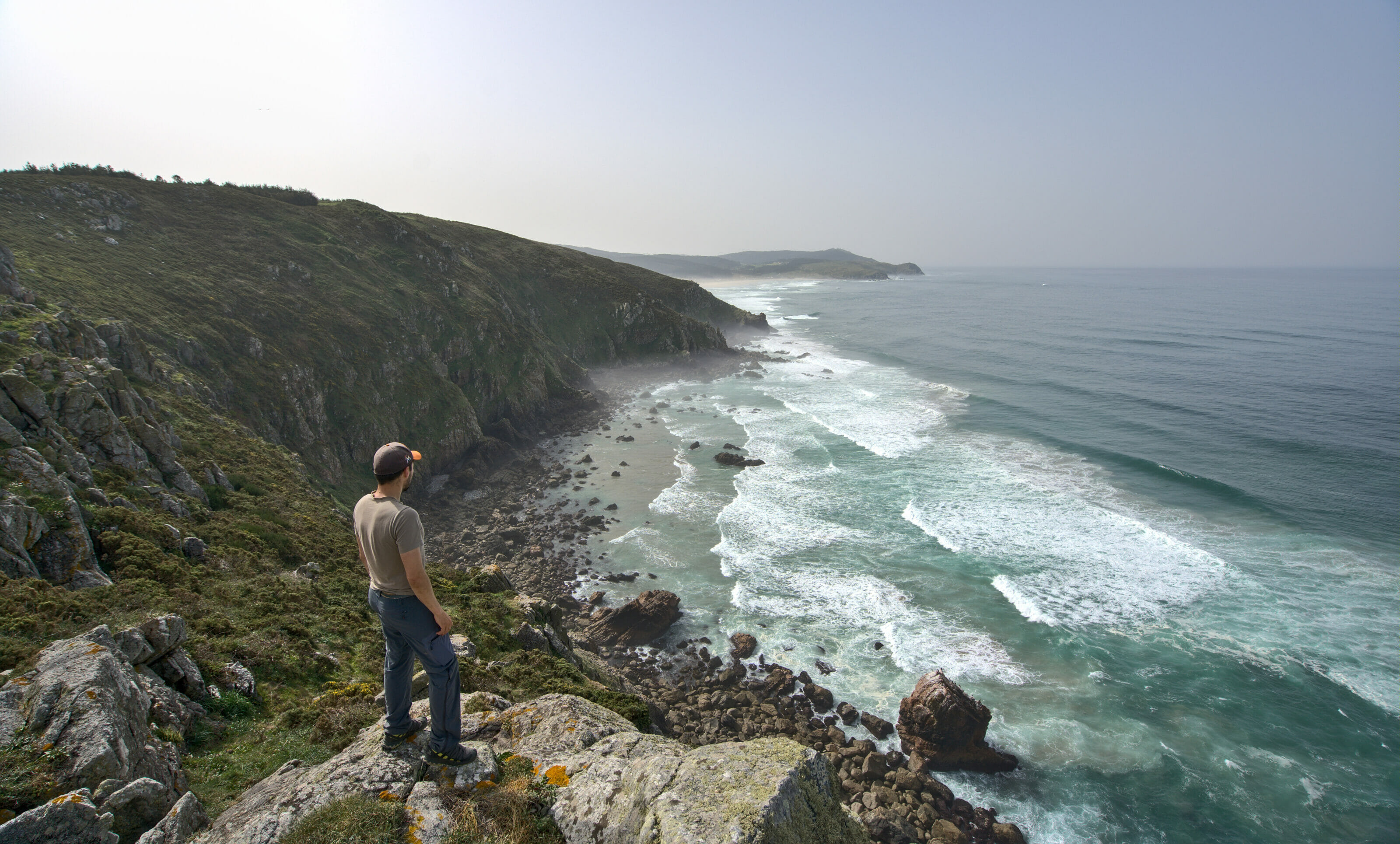
Hiking to Cabo Home
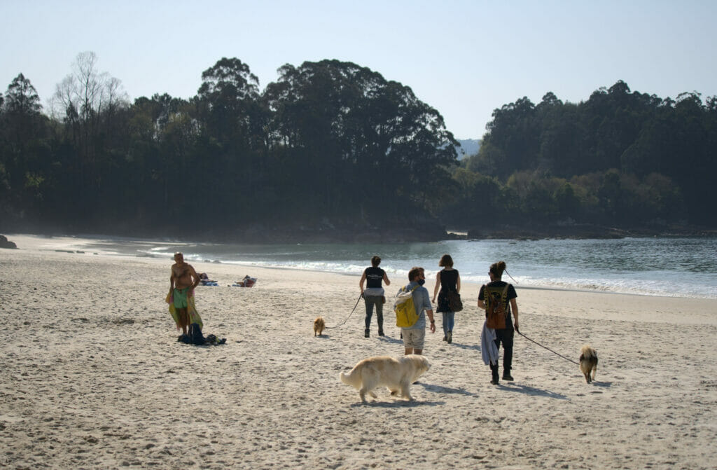
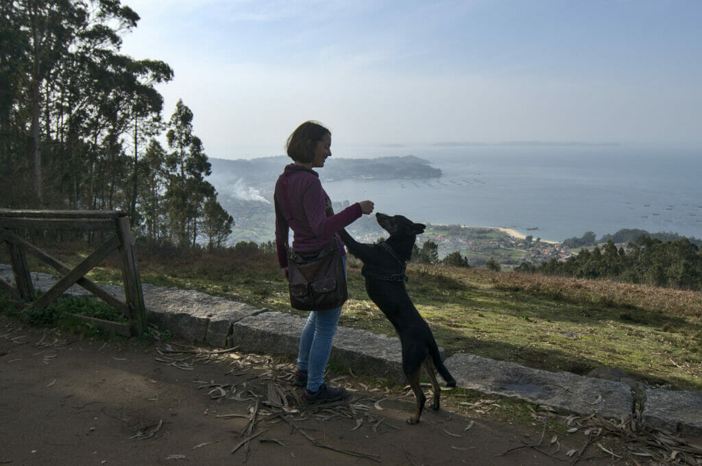
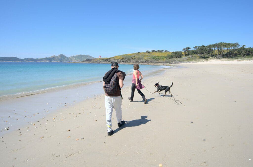
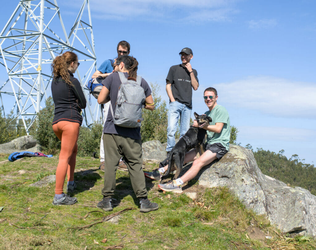
As mentioned above, the Cabo Home was unfortunately not accessible during our initial road trip (Covid restrictions). We were glad to be still in Galicia when the first relaxations came! 🙂 So we took advantage of a sunny Saturday to leave for Cabo Home with all our colivers from Anceu Coliving.
As usual we decided to go for a little hike to discover the area… I think that some of our friends were secretly hoping that we would just go to the beach but no way 😉 Well, I promise you, I don’t think anyone regretted following us that day.
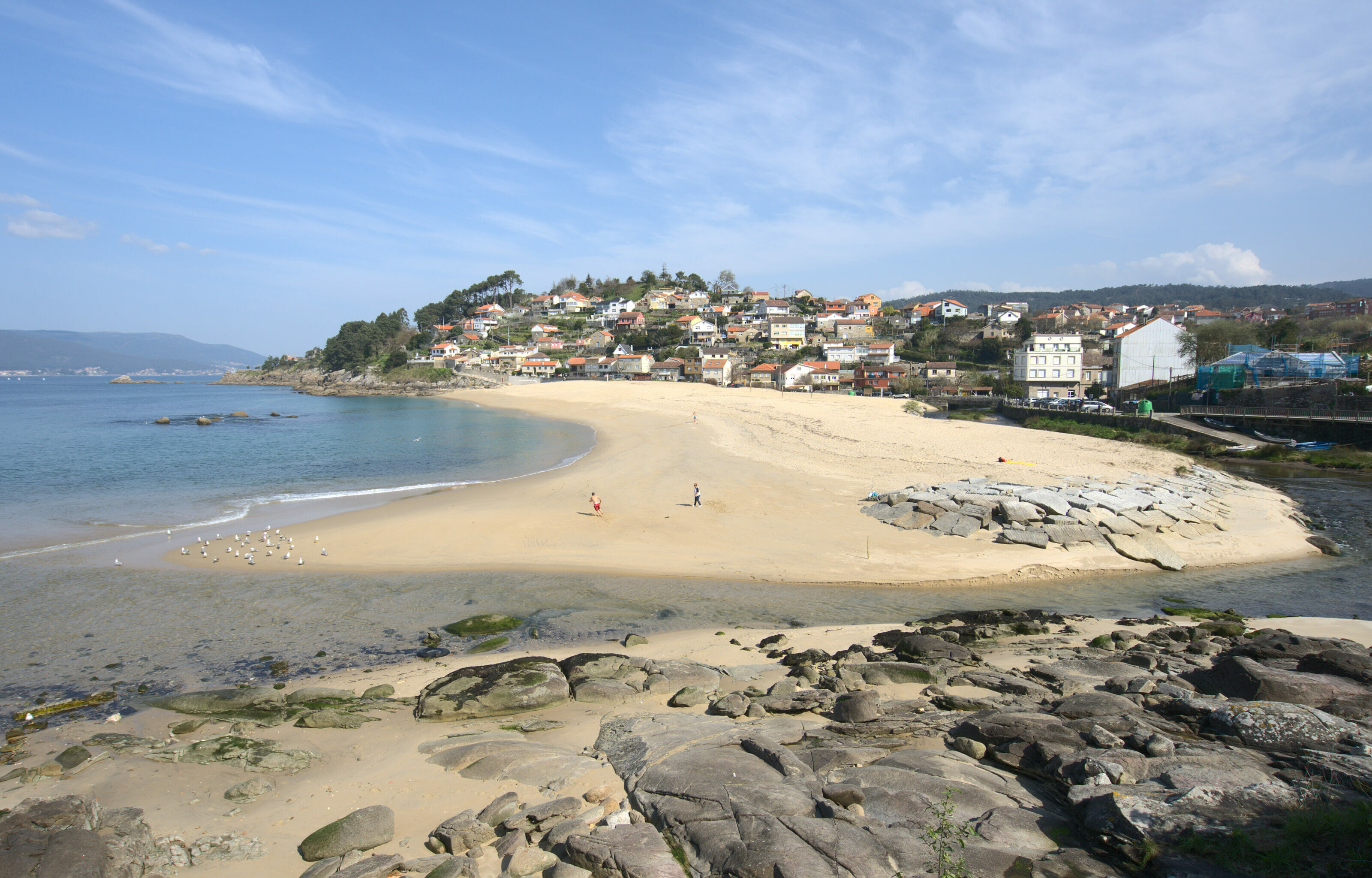
To begin the walk we parked at the small parking lot that overlooks the beach of Barra. From the beach we took the beautiful little path that runs along the sea towards the first lighthouse; the lighthouse of Punta Saborido.
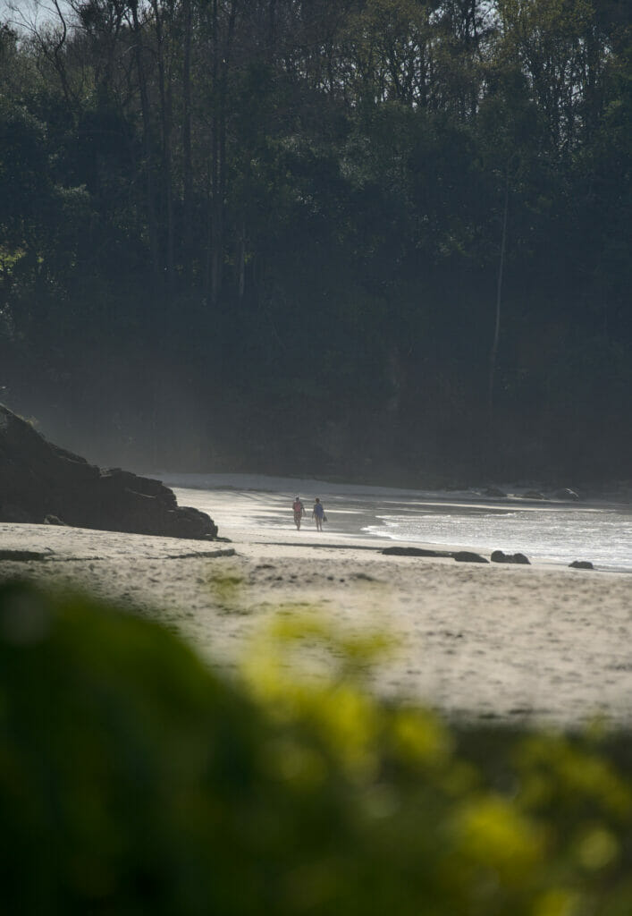
From the point, we then went back to arrive on the beautiful beach of Melide. In the summer, this beach is apparently quite popular, but in April, except for a few brave people who went in the water, we had the beach almost all to ourselves! (I might as well say that the dogs were quite happy)
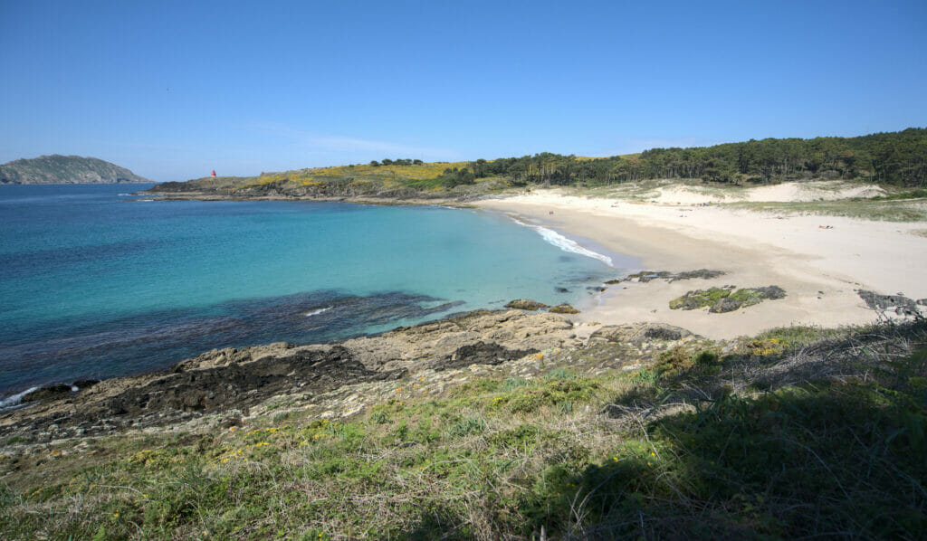
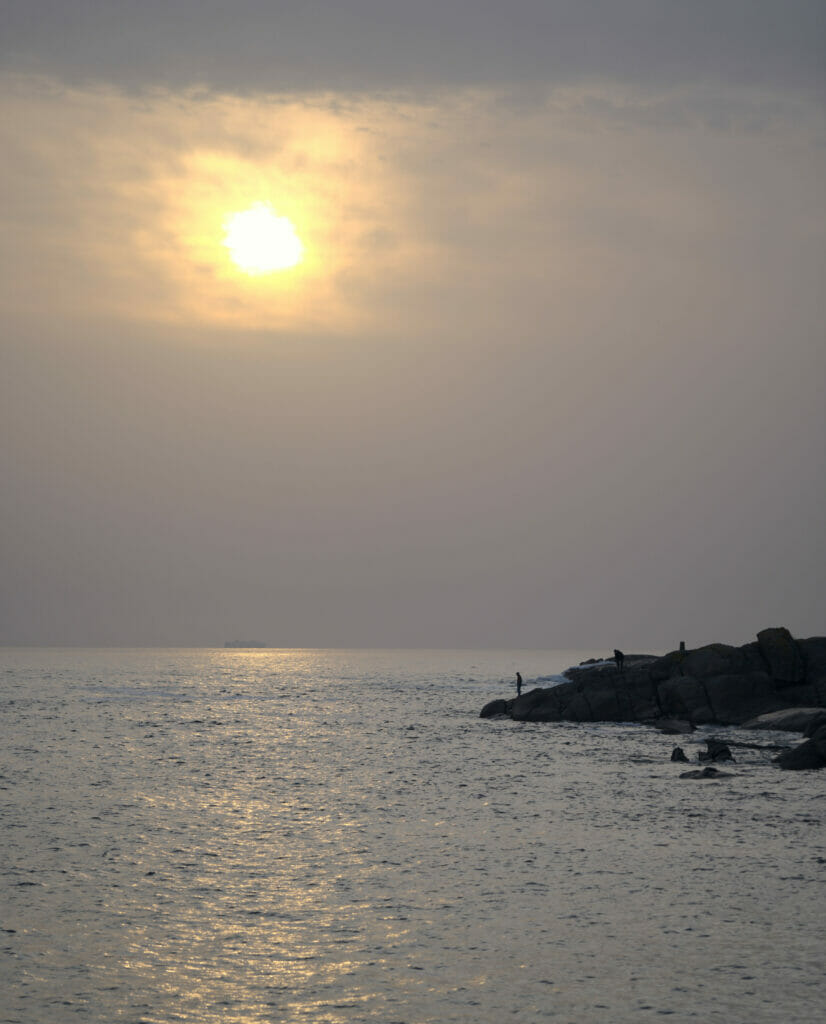
The next part of the walk took us to the lighthouse of Punta Robaleira and the one of Cabo Home… But I think that pictures speak more than words to describe this absolutely magical place!
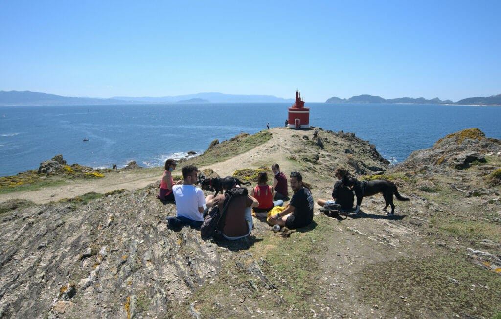
If you come to the area we strongly recommend you to make another small detour to Monte Facho before returning to the car. Some of our fellow hikers had already abandoned us at this point of the hike, but believe us: the view from the top is worth the detour!
All in all, our loop was something like 11km (with relatively little elevation gain except for the small climb to Monte Facho). It took us about 4h30 to do the tour, but let’s face it: we REALLY took our time to stroll around! The detailed map is below:
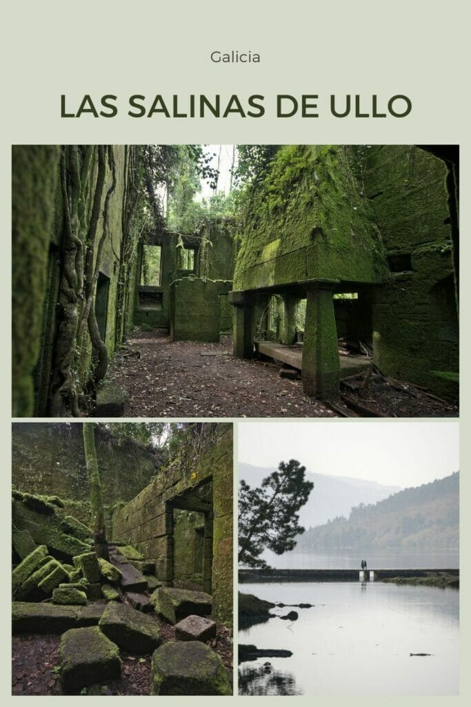
Salinas de Ullo and the old abandoned salt factory
Finally, on the way back to the coliving, we decide to make a small stop to the salt flats of Ullo which are at the end of the estuary of Vigo and which had been recommended to us by people of the Anceu coliving. These salt flats date from the 17th century and were very important because at the time the salt was necessary to preserve the food.
You will be able to observe a large basin which was used to collect the sea water and to carry out a 1st evaporation as well as a 2nd smaller one where the salt crystallized. Nowadays, these salt pans are rather a shelter for birds of all kinds and a very nice place to walk around.
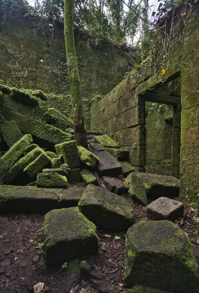
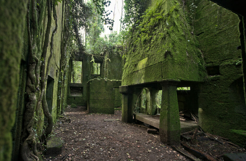
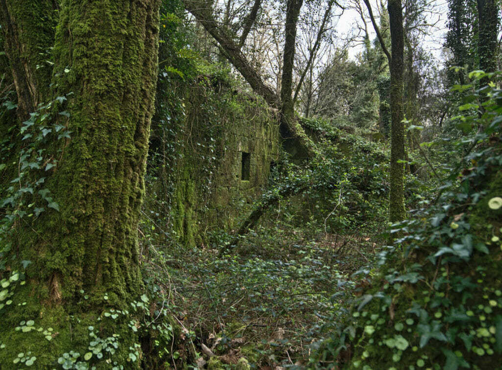
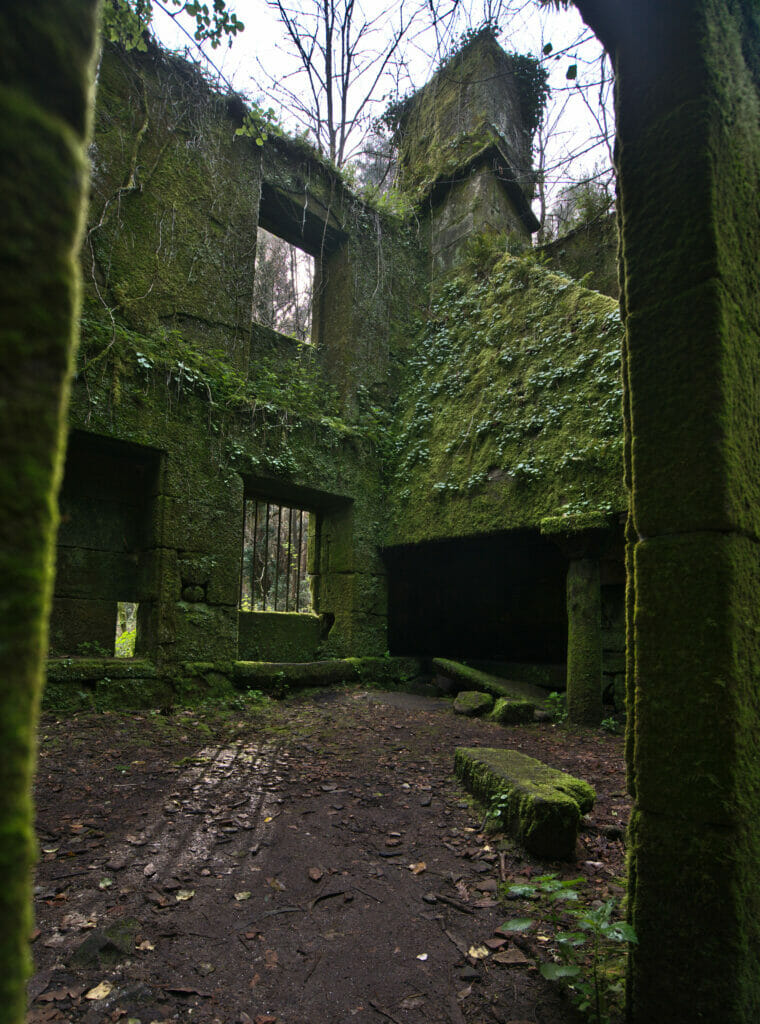
But the most unexpected discovery that has been made in Galicia so far is a few meters away, hidden in the forest. Here we find the ruins of a huge building dating from the 18-19th century, which was used at the time in the manufacture of salt. The building is completely abandoned… it has lost its roof and some walls have collapsed. However, in some rooms you can still see huge ovens and chimneys. And it’s also impressive to see how nature has taken over. The walls are completely covered with moss and trees have grown in the middle of the building… it really reminded us of the Angkor temples on a smaller scale.
So that you can find this place easily, I put a small point of interest on the map below.
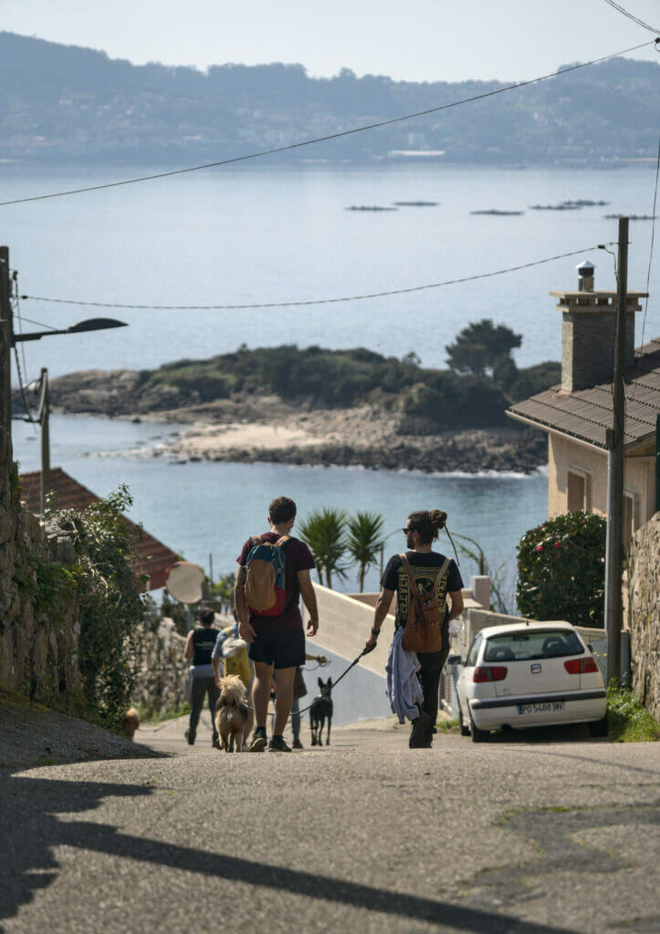
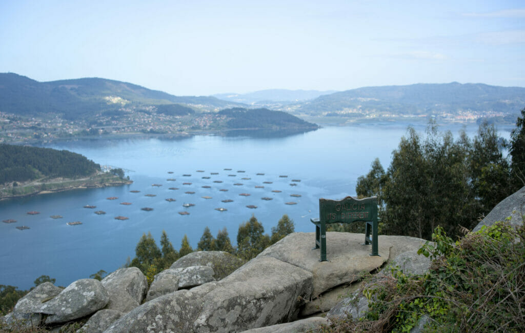
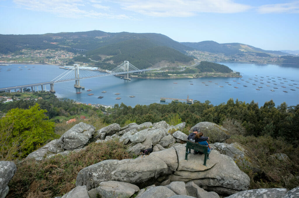
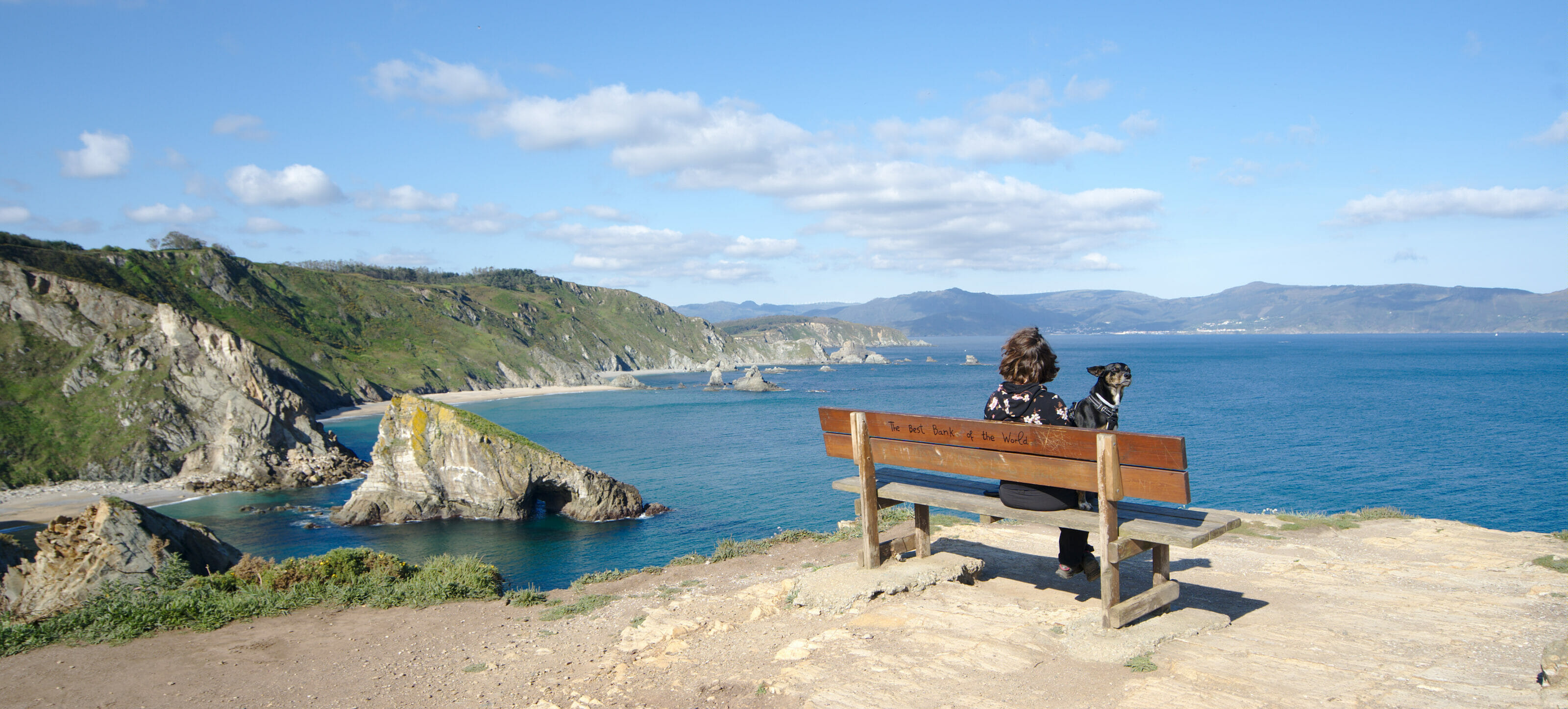
The Redondela miradors (and another best bench of the world)
During our last trip in Galicia in 2022 we did a new cool hike in the area above Redondela. A pretty loop which offers splendid views on the Ria of Vigo and on the Rande bridge which connects the cities of Vigo and Pontevedra. We also found there our 2nd “best bench of the world” in Galicia after the Loiba viewpoint in the Rias Altas. So we won’t go as far as saying that it is the best bench of the world but we must say that the view is rather nice… and by looking well, we can even see the Cies islands in the background.

Finally, here is the map of the hike:
Useful Infos to prepare a Road Trip in Galicia
Unfortunately, most of the places we describe in our blog posts about Galicia are not accessible by public transport. You will clearly need a vehicle if you want to fully enjoy your stay in Galicia. As always, to rent a car, we recommend the rentalcars comparison service that we use every time we need to rent a car
During our road trip we travelled with Dahu, our van that we presented here. If you are interested in trying Vanlife in Galicia, you should know that it is easy to rent one for a given period. On Yescapa you can find for example vans rented by private owners (with all the required insurances) from 60€ per day. Otherwise you can also check what a pro rental company like Campstar offers.
If you want to know more about Motorhome or Campervan rental, we also wrote a comprehensive guide about this topic below
To find an accommodation in the area, you can use the interactive map below which groups several booking platforms in one place for simplicity. We also recommend you to have a look on Booking
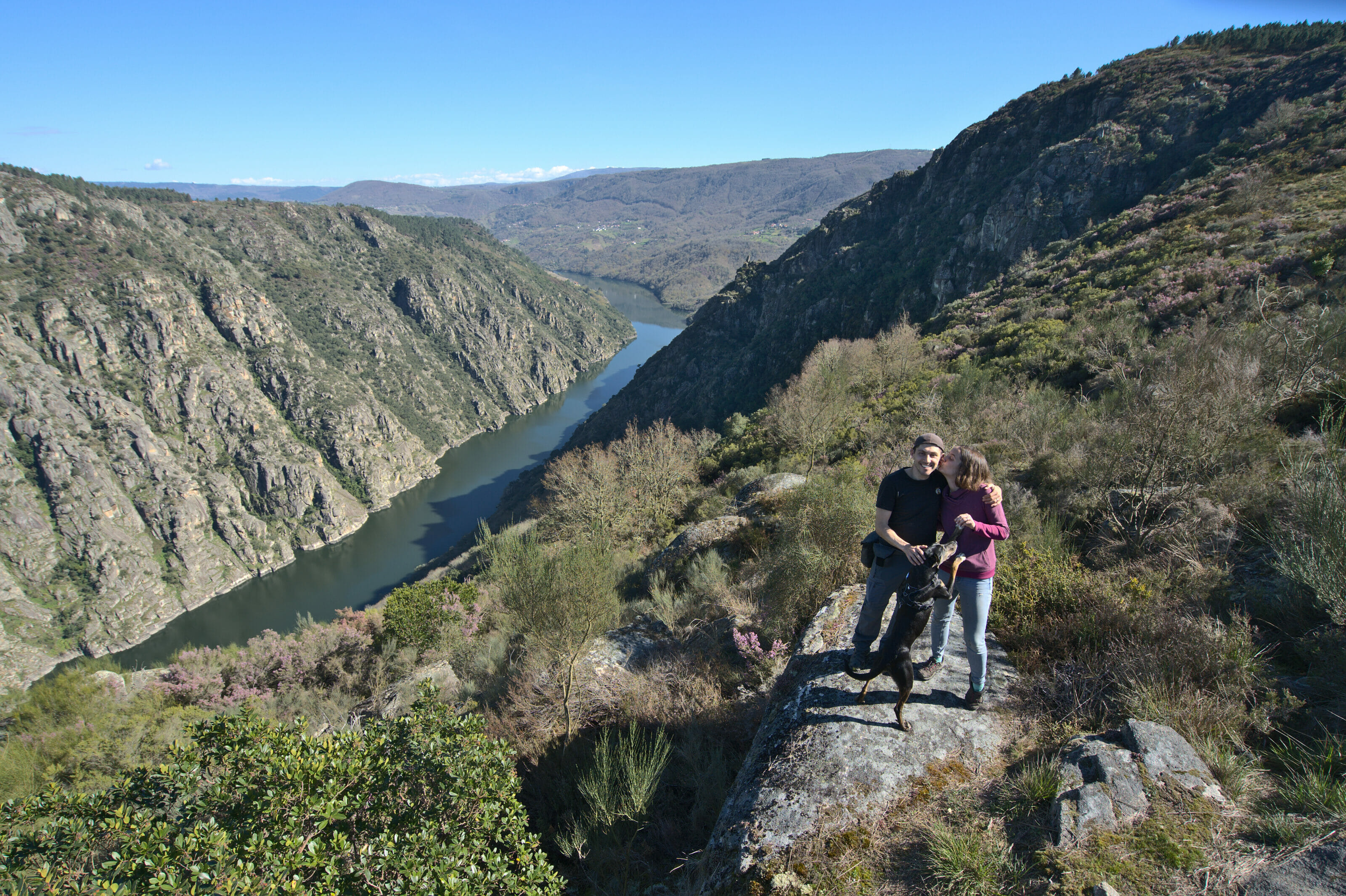
That’s it for this nice little trip between the rias of Vigo and Pontevedra. We are going to try to go back there to see the Home Cape that we could not discover this time… But Galicia is vaste and we still have many places to discover (places like Costa da Morte or Rias Altas). Moreover at the time of writing these lines, we just came back from a great road trip in the wine region of Ribeira Sacra which was really awesome.
Note: This article contains affiliate links to Rentalcars and Stay22. By booking your vehicle or accommodation through our link you do not pay anything extra but we will receive a small commission. Thank you for your support!
Pin it on Pinterest

Join the discussion