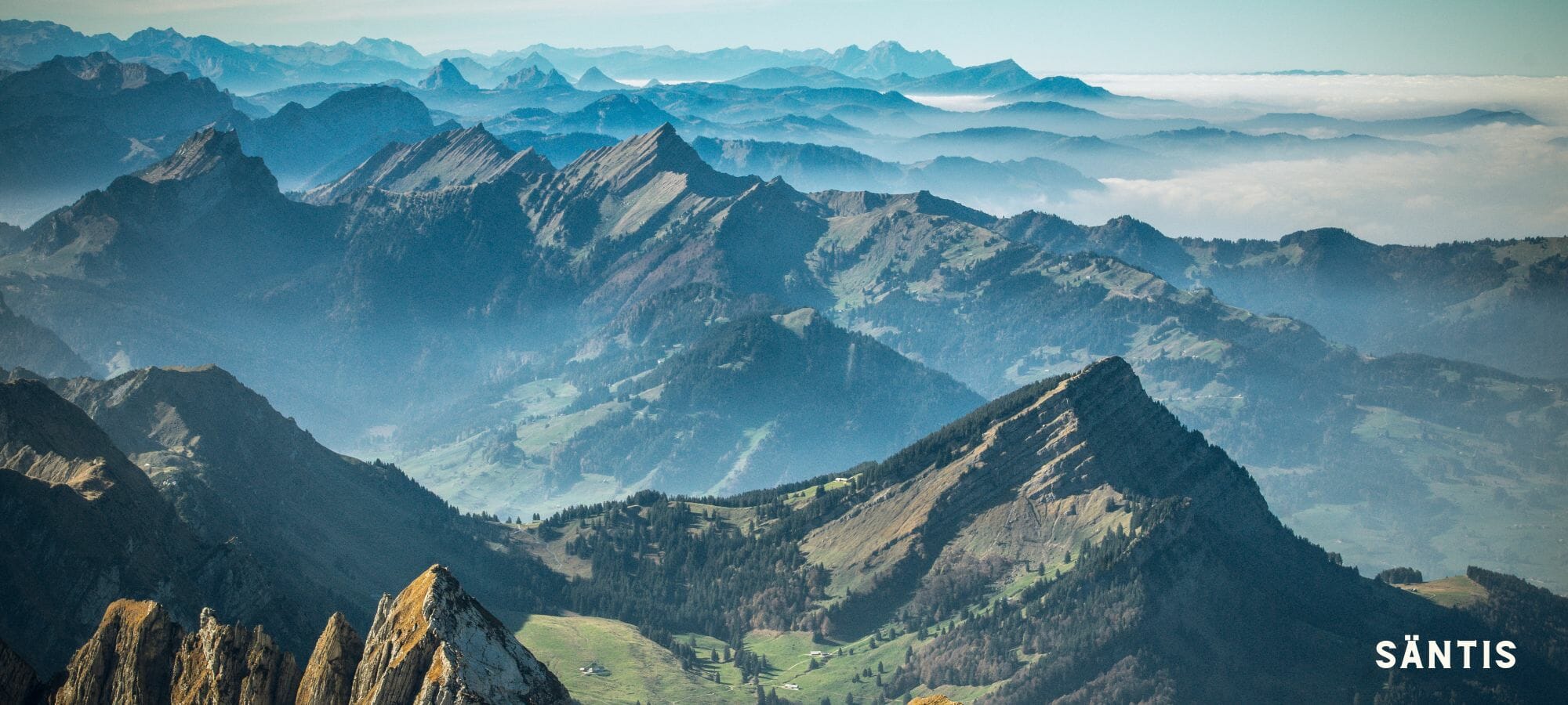

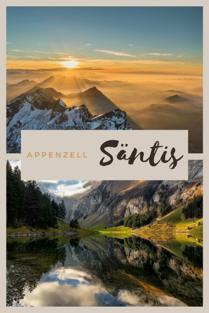
If there is an emblematic mountain in Eastern Switzerland, it would be the Säntis! The highest point of the Alpstein massif, it is located on the border between the cantons of Appenzell Innerrhoden, Appenzell Ausserrhoden and St. Gallen.
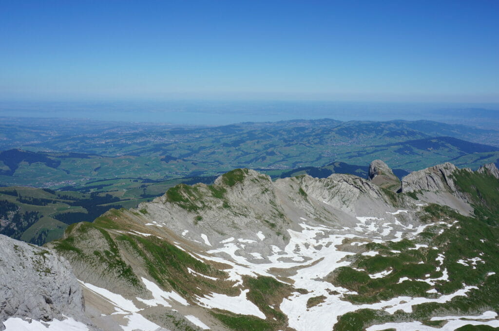
With its 2502m of altitude it is not so impressive (at least if we compare it to the giants of the Bernese or Valaisan Alps 😉 Nevertheless, it remains an incredible summit because it has the particularity to be very isolated, which allows to have a 360° view from its summit! On a clear day, you can even see the top of the Mont-Blanc!
In short, as a native Appenzeller, I had to go up there at least once in my life! In this article, you will find all the possible options to reach the top of the Säntis: by foot or by gondola. 🙂
This article was originally written in 2014. Since then, we have returned to the area several times and this content has been fully reviewed and updated in December 2022. Please feel free to send us any changes or corrections so that we can keep this content current.
The Säntis on foot: possible routes
While preparing our hike, we quickly saw that there was no lack of route options to reach the summit. Of course, it is possible to combine the variants almost endlessly and thus create a personalized itinerary, but here are roughly the different options represented on a map.
Note : if you want to download our track, you can simply create an AllTrails account (it’s free) and export the map in the desired format.
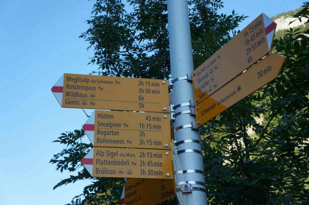
red route: the one we followed. From Wasserauen, the summit of the Säntis is reached via the Meglisalp and the Wagenlücke (alternative: via the Seealpsee and/or the Rotsteinpass)
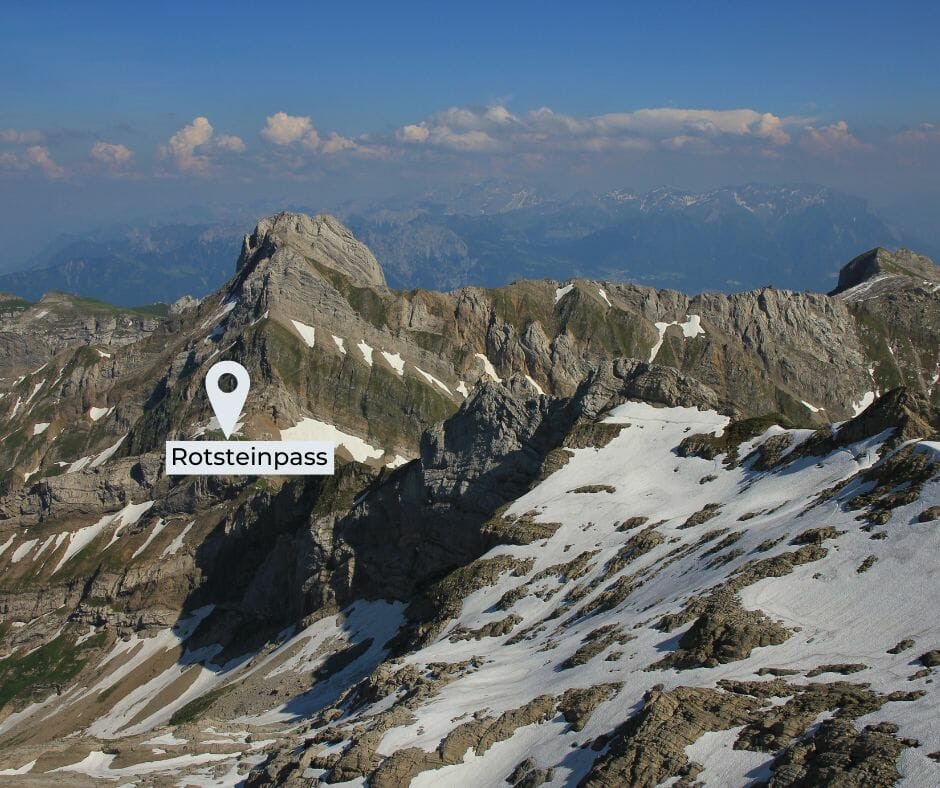
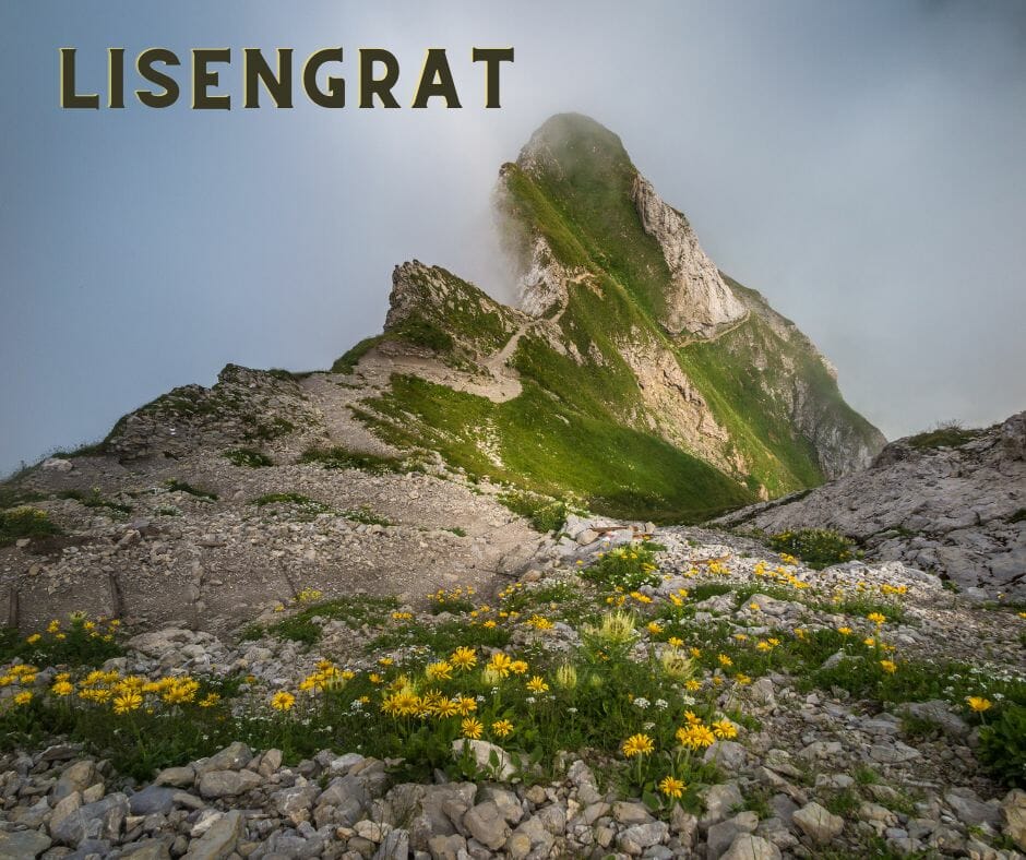
yellow route: variant from the Meglisalp. Here we pass the Rotsteinpass (name of the pass and the refuge) and the Lisengrat, a rather vertiginous ridge path.
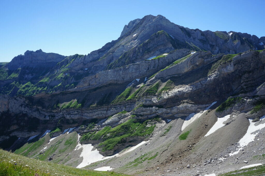
green route: A panoramic route from the Ebenalp (it can be reached from Wasserauen either on foot or by gondola). This is the route with the least amount of elevation gain and follows the impressive Öhrli ridge.
blue route:From the Schwägalp (departure of the cable car). This route is a classic. Not necessarily the most panoramic (in our humble opinion) but it allows you to come back to the starting point with the cable car.
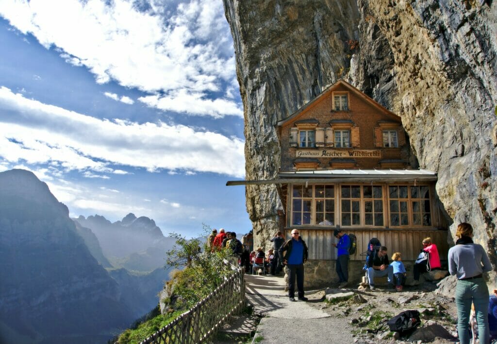
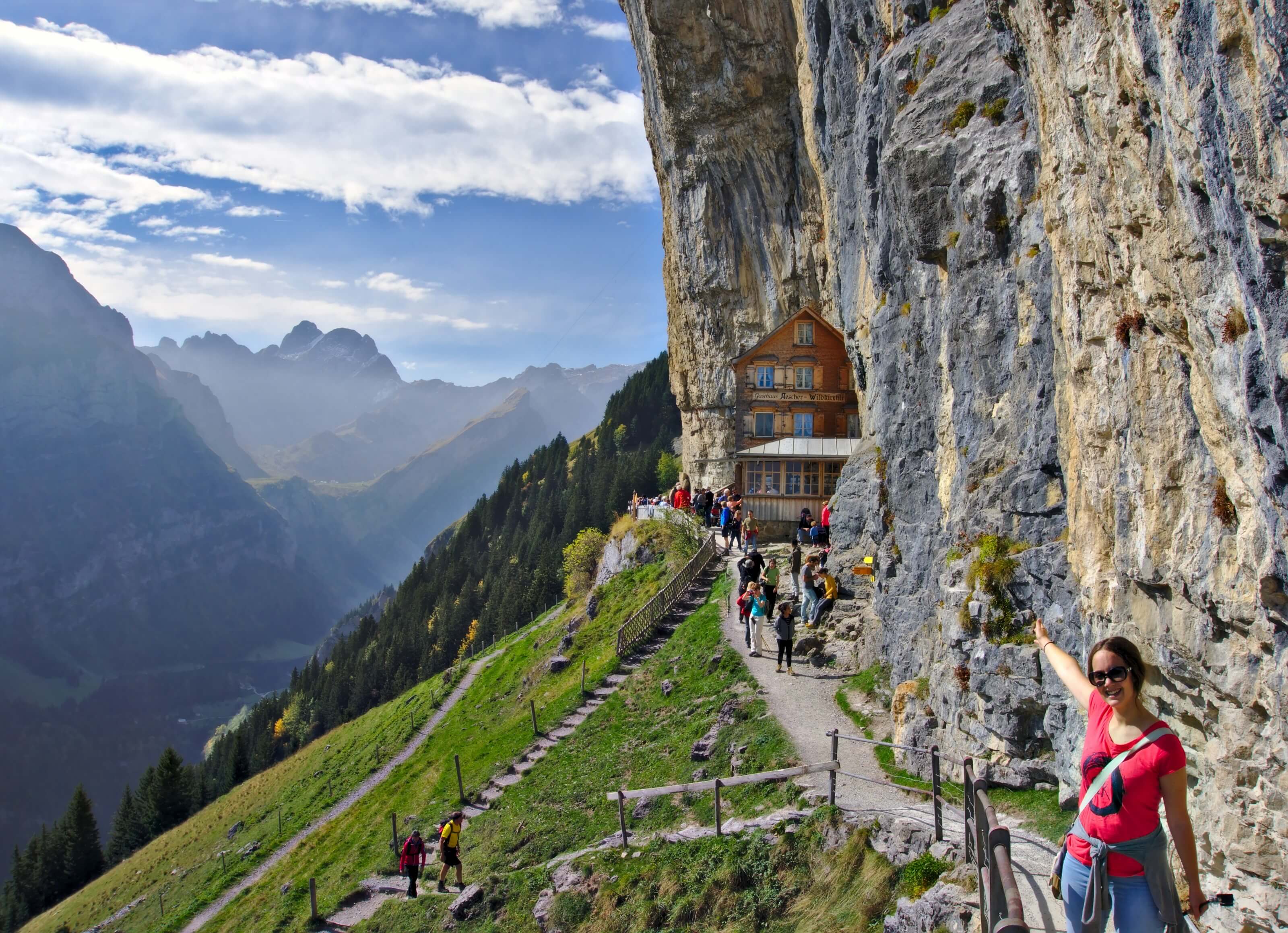
The ascent to the Säntis is not technical and it is an accessible route for many walkers who are used to mountain paths. The relatively high altitude difference (about 1700m) should not be underestimated. If you are looking for an easier hike in the area, we encourage you to check out our article on a nice loop passing by the Seealpsee and the famous Aescher hotel.
The Säntis from Wasserauen
We’ve done a lot of hiking in the Alpstein region, but we’re still far from knowing all the trails 😉 In this article, we will tell you about our first ascent of the Säntis from Wasserauen. At the end of the article you will also find our suggestion for a 2-day itinerary (with a night at the Rotsteinpass hut).

Are you planning to visit Switzerland by train? We advise you to read our article which will allow you to compare the Swiss travel pass with the half-fare card. The article also includes 3 examples of train routes through Switzerland and the associated budget depending on the ticket you take.
If you prefer not to take a travel pass, but rather take advantage of the Supersaver tickets and day passes, then go to this post for all the details.
From Wasserauen to Meglisalp
It’s 6:52 am when we arrive at the little parking lot next to the station of Wasserauen. So I explain you right away that for me, who is a big fan of sleeping in, and not really a hiker, it was a bit of a shock when Benoit told me that we had to get up so early 😉 Well in the end, the choice was more than judicious. As it was very hot that day, leaving early allowed us to arrive at our destination shortly after noon. And thus to avoid walking under a blazing sun all day long. But still, for a sleep-loving apprentice hiker it’s a shock I tell you 😉
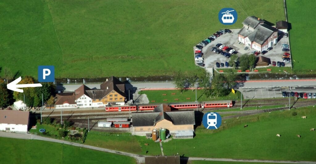
Wasserauen is a very good place to start hiking. The easiest (and best) way is to come by train. There are some parking places, but their number has been strongly reduced in 2022. If you come during a busy period, there is a good chance that you will not be able to park. If you arrive by car, it may be worthwhile to park in Urnäsch. This small town is directly connected to Wasserauen (by train) as well as to Schägalp (by bus). This allows you to walk up and down by gondola.
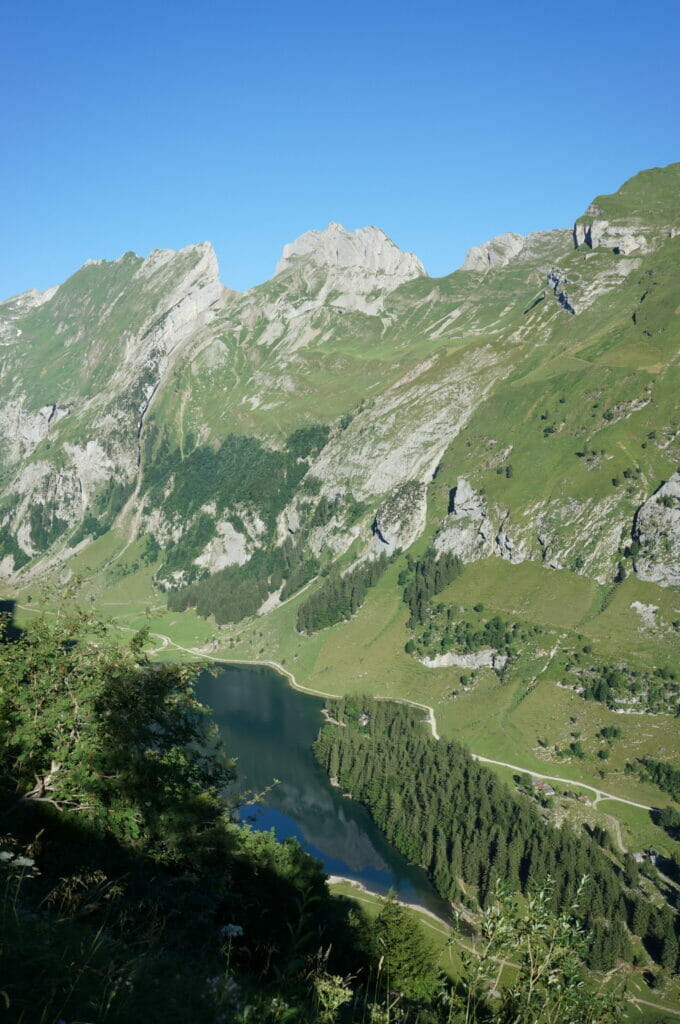
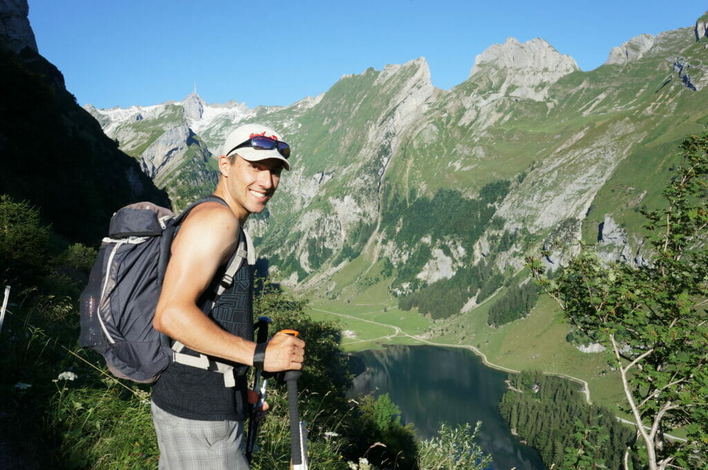
So it was at a time when I am usually still in the arms of Morpheus that we set off for the first stage: the Meglisalp. The start is in Wasserauen which is located at 870m of altitude. The Meglisalp is a small alpine pasture located at 1517m and is about 2 hours walk away. This first section is quite easy. We begin by a rather rough rise in the forest history to put a little the calves in leg. Then it is a quiet walk which climbs certainly, but the way is well marked and the sight is to cut the breath. If you take the same path as us, you will pass just above the Seealpsee. The view is magnificent, and even for me, who is not a big fan of heights, I had no problem looking down, that’s saying something!
If you’re planning a trip to Switzerland, don’t miss our new ebook. Released in May 2025, this 75-page guide will help you prepare for your upcoming stay in Switzerland. We’ve compiled all our best tips and tricks for visiting our beloved little country without breaking the bank. You’ll find advice on transportation, accommodations, where to shop, as well as a list of free activities and events throughout the seasons, along with our personal recommendations for hikes and must-see spots, and a selection of off-the-beaten-path itineraries (with estimated budgets). This ultra-complete guide also includes a fantastic interactive map featuring over 500 addresses and deals.

To learn more about the ebook and the interactive map, the introductory article is available here.
The small alp of the Meglisalp
Once we have passed the first rough ascent we can already see our first goal of the day: the Meglisalp. It is just 9 am when we arrive here. We start to meet the first hikers coming back down after having spent the night of August 1st either at the Meglisalp or at the Säntis. The welcome is super friendly!
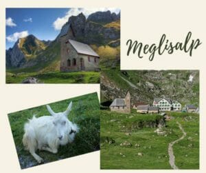
In addition to the little goats that enjoy life in the shade, we also met an old man who looks after the animals and the alp during the summer. With his pipe in his mouth and a strong Appenzell accent he started to advise us different routes to reach the summit.
But I explained to him that my grandfather had already mapped out a route for us to follow. He nodded briefly. When he learned that my grandfather was a native Appenzeller and that he lived in Gais he smiled. He quickly said that he would not dare to contradict him. So we had the best way 😉
From Meglisalp to Wagenlücke
Once on the Meglisalp, you can already see the summit. And as a novice in this field I naively said to myself:
“Well, I don’t know why my grandfather was worried about my physical condition… pfff that’s going to be an easy one”
Well then I guarantee you that appearances are damnably deceptive!
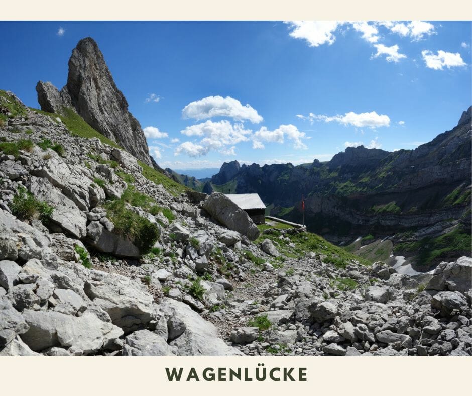
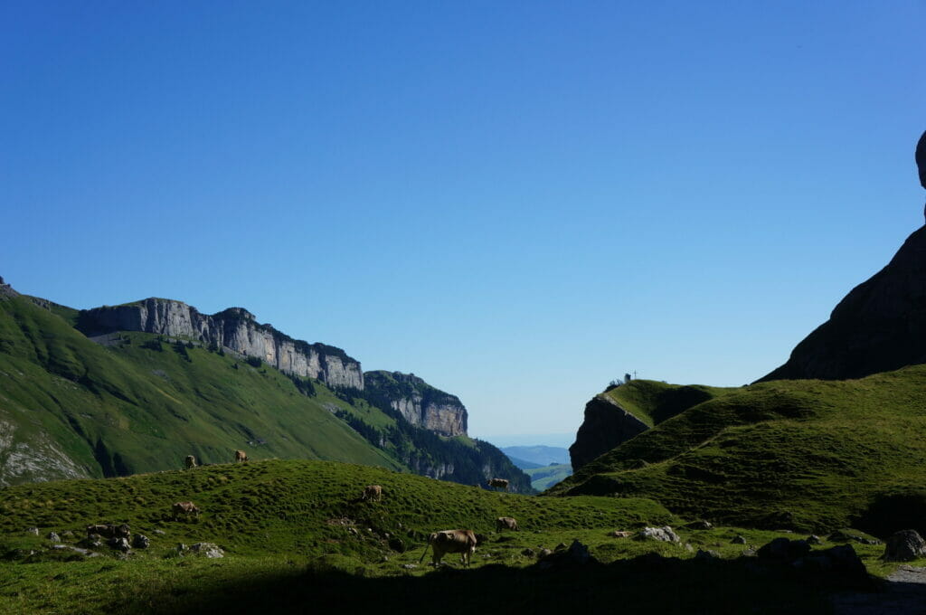
According to our little walking plan the next stage was the Wagenlücke. It is located at 2075m above sea level, just 500m above our heads.
500m sounds ridiculous when you say it like that, but I guarantee you that when it climbs steeply and the sun starts to beat down on your shoulders, it gets harder and harder. But my grandfather, like Benoit, doubted that I would make it to the top, so it was obvious that I was going to keep going up as if nothing had happened, keeping the banana! I kept the banana until the top, but on the other hand the little breaks to refuel became necessary! So after about 2 more hours of walking we had a little snack at the Wagenlücke. Well, I agree, there are worse places to eat your Appenzell gingerbread.
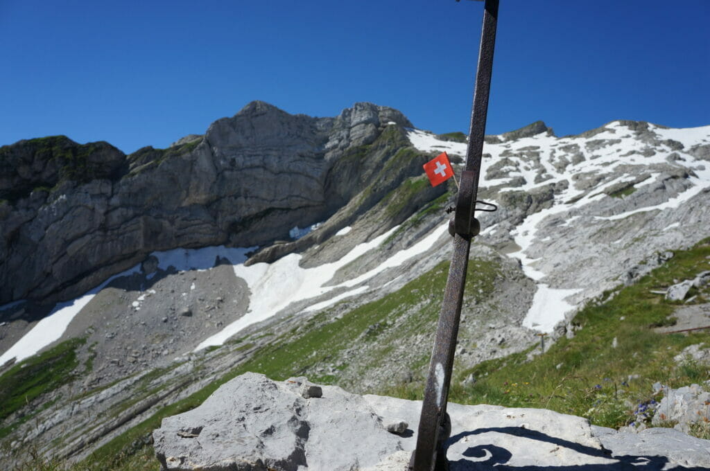
Last ascent of the Wagenlücke on the Säntis
When you are at the Wagenlücke, you have the final goal in sight. And it’s funny because there is a small sign that says: 1h30! It’s at this moment that the beginner hiker that I am starts thinking “Huh? what? But it’s “right” there”…
Yeah well ok, I forgot to count the last 550 meters of elevation gain in my very clever calculation 😉
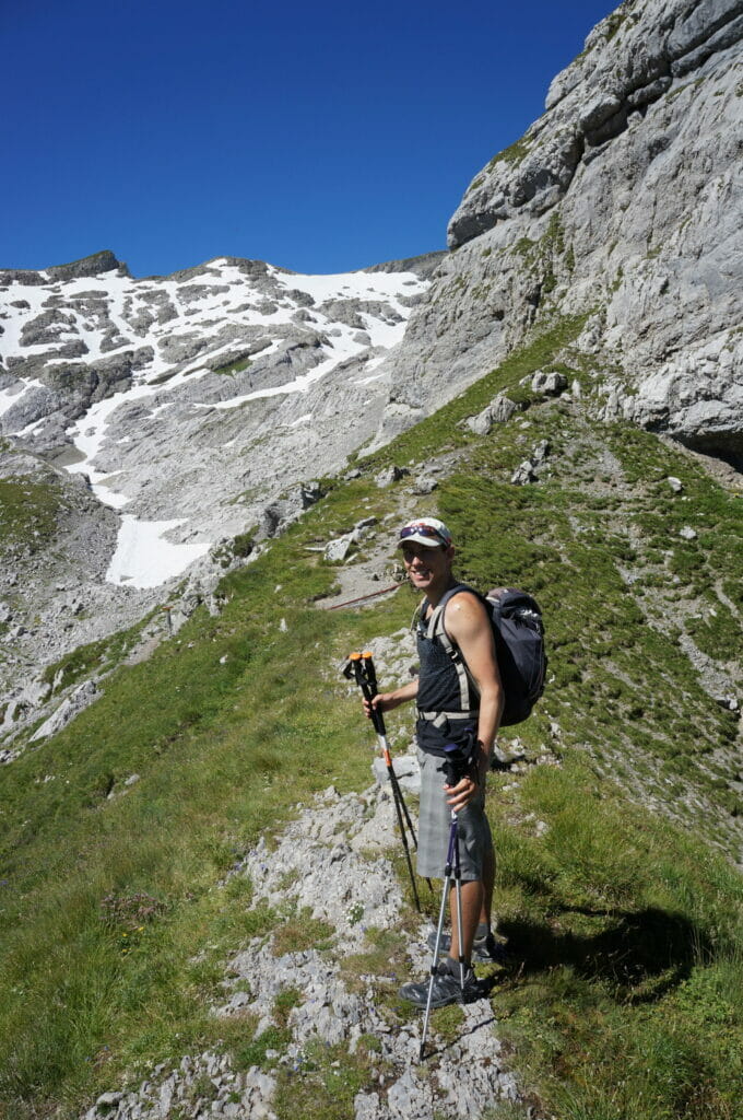
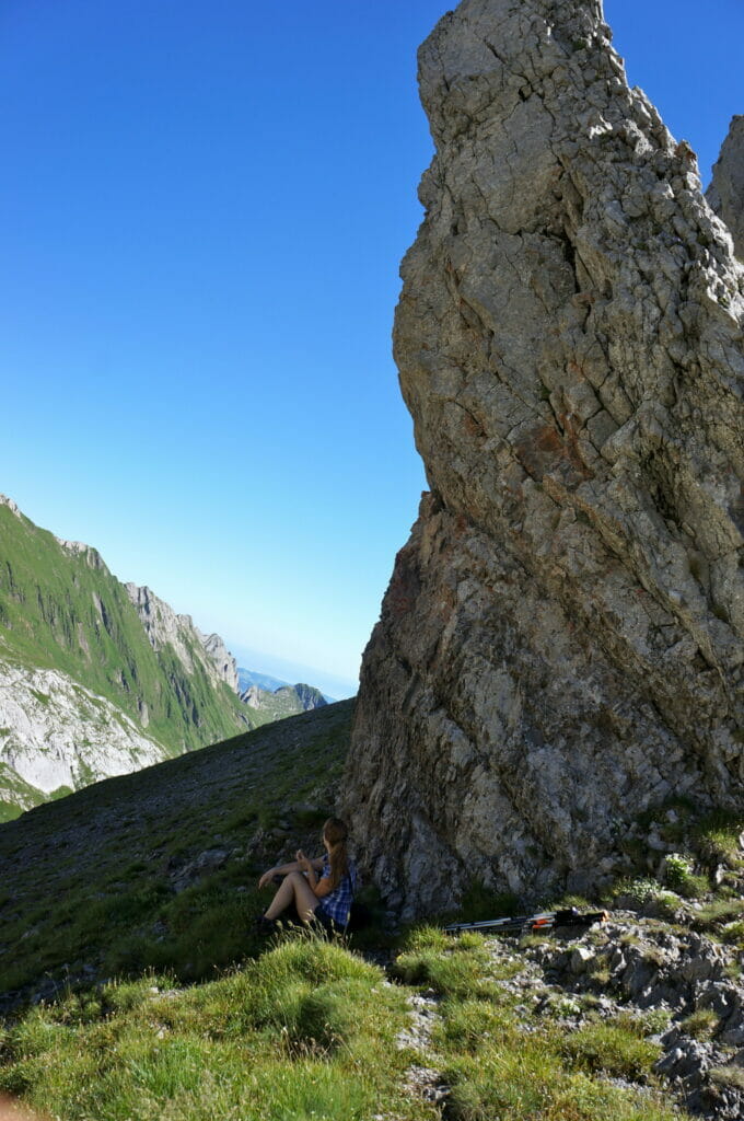
From that moment on, the landscapes change. Or at least the small dirt paths give way to rocks, scree and névés. It reminded me of our last walk to the Sanetsch pass, except that this time it was a steep climb! My thighs start to burn, and when I have to take steps to reach the “steps” located 70cm above, it hurts… very much…
Benoit asked me if I was ok, the only thing I could answer was: “Yes nickel, I feel like Didier Cuche when he arrives at the bottom of the Lauberhorn if I consider my thighs but otherwise it’s ok!
But as I didn’t want to lose face, and especially as the prospect of turning back seemed to me much more perilous than finishing the effort in order to enjoy a well-deserved snack at the top, I continued with a smile! At the same time, with such a panorama, it’s hard not to enjoy every moment!
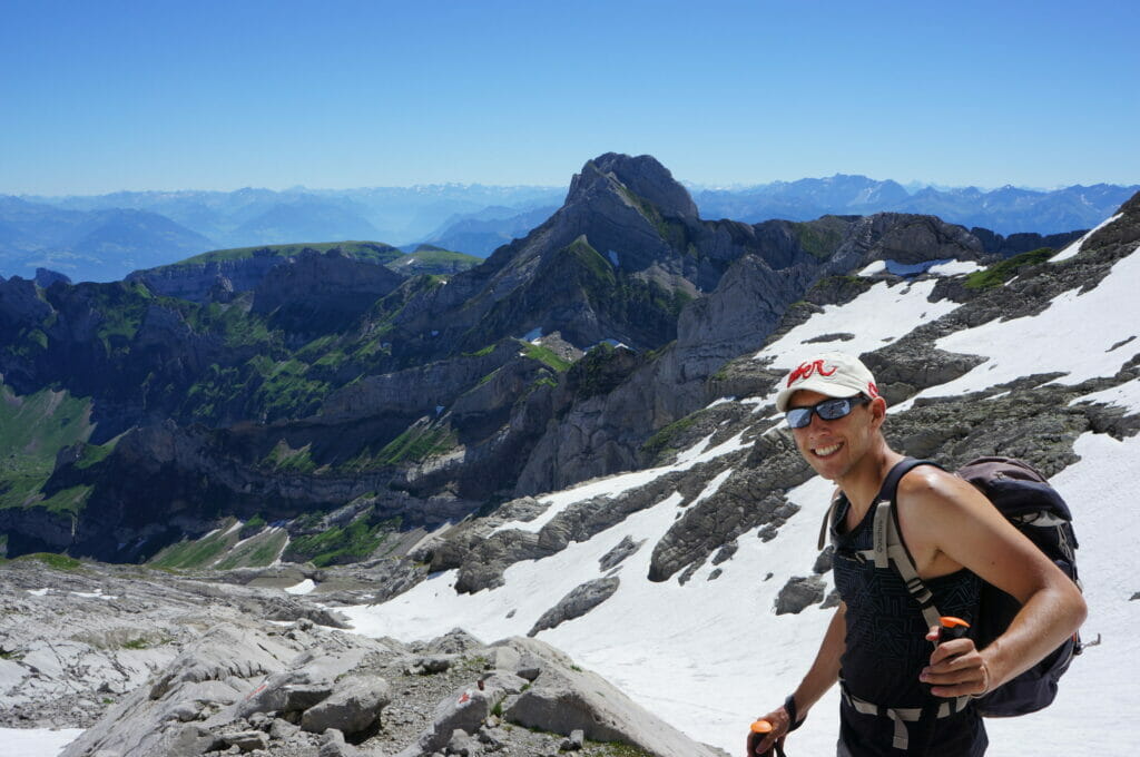
The summit of the Säntis
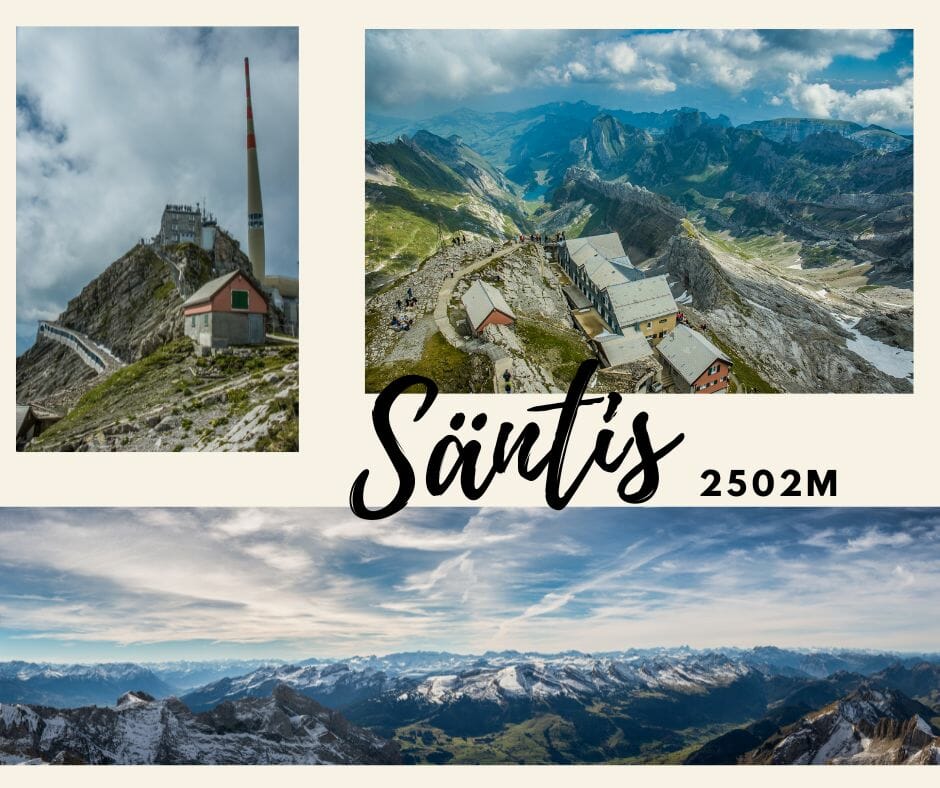
It wasn’t quite 1pm when we set foot on the platform of the Säntis summit! It’s good to get there, and the view is splendid! In Appenzell there is no other mountain that high, which means that from the Säntis you can really enjoy a 360° panorama! When the weather is clear you can see the Austrian and Italian Tyrol, Germany and even the Mont Blanc!
On the other hand, I must admit that my pleasure was a bit spoiled by the flood of tourists on the Säntis! Yes, you heard me right, hundreds of Americans, Japanese, French and Swiss came up to admire the panorama armed with their reflex camera and with their little pumps on their feet or in flip-flops…
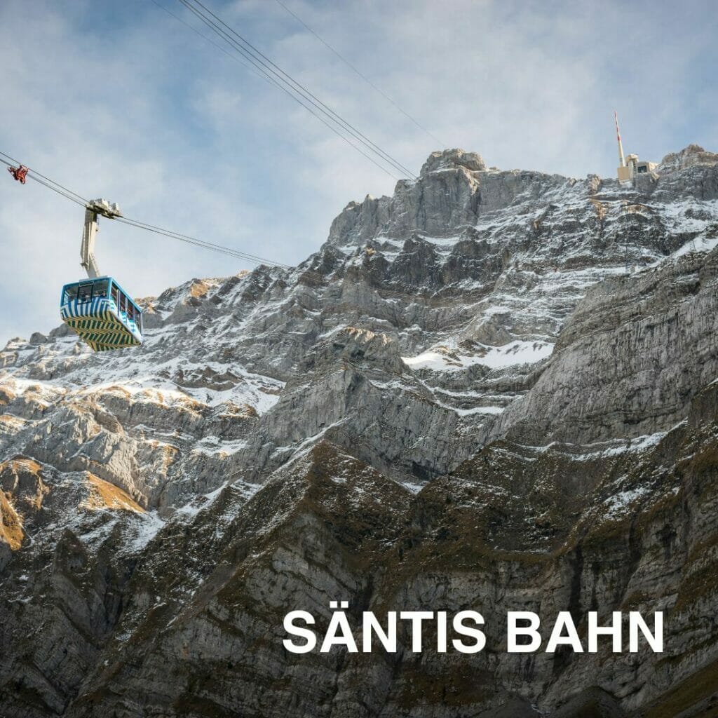
Because yes, there is a gondola which arrives at the top… In short, I don’t care, all this happy little world didn’t manage to spoil my pleasure, I walked up, guys, AND NA! I deserved my 8€ beer more than you did (yes, the special Swiss rate for mountain tourists)… But come on, let’s be honest, even if paying 38 CHF to go back down in a cabin really shocked me, I admit I’m not ready to walk all the way back in one day; my legs would probably never recover… So thank you little gondola for being there for me!
The hike to the Säntis from Wasserauen: key information
- duration : about 5 to 6 hours from Wasserauen to the summit. For the descent count 4h30
- Distance: about 10km (one way)
- ascent : 1700m
- descent : 0m (or almost)
- difficulty : Up to Wagenlücke the difficulty is medium, but the last part is quite steep so you really need good shoes and a not too bad physical condition
- price : Cabin to go back down: 38 CHF/person for the descent only… They abuse a bit… If you have a 1/2 fare or a general subscription or the Swiss Travel Pass: 19 CHF for the descent. For a return trip in a cabin, count 54 CHF for the normal fare and 27 CHF for the half fare or with a general subscription
The route we followed:
- By car: By car you can drive to the parking lot in Wasserauen. To get back to the car you can take a post bus from the cabins to Urnäsch and then a train back to Wasserauen (55 minutes ride)
- By public transport: By train directly to Wasserauen, the start of the hike is 2 steps from the station. For the return trip you can take the bus at the arrival of the cable car
For this itinerary we recommend you to come by public transport (or to park in Urnäsch to be more central)
The Säntis in 2 days: the most panoramic option
At the time we went up to the Säntis I was what we could call a Sunday hiker… I had never slept in a hut and clearly the idea had never occurred to me.
At the end of 2022, when I write the update of this article, my vision of the hike (and the level of difficulty) have evolved a bit 😉 Looking at the maps I can’t help but think that the “best route” would probably be this one:
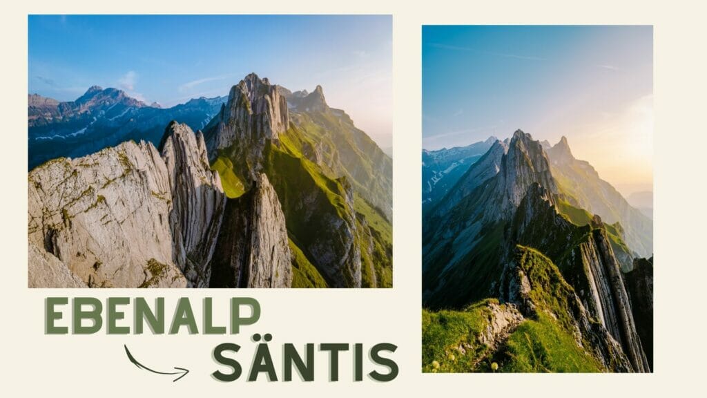
Wasserauen – Ebenalp – Schäfler – Öhrligrueb Ridge – Säntis – Lisengrat- Rotsteinpass – Meglisalp – Wasserauen (if you look at the map at the beginning of the article, this is like combining the green route with the yellow one and then the red one, the whole thing 🙂
If we consider that we go up to Ebenalp by cabin, the route is about 20km with 1300m of ascent and 2000m of descent. Bold but not crazy, I think I would opt for a “split” of this route by spending a night at the Rotsteinpass hut. This way, we could enjoy the ridge and the summit, spend the night with a great view and the next day go back down quietly (potentially adding a detour to the Seealpsee). With Benoit, we are already thinking that we would do this route during the summer of 2023, so who knows, maybe we will come back here soon for a new update 😉
Here is the map of this “perfect” route as we would like to do it:
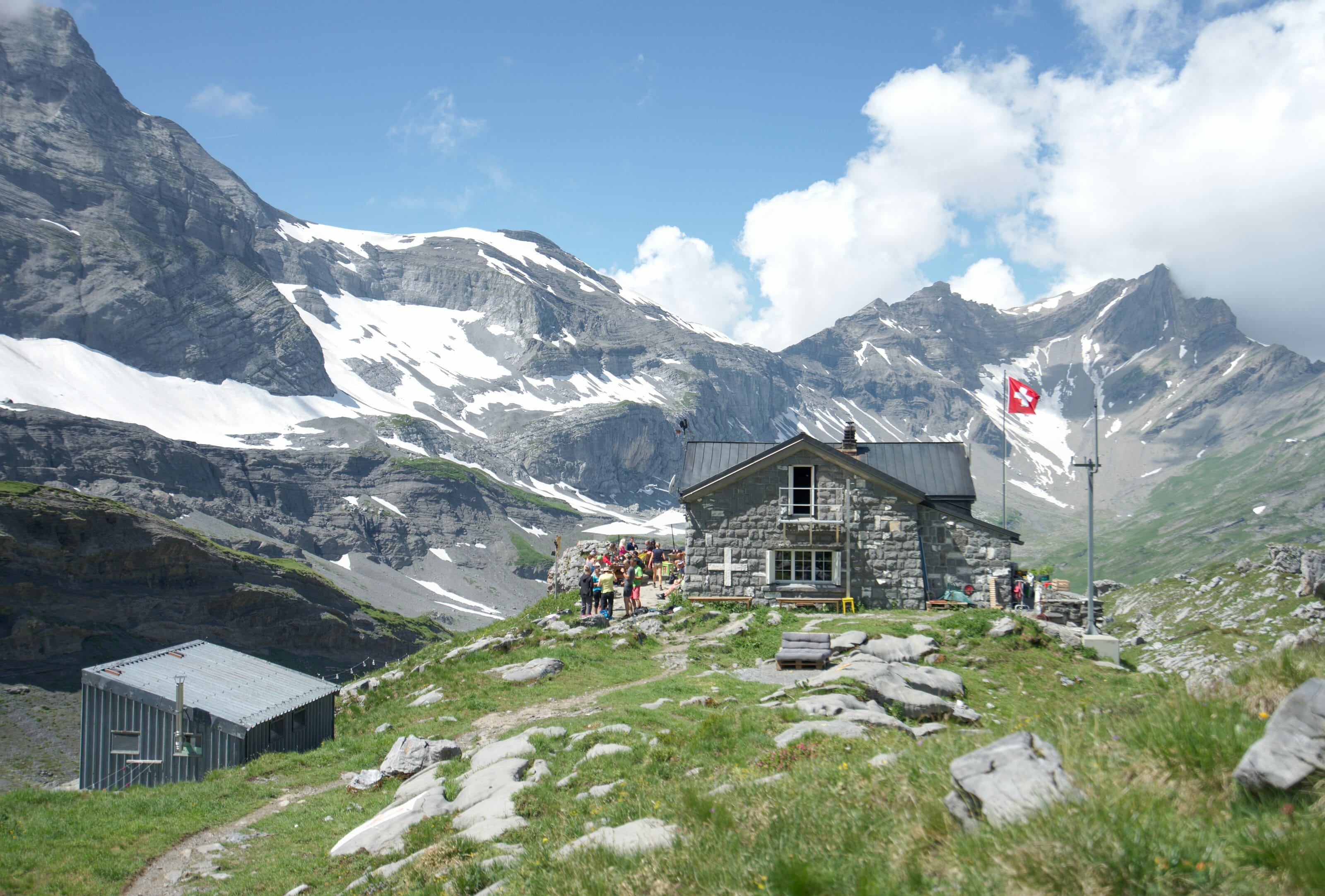
For overnight stays on the Rotsteinpass, it is best to book by phone at +41 71 799 11 41. A night in a dormitory (including half board) costs CHF 75 per person (with the possibility of sleeping in a double room).
That’s all for today. We hope you enjoyed this article and that it will give you ideas for your future walks in the Alpstein.
Have you ever thought about going to Appenzell for a little vacation? If not, now is the time 😉
Pin it


Join the discussion